

Free Karwendel Travel Guide & Mobile App
Explore Karwendel with free travel guides. Discover regional history, expert tips, proposed trips, and audio guides on web or mobile app.


Explore Austria’s Karwendel for limestone peaks, alpine valleys, wildlife, mountain huts and rewarding walks near Innsbruck and Tyrol.
Read more about Karwendel
When is the best time to visit Karwendel?
Best: July–September · 19–22°C| Month | High (°C) | Rainfall (mm) |
|---|---|---|
| January | 2 | 50 |
| February | 3 | 40 |
| March | 8 | 50 |
| April | 12 | 60 |
| May | 17 | 90 |
| June | 20 | 110 |
| July (best) | 22 | 120 |
| August (best) | 22 | 110 |
| September (best) | 19 | 90 |
| October | 13 | 70 |
| November | 6 | 60 |
| December | 3 | 60 |
Getting to and around Karwendel
How to get there
Transportation
Top city travel guides in Karwendel
The cities of Karwendel, and the easiest places to base yourself.

Swipe for more cities
Destinations in Karwendel
Resorts, valleys and scenic spots worth a trip of their own.
-

-
-


Swipe for more destinations
Best attractions in Karwendel
The Karwendel’s attractions are primarily landscapes and outdoor experiences rather than a concentration of museums or built entertainment. Marked paths lead from valley settlements into forests, limestone gorges, alpine meadows and high basins, with options ranging from accessible walks to demanding summit routes. The Großer Ahornboden and Eng valley combine ancient maple trees, pasture and dramatic cliffs, while the Hinterautal near Scharnitz offers a long, quieter approach into the mountain interior. Halltal provides a close-to-Innsbruck setting shaped by salt-mining history, and the Martinswand presents a striking southern limestone escarpment. Mountain huts add a practical and social dimension to longer routes, serving traditional food and providing overnight bases when open. Wildlife watching, photography, climbing, cycling on suitable lower roads and summer alpine grazing are all part of the experience. Visitors seeking museums, urban culture or extensive indoor attractions should use Innsbruck, Hall in Tirol or Schwaz as complementary destinations outside or at the edge of the mountain area rather than expecting the protected valleys themselves to function as conventional resort centres.
-
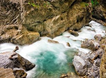
Partnachklamm
Explore the breathtaking beauty of Partnachklamm, a stunning gorge in Garmisch-Partenkirchen, perfect for hiking and nature enthusiasts.
-
Spa
Kristall Therme trimini Kochel am See
Discover ultimate relaxation at Kristall Therme trimini Kochel am See, a premier spa in the Bavarian Alps offering thermal baths, saunas, and wellness treatments.
-
Tourist attraction
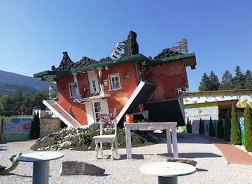
Tirolland / Haus Steht Kopf + Dinoland
Explore the enchanting Tirolland, where a house stands upside down and dinosaurs come to life, creating unforgettable memories in the Austrian countryside.
-
Mountain cable car
Karwendel-Bergbahn
Experience breathtaking views and adventure at the Karwendel-Bergbahn, your gateway to the stunning Austrian Alps and nature's wonders.
Best landmarks in Karwendel
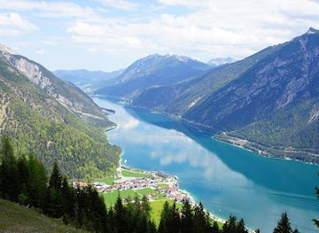
The Großer Ahornboden is the Karwendel’s most recognisable natural landmark, a broad alpine basin in the Eng valley where old sycamore maples stand below an amphitheatre of pale limestone peaks. Its value lies not only in its appearance but also in the long history of alpine grazing that maintains the open meadow. The Martinswand near Zirl marks the southern edge with a formidable cliff face visible from the Inn Valley and associated with climbing and historic routes through the limestone. In Halltal, the steep valley, former salt-working landscape and small historic sites express the relationship between the Karwendel and Tyrol’s salt economy. The Falkenhütte, when accessible and operating, is an important mountain refuge beneath the Laliderer walls and a symbol of classic Karwendel mountaineering. Around Scharnitz, the wooded valley entrances and river corridors provide a contrasting landmark setting, showing how the range changes from accessible foothills to remote alpine terrain.
-
Castle
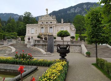
Linderhof Palace
Experience the splendor of Linderhof Palace, a stunning castle in the Bavarian Alps, famed for its exquisite gardens and rich history.
-
Historical landmark
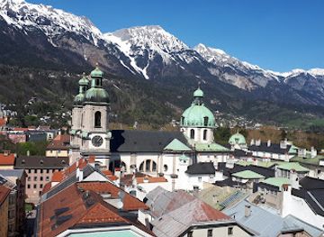
Golden Roof
Discover the splendor of the Golden Roof in Innsbruck, Austria, an architectural masterpiece rich in history and culture.
-
Historical landmark
Triumphpforte
Explore Innsbruck's Triumphpforte, a historic triumphal arch that embodies the city's rich cultural heritage and architectural beauty.
-
Historical landmark
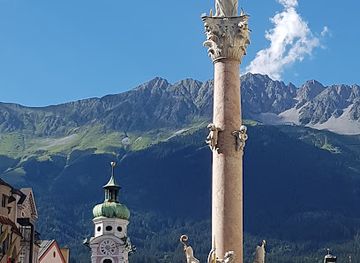
Annasäule
Explore Annasäule, a historical landmark in Innsbruck, symbolizing resilience and faith amid the charming streets of Tyrolean culture.
Explore Karwendel on the map
Plan your trip on one map. See where the top cities, national parks and sights are, and book hotels and experiences in a few clicks.
Best hotels in Karwendel
Best restaurants in Karwendel
Dining in the Karwendel follows the rhythm of mountain travel. Alpine huts and simple establishments in gateway villages serve hearty Tyrolean cooking such as dumplings, soups, goulash, savoury noodle dishes and cakes, with menus shaped by seasonal supplies and the practical needs of walkers. On working pastures, locally produced milk, butter and cheese may feature more prominently than elaborate restaurant cuisine, while village inns provide broader menus and regional specialities. The southern edge benefits from proximity to the food culture of the Inn Valley, where bakeries, cafés and traditional restaurants are more plentiful. Expect early or seasonally variable service in remote areas, and do not assume that every hut accepts cards. For more ambitious dining, Hall in Tirol, Innsbruck and other towns outside the mountain interior offer the greatest choice, while the Karwendel itself is best suited to uncomplicated food eaten as part of a day in the hills.
-
Restaurant
Alpengasthof Gröbl-Alm - Leuthner oHG
Experience authentic Bavarian cuisine amidst breathtaking alpine scenery at Alpengasthof Gröbl-Alm.
-
Restaurant
Restaurant Seegrube
Experience authentic Austrian cuisine amidst breathtaking mountain views at Restaurant Seegrube in Innsbruck.
-
 Restaurant
Gramai Alm Alpengenuss & Natur Spa
Experience culinary delights and serene wellness at Gramai Alm Alpengenuss & Natur Spa in the heart of Austria's stunning Karwendel Nature Park.
-
Hotel
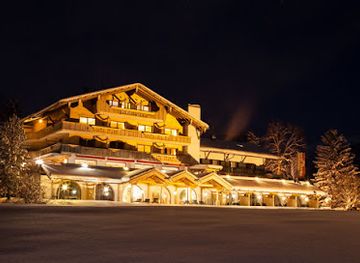
Alpenrose Traditionsgasthof
Discover Bavarian charm and culinary delights at Alpenrose Traditionsgasthof in scenic Mittenwald.

Best bars in Karwendel
Evening life in the Karwendel is restrained and closely linked to its mountain setting. In gateway villages such as Scharnitz, Hall in Tirol and the settlements along the Inn Valley, visitors will find traditional inns, hotel bars and restaurants where conversation and local beer or wine are more typical than late-night clubbing. Some mountain huts provide an informal evening atmosphere for overnight guests, but their hours and seasonal operation depend on weather and staffing. The main concentration of cocktail bars, live music, student venues and nightclubs is in Innsbruck, outside the Karwendel and easily reached as an urban complement to a mountain stay. In the range itself, plan around daylight, hut rules and the next day’s route rather than expecting a large nightlife scene.
-
Bar
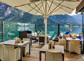
Restaurant Bar SeeEck Achensee
Experience the perfect blend of Tyrolean traditions and modern flavors at Restaurant Bar SeeEck, set against stunning views of Lake Achensee.
-
Bar
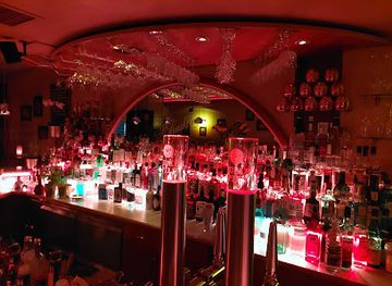
M+M Bar - die Cocktailbar in Innsbruck
Discover the lively M+M Bar in Innsbruck, where exceptional cocktails and a vibrant atmosphere create the perfect night out.
-
Cafe
Seebar Achensee
Discover the serene beauty of Lake Achensee at Seebar Achensee, a charming cafe offering delightful treats and stunning views.
-
Bar
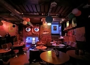
Zappa Music Bar
Discover the vibrant atmosphere and community spirit at Zappa Music Bar in Innsbruck, where live music and friendly faces create unforgettable nights.
Best nightclubs in Karwendel
Evening life in the Karwendel is restrained and closely linked to its mountain setting. In gateway villages such as Scharnitz, Hall in Tirol and the settlements along the Inn Valley, visitors will find traditional inns, hotel bars and restaurants where conversation and local beer or wine are more typical than late-night clubbing. Some mountain huts provide an informal evening atmosphere for overnight guests, but their hours and seasonal operation depend on weather and staffing. The main concentration of cocktail bars, live music, student venues and nightclubs is in Innsbruck, outside the Karwendel and easily reached as an urban complement to a mountain stay. In the range itself, plan around daylight, hut rules and the next day’s route rather than expecting a large nightlife scene.
-
Night club
Tante Emma Club
Experience the vibrant nightlife of Innsbruck at Tante Emma Club, where music, dance, and good company come together for an unforgettable night out.
-
Disco club
Stefan’s Laterndl - Bar Diskothek
Discover the energy and excitement of Pertisau's nightlife at Stefan’s Laterndl, a top disco club featuring cocktails, dancing, and dart games.
-
Disco club
Disco Collage - Club Mittenwald
Experience the vibrant nightlife at Disco Collage, Mittenwald's premier disco club offering electric music and an unforgettable atmosphere.
-
Night club
Luna Innsbruck
Dive into the heart of Innsbruck's nightlife at Luna Innsbruck, where vibrant music and exhilarating atmosphere come together.



Best shops in Karwendel
Shopping in the Karwendel is concentrated in its gateway villages and neighbouring towns rather than in the high valleys. Scharnitz and the eastern access communities provide practical outdoor equipment, food supplies and small locally oriented shops, while Hall in Tirol offers a historic urban setting with independent retailers, craft businesses, cafés and galleries. Regional purchases may include Tyrolean cheese, smoked or cured foods, mountain herbs, honey, schnapps, woollen goods and small craft items, although availability varies by season and locality. Farmers’ markets and specialist food shops in the Inn Valley are useful for assembling a picnic before a walk. Innsbruck, outside the Karwendel, has the broadest choice of outdoor equipment, books, design goods and conventional retail. In protected mountain areas, avoid removing plants, stones or other natural materials as souvenirs; durable local food and responsibly made crafts are more appropriate purchases.
-
Shopping mall
DEZ Innsbruck
Explore DEZ Innsbruck, a vibrant shopping mall offering fashion, dining, and leisure in a stunning alpine setting, perfect for every tourist's delight.
-
Shopping mall
Sillpark
Discover Sillpark, the ultimate shopping experience in Innsbruck, featuring diverse stores, delightful dining, and a vibrant atmosphere.
-
Shopping mall
Kaufhaus Tyrol
Explore Kaufhaus Tyrol in Innsbruck, where shopping meets culture in a vibrant atmosphere filled with local and international brands.
-
Shopping mall
RathausGalerien
Experience the best of shopping, dining, and hospitality at RathausGalerien in Innsbruck, the heart of Tyrol's vibrant culture.


Get your free copy of our complete guide to Karwendel, delivered straight to you.
Everything on this page, from attractions and restaurants to essentials and local phrases, in one PDF you can read offline, print or share.
Already have an account? Sign in
Your Karwendel guide is ready.
We'll send it to · Not you? Sign out

Getting your guide ready…
We are putting together a fresh copy of the Karwendel guide. This can take up to a minute.
This can take a few moments. If your browser asks, choose Allow so the download can start. You'll find the guide in your Downloads folder.
Nothing happened? Download it again
Sorry, the guide is taking longer than usual. Please try again in a minute, or get it by email instead.
Karwendel essentials
Currency and Payment
Safety
Emergency Situations
Do's and Don'ts
Local Tips
From Eve
Local phrases worth knowing
You don't need to get them perfect. A few words go a long way, and locals appreciate the effort.
Basics
| English | Local | Say it |
|---|---|---|
| Hello | Grüß Gott | [Greez Got] |
| Goodbye | Auf Wiedersehen | [Owf Veederzehn] |
| Yes | Ja | [Yah] |
| No | Nein | [Nyn] |
| Please/You're welcome | Bitte | [Bitt-eh] |
| Thank you | Danke | [Dahn-kah] |
| Excuse me/Sorry | Entschuldigung | [Ent-shool-dee-goong] |
| How are you? | Wie geht's? | [Vee gates?] |
| Fine. And you? | Gut. Und dir? | [Gooot. Oond deer?] |
| Do you speak English? | Sprechen Sie Englisch? | [Shprecken Zee Englisch?] |
| I don't understand | Ich verstehe nicht | [Ikh fer-shtay-eh nikht] |
Eating & Drinking
| English | Local | Say it |
|---|---|---|
| I'd like to see the menu, please | Ich hätte gerne die Speisekarte, bitte | [Ikh het-teh gair-neh dee Shpieze-kahr-teh, bitt-eh] |
| I don't eat meat | Ich esse kein Fleisch | [Ikh ess-eh kyn Flysh] |
| Cheers! | Prost! | [Prohst!] |
| I would like to pay, please | Ich möchte bezahlen, bitte | [Ikh merkh-teh beh-tsah-len, bitt-eh] |
Emergencies
| English | Local | Say it |
|---|---|---|
| Help! | Hilfe! | [Hil-feh!] |
| Go away! | Geh weg! | [Gay vek!] |
| Call the Police! | Rufen Sie die Polizei! | [Roo-fen Zee dee Poh-lee-tsai!] |
| Call a doctor! | Rufen Sie einen Arzt! | [Roo-fen Zee eye-nen Arts-t!] |
| I'm lost | Ich bin verloren | [Ikh bin fer-lo-ren] |
| I'm ill | Ich bin krank | [Ikh bin krank] |
Shopping
| English | Local | Say it |
|---|---|---|
| I'd like to buy... | Ich möchte ... kaufen | [Ikh merkh-teh ... kau-fen] |
| I'm just looking | Ich schaue nur | [Ikh shau-eh noor] |
| How much is it? | Wie viel kostet es? | [Vee feel kost-et es?] |
| That's too expensive | Das ist zu teuer | [Das ist tsoo toy-er] |
| Can you lower the price? | Könnten Sie den Preis senken? | [Kurn-ten Zee den Pryce zen-ken?] |
Time & Numbers
| English | Local | Say it |
|---|---|---|
| What time is it? | Wie spät ist es? | [Vee shpaht ist es?] |
| It's one o'clock | Es ist ein Uhr | [Es ist ayn Oor] |
| Half past (10) | Halb (10) | [Halb (10)] |
| Morning | Morgen | [Mor-gen] |
| Afternoon | Nachmittag | [Nah-cht-mit-tahg] |
| Evening | Abend | [Ah-bent] |
| Yesterday | Gestern | [Ges-tern] |
| Today | Heute | [Hoy-teh] |
| Tomorrow | Morgen | [Mor-gen] |
| 1 | Eins | [Ayns] |
| 2 | Zwei | [Tsvy] |
| 3 | Drei | [Dry] |
| 4 | Vier | [Feer] |
| 5 | Fünf | [Fünf] |
| 6 | Sechs | [Zex] |
| 7 | Sieben | [Zee-ben] |
| 8 | Acht | [Acht] |
| 9 | Neun | [Noyn] |
| 10 | Zehn | [Tsen] |
Transport & Directions
| English | Local | Say it |
|---|---|---|
| Where's a/the...? | Wo ist ein/eine ...? | [Vo ist ayn/ay-neh ...?] |
| What's the address? | Was ist die Adresse? | [Vas ist dee Ah-dres-se?] |
| Can you show me (on the map)? | Könnten Sie mir (auf der Karte) zeigen? | [Kurn-ten Zee meer (owf der Kar-teh) tsai-gen?] |
| When's the next (bus)? | Wann kommt der nächste (Bus)? | [Vahn kommt der nay-sht-eh (Boos)?] |
| A ticket (to ....) | Ein Ticket (nach ....) | [Ayn TICKET (nahkh ....)] |
History of Karwendel
Early settlement and the Halltal salt tradition
The southern Karwendel was influenced early by salt production in the Halltal above Absam and Hall in Tirol. Brine and rock salt resources helped make the Hall area an important centre long before modern tourism, while mountain tracks connected working communities with pastures and valleys. The mines themselves belong to the cultural landscape on the Karwendel’s southern margin, where steep terrain shaped both settlement and transport. Salt extraction declined in the twentieth century, but the history remains visible in the Halltal landscape and in the historic town of Hall, just below the mountains.
Medieval alpine farming and mountain routes
During the medieval period, communities around the Karwendel developed a mixed economy based on farming, forestry, livestock and small-scale trade. Summer grazing on high pastures allowed villages in the Inn Valley and northern Tyrol to use land that was unsuitable for permanent settlement. Paths through valleys such as the Halltal, Hinterautal and Riss area served local movement rather than mass travel, linking pastures, hunting grounds and neighbouring communities. The seasonal rhythm of taking cattle to alpine meadows remains part of the region’s identity and has helped preserve open grassland amid expanding forest.
Tyrolean mining and regional prosperity
The wider southern Karwendel was affected by the mining wealth that transformed Tyrol in the late medieval and early modern periods. Silver and copper extraction around Schwaz, outside the central mountain wilderness but close to its eastern approaches, brought merchants, labourers and administrative power into the surrounding valleys. Innsbruck, Hall and Schwaz developed churches, civic buildings and trading connections that still frame access to the range. Mining did not turn the Karwendel into an industrial landscape; instead, its steep interior remained dominated by forestry, pasture and difficult mountain transport.
The rise of mountaineering in the nineteenth century
Scientific exploration and organised mountaineering grew in the nineteenth century as improved roads and railways made the northern Tyrolean Alps more accessible. Climbers began to map and ascend the Karwendel’s limestone summits, while guides from surrounding villages found new work leading visitors through the valleys and across high passes. The range remained less urbanised than some Alpine destinations because its ridges are broad, rugged and divided by long approaches. This combination of accessibility at the edges and remoteness within the range became a defining feature of Karwendel travel.
War, borders and mountain infrastructure
The Karwendel lies near the longstanding cultural and political connections between Tyrol and Bavaria. Roads and passes across the northern Alps acquired strategic importance during the twentieth century, while the First and Second World Wars affected transport, employment and movement throughout the region. Unlike heavily built-up resort areas, much of the high Karwendel retained its forest and pasture character. After 1945, improved roads, cable-car access around the southern edge and growing private motoring made day walks easier, but the central valleys continued to depend on careful access management.
Conservation and the Alpenpark Karwendel
Conservation became increasingly important as mountaineering, forestry and motor access expanded. The protected landscape now known as the Alpenpark Karwendel developed from early efforts to safeguard the range’s forests, alpine meadows, limestone terrain and wildlife. It is regarded as Austria’s oldest nature park, with protection extending across a large part of the North Tyrolean Karwendel. Conservation today balances habitat protection with traditional grazing, responsible recreation and the needs of communities at the mountain edges. The protected status is central to the region’s modern identity.
Karwendel in Photos
Browse through our photo collection highlighting the charm and character of the destination.
Neighbouring regions of Karwendel
The closest regions to Karwendel, if you have time for more than one.
-

-

-

-

-


Swipe for more regions
Explore more
Explore more of Austria
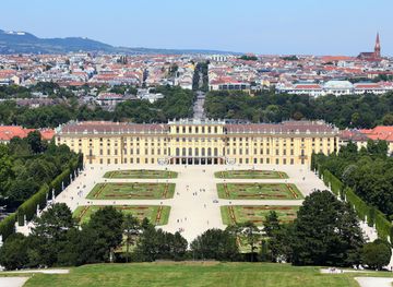
Discover Austria's blend of alpine landscapes, rich cultural heritage, and culinary delights, from Vienna's historic charm to Tyrol's dramatic beauty.
Explore Austria