

Free Greater Noakhali Travel Guide & Mobile App
Explore Greater Noakhali with free travel guides. Discover regional history, expert tips, proposed trips, and audio guides on web or mobile app.


Explore Greater Noakhali in Bangladesh for riverine landscapes, historic mosques, Gandhi heritage, island journeys and coastal village life.
Read more about Greater Noakhali
When is the best time to visit Greater Noakhali?
Best: December–February · 25–27°C| Month | High (°C) | Rainfall (mm) |
|---|---|---|
| January (best) | 25 | 11 |
| February (best) | 27 | 16 |
| March | 32 | 25 |
| April | 35 | 36 |
| May | 36 | 51 |
| June | 34 | 90 |
| July | 33 | 110 |
| August | 33 | 106 |
| September | 33 | 85 |
| October | 32 | 60 |
| November | 30 | 25 |
| December (best) | 25 | 11 |
Getting to and around Greater Noakhali
How to get there
Transportation
Top city travel guides in Greater Noakhali
The cities of Greater Noakhali, and the easiest places to base yourself.
-
-

-


Swipe for more cities
Best attractions in Greater Noakhali
Greater Noakhali's attractions are shaped by its delta environment and layered history. In Noakhali District, the Gandhi Ashram at Jayag provides an important account of Gandhi's 1946 peace mission, while Bajra Shahi Mosque near Sonamuri offers a fine example of historic brick Islamic architecture. Maijdee and nearby rural areas are best explored through a combination of civic sites, markets, ponds, village roads and memories of the former Noakhali town lost to river erosion. Hatiya and Nijhum Dwip bring a different experience, with mangrove vegetation, tidal channels, open coastal scenery and opportunities for observing wetland birds, subject to weather and local access. Lakshmipur's riverside settlements and agricultural surroundings reveal the everyday life of a working estuarine district, while Feni provides a more connected inland base for excursions, markets and nearby countryside. The region is not dominated by large theme attractions or grand urban museums; its interest lies in changing landscapes, religious buildings, village architecture, river transport, local history and the close relationship between settlement and water.
-
Himchari Fountain and Hill
Discover the serene beauty of Himchari: lush hills, cascading waterfalls, and panoramic ocean views await just south of Cox's Bazar along scenic Marine Drive.
-
Dharmasagar
Discover Dharmasagar: A historical lake in Cumilla offering serene beauty and a tranquil escape, perfect for history buffs and nature lovers.
-
Khoiyachara Waterfalls
Discover the majestic Khoiyachora Waterfalls in Bangladesh, a multi-tiered natural wonder amidst lush green hills.
-
Maijdee Park.
Discover a tranquil oasis in Noakhali: Maijdee Park, where nature, culture, and history meet. A perfect escape for relaxation and community engagement.


Best landmarks in Greater Noakhali
Bajra Shahi Mosque at Bajra in Sonaimuri is Greater Noakhali's most distinctive historic architectural landmark. Built in the eighteenth century, its decorated brick form and domed composition illustrate the continuing importance of mosque architecture in rural Bengal during the later Mughal and early colonial period. The Gandhi Ashram at Jayag is a landmark of modern political and moral history rather than monumental architecture, preserving the memory of Gandhi's stay in Noakhali during the communal crisis of 1946. Maijdee itself represents another important regional landmark in a broader historical sense: it replaced the former Noakhali town after river erosion made the old settlement untenable. Across the southern districts, embankments, ferry ghats, tidal channels and newly formed chars are living geographical landmarks, showing how the Meghna delta continues to redraw the edges of habitation. Nijhum Dwip adds a natural dimension, with low coastal land, mangrove growth and wide estuarine views rather than masonry monuments.
-
Park
Maijdee Park.
Discover a serene escape in Noakhali at Maijdee Park, where nature, culture, and community converge for a refreshing experience.
-
Historical landmark
Dalal Bazar Jomidar Bari
Explore the historical Dalal Bazar Jomidar Bari in Lakshmipur, Bangladesh, and discover the legacy of the zamindars and the region's rich cultural heritage.
-
River port
Shahid Mahmudul Hasan Ghat
Experience the vibrant river life of Bangladesh at Shahid Mahmudul Hasan Ghat, the gateway to the enchanting islands of the Bay of Bengal.
-
Amusement park
Noakhali Dream World Park
Experience thrilling rides and serene landscapes at Noakhali Dream World Park, the largest entertainment center in the district, perfect for family fun and unforgettable memories.


Explore Greater Noakhali on the map
Plan your trip on one map. See where the top cities, national parks and sights are, and book hotels and experiences in a few clicks.
Best hotels in Greater Noakhali
Best restaurants in Greater Noakhali
Food in Greater Noakhali is rooted in the rice-and-fish traditions of eastern Bengal, with freshwater and estuarine fish, prawns, seasonal vegetables, lentils, rice cakes and spiced preparations common in homes and local eateries. Coastal and riverine communities make use of fish that enters through the Meghna and surrounding waterways, while coconut, betel nut and locally grown produce appear in markets and household cooking. Feni, Maijdee and Lakshmipur have the broadest choice of Bengali restaurants, tea stalls, bakeries and informal eateries; smaller towns and island settlements offer simpler meals centred on rice, fish, vegetables and dal. Visitors should look for busy local restaurants rather than expect a large international dining scene. Breakfast stalls, sweet shops and roadside tea places are useful windows into daily food culture, while seasonal pitha and other rice-based snacks may be available during cooler months and festival periods.
-
Chinese
Sky View Restaurant
Experience exquisite Chinese cuisine and delightful breakfast options at Sky View Restaurant while enjoying breathtaking views in Noakhali.
-
Hotel
Nice Guest House ,Training Hall & Dolna Food Heaven (Hotel in Noakhali)
Unwind at Nice Guest House in Noakhali – where comfort meets delectable dining experiences in a vibrant setting.
-
Restaurant
Food Fiesta
Experience a fusion of local Bangladeshi flavors and international cuisine at Food Fiesta in Noakhali.
-
Chinese
Mehran Dine
Experience authentic Chinese cuisine at Mehran Dine in Noakhali, where tradition meets taste in every bite.


Best bars in Greater Noakhali
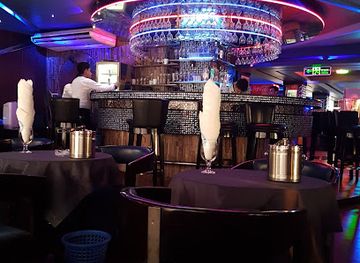
Nightlife in Greater Noakhali is comparatively quiet and centres on family restaurants, tea stalls, cafés, hotel dining rooms and evening markets rather than dedicated nightclub districts. Feni has the most commercially active evening scene because of its size and position on the Dhaka–Chattogram corridor, while Maijdee and Lakshmipur offer modest urban concentrations of restaurants and cafés. In rural areas, evenings are more likely to involve conversation at a tea stall, a meal with family or community events than late-night entertainment. Alcohol is not central to public social life, and visitors should respect Bangladesh's conservative social expectations and local regulations. Coastal and island settlements become especially quiet after dark, with limited transport and lighting, so plan returns before nightfall and rely on accommodation providers for local guidance.
-
Bluemoon Recreation Club
Discover Bluemoon Recreation Club: A vibrant bar and recreation center in Banani, Dhaka, perfect for relaxation and socializing.
-
Restaurant
Rajmahal Restora
Discover the authentic flavors of Bangladesh at Rajmahal Restora, a must-visit dining destination in Noakhali, known for its delectable local cuisine.
-
Sky View Restaurant
Experience the finest Chinese cuisine with a breathtaking view at Sky View Restaurant in Noakhali, where every meal is a delightful adventure.
-
Bar
আমানিয়া হোটেল এন্ড রেস্টুরেন্ট
Experience the vibrant flavors and warm hospitality at Amaniya Hotel and Restaurant in Maijdee, Noakhali.


Best nightclubs in Greater Noakhali
Nightlife in Greater Noakhali is comparatively quiet and centres on family restaurants, tea stalls, cafés, hotel dining rooms and evening markets rather than dedicated nightclub districts. Feni has the most commercially active evening scene because of its size and position on the Dhaka–Chattogram corridor, while Maijdee and Lakshmipur offer modest urban concentrations of restaurants and cafés. In rural areas, evenings are more likely to involve conversation at a tea stall, a meal with family or community events than late-night entertainment. Alcohol is not central to public social life, and visitors should respect Bangladesh's conservative social expectations and local regulations. Coastal and island settlements become especially quiet after dark, with limited transport and lighting, so plan returns before nightfall and rely on accommodation providers for local guidance.
-
Bar
Bluemoon Recreation Club
Experience the perfect blend of fitness, dining, and nightlife at Bluemoon Recreation Club in Dhaka.
-
Bar
SKYe Lounge Bar
Experience the vibrant atmosphere and stunning skyline views at SKYe Lounge Bar, the ultimate destination for cocktails and casual dining in Dhaka.
-
Night club
নোয়া খালি মাইজদি
Dive into the vibrant nightlife of Dhaka at নোয়া খালি মাইজদি, where music, dance, and unforgettable moments come alive.
-
Club
Noakhali Club
Discover the heart of Noakhali's nightlife at Noakhali Club, a lively venue for entertainment, culture, and social gatherings.


Best shops in Greater Noakhali
Shopping in Greater Noakhali is centred on traditional market towns, high streets, roadside stalls and district-level bazaars rather than large destination shopping complexes. Feni offers the broadest urban retail selection, while Maijdee and Lakshmipur are useful for clothing, household goods, sweets, books, mobile services and everyday Bengali food products. Rural markets are particularly interesting for seasonal vegetables, fish, rice, spices, betel nut, coconut products and practical goods used by farming and fishing communities. Visitors can look for locally made snacks, sweets, woven items and simple handicrafts, although the availability and quality vary between markets. Nijhum Dwip and other coastal areas are not dependable places for specialised souvenirs, so buy essentials and gifts in the main towns before travelling onwards. Bargaining may be normal in informal markets, but it is better conducted politely and with awareness of local prices.
-
Shopping mall
Noakhali Super Market
Discover a shopping paradise at Noakhali Super Market, the largest shopping destination in greater Noakhali, blending local culture with modern retail.
-
Bazar
Senbag Bazar
Discover the lively atmosphere of Senbag Bazar in Kadra, where local culture and vibrant shopping await every traveler.
-
Market
Jamiderhat Bazar ( জমিদারহাট বাজার )
Discover the vibrant culture and authentic flavors of Bangladesh at Jamiderhat Bazar, a must-visit market in Rasulpur for an unforgettable experience.
-
Clothing store
M/s Mobarak Cloth Store
Explore the rich textile heritage at M/s Mobarak Cloth Store in Char Jublee, offering a stunning collection of traditional and contemporary clothing.


Get your free copy of our complete guide to Greater Noakhali, delivered straight to you.
Everything on this page, from attractions and restaurants to essentials and local phrases, in one PDF you can read offline, print or share.
Already have an account? Sign in
Your Greater Noakhali guide is ready.
We'll send it to · Not you? Sign out

Getting your guide ready…
We are putting together a fresh copy of the Greater Noakhali guide. This can take up to a minute.
This can take a few moments. If your browser asks, choose Allow so the download can start. You'll find the guide in your Downloads folder.
Nothing happened? Download it again
Sorry, the guide is taking longer than usual. Please try again in a minute, or get it by email instead.
Greater Noakhali essentials
Currency and Payment
Safety
Emergency Situations
Do's and Don'ts
Local Tips
From Eve
Local phrases worth knowing
You don't need to get them perfect. A few words go a long way, and locals appreciate the effort.
Basics
| English | Local | Say it |
|---|---|---|
| Hello | হ্যালো | [Halo] |
| Goodbye | বিদায় | [Biday] |
| Yes | হ্যাঁ | [Hya] |
| No | না | [Na] |
| Please/You’re welcome | অনুগ্রহ করে/স্বাগতম | [Onugroho kore/Swagatam] |
| Thank you | ধন্যবাদ | [Dhonnobad] |
| Excuse me/Sorry | মাফ করবেন/দুঃখিত | [Maf korben/Dukhito] |
| How are you? | আপনি কেমন আছেন? | [Apni kemon achen?] |
| Fine. And you? | ভালো। এবং আপনি? | [Bhalo. Ebong apni?] |
| Do you speak English? | আপনি কি ইংরেজি বলছেন? | [Apni ki Ingreji bolchen?] |
| I don't understand | আমি বুঝি না | [Ami bujhi na] |
Eating & Drinking
| English | Local | Say it |
|---|---|---|
| I’d like to see the menu, please | অনুগ্রহ করে মেনু দেখাবেন | [Onugroho kore menu dekhaben] |
| I don’t eat meat | আমি মাংস খাই না | [Ami mangsho khai na] |
| Cheers! | চিয়ার্স! | [Cheers!] |
| I would like to pay, please | অনুগ্রহ করে আমি পরিশোধ করতে চাই | [Onugroho kore ami porishodh korte chai] |
Emergencies
| English | Local | Say it |
|---|---|---|
| Help! | শাহায্য করো! | [Shahajjo koro!] |
| Go away! | দূর হও! | [Dur hao!] |
| Call the Police! | পুলিশকে ডাকুন! | [Polishke dakhun!] |
| Call a doctor! | ডাক্তার ডাকুন! | [Daktar dakhun!] |
| I’m lost | আমি হারিয়ে গেছি | [Ami hariye gechi] |
| I’m ill | আমি অসুস্থ | [Ami osustho] |
Shopping
| English | Local | Say it |
|---|---|---|
| I’d like to buy... | আমি কিনতে চাই... | [Ami kinte chai...] |
| I’m just looking | আমি শুধু দেখছি | [Ami shudhu dekhchi] |
| How much is it? | এটার দাম কত? | [Etar dam koto?] |
| That’s too expensive | এটি খুব ব্যয়বহুল | [Eti khub byoybohul] |
| Can you lower the price? | আপনি কি দাম কমাতে পারেন? | [Apni ki dam komate paren?] |
Time & Numbers
| English | Local | Say it |
|---|---|---|
| What time is it? | এখন কত বাজে? | [Ekhon koto bajje?] |
| It’s one o'clock | এটি একটা বাজে | [Eti ekta bajje] |
| Half past (10) | সাড়ে (১০) | [Sare (10)] |
| Morning | সকাল | [Sakal] |
| Afternoon | দুপুর | [Dupur] |
| Evening | সন্ধ্যা | [Shondhya] |
| Yesterday | গতকাল | [Gotokal] |
| Today | আজ | [Aj] |
| Tomorrow | কাল | [Kal] |
| 1 | ১ | [1] |
| 2 | ২ | [2] |
| 3 | ৩ | [3] |
| 4 | ৪ | [4] |
| 5 | ৫ | [5] |
| 6 | ৬ | [6] |
| 7 | ৭ | [7] |
| 8 | ৮ | [8] |
| 9 | ৯ | [9] |
| 10 | ১০ | [10] |
Transport & Directions
| English | Local | Say it |
|---|---|---|
| Where's a/the...? | কোথায় একটি ...? | [Kothay akta...?] |
| What’s the address? | ঠিকানা কি? | [Thikana ki?] |
| Can you show me (on the map)? | আপনি কি আমাকে দেখাতে পারেন (নকশায়)? | [Apni ki amake dekhate paren (nokshay)?] |
| When's the next (bus)? | পরবর্তী (বাস) কখন? | [Poroborti (bas) kokhon?] |
| A ticket (to ....) | একটি টিকেট (যাতে ...) | [Ekti ticket (jagate...)] |
History of Greater Noakhali
Early Delta Settlement and Bhulua
The lands around present-day Noakhali and Lakshmipur developed through the gradual formation of the lower Meghna delta. River channels, deposited silt and coastal accretion repeatedly altered the relationship between settlement and water. Medieval traditions associate the area with Bhulua, a local political formation whose influence extended across parts of the eastern delta. Although the precise boundaries of historical Bhulua changed over time, the name survives in regional historical memory and helps explain why the area developed a distinct identity between central Bengal and the coastal frontier.
Sultanate and Mughal Incorporation
From the late medieval period, the region became increasingly connected to the political and commercial systems of Bengal's sultanates and, later, the Mughal Empire. Mughal administration brought revenue collection, Muslim settlement and stronger links with inland markets, while waterways remained the principal means of movement. Agricultural expansion followed the clearing and cultivation of delta lands. Several surviving mosques and religious foundations, including the later Bajra Shahi Mosque, reflect the long development of Islamic institutions in the countryside rather than a single moment of political change.
Coastal Frontier and Maritime Insecurity
The estuarine coast around Noakhali and the islands of the lower Meghna was historically difficult for distant governments to control. River channels, shifting sandbars and connections towards the Bay of Bengal created opportunities for trade as well as raiding. Accounts of Portuguese and Arakanese activity in the wider coastal zone form part of the region's early modern history, although the intensity and location of such activity varied over time. These conditions encouraged settlements to remain closely tied to waterways, defensive sites and locally organised authority.
Colonial Administration and Changing Land
Under British rule, the region was incorporated into the administrative and revenue structures of eastern Bengal. Roads, courts, schools and market centres expanded, but the delta's physical instability continued to shape government and private life. River erosion repeatedly damaged settlements, including the old Noakhali town, and administrative functions eventually shifted inland to Maijdee. Colonial commercial networks also linked rice, fish, betel nut and other local products to larger markets, while giving towns a more formal civic structure.
The Gandhi Peace Mission of 1946
Communal violence in Noakhali in 1946 led Mahatma Gandhi to travel through affected villages, including areas around Jayag and nearby settlements. He stayed in the region for several months, speaking with communities and advocating reconciliation during a period of profound political tension before the partition of British India. The Gandhi Ashram at Jayag preserves the memory of this peace mission and the local efforts associated with it. The episode remains one of the most internationally recognisable chapters in Greater Noakhali's modern history.
Partition, Migration and Administrative Change
The partition of 1947 placed the region within East Bengal, later East Pakistan, and brought major changes in population, property ownership, political institutions and cross-border connections. Noakhali, Lakshmipur and Feni continued to function as linked areas, though their administrative status changed over subsequent decades. The growth of roads, schools and market towns gradually reduced dependence on waterways for some journeys, while river erosion and land formation continued to move the practical boundaries of settlement.
The Liberation War and Bangladesh
During the Liberation War of 1971, people across the Greater Noakhali area took part in resistance, political mobilisation, relief work and the formation of forces supporting Bangladesh's independence. The war affected towns and villages through military operations, displacement and disruption of communications. After independence, the region developed within Bangladesh's new national framework, with expanded local administration and transport links. Its contemporary character reflects both this national history and the older realities of a densely inhabited, environmentally changeable delta.
Greater Noakhali in Photos
Browse through our photo collection highlighting the charm and character of the destination.
Neighbouring regions of Greater Noakhali
The closest regions to Greater Noakhali, if you have time for more than one.
-

-

-

-

-


Swipe for more regions
Explore more

Explore more of Bangladesh
Discover Bangladesh: A land of rivers, rich culture, and breathtaking landscapes. Explore ancient sites, vibrant cities, and the unique flavors of this South Asian gem.
Explore Bangladesh