

Free Western Belize Travel Guide & Mobile App
Explore Western Belize with free travel guides. Discover regional history, expert tips, proposed trips, and audio guides on web or mobile app.


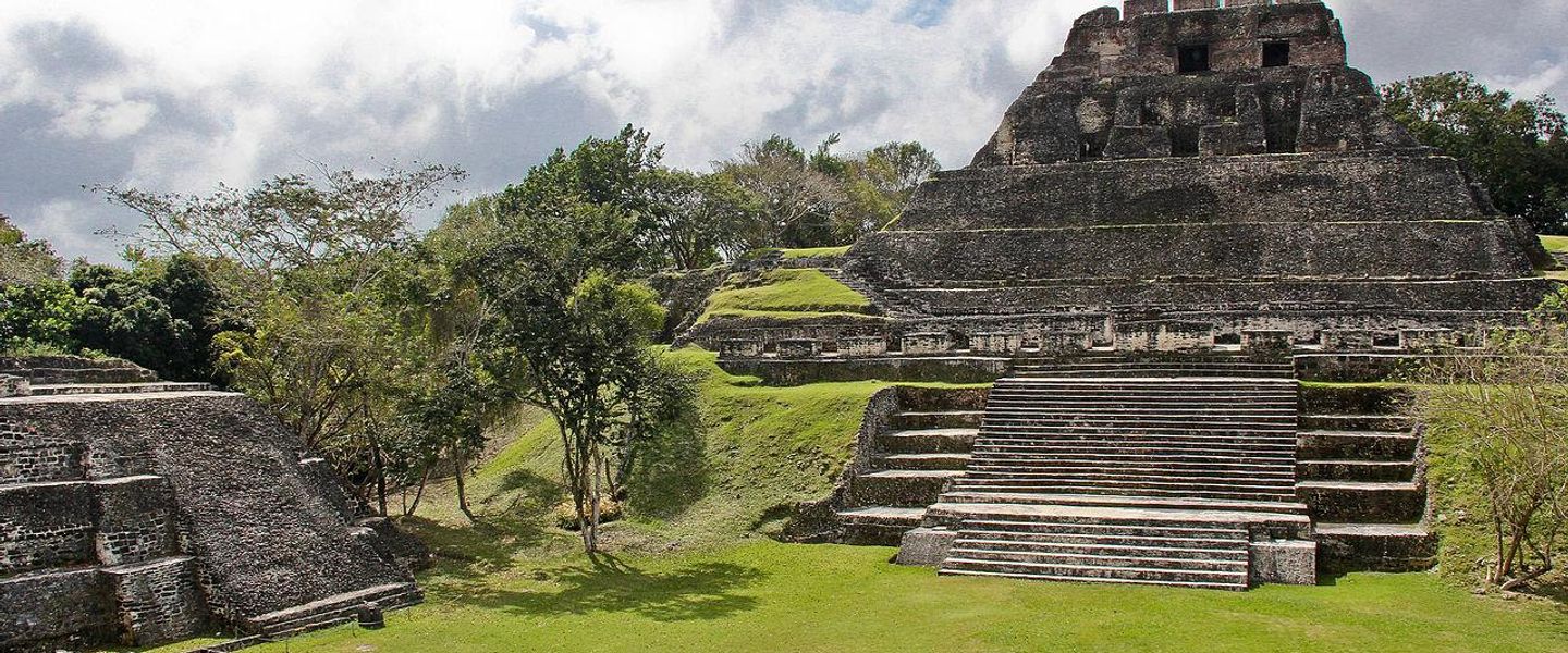


Western Belize combines Maya ruins, river adventures, limestone caves, wildlife and forested mountain landscapes around San Ignacio and Belmopan.
Read more about Western Belize
When is the best time to visit Western Belize?
Best: January–March · 29–30°C| Month | High (°C) | Rainfall (mm) |
|---|---|---|
| January (best) | 29 | 75 |
| February (best) | 29 | 70 |
| March (best) | 30 | 60 |
| April | 30 | 70 |
| May | 32 | 115 |
| June | 32 | 175 |
| July | 32 | 175 |
| August | 32 | 185 |
| September | 32 | 200 |
| October | 31 | 185 |
| November | 29 | 135 |
| December | 29 | 95 |
Getting to and around Western Belize
How to get there
Transportation
Top city travel guides in Western Belize
The cities of Western Belize, and the easiest places to base yourself.
-

-

-

-


Swipe for more cities
Destinations in Western Belize
Resorts, valleys and scenic spots worth a trip of their own.
-

-

-


Swipe for more destinations
Best attractions in Western Belize
Western Belize’s attractions combine Maya archaeology, cave exploration, rivers and forest landscapes rather than concentrating in a single urban centre. Xunantunich, reached near San José Succotz after crossing the Mopan River, is one of the region’s most accessible major sites, while Caracol offers a more remote archaeological experience deep in the forest. Cahal Pech, above San Ignacio, provides a compact introduction to Maya architecture and settlement history. Actun Tunichil Muknal is a demanding guided cave excursion involving walking, swimming and climbing, with ancient ceremonial remains inside the cave system. Other cave activities, including Barton Creek Cave and selected areas of the Caves Branch network, offer different levels of adventure. Mountain Pine Ridge Forest Reserve changes the scenery with pine woodland, rocky streams and waterfalls such as Rio On Pools and Big Rock Falls. River canoeing, tubing, birdwatching, hiking and wildlife excursions are widespread, though access depends on weather and road conditions. Belmopan’s government district and nearby nature sites provide a more low-key complement to San Ignacio’s tour infrastructure.
-
Tourist attraction
Corozal House Of Culture
Explore the rich cultural heritage of Corozal at the House of Culture, where history, art, and local traditions come to life.
-
Tourist attraction
Corozal - Gateway To Ancient Chactemal
Discover Corozal, the charming gateway to the ancient Maya site of Chactemal, known for its stunning beaches and rich cultural heritage.
-
 Lodge
LodgeBelize River Lodge
Experience the natural beauty and adventure at Belize River Lodge, your perfect retreat for bird watching, fishing, and exploration in Belize.
-
Tourist attraction
Isiah Emmanuel Morter Monument
Explore the Isiah Emmanuel Morter Monument in Belize City, a significant tribute to local history and a beautiful landmark for tourists seeking culture and heritage.
Best landmarks in Western Belize
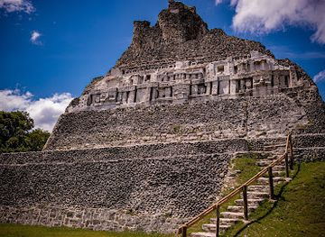
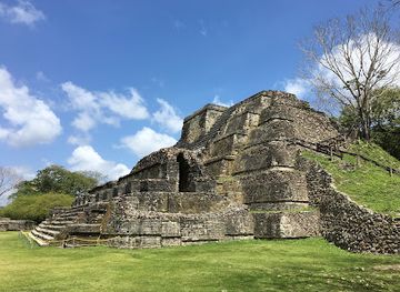
The most recognisable landmarks of Western Belize are closely tied to its Maya and inland landscapes. El Castillo at Xunantunich dominates the ridge above the Mopan River and remains one of Belize’s most memorable archaeological structures, with views across the surrounding countryside. Cahal Pech occupies a hill above San Ignacio, where its plazas and temples reveal how a Maya centre was integrated into a lived landscape. Farther south-west, Caracol’s great monuments and causeways extend through protected forest, giving the site both archaeological importance and a powerful geographical setting. The steep limestone entrances and underground chambers of ATM Cave are natural and cultural landmarks at once, although access is controlled and physically demanding. In Mountain Pine Ridge, granite formations, Rio On Pools and Big Rock Falls provide a contrasting natural identity. Belmopan’s planned government quarter is a modern civic landmark, representing Belize’s decision to place its capital in the inland west rather than on the vulnerable coast.
-
Archaeological site
Xunantunich Mayan Ruins
Explore the ancient wonders of Xunantunich Mayan Ruins, a breathtaking archaeological site in Belize that showcases the rich history of the Maya civilization.
-
Grill
Secret Beach Belize
Experience the serene beauty and vibrant culture of Secret Beach in Belize, where adventure meets relaxation in a tropical paradise.
-
Historical landmark
Altun Ha
Explore the ancient Mayan city of Altun Ha in Belize, where history, architecture, and nature converge in a breathtaking setting.
-
Zoo
The Belize Zoo and Tropical Education Center
Discover the incredible wildlife of Belize at The Belize Zoo and Tropical Education Center, a unique conservation-focused destination for all ages.
Explore Western Belize on the map
Plan your trip on one map. See where the top cities, national parks and sights are, and book hotels and experiences in a few clicks.
Best hotels in Western Belize
Best restaurants in Western Belize
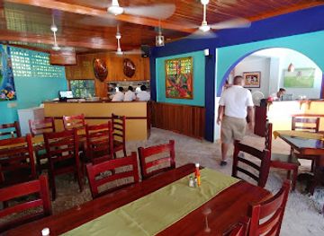
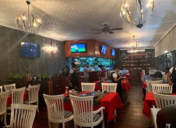
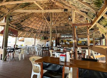
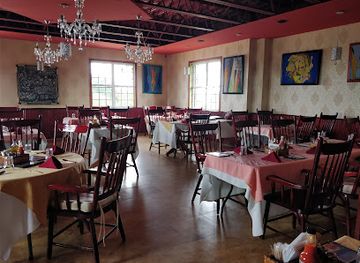
Dining in Western Belize is strongest in San Ignacio, Santa Elena and Belmopan, where small restaurants, cafés, market stalls and casual eateries reflect Belize’s Creole, Mestizo, Maya and Caribbean influences. Rice and beans with stewed chicken, garnaches, tamales, salbutes and fried plantain are common points of introduction, while fresh fruit juices and local snacks suit the hot climate. Restaurants in San Ignacio often serve visitors heading to caves and ruins, alongside international and vegetarian options, whereas rural lodges may focus on straightforward meals using local produce. Markets are useful for fruit, baked goods and prepared food, and farms in the Cayo area contribute vegetables, dairy products and other ingredients. Mennonite communities have also influenced the western interior’s agricultural economy, although particular products and businesses vary. Tipping is customary for good service, and visitors should carry cash for smaller establishments outside the main towns.
-
Central American
Elvi's Kitchen
Discover Elvi's Kitchen in San Pedro: A vibrant seafood restaurant offering authentic Central American cuisine and delightful cocktails.
-
Restaurant
Midtown Restaurant & Bar
Discover the vibrant flavors of Belize at Midtown Restaurant & Bar - where culinary excellence meets warm hospitality.
-
Restaurant
Bird's Isle Restaurant
Experience authentic Belizean cuisine with stunning views at Bird's Isle Restaurant in Belize City.
-
Restaurant
Celebrity Restaurant & Bar
Discover exquisite flavors at Celebrity Restaurant & Bar in Belize City, where local cuisine meets stunning waterfront views.
Best bars in Western Belize
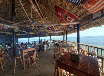
Evening life in Western Belize is concentrated in San Ignacio and Santa Elena, with a relaxed mix of Belizean pubs, hotel bars, casual restaurants and occasional live music rather than a large nightclub scene. The towns’ central streets are the most practical places for a drink after a day of cave or ruin visits, and some venues serve local beer, rum-based drinks and simple cocktails. Belmopan has a quieter evening character shaped by residents, students and government workers, with restaurants and modest bars rather than a dedicated entertainment district. In rural Cayo, evenings normally centre on lodge dining, community events or a small local bar, and venues may close earlier than visitors expect. Check current arrangements locally, particularly outside the main towns, and use a trusted taxi or pre-arranged transport if returning from an evening venue.
-
Grill
Palapa Bar and Grill
Experience the vibrant flavors and lively atmosphere of Palapa Bar and Grill, San Pedro's top spot for delicious food and live music!
-
Grill
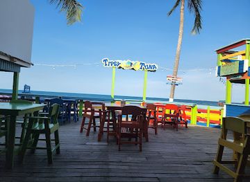
Tipsy Tuna
Discover the vibrant culinary scene at Tipsy Tuna, a grill and bar in Placencia offering delightful flavors and a relaxed atmosphere.
-
Grill
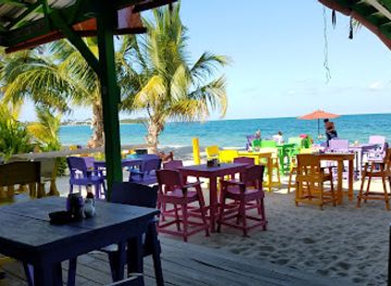
Barefoot Beach Bar
Experience the vibrant atmosphere and delicious grill options at Barefoot Beach Bar in Placencia, Belize, your perfect beach getaway.
-
Restaurant
Midtown Restaurant & Bar
Discover the flavors of Belize at Midtown Restaurant & Bar, where local ingredients meet international cuisine in a welcoming atmosphere.
Best nightclubs in Western Belize
Evening life in Western Belize is concentrated in San Ignacio and Santa Elena, with a relaxed mix of Belizean pubs, hotel bars, casual restaurants and occasional live music rather than a large nightclub scene. The towns’ central streets are the most practical places for a drink after a day of cave or ruin visits, and some venues serve local beer, rum-based drinks and simple cocktails. Belmopan has a quieter evening character shaped by residents, students and government workers, with restaurants and modest bars rather than a dedicated entertainment district. In rural Cayo, evenings normally centre on lodge dining, community events or a small local bar, and venues may close earlier than visitors expect. Check current arrangements locally, particularly outside the main towns, and use a trusted taxi or pre-arranged transport if returning from an evening venue.
-
Grill
Thirsty Thursday
Discover the vibrant culinary scene at Thirsty Thursday, a must-visit grill in Belize City offering delicious food and a lively atmosphere.
-
Bar
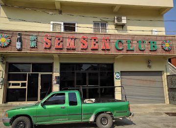
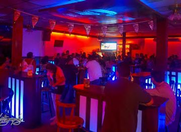
Sen Sen Club
Discover the vibrant nightlife at Sen Sen Club in Belize City, where locals and tourists unite over drinks and live entertainment.
-
Night club
Hi5 Pub & Nightclub
Discover the vibrant nightlife of Orange Walk at Hi5 Pub & Nightclub, where great music, delicious food, and unforgettable experiences await.
-
Casino
MONETA Night Club and Casino
Discover the excitement of MONETA Night Club and Casino, a premier hotspot for gaming and nightlife in San Pedro, Belize.

Best shops in Western Belize
Shopping in Western Belize is practical and locally oriented, with San Ignacio and Santa Elena providing the broadest choice of small shops, market stalls, craft sellers, cafés and food outlets. San Ignacio Market is useful for fresh produce, snacks and an everyday view of regional commerce, while Belmopan has a quieter market and retail scene serving local residents and government workers. Visitors can look for carved wood, small artworks, woven goods, locally produced food, chocolate, spices and packaged agricultural products, but quality and availability vary by season and vendor. Shops connected with tourism often sell Maya-inspired crafts, so ask about provenance rather than assuming that every item was made locally or represents a specific Maya community. Rural Cayo businesses and farms may offer dairy products, baked goods or other produce, subject to opening arrangements. Carry cash for informal stalls, and check customs and airline restrictions before buying food, seeds, wood or other natural materials.
-
Department store
Mirab Department Store
Experience the best of Belizean shopping at Mirab Department Store, where quality products meet exceptional service in Belize City.
-
Shopping mall
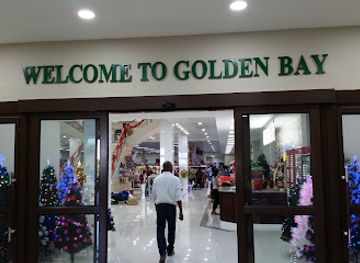
Golden Bay Store
Discover the best of Belizean culture and shopping at Golden Bay Store, your ultimate retail destination in Belize City.
-
Gift shop
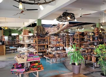
Art Box - Belize Artisan Store & Cafe
Explore Belize's rich artisan culture at Art Box, an artisan store and café offering unique crafts, local foods, and a taste of the vibrant Belizean spirit.
-
Art gallery
GariMaya Gift Shop
Explore the rich artistry of Belize at GariMaya Gift Shop, where local craftsmanship meets unforgettable souvenirs.


Get your free copy of our complete guide to Western Belize, delivered straight to you.
Everything on this page, from attractions and restaurants to essentials and local phrases, in one PDF you can read offline, print or share.
Already have an account? Sign in
Your Western Belize guide is ready.
We'll send it to · Not you? Sign out

Getting your guide ready…
We are putting together a fresh copy of the Western Belize guide. This can take up to a minute.
This can take a few moments. If your browser asks, choose Allow so the download can start. You'll find the guide in your Downloads folder.
Nothing happened? Download it again
Sorry, the guide is taking longer than usual. Please try again in a minute, or get it by email instead.
Western Belize essentials
Currency and Payment
Safety
Emergency Situations
Do's and Don'ts
Local Tips
From Eve
Local phrases worth knowing
You don't need to get them perfect. A few words go a long way, and locals appreciate the effort.
Basics
| English | Local | Say it |
|---|---|---|
| Hello | Beli | [Beh-lee] |
| Goodbye | Bye | [Bye] |
| Yes | Yes | [Yes] |
| No | No | [No] |
| Please/You're welcome | Please | [Pleez] |
| Thank you | Thank you | [Thank you] |
| Excuse me/Sorry | Excuse me | [Ex-kyoos mee] |
| How are you? | How you di? | [How yuh dee?] |
| Fine. And you? | I good. An yuh? | [I good. An yuh?] |
| Do you speak English? | You speak English? | [Yuh speek English?] |
| I don't understand | I noh undastand | [I noh un-dah-stand] |
Eating & Drinking
| English | Local | Say it |
|---|---|---|
| I'd like to see the menu, please | Mi wah si di menu, please | [Mi wah see dee meh-noo, pleez] |
| I don't eat meat | Mi noh eat meat | [Mi noh eat meet] |
| Cheers! | Cheers! | [Cheers!] |
| I would like to pay, please | Mi wah pay, please | [Mi wah pay, pleez] |
Emergencies
| English | Local | Say it |
|---|---|---|
| Help! | Help! | [Help!] |
| Go away! | Guh weh! | [Guh weh!] |
| Call the Police! | Call di Police! | [Call dee Po-lees!] |
| Call a doctor! | Call a docta! | [Call a dok-ta!] |
| I'm lost | Mi lost | [Mi lost] |
| I'm ill | Mi sick | [Mi sick] |
Shopping
| English | Local | Say it |
|---|---|---|
| I'd like to buy... | Mi wah buy... | [Mi wah buy...] |
| I'm just looking | Mi jus deh look | [Mi jus deh look] |
| How much is it? | How much fi dis? | [How much fee dis?] |
| That's too expensive | Dat too pricey | [Dat too pry-see] |
| Can you lower the price? | Yuh can lower di price? | [Yuh can low-er dee pryce?] |
Time & Numbers
| English | Local | Say it |
|---|---|---|
| What time is it? | Wah time it? | [Wah time it?] |
| It's one o'clock | It one o'clock | [It one o'clock] |
| Half past (10) | Half past ten | [Half past ten] |
| Morning | Mornin' | [Mornin'] |
| Afternoon | Afternoon | [Afternoon] |
| Evening | Evenin' | [Evenin'] |
| Yesterday | Yesterday | [Yesterday] |
| Today | Today | [Today] |
| Tomorrow | Tomorrow | [Tomorrow] |
| 1 | Wan | [Wahn] |
| 2 | Tu | [Too] |
| 3 | Tree | [Tree] |
| 4 | Foh | [Foh] |
| 5 | Fai | [Fai] |
| 6 | Sih | [Sih] |
| 7 | Sev | [Sev] |
| 8 | Eit | [Eit] |
| 9 | Nain | [Nain] |
| 10 | Ten | [Ten] |
Transport & Directions
| English | Local | Say it |
|---|---|---|
| Where's a/the...? | Wah deh...? | [Wah deh...?] |
| What's the address? | Wah di address? | [Wah dee ah-dress?] |
| Can you show me (on the map)? | Yuh can show mi (pon di map)? | [Yuh can show mi (pon dee map)?] |
| When's the next (bus)? | When di next (bus)? | [When dee next (bus)?] |
| A ticket (to ....) | A ticket (to....) | [A ticket (to....)] |
History of Western Belize
Early Maya settlement and the Classic cities
Western Belize contains some of the most important Maya archaeological sites in the country. Xunantunich, above the Mopan River, flourished particularly during the Maya Classic period, while Caracol became a major political power in the southern lowlands. Their plazas, temples, carved monuments and sophisticated water-management systems show that the region supported complex urban societies linked to wider networks across the Maya world. Settlement continued through changing political circumstances, and caves in the surrounding limestone landscape held ceremonial importance as well as practical value.
Caracol and the Maya lowland rivalries
Caracol was among the most influential Maya polities of the central lowlands. Its rulers recorded military victories and political relationships on carved monuments, including conflicts involving Tikal in present-day Guatemala. The site’s extensive causeways, reservoirs and monumental architecture indicate a large and organised population rather than an isolated ceremonial centre. Today, Caracol’s remote forest location preserves a strong sense of scale, although its distance from San Ignacio means that visiting it requires a full-day journey and careful planning.
Spanish missions and frontier contact
Spanish missionaries and officials entered the wider region during the colonial period, encountering established Maya communities and a difficult interior environment. Permanent Spanish control remained limited, and the forests west of the Belize River stayed politically contested. Mission activity, trade and occasional conflict formed part of a wider frontier history in which Maya communities negotiated, resisted or adapted to outside pressures. Much of the region’s later development therefore emerged through gradual contact rather than a single, comprehensive colonial transformation.
British logging and the inland economy
From the eighteenth century onwards, British logwood and mahogany interests expanded through the territory then known as British Honduras. Rivers and rough tracks were important for moving timber, and the western interior became connected to an extractive economy shaped by forests, labour and trading settlements. Logging altered landscapes and encouraged the growth of transport routes and commercial centres, while also contributing to social divisions and exploitation that affected the colony more broadly. Remnants of this history remain in the region’s roads, settlements and enduring relationship with forest resources.
New communities and agricultural development
The modern population of western Belize reflects several waves of settlement, including Maya, Mestizo, Creole, Garifuna and later immigrant communities. Mennonite communities established agricultural settlements in parts of Cayo during the twentieth century, contributing to farming, food production and local commerce. Their presence sits within a wider pattern of rural development in which cattle, crops and small-scale enterprise have complemented tourism. The region’s cultural landscape is consequently more varied than its archaeological image alone suggests.
Belmopan and the road to independence
Hurricane Hattie devastated Belize City in 1961, encouraging the colonial government to develop an inland capital away from the coast. Belmopan was established in the 1970s and became the capital of independent Belize in 1981. Its planned layout and government buildings contrast with the older commercial character of San Ignacio and Santa Elena. The capital’s creation marked a major shift in the geography of national administration and helped give the western interior a more prominent role in Belize’s political life.
Archaeology, conservation and adventure tourism
Since the late twentieth century, archaeology and conservation have reshaped how Western Belize is understood and visited. Excavation and research at sites such as Caracol and Xunantunich have brought Maya history to international attention, while protected areas and forest reserves support wildlife conservation. Guided cave visits, river activities and archaeological tourism now provide important local income. This development also brings responsibilities: fragile cave deposits, ancient remains, forest habitats and archaeological structures require controlled access and respectful behaviour.
Western Belize in Photos
Browse through our photo collection highlighting the charm and character of the destination.
Neighbouring regions of Western Belize
The closest regions to Western Belize, if you have time for more than one.
-

-

-

-

-


Swipe for more regions
Explore more
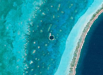
Explore more of Belize
Discover Belize: A Caribbean paradise known for its stunning barrier reef, rich cultural heritage, and eco-friendly adventures in lush rainforests and pristine waters.
Explore Belize