Mount Tamalpais: Marin's Majestic Peak
Discover breathtaking panoramic views, redwood forests, and historic trails atop Mount Tamalpais, Marin County's iconic peak, offering an unforgettable escape into nature just north of San Francisco.
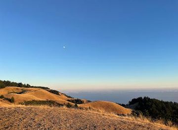
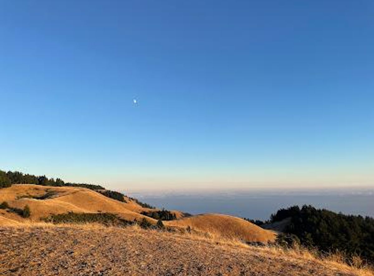
Mount Tamalpais, a Marin County landmark, beckons with its stunning natural beauty and panoramic vistas. Rising majestically from the heart of Marin, just north of San Francisco, this iconic peak offers a diverse landscape of redwood forests, oak woodlands, and open grasslands. For generations, 'Mount Tam' has been a beloved destination for outdoor enthusiasts, offering a respite from the bustling city and a chance to reconnect with nature. Geologically, Mount Tamalpais is composed of Franciscan chert, a type of sedimentary rock. Its unique serpentine soil fosters the growth of pygmy cypress trees, a fascinating example of adaptation to nutrient-poor conditions. The mountain's varied topography supports a remarkable array of plant life, with over 750 species thriving within its boundaries. In springtime, the slopes come alive with vibrant wildflowers, painting the landscape in a kaleidoscope of colors. The mountain's history is rich and multifaceted. Before European colonization, the Coast Miwok people inhabited the area, living in harmony with the land and its resources. They revered Mount Tamalpais as a sacred place, a connection to their spiritual beliefs and ancestral heritage. The name 'Tamalpais' itself is derived from the Miwok language, meaning 'bay mountain' or 'coast mountain.' In the late 19th century, Mount Tamalpais gained popularity as a recreational destination for San Franciscans. Trails were developed, and in 1896, the Mount Tamalpais Scenic Railway was completed. This 'crookedest railroad in the world' transported visitors to the summit, where they could enjoy the Summit Tavern, a hotel and restaurant offering stunning views and lively entertainment. Though the railway was dismantled in the 1930s, its legacy lives on in the Old Railroad Grade Trail, a popular hiking route that follows the former railway bed. Today, Mount Tamalpais State Park encompasses much of the mountain, preserving its natural and cultural heritage for future generations. The park boasts over 60 miles of trails, connecting to a 200-mile trail system that extends across the surrounding lands. Hikers can explore a variety of routes, from gentle strolls to challenging climbs, each offering unique perspectives and breathtaking scenery. The East Peak, the mountain's highest point, is a must-visit destination. From here, visitors can enjoy panoramic views of the San Francisco Bay Area, the Pacific Ocean, and the distant Sierra Nevada on clear days. The East Peak Visitor Center, housed in a historic stone building, offers exhibits on the mountain's natural and cultural history. Nearby, the Gravity Car Barn tells the story of the Mount Tamalpais Scenic Railway. For those seeking a more immersive experience, camping is available at several campgrounds within the park. Pantoll Campground and Bootjack Campground offer first-come, first-served campsites, while Steep Ravine Environmental Campground provides a unique opportunity to camp in rustic cabins or environmental campsites near the ocean. Reservations are highly recommended, especially during peak season. Mount Tamalpais is also a haven for wildlife. Red-tailed hawks, turkey vultures, and other birds of prey soar overhead, while black-tailed deer, coyotes, and bobcats roam the forests and grasslands. The park's diverse habitats support a wide array of animal species, making it a prime destination for wildlife watching. Whether you're a seasoned hiker, a casual nature lover, or simply seeking a moment of peace and tranquility, Mount Tamalpais offers something for everyone. Its stunning scenery, rich history, and diverse recreational opportunities make it a truly special place. Come and experience the magic of 'Mount Tam' for yourself, and discover why it has captured the hearts of generations.
Local tips
- Check the weather forecast before you go, as conditions on Mount Tamalpais can change rapidly. Even on a sunny day in San Francisco, the summit can be foggy and windy.
- Bring layers of clothing, as temperatures can vary significantly depending on the elevation and time of day. A jacket or sweater is always a good idea.
- Wear sturdy hiking shoes, as the trails can be steep and uneven in places. Proper footwear will help you avoid slips and falls.
- Bring plenty of water and snacks, especially if you plan on hiking. There are limited options for purchasing food and drinks within the park.
- Arrive early, especially on weekends and holidays, as parking lots can fill up quickly. Consider carpooling or using public transportation to avoid parking hassles.
A brief summary to Mt Tamalpais
- California, US
Getting There
-
Driving
From Highway 101, take the Stinson Beach exit (Highway 1) and follow the signs up the mountain. This scenic route winds its way up to Mount Tamalpais State Park. Parking is available at various locations, including East Peak, Pantoll, and Bootjack. Parking fees are $8 per vehicle ($7 for seniors) at East Peak, Pantoll, and Bootjack lots. Credit cards are accepted at Pantoll during business hours; cash or check self-registration is required at East Peak and Bootjack.
-
Public Transport
Take the Golden Gate Transit Route 61 bus from Sausalito Ferry Terminal to Pantoll Ranger Station on weekends and holidays during the summer. From the Pantoll Ranger Station, you can access various trails leading to the summit and other points of interest. A one-way fare on Golden Gate Transit is approximately $4-$7, depending on the distance.
-
Taxi/Ride-Share
A taxi or ride-share from Mill Valley to Pantoll Ranger Station or East Peak will cost approximately $25-$40, depending on traffic and availability. Be aware that cell service can be unreliable in certain areas of the park, so arranging a return trip in advance is recommended.