

Free Martinez Travel Guide & Mobile App
Plan your Martinez trip with Evendo. Get free guides to top attractions, restaurants, hotels, and bars. Web access or download the mobile app.


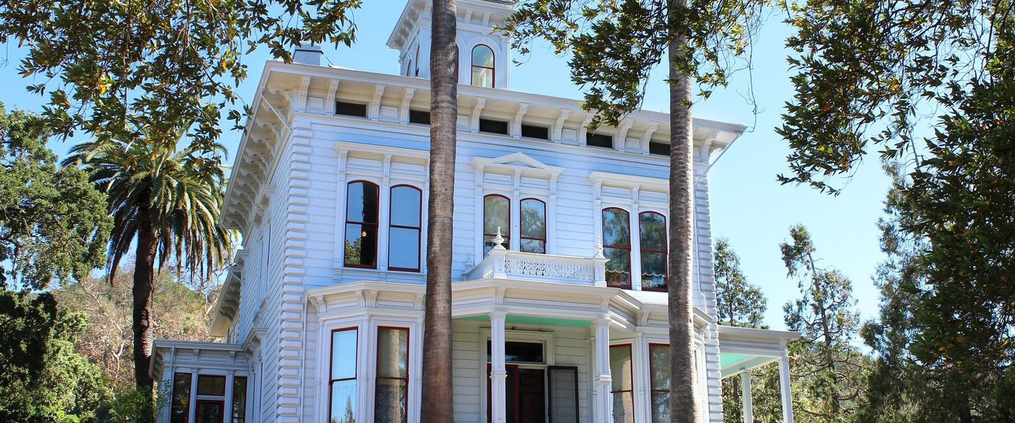


Martinez, California, pairs a historic waterfront, John Muir heritage, Carquinez Strait views, independent shops and relaxed Bay Area sightseeing and culture.
Waterfront History
Martinez occupies a graceful bend on the southern shore of the Carquinez Strait, where the Sacramento and San Joaquin rivers move towards San Francisco Bay. The Contra Costa County seat developed as a port and trading settlement during the nineteenth century, and its historic centre still retains a strong sense of that earlier commercial life. Downtown streets lined with low-rise buildings lead towards the waterfront, where marinas, walking paths and broad views across the strait reveal the city's maritime setting.Read more about Martinez
John Muir's Martinez
Downtown and the Open Landscape
When is the best time to visit Martinez?
Best: June–August · 26–28°C| Month | High (°C) | Rainfall (mm) |
|---|---|---|
| January | 14 | 90 |
| February | 15 | 80 |
| March | 18 | 70 |
| April | 20 | 40 |
| May | 22 | 20 |
| June (best) | 26 | 10 |
| July (best) | 28 | 0 |
| August (best) | 28 | 0 |
| September | 27 | 10 |
| October | 23 | 30 |
| November | 17 | 60 |
| December | 13 | 80 |
Getting to and around Martinez
How to get there
Transportation
Best attractions in Martinez
Martinez's principal attractions are closely tied to its history and setting. The John Muir National Historic Site preserves the Victorian home where the conservationist spent his final years, along with orchards and access to the Mount Wanda landscape associated with his family. In the centre, the Martinez Museum offers a local perspective on the county seat's people and development, while the Martinez Adobe recalls the Mexican-era rancho owned by Ygnacio Martinez. Historic downtown streets lead naturally towards the marina and waterfront paths, where the Carquinez Strait supplies wide views, working-water scenery and opportunities for birdwatching. The Martinez Regional Shoreline and Carquinez Strait Regional Shoreline extend the experience into marshes, open grassland and tidal habitats. Small galleries, independent shops, cafés and seasonal community events add texture to sightseeing without overwhelming the city's compact scale.
-
Water park
Six Flags Hurricane Harbor Concord
Experience endless fun and adventure at Six Flags Hurricane Harbor Concord, California's ultimate water park destination for families and thrill-seekers alike.
19 min drive · 6.3 km from city centre
-
Tourist attraction
John Muir National Historic Site
Explore the home and landscapes that inspired John Muir, the 'Father of the National Parks,' and discover his enduring legacy of environmental conservation in Martinez, California.
19 min walk · 1.5 km from city centre
-
Tourist attraction
John Muir National Historic Site
Explore the home and legacy of John Muir, the 'Father of National Parks,' at this historic site in Martinez, California, and discover the roots of American conservation.
19 min walk · 1.5 km from city centre
-
Tourist attraction
Radke Martinez Regional Shoreline Park
Discover a scenic waterfront escape at Radke Martinez Regional Shoreline Park, offering hiking, birdwatching, and recreational activities along the Carquinez Strait in Martinez, California.
11 min drive · 3.7 km from city centre



Best landmarks in Martinez
The John Muir National Historic Site is Martinez's most consequential landmark, preserving the Strentzel family house in which John Muir lived and worked from 1890 until 1914. The Martinez Adobe, associated with Ygnacio Martinez and the rancho era, represents the city's Mexican Californian origins. Downtown's historic commercial buildings and streets express the nineteenth-century port and county-seat economy through wooden and masonry shopfronts rather than one monumental architectural ensemble. The Martinez Museum adds civic and social context, while the Campbell Theater reflects the cultural life of the historic centre. Along the water, the marina and shoreline are geographical landmarks as much as built ones: they make visible Martinez's relationship with the Carquinez Strait, the inland waterways and the transport routes that shaped the city.
-
Historical place
John Muir National Historic Site
Explore the John Muir National Historic Site, a beautiful blend of history and nature celebrating the legacy of America's conservation pioneer.
19 min walk · 1.5 km from city centre
-
Park
Radke Martinez Regional Shoreline Park
Discover the natural beauty and recreational opportunities at Radke Martinez Regional Shoreline Park, a serene escape in California's stunning landscape.
11 min drive · 3.7 km from city centre
-
Park
Hidden Lakes Park
Experience the natural beauty and tranquility of Hidden Lakes Park in Martinez, California, where serene lakes and lush landscapes await nature lovers.
10 min drive · 3.2 km from city centre
-
Park
Rankin Park
Explore Rankin Park in Martinez, CA - a tranquil haven with stunning views, recreational facilities, and lush greenery perfect for your next outdoor adventure.
9 min drive · 3.1 km from city centre


Explore Martinez on the map
Plan your Martinez trip on one map. See where the top attractions, landmarks, restaurants, bars and hotels are, find what's near where you're staying, and book hotels and experiences in a few clicks.
Best hotels in Martinez
Best restaurants in Martinez
Martinez's dining scene is concentrated around historic downtown and the waterfront, where independent restaurants, cafés, bakeries and bars occupy former commercial buildings and make the centre easy to explore on foot. Menus reflect the broader Bay Area rather than a single rigid local cuisine, combining California cooking with Mexican, Italian, Asian and other international influences. Fresh produce, seafood from the wider Bay region and locally made beer or wine commonly shape contemporary offerings, while coffee, pastries and relaxed brunch suit the town's daytime pace. The farmers' market and seasonal community events provide opportunities to encounter regional fruit, vegetables, prepared foods and small producers. Dining near the marina emphasises the Carquinez Strait setting, whereas Main Street and surrounding blocks offer the greatest concentration of everyday restaurants and casual evening places.
-
American
Copper Skillet Courtyard
Discover the flavors of America at Copper Skillet Courtyard – where every meal is made with love in a cozy setting.
8 min drive · 2.6 km from city centre
-
Hamburger
1/4 Lb Big Burger
Discover mouthwatering burgers at 1/4 Lb Big Burger in Martinez - where quality meets affordability!
6 min drive · 1.9 km from city centre
-
Mexican
La Tapatia Mexican Cuisine & Catering
Discover the rich flavors of Mexico at La Tapatia Mexican Cuisine & Catering in Martinez - a feast for your senses awaits!
8 min drive · 2.7 km from city centre
-
American
Vic's
Experience delightful American cuisine at Vic's in Martinez - your go-to spot for breakfast, brunch, and lunch!
6 min drive · 2.1 km from city centre


Best bars in Martinez
Martinez has a modest, locally oriented evening scene rather than a large nightclub district. Downtown bars, breweries and relaxed restaurants provide places for conversation, craft beer and occasional live music, with venues such as Armistice Brewing Company contributing to the city's small-scale brewing culture. The central streets are generally more active in the early evening than late at night, and entertainment can include community performances, music events and cultural programming at local venues such as the historic Campbell Theater. The waterfront is suited to an early evening walk, but it is not a continuous strip of late-night entertainment. Visitors should expect activity to be spread through the downtown area and should check individual venues for current programmes and access arrangements.
-
American
Copper Skillet Courtyard
Experience the delightful flavors of America at Copper Skillet Courtyard, a charming breakfast spot in Martinez, California.
8 min drive · 2.6 km from city centre
-
American
Vic's
Discover the charm of Vic's in Martinez, California, where delicious American breakfast, brunch, and lunch await you in a cozy atmosphere.
6 min drive · 2.1 km from city centre
-
Greek
Troy
Experience the essence of Greek cuisine at Troy in Martinez, CA, where authentic flavors and a warm atmosphere await every visitor.
8 min drive · 2.7 km from city centre
-
Barbecue
Slow Hand BBQ - Martinez
Experience the best of barbecue at Slow Hand BBQ in Martinez, California, where mouthwatering meats and a cozy atmosphere await.
8 min drive · 2.8 km from city centre


Best nightclubs in Martinez
Martinez has a modest, locally oriented evening scene rather than a large nightclub district. Downtown bars, breweries and relaxed restaurants provide places for conversation, craft beer and occasional live music, with venues such as Armistice Brewing Company contributing to the city's small-scale brewing culture. The central streets are generally more active in the early evening than late at night, and entertainment can include community performances, music events and cultural programming at local venues such as the historic Campbell Theater. The waterfront is suited to an early evening walk, but it is not a continuous strip of late-night entertainment. Visitors should expect activity to be spread through the downtown area and should check individual venues for current programmes and access arrangements.
-
Lounge
CJ's Saloon
Discover the vibrant atmosphere and eclectic cocktails at CJ's Saloon, the perfect lounge spot for relaxation and socializing in Pleasant Hill.
14 min drive · 4.7 km from city centre
-
Bar
Cue & Brew
Experience the vibrant atmosphere of Cue & Brew, where great drinks and fun pool games await in the heart of Martinez, California.
9 min walk · 0.7 km from city centre
-
Cocktail bar
Brix & Craft, Craft Cocktails Wine & Artisan Pizza
Experience the perfect blend of craft cocktails, fine wines, and artisan pizzas at Brix & Craft in Martinez, California.
8 min drive · 2.7 km from city centre
-
Bar
Nu-Rays Bar
Discover the lively ambiance of Nu-Rays Bar, a karaoke hotspot in Martinez, perfect for a fun night out with friends and locals alike.
8 min drive · 2.7 km from city centre


Best shops in Martinez
Shopping in Martinez centres on the historic downtown, particularly Main Street and adjoining blocks where independent retailers, antique dealers, cafés, galleries and specialist shops occupy older premises. The city's established antique-shopping reputation gives the centre a browsing-oriented character, with furniture, objects, books and decorative pieces often more prominent than large-chain retail. Visitors may also find locally made art, gifts, California food products and small-batch goods through independent businesses and seasonal markets. The farmers' market provides a more direct connection with regional produce and prepared foods when operating. Retail is modest in scale and best understood as part of the downtown streetscape: shopfronts, heritage buildings and nearby waterfront walks can be combined rather than treated as a single enclosed shopping area.
-
Department store
Walmart
Discover Walmart in Martinez, California: a convenient department store with everything from groceries to electronics, perfect for every tourist's needs.
8 min walk · 0.6 km from city centre
-
Grocery store
Nob Hill Foods
Explore local flavors and gourmet delights at Nob Hill Foods, the premier grocery store in Martinez, California, perfect for all culinary adventurers.
10 min walk · 0.8 km from city centre
-
Cannabis store
Velvet Cannabis Weed Dispensary Martinez
Explore Velvet Cannabis in Martinez, California, for premium cannabis products and a welcoming atmosphere designed for enthusiasts of all levels.
9 min drive · 3.0 km from city centre
-
Coffee shop
Barrelista Coffee House
Discover the perfect blend of coffee and community at Barrelista Coffee House in Martinez, California, where every sip is an experience.
8 min drive · 2.7 km from city centre


Get your free copy of our complete guide to Martinez, delivered straight to you.
Everything on this page, from attractions and restaurants to essentials and local phrases, in one PDF you can read offline, print or share.
Already have an account? Sign in
Your Martinez guide is ready.
We'll send it to · Not you? Sign out

Getting your guide ready…
We are putting together a fresh copy of the Martinez guide. This can take up to a minute.
This can take a few moments. If your browser asks, choose Allow so the download can start. You'll find the guide in your Downloads folder.
Nothing happened? Download it again
Sorry, the guide is taking longer than usual. Please try again in a minute, or get it by email instead.
Martinez essentials
Currency and Payment
Safety
Emergency Situations
Do's and Don'ts
Local Tips
From Eve
Local phrases worth knowing
You don't need to get them perfect. A few words go a long way, and locals appreciate the effort.
Basics
| English | Local | Say it |
|---|---|---|
| Hello | Howdy | [haʊdi] |
| Goodbye | Catch you later | [kætʃ ju ˈleɪtər] |
| Yes | Yep | [jɛp] |
| No | Nope | [noʊp] |
| Please/You're welcome | Please/You're welcome | [pliːz/jʊər ˈwɛlkəm] |
| Thank you | Thanks a lot | [θæŋks ə lɒt] |
| Excuse me/Sorry | Pardon me | [ˈpɑːrdn miː] |
| How are you? | How's it going? | [haʊz ɪt ˈɡoʊɪŋ] |
| Fine. And you? | Good. How about you? | [ɡʊd haʊ əˈbaʊt juː] |
| Do you speak English? | You speak English? | [juː spiːk ˈɪŋɡlɪʃ] |
| I don't understand | I don't get it | [aɪ doʊnt ʌndərˈstænd] |
Eating & Drinking
| English | Local | Say it |
|---|---|---|
| I'd like to see the menu, please | Can I check out the menu? | [kæn aɪ tʃɛk aʊt ðə ˈmɛnjuː] |
| I don't eat meat | I'm vegetarian | [aɪm ˌvɛdʒɪˈtɛriən] |
| Cheers! | Cheers! | [ʧɪrz] |
| I would like to pay, please | I'll settle up now, please | [aɪl ˈsɛtəl ʌp naʊ pliːz] |
Emergencies
| English | Local | Say it |
|---|---|---|
| Help! | Help! | [hɛlp] |
| Go away! | Get lost! | [ɡɛt lɒst] |
| Call the Police! | Call the cops! | [kɔl ðə kɒps] |
| Call a doctor! | Get a doctor! | [ɡɛt ə ˈdɑktər] |
| I'm lost | I'm lost | [aɪm lɒst] |
| I'm ill | I'm sick | [aɪm sɪk] |
Shopping
| English | Local | Say it |
|---|---|---|
| I'd like to buy... | I wanna get... | [aɪ ˈwɑnə ɡɛt] |
| I'm just looking | Just browsing | [ʤʌst ˈbraʊzɪŋ] |
| How much is it? | How much does it cost? | [haʊ mʌʧ ˈdʌz ɪt kɒst] |
| That's too expensive | That's a rip-off | [ðæts ə rɪp-ɔf] |
| Can you lower the price? | Can you cut the price? | [kæn juː ˈkʌt ðə praɪs] |
Time & Numbers
| English | Local | Say it |
|---|---|---|
| What time is it? | What's the time? | [wɑts ðə taɪm] |
| It's one o'clock | It's one | [ɪts wʌn] |
| Half past (10) | Half past ten | [hæf pæst tɛn] |
| Morning | Morning | [ˈmɔrnɪŋ] |
| Afternoon | Afternoon | [ˌæftərˈnun] |
| Evening | Evening | [ˈivnɪŋ] |
| Yesterday | Yesterday | [ˈjɛstərˌdeɪ] |
| Today | Today | [təˈdeɪ] |
| Tomorrow | Tomorrow | [təˈmɑroʊ] |
| 1 | One | [wʌn] |
| 2 | Two | [tu] |
| 3 | Three | [θriː] |
| 4 | Four | [fɔr] |
| 5 | Five | [faɪv] |
| 6 | Six | [sɪks] |
| 7 | Seven | [ˈsɛvən] |
| 8 | Eight | [eɪt] |
| 9 | Nine | [naɪn] |
| 10 | Ten | [tɛn] |
Transport & Directions
| English | Local | Say it |
|---|---|---|
| Where's a/the...? | Where can I find...? | [wɛr kæn aɪ faɪnd] |
| What's the address? | What's the street? | [wɑts ðə strit] |
| Can you show me (on the map)? | Can you point it out (on the map)? | [kæn juː pɔɪnt ɪt aʊt ɒn ðə mæp] |
| When's the next (bus)? | When's the next bus? | [wɛnz ðə nɛkst bʌs] |
| A ticket (to ....) | One ticket (to ....) | [wʌn ˈtɪkɪt tu] |
History of Martinez
Indigenous Landscapes and Spanish Claims
Before the modern town emerged, the Carquinez Strait and surrounding valleys were part of the homeland of Indigenous communities connected with the Bay Miwok and adjoining peoples. Spanish expeditions entered the wider region in the eighteenth century, followed by the establishment of Mission San Francisco de Asís and the redistribution of lands under Mexican rule. The shoreline's position between inland river routes and San Francisco Bay later gave it strategic and commercial importance. These earlier layers remain part of Martinez's regional history, although much of the modern urban fabric dates from the Mexican and American periods.
Rancho El Pinole and Ygnacio Martinez
Under Mexican rule, Ygnacio Martinez, a soldier and civic official, received Rancho El Pinole in 1834. His adobe residence stood near the area that became Martinez, and the settlement eventually took his name. The rancho economy relied on cattle, agriculture and access to the waterways of the East Bay. The Martinez Adobe, preserved as a historic site, represents this period of landholding and Hispanic Californian settlement. Martinez's story also reflects the major political transition by which California moved from Mexican governance to United States control after the Mexican-American War.
A Port During the Gold Rush
The town grew rapidly after the discovery of gold in 1848, when its position near the Carquinez Strait made it a useful stopping point for people, provisions and agricultural goods moving between the Sacramento Valley and San Francisco Bay. Martinez was established as a town in the late 1840s and became the county seat of Contra Costa County in 1850, when California entered the Union. Warehouses, wharves, ferries and commercial premises developed around the waterfront, laying the foundations for the historic centre visible today.
Railways, Industry and Civic Growth
During the nineteenth and early twentieth centuries, transport connections strengthened Martinez's role as a regional centre. River and bay shipping were joined by railways, while agriculture, petroleum-related activity, manufacturing and county administration supported urban growth. The rebuilt and surviving commercial buildings of downtown reflect this era of expansion, when Main Street served local residents, traders and travellers. Industrial development also transformed the wider Carquinez corridor, bringing employment and infrastructure while contributing to the working waterfront character that continues to distinguish Martinez from purely residential Bay Area suburbs.
John Muir's Home in Martinez
Naturalist and conservationist John Muir moved to Martinez in 1890 after marrying Louisa Strentzel, whose family owned an extensive fruit ranch nearby. Muir lived in the Strentzel house, now the John Muir National Historic Site, until his death in 1914. From Martinez he wrote influential works, corresponded with fellow conservationists and helped shape public support for the protection of American landscapes. The house, orchards and nearby Mount Wanda preserve the local setting associated with this mature phase of his life, when his scientific observations and environmental advocacy were closely connected.
A Historic East Bay City Today
Twentieth-century Martinez developed as a county-government centre and part of the industrial and transport network linking the inner East Bay with the Delta and San Francisco Bay. Later suburban growth changed the city's scale, but the old waterfront and downtown remained legible, while conservation areas protected hills, marshes and shoreline habitat. Contemporary Martinez combines civic institutions, older commercial buildings, small businesses and open spaces. Its identity is therefore shaped less by a single monumental district than by the continuing relationship between county history, maritime geography and the legacy of John Muir.
Martinez in Photos
Browse through our photo collection highlighting the charm and character of the destination.
Cities near Martinez
The closest cities to Martinez, if you have time for more than one stop.
-

-

-

-
-


Swipe for more cities
Explore more
Explore more of California
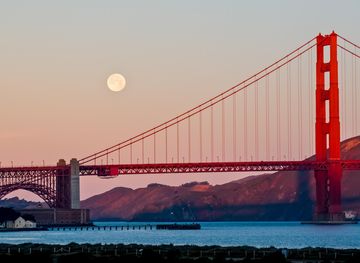
Discover California: A land of diverse landscapes, iconic cities, and endless adventures, from sun-soaked beaches to towering redwoods and vibrant cultural experiences.
Explore California