

Free Uncompahgre Plateau Travel Guide & Mobile App
Explore Uncompahgre Plateau with free travel guides. Discover regional history, expert tips, proposed trips, and audio guides on web or mobile app.


Explore Colorado's Uncompahgre Plateau for high forests, red-rock canyons, wildlife, public-land trails and wide western mountain views.
Read more about Uncompahgre Plateau
Getting to and around Uncompahgre Plateau
How to get there
Transportation
Top city travel guides in Uncompahgre Plateau
The cities of Uncompahgre Plateau, and the easiest places to base yourself.
-

-

-


Swipe for more cities
Destinations in Uncompahgre Plateau
Resorts, valleys and scenic spots worth a trip of their own.

Swipe for more destinations
Best attractions in Uncompahgre Plateau
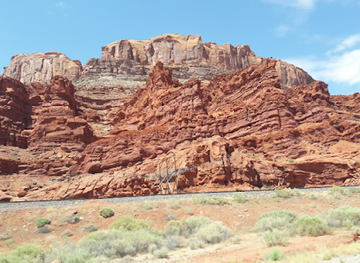
The Uncompahgre Plateau's attractions are primarily landscapes and public-land experiences rather than a chain of formal visitor sites. Uncompahgre National Forest provides extensive opportunities for hiking, camping, mountain biking, wildlife watching, hunting and scenic driving, with higher elevations offering pine and aspen forest and lower margins opening into sagebrush and pinyon-juniper country. Forest roads and trails lead to viewpoints, meadows and wildlife habitat, though many are seasonal and require careful preparation. Along the western side, the Dominguez-Escalante National Conservation Area presents a contrasting world of red-rock canyons, riparian corridors, open desert and archaeological resources. Escalante Canyon and nearby Gunnison River landscapes are especially rewarding for geology and quiet exploration, but heat and limited water make planning essential. Winter changes the plateau into a destination for snowmobiling and other snow-based recreation where routes and conditions allow. Montrose, outside the plateau's backcountry, supplies museums, services and trip-planning facilities, while the historic mining towns of Ouray and Telluride are nearby regional excursions rather than attractions within the plateau itself.
-
National park
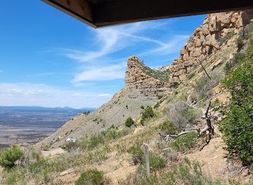
Mesa Verde National Park
Discover the ancient cliff dwellings and rich cultural heritage of the Ancestral Puebloans at Mesa Verde National Park in Colorado.
-
Tourist attraction
Bishop Castle
Explore a towering, hand-built castle in the Colorado Rockies, a testament to one man's vision and a unique roadside attraction.
-
National park
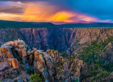
Black Canyon of the Gunnison National Park
Discover the depths of Colorado's Black Canyon: a dramatic landscape of ancient rock, towering cliffs, and unparalleled natural beauty.
-
National forest
San Juan National Forest
Explore 1.8 million acres of Colorado wilderness: hiking, camping, fishing, and history in the San Juan National Forest.

Best landmarks in Uncompahgre Plateau
The Uncompahgre Plateau's most meaningful landmarks are broad geographical forms and protected canyon landscapes rather than monumental urban architecture. The plateau itself is the defining feature: a long, elevated landform whose forested crest rises above the Uncompahgre Valley and whose edges break into steep drainages and mesas. The western canyon country associated with Escalante Canyon and the Dominguez-Escalante National Conservation Area provides some of the region's clearest visual contrasts, with layered sandstone, narrow ravines, cottonwood-lined waterways and the Gunnison River corridor. Forested ridgelines, open high meadows and distant views towards the San Juan Mountains form recurring natural reference points along the higher roads. Archaeological places within the conservation landscape also carry profound significance, although many are deliberately unobtrusive and should not be approached or disturbed without permission. The historic mining architecture of Ouray and Telluride is important to western Colorado but lies outside the plateau; Montrose's civic and commercial buildings likewise belong to the gateway valley rather than the upland itself.
-
Archaeological museum
Manitou Cliff Dwellings
Discover the ancient cliff dwellings of the Ancestral Puebloans at Manitou Cliff Dwellings, an archaeological museum steeped in history and natural beauty.
-
National forest
Uncompahgre National Forest
Explore the breathtaking beauty of Uncompahgre National Forest in Colorado, a paradise for outdoor adventures and serene nature experiences.
-
Historical landmark
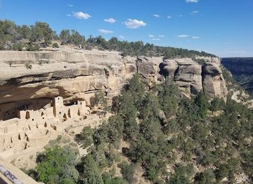
Cliff Palace
Uncover the ancient history and stunning architecture of Cliff Palace, a UNESCO World Heritage Site in Mesa Verde National Park, Colorado.
-
Historical place
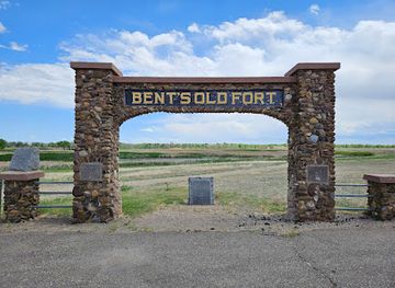
Bent's Old Fort National Historic Site
Explore Bent's Old Fort National Historic Site, a living museum that captures the essence of 19th-century life along the historic Santa Fe Trail in Colorado.


Explore Uncompahgre Plateau on the map
Plan your trip on one map. See where the top cities, national parks and sights are, and book hotels and experiences in a few clicks.
Best hotels in Uncompahgre Plateau
Best restaurants in Uncompahgre Plateau
There is no concentrated restaurant district on the Uncompahgre Plateau; dining is centred on Montrose and communities around its margins, with occasional rural cafés, lodges and country establishments along the approach roads. Visitors should expect practical, informal meals in the gateway towns, including American diner fare, burgers, Mexican-influenced cooking, pizza, barbecue and locally sourced seasonal dishes. Western Colorado's agricultural valleys contribute fruit, vegetables, beef and other produce, while Colorado's wider craft-beer culture is well represented in nearby towns. Picnic provisions are particularly useful for forest and canyon excursions, where services are absent. Farmers' markets and independent food shops around Montrose can provide regional produce for self-catering, but market days vary by season. In the plateau's backcountry, carry all food and water required for the outing and do not assume that a scenic road will lead to a café or fuel station.
-
American
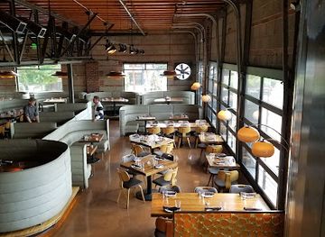
The Rabbit Hole
Discover the enchanting dining experience at The Rabbit Hole in downtown Colorado Springs, where fine American cuisine meets whimsical charm.
-
Restaurant
Linger
Experience diverse global flavors and stunning views at Linger in Denver's Highland neighborhood - where dining meets adventure.
-
Steak
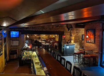
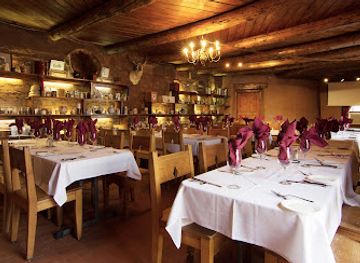
The Fort
Discover The Fort: An exquisite steakhouse offering unique American cuisine set against the stunning backdrop of Colorado's landscapes.
-
National forest
Uncompahgre National Forest
Explore Uncompahgre National Forest: A haven for nature lovers with stunning landscapes, diverse wildlife, and endless outdoor adventures await you.

Best bars in Uncompahgre Plateau
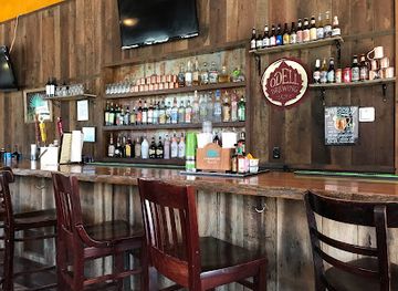
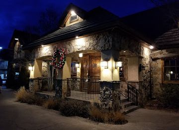
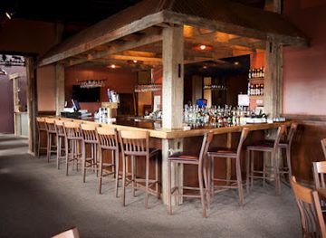
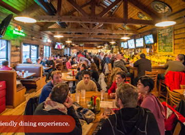
Evening life associated with the Uncompahgre Plateau is concentrated in Montrose and nearby communities rather than in the forested uplands. Montrose offers the broadest choice of traditional pubs, breweries, casual bars, restaurants and occasional live-music events, while smaller settlements tend towards local bars, cafés and early-closing dining rooms. The plateau itself is better suited to dark-sky stargazing, campfire rules permitting, than to organised nightlife. Visitors staying in rural cabins or camps should plan evenings around weather, wildlife and limited services, and should not drink and drive on remote roads. The nearby mountain towns of Ouray and Telluride have their own evening scenes, but they lie outside the Uncompahgre Plateau and should be treated as separate stops rather than as local nightlife districts.
-
Grill
Gold Belt Bar & Grill
Experience the warm atmosphere and delicious grill specialties at Gold Belt Bar & Grill in Ouray, Colorado, where culinary delight meets stunning mountain views.
-
Steak
The Stone House
Discover The Stone House, a premier steak and seafood dining experience in Montrose, Colorado, where exquisite flavors meet a cozy atmosphere.
-
Southwestern American
Camp Robber
Savor authentic Southwestern American cuisine at Camp Robber in Montrose, where every meal is a celebration of flavor and warmth.
-
Brewpub
Smuggler Union Restaurant & Brewery
Experience the perfect blend of craft beer and gourmet cuisine at Smuggler Union Restaurant & Brewery in Telluride, Colorado.
Best nightclubs in Uncompahgre Plateau
Evening life associated with the Uncompahgre Plateau is concentrated in Montrose and nearby communities rather than in the forested uplands. Montrose offers the broadest choice of traditional pubs, breweries, casual bars, restaurants and occasional live-music events, while smaller settlements tend towards local bars, cafés and early-closing dining rooms. The plateau itself is better suited to dark-sky stargazing, campfire rules permitting, than to organised nightlife. Visitors staying in rural cabins or camps should plan evenings around weather, wildlife and limited services, and should not drink and drive on remote roads. The nearby mountain towns of Ouray and Telluride have their own evening scenes, but they lie outside the Uncompahgre Plateau and should be treated as separate stops rather than as local nightlife districts.
-
Night club
The Church Nightclub
Discover the vibrant nightlife of Denver at The Church Nightclub, a unique venue blending music, dance, and historic charm.
-
Night club
Temple Nightclub Denver
Discover the ultimate nightlife experience at Temple Nightclub Denver, where electrifying music and vibrant energy come together.
-
Dance club
El Potrero Night Club
Dive into the vibrant nightlife of Glendale at El Potrero Night Club, where dancing, karaoke, and live music create unforgettable memories.
-
Night club
Cecilia's Nightclub and Cocktail Bar
Discover the heart of Breckenridge's nightlife at Cecilia's Nightclub and Cocktail Bar, home to creative cocktails and a vibrant dance floor.


Best shops in Uncompahgre Plateau
Shopping on the Uncompahgre Plateau is principally a matter of provisioning rather than browsing a large retail district. Montrose, outside the backcountry and serving as the main gateway, has supermarkets, outdoor retailers, independent shops, galleries and services for camping, fishing and road travel. Seasonal farmers' markets and farm stands around the Uncompahgre Valley can offer fruit, vegetables, preserves and other locally produced food, while western-themed goods, books, artwork and practical outdoor equipment are common in regional shops. Small communities on the plateau's margins may have limited opening arrangements and should not be relied upon for specialist supplies. Appropriate souvenirs include locally made art, regional food products and maps or books about western Colorado, but visitors should never buy archaeological artefacts or natural objects collected illegally. Stock up before entering remote forest or canyon country, where there are no dependable shops.
-
Shopping mall
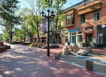
Pearl Street Mall
Discover the charm of Boulder at Pearl Street Mall, a vibrant open-air shopping and dining destination filled with local culture and unique experiences.
-
National forest
Uncompahgre National Forest
Experience the breathtaking beauty of Uncompahgre National Forest, a haven for outdoor enthusiasts and nature lovers in Colorado.
-
Department store
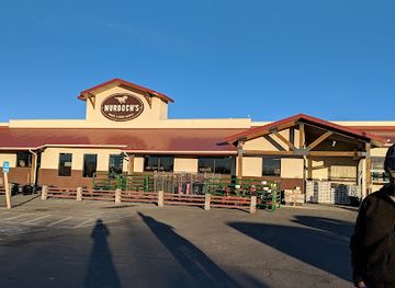
Murdoch's Ranch & Home Supply
Discover a diverse range of products at Murdoch's Ranch & Home Supply in Montrose, Colorado, from clothing and hardware to sporting goods.
-
Grocery store
Natural Grocers
Discover Montrose's Natural Grocers, your go-to spot for organic foods, fresh produce, and health-conscious shopping while exploring beautiful Colorado.


Get your free copy of our complete guide to Uncompahgre Plateau, delivered straight to you.
Everything on this page, from attractions and restaurants to essentials and local phrases, in one PDF you can read offline, print or share.
Already have an account? Sign in
Your Uncompahgre Plateau guide is ready.
We'll send it to · Not you? Sign out

Getting your guide ready…
We are putting together a fresh copy of the Uncompahgre Plateau guide. This can take up to a minute.
This can take a few moments. If your browser asks, choose Allow so the download can start. You'll find the guide in your Downloads folder.
Nothing happened? Download it again
Sorry, the guide is taking longer than usual. Please try again in a minute, or get it by email instead.
Uncompahgre Plateau essentials
Currency and Payment
Safety
Emergency Situations
Do's and Don'ts
Local Tips
From Eve
Local phrases worth knowing
You don't need to get them perfect. A few words go a long way, and locals appreciate the effort.
Basics
| English | Local | Say it |
|---|---|---|
| Hello | Howdy | [hau-dee] |
| Goodbye | See ya later | [see ya lay-ter] |
| Yes | Yep | [yehp] |
| No | Nah | [nah] |
| Please/You're welcome | No problem | [noh prob-lum] |
| Thank you | Thanks a lot | [thangs a lot] |
| Excuse me/Sorry | Pardon me | [par-don mee] |
| How are you? | How ya doin'? | [how ya doin'?] |
| Fine. And you? | Good. And you? | [gud. and you?] |
| Do you speak English? | Do ya talk English? | [do ya talk ing-glish?] |
| I don't understand | I ain't followin' | [I ain't fol-lin'] |
Eating & Drinking
| English | Local | Say it |
|---|---|---|
| I'd like to see the menu, please | Can I see the menu? | [can I see the men-yoo?] |
| I don't eat meat | I don't eat meat | [I don't eat meat] |
| Cheers! | Cheers! | [cheers!] |
| I would like to pay, please | Can I get the check? | [can I get the chek?] |
Emergencies
| English | Local | Say it |
|---|---|---|
| Help! | Help! | [help!] |
| Go away! | Leave me alone! | [leave me a-lone!] |
| Call the Police! | Call 911! | [call nine-one-one!] |
| Call a doctor! | Get a doctor! | [get a doc-tor!] |
| I'm lost | I’m turned around | [I’m turned a-round] |
| I'm ill | I ain't feelin' good | [I ain't feelin' gud] |
Shopping
| English | Local | Say it |
|---|---|---|
| I'd like to buy... | I wanna buy... | [I wanna buy...] |
| I'm just looking | Just browsing | [just brow-sing] |
| How much is it? | What’s it cost? | [what's it cost?] |
| That's too expensive | That costs too much | [that costs too much] |
| Can you lower the price? | Can ya make it cheaper? | [can ya make it chee-per?] |
Time & Numbers
| English | Local | Say it |
|---|---|---|
| What time is it? | What time ya got? | [what time ya got?] |
| It's one o'clock | It’s one o'clock | [it's wun o'clock] |
| Half past (10) | Half past ten | [half past ten] |
| Morning | Morning | [mor-ning] |
| Afternoon | Afternoon | [af-ter-noon] |
| Evening | Evening | [ee-ven-ing] |
| Yesterday | Yesterday | [yes-ter-day] |
| Today | Today | [to-day] |
| Tomorrow | Tomorrow | [to-mor-row] |
| 1 | One | [wun] |
| 2 | Two | [too] |
| 3 | Three | [three] |
| 4 | Four | [for] |
| 5 | Five | [fiv] |
| 6 | Six | [siks] |
| 7 | Seven | [sev-en] |
| 8 | Eight | [ait] |
| 9 | Nine | [nain] |
| 10 | Ten | [ten] |
Transport & Directions
| English | Local | Say it |
|---|---|---|
| Where's a/the...? | Where's the...? | [where's the...?] |
| What's the address? | What’s the address? | [what's the ad-dress?] |
| Can you show me (on the map)? | Can ya point it out? | [can ya point it out?] |
| When's the next (bus)? | When’s the next bus? | [when's the next bus?] |
| A ticket (to ....) | A ticket to... | [a tik-it to...] |
History of Uncompahgre Plateau
Ute Homelands and Ancient Settlement
The Uncompahgre Plateau lies within the traditional homeland of the Ute peoples, including bands associated with the Uncompahgre Valley and surrounding western Colorado. The plateau's forests, springs, hunting grounds and canyon corridors supported seasonal movement and provided access to varied ecological zones. Archaeological evidence in the wider region records a much longer human presence, including rock shelters, stone tools and other traces of earlier communities. These resources are protected and often fragile. The modern landscape of forest roads and recreation areas should therefore be understood as overlying an older cultural geography rather than replacing it.
The Domínguez–Escalante Expedition, 1776
In 1776, the Franciscan missionaries Silvestre Vélez de Escalante and Francisco Atanasio Domínguez travelled through parts of the Colorado Plateau and western Colorado while seeking routes between Spanish settlements. Their expedition crossed difficult terrain associated with the wider Uncompahgre and Gunnison country, recording landscapes and encounters that later became important to the historical mapping of the region. The journey was not the beginning of Indigenous history here, but it marked an early written account by representatives of the Spanish colonial world. The Dominguez-Escalante National Conservation Area preserves landscapes connected with this broader historical setting.
U.S. Expansion and the Ute Removal Era
During the nineteenth century, increasing American settlement, military pressure and mineral expansion transformed western Colorado. Treaties and federal policies progressively reduced Ute territorial control, while the establishment of reservations and the forced removal of Ute communities from parts of Colorado caused profound cultural and social loss. The Uncompahgre Plateau was not an empty wilderness awaiting settlement: it was part of a living Indigenous landscape that became subject to new political boundaries and land-management systems. This history remains essential when interpreting nearby museums, public lands and archaeological places.
Mining, Town Building and Regional Supply Routes
The late nineteenth-century mining boom in the San Juan Mountains and surrounding valleys brought prospectors, merchants, roads and rail connections into western Colorado. Towns such as Ouray and Telluride, outside the plateau itself, grew as mining centres, while Montrose developed as an agricultural and transport hub on the eastern side. The plateau supplied timber, grazing areas and routes through rugged country, although it did not become a densely settled mining district on the scale of the high San Juans. Reminders of this period survive in historic roads, cabins, ranching patterns and the older communities around its margins.
Ranching, Timber and Federal Forest Management
As mining declined in some districts, ranching and forestry became important elements of the regional economy. Livestock operations used the plateau's lower valleys and summer range, while timber harvesting and road construction expanded access to forest resources. The Uncompahgre National Forest, established in the early twentieth century, helped place large parts of the landscape under federal management. Over time, priorities broadened to include watershed protection, wildlife, recreation and habitat conservation. Present-day roads, campgrounds and trail systems reflect this layered history of working forest and public recreation rather than a landscape shaped solely for tourism.
Modern Public Lands and Conservation
The twentieth and twenty-first centuries brought growing recognition of the plateau's ecological and geological value. Forest management, grazing, hunting, recreation and conservation now operate alongside one another across a large public-land landscape. The Dominguez-Escalante National Conservation Area, designated in 2009 along the Gunnison River and its canyon country, protects important archaeological, scenic and natural resources on and around the plateau's western side. Contemporary debate continues over fire management, access, energy development, water and habitat, making the region an instructive example of how western public lands are shared and managed.
Uncompahgre Plateau in Photos
Browse through our photo collection highlighting the charm and character of the destination.
Neighbouring regions of Uncompahgre Plateau
The closest regions to Uncompahgre Plateau, if you have time for more than one.
-

-

-
-

-


Swipe for more regions
Explore more

Explore more of Colorado
Discover Colorado: A stunning blend of rugged mountains, vibrant cities, and rich history, offering endless adventures and unforgettable experiences.
Explore Colorado