St. Bavnehøj Bronze Age Burial Mound
Ancient beacon hill and Bronze Age burial mound above Rønde, offering big views over Kalø and Mols Bjerge after a short, steep climb through wind‑swept landscape.
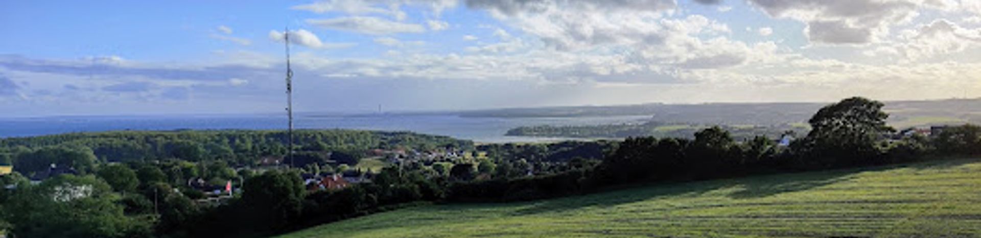
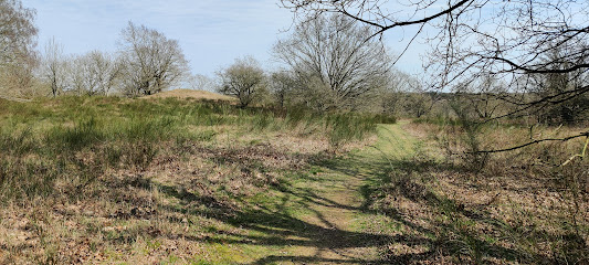
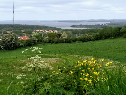
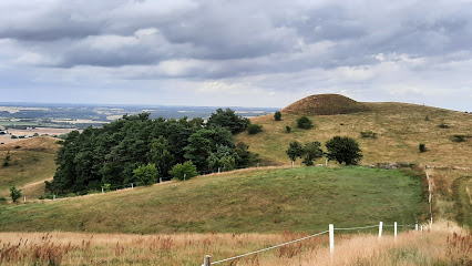
St. Bavnehøj rises just east of the small town of Rønde, a more than 3000‑year‑old Bronze Age burial mound that doubles as one of Djursland’s finest viewpoints. A short but steep forest path leads from the roadside up to the rounded hilltop, where low stone walls frame wide views over Kalø, Mols Bjerge and the flat Midtdjurs landscape. The mound has never been excavated, preserving its mysterious interior, while later history layered on beacon fires and signal chains that once linked these high points across the region.
A brief summary to St. Bavnehøj
- 8410, Rønde, DK
- Duration: 0.5 to 1.5 hours
- Free
-
 Outdoor
- Mobile reception: 4 out of 5
- Monday 12 am-12 am
- Tuesday 12 am-12 am
- Wednesday 12 am-12 am
- Thursday 12 am-12 am
- Friday 12 am-12 am
- Saturday 12 am-12 am
- Sunday 12 am-12 am
Local tips
- Wear sturdy shoes: the 150‑metre path is short but quite steep and can be slippery in wet weather.
- Bring a windproof layer, as the exposed summit catches much more breeze than the town below.
- Pair your visit with a longer walk in the nearby Kalø forests or out towards Kalø Slotsruin for a half‑day excursion.
- Visit on a clear day for the best long‑distance views over Midtdjurs, Kalø Vig and the ridges of Mols Bjerge.
For the on-the-go comforts that matter to you
- Trash Bins
Getting There
-
Car from Aarhus
From central Aarhus, reaching St. Bavnehøj by car typically takes 35–45 minutes, following main routes towards Rønde and continuing to the eastern edge of town. There is a small parking area near the base of the hill, free of charge, but space is limited at busy times. The final approach uses standard paved roads suitable for all vehicles, though traffic can slow during peak commuting hours.
-
Bus from Aarhus to Rønde and walk
Regional buses between Aarhus and Rønde run several times per hour during the day, with journey times around 45–55 minutes and single tickets usually costing about 40–60 DKK depending on route and time. From Rønde’s main bus stops, expect a 15–25 minute walk through town and along the main road to reach the start of the steep 150‑metre path up to St. Bavnehøj. The walk is on paved and then unpaved surfaces and is not ideal for heavy luggage or wheelchairs.
-
Cycling from Rønde
If you are staying in or near Rønde, cycling to St. Bavnehøj takes around 5–10 minutes from most parts of town. Local roads are paved but can carry fast‑moving traffic, so basic road awareness is important. You can leave your bike near the small parking area at the base of the hill and continue on foot up the short, steep path. There is no fee for access, but the climb itself is on rough, uneven ground.
St. Bavnehøj location weather suitability
-
 Clear Skies
-
 Mild Temperatures
-
 Any Weather
-
 Cold Weather
-
 Windy Conditions
Discover more about St. Bavnehøj
Ancient hilltop resting place above Rønde
St. Bavnehøj sits on the eastern edge of Rønde as a large, grass‑clad Bronze Age burial mound, raised more than 3000 years ago on a naturally high ridge above the surrounding farmland. The people who built it chose the site carefully: from here, the dead would rest on a vantage point with an unbroken horizon, visible from far across Djursland. The mound itself is smoothly rounded, its proportions softened by time and grazing, but its size still makes it one of the most striking prehistoric monuments in the Kalø area. Unlike many barrows that have been opened, this one has never been scientifically excavated. Its interior remains unknown, though traces of attempted looting are visible in small disturbances in the surface. The lack of excavation adds to the sense of enigma; visitors stand on a hill that still conceals whatever gifts, weapons or bones were set here in the Bronze Age, untouched beneath layers of turf and roots.From sacred mound to coastal signal beacon
Centuries after its original role as a grave, St. Bavnehøj found a second life as part of a regional warning system. The word “bavn” refers to a beacon fire, and many high Bronze Age barrows were reused as platforms for signal bonfires. On dark nights, watchers could light stacked wood here, with the blaze seen from other high points like Agri Bavnehøj and Ellemandsbjerget, forming a chain of messages across southern Djursland. This history as a beacon is easy to imagine on a windy day, when the summit feels exposed to the elements. The open crest, stripped of trees by centuries of use, recalls a time when ships in Kalø Vig or strangers on the move might trigger a flare of light to warn inland farms and manors. Today only the name survives, but the hill’s dual identity as both burial place and lookout adds depth to the simple act of climbing it.Views over Kalø, Mols Bjerge and Midtdjurs
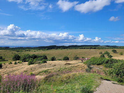
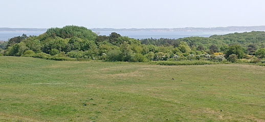
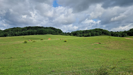
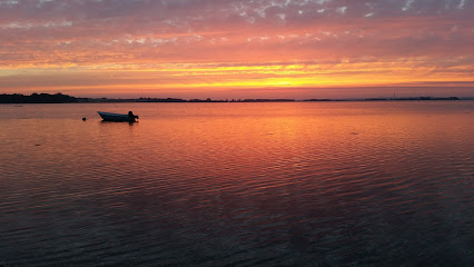
From the top of St. Bavnehøj, the landscape of eastern Jutland reads like a relief map. To the north, the land falls away into the flatter Midtdjurs countryside, a low, even plain shaped by meltwater that spilled off the Mols glaciers at the end of the last Ice Age. Fields, hedgerows and scattered farms stretch out in a patchwork that contrasts with the more dramatic terrain to the south. Turning that way, you look over the Kalø peninsula, the main farm complex of Kalø Hovedgård and the dark blocks of Hestehave and Ringelmose forests. Beyond lies the broken skyline of Mols Bjerge, with its heather‑covered ridges and scattered burial mounds, and the shimmering water of Kalø Vig. On clear days the light plays across sea and fields, and the low stone walls near the summit offer a place to sit and trace the contours of this protected landscape.A short, steep path into prehistory
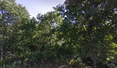
Reaching St. Bavnehøj involves only a brief effort: a roughly 150‑metre path climbing sharply from the roadside east of Rønde. The ascent is over quickly, but the gradient and sometimes uneven ground demand steady footwear and may feel demanding for those with limited mobility. The route threads between trees and low undergrowth before emerging onto the open top, where wind and weather are immediately more intense than in town below. Because the path is so short, it is easy to include the hill as a pause on a longer walk through the Kalø forests or as a quick detour from Rønde. Nearby, the smaller and now overgrown Lille Bavnehøj hides in the vegetation, a reminder that these mounds were often raised in groups on the best viewpoints. Together they form a small prehistoric landscape, squeezed between modern roads yet still surprisingly atmospheric once you leave the traffic behind.Stone walls, old drove roads and living landscape
Around St. Bavnehøj, low stone dykes and field boundaries hint at later layers of rural history. To the south, similar walls line the route of Molsvej towards Kalø, marking what was once the village’s old drove road to the coastal meadows. Cattle would have been walked this way between the pastures and the farms on higher ground, using the same natural corridors that prehistory had already marked with mounds and monuments. Today the area blends this cultural heritage with everyday use. The hillside is kept open by grazing and occasional clearing, preserving the views that make the mound such a compelling stop. Birds circle on the thermals above Kalø Vig, tractors work the fields below, and the town of Rønde spreads along the ridge. Standing on the summit, you feel how people across millennia have used the same high ground for ceremony, warning, farming and, now, quiet contemplation.Iconic landmarks you can’t miss
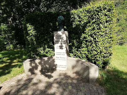
Mindesten for Egil Fischer
10.5 km
A quiet memorial honoring Denmark's visionary architect and pioneer of planned communities.
Olaf Ryes Skanse
15.6 km
A 19th-century Danish military fortification honoring a war hero with commanding views across the Jutland landscape.
Trøjborg Beboerhus
22.2 km
Experience the vibrant community spirit of Aarhus at Trøjborg Beboerhus, a hub for cultural events, workshops, and local gatherings.
Nordisk Film Cinemas Trøjborg
22.2 km
Experience local Danish cinema culture at Nordisk Film Cinemas Trøjborg—an atmospheric neighborhood movie house blending modern comfort with classic charm in Aarhus.
Folkehuset Trøjborg
22.6 km
Folkehuset Trøjborg blends Danish hygge, vibrant community life, and affordable culture, making it a beloved gathering place in the heart of Aarhus’ Trøjborg district.
University Park, Aarhus
22.9 km
Explore seven centuries of art at SMK – Denmark’s national gallery, marrying old masters, modern pioneers, and cutting-edge exhibitions in stunning parkland surroundings.
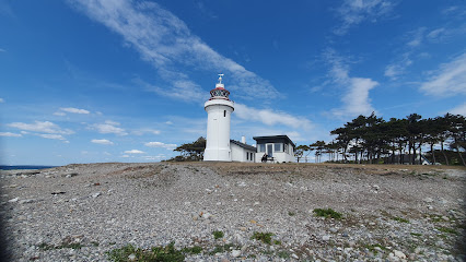
Sletterhage Fyr.
22.9 km
Discover Denmark's maritime history at Sletterhage Fyr. Explore scenic coastal landscapes, hike to WWII landmarks, and enjoy panoramic views of the Kattegat Strait on the Djursland Peninsula.
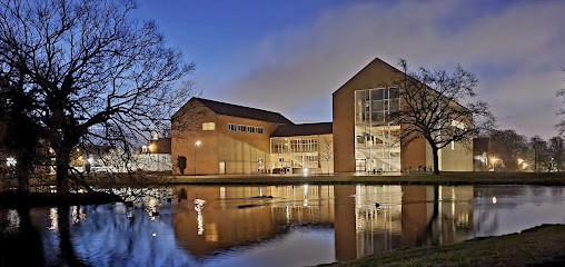
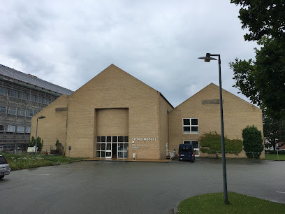
Steno Museum
23.2 km
Explore the Steno Museum in Aarhus, where science and history come alive through engaging exhibits and interactive experiences.
Skovgårde Voldsted
23.2 km
Medieval earthwork fortifications revealing Denmark's feudal past in rural Djursland.
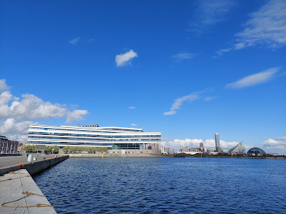
Aarhus waterfront
23.2 km
Aarhus Waterfront blends urban vibrancy, Nordic design, and harbor heritage with panoramic sea views and lively promenades, making it a quintessential Danish experience.
History Hunts med Hvem.nu
23.3 km
Malmo Live Concert Hall blends iconic Nordic architecture, world-class live music, and a vibrant atmosphere in Malmö, just across the bridge from Copenhagen.
Latin Quarter
23.3 km
Winding cobblestone streets, historic facades, and a creative spirit fill Aarhus’s Latin Quarter, the city’s oldest district and its cultural heartbeat.
Herman Sallings Plads
23.3 km
Aarhus’s vibrant harborfront plaza, bridging the historic city and the modern waterfront, alive with urban energy, culture, and panoramic views.
Endless Connection
23.3 km
Experience the dynamic interplay of art and water at Aarhus's Endless Connection, an interactive fountain by Jeppe Hein.
The Occupation Museum
23.4 km
Malmo Live Concert Hall offers world-class music, architecture, and vibrant city energy in the heart of Malmö, steps from the waterfront and cultural highlights.
Unmissable attractions to see
Gravhøj
0.0 km
A 3000-year-old Bronze Age burial mound turned beacon hill, St. Bavnehøj’s Gravhøj above Rønde pairs deep prehistory with wide, wind-swept views over Kalø and Mols.
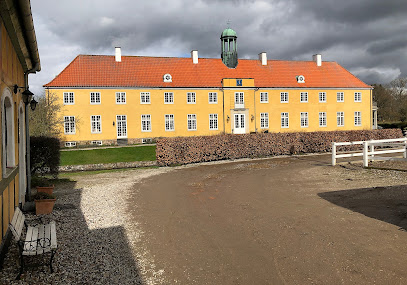
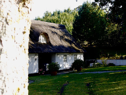
Jagtslottet, Kalø
0.7 km
A modest 1890s hunting lodge turned tranquil viewpoint, Jagtslottet overlooks Kalø’s forests and castle ruins in the heart of Mols Bjerge National Park.
Mols Bjerge National Park
2.0 km
Undulating Ice Age hills, wild heaths, beaches and Bronze Age mounds come together in one of Denmark’s most diverse landscapes, perfect for hiking and slow exploration.
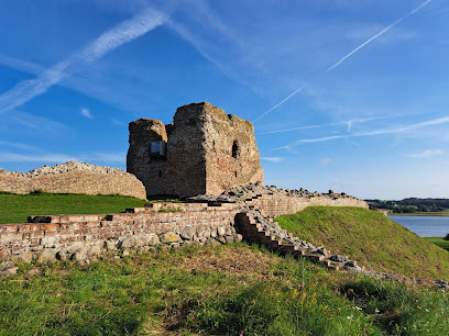
Kalø Castle
3.2 km
Walk Denmark’s longest medieval road to a sea-breezed island, where the weathered stones of Kalø Castle Ruins tell stories of kings, rebels and a daring escape.
Møllerup
4.5 km
Historic yellow‑timbered manor, working estate and atmospheric rural retreat on the edge of Mols Bjerge National Park in scenic East Jutland.
mounds from the bronze age
7.4 km
Soft grassy mounds on a quiet ridge in Mols, these Bronze Age graves offer big horizons, deep time and a tranquil pause amid Denmark’s rolling farmland.
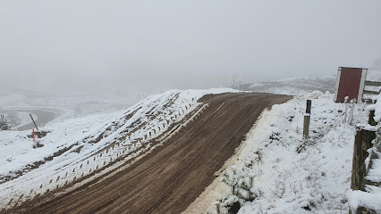
Mols Cross Club
7.8 km
Club-run motocross in the rolling Mols Bjerge landscape, where off-road riders test their skills on a sculpted dirt track just outside coastal Ebeltoft.
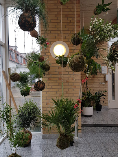
Safis Kokedameri
8.7 km
A tiny kokedama-focused garden in Ebeltoft where plants become living design pieces and a calm pause between town streets and the wilds of Mols Bjerge.
Kvalitetssti Mols Bjerge, Bjergetapen
8.9 km
Denmark’s “mountain stage”: a demanding, day-long loop through the heather-clad hills, ravines and far-reaching views of Mols Bjerge near Ebeltoft.
Svampedam
9.1 km
Rolling hills and panoramic trails in Denmark's most dramatic national park landscape.
Poskær Stenhus
9.2 km
Denmark’s largest round barrow, Poskær Stenhus blends towering Neolithic stones, quiet fields and soft Mols Bjerge light into a compact, atmospheric time capsule.
Mols Bjerge stien
9.2 km
An Ice Age–sculpted long-distance trail of low Danish “mountains”, wide views, rare nature and historic sites winding through Nationalpark Mols Bjerge.
Kvalitetssti Langemosestien
9.7 km
A short but varied loop through oak forest, open hills and tranquil bog in Nationalpark Mols Bjerge, with sweeping glimpses of Ebeltoft Vig along the way.
Tipi Tur
9.7 km
Authentic glamping in Mols Bjerge's glacial landscape—yurts, tipis, and forest adventure await.
Tremosegaard
9.7 km
A peaceful shelter site on the edge of Mols Bjerge National Park, where meadows, a small bog and farm fields create a gentle escape into rural Denmark.
Essential places to dine
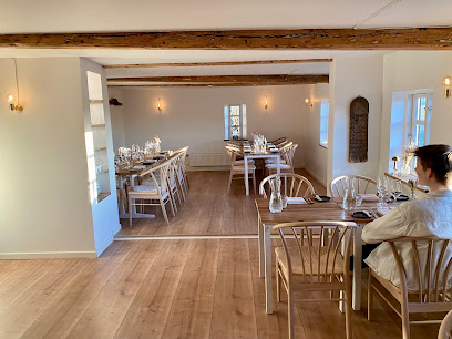
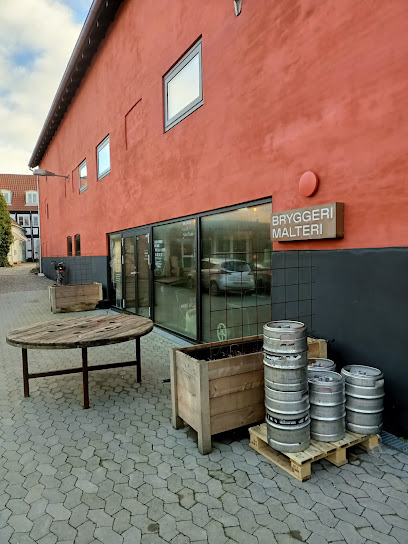
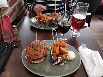
Restaurant Bag Søjlen
0.5 km
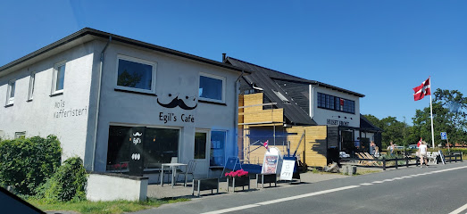
Intimate Danish–French dining on Rønde’s main street, pairing warm candlelit ambience with carefully plated seasonal dishes and indulgent desserts.
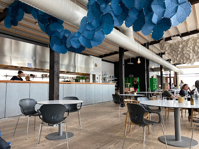
Restaurant Moment
6.5 km
Radically green fine dining in a timber-clad restaurant at Friland, where Nordic tasting menus grow out of the surrounding permaculture gardens and seasons.
MolsCafeen
7.4 km
Rural cafe and cozy bed and breakfast on Kølbakken, pairing homely Danish cooking with wide countryside views toward the Mols Bjerge landscape near Ebeltoft.
Restaurant Skovmøllen Femmøller
9.2 km
Authentic Danish comfort food beside a peaceful mill pond, where tradition meets genuine hospitality.
Restaurant Mols Bjerge
9.8 km
Authentic Sicilian cuisine and wood-fired pizzas in the heart of Danish countryside, near Mols Bjerge.
Labacate Café
10.7 km
Brazilian warmth, specialty coffee and artisan sourdough in a cozy coastal café just steps from the beach in Femmøller near Ebeltoft.
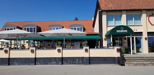
Molskroen Strandhotel og Molskroens Brasserie
10.8 km
A coastal Danish strandhotel pairing sea views, Nordic comfort and refined local cuisine on the edge of Mols Bjerge National Park near Ebeltoft.
Molskroens Isbod
10.8 km
Casual seaside ice cream stand near Mols Bjerge and Ebeltoft, serving classic Danish soft ice and scoops to beachgoers, walkers and cyclists on sunny days.
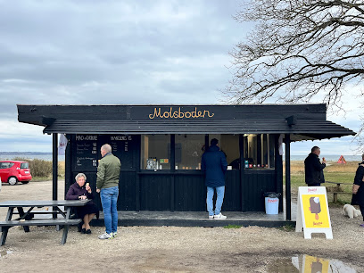
Molsboden
10.8 km
A small red beach stand at Femmøller Strand serving burgers, ice cream and local drinks, perfectly placed between Ebeltoft’s calm bay waters and the hills of Mols.
Knebel Bro Pizza Grill
11.0 km
Casual harbour-neighbourhood pizzeria and grill in Knebel, serving hearty, inexpensive takeaway classics to sailors, locals and holidaymakers on the Mols peninsula.
Restaurant Bindingsværket
13.4 km
Refined seasonal Nordic cuisine in a traditional half-timbered farmhouse, surrounded by the quiet fields of Drammelstrup on Djursland.
Stenbækhus / mad på Mols
13.9 km
Family-run Danish kitchen celebrating seasonal ingredients and coastal charm in Knebel's welcoming courtyard.
Karens Brasserie
16.2 km
Comforting Danish home cooking and generous brunches by Ebeltoft’s harbour, where casual brasserie dining meets views towards the historic frigate Jylland.
Lundbergs Spisehus
16.3 km
Laid‑back Nordic cooking, freshly baked bread and courtyard vibes inside Ebeltoft’s red‑brick Maltfabrikken creative hub.
Manzana Tapas Bar
16.3 km
Intimate Spanish tapas and sangria on Ebeltoft’s cobbled main street, blending Mediterranean flavours with Danish hygge in a warm, social dining setting.
Markets, malls and hidden boutiques
Troldhedesten
6.0 km
Coastal fitness hub where quality equipment meets active Danish living.
EnergyBar.nu
6.5 km
Compact organic food shop in rural Vrinners, specializing in Danish-made energy bars and protein products that power explorations around Knebel and Mols Bjerge.
Is På Toppen - Outdoor Cykel- og Vandrecafe
8.0 km
Beloved outdoor café and ice cream bar at the edge of Mols Bjerge National Park, renowned among hikers and cyclists for homemade treats and countryside atmosphere.
Nixn
8.3 km
Curated contemporary fashion in charming Danish countryside retail.

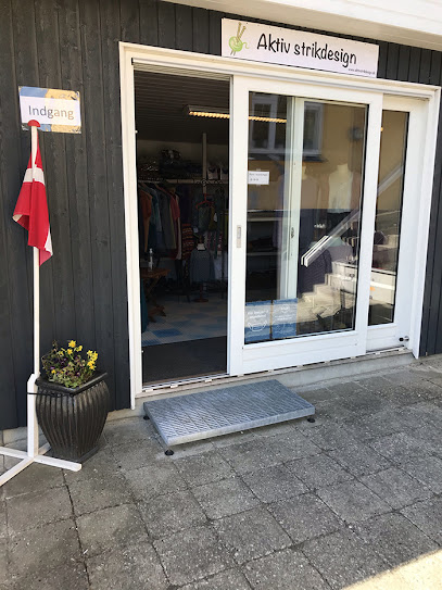
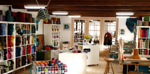
Aktivstrikdesign
8.6 km
Where yarn, community, and Danish hygge come together in a welcoming knitting space.
Garn10
9.6 km
A cozy village yarn shop in Knebel where shelves of color, texture, and Nordic fibers invite you to slow down, browse, and bring home a creative Danish souvenir.
Miss A - Gaveideer og indretning til dit hjem
9.7 km
Curated gifts and home décor in the heart of scenic Mols Bjerge
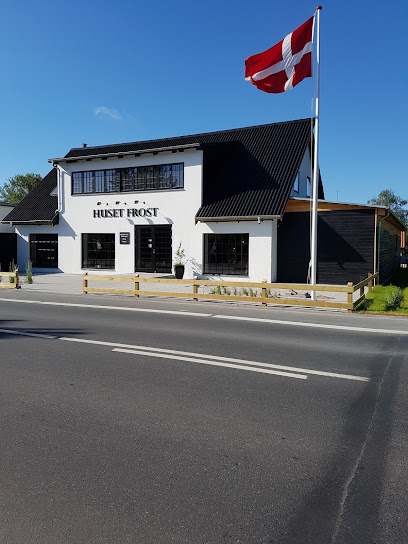
Huset Frost
10.6 km
Experience the fusion of gourmet dining and sustainable design at Huset Frost in Ebeltoft.
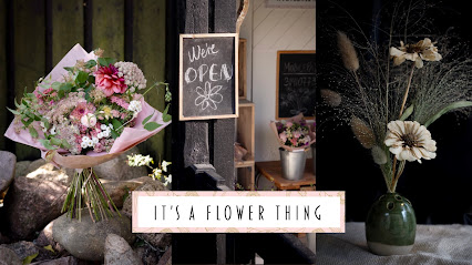
It’s a Flower Thing
10.7 km
Handcrafted ceramics and seasonal flowers grown in harmony with nature's rhythms.
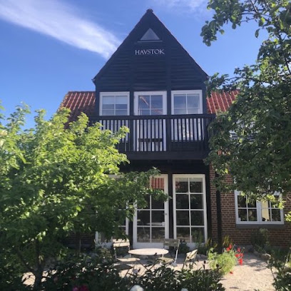
Havstok
10.7 km
Handcrafted rustic furnishings in Denmark's charming maritime heritage town.
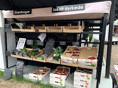
Mols Haven
12.5 km
A cosy countryside fruit and vegetable store in Knebel, offering seasonal Danish produce and a friendly village welcome on the doorstep of Mols Bjerge.
Bundgaards Vinimport/ Molshonning v/ Ole Bundgaard
14.7 km
Small-scale wine importer and honey producer in a Mols village home, blending European bottles and local Molshonning in a relaxed, personal cellar-style setting.
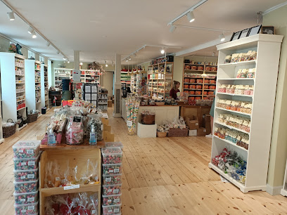
Mols Bolsjer A/S
16.3 km
Cosy old-town sweet shop in Ebeltoft, showcasing handmade Danish boiled candies and licorice from local production, perfect for treats and edible souvenirs.
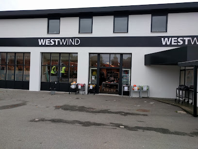
WestWind Ebeltoft
16.4 km
Coastal clothing and outdoor gear on Ebeltoft’s waterfront road, keeping visitors warm, dry and comfortable for walks, beach days and bay-side adventures.
Nordic Bar Group
19.2 km
Denmark's trusted supplier of professional bar equipment and sustainable glassware to European hospitality.

Essential bars & hidden hideouts
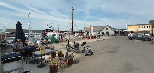
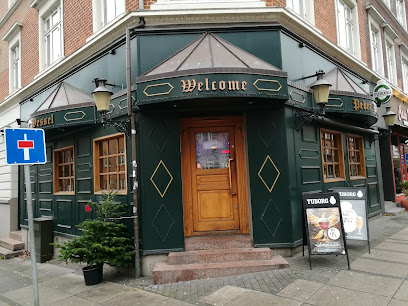
Bodega Kringlen v/Annelise Dalgaard
0.6 km
Unpretentious local bodega on Rønde’s main street, serving cold beer, simple drinks and small-town Danish bar atmosphere late into the evening.
Mørke Roadhouse
8.1 km
Unpretentious beer hall on Ebeltoftvej where locals and travelers share cold pints, warm conversation, and long, easygoing evenings in small-town Mørke.
Byportene Bodega
10.4 km
Cozy neighborhood bodega in Hornslet with cold beers, warm lighting and easygoing local charm for unpretentious evenings out.
Mejeriets Bar
11.7 km
Cozy neighbourhood bar and eatery by the harbour in Knebel, offering simple food, evening drinks and a relaxed local atmosphere after days out on Djursland.
Ebeltoft Strandbar
16.2 km
Laid-back beachfront bar on Ebeltoft Bay, serving simple seaside food, cold drinks and big-sky sunsets just steps from the sand on Strandvejen.
Brewpub på Maltfabrikken
16.3 km
Fresh local beer served beneath the beams of Ebeltoft’s restored red malt factory, where industrial heritage and modern Danish craft brewing meet.
Toldboden
16.3 km
Relaxed harbourside bar in Ebeltoft, blending maritime character, waterfront views and late-opening drinks in a cosy, casual setting by the marina.
Klub K
16.3 km
Small-town harbor bar turned late-night disco, Klub K keeps Ebeltoft dancing on weekend nights with simple drinks, big beats and an easygoing local vibe.
Umage Ølbar
16.3 km
Craft beer bar in Ebeltoft with 14 taps, 50+ bottled beers, and comfort food.
Stockfleths Østers & Bobbelbar
16.3 km
Former oyster and bubbles bar on Ebeltoft’s old fishing harbour, where luxury shellfish, sparkling wine and maritime history came together in a relaxed coastal setting.
Bar Pia
16.4 km
Unpretentious neighbourhood bar in central Ebeltoft, offering simple drinks, local atmosphere, and a relaxed glimpse into everyday Danish pub life.
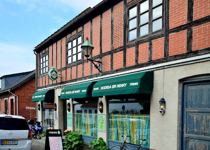
Sir Henry Bodega
16.4 km
Unpretentious Danish bar in Ebeltoft’s cobbled old town, pouring local beers and classic drinks in a cozy, lived-in setting from morning till late.
Den Skæve Bar
16.5 km
A crooked timber-framed pub in Ebeltoft's old town, where live music and garden charm meet Danish hospitality.
K
22.1 km
Discover K, the cozy cafe and cocktail bar in Aarhus, where innovative drinks and a warm atmosphere await every visitor.
Peder Wessel
22.2 km
Experience the vibrant nightlife at Peder Wessel, Aarhus' charming bar with affordable drinks and a welcoming atmosphere.
For the vibe & atmosphere seeker
- Scenic
- Tranquil
- Relaxing
- Unique
For the architecture buff
- Historic
- Viewpoints
- Parks & Gardens
- Heritage Neighborhoods
- Landmarks
For the view chaser and sunset hunter
- Iconic Views
- Panoramas
- Sunrise Spots
- Sunset Spots
For the social media creator & influencer
- Instagrammable
- Photo Spots
- Selfie Spots
- Reel-Friendly
- Architectural Shots
For the eco-conscious traveler
- Low Impact
- Protected Area
- Public-Transport Accessible
- Leave-No-Trace Critical
- Locally Managed
- Wildlife Habitat
For the kind of experience you’re after
- Mindfulness
- Cultural Heritage
- Photowalk
- Adventure Photo Shoot
- Nature Escape
- Roadtrip Stop
- Day Trip
For how adventurous you want the journey to be
- Easy Access
- Requires Hike
Location Audience
- Family Friendly
- Senior Friendly
- Child Friendly
- Teen Friendly
- Solo Friendly
- Couple Friendly
- Solo Female Friendly


