Kvalitetssti Mols Bjerge, Bjergetapen
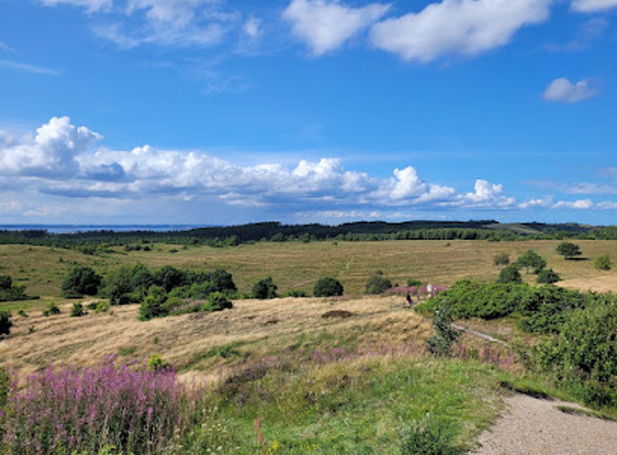
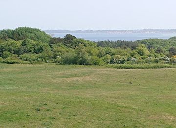
Denmark’s “mountain stage”: a demanding, day-long loop through the heather-clad hills, ravines and far-reaching views of Mols Bjerge near Ebeltoft.
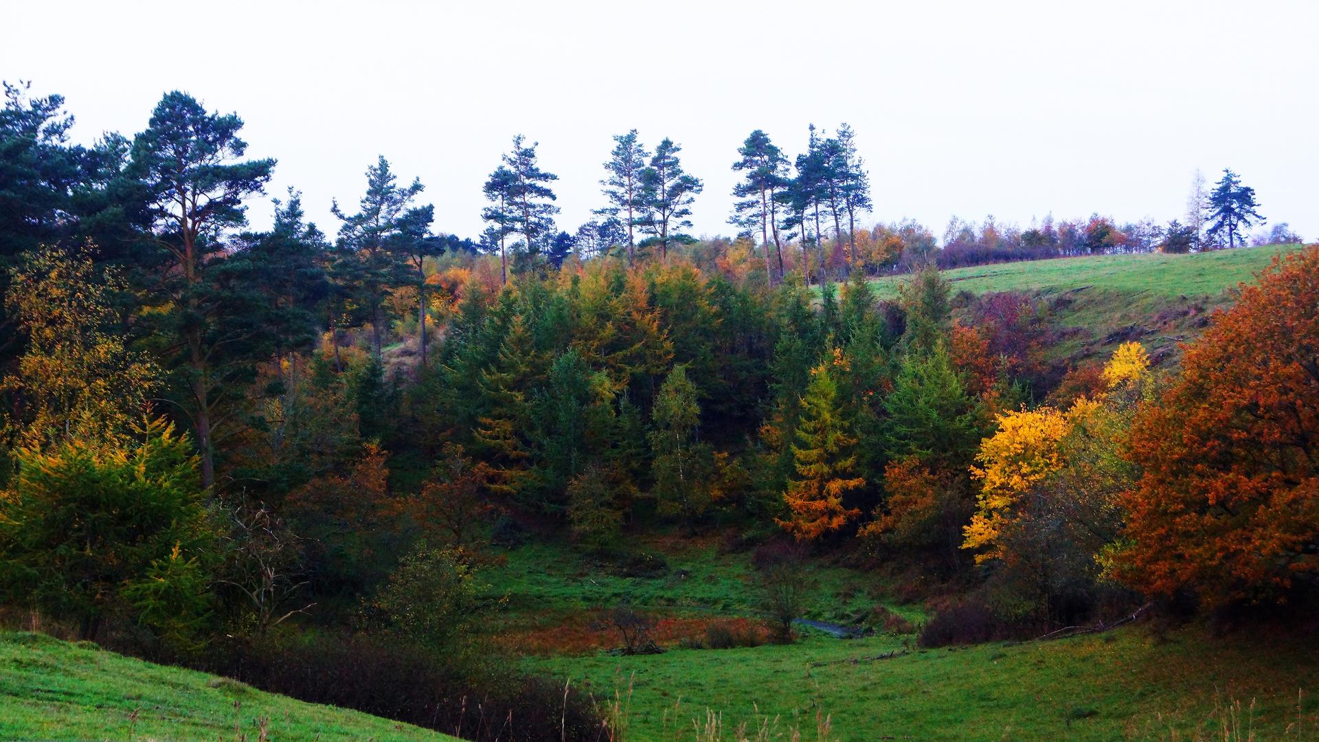
An Ice Age Landscape in the Heart of Djursland
The Bjergetapen, or mountain stage, of the Mols Bjerge Trail plunges you into one of Denmark’s most striking Ice Age landscapes. Here in the hills above Ebeltoft, glaciers once ground their way across Djursland, leaving behind sharp ridges, deep hollows and a tangle of dry valleys. Today those ancient forms shape every step of the route. The loop begins and ends near Femmøller, but once you leave the trailhead the modern world quickly drops away and the view opens onto a sea of rolling, grass-covered hills. The terrain is unusually dramatic for Denmark: rounded summits rise and fall in quick succession, slopes tilt steeply to hidden basins, and the light shifts constantly across the undulating ground. Scattered farmsteads and distant church spires remind you that this is still a lived-in landscape, yet buildings are rare along the stage, reinforcing the sense of remoteness that many hikers do not expect to find so close to Ebeltoft.Hills, Ravines and Heather-Covered Slopes
As you follow the certified quality trail, the path threads through narrow ravines lined with gnarled trees, then climbs to open viewpoints where wind strokes the heather and sheep graze on old grasslands. The kettle holes and steep-sided depressions you pass are direct signatures of melting ice blocks left behind at the end of the last glaciation. In some hollows, scrub and scattered birch create sheltered pockets, while others remain open, inviting long pauses to take in the contours of the hills. The route’s reputation as the most demanding stage of the Mols Bjerge Trail stems less from any technical difficulty and more from the constant ascents and descents. Paths can be narrow, rooty and uneven, especially where they wind through beech and oak woodland, and sections may be muddy after rain. Good footwear and a steady pace make the day entirely manageable for reasonably fit walkers, and the reward is a chain of ever-changing views over Mols Bjerge and the wider national park.Wildlife, Grazing and Subtle Seasonal Changes
Bjergetapen is also an excellent stage for quietly observing nature. Open grasslands and heath support butterflies and grasshoppers in summer, while skylarks and other songbirds provide a constant soundtrack above the hills. In the more wooded ravines you may glimpse roe deer slipping between the trunks or hear woodpeckers at work on older trees. Grazing projects using cattle, sheep and sometimes horses help keep the hills open, maintaining the mosaic of habitats that make this area so distinctive. Seasonality plays a big role in the experience. Spring brings fresh greens and clear views, with cool air ideal for longer days on the trail. In late summer the heath can blush purple, while autumn paints the scattered woodlands in warm tones and often delivers long, low light across the hills. Even on calm winter days the bare shapes of the terrain stand out sharply, making the glacial story easier to read in the contours themselves.A Full-Day Circuit for Dedicated Walkers
This circular stage is typically described as around 19–20 km, taking most hikers about six to seven hours including breaks. It is waymarked and part of the internationally certified Mols Bjerge Trail, which runs a total of 80 km between Rønde and Ebeltoft. Bjergetapen stands out among the four stages as the most strenuous and, for many walkers, the most immersive in terms of pure landscape. There are no major facilities once you are out on the trail, so you need to carry water, snacks and appropriate clothing for rapidly changing coastal weather. The route is well suited to day packs rather than heavy multi-day loads, and trekking poles can ease the repeated short climbs and descents. Families with hiking experience and older children often enjoy the challenge, but this is not a casual stroll: it is a full-day outing in hilly country.Link in a Larger Network of Trails
Although Bjergetapen forms a distinct loop, it also acts as a hinge within the wider Mols Bjerge Trail network. Nearby stages lead towards Kalø and Ebeltoft, opening possibilities for multi-day hikes that combine demanding hill sections with gentler coastal and forest stretches. Trail information, maps and route suggestions are available through the national park and local tourist offices, making it easy to integrate this stage into a broader exploration of Djursland. For many trekkers, walking Bjergetapen is less about ticking off a distance and more about spending unhurried time in a rare Danish landscape where Ice Age forms remain so clearly legible. The combination of rolling panoramas, quiet ravines and almost continuous views makes this stage a highlight for anyone who appreciates geography under their boots as much as scenery before their eyes.Local tips
- Wear sturdy, waterproof hiking shoes; repeated short climbs, roots and potentially muddy sections make this stage more demanding than many Danish routes.
- Carry all the water and food you need for a full day; there are no cafés or shops once you are out in the hills and facilities are sparse on the loop.
- Check the weather forecast and pack windproof layers; exposed hilltops can feel significantly cooler and breezier than sheltered low-lying areas.
- Use an updated map or the national park’s official app; waymarking is good but junctions in wooded ravines and open heath can be confusing in poor visibility.
- Respect grazing animals and stay on marked paths; give cattle and horses space and help protect the sensitive heath and grassland habitats.
A brief summary to Kvalitetssti Mols Bjerge, Bjergetapen
- Ebeltoft, DK
- Visit website
Getting There
-
Car
From central Ebeltoft, driving to the Bjergetapen trailhead near Femmøller typically takes about 15–20 minutes via local roads. Parking at the designated lots in the Mols Bjerge area is usually free, but spaces can be limited on sunny weekends and in school holidays, so arriving early in the day is advisable. There are no fuel stations directly by the trailhead, so fill up in Ebeltoft or along main routes beforehand.
-
Bus
Regional bus services connect Ebeltoft with stops near the Mols Bjerge Trail, often using the line that runs between Ebeltoft and Rønde. Travel time from Ebeltoft town to stops by Femmøller or other access points is typically 20–35 minutes, depending on the timetable and intermediate stops. Single tickets for this distance generally fall in the range of 25–45 DKK, and services run more frequently on weekdays than late evenings and Sundays, so always check the latest schedule before planning a hike.
-
Bike
Cycling from Ebeltoft to the Bjergetapen starting area is a scenic option, usually taking 30–45 minutes each way at a moderate pace. The route makes use of paved local roads and some hilly sections, so basic fitness and lights for low‑light conditions are important. There is no extra cost beyond any bike rental you might arrange in Ebeltoft, and a sturdy lock is recommended so you can secure your bike near the trail access while you hike.