From Eve
Know before you go
Hi, I'm Eve. Here are a few practical things to know before exploring Mols Bjerge stien.
Local know-how to help you travel smarter and make the most of every moment.
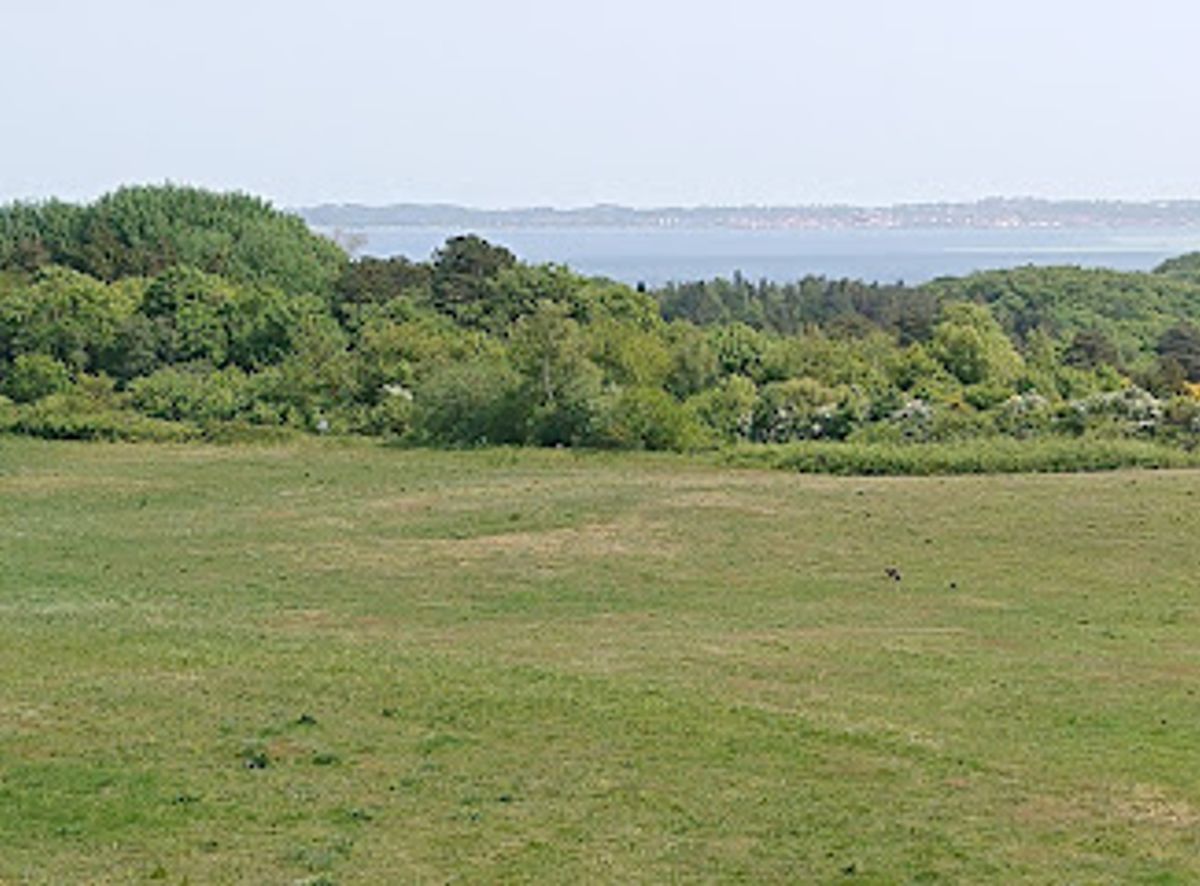
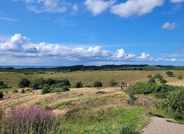
An Ice Age–sculpted long-distance trail of low Danish “mountains”, wide views, rare nature and historic sites winding through Nationalpark Mols Bjerge.
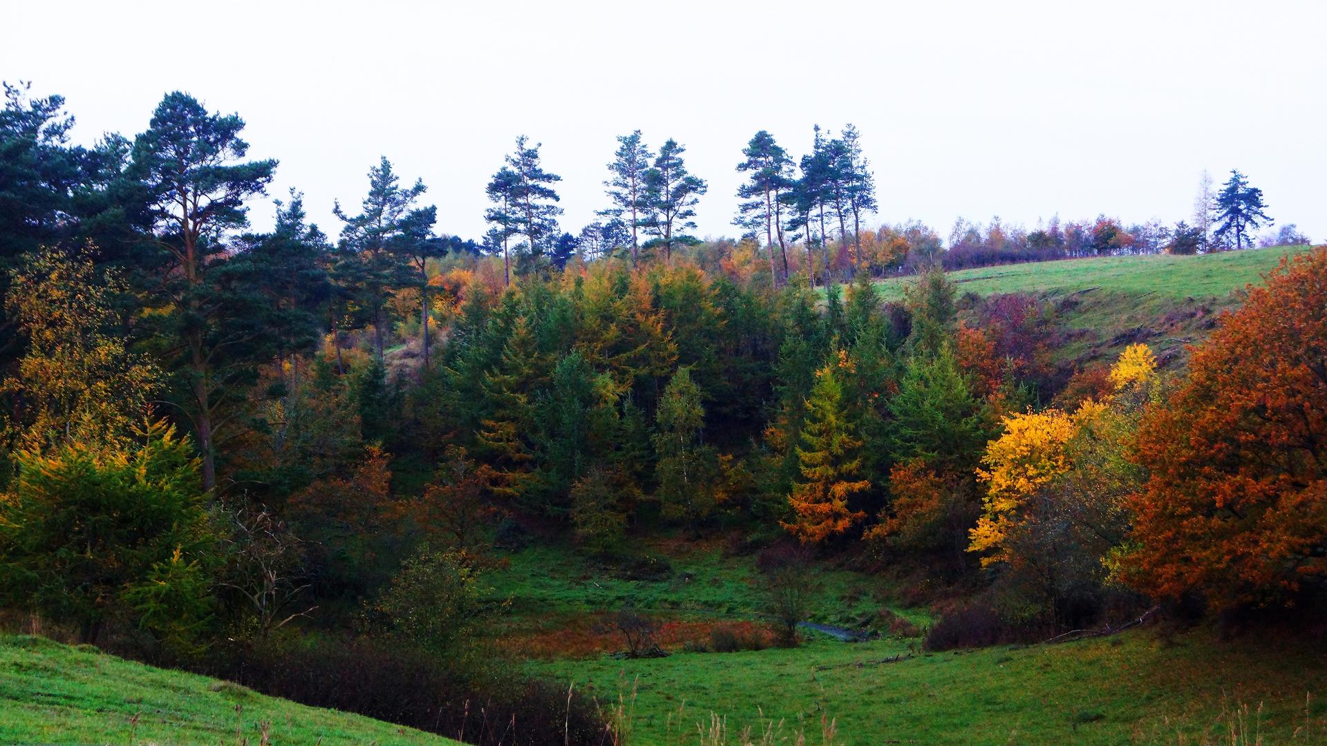
Mols Bjerge-stien is a certified long-distance hiking trail winding 60–80 km through Nationalpark Mols Bjerge near Ebeltoft. Crossing Denmark’s most striking Ice Age landscape, it links coastal meadows, heather-clad hills, dead-ice hollows and historic farm country. Divided into four day-stages of around 20 km, the route offers big sky views, rare flora and fauna, ancient burial mounds and castle ruins, plus tranquil corners for picnics and birdwatching.
Opening times, essentials, and a few local tips gathered into one calmer, easier-to-scan planning section.
Hi, I'm Eve. Here are a few practical things to know before exploring Mols Bjerge stien.
Local know-how to help you travel smarter and make the most of every moment.
Car from Aarhus
From central Aarhus to a main trail access near Kalø Castle in Nationalpark Mols Bjerge typically takes about 35–45 minutes by car, depending on traffic. Several free public parking areas serve the castle ruin and nearby trailheads, but they can feel busy on sunny weekends. There are no entrance fees for the national park or the trail, and standard fuel and toll costs are the only expenses.
Bus from Aarhus to Rønde and Kalø area
Regional buses run between Aarhus and Rønde in roughly 45–60 minutes, with onward local services towards stops close to Kalø and other Mols Bjerge trail access points. A single adult bus ticket on this corridor usually costs in the range of 40–80 DKK depending on zones and ticket type. Services are more frequent on weekdays and in daytime hours, so check the timetable in advance if you plan early morning or evening hikes.
Bus from Ebeltoft town
Ebeltoft lies directly on one of the stages of Mols Bjerge-stien, and local buses link the town with nearby villages and trailheads within about 15–30 minutes. Standard regional fares apply, typically around 25–50 DKK for short trips within the area. Services can be less frequent in the evening and on weekends, so plan your start and end points around bus times if you are not using a car.
Cycling to trail access points
Confident cyclists can reach various Mols Bjerge-stien access points from Ebeltoft or Rønde in around 30–60 minutes, using a mix of quiet country roads and bike-friendly routes. There is no charge to bring your bike to informal parking or rest areas, but be prepared for some hilly stretches in the national park and carry lights and reflective gear if riding in low light.
Catch the right light and the right mood, whether you want a bright city moment or a more cinematic evening visit.


Use Tower Bridge as your starting point for nearby food, family ideas, nightlife, and more local discoveries.
A quick look at seasonal patterns and peak visiting hours.

Explore expert travel guides, compare and book tours, experiences, hotels, and more—all from the palm of your hand. Download now for seamless trip planning wherever your wanderlust takes you.
Discover the natural beauty and historical charm of Mols Bjerge, Denmark's captivating national park in the heart of Djursland, perfect for nature lovers and adventurers.
Tell me more about Mols Bjerge