

Quilotoa Crater Lake Travel Guide - Free Web & App
Your ultimate guide to Quilotoa Crater Lake. Discover top landmarks, proposed trips, and local tips. Free on the web or via the Evendo companion app.


Quilotoa Crater Lake in Ecuador pairs a turquoise caldera, Andean trails, Kichwa villages and high-altitude adventures near Latacunga for visitors.
The Caldera and Its Setting
Quilotoa Crater Lake lies in Ecuador’s central Andes, within the highlands of Cotopaxi Province and close to the village of Quilotoa. The lake occupies a broad volcanic caldera whose steep inner walls descend towards water that can appear deep blue, green or turquoise as sunlight, weather and viewing angle change. The surrounding rim rises to roughly 3,900 metres above sea level, creating an expansive landscape of dark volcanic slopes, grassland, cultivated fields and distant Andean ridges.Read more about Quilotoa Crater Lake
Highland Communities and the Quilotoa Loop
Walking the Rim
When is the best time to visit Quilotoa Crater Lake?
Best: July–September · 14°C| Month | High (°C) | Rainfall (mm) |
|---|---|---|
| January | 14 | 94 |
| February | 14 | 103 |
| March | 14 | 130 |
| April | 14 | 121 |
| May | 14 | 74 |
| June | 14 | 53 |
| July (best) | 14 | 44 |
| August (best) | 14 | 38 |
| September (best) | 14 | 38 |
| October | 15 | 56 |
| November | 14 | 77 |
| December | 14 | 84 |
Getting to and around Quilotoa Crater Lake
How to get there
Transportation
Best attractions in Quilotoa Crater Lake
Quilotoa’s defining attraction is the crater rim, where a network of viewpoints reveals the lake from changing angles and shows the scale of the volcanic depression. The main Quilotoa viewpoint provides the most familiar panorama, while Shalalá on the eastern side offers another recognised perspective and links the landscape with community tourism. A steep path descends from the rim towards the lakeshore, creating a more demanding walking experience than the viewpoints alone, with the return ascent requiring care at high altitude. Beyond the caldera, the Quilotoa Loop leads through highland scenery of cultivated slopes, ravines and scattered Kichwa settlements. Zumbahua acts as an important approach point, while Chugchilán is associated with longer rural walking routes and accommodation along the loop. The attractions are primarily geological and landscape-based rather than museum-led, and distances between them mean that a vehicle or planned local transport is often needed.
-
Volcano
Quilotoa
Explore the breathtaking beauty of Quilotoa, a stunning volcanic crater lake in the Andes of Ecuador, known for its vibrant turquoise waters and rich culture.
-
Mirador Monte Juyende
Experience the breathtaking views at Mirador Monte Juyende, a stunning viewpoint over a crater lake in Ecuador's scenic Quinta Tunguiche region.


Best landmarks in Quilotoa Crater Lake
The principal landmark is Quilotoa’s volcanic caldera, a broad collapsed volcanic basin whose steep walls enclose the high-altitude lake. The water’s shifting blue-green colour is one of its most recognisable visual characteristics, while the surrounding rim provides a natural amphitheatre of dark slopes, grassland and cultivated Andean terrain. The main crater viewpoint and the Shalalá viewpoint are important visitor landmarks because they frame the lake from different sides and connect scenic appreciation with community-managed tourism. The descent towards the lakeshore is another defining physical feature, revealing the scale of the inner walls more clearly than a rim panorama. Outside the caldera, the rural roads and ravines of the Quilotoa Loop form a wider cultural landscape, linking the natural landmark with Kichwa villages, farms and highland routes rather than with a dense group of historic buildings.
-
Observation deck
Mirador to Laguna Quilotoa
Experience the awe-inspiring beauty of Laguna Quilotoa from this stunning viewpoint, a jewel of the Ecuadorian Andes. A must-see!
-
Lake
Quilotoa Lake
Discover Quilotoa Lake: A breathtaking volcanic crater lake in the Andes, offering stunning views, hiking, and cultural experiences.
-
Hiking area
La Laguna Quilotoa
Discover Laguna Quilotoa, a stunning turquoise lake nestled in a volcanic crater in the Ecuadorian Andes. Hike, kayak, and immerse yourself in Andean culture.
-
Volcano
Quilotoa
Discover Quilotoa: A breathtaking volcanic crater lake in the Andes, offering stunning scenery, hiking, and cultural immersion in Ecuador.


Explore Quilotoa Crater Lake on the map
Plan your trip on one map. See where the top attractions, landmarks, restaurants and hotels are, and book hotels and experiences in a few clicks.
Best hotels in Quilotoa Crater Lake
Best restaurants in Quilotoa Crater Lake
Dining around Quilotoa is modest and closely tied to community accommodation, small local eateries and roadside establishments rather than a concentrated restaurant scene. Visitors can expect simple Andean meals based on staples such as potatoes, grains, soup, rice and locally available vegetables, with menus varying according to the household or community business. In the wider highlands, traditional foods may include llapingachos, locro de papas and other Ecuadorian mountain dishes, although availability should not be assumed at every stop. Quilotoa village and settlements along the loop provide the most convenient places to arrange meals, while Latacunga offers a broader choice of restaurants and markets before or after the journey. Travellers making a full-day excursion should carry water and snacks, particularly if planning a long walk, and should confirm meal arrangements with rural accommodation in advance.
-
Observation deck
Mirador to Laguna Quilotoa
Experience unparalleled beauty at Mirador to Laguna Quilotoa with its stunning crater lake views and rich cultural heritage.
-
Lake
Quilotoa Lake
Explore Quilotoa Lake: A breathtaking crater lake in Ecuador known for its vibrant turquoise waters and stunning Andean landscapes.
-
 Hotel
Hosteria Chukirawa
Discover tranquility and adventure at Hosteria Chukirawa by Quilotoa Lake, where nature's beauty meets cozy accommodations.
-
Hotel
Shalala Lodge
Discover tranquility at Shalala Lodge, where luxury meets nature in Ecuador's breathtaking Quilotoa region.


Best bars in Quilotoa Crater Lake
Quilotoa is a quiet rural destination with no established nightclub district and limited late-night entertainment. Evenings are generally centred on guesthouses, community accommodation and small local establishments where visitors may share a meal, talk with hosts or prepare for an early walk. Along the Quilotoa Loop, Chugchilán and other settlements offer a little more visitor-oriented hospitality, but nightlife remains informal and small-scale rather than commercial. Latacunga has the widest choice of evening cafés, bars and restaurants in the region, although it lies outside the crater area and functions as a gateway town. Evening conditions around the lake can be cold and dark, so plans are better focused on local hospitality and the highland atmosphere than on searching for a busy entertainment scene.
-
Observation deck
Mirador to Laguna Quilotoa
Discover the stunning beauty of Laguna Quilotoa at its breathtaking observation deck, where nature meets adventure in Ecuador's Andes.
-
Lake
Quilotoa Lake
Discover Quilotoa Lake, Ecuador's stunning volcanic crater lake, surrounded by majestic mountains and rich indigenous culture.
-
Restaurant
Quilotoa
Discover the breathtaking Quilotoa Crater Lake, a stunning volcanic gem in Ecuador with turquoise waters, hiking trails, and rich cultural experiences.
-
Hotel
Hosteria Chukirawa
Discover tranquility and adventure at Hosteria Chukirawa, where stunning views of Quilotoa lagoon await your visit.


Best nightclubs in Quilotoa Crater Lake
Quilotoa is a quiet rural destination with no established nightclub district and limited late-night entertainment. Evenings are generally centred on guesthouses, community accommodation and small local establishments where visitors may share a meal, talk with hosts or prepare for an early walk. Along the Quilotoa Loop, Chugchilán and other settlements offer a little more visitor-oriented hospitality, but nightlife remains informal and small-scale rather than commercial. Latacunga has the widest choice of evening cafés, bars and restaurants in the region, although it lies outside the crater area and functions as a gateway town. Evening conditions around the lake can be cold and dark, so plans are better focused on local hospitality and the highland atmosphere than on searching for a busy entertainment scene.
-
Lake
Quilotoa Lake
Discover the breathtaking beauty of Quilotoa Lake, a stunning turquoise gem nestled in the Andes, perfect for adventure and cultural exploration.
-
Volcano
Quilotoa
Experience the enchanting beauty of Quilotoa, a volcanic crater lake in Ecuador, perfect for hiking, photography, and cultural exploration.
-
Hotel
Shalala Lodge
Discover tranquility and stunning views at Shalala Lodge in Laguna Quilotoa, the perfect escape for nature lovers and adventure seekers alike.
-
Hotel
Runa Wasi Quilotoa
Discover the breathtaking beauty of Quilotoa at Runa Wasi, your cozy base for adventure in the Andes.


Best shops in Quilotoa Crater Lake
Shopping at Quilotoa is limited but closely connected with local community enterprise. Small stalls and visitor facilities may offer woven textiles, woollen goods, hats, jewellery, carved items and other handicrafts associated with Andean rural markets, although designs, materials and availability vary between communities. The Quilotoa Loop provides opportunities to buy directly from local sellers, giving visitors a more direct connection with the households and associations involved in tourism. Zumbahua and Latacunga offer broader access to everyday supplies, regional produce and market shopping, while Latacunga has the most extensive retail choice in the area. Bargaining practices differ, so transactions are best handled politely and with respect for the work involved. Visitors should carry essential provisions from a larger town rather than expecting the crater area to function as a full shopping centre.
-
Lake
Quilotoa Lake
Discover the breathtaking beauty of Quilotoa Lake, a stunning volcanic caldera in the heart of the Ecuadorian Andes, perfect for adventure seekers and nature lovers.
-
Hiking area
La Laguna Quilotoa
Discover the stunning turquoise waters of La Laguna Quilotoa, a must-visit hiking area in the heart of Ecuador's Andes Mountains.
-
Volcano
Quilotoa
Explore Quilotoa, Ecuador's breathtaking volcanic crater lake, where stunning landscapes meet rich cultural experiences.
-
Hotel
Hosteria Chukirawa
Experience the beauty of Quilotoa at Hosteria Chukirawa, where stunning views meet authentic Ecuadorian hospitality.


Get your free copy of our complete guide to Quilotoa Crater Lake, delivered straight to you.
Everything on this page, from attractions and restaurants to essentials and local phrases, in one PDF you can read offline, print or share.
Already have an account? Sign in
Your Quilotoa Crater Lake guide is ready.
We'll send it to · Not you? Sign out

Getting your guide ready…
We are putting together a fresh copy of the Quilotoa Crater Lake guide. This can take up to a minute.
This can take a few moments. If your browser asks, choose Allow so the download can start. You'll find the guide in your Downloads folder.
Nothing happened? Download it again
Sorry, the guide is taking longer than usual. Please try again in a minute, or get it by email instead.
Quilotoa Crater Lake essentials
Currency and Payment
Safety
Emergency Situations
Do's and Don'ts
Local Tips
From Eve
Local phrases worth knowing
You don't need to get them perfect. A few words go a long way, and locals appreciate the effort.
Basics
| English | Local | Say it |
|---|---|---|
| Hello | Shimi | [shee-mee] |
| Goodbye | Kali | [kah-lee] |
| Yes | Ee | [ee] |
| No | Mana | [mah-nah] |
| Please/You're welcome | Sílalama | [see-lah-lah-mah] |
| Thank you | Yallik | [yah-leek] |
| Excuse me/Sorry | Pakari | [pah-kah-ree] |
| How are you? | Ima shimi? | [ee-mah shee-mee] |
| Fine. And you? | Alli. Ima? | [ah-lee ee-mah] |
| Do you speak English? | Inglish shamukunata yachashkanki? | [ing-gleesh shah-moo-koo-nah-tah yah-chahsh-kahn-kee] |
| I don't understand | Mana rikurishka | [mah-nah ree-koo-ree-shkah] |
Eating & Drinking
| English | Local | Say it |
|---|---|---|
| I'd like to see the menu, please | Menuka rikushka, s'ilalama | [meh-noo-kah ree-koo-shkah, see-lah-lah-mah] |
| I don't eat meat | Chakra mana mikushka | [chah-krah mah-nah mee-koo-shkah] |
| Cheers! | Salud! | [sah-lood] |
| I would like to pay, please | Shukushka, s'ilalama | [shoo-koo-shkah, see-lah-lah-mah] |
Emergencies
| English | Local | Say it |
|---|---|---|
| Help! | Yanapan! | [yah-nah-pahn] |
| Go away! | Imayay! | [ee-mah-yahy] |
| Call the Police! | Pulishman llamanki! | [poo-lee-sh-mahn yah-mahn-kee] |
| Call a doctor! | Sirqay llamanki! | [seer-kahy yah-mahn-kee] |
| I'm lost | Llakikushka | [lyah-kee-koo-shkah] |
| I'm ill | Kashnashka | [kahsh-nah-shkah] |
Shopping
| English | Local | Say it |
|---|---|---|
| I'd like to buy... | Rikushka... | [ree-koo-shkah] |
| I'm just looking | Kikinkama | [kee-keen-kah-mah] |
| How much is it? | Kayka shinallatak? | [kahy-kah shee-nahl-lah-tahk] |
| That's too expensive | Kayka pachata charishka | [kahy-kah pah-chah-tah chah-ree-shkah] |
| Can you lower the price? | Rikuchishpa rimashkanki? | [ree-koo-cheesh-pah ree-mahsh-kahn-kee] |
Time & Numbers
| English | Local | Say it |
|---|---|---|
| What time is it? | Kayka wañuyta? | [kahy-kah wah-nyoo-ytah] |
| It's one o'clock | Shuk wañuy | [shook wah-nyoo-ee] |
| Half past (10) | Iskay pachallata | [ees-kahy pah-chahl-lah-tah] |
| Morning | Pacha | [pah-chah] |
| Afternoon | Inti | [een-tee] |
| Evening | Tuta | [too-tah] |
| Yesterday | Antisuyo | [ahn-tee-soo-yoh] |
| Today | Kaya | [kah-yah] |
| Tomorrow | Kachi | [kah-chee] |
| 1 | Huk | [hook] |
| 2 | Iskay | [ees-kahy] |
| 3 | Kimsa | [keem-sah] |
| 4 | Tawa | [tah-wah] |
| 5 | Pichqa | [peech-kah] |
| 6 | Soqta | [sohk-tah] |
| 7 | Qanchis | [kahn-chees] |
| 8 | Pusaq | [poo-sahk] |
| 9 | Isqun | [eess-koon] |
| 10 | Chunka | [choon-kah] |
Transport & Directions
| English | Local | Say it |
|---|---|---|
| Where's a/the...? | Kayka... | [kahy-kah] |
| What's the address? | Kayka chaski? | [kahy-kah chahs-kee] |
| Can you show me (on the map)? | Rikushpa kikinkashkanki (mapa ñan)? | [ree-koo-sh-pah kee-keen-kahsh-kahn-kee (mah-pah nyahn)] |
| When's the next (bus)? | Kayka shuyay (chaski)? | [kahy-kah shoo-yahy (chahs-kee)] |
| A ticket (to ....) | Tikita (.... rikushkanki) | [tee-kee-tah (ree-koo-sh-kahn-kee)] |
History of Quilotoa Crater Lake
Volcanic Origins of the Caldera
Quilotoa is a volcanic caldera, formed when a major eruption emptied part of the underlying magma system and the summit area collapsed. Geological studies generally place the principal Quilotoa eruption in the late thirteenth century, although the precise chronology and scale are matters for scientific interpretation. The resulting depression later filled with water, producing the lake and the steep inner walls that define the landscape today. Volcanic ash and altered rock have influenced the colours seen on the crater slopes and in the water, while the high elevation has shaped the surrounding grasslands and agricultural terrain.
Longstanding Kichwa Presence
The countryside around Quilotoa has long been associated with Kichwa-speaking Andean communities whose livelihoods developed around highland farming, livestock and local exchange. Settlement patterns are dispersed across ridges and valleys rather than concentrated in a single urban centre. Community identity remains central to the visitor experience, particularly through local guiding, accommodation, handicrafts and the management of viewpoints and tourism facilities. The landscape therefore reflects continuing human use as well as volcanic geology, with cultivated plots and grazing land occupying ground around the caldera.
Farming the Highland Slopes
For generations, communities in the Quilotoa region have adapted agriculture to steep terrain, thin soils, strong sunlight and cold nights. Fields, pasture and rural tracks form a characteristic pattern across the surrounding hills, while local households have combined subsistence production with small-scale trade and craft work. The highlands have also been shaped by movement between villages and market towns, linking the lake region with Zumbahua, Latacunga and other settlements. These practical relationships with land and altitude remain important to understanding Quilotoa beyond its role as a scenic attraction.
The Rise of the Quilotoa Loop
Quilotoa became increasingly known to visitors as travel through Ecuador’s central highlands expanded and the route between the lake, Zumbahua and Chugchilán developed a reputation for rural scenery and walking. Rather than growing into a conventional resort, the area has retained a small-scale tourism pattern based on community accommodation, local transport, guiding and handicraft sales. The wider Quilotoa Loop has allowed villages beyond the crater to benefit from visitors, while also making the lake part of a multi-day highland journey rather than only a short stop from Latacunga.
Community Tourism and Conservation
Modern tourism around Quilotoa is closely connected with efforts by local communities to manage visitor facilities and create income from guiding, accommodation, transport and craft production. The caldera is a sensitive high-altitude environment, and increased footfall places pressure on paths, slopes and waste management. Responsible visitation is consequently important: visitors are expected to remain on appropriate routes, avoid disturbing the landscape and respect community arrangements. Contemporary Quilotoa combines a dramatic volcanic setting with an evolving rural tourism economy whose future depends on balancing access with care for the environment and local control.
Quilotoa Crater Lake in Photos
Browse through our photo collection highlighting the charm and character of the destination.
Neighbouring destination travel guides
The closest destinations to Quilotoa Crater Lake, if you have time for more than one.
-
-

-

-
-


Swipe for more destinations
Explore more
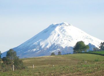
Explore more of Cotopaxi Region
Explore the Cotopaxi Region: Home to Ecuador's iconic volcano, rich cultural heritage, and breathtaking landscapes perfect for adventure and relaxation.
Explore Cotopaxi Region
Explore more of Ecuador
Explore Ecuador: From the Amazon rainforest and Andean highlands to the Pacific coast and Galápagos Islands, discover diverse landscapes and vibrant cultures.
Explore Ecuador