

Streymoy Island Travel Guide - Free Web & App
Your ultimate guide to Streymoy Island. Discover top landmarks, proposed trips, and local tips. Free on the web or via the Evendo companion app.


Streymoy Island, Faroe Islands, combines Tórshavn, Kirkjubøur and dramatic fjords, cliffs, villages and hiking landscapes across the Faroese heartland.
A Mountainous Faroese Heartland
Streymoy is the largest and most populous island in the Faroe Islands, extending from the capital, Tórshavn, in the south to steep northern mountains and sheltered fjords. Its landscape is defined by dark basalt, grass-covered slopes, narrow sounds and sea cliffs shaped by the North Atlantic. Roads and tunnels connect a string of settlements, but the island still feels spacious beyond the main urban areas, with weather and terrain influencing every journey.Read more about Streymoy Island
Villages, Heritage and Coastal Landscapes
Walking, Wildlife and Faroese Character
When is the best time to visit Streymoy Island?
Best: June–August · 14–15°C| Month | High (°C) | Rainfall (mm) |
|---|---|---|
| January | 6 | 150 |
| February | 6 | 130 |
| March | 7 | 130 |
| April | 8 | 110 |
| May | 11 | 80 |
| June (best) | 14 | 70 |
| July (best) | 15 | 80 |
| August (best) | 15 | 90 |
| September | 14 | 110 |
| October | 11 | 140 |
| November | 8 | 150 |
| December | 6 | 150 |
Getting to and around Streymoy Island
How to get there
Transportation
Best attractions in Streymoy Island
Streymoy's attractions range from the urban heritage of Tórshavn to remote valleys and exposed northern coasts. In the capital, the old harbour area of Tinganes and the open-air village of Hoyvíksgarður introduce Faroese political and rural history. Kirkjubøur, south-west of Tórshavn, combines a historic church, the ruins of Magnus Cathedral and traditional farm buildings. North-western Streymoy brings the dramatic landscapes of Saksun, where a tidal lagoon lies below a mountain-ringed valley, and Tjørnuvík, a village facing the sea stacks Risin and Kellingin. Vestmanna is associated with boat excursions beneath high coastal cliffs and sea bird habitats, subject to weather and seasonal conditions. Kvívík offers archaeological interest linked to early settlement, while Haldórsvík, Hvalvík and the valleys around Kollafjørður reveal the island's quieter village character. Hiking routes connect several of these landscapes, although access, path fees and private-land arrangements should be checked locally.
-
Vestmanna Tourist Centre
Explore the Faroe Islands from Vestmanna Tourist Centre: boat tours, local cuisine, history, and stunning scenery await!
-
Tourist attraction
Nólsoy Lighthouse
Hike to the historic Nólsoy Lighthouse for breathtaking views and a glimpse into the Faroe Islands' rugged beauty and maritime past.
-
Vestmanna
Explore Vestmanna, a charming village in the Faroe Islands, rich in stunning landscapes, vibrant culture, and unforgettable outdoor adventures.
Best landmarks in Streymoy Island
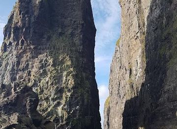
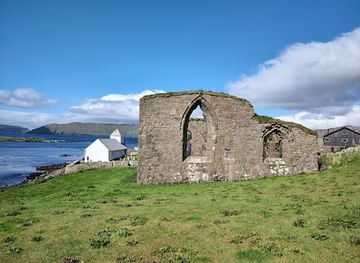
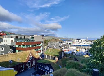
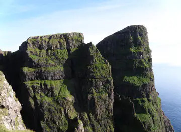
Streymoy's most recognisable landmarks combine volcanic landforms with traces of Faroese settlement. The sea stacks Risin and Kellingin rise offshore from Tjørnuvík and are among the archipelago's best-known coastal silhouettes. At Saksun, a tidal lagoon occupies the mouth of a former inlet below steep basalt mountains, creating a landscape shaped by both geology and changing water levels. Vestmanna's cliffs form a dramatic coastal wall marked by caves, ledges and important seabird habitat, viewed most closely from the sea when excursions operate. Kirkjubøur provides the island's chief historic landmark group: the medieval Kirkjubøur Church, the unfinished Magnus Cathedral and the traditional Roykstovan farmhouse. In Tórshavn, the grass-roofed buildings of Tinganes recall the capital's long political and trading role, while the harbour remains a practical symbol of the island's maritime identity.
-
Historical place
Kirkjubømúrurin
Discover the historic charm of Kirkjubøur, a captivating village on the Faroe Islands, rich in culture and breathtaking scenery.
-
Tourist attraction
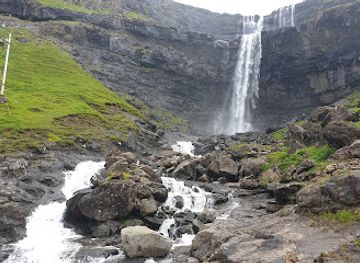
Fossá
Explore the stunning Fossá waterfall, the tallest in the Faroe Islands, where nature's beauty meets tranquility in a breathtaking landscape.
-
Cultural center
The Nordic House
Explore the Nordic House, the cultural center of the Faroe Islands, where art, history, and contemporary creativity converge in Tórshavn.
-
Historical landmark
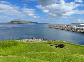
Skansin
Explore Skansin, a historical fortress in Tórshavn, combining rich maritime history with stunning coastal views in the heart of the Faroe Islands.
Explore Streymoy Island on the map
Plan your trip on one map. See where the top attractions, landmarks, restaurants and hotels are, and book hotels and experiences in a few clicks.
Best hotels in Streymoy Island
Best restaurants in Streymoy Island
Dining on Streymoy is concentrated in Tórshavn and larger settlements rather than at remote viewpoints or hiking destinations. The capital offers the widest choice, from cafés and bakeries to restaurants presenting Faroese ingredients such as lamb, fish, shellfish, fermented specialities and locally sourced dairy or produce. Traditional village cafés, guesthouse restaurants and rural eating places provide more limited but useful options around the island, although opening patterns can be seasonal and reservations may be sensible. Seafood reflects the islands' maritime setting, while lamb and simple farmhouse cooking connect the table with Streymoy's grazing landscape. Farm shops and small food producers may offer regional goods, but visitors heading to Saksun, Tjørnuvík or mountain routes should not rely on finding food there. Local dining in Tórshavn is also the best place to encounter contemporary interpretations of Faroese culinary traditions.
-
Scandinavian
Katrina Christiansen
Experience authentic Scandinavian cuisine at Katrina Christiansen in Tórshavn – where tradition meets modern flavor.
-
Restaurant
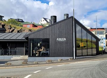
Angus Steakhouse
Experience exquisite dining at Angus Steakhouse in Tórshavn - where exceptional steaks meet Faroese culinary traditions.
-
Restaurant
Áarstova
Experience authentic Faroese cuisine at Áarstova in Tórshavn - where tradition meets culinary excellence.
-
Restaurant
THE TARV Grillhouse
Experience culinary excellence at The TARV Grillhouse in Tórshavn - where local flavors meet modern cuisine.
Best bars in Streymoy Island
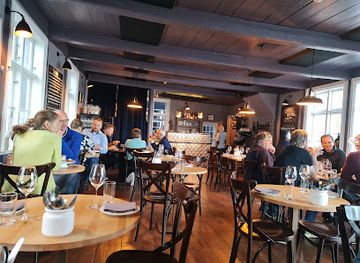
Tórshavn contains the Faroe Islands' most substantial evening scene, with pubs, bars, cafés and occasional live music venues concentrated around the historic centre and harbour area. The atmosphere is sociable but generally compact rather than metropolitan, and the choice is much smaller once visitors leave the capital. In villages such as Vestmanna, Hvalvík or Tjørnuvík, evenings are more likely to centre on a local gathering place, guesthouse or quiet meal than on dedicated nightlife. Cultural events and concerts may take place in Tórshavn or other settlements, but schedules vary and should be checked locally. Remote parts of Streymoy offer dark skies, harbour walks and the sound of weather on the coast rather than late-night entertainment, so visitors staying outside the capital should plan evening transport and dining in advance.
-
Irish pub
Irish Pub Torshavn
Experience authentic Irish cuisine and hospitality at Irish Pub Torshavn, a cozy retreat in the heart of the Faroe Islands.
-
Scandinavian
Katrina Christiansen
Discover the essence of Scandinavian cuisine at Katrina Christiansen in Tórshavn, where fresh local ingredients meet unforgettable flavors.
-
Restaurant
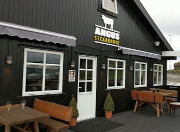
Angus Steakhouse
Experience the finest steaks and local flavors in Tórshavn at Angus Steakhouse, a top dining destination for meat lovers.
-
Seafood
Barbara Fish House
Experience the finest seafood dining at Barbara Fish House in Tórshavn, where every dish celebrates the rich maritime culture of the Faroe Islands.


Best nightclubs in Streymoy Island
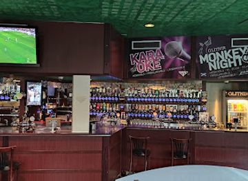
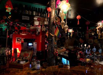
Tórshavn contains the Faroe Islands' most substantial evening scene, with pubs, bars, cafés and occasional live music venues concentrated around the historic centre and harbour area. The atmosphere is sociable but generally compact rather than metropolitan, and the choice is much smaller once visitors leave the capital. In villages such as Vestmanna, Hvalvík or Tjørnuvík, evenings are more likely to centre on a local gathering place, guesthouse or quiet meal than on dedicated nightlife. Cultural events and concerts may take place in Tórshavn or other settlements, but schedules vary and should be checked locally. Remote parts of Streymoy offer dark skies, harbour walks and the sound of weather on the coast rather than late-night entertainment, so visitors staying outside the capital should plan evening transport and dining in advance.
-
Irish pub
Irish Pub Torshavn
Discover the charm of Tórshavn at Irish Pub, where authentic Irish hospitality meets local flavor in a vibrant atmosphere.
-
Bar
Sirkus Bar
Experience Tórshavn's vibrant nightlife at Sirkus Bar, where locals and travelers gather for great drinks and unforgettable moments.
-
Bar
Glitnir
Experience the vibrant nightlife of Tórshavn at Glitnir, where exceptional drinks meet a lively atmosphere in the heart of the Faroe Islands.
-
Bar
Tórshøll
Experience the vibrant nightlife of Tórshavn at Tórshøll, where friendly bartenders serve up local flavors and unforgettable memories.


Best shops in Streymoy Island
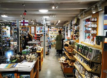
Shopping is most varied in Tórshavn, where visitors can find Faroese knitwear, wool products, design goods, books, art, outdoor equipment and regional food items through independent shops and galleries. Traditional woollen garments and contemporary knitwear reflect the islands' cool, wet climate and enduring sheep-farming culture, while local art often draws on the sea, mountains and changing northern light. Smaller settlements on Streymoy have village shops and occasional craft or food outlets, but retail choice becomes limited outside the capital. Farm shops and producers may offer local specialities, although availability and opening arrangements vary. Visitors travelling to Saksun, Tjørnuvík or the Vestmanna area should purchase essentials beforehand in Tórshavn or another substantial settlement rather than expecting a permanent commercial centre at a natural attraction.
-
Gift shop
H. N. Jacobsens Bókahandil
Explore H. N. Jacobsens Bókahandil, Tórshavn's beloved gift shop offering books, souvenirs, and unique Faroese treasures.
-
Grocery store
Á Handil
Explore the culinary wonders of Tórshavn at Á Handil, your go-to grocery store for local and international delights.
-
Clothing store
Guðrun & Guðrun
Discover unique Faroese fashion at Guðrun & Guðrun, a clothing store that blends tradition with modern style in Tórshavn.
-
Grocery store
Á handil
Discover the local flavors of the Faroe Islands at Á handil, Tórshavn's beloved grocery store featuring artisanal foods and fresh produce.

Get your free copy of our complete guide to Streymoy Island, delivered straight to you.
Everything on this page, from attractions and restaurants to essentials and local phrases, in one PDF you can read offline, print or share.
Already have an account? Sign in
Your Streymoy Island guide is ready.
We'll send it to · Not you? Sign out

Getting your guide ready…
We are putting together a fresh copy of the Streymoy Island guide. This can take up to a minute.
This can take a few moments. If your browser asks, choose Allow so the download can start. You'll find the guide in your Downloads folder.
Nothing happened? Download it again
Sorry, the guide is taking longer than usual. Please try again in a minute, or get it by email instead.
Streymoy Island essentials
Currency and Payment
Safety
Emergency Situations
Do's and Don'ts
Local Tips
From Eve
Local phrases worth knowing
You don't need to get them perfect. A few words go a long way, and locals appreciate the effort.
Basics
| English | Local | Say it |
|---|---|---|
| Hello | Halló | [HAH-loh] |
| Goodbye | Farvæl | [FAHR-vayl] |
| Yes | Ja | [yah] |
| No | Nei | [nay] |
| Please/You're welcome | Vær så god | [vair soh gohd] |
| Thank you | Takk fyri | [tahk FEE-ree] |
| Excuse me/Sorry | Fyrirgef meg | [FEER-ir-gehv meh] |
| How are you? | Hvussu hevur tú tað? | [HVOOS-soo HEH-vur too tah] |
| Fine. And you? | Godt. Og tú? | [goht oh too] |
| Do you speak English? | Talar tú enskt? | [TAH-lahr too enskt] |
| I don't understand | Eg skilji ikki | [ey shil-yee ihkee] |
Eating & Drinking
| English | Local | Say it |
|---|---|---|
| I'd like to see the menu, please | Eg vil síggja menuin, vænliga | [ey vil SEE-ya meh-NOO-in VAHN-lee-gah] |
| I don't eat meat | Eg eti ikki kjøt | [ey eh-tee ihkee chyut] |
| Cheers! | Skál! | [skowl] |
| I would like to pay, please | Eg vil gjalda, vænliga | [ey vil yal-da VAHN-lee-gah] |
Emergencies
| English | Local | Say it |
|---|---|---|
| Help! | Hjálp! | [HYAWLP] |
| Go away! | Far avstað! | [FAHR AV-stath] |
| Call the Police! | Ring eftir lógmanni! | [ring EV-teer LOWG-mahn-ee] |
| Call a doctor! | Ring eftir læknari! | [ring EV-teer LYE-knar-ee] |
| I'm lost | Eg er týstur | [ey ar TEES-tur] |
| I'm ill | Eg er sjúkur | [ey ar SYOO-kur] |
Shopping
| English | Local | Say it |
|---|---|---|
| I'd like to buy... | Eg vil keypa... | [ey vil KAY-pah] |
| I'm just looking | Eg er bara at síggja | [ey ar BAH-rah at SEE-ya] |
| How much is it? | Hvussu nógv kostar tað? | [HVOOS-soo NOHV kost-ar tah] |
| That's too expensive | Tað er ov dyrt | [tah ar ohv deert] |
| Can you lower the price? | Kanstu lægga prísin? | [kahn-stoo LYE-gah PREES-een] |
Time & Numbers
| English | Local | Say it |
|---|---|---|
| What time is it? | Hvat er tíðin? | [kvat ar TEE-din] |
| It's one o'clock | Tað er eitt | [tah ar eyt] |
| Half past (10) | Hálf tið (10) | [howlf tee-th (tayn)] |
| Morning | Morgun | [MORE-goon] |
| Afternoon | Ettermiðdegi | [ET-ter-mith-deh-gee] |
| Evening | Kvøld | [kvool] |
| Yesterday | Í gjár | [ee DYOW-ar] |
| Today | Í dag | [ee dah] |
| Tomorrow | Í morgin | [ee MORE-gin] |
| 1 | Eitt | [eyt] |
| 2 | Tvø | [tvoo] |
| 3 | Trý | [tree] |
| 4 | Fýra | [FEER-ah] |
| 5 | Fimm | [feem] |
| 6 | Seks | [seks] |
| 7 | Sjey | [shay] |
| 8 | Átta | [OWT-tah] |
| 9 | Ni | [nee] |
| 10 | Tíggju | [TEE-yoo] |
Transport & Directions
| English | Local | Say it |
|---|---|---|
| Where's a/the...? | Hvar er ein... | [kvar ar ayn] |
| What's the address? | Hvat er heimilsheiðurin? | [kvat ar HAY-mils-HAY-thur-een] |
| Can you show me (on the map)? | Kanstu vísa mær (á kortinum)? | [kahn-stoo VEE-sah myar (ow KOHR-teen-oom)] |
| When's the next (bus)? | Hvussu langt er til næsta (buss)? | [HVOOS-soo lahngt ar til NAY-stah (boos)] |
| A ticket (to ....) | Eiða (til ....) | [EYE-thah (til ....)] |
History of Streymoy Island
Basalt Foundations and Glacial Valleys
Streymoy belongs to the volcanic North Atlantic archipelago formed from successive basalt lava flows millions of years ago. Later erosion, including glacial action during Ice Age periods, cut valleys and fjords into the layered rock. This geological structure explains the island's characteristic stepped mountains, exposed cliffs and flat-topped ridges. Human history developed within this demanding terrain: settlements generally occupied sheltered coastal ground, while the uplands remained primarily grazing country.
Norse Settlement and Rural Communities
Norse settlers established communities in the Faroe Islands during the Viking Age, building a society based on farming, fishing and the management of scattered coastal settlements. On Streymoy, villages such as Kvívík preserve archaeological evidence associated with early Norse occupation, while places including Saksun, Tjørnuvík and Kirkjubøur developed around fertile valleys, natural harbours or useful grazing land. Local life remained closely connected to sheep husbandry, small-scale agriculture and the sea, with travel between settlements often dependent on boats and mountain paths.
Kirkjubøur and Medieval Faroe
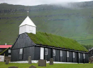
Kirkjubøur became the religious and administrative centre of the medieval Faroe Islands. Its church and ecclesiastical buildings reflect the importance of the settlement before and around the Reformation, while the ruined Magnus Cathedral remains one of the archipelago's most prominent medieval structures. The historic farmhouse known as Roykstovan is associated with the long-lived Patursson family and illustrates the continuity of settlement at the site. Kirkjubøur's surviving buildings provide an unusually concentrated record of Faroese religious, agricultural and political history.
Tórshavn and the Growth of Maritime Trade
Tórshavn developed around its protected harbour and became the islands' central place for administration, commerce and maritime exchange. The old quarter, including the grass-roofed houses of Tinganes, recalls the town's role in the Faroese Løgting and later trading life. As transport, communications and public administration modernised, Tórshavn expanded beyond its historic core and became the main service centre for Streymoy and the wider archipelago. The town's growth changed the island's economic balance while leaving rural communities tied to fishing, farming and local industries.
Roads, Tunnels and Modern Conservation
Twentieth- and twenty-first-century roads, bridges and subsea tunnels transformed movement across Streymoy, reducing the isolation of villages and making the island more accessible from Vágar, Eysturoy and Sandoy. Modern tourism has increased interest in landscapes such as Saksun, Tjørnuvík and the Vestmanna cliffs, while conservation and visitor-management concerns have become increasingly important. Shorelines, nesting areas, grazing land and fragile paths require careful treatment, and access rules may differ between public routes and privately managed land.
Streymoy Island in Photos
Browse through our photo collection highlighting the charm and character of the destination.
Cities in Streymoy Island
The towns and cities of Streymoy Island, and the easiest places to base yourself.
-

-
-
-

-

-


Swipe for more cities
Neighbouring destination travel guides
The closest destinations to Streymoy Island, if you have time for more than one.
-

-

-

-
-


Swipe for more destinations
Explore more

Explore more of Streymoy
Discover Streymoy, the heart of the Faroe Islands, where dramatic landscapes, rich history, and charming villages create an unforgettable travel experience.
Explore Streymoy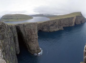
Explore more of Faroe Islands
Discover the Faroe Islands: A land of rugged beauty, rich history, and tranquil villages, perfect for nature lovers and adventurers seeking an off-the-beaten-path destination.
Explore Faroe Islands