

Suðuroy Island Travel Guide - Free Web & App
Your ultimate guide to Suðuroy Island. Discover top landmarks, proposed trips, and local tips. Free on the web or via the Evendo companion app.


Suðuroy Island in the Faroe Islands offers sea cliffs, quiet villages, dramatic hikes, birdlife and rich maritime heritage at the Atlantic’s edge.
Landscapes and Island Character
Suðuroy is the southernmost of the main Faroe Islands, a long, mountainous island shaped by North Atlantic weather and dramatic basalt geology. Steep sea cliffs, narrow valleys, grassy ridges and sheltered fjords define an environment that feels more spacious and rural than the archipelago’s central islands. The island’s settlements lie mainly around the coast, where villages occupy small strips of level ground beside coves and sounds. Among them are Tvøroyri, the principal settlement and an important ferry gateway, Vágur, Hvalba, Fámjin, Sumba, Porkeri, Hov, Sandvík, Akrar and Lopra.Read more about Suðuroy Island
Villages, Heritage and Wildlife
Exploring Suðuroy
When is the best time to visit Suðuroy Island?
Best: June–August · 12–14°C| Month | High (°C) | Rainfall (mm) |
|---|---|---|
| January | 7 | 150 |
| February | 6 | 120 |
| March | 6 | 100 |
| April | 7 | 90 |
| May | 10 | 70 |
| June (best) | 12 | 60 |
| July (best) | 14 | 60 |
| August (best) | 14 | 70 |
| September | 12 | 80 |
| October | 10 | 100 |
| November | 7 | 150 |
| December | 7 | 150 |
Getting to and around Suðuroy Island
How to get there
Transportation
Best attractions in Suðuroy Island
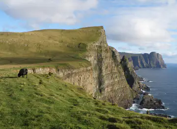
Suðuroy’s principal attractions are its coastal landscapes, villages and walking country rather than a concentration of formal visitor facilities. Beinisvørð, above the western coast, is the island’s best-known high viewpoint, with sheer cliffs and broad views across the Atlantic when visibility is clear. Hvannhagi, reached on foot from the Tvøroyri area, is a remote natural hollow framed by steep slopes and coastal scenery. In the south, Sumba, Akrar and Lopra offer access to a strongly maritime landscape, while Fámjin occupies a sheltered valley on the west coast and is associated with distinctive village heritage. Hvalba and Sandvík reveal the island’s northern character, including its farming and coal-mining history. Tvøroyri and Vágur provide the most substantial settlement environments, with harbours, local services and cultural interest, while the roads between villages create changing views of fjords, pasture, cliffs and mountain ridges.
-
Tourist attraction
Hvannhagi
Discover Hvannhagi: Hike to a breathtaking Faroese valley with a stunning lake, surrounded by dramatic mountains and rich birdlife.
-
Mountain peak
Rituskor
Experience the thrill of crossing a bridge between cliffs and witness breathtaking panoramic views at Rituskor in the Faroe Islands.
-
Tourist attraction
Ruth Smith Art Museum
Discover the art of Ruth Smith in Vágur, Faroe Islands, showcasing vibrant landscapes and portraits reflecting Faroese life and culture.
-
Park
Viðarlundin við Tvøroyrar kirkju
Discover the tranquility of Viðarlundin in Tvøroyri, a stunning park offering breathtaking views and a peaceful escape into nature.

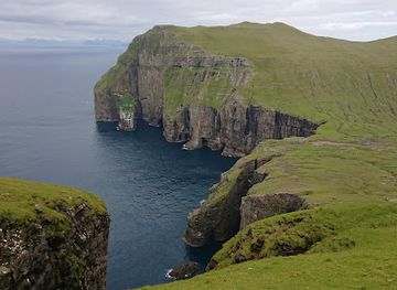


Best landmarks in Suðuroy Island
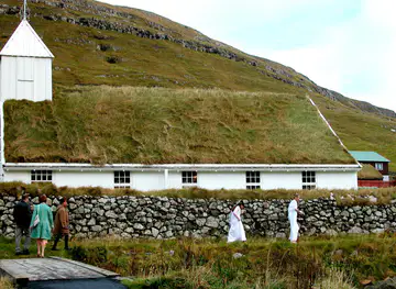
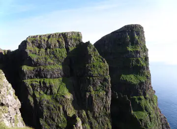
Suðuroy’s defining landmarks are primarily natural. Beinisvørð dominates the western coast with a high, sharply cut cliff face and is one of the island’s most recognisable viewpoints. The sea stack and cliff scenery around the southern coast express the island’s exposed position at the edge of the North Atlantic, while Hvannhagi forms a memorable inland-and-coastal landscape near Tvøroyri. The villages themselves are important cultural landmarks: Fámjin’s church and traditional settlement setting, the harbour environments of Tvøroyri and Vágur, and the historic communities of Hvalba, Sumba and Porkeri show how people adapted to narrow coastal sites. Old turf-roofed houses, boat-related buildings and village churches are significant not because of monumental scale, but because they preserve the close relationship between farming, fishing, faith and weather that shaped Suðuroy’s identity.
-
Cafe
Cafe MorMor
Experience the charm of Cafe MorMor, a delightful café in Tvøroyri, where local flavors meet stunning views in the heart of the Faroe Islands.
-
Natural beauty spot
Hvannhagi
Discover the breathtaking beauty of Hvannhagi, a hidden natural treasure in the Faroe Islands, perfect for hiking and immersing in nature's tranquility.
-
Island
Suðuroy
Explore Suðuroy, the southernmost island of the Faroe Islands, renowned for its stunning landscapes, unique wildlife, and rich culture.
-
Art cafe
Oyggin Art Gallery
Experience the vibrant fusion of art and cuisine at Oyggin Art Gallery, a must-visit art cafe in the heart of the Faroe Islands.


Explore Suðuroy Island on the map
Plan your trip on one map. See where the top attractions, landmarks, restaurants and hotels are, and book hotels and experiences in a few clicks.
Best hotels in Suðuroy Island
Best restaurants in Suðuroy Island
Dining on Suðuroy is concentrated in the larger settlements, particularly Tvøroyri and Vágur, with additional options in village cafés, guesthouses and local service businesses rather than a continuous restaurant scene. Menus reflect Faroese food culture and the island’s maritime setting, with fish, seafood, lamb, dairy products and simple café fare commonly associated with regional eating. Traditional Faroese foods may include dried or fermented meat and fish, although availability varies and visitors should regard them as local specialities rather than guaranteed menu items. Small shops provide supplies for picnics and self-catering, which is useful before longer walks or drives through the southern villages. Farm products, bakery goods and locally sourced ingredients may also appear through seasonal or community-based outlets, but opening arrangements can be limited outside the main population centres.
-
Restaurant
Matstovan i Porkeri
Discover authentic Faroese flavors at Matstovan i Porkeri – where local ingredients meet stunning views for an unforgettable dining experience.
-
Restaurant
Matstovan Garðslon
Discover the authentic flavors of the Faroe Islands at Matstovan Garðslon in Vágur – where every dish tells a story.
-
Restaurant
Báran
Experience authentic Faroese cuisine at Báran in Vágur – where local ingredients meet breathtaking views.
-
Pizza Takeout
Pizzakøkurin
Experience authentic Faroese flavors at Pizzakøkurin, where delicious pizzas meet stunning landscapes in Vágur.


Best bars in Suðuroy Island
Suðuroy does not have a large nightclub district or a late-night entertainment scene. Evening life is centred on local cafés, restaurants, community halls and traditional pubs or social venues in settlements such as Tvøroyri and Vágur, where the atmosphere is generally informal and closely connected with island community life. Cultural events, live music and seasonal gatherings may take place, but schedules are not constant and should be checked locally. In smaller villages, evenings are usually quiet, with accommodation, conversation and changing views over the water providing the main experience. Visitors should plan transport carefully after dark, particularly if staying outside the larger settlements, as rural roads, tunnels and weather can make travel slower than expected.
-
Cafe
Cafe MorMor
Discover the flavors of the Faroe Islands at Cafe MorMor, where local ingredients meet cozy ambiance for an unforgettable culinary experience.
-
Cafe
Glasstovan
Discover the essence of Faroese culture at Glasstovan, a charming café in Tvøroyri, offering delightful treats and stunning views.
-
Restaurant
Matstovan i Porkeri
Discover the authentic flavors of the Faroe Islands at Matstovan i Porkeri, where local cuisine meets a warm and inviting atmosphere.
-
Restaurant
Matstovan Garðslon
Experience the heart of Faroese cuisine at Matstovan Garðslon, where local flavors meet delightful culinary artistry in a cozy atmosphere.


Best nightclubs in Suðuroy Island
Suðuroy does not have a large nightclub district or a late-night entertainment scene. Evening life is centred on local cafés, restaurants, community halls and traditional pubs or social venues in settlements such as Tvøroyri and Vágur, where the atmosphere is generally informal and closely connected with island community life. Cultural events, live music and seasonal gatherings may take place, but schedules are not constant and should be checked locally. In smaller villages, evenings are usually quiet, with accommodation, conversation and changing views over the water providing the main experience. Visitors should plan transport carefully after dark, particularly if staying outside the larger settlements, as rural roads, tunnels and weather can make travel slower than expected.
-
Cultural center
Salt - Sound Art & Live Theatre
Discover the enchanting world of sound art and live theatre at Salt, a cultural center in the beautiful Faroe Islands.
-
Cafe
Hjá Jugga
Experience the warmth and flavors of the Faroe Islands at Hjá Jugga, a cozy café in the heart of Vágur, perfect for relaxation and local cuisine.
-
 Bar
Tvøroyrar Klubbi
Discover the vibrant nightlife of Tvøroyri at Tvøroyrar Klubbi, where locals and tourists come together for unforgettable evenings.
-
Bar
Biskupskelda - Beer Brewery & shop
Discover the flavors of the Faroe Islands at Biskupskelda, a delightful brewery offering unique local beers in a cozy atmosphere.


Best shops in Suðuroy Island
Shopping on Suðuroy is practical and local rather than extensive. Tvøroyri and Vágur have the broadest range of everyday shops and supplies, while smaller villages may offer limited provisions through local stores or service businesses. Visitors may find Faroese woollen goods, knitwear, handicrafts, artwork and locally produced food through shops, craft outlets or seasonal community initiatives, although stock and opening arrangements vary. Wool is particularly meaningful in the Faroese context, reflecting the continuing importance of sheep farming and textile traditions across the islands. Food shops are useful for preparing walks, especially when travelling towards Fámjin, Hvalba, Sumba or the southern settlements, where retail choices are fewer. The best purchases are generally connected with local materials, island food culture and small-scale makers rather than conventional retail brands.
-
Supermarket
Bónus
Discover the heart of local shopping at Bónus Supermarket in Tvøroyri, where quality meets affordability in the stunning Faroe Islands.
-
Supermarket
Zacharias Muller Supermarket
Discover local flavors and essentials at Zacharias Muller Supermarket, Porkeri's charming grocery destination for fresh produce and Faroese specialties.
-
Supermarket
Bakkhús Supermarket
Discover the true flavors of the Faroe Islands at Bakkhús Supermarket in Hvalba, your local source for fresh produce and traditional delicacies.
-
Shopping mall
Torgið Shopping Center
Explore Torgið Shopping Center in Vágur for a unique shopping experience filled with local culture, diverse shops, and delightful cafes.


Get your free copy of our complete guide to Suðuroy Island, delivered straight to you.
Everything on this page, from attractions and restaurants to essentials and local phrases, in one PDF you can read offline, print or share.
Already have an account? Sign in
Your Suðuroy Island guide is ready.
We'll send it to · Not you? Sign out

Getting your guide ready…
We are putting together a fresh copy of the Suðuroy Island guide. This can take up to a minute.
This can take a few moments. If your browser asks, choose Allow so the download can start. You'll find the guide in your Downloads folder.
Nothing happened? Download it again
Sorry, the guide is taking longer than usual. Please try again in a minute, or get it by email instead.
Suðuroy Island essentials
Currency and Payment
Safety
Emergency Situations
Do's and Don'ts
Local Tips
From Eve
Local phrases worth knowing
You don't need to get them perfect. A few words go a long way, and locals appreciate the effort.
Basics
| English | Local | Say it |
|---|---|---|
| Hello | Halló | [haɫɔ] |
| Goodbye | Farvæl | [fɑrvɛl] |
| Yes | Ja | [ja] |
| No | Nei | [nɛi] |
| Please/You're welcome | Vær så god | [vɛr sɔ gɔð] |
| Thank you | Takk fyri | [taʰk fyrɪ] |
| Excuse me/Sorry | Fyrirgev mær | [fyriɹjɛv mɛaɹ] |
| How are you? | Hvussu hevur tú tað? | [kvusːu hɛvʊɹ tuː taː] |
| Fine. And you? | Godt. Og tú? | [goʊt ɔk tuː] |
| Do you speak English? | Talar tú enskt? | [talaɹ tuː ɛnskt] |
| I don't understand | Eg skilji ikki | [ɛa skɪlji ɪhtkɪ] |
Eating & Drinking
| English | Local | Say it |
|---|---|---|
| I'd like to see the menu, please | Eg vil síggja matsedilin, vænta | [ɛa vil siːja matsɛdilɪn vɛnta] |
| I don't eat meat | Eg eta ikki kjøt | [ɛa ɛtɑ ɪhtkɪ çøt] |
| Cheers! | Skál! | [skɔɫ] |
| I would like to pay, please | Eg vil gjalda, vænta | [ɛa vil ɹjaldɑ vɛnta] |
Emergencies
| English | Local | Say it |
|---|---|---|
| Help! | Hjálp! | [çlaʊp] |
| Go away! | Far til fjøru! | [fɑɹ tɪl fjøːɹʊ] |
| Call the Police! | Ringi til løgregluna! | [ɹɪŋɪ tɪl løɣɹɛɣlʊna] |
| Call a doctor! | Ringi til læknin! | [ɹɪŋɪ tɪl læknɪn] |
| I'm lost | Eg er týstur | [ɛa ɛaʰ toɪstʊɹ] |
| I'm ill | Eg er veikur | [ɛa ɛaʰ vɛɪkʊɹ] |
Shopping
| English | Local | Say it |
|---|---|---|
| I'd like to buy... | Eg vil keypa... | [ɛa vil tʃeɪpa] |
| I'm just looking | Eg bara sigi | [ɛa bara sɪɣɪ] |
| How much is it? | Hvussu nógv kostar tað? | [kvusːu nɔɪv kostar taː] |
| That's too expensive | Tað er ov dýrt | [taː ɛa ɔv diːɹt] |
| Can you lower the price? | Kanstu sætta prísin? | [kansˌtu sɛaʰtɑ pɹiːsɪn] |
Time & Numbers
| English | Local | Say it |
|---|---|---|
| What time is it? | Hvussu tíð er tað? | [kvusːu tiːð ɛaʰ taː] |
| It's one o'clock | Tað er eitt | [taː ɛaʰ aɪt] |
| Half past (10) | Hálvgilt (10) | [haʊlvgɪlt (10)] |
| Morning | Morgun | [moɹɣʊn] |
| Afternoon | Eftirmiðdagur | [ɛaʰtɪɹmiðaɣʊɹ] |
| Evening | Kvøld | [kvøɫ] |
| Yesterday | Í gjár | [iː çaʊaɹ] |
| Today | Í dag | [iː dav] |
| Tomorrow | Á morgun | [aʊ moɹɣʊn] |
| 1 | Eitt | [aɪt] |
| 2 | Tvær | [tvaɪɹ] |
| 3 | Tríggjar | [tɹiːɣaɹ] |
| 4 | Fýra | [fʊɪɹa] |
| 5 | Fimm | [fɪm] |
| 6 | Seks | [sɛks] |
| 7 | Sjey | [ʃɛɪ] |
| 8 | Átta | [aʊtʰa] |
| 9 | Niður | [niːðʊɹ] |
| 10 | Tíggju | [tʰɪɣʊ] |
Transport & Directions
| English | Local | Say it |
|---|---|---|
| Where's a/the...? | Har er ein/het... | [haɹ ɛaʰ aɪn/hɛt] |
| What's the address? | Hvussu er adressan? | [kvusːu ɛaʰ aðɹɛsːan] |
| Can you show me (on the map)? | Kannstu vísa meg (á korti)? | [khansˌtu vɪːsa mɛaɣ (aʊ kɔɹtɪ)] |
| When's the next (bus)? | Nær er næsta (bussin)? | [neɛaʰ ɛaʰ næsta (bʊsːɪn)] |
| A ticket (to ....) | Ein miði (til ....) | [aɪn miðɪ (tɪl ....)] |
History of Suðuroy Island
Basalt Foundations and Atlantic Erosion
Suðuroy, like the rest of the Faroe Islands, is formed from successive layers of basaltic lava created by volcanic activity in the North Atlantic during the early geological history of the region. Later erosion by the sea, ice and weather carved the island into steep coastal cliffs, narrow valleys and sheltered inlets. The exposed western coast shows particularly clearly how Atlantic forces continue to shape the island, while the eastern side contains several more protected fjords and settlements. This geological structure explains both Suðuroy’s dramatic scenery and the limited amount of level land available for farming and building.
Norse Settlement and Village Origins
The Faroes were settled by Norse communities during the Viking Age, and Suðuroy developed as part of that wider island society. Farming, fishing and the seasonal use of outlying coastal and upland areas formed the basis of life. Place names, settlement patterns and traditional agricultural practices preserve evidence of the Norse cultural framework, although the island’s history was shaped over centuries by changing political and economic conditions. Villages grew in locations offering access to pasture, freshwater, landing places and sheltered bays, creating the dispersed coastal pattern still visible today.
Farming, Fishing and Isolation
For much of its history, Suðuroy’s communities depended on a mixed economy of sheep farming, small-scale agriculture, fishing and the harvesting of seabirds and other marine resources. Travel between villages and to the northern islands was difficult, particularly before modern roads, tunnels and regular ferry services. The sea was therefore both a source of food and income and a major barrier. Traditional houses, village churches, boat-related customs and communal practices reflect a society where labour was closely tied to weather, tides and the availability of limited land.
Coal Mining at Hvalba
Suðuroy is associated with coal mining, an unusual industrial chapter in the Faroes. Coal was extracted around Hvalba and in neighbouring parts of the island, providing a local fuel source and employment at different periods. Mining never transformed Suðuroy into an industrial region on the scale found elsewhere in Europe, but it left a distinct mark on local history and landscape. The coalfields demonstrate how island communities used available natural resources when imported fuel was costly or difficult to obtain, while also revealing the demanding work behind everyday life in a remote North Atlantic environment.
Modern Connections and Heritage Preservation
The twentieth century brought improved roads, tunnels, harbour facilities, telecommunications and more reliable connections with the rest of the Faroe Islands, reducing Suðuroy’s former isolation while encouraging changes in employment and population. Fishing remains important to the island’s identity, but many residents also work in public services, transport and other modern sectors. Heritage museums, historic buildings and local cultural activities preserve aspects of village life, maritime work and industrial history. At the same time, hiking tourism has drawn attention to landscapes such as Beinisvørð and Hvannhagi, making responsible access and respect for fragile coastal environments increasingly important.
Suðuroy Island in Photos
Browse through our photo collection highlighting the charm and character of the destination.
Cities in Suðuroy Island
The towns and cities of Suðuroy Island, and the easiest places to base yourself.
-
-


Swipe for more cities
Neighbouring destination travel guides
The closest destinations to Suðuroy Island, if you have time for more than one.
-

-
-

-
-


Swipe for more destinations
Explore more

Explore more of Suðuroy
Discover the untouched beauty and rich culture of Suðuroy in the Faroe Islands, an island of dramatic cliffs, charming villages, and unforgettable landscapes.
Explore Suðuroy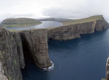
Explore more of Faroe Islands
Discover the Faroe Islands: A land of rugged beauty, rich history, and tranquil villages, perfect for nature lovers and adventurers seeking an off-the-beaten-path destination.
Explore Faroe Islands