

Great River Road Travel Guide - Free Web & App
Your ultimate guide to Great River Road. Discover top landmarks, proposed trips, and local tips. Free on the web or via the Evendo companion app.


Great River Road Illinois follows the Mississippi from Cairo to East Dubuque, linking river towns, historic sites, scenic bluffs, wildlife refuges and food.
A River Route Through Illinois
Great River Road is not a single town or enclosed park but a scenic route tracing the Mississippi River along the western edge of Illinois. The Illinois section runs for roughly 550 miles between Cairo in the south and East Dubuque in the north, passing through river ports, historic communities, floodplain forests, agricultural country and wooded limestone bluffs. Its character changes markedly along the way: the broad lowlands around the confluence of the Mississippi and Ohio rivers give way to the historic river city of Alton, the limestone scenery of the Illinois Valley and the tall bluffs of the Driftless Area near Galena and Savanna.Read more about Great River Road
River Towns and Landscapes
Exploring the Corridor
When is the best time to visit Great River Road?
Best: May–June, September · 23–28°C| Month | High (°C) | Rainfall (mm) |
|---|---|---|
| January | 3 | 40 |
| February | 4 | 40 |
| March | 11 | 50 |
| April | 17 | 70 |
| May (best) | 23 | 80 |
| June (best) | 28 | 90 |
| July | 29 | 90 |
| August | 28 | 90 |
| September (best) | 24 | 80 |
| October | 17 | 70 |
| November | 9 | 60 |
| December | 3 | 50 |
Getting to and around Great River Road
How to get there
Transportation
Best attractions in Great River Road
The Illinois Great River Road's attractions unfold in distinct sections. At the southern end, Cairo stands near the confluence of the Mississippi and Ohio rivers, with Fort Defiance State Park offering a historic river viewpoint, while nearby communities connect the route with the broader Mississippi floodplain. Around Alton and Grafton, the Meeting of the Great Rivers landscape, Pere Marquette State Park and the Great River Road Visitor Center provide access to bluffs, woodland, river scenery and seasonal wildlife. Quincy combines an important historic district with Mississippi views, and Nauvoo preserves nineteenth-century buildings and stories associated with its Latter-day Saint past. Northward, Mississippi Palisades State Park near Savanna presents wooded ravines and elevated overlooks, while Galena offers a remarkably intact historic townscape and access to rolling upland country. Wetlands, backwaters, state parks and conservation areas along the corridor add opportunities for birdwatching, photography, hiking and quiet observation.
-
Tourist attraction
The McCully Heritage Project
Explore The McCully Heritage Project in Kampsville, Illinois: a serene destination blending wildlife, history, and stunning landscapes for unforgettable experiences.
-
Tourist attraction
Center For American Archeology Museum
Discover the rich archaeological heritage of North America at the Center For American Archeology Museum in Kampsville, Illinois.
-
Tourist attraction
Cheney Mansion
Experience the elegance of Cheney Mansion in Jerseyville, Illinois, a historic estate offering guided tours, stunning gardens, and a glimpse into the past.
-
Tourist attraction
Old School Museum
Explore the Old School Museum in Winchester for an immersive journey through educational history and nostalgic artifacts that capture the spirit of the past.


Explore Great River Road on the map
Plan your trip on one map. See where the top attractions, landmarks, restaurants and hotels are, and book hotels and experiences in a few clicks.
Best hotels in Great River Road
Best restaurants in Great River Road
Dining along Great River Road Illinois reflects the Mississippi's working communities and the agricultural landscape behind them. Options are concentrated in gateway cities and towns such as Alton, Grafton, Quincy, Nauvoo, Galena and the Savanna area, with smaller villages offering cafés, bakeries, taverns and independently run restaurants rather than a continuous riverside dining strip. Menus commonly draw on Midwestern produce, corn, pork, beef and seasonal ingredients, while river towns also retain traditions of casual American cooking and convivial local pubs. Farm shops and producers may appear along the wider route, although availability varies by season and location. Visitors exploring parks and remote viewpoints should not assume that food is available nearby and may need to carry provisions between communities. Regional wineries and orchard-country businesses are more prominent in some northern and western sections, while the larger towns provide the broadest choice of breakfast, lunch and evening meals.
-
American
Brass Door Restaurant-Catering
Experience the warmth of American cuisine at Brass Door Restaurant in Carrollton, IL - where comfort meets culinary excellence.
-
Italian
Nucci's Pasta House
Discover the essence of Italy at Nucci's Pasta House in Pittsfield - where homemade pasta meets exceptional hospitality.
-
Grill
Two Dog Bar & Grill
Experience affordable American cuisine in a friendly atmosphere at Two Dog Bar & Grill in Roodhouse.
-
Restaurant
Goetten Oasis Restaurant
Experience the vibrant flavors and lively atmosphere at Goetten Oasis Restaurant in Carrollton – where great food meets unforgettable moments.


Best bars in Great River Road
Evening entertainment on the Illinois Great River Road is generally local, sociable and town-based rather than centred on nightclubs. Alton, Grafton, Quincy and Galena have the greatest concentration of restaurants, bars, breweries, traditional pubs and occasional live-music settings, while smaller communities tend to offer a handful of taverns or hotel bars serving residents and visitors. Seasonal festivals, community concerts and events connected with historic districts can add activity, but programmes and venues vary and should be checked locally. After dark, the appeal in rural stretches is more likely to be a quiet drink, a meal or open-sky views than organised nightlife; parks, riverbanks and isolated roads may have limited lighting and should not be treated as entertainment precincts. Visitors staying outside a town should plan their return journey, as evening transport options are limited across much of the corridor.
-
Bar
The Pavillion
Discover the charm of The Pavilion in Kampsville, a delightful bar and restaurant offering delicious food and a welcoming atmosphere for all.
-
Grill
Dick's Riverside Bar & Grill
Discover Dick's Riverside Bar & Grill: A riverside gem offering delicious grilled dishes and stunning views in Kampsville, Illinois.
-
Grill
Riverbank
Discover Riverbank Grill, where delicious grilled dishes meet breathtaking riverside views in the heart of Pittsfield, Illinois.
-
Bar
Michael Tavern
Experience the charm of Michael Tavern, a cozy bar in Illinois, perfect for unwinding with friends or enjoying local flavors.


Best nightclubs in Great River Road
Evening entertainment on the Illinois Great River Road is generally local, sociable and town-based rather than centred on nightclubs. Alton, Grafton, Quincy and Galena have the greatest concentration of restaurants, bars, breweries, traditional pubs and occasional live-music settings, while smaller communities tend to offer a handful of taverns or hotel bars serving residents and visitors. Seasonal festivals, community concerts and events connected with historic districts can add activity, but programmes and venues vary and should be checked locally. After dark, the appeal in rural stretches is more likely to be a quiet drink, a meal or open-sky views than organised nightlife; parks, riverbanks and isolated roads may have limited lighting and should not be treated as entertainment precincts. Visitors staying outside a town should plan their return journey, as evening transport options are limited across much of the corridor.
-
 Night club
The JA & MA Dark Church & Hookah Lounge
Discover the vibrant nightlife at The JA & MA Dark Church & Hookah Lounge in Kane, where exotic hookah meets an energetic club scene.
Best shops in Great River Road
Shopping is concentrated in the historic towns and gateway communities rather than along the rural route itself. Galena has the corridor's most established visitor-oriented retail area, with independent shops, galleries, antiques, art and locally themed goods set within its historic commercial streets. Alton, Quincy, Nauvoo, Grafton and other river towns provide smaller selections of boutiques, bookshops, craft outlets, food producers and practical supplies, while farm stands and orchard or winery businesses may appear seasonally in the surrounding countryside. Regional purchases can include Illinois food products, preserves, baked goods, wine, handmade objects and artwork, although ranges vary between communities. Visitors travelling through remote stretches should buy essentials before leaving larger towns and should distinguish permanent local businesses from temporary festival stalls or seasonal roadside stands.
-
Antique store
Pink Elephant Antique Mall
Explore a treasure trove of antiques, vintage furniture, and unique home goods at Pink Elephant Antique Mall in Livingston, Illinois, where every visit is a new adventure.
-
Department store
Pittsfield Farm & Home Supply
Discover Pittsfield Farm & Home Supply: Your local hub for agricultural supplies, clothing, and sporting goods in the heart of Illinois.
-
Antique store
The Chirping Frog Antique Mall
Explore a treasure trove of vintage collectibles and unique antiques at The Chirping Frog Antique Mall in Worden, Illinois.
-
Veterans organization
American Legion
Explore the American Legion in Kampsville, a community hub honoring veterans with engaging activities and rich historical significance.


Get your free copy of our complete guide to Great River Road, delivered straight to you.
Everything on this page, from attractions and restaurants to essentials and local phrases, in one PDF you can read offline, print or share.
Already have an account? Sign in
Your Great River Road guide is ready.
We'll send it to · Not you? Sign out

Getting your guide ready…
We are putting together a fresh copy of the Great River Road guide. This can take up to a minute.
This can take a few moments. If your browser asks, choose Allow so the download can start. You'll find the guide in your Downloads folder.
Nothing happened? Download it again
Sorry, the guide is taking longer than usual. Please try again in a minute, or get it by email instead.
Great River Road essentials
Currency and Payment
Safety
Emergency Situations
Do's and Don'ts
Local Tips
From Eve
Local phrases worth knowing
You don't need to get them perfect. A few words go a long way, and locals appreciate the effort.
Basics
| English | Local | Say it |
|---|---|---|
| Hello | Howdy | [haw-dee] |
| Goodbye | See ya | [see yuh] |
| Yes | Yep | [yep] |
| No | Nah | [nah] |
| Please/You're welcome | Please | [pleez] |
| Thank you | Thanks | [thaynks] |
| Excuse me/Sorry | Pardon me | [pahr-dn mee] |
| How are you? | Howdy | [haw-dee] |
| Fine. And you? | Doin' fine. You? | [doin' fahyn. yuh?] |
| Do you speak English? | Ya speak English? | [yah speak ing-glish?] |
| I don't understand | I ain't gettin' ya | [I aint get-tin' yuh] |
Eating & Drinking
| English | Local | Say it |
|---|---|---|
| I'd like to see the menu, please | Gimme the menu, please | [gim-mee the men-yoo, pleez] |
| I don't eat meat | I don't do meat | [I don't doh meet] |
| Cheers! | Cheers! | [cheers!] |
| I would like to pay, please | I'll settle up, please | [I'll set-tl up, pleez] |
Emergencies
| English | Local | Say it |
|---|---|---|
| Help! | Help! | [help!] |
| Go away! | Git! | [git!] |
| Call the Police! | Call the cops! | [call the cops!] |
| Call a doctor! | Call a doc! | [call a doc!] |
| I'm lost | I'm turned around | [I'm turned around] |
| I'm ill | I'm feelin' poorly | [I'm feel-in' poor-lee] |
Shopping
| English | Local | Say it |
|---|---|---|
| I'd like to buy... | I wanna buy... | [I wanna buy...] |
| I'm just looking | Jus' lookin' | [jus' look-in'] |
| How much is it? | How much? | [how much?] |
| That's too expensive | That's steep | [that's steep] |
| Can you lower the price? | Can ya come down on the price? | [can yuh come down on the price?] |
Time & Numbers
| English | Local | Say it |
|---|---|---|
| What time is it? | What's the time? | [what's the time?] |
| It's one o'clock | It's one | [it's one] |
| Half past (10) | Half past ten | [half past ten] |
| Morning | Mornin' | [morn-in'] |
| Afternoon | Afternoon | [af-ter-noon] |
| Evening | Evenin' | [even-in'] |
| Yesterday | Yest'day | [yest'day] |
| Today | Today | [to-day] |
| Tomorrow | Tomorrah | [to-mor-rah] |
| 1 | One | [wun] |
| 2 | Two | [too] |
| 3 | Three | [three] |
| 4 | Four | [for] |
| 5 | Five | [fahyv] |
| 6 | Six | [siks] |
| 7 | Seven | [sev-uhn] |
| 8 | Eight | [eyt] |
| 9 | Nine | [nahyn] |
| 10 | Ten | [ten] |
Transport & Directions
| English | Local | Say it |
|---|---|---|
| Where's a/the...? | Where's the... | [where's the...] |
| What's the address? | What's the addy? | [what's the add-ee?] |
| Can you show me (on the map)? | Can ya show me (on the map)? | [can yuh show me (on the map)?] |
| When's the next (bus)? | When's the next (bus)? | [when's the next (bus)?] |
| A ticket (to ....) | A ticket (to ....) | [a ticket (to ....)] |
History of Great River Road
A River Shaped by Ice and Water
The landscapes along Great River Road reflect the long geological history of the Mississippi basin and the effects of glaciation. In northern Illinois, the river cuts through the rugged limestone country associated with the Driftless Area, where the landscape escaped the deepest levelling effects of the last continental ice sheets. Farther south, broad floodplains and backwaters dominate around the Mississippi and Ohio confluence. These contrasting landforms influenced settlement, transport, agriculture and the location of later river towns, while continuing to shape flood management and wildlife conservation along the corridor.
Indigenous River Landscapes
Long before European settlement, Indigenous peoples lived along and travelled the Mississippi and its tributaries, using the river corridor for movement, fishing, hunting, trade and agriculture. The wider Illinois region contains important archaeological evidence of Mississippian societies, including the monumental site at Cahokia near modern Collinsville, close to the southern Great River Road corridor. Later historic communities included the Illiniwek and other Native nations, while forced removals and changing federal policies profoundly disrupted Indigenous life. The river remains a significant cultural landscape rather than merely a transport route.
French and American Frontiers
French exploration and settlement brought the Mississippi into European colonial networks, with Cahokia and Kaskaskia becoming early centres in the Illinois Country. After the United States acquired the region, the river formed a major frontier boundary and transport artery. Cairo's position at the meeting of the Mississippi and Ohio rivers gave it strategic importance, while settlements such as Alton, Quincy and Galena developed through river trade, agriculture, lead mining and connections to inland markets. Nauvoo grew rapidly in the 1840s as the centre of a large Latter-day Saint community before its population dispersed after conflict and migration.
Commerce, Steamboats and Industry
During the nineteenth century, steamboats, flatboats and later railways connected Illinois river towns with the wider Mississippi system. Grain, livestock, timber and manufactured goods moved through ports including Alton, Quincy and Galena, while river landings helped sustain warehouses, mills and businesses. The river could also be dangerous and unpredictable, with flooding, shifting channels and ice affecting navigation. As rail and road transport expanded, many small landings declined, but their commercial history survives in historic districts, warehouses, riverfront buildings and museums across the route.
From Working Corridor to Scenic Byway
Twentieth-century flood-control projects, changing agriculture and the decline of commercial river traffic altered many Mississippi communities, while new roads made the river accessible for leisure travel. State parks, conservation areas and wildlife refuges protected sections of floodplain, bluff and woodland habitat. The Great River Road developed as a coordinated scenic route following the Mississippi through several states, and the Illinois section became a way to connect historic towns with public landscapes and river overlooks. Today, heritage tourism, outdoor recreation and conservation sit alongside agriculture and modern industry.
Great River Road in Photos
Browse through our photo collection highlighting the charm and character of the destination.
Cities in Great River Road
The towns and cities of Great River Road, and the easiest places to base yourself.

Swipe for more cities
Neighbouring destination travel guides
The closest destinations to Great River Road, if you have time for more than one.
-
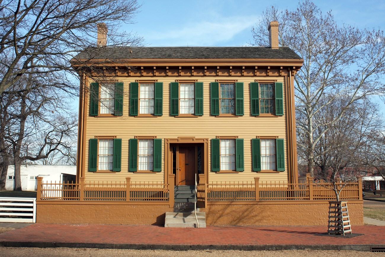 Lincoln Home National Historic Site
 in Illinois preserves Abraham Lincoln’s Springfield home, historic streets, presidential history and nearby museums.
-

-

-

-


Swipe for more destinations
Explore more

Explore more of Corn Belt
Explore Illinois's Corn Belt for wide prairies, farm heritage, university culture, historic towns, local food and open-road landscapes.
Explore Corn Belt
Explore more of Illinois
Discover Illinois: From Chicago's iconic skyline to the tranquil beauty of its countryside, experience the diverse allure of the Prairie State.
Explore Illinois