

Free Illinois Ozarks Travel Guide & Mobile App
Explore Illinois Ozarks with free travel guides. Discover regional history, expert tips, proposed trips, and audio guides on web or mobile app.


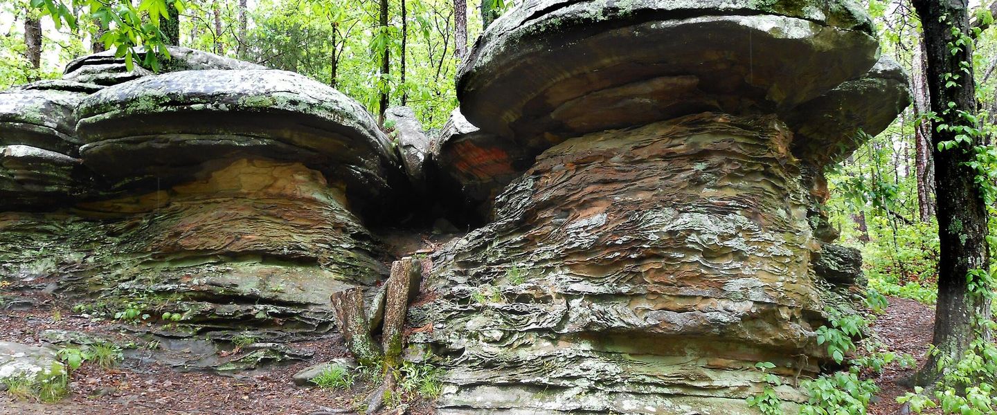


Explore the Illinois Ozarks for sandstone bluffs, forest trails, caves, river valleys, small towns and southern Illinois food traditions.
Read more about Illinois Ozarks
When is the best time to visit Illinois Ozarks?
Best: May, September–October · 22–28°C| Month | High (°C) | Rainfall (mm) |
|---|---|---|
| January | 6 | 72 |
| February | 9 | 77 |
| March | 15 | 104 |
| April | 20 | 110 |
| May (best) | 25 | 121 |
| June | 30 | 109 |
| July | 33 | 107 |
| August | 32 | 93 |
| September (best) | 28 | 92 |
| October (best) | 22 | 91 |
| November | 14 | 89 |
| December | 8 | 80 |
Getting to and around Illinois Ozarks
How to get there
Transportation
Destinations in Illinois Ozarks
Resorts, valleys and scenic spots worth a trip of their own.
-

-


Swipe for more destinations
Best attractions in Illinois Ozarks
The Illinois Ozarks' attractions are primarily outdoor and landscape-based. Giant City State Park is known for its sandstone formations, forest trails and climbing areas, while the surrounding Shawnee Hills provide routes for hiking, cycling, horseback riding and wildlife watching. Garden of the Gods Recreation Area, within the Shawnee National Forest, has dramatic rock outcrops and viewpoints over wooded valleys, with longer trails extending through the surrounding forest. In the western hills, the Mississippi-facing country around Union County includes Trail of Tears State Forest, Bald Knob Wilderness and the archaeological landscape of Kinkaid Mounds. The eastern uplands lead towards Cave-in-Rock State Park and the Ohio River, where caves and river scenery add a different character. Wetland areas connected with the Cache River offer birdwatching and seasonal landscape contrasts. Smaller towns, local wineries, orchards, galleries and historical sites provide useful pauses between trail outings, but visitors should expect attractions to be dispersed and often reached by car rather than arranged in a single walkable tourism centre.
-
Tourist attraction
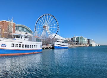
Navy Pier
Explore Navy Pier, a vibrant cultural and entertainment hub on Chicago's waterfront, featuring attractions, dining, and stunning views.
-
Tourist attraction
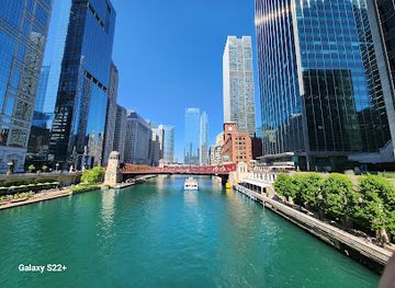
Riverwalk
Explore Chicago's Riverwalk, a stunning waterfront destination that offers scenic views, dining, and vibrant urban culture in the heart of the city.
-
National forest
Shawnee National Forest
Explore the stunning landscapes and diverse ecosystems of Shawnee National Forest, a premier destination for outdoor adventures in southern Illinois.
-
State park
Ha Ha Tonka State Park
Explore the breathtaking landscapes, historic ruins, and diverse outdoor activities at Ha Ha Tonka State Park in Missouri's enchanting Ozarks.

Best landmarks in Illinois Ozarks
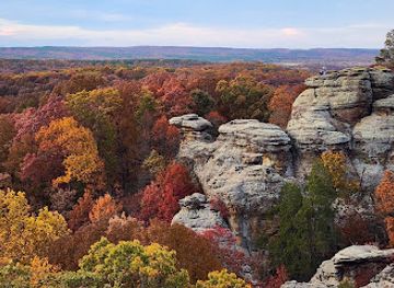
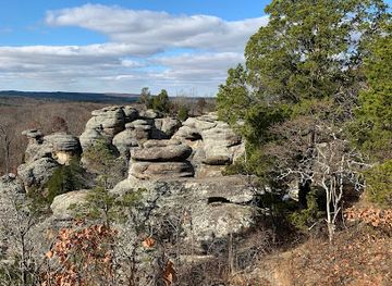
The Illinois Ozarks' most recognisable landmarks are products of geology and woodland rather than monumental urban architecture. The sandstone formations at Garden of the Gods form the area's signature natural scene, with narrow ridges and weathered outcrops overlooking the Shawnee Hills. Giant City State Park's massive rock walls and passage-like formations show the same ancient sandstone in a different setting and have become closely associated with southern Illinois. Cave-in-Rock, beside the Ohio River in Hardin County, is a natural cavern with a long history of river travel and frontier legend, now protected within a state park. Kinkaid Mounds in Union County preserves an important archaeological landscape of Mississippian earthworks, while the bluffs and forests around Bald Knob and the Mississippi side of the Shawnee Hills define the western edge of the region. These places are significant because they reveal the interaction of geology, Indigenous history, river movement and modern conservation.
-
Monument
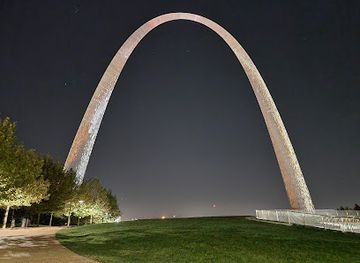
The Gateway Arch
Experience the Gateway to the West: Ascend to new heights and explore the history of American expansion at this iconic St. Louis landmark.
-
State park
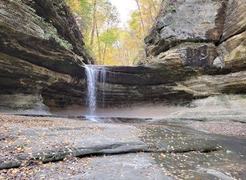
Starved Rock State Park
Explore stunning canyons, waterfalls, and hiking trails at Starved Rock State Park, a historic and scenic destination in Illinois.
-
National forest
Shawnee National Forest
Explore Illinois's Shawnee National Forest: hiking, camping, scenic beauty, and rich history in a diverse natural landscape.
-
Hiking area
Garden of the Gods
Explore Illinois's natural beauty at Garden of the Gods: stunning rock formations, panoramic views, and unforgettable hiking in Shawnee National Forest.

Explore Illinois Ozarks on the map
Plan your trip on one map. See where the top cities, national parks and sights are, and book hotels and experiences in a few clicks.
Best hotels in Illinois Ozarks
Best restaurants in Illinois Ozarks
Dining in the Illinois Ozarks combines southern Illinois comfort food with broader Midwestern traditions. In Carbondale and the larger surrounding towns, independent restaurants, cafés and bakeries sit alongside familiar American establishments, while rural communities are more likely to centre on diners, family restaurants, taverns and seasonal food stands. Barbecue, fried catfish, country-fried dishes, biscuits, sweet corn, orchard fruit and homemade pies reflect the area's position between the Midwest and the South, although none should be treated as exclusive to this region. Farmers' markets and farm shops may offer local vegetables, honey, jams, apples and other produce at the appropriate time of year. Vineyards and wineries in the Shawnee Hills contribute locally produced wine and tasting-room food, particularly along rural routes west and south of Carbondale. Dining choices can thin out quickly beyond the principal towns, so hikers and drivers should obtain provisions before heading into the forest.
-
American
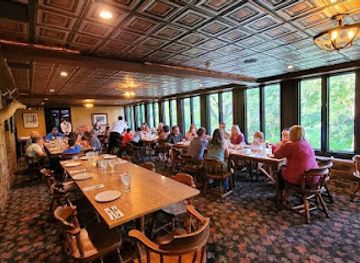
Giant City State Park Lodge & Restaurant
Experience the perfect blend of nature and American cuisine at Giant City State Park Lodge & Restaurant in Makanda, Illinois.
-
Vegetarian
Longbranch Cafe & Bakery
Discover the delightful vegetarian cuisine at Longbranch Cafe & Bakery in Carbondale - where every bite is a taste of local charm.
-
Gastropub
Underground Public House
Experience local flavors at Underground Public House in Carbondale - where gastropub meets community spirit.
-
Grill
Mase's Place
Discover Mase's Place in Pomona for an unforgettable grilling experience filled with flavor and community spirit.


Best bars in Illinois Ozarks
Evening life in the Illinois Ozarks is concentrated in Carbondale, Marion and a handful of larger towns rather than spread across the countryside. Carbondale has the broadest selection, with pubs, casual bars, cafés, live music and venues shaped partly by its university population; the atmosphere and operating patterns vary with the academic calendar. Elsewhere, historic-style taverns, local bars, restaurant lounges, brewery-oriented venues and winery tasting rooms provide a quieter evening. Rural communities generally close earlier, and a night in the forest is more likely to involve a campsite, porch or stargazing than a club. Visitors should plan a safe return after wine tasting or drinking, particularly where roads are winding and taxis or ride-hailing coverage may be limited.
-
Bar
Fast Eddie's Bon Air
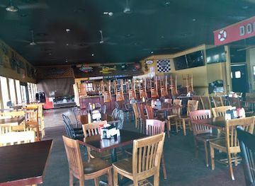
Discover the lively atmosphere and delicious fare at Fast Eddie's Bon Air, Alton's favorite bar for great food and memorable nights.
-
American
Giant City State Park Lodge & Restaurant
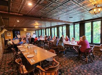
Discover the breathtaking landscapes and delightful dining at Giant City State Park Lodge & Restaurant, a haven for nature lovers and food enthusiasts.
-
Pizza
Quatro's Deep Pan Pizza
Experience the best deep-dish pizza in Carbondale at Quatro's Deep Pan Pizza, where family dining meets Italian culinary tradition.
-
Grill
Dog Days Bar and Grill
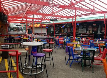
Discover the perfect blend of grills and live music at Dog Days Bar and Grill in Osage Beach, a vibrant lakeside dining experience.

Best nightclubs in Illinois Ozarks
Evening life in the Illinois Ozarks is concentrated in Carbondale, Marion and a handful of larger towns rather than spread across the countryside. Carbondale has the broadest selection, with pubs, casual bars, cafés, live music and venues shaped partly by its university population; the atmosphere and operating patterns vary with the academic calendar. Elsewhere, historic-style taverns, local bars, restaurant lounges, brewery-oriented venues and winery tasting rooms provide a quieter evening. Rural communities generally close earlier, and a night in the forest is more likely to involve a campsite, porch or stargazing than a club. Visitors should plan a safe return after wine tasting or drinking, particularly where roads are winding and taxis or ride-hailing coverage may be limited.
-
Bar
The Hangar 9
Discover the lively nightlife and vibrant music scene at The Hangar 9, Carbondale's top spot for unforgettable entertainment experiences.
-
Lounge
City Limits Lounge
Experience the charm of City Limits Lounge in Benton, IL – a cozy retreat for delicious drinks and unforgettable moments.
-
Night club
Oz Nightclub
Discover the vibrant nightlife at Oz Nightclub in Sauget, Illinois, where music, dancing, and fun await every night.
-
Bar
Chevie's Lounge
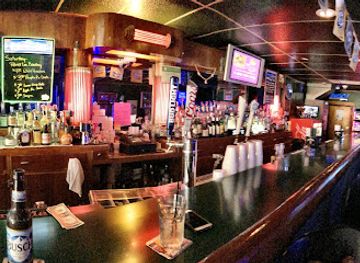
Experience the vibrant atmosphere of Chevie's Lounge in Herrin, where great drinks and lively events create unforgettable nights.



Best shops in Illinois Ozarks
Shopping in the Illinois Ozarks is dispersed among small-town main streets, local food outlets, farm shops, galleries and seasonal markets rather than concentrated in a large retail district. Carbondale and Marion provide the widest general choice, including books, outdoor equipment, groceries, independent cafés and practical supplies for forest trips. Anna-Jonesboro, Vienna, Golconda and other communities offer smaller selections of antiques, gifts, crafts and locally made products. Shawnee Hills wineries sell regional bottles and related gifts, while orchards, farm stands and markets may offer apples, honey, preserves, baked goods and seasonal produce. Art studios and galleries around the southern Illinois university and rural communities can be good sources of ceramics, paintings, woodwork and photography connected with the landscape. Opening days and hours vary considerably, so rural shopping is best approached as part of a planned route rather than assumed to be available at every trailhead.
-
 National forest
Shawnee National Forest
Explore Shawnee National Forest, a stunning expanse of natural beauty in Southern Illinois, featuring breathtaking landscapes, diverse wildlife, and endless outdoor adventures.
-
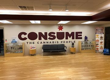
Cannabis store
Consume Cannabis - Marion
Experience the finest cannabis products at Consume Cannabis in Marion, where quality meets knowledge in a welcoming atmosphere.
-
Shopping mall
University Mall
Experience the lively atmosphere of University Mall in Carbondale, Illinois – a shopping destination with diverse stores and delightful dining options.
-
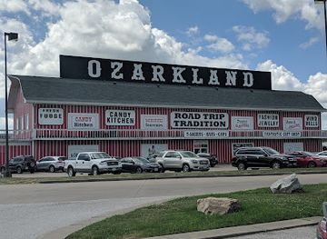
Gift shop
Ozarkland
Explore Ozarkland in Kingdom City, Missouri: Your one-stop shop for unique gifts, local candies, and unforgettable souvenirs.

Get your free copy of our complete guide to Illinois Ozarks, delivered straight to you.
Everything on this page, from attractions and restaurants to essentials and local phrases, in one PDF you can read offline, print or share.
Already have an account? Sign in
Your Illinois Ozarks guide is ready.
We'll send it to · Not you? Sign out

Getting your guide ready…
We are putting together a fresh copy of the Illinois Ozarks guide. This can take up to a minute.
This can take a few moments. If your browser asks, choose Allow so the download can start. You'll find the guide in your Downloads folder.
Nothing happened? Download it again
Sorry, the guide is taking longer than usual. Please try again in a minute, or get it by email instead.
Illinois Ozarks essentials
Currency and Payment
Safety
Emergency Situations
Do's and Don'ts
Local Tips
From Eve
Local phrases worth knowing
You don't need to get them perfect. A few words go a long way, and locals appreciate the effort.
Basics
| English | Local | Say it |
|---|---|---|
| Hello | Howdy | [Hau-dee] |
| Goodbye | See ya | [See ya] |
| Yes | Yep | [Yep] |
| No | Nope | [Nope] |
| Please/You're welcome | Please/No problem | [Pleez/No prob] |
| Thank you | Thanks a lot | [Thanks a lot] |
| Excuse me/Sorry | Pardon me/Sorry | [Pardon me/Sorry] |
| How are you? | How ya doin'? | [How ya doin'?] |
| Fine. And you? | I’m good. How 'bout you? | [I’m good. How 'bout you?] |
| Do you speak English? | Ya speakin' English? | [Ya speakin' English?] |
| I don't understand | I ain't gettin' it | [I ain't gettin' it] |
Eating & Drinking
| English | Local | Say it |
|---|---|---|
| I'd like to see the menu, please | Can I see the menu, please? | [Can I see the menu, please?] |
| I don't eat meat | I don't do meat | [I don't do meat] |
| Cheers! | Cheers! | [Cheers!] |
| I would like to pay, please | Can I pay up, please? | [Can I pay up, please?] |
Emergencies
| English | Local | Say it |
|---|---|---|
| Help! | Help! | [Help!] |
| Go away! | Get lost! | [Get lost!] |
| Call the Police! | Call the cops! | [Call the cops!] |
| Call a doctor! | Get a doctor! | [Get a doctor!] |
| I'm lost | I’m lost | [I’m lost] |
| I'm ill | I ain't feelin' well | [I ain't feelin' well] |
Shopping
| English | Local | Say it |
|---|---|---|
| I'd like to buy... | I wanna buy... | [I wanna buy...] |
| I'm just looking | Just lookin' around | [Just lookin' around] |
| How much is it? | What’s the damage? | [What’s the damage?] |
| That's too expensive | That’s a bit pricey | [That’s a bit pricey] |
| Can you lower the price? | Can ya knock the price down? | [Can ya knock the price down?] |
Time & Numbers
| English | Local | Say it |
|---|---|---|
| What time is it? | What time is it? | [What time is it?] |
| It's one o'clock | It’s one o’clock | [It’s one o’clock] |
| Half past (10) | Half past ten | [Half past ten] |
| Morning | Mornin' | [Mornin'] |
| Afternoon | Afternoon | [Afternoon] |
| Evening | Evenin' | [Evenin'] |
| Yesterday | Yesterday | [Yesterday] |
| Today | Today | [Today] |
| Tomorrow | Tomorrow | [Tomorrow] |
| 1 | One | [One] |
| 2 | Two | [Two] |
| 3 | Three | [Three] |
| 4 | Four | [Four] |
| 5 | Five | [Five] |
| 6 | Six | [Six] |
| 7 | Seven | [Seven] |
| 8 | Eight | [Eight] |
| 9 | Nine | [Nine] |
| 10 | Ten | [Ten] |
Transport & Directions
| English | Local | Say it |
|---|---|---|
| Where's a/the...? | Where's a...? | [Where's a...?] |
| What's the address? | What’s the address? | [What’s the address?] |
| Can you show me (on the map)? | Can ya show me on the map? | [Can ya show me on the map?] |
| When's the next (bus)? | When's the next bus? | [When's the next bus?] |
| A ticket (to ....) | A ticket to... | [A ticket to...] |
History of Illinois Ozarks
Indigenous Landscapes and Kinkaid Mounds
Southern Illinois has been occupied by Indigenous peoples for thousands of years. The Mississippi, Ohio and Cache river systems supported settlement, movement and trade, while the wooded uplands provided hunting and plant resources. Kinkaid Mounds in Union County is an important archaeological reminder of the Mississippian period, when large, organised communities built platform and ceremonial mounds in the region. The site belongs to a much wider cultural landscape extending across the central Mississippi Valley, and its surviving earthworks demonstrate that the southern Illinois uplands were connected to complex societies long before European colonisation.
French Colonial and River Frontier Influence
European influence reached the southern Illinois river country through French exploration and settlement connected with the Mississippi Valley. The region's waterways linked it to trading networks that extended towards the lower Mississippi and the Ohio Valley. Although population remained sparse in the wooded uplands, river corridors and strategically placed crossings became important to later military and commercial development. The legacy is visible less in grand colonial architecture than in the region's long orientation towards rivers, overland routes and the movement of people and goods between Illinois, Missouri, Kentucky and Tennessee.
Settlement, Agriculture and the River Economy
After the United States expanded into the region, settlers established farms, mills, ferries and small communities among the hills and bottomlands. The rugged terrain limited large-scale agriculture compared with central Illinois, encouraging mixed farming, timber work, orchards and local industries. River landings and roads connected inland settlements with the Mississippi and Ohio, while towns such as Golconda and Cave-in-Rock developed identities shaped by transport and trade. Many modern roads, property patterns and town centres reflect this nineteenth-century transition from frontier settlement to a more established rural economy.
The Trail of Tears in Southern Illinois
The forced removal of Cherokee people in the 1830s brought one of the most painful episodes in the region's history. Detachments travelling west crossed southern Illinois during the winter of 1838–39, using routes near the Ohio River and stopping at or near places that are now associated with the Trail of Tears. Poor conditions, exposure and inadequate provisions caused deaths along the journey. The Trail of Tears State Forest and related commemorative sites help visitors understand that the region's roads and river corridors were part of a national history of dispossession, rather than simply scenic routes.
Timber, Fluorspar and Small-Scale Industry
The hills supported timber cutting, sawmilling and small farms, while mineral resources contributed to the economy of southeastern Illinois. Fluorspar mining became particularly important in the Illinois-Kentucky district, including parts of Hardin and Pope counties, during the nineteenth and twentieth centuries. The industry supplied a mineral used in metallurgy, chemicals and other manufacturing, but fluctuating markets and changing extraction methods eventually reduced its importance. Quarries, mine landscapes and former transport routes remain reminders that the Illinois Ozarks have long been a working countryside as well as a recreational destination.
Conservation and the Shawnee National Forest
Twentieth-century conservation transformed how the southern uplands were managed. The Shawnee National Forest was established in 1933, bringing extensive federal stewardship to land affected by farms, timber cutting and erosion. State parks and nature preserves complemented the national forest, protecting sandstone formations, wetlands, caves, prairies and mature woodland. Civilian Conservation Corps work during the New Deal era helped develop trails, roads and recreational facilities in many American forests. The resulting public-land network now forms the practical backbone of travel in the Illinois Ozarks, while continuing to support habitat protection and outdoor recreation.
Illinois Ozarks in Photos
Browse through our photo collection highlighting the charm and character of the destination.
Neighbouring regions of Illinois Ozarks
The closest regions to Illinois Ozarks, if you have time for more than one.
-

-

-

-
-


Swipe for more regions
Explore more

Explore more of Illinois
Discover Illinois: From Chicago's iconic skyline to the tranquil beauty of its countryside, experience the diverse allure of the Prairie State.
Explore Illinois