

Free Shawnee Hills Travel Guide & Mobile App
Explore Shawnee Hills with free travel guides. Discover regional history, expert tips, proposed trips, and audio guides on web or mobile app.


Explore Shawnee Hills forests, sandstone bluffs, vineyards, river towns and outdoor trails across southern Illinois.
Read more about Shawnee Hills
Getting to and around Shawnee Hills
How to get there
Transportation
Destinations in Shawnee Hills
Resorts, valleys and scenic spots worth a trip of their own.
-

-

-

-

-


Swipe for more destinations
Best attractions in Shawnee Hills
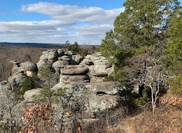
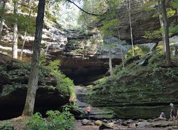
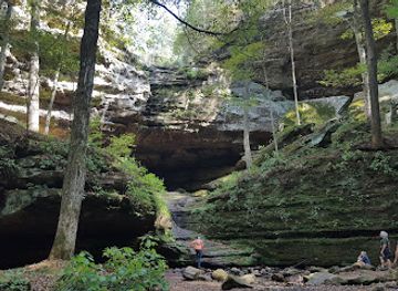
The Shawnee Hills offer a varied outdoor attraction landscape centred on the Shawnee National Forest, whose trails, lakes, forests and sandstone country support hiking, horse riding, fishing, climbing, paddling and wildlife watching. Garden of the Gods Recreation Area is the best-known viewpoint area, with trails through weathered rock formations and elevated panoramas. Giant City State Park combines woodland walks, cliffs and distinctive sandstone features, while Ferne Clyffe State Park is valued for its forest scenery, rock shelters and seasonal waterfall. The region also includes state conservation areas, lakes, river corridors and quiet country roads suited to slower exploration. Around Alto Pass and Cobden, vineyards, orchards and farm businesses add a food-and-landscape dimension, while Carbondale contributes museums, galleries, performances and university events. Southern Illinois' attractions are generally spread across a large rural area rather than concentrated in one resort town, so a rewarding itinerary balances trail destinations with small communities, local food and geological viewpoints.
-
 National forest
Shawnee National Forest
Discover the natural beauty of Shawnee National Forest, a premier destination for outdoor adventures and breathtaking landscapes in Illinois.
-
Hiking area
Garden of the Gods
Discover the awe-inspiring rock formations and scenic trails of Garden of the Gods in Shawnee National Forest, a must-visit for nature enthusiasts.
-
State park
Giant City State Park
Discover the natural beauty and outdoor adventures at Giant City State Park, a must-visit destination in Illinois for nature lovers and outdoor enthusiasts.
-
State park
Ferne Clyffe State Park
Explore Ferne Clyffe State Park: A serene escape in Illinois with hiking trails, beautiful cliffs, and diverse wildlife for nature lovers and adventurers.
Best landmarks in Shawnee Hills
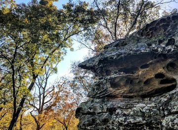
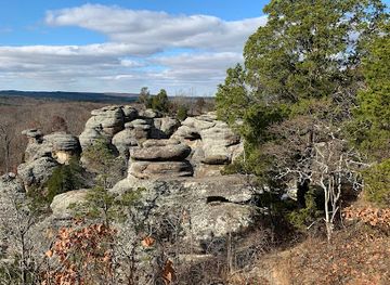
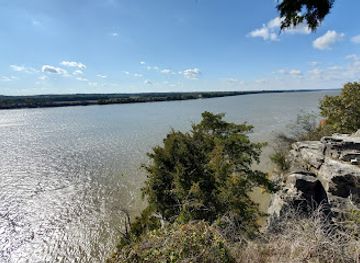
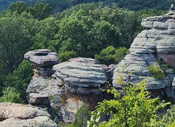
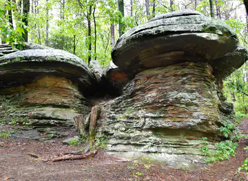
Garden of the Gods' sandstone formations are the Shawnee Hills' most recognisable natural landmark, shaped by erosion into narrow ridges, overhangs and elevated viewpoints above the forest. In the western and central hills, Giant City State Park is marked by massive sandstone bluffs and the corridor known as Giant City, whose scale makes the area's geology immediately legible. The Ohio River landmark at Cave-in-Rock combines a natural limestone cave with the frontier and river history of the surrounding community. The Mississippi and Ohio river landscapes form the region's broad geographical frame, even where their channels lie beyond the forested uplands. Bald Knob, near Alto Pass, is a significant high point associated with sweeping views and protected natural habitat, while the historic town centres of Golconda and nearby river communities retain buildings and street patterns shaped by nineteenth-century trade. Together these places show why the Shawnee Hills are defined as much by geology and topography as by individual buildings.
-
Tourist attraction
Shawnee National Forest
Explore Illinois's Shawnee National Forest: hiking, camping, scenic drives, and outdoor adventures in a diverse natural setting.
-
Tourist attraction
Garden of the Gods
Explore the majestic sandstone formations and panoramic views at Garden of the Gods, a natural wonder in Illinois' Shawnee National Forest.
-
State park
Ferne Clyffe State Park
Explore towering bluffs, scenic waterfalls, and lush trails in the heart of the Illinois Ozarks at Ferne Clyffe State Park.
-
State park
Cave-In-Rock State Park
Explore a historic cave, hike scenic trails, and enjoy river views at this Southern Illinois state park, once a haven for river pirates.

Explore Shawnee Hills on the map
Plan your trip on one map. See where the top cities, national parks and sights are, and book hotels and experiences in a few clicks.
Best hotels in Shawnee Hills
Best restaurants in Shawnee Hills
Dining in the Shawnee Hills reflects southern Illinois' position between Midwestern farming country and the culinary traditions of the American South. Barbecue is strongly associated with the region, particularly around Murphysboro, while cafés, diners and family restaurants in Carbondale, Marion and smaller towns provide familiar American meals alongside contemporary cooking. Orchards around Cobden and Alto Pass contribute seasonal fruit, and the Shawnee Hills Wine Trail has encouraged tasting rooms and food-focused stops linked to local vineyards. Farmers' markets and farm stands may offer produce, preserves, baked goods and other regional products when in season. Rural inns, pubs and casual restaurants are useful for travellers touring the forest, although choices become more limited away from the main towns. The dining scene is generally relaxed rather than formal, with local ingredients, barbecue, sandwiches, pies and Southern-influenced comfort food forming a practical introduction to the area's character.
-
National forest
Shawnee National Forest
Explore Shawnee National Forest: A breathtaking escape into nature with stunning vistas and endless outdoor adventures.
-
Restaurant
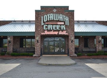
Lotawata Creek
Discover Lotawata Creek: A Culinary Gem in Fairview Heights Offering Fresh Local Flavors in an Inviting Atmosphere.
-
Hiking area
Garden of the Gods
Discover breathtaking views and unique rock formations at Garden of the Gods in Southern Illinois – a must-visit hiking destination.
-
American
Giant City State Park Lodge & Restaurant
Experience breathtaking landscapes and hearty American cuisine at Giant City State Park Lodge & Restaurant - your perfect retreat into nature.

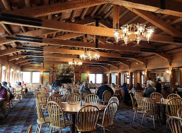
Best bars in Shawnee Hills
Evening life is concentrated in Carbondale, where Southern Illinois University supports a mixture of pubs, cafés, casual bars, live music and student-oriented venues. The town has the region's broadest choice for an evening out, but it is not comparable with a major metropolitan nightlife centre. Marion and nearby communities offer additional restaurants, bars and occasional live entertainment, while smaller towns tend towards traditional pubs, taverns and early-closing dining rooms. Wineries around Alto Pass and Cobden provide a more leisurely alternative, with tasting rooms and rural settings rather than club culture. Murphysboro and other river towns have local bars and community venues, but nightlife can be seasonal or event-dependent. Visitors should check current arrangements locally, arrange a designated driver for winery visits, and avoid assuming that remote venues provide late transport.
-
American
Giant City State Park Lodge & Restaurant
Experience the perfect blend of nature and American cuisine at Giant City State Park Lodge & Restaurant in Southern Illinois.
-
Grill
Midland Inn
Discover Midland Inn: A vibrant grill restaurant in Murphysboro, IL, known for its delicious smoked wings and friendly atmosphere.
-
Sports bar
Jesse Oaks Food & Drink
Experience the excitement of Jesse Oaks Food & Drink, a lively sports bar in Gages Lake, offering delicious food, live music, and outdoor fun.
-
Restaurant
E'Town River Restaurant
Discover authentic Southern cuisine at E'Town River Restaurant, where every meal is a celebration of local flavors and riverside charm.
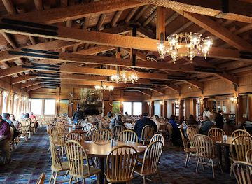
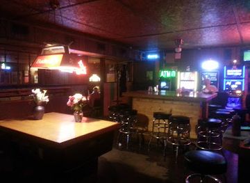


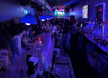
Best nightclubs in Shawnee Hills
Evening life is concentrated in Carbondale, where Southern Illinois University supports a mixture of pubs, cafés, casual bars, live music and student-oriented venues. The town has the region's broadest choice for an evening out, but it is not comparable with a major metropolitan nightlife centre. Marion and nearby communities offer additional restaurants, bars and occasional live entertainment, while smaller towns tend towards traditional pubs, taverns and early-closing dining rooms. Wineries around Alto Pass and Cobden provide a more leisurely alternative, with tasting rooms and rural settings rather than club culture. Murphysboro and other river towns have local bars and community venues, but nightlife can be seasonal or event-dependent. Visitors should check current arrangements locally, arrange a designated driver for winery visits, and avoid assuming that remote venues provide late transport.
-
Night club
The Hangar 9
Experience the vibrant nightlife at The Hangar 9, Carbondale's premier live music venue and night club, perfect for unforgettable evenings.
-
Night club
Saddle Up at Q Saloon and Eatery
Discover the pulse of Aurora's nightlife at Saddle Up at Q Saloon and Eatery, where live music, delicious barbecue, and a lively bar scene await.
-
Bar
Studio 63
Experience vibrant nightlife and great music at Studio 63 in Summit, Illinois - your ultimate destination for fun and entertainment.
-
Night club
Oz Nightclub
Experience the vibrant nightlife at Oz Nightclub in Sauget, IL – where music and excitement create unforgettable memories.
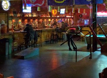


Best shops in Shawnee Hills
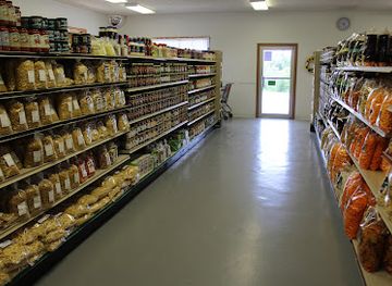
Shopping in the Shawnee Hills is dispersed among Carbondale's independent businesses, the high streets of Marion, Harrisburg, Vienna and Murphysboro, and rural farm, orchard and vineyard enterprises. Carbondale offers the broadest selection of books, clothing, arts, gifts and locally oriented food, with university influence contributing to its independent retail character. Around Alto Pass and Cobden, visitors can look for regional wine, orchard products, preserves and seasonal produce, while market stalls and farm stands vary with the growing calendar. Galleries, craft shops and studios provide pottery, paintings, woodwork and other locally made goods, although opening arrangements may be limited outside the larger towns. Traditional souvenirs include bottles from the Shawnee Hills Wine Trail, regional food products and outdoor-themed items rather than mass-market luxury goods. Farmers' markets are useful for meeting local producers and buying picnic supplies, but their days and seasons should be checked before travelling.
-
Department store
Dillard's
Discover a stylish shopping haven at Dillard's in Shawnee, offering an extensive selection of fashion, beauty, and home goods for every taste.
-
Grocery store
Shawnee Country Store
Discover Shawnee Country Store: a charming grocery store and bakery in Ava, Illinois, offering fresh local produce, deli delights, and homemade ice cream.
-
Shopping mall
Makanda Boardwalk
Experience the unique charm of Makanda Boardwalk, a shopping haven featuring local artisans, delicious treats, and a welcoming atmosphere.
-
Liquor store
The Oasis
Discover an extensive selection of local and international beverages at The Oasis, Goreville's premier liquor store for tourists.



Get your free copy of our complete guide to Shawnee Hills, delivered straight to you.
Everything on this page, from attractions and restaurants to essentials and local phrases, in one PDF you can read offline, print or share.
Already have an account? Sign in
Your Shawnee Hills guide is ready.
We'll send it to · Not you? Sign out

Getting your guide ready…
We are putting together a fresh copy of the Shawnee Hills guide. This can take up to a minute.
This can take a few moments. If your browser asks, choose Allow so the download can start. You'll find the guide in your Downloads folder.
Nothing happened? Download it again
Sorry, the guide is taking longer than usual. Please try again in a minute, or get it by email instead.
Shawnee Hills essentials
Currency and Payment
Safety
Emergency Situations
Do's and Don'ts
Local Tips
From Eve
Local phrases worth knowing
You don't need to get them perfect. A few words go a long way, and locals appreciate the effort.
Basics
| English | Local | Say it |
|---|---|---|
| Hello | Wáhko | [Wah-koh] |
| Goodbye | Néne | [Nay-nay] |
| Yes | Né | [Nay] |
| No | Én | [En] |
| Please/You're welcome | Nisú | [Nee-soo] |
| Thank you | Nehó | [Nay-ho] |
| Excuse me/Sorry | Nehóhó | [Nay-hoh-ho] |
| How are you? | Nénéná? | [Nay-nay-nah] |
| Fine. And you? | Nehó. Nénéná? | [Nay-ho. Nay-nay-nah] |
| Do you speak English? | Nisúéé wáhko énglís? | [Nee-soo-eh wah-koh eng-lees] |
| I don't understand | Nihé wéahkóh | [Nee-heh weh-ah-koh] |
Eating & Drinking
| English | Local | Say it |
|---|---|---|
| I'd like to see the menu, please | Nisú ékíh wáhko, nisú | [Nee-soo eh-kee wah-koh, nee-soo] |
| I don't eat meat | Nihé wéahkóh píká | [Nee-heh weh-ah-koh pee-kah] |
| Cheers! | Nihíh! | [Nee-hee!] |
| I would like to pay, please | Nisú wáhko áyáh, nisú | [Nee-soo wah-koh ah-yah, nee-soo] |
Emergencies
| English | Local | Say it |
|---|---|---|
| Help! | Nihé! | [Nee-heh!] |
| Go away! | Nisú wéahkóh! | [Nee-soo weh-ah-koh!] |
| Call the Police! | Nisú kóh wáhko pálís! | [Nee-soo koh wah-koh pah-lees!] |
| Call a doctor! | Nisú kóh wáhko dákta! | [Nee-soo koh wah-koh dahk-tah!] |
| I'm lost | Nihé wéahkóh nénáh | [Nee-heh weh-ah-koh nay-nah] |
| I'm ill | Nihé nénáh wáhko | [Nee-heh nay-nah wah-koh] |
Shopping
| English | Local | Say it |
|---|---|---|
| I'd like to buy... | Nisú ékíh písí... | [Nee-soo eh-kee pee-see...] |
| I'm just looking | Nihé nénahká | [Nee-heh nay-nah-kah] |
| How much is it? | Nénéná wáhko? | [Nay-nay-nah wah-koh?] |
| That's too expensive | Hóhko ékíh písí | [Hoh-koh eh-kee pee-see] |
| Can you lower the price? | Nisú nénéná písí hénah? | [Nee-soo nay-nay-nah pee-see heh-nah?] |
Time & Numbers
| English | Local | Say it |
|---|---|---|
| What time is it? | Nénéná wáhko hénah? | [Nay-nay-nah wah-koh heh-nah?] |
| It's one o'clock | Wáhko nénáh | [Wah-koh nay-nah] |
| Half past (10) | Nénáh nénénáh | [Nay-nah nay-nay-nah] |
| Morning | Néne | [Nay-nay] |
| Afternoon | Nénénáh | [Nay-nay-nah] |
| Evening | Náhko | [Nah-koh] |
| Yesterday | Nénáh wáhko | [Nay-nah wah-koh] |
| Today | Nénénáh wáhko | [Nay-nay-nah wah-koh] |
| Tomorrow | Nénáh náhko | [Nay-nah nah-koh] |
| 1 | Nénáh | [Nay-nah] |
| 2 | Nénáh kóh | [Nay-nah koh] |
| 3 | Nénáh núh | [Nay-nah noo] |
| 4 | Nénáh néné | [Nay-nah nay-nay] |
| 5 | Nénáh núh néné | [Nay-nah noo nay-nay] |
| 6 | Nénáh núh kóh | [Nay-nah noo koh] |
| 7 | Nénáh núh núh | [Nay-nah noo noo] |
| 8 | Nénáh núh néné | [Nay-nah noo nay-nay] |
| 9 | Nénáh núh nénáh | [Nay-nah noo nay-nah] |
| 10 | Nénáh núh kóh | [Nay-nah noo koh] |
Transport & Directions
| English | Local | Say it |
|---|---|---|
| Where's a/the...? | Wáhko nénénáh...? | [Wah-koh nay-nay-nah...?] |
| What's the address? | Wáhko ékíh nénénáh? | [Wah-koh eh-kee nay-nay-nah?] |
| Can you show me (on the map)? | Nisú nénénáh wáhko (píhka)? | [Nee-soo nay-nay-nah wah-koh (pee-kah)?] |
| When's the next (bus)? | Nénénáh wáhko nénáh (písí)? | [Nay-nay-nah wah-koh nay-nah (pee-see)?] |
| A ticket (to ....) | Nihé ékíh (hénah)... | [Nee-heh eh-kee (heh-nah)...] |
History of Shawnee Hills
Indigenous Landscapes and River Corridors
The Shawnee Hills stand within a wider landscape shaped for millennia by Indigenous peoples, including communities associated with the Mississippian cultural tradition and later nations such as the Illiniwek and Shawnee. The Mississippi and Ohio river systems provided routes for movement, trade and subsistence, while the forested uplands supplied game, plants and stone resources. Although later settlement transformed the region, its rivers, ridges and archaeological places remain evidence of long Indigenous relationships with southern Illinois. Visitors should understand that the landscape's history begins well before European mapping, farming and town building.
European Settlement and the Illinois Frontier
French exploration and settlement along the Mississippi and lower Ohio helped bring southern Illinois into colonial networks, although permanent European occupation expanded unevenly. After the United States acquired the territory, settlers moved into the hills and river bottoms, establishing farms, mills, ferries and small communities. Golconda and other river settlements benefited from their position near important waterways, while the rough uplands remained more thinly populated. Early roads followed valleys and ridges, creating transport patterns that still help explain the scattered character of the region.
River Trade, Forts and the Civil War Era
The Ohio and Mississippi rivers gave the Shawnee Hills strategic importance during the nineteenth century. River landings supported trade and communication, and Cave-in-Rock became associated with the fortified river frontier and the difficult travel conditions of the Ohio Valley. During the American Civil War, southern Illinois remained within the Union, but its proximity to the Confederate states made the region politically and militarily sensitive. Camp sites, transportation routes and river movements connected local communities to the wider conflict, even when major battles occurred elsewhere.
Timber, Stone and Rural Industry
The hills supported a range of resource-based industries as settlement grew. Timber was harvested from the hardwood forests, while sandstone and limestone were quarried for construction and other uses. Farms occupied more fertile valleys and bottomlands, and small mills and transport enterprises developed around local waterways. These industries altered the forests but also helped create the roads, towns and working landscapes familiar today. Protected areas such as the Shawnee National Forest now preserve substantial woodland, while exposed quarry faces and historic routes continue to reflect the region's economic past.
The National Forest and Conservation Movement
The Shawnee National Forest was established in the early twentieth century during a period when the United States was responding to soil erosion, depleted timberlands and poorly managed farmland. Public acquisition and conservation gradually reshaped parts of southern Illinois, allowing forests, wetlands and wildlife habitat to recover while retaining opportunities for recreation and sustainable land use. Later state parks and recreation areas added further protection for distinctive sandstone formations, cliffs and ravines. The region's modern identity as an outdoor destination is closely tied to this conservation history.
Southern Illinois University and Cultural Change
The growth of Southern Illinois University in Carbondale transformed the social and cultural life of the central Shawnee Hills. From a teachers' college, the institution developed into a major public university, attracting students, researchers, artists and international communities. Its presence brought theatres, galleries, public lectures, specialist knowledge and new businesses to a largely rural region. Carbondale's contemporary character therefore sits alongside older agricultural, forestry and river traditions, creating one of the clearest contrasts within southern Illinois.
Orchards, Vineyards and Regional Tourism
Modern southern Illinois has increasingly promoted its landscape through orchards, wineries, farm enterprises, scenic drives and outdoor recreation. The Shawnee Hills Wine Trail links vineyards and tasting rooms in the Alto Pass and Cobden area, where a distinctive local wine industry developed in the late twentieth century. Tourism has not replaced farming or forestry, but it has added new economic uses to the hills. Today, geology, conservation, food production and small-town heritage are presented together as the region's principal cultural and visitor story.
Shawnee Hills in Photos
Browse through our photo collection highlighting the charm and character of the destination.
Neighbouring regions of Shawnee Hills
The closest regions to Shawnee Hills, if you have time for more than one.
-

-

-
-
-


Swipe for more regions
Explore more

Explore more of Illinois
Discover Illinois: From Chicago's iconic skyline to the tranquil beauty of its countryside, experience the diverse allure of the Prairie State.
Explore Illinois