

Free Port Erin Travel Guide & Mobile App
Plan your Port Erin trip with Evendo. Get free guides to top attractions, restaurants, hotels, and bars. Web access or download the mobile app.


Port Erin, Isle of Man, pairs a sandy bay with Bradda Head, coastal walks, railway heritage and a relaxed southern-Manx seaside atmosphere today.
A Sheltered Southern Harbour
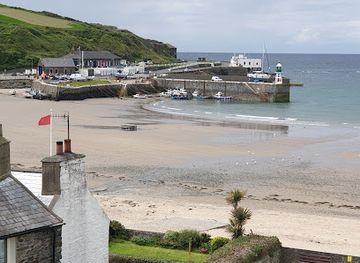
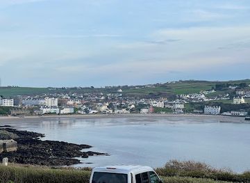
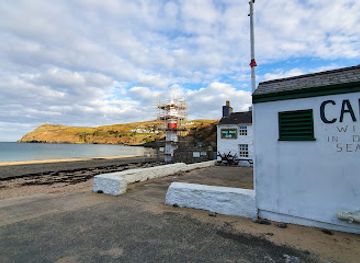
Port Erin occupies a broad, sheltered bay at the southern end of the Isle of Man, where a crescent of sand faces the Irish Sea and the dark outline of Bradda Head rises to the west. Once a fishing settlement and later a Victorian seaside resort, it remains one of the island’s most appealing bases for coastal scenery, maritime history and unhurried village life. The beach, promenade and surrounding hills create a compact setting that is easy to explore on foot, while the sea gives the village a strong sense of openness.Read more about Port Erin
Coastal Walks and Island Heritage
When is the best time to visit Port Erin?
Best: June–August · 18–20°C| Month | High (°C) | Rainfall (mm) |
|---|---|---|
| January | 9 | 82 |
| February | 9 | 65 |
| March | 10 | 57 |
| April | 11 | 46 |
| May | 14 | 52 |
| June (best) | 18 | 43 |
| July (best) | 20 | 45 |
| August (best) | 20 | 54 |
| September | 18 | 64 |
| October | 14 | 76 |
| November | 12 | 87 |
| December | 10 | 87 |
Getting to and around Port Erin
How to get there
Transportation
Best attractions in Port Erin
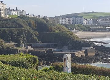
Port Erin’s principal attraction is its broad sandy beach, a sheltered sweep backed by a promenade and framed by low hills and Bradda Head. The coastal path climbing towards the headland introduces rocky coves, open sea views and Milner’s Tower, the unusual key-shaped monument above the bay. In the village, the Isle of Man Steam Railway terminus and adjoining railway museum offer a close look at the island’s heritage railways, locomotives and Victorian travel culture. The harbour provides a quieter maritime setting, while the nearby Port Erin Marine Nature Reserve reflects the importance of the surrounding waters and shoreline habitats. A short journey along the southern coast brings visitors to Port St Mary and onward towards The Sound, where the landscape becomes more rugged and the Calf of Man lies offshore. Together these places make Port Erin a base for combining beach time, walking, transport history and coastal sightseeing.
-
Railway services
Isle of Man Steam Railway - (Port Erin, Station)
Explore the enchanting Isle of Man Steam Railway, a historic journey through breathtaking landscapes and charming coastal villages.
1 min walk · 0.1 km from city centre
-
Park
Bradda Glen
Discover the breathtaking landscapes and scenic trails of Bradda Glen, a tranquil park on the Isle of Man, perfect for nature lovers and adventurers.
9 min walk · 0.8 km from city centre
-
Tourist attraction
Port Erin Beach Huts
Discover the enchanting Port Erin Beach Huts on the Isle of Man—where stunning coastal views meet cozy charm and outdoor adventure.
4 min walk · 0.3 km from city centre
-
Park
Athol Park Glen
Explore the natural beauty of Athol Park Glen in Port Erin, a serene escape perfect for leisurely strolls, picnics, and family fun amidst stunning landscapes.
3 min walk · 0.2 km from city centre
Best landmarks in Port Erin
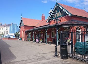
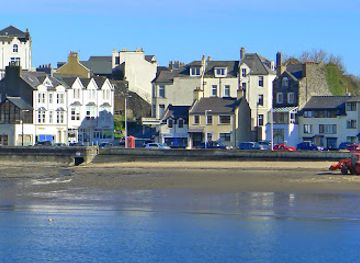
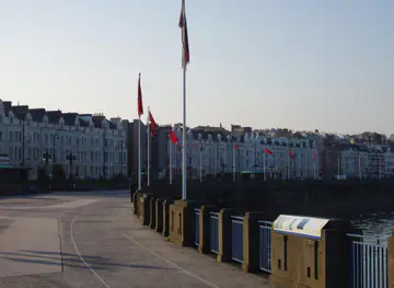
Milner’s Tower is Port Erin’s defining landmark, standing on Bradda Head as a distinctive nineteenth-century monument shaped like a key and visible from the bay. Its elevated position links the village’s Victorian development with the dramatic coastal topography that surrounds it. The Isle of Man Steam Railway station is another important landmark, not because of monumental architecture but because its terminus preserves the southern end of one of the island’s celebrated heritage railway routes. The harbour and sea walls express Port Erin’s older maritime identity, while the promenade reflects its later life as a seaside resort. Around the bay, surviving Victorian and early twentieth-century buildings help explain how rail access encouraged hotels and holiday accommodation. Nearby Port St Mary contributes a complementary harbour landscape, placing Port Erin within a wider chain of southern Manx coastal settlements.
-
Railroad company
Port Erin Railway Station
Discover the charm of Port Erin Railway Station, a historic gem of the Isle of Man where vintage steam trains and stunning landscapes await.
1 min walk · 0.1 km from city centre
-
Restaurant
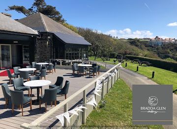
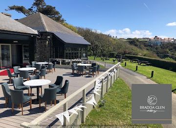
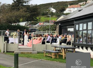
Bradda Glen Restaurant, Function Rooms & Wedding Venue
Experience exquisite dining at Bradda Glen Restaurant in Port Erin, featuring scenic views, a vibrant beer garden, and versatile event spaces.
11 min walk · 0.8 km from city centre
-
 Hotel
HotelFalcon's Nest Hotel
Experience the charm of Port Erin at Falcon's Nest Hotel, where comfort meets breathtaking coastal views on the Isle of Man.
1 min walk · 0.1 km from city centre
-
Railway services
Isle of Man Steam Railway - (Port Erin, Station)
Explore the Isle of Man's scenic beauty aboard the historic Steam Railway, a journey filled with nostalgia and breathtaking views.
1 min walk · 0.1 km from city centre
Explore Port Erin on the map
Plan your Port Erin trip on one map. See where the top attractions, landmarks, restaurants, bars and hotels are, find what's near where you're staying, and book hotels and experiences in a few clicks.
Best hotels in Port Erin
Best restaurants in Port Erin
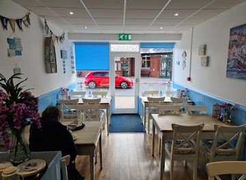
Dining in Port Erin is shaped by its seaside setting and small-village scale, with cafés, pubs and restaurants generally concentrating around the centre, promenade and harbour. Menus commonly draw on the island’s maritime and farming traditions, including locally landed seafood when available, Manx produce and familiar British café and pub dishes. Tea, cakes and light lunches suit days spent on the beach or walking the headland, while evening meals tend to be relaxed rather than formal. Port Erin’s food scene is complemented by the wider south of the island, where Port St Mary and nearby villages provide additional places to eat. Visitors should expect seasonal variation and a quieter choice of establishments than in Douglas, particularly outside summer, and should check current opening arrangements rather than relying on assumptions about late dining.
-
Fish & Chips
Port Erin Chippy & Diner
Discover authentic British fish and chips at Port Erin Chippy & Diner – a delightful seaside dining experience in Isle of Man.
1 min walk · 0.1 km from city centre
-
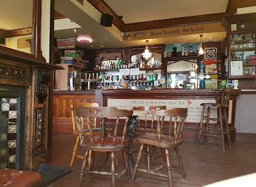
Pub
Bay Hotel
Experience local charm and stunning views at The Bay Hotel in Port Erin – your perfect retreat on the Isle of Man.
4 min walk · 0.3 km from city centre
-
Restaurant
Bradda Glen Restaurant, Function Rooms & Wedding Venue
Discover Bradda Glen Restaurant in Port Erin - where exceptional cuisine meets stunning views on the Isle of Man.
11 min walk · 0.8 km from city centre
-
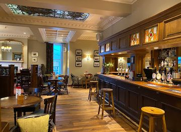
Restaurant
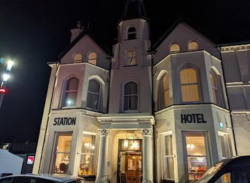
The Station
Discover the heart of Port Erin at The Station – where great food meets warm hospitality in a charming pub atmosphere.
1 min walk · 0.1 km from city centre
Best bars in Port Erin
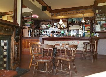
Port Erin has a modest evening scene centred on traditional pubs, hotel bars and relaxed venues where residents and visitors gather after a day by the sea. The atmosphere is sociable and unhurried rather than built around large nightclubs, with conversation, local drinks and occasional live entertainment more characteristic than late-night dancing. The promenade and village centre are the natural areas for an evening outing, while Port St Mary offers another nearby coastal setting. Cultural evenings across the Isle of Man may include music, theatre or seasonal events, but organised entertainment varies through the year. Visitors seeking a wider choice of bars, performances and late venues generally travel to Douglas, while in Port Erin it is sensible to check current opening times and transport before planning a late return.
-
Fish & Chips
Port Erin Chippy & Diner
Experience the authentic taste of British cuisine at Port Erin Chippy & Diner, renowned for its exceptional fish and chips and inviting seaside ambience.
1 min walk · 0.1 km from city centre
-
Pub
Bay Hotel
Discover the Bay Hotel in Port Erin, a charming pub offering delicious food, local brews, and stunning coastal views for an unforgettable experience.
4 min walk · 0.3 km from city centre
-
Restaurant
Bradda Glen Restaurant, Function Rooms & Wedding Venue
Discover culinary delights and breathtaking views at Bradda Glen Restaurant, the perfect venue for dining and events in Port Erin.
11 min walk · 0.8 km from city centre
-
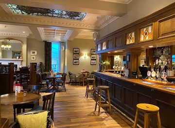
Pub
The Station
Experience the authentic Isle of Man hospitality at The Station, Port Erin's vibrant pub serving delicious food and local drinks.
1 min walk · 0.1 km from city centre
Best nightclubs in Port Erin
Port Erin has a modest evening scene centred on traditional pubs, hotel bars and relaxed venues where residents and visitors gather after a day by the sea. The atmosphere is sociable and unhurried rather than built around large nightclubs, with conversation, local drinks and occasional live entertainment more characteristic than late-night dancing. The promenade and village centre are the natural areas for an evening outing, while Port St Mary offers another nearby coastal setting. Cultural evenings across the Isle of Man may include music, theatre or seasonal events, but organised entertainment varies through the year. Visitors seeking a wider choice of bars, performances and late venues generally travel to Douglas, while in Port Erin it is sensible to check current opening times and transport before planning a late return.
-
Pub
Bay Hotel
Discover the Bay Hotel: A lively pub in Port Erin, Isle of Man, offering drinks, delicious food, and vibrant live music in a cozy setting.
4 min walk · 0.3 km from city centre
-
Restaurant
Bradda Glen Restaurant, Function Rooms & Wedding Venue
Experience the culinary delights of Bradda Glen, a versatile restaurant and event venue in the scenic Port Erin, perfect for dining and celebrations.
11 min walk · 0.8 km from city centre
-
Pub
The Station
Discover the heart of Port Erin at The Station, where local flavors meet a warm, inviting atmosphere perfect for relaxation and celebration.
1 min walk · 0.1 km from city centre
-
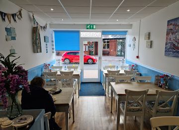
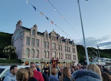
Bar
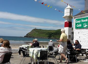
Foraging Vintners and Noa at the Cosy Nook
Experience the cozy charm of Foraging Vintners and Noa at the Cosy Nook, a delightful bar and café in Port Erin offering local flavors and stunning views.
3 min walk · 0.3 km from city centre
Best shops in Port Erin
Shopping in Port Erin is village-sized and practical, with local shops, cafés, galleries and small retailers rather than extensive department stores or a large commercial district. Visitors may find Manx-themed gifts, locally made crafts, artwork, food products and seaside essentials, while the railway museum provides an opportunity to browse heritage-related items. The promenade and central streets are the most natural areas to explore, although opening arrangements can vary with the season. For a broader choice of shops, Douglas is the island’s principal retail centre, while Castletown and Port St Mary offer additional southern stops with their own historic character. Purchases that travel well include Manx produce, island-made textiles, pottery and craft items, but visitors should distinguish genuinely local goods from generic souvenirs and ask about provenance where it matters.
-
Restaurant
Bradda Glen Restaurant, Function Rooms & Wedding Venue
Explore Bradda Glen Restaurant in Port Erin for exquisite local cuisine, stunning views, and versatile event spaces, perfect for any occasion.
11 min walk · 0.8 km from city centre
-
Coffee shop
Whistlestop Coffee Shop
Discover the charm of Whistlestop Coffee Shop at Port Erin's Railway Station, where great coffee meets local hospitality in a cozy atmosphere.
1 min walk · 0.1 km from city centre
-
Bar
Foraging Vintners and Noa at the Cosy Nook
Experience the best of Isle of Man's flavors at Foraging Vintners and Noa at the Cosy Nook, a cozy bar and café in Port Erin.
3 min walk · 0.3 km from city centre
-
Gift shop
Bridge Bookshop
Explore a treasure trove of books, art supplies, and music at Bridge Bookshop, a charming gift shop in Port Erin, Isle of Man.
1 min walk · 0.1 km from city centre
Get your free copy of our complete guide to Port Erin, delivered straight to you.
Everything on this page, from attractions and restaurants to essentials and local phrases, in one PDF you can read offline, print or share.
Already have an account? Sign in
Your Port Erin guide is ready.
We'll send it to · Not you? Sign out

Getting your guide ready…
We are putting together a fresh copy of the Port Erin guide. This can take up to a minute.
This can take a few moments. If your browser asks, choose Allow so the download can start. You'll find the guide in your Downloads folder.
Nothing happened? Download it again
Sorry, the guide is taking longer than usual. Please try again in a minute, or get it by email instead.
Port Erin essentials
Currency and Payment
Safety
Emergency Situations
Do's and Don'ts
Local Tips
From Eve
Local phrases worth knowing
You don't need to get them perfect. A few words go a long way, and locals appreciate the effort.
Basics
| English | Local | Say it |
|---|---|---|
| Hello | Ellan vannin | [el-lan van-in] |
| Goodbye | Slane lhiat | [slan-eh lee-at] |
| Yes | She | [sheh] |
| No | Cha nel | [cha nel] |
| Please/You're welcome | Cur dooinney | [koor doo-in-eh] |
| Thank you | Gura mie ayd | [goo-rah my ayd] |
| Excuse me/Sorry | Cuir kiarail | [koor kee-ah-rail] |
| How are you? | Conaa t'ou? | [kon-ah too?] |
| Fine. And you? | Ard. As t'ou? | [ard. as too?] |
| Do you speak English? | Vel oo Gaelg loayrt? | [vel oo gaelg loy-rt?] |
| I don't understand | Cha nel feme aym | [cha nel fem-eh aim] |
Eating & Drinking
| English | Local | Say it |
|---|---|---|
| I'd like to see the menu, please | Ta mish goll er y cardan, my jig | [tah mish goll er ee card-an, my jig] |
| I don't eat meat | Cha nel mish graih kied | [cha nel mish gree keed] |
| Cheers! | Slaynt vie! | [slaynt vee] |
| I would like to pay, please | Ta mish goll dy phaitch, my jig | [tah mish goll dee faytch, my jig] |
Emergencies
| English | Local | Say it |
|---|---|---|
| Help! | Cur shiu! | [koor shoo!] |
| Go away! | Gow mygeayrt! | [gow my-gar-t!] |
| Call the Police! | Cur y Phobble! | [koor ee fob-bleh!] |
| Call a doctor! | Cur dorrys! | [koor dor-rys!] |
| I'm lost | Ta mish currit | [tah mish koor-rit] |
| I'm ill | Ta mish goll myr feer | [tah mish goll meer ferr] |
Shopping
| English | Local | Say it |
|---|---|---|
| I'd like to buy... | Ta mish goll er chee... | [tah mish goll er chee...] |
| I'm just looking | Ta mish goll er shiartal | [tah mish goll er sheer-tal] |
| How much is it? | Cre'n lieh t'eh? | [kren lee-eh tay?] |
| That's too expensive | Ta shen ro hwoaie | [tah shen roh hwoy] |
| Can you lower the price? | Vel oo jerkit y phadjer? | [vel oo jer-kit ee fad-jer?] |
Time & Numbers
| English | Local | Say it |
|---|---|---|
| What time is it? | Cre'n traa t'eh? | [kren traa tay?] |
| It's one o'clock | Ta'n traa jeih er un | [tahn traa yay air oon] |
| Half past (10) | Lheihys aash(10) | [lay-s ash(10)] |
| Morning | Oie vie | [oy vee] |
| Afternoon | Aghin-oon | [ag-gin oon] |
| Evening | Dea-ooir | [jay-ooir] |
| Yesterday | Jeheiney | [jay-hay-nee] |
| Today | Jiu | [joo] |
| Tomorrow | Yindyssagh | [yin-dis-sach] |
| 1 | Un | [oon] |
| 2 | Doo | [doo] |
| 3 | Tree | [tree] |
| 4 | Kiare | [kee-ar-eh] |
| 5 | Queig | [kwee-eg] |
| 6 | Shey | [shay] |
| 7 | Shiaght | [shee-akht] |
| 8 | Hoght | [hoght] |
| 9 | Nuy | [noo-ee] |
| 10 | Jeih | [yay] |
Transport & Directions
| English | Local | Say it |
|---|---|---|
| Where's a/the...? | C'raad t'eh... | [krahd tay...] |
| What's the address? | Cre'n chroo t'eh? | [kren chroo tay?] |
| Can you show me (on the map)? | Vel oo er-lheh mee (er y harvaal)? | [vel oo air-lay mee (air ee har-vahl)?] |
| When's the next (bus)? | Quoi yn jeant (boayrd)? | [kwee un yant (boh-ard)?] |
| A ticket (to ....) | Kiart (gys ....) | [kee-art (giss ....)] |
History of Port Erin
Early Settlement in the Southern Peninsula
Port Erin developed within the wider landscape of the Isle of Man’s southern peninsula, an area shaped by farming, fishing and maritime movement long before the modern resort emerged. The bay provided a natural landing place, while surrounding headlands offered shelter and extensive views across the Irish Sea. The island’s earlier history includes Celtic Christian traditions, Norse influence and later Manx political institutions, although Port Erin itself was not a major urban centre in those periods. Its importance lay in its coastal position and relationship with neighbouring settlements such as Port St Mary. The landscape visible today, with open slopes, sheltered water and working harbours nearby, reflects this longstanding connection between settlement and the sea.
Fishing and Maritime Livelihoods
Before tourism transformed the village, Port Erin’s economy was closely connected with fishing and coastal trade. Families around the bay depended on the sea, while the harbour and nearby coves supported boats and maritime activity. The southern Manx coast could be hazardous, and the need for rescue provision became increasingly important as fishing and shipping grew. The area’s maritime character also linked Port Erin with Port St Mary and other island communities rather than isolating it as a purely local settlement. Although modern visitors chiefly encounter the beach, promenade and leisure facilities, the village’s arrangement around a protected bay preserves the geographical logic of its earlier fishing life.
The Railway and Victorian Tourism
The arrival of the railway in the 1870s changed Port Erin’s fortunes. The Isle of Man Railway opened its Douglas–Peel route in 1873 and extended the southern line to Port Erin in 1874, making the bay more accessible to visitors from the island’s capital. Rail travel encouraged the growth of hotels, boarding houses and seaside leisure, helping Port Erin develop as a Victorian resort. The railway also connected the village with the island’s agricultural interior and commercial networks. Its surviving steam operation and terminus are now important parts of Port Erin’s identity, preserving a tangible link with the period when improved transport reshaped Manx tourism.
Bradda Head and Milner’s Tower
Port Erin’s most recognisable historic structure is Milner’s Tower on Bradda Head. Built in 1871, the tower was funded by William Milner, a philanthropist associated with the village, and designed in the form of a key. It commemorates Milner and reflects the Victorian fashion for placing prominent ornamental structures in elevated coastal settings. The tower became both a landmark for people approaching by sea and a destination reached by paths from the bay. Its position gives it significance beyond its unusual silhouette: it provides a visible link between Port Erin’s resort development, private philanthropy and the dramatic headland that defines the village’s western outlook.
A Modern Manx Seaside Village
During the twentieth century, Port Erin continued to balance residential life, tourism and maritime traditions. The wider Isle of Man experienced changing transport patterns and the decline of many traditional coastal industries, while the railway and the bay remained central to Port Erin’s visitor identity. Today the village is considerably quieter than a large British resort, with attractions focused on the beach, coast paths, local heritage and the southern island landscape. Its history is therefore read less through monumental urban development than through the relationship between the railway terminus, harbour setting, Victorian buildings, headland paths and the continuing presence of the sea.
Port Erin in Photos
Browse through our photo collection highlighting the charm and character of the destination.
Cities near Port Erin
The closest cities to Port Erin, if you have time for more than one stop.
-

-

-

-

-


Swipe for more cities

