

Free Ustyurt Plateau Travel Guide & Mobile App
Explore Ustyurt Plateau with free travel guides. Discover regional history, expert tips, proposed trips, and audio guides on web or mobile app.


Explore Kazakhstan’s Ustyurt Plateau from Aktau through remote cliffs, salt depressions, desert wildlife and carefully planned 4x4 journeys.
Read more about Ustyurt Plateau
When is the best time to visit Ustyurt Plateau?
Best: May–June, September · 24–30°C| Month | High (°C) | Rainfall (mm) |
|---|---|---|
| January | 0 | 12 |
| February | 3 | 10 |
| March | 10 | 15 |
| April | 17 | 20 |
| May (best) | 24 | 25 |
| June (best) | 30 | 15 |
| July | 33 | 10 |
| August | 32 | 10 |
| September (best) | 24 | 15 |
| October | 15 | 20 |
| November | 6 | 12 |
| December | 2 | 10 |
Getting to and around Ustyurt Plateau
How to get there
Transportation
Top city travel guides in Ustyurt Plateau
The cities of Ustyurt Plateau, and the easiest places to base yourself.

Swipe for more cities
Best attractions in Ustyurt Plateau
-
Tourist attraction
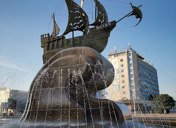
I LOVE AKTAU
Discover the vibrant charm of I LOVE AKTAU, a stunning coastal attraction in Kazakhstan, perfect for unforgettable memories and local experiences.
-
Park
Alleya T. G. Shevchenko
Experience tranquility and natural beauty in Aktau's Alleya T. G. Shevchenko Park, a perfect escape for nature lovers and culture enthusiasts.
-
Hiking area
Skal'naya Tropa
Explore the breathtaking landscapes and diverse trails of Skal'naya Tropa in Aktau, a top destination for hiking and outdoor adventures in Kazakhstan.
-
Sculpture
Pamyatnik Mayak
Discover the captivating Pamyatnik Mayak, an iconic lighthouse sculpture in Aktau, symbolizing Kazakhstan's rich maritime heritage and coastal beauty.
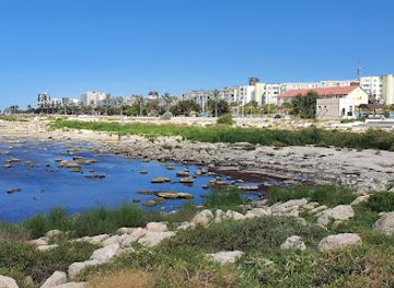
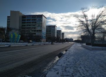
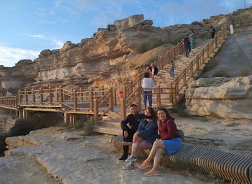

Best landmarks in Ustyurt Plateau
-
Tourist attraction
I LOVE AKTAU
Explore the artistic heart of Aktau at I LOVE AKTAU, a vibrant tourist attraction with stunning views and local culture.
-
Amusement park
AkBota
Experience the thrill of AkBota, Aktau's premier amusement park, filled with rides, games, and seaside fun for all ages.
-
 Hotel
Caspian Riviera Grand Palace Hotel
Experience unparalleled luxury at Caspian Riviera Grand Palace Hotel in Aktau, where stunning views and world-class amenities await.
-
Tourist attraction
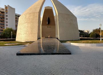
Eternal Flame World War II Memorial
Explore the Eternal Flame World War II Memorial in Aktau, a moving tribute to bravery and sacrifice that illuminates the spirit of Kazakhstan's history.
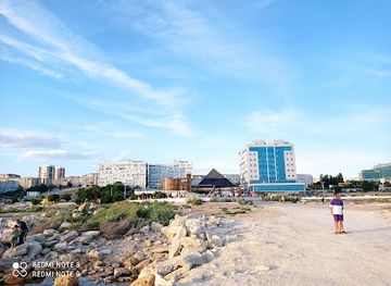
Explore Ustyurt Plateau on the map
Plan your trip on one map. See where the top cities, national parks and sights are, and book hotels and experiences in a few clicks.
Best hotels in Ustyurt Plateau
Best restaurants in Ustyurt Plateau
-
Restaurant
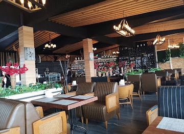
Lamore
Discover the luxury dining experience at Lamore in Aktau - where exquisite cuisine meets elegant ambiance.
-
Restaurant
Айтан
Experience authentic Kazakh cuisine at Айтан in Aktau - where local flavors meet international flair.
-
Restaurant
Семейный Ресторан Beluga
Savor the authentic taste of Kazakhstan at Семейный Ресторан Beluga - where every meal is a celebration of flavor and warmth.
-
Restaurant
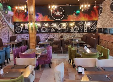
Tandir House
Experience authentic Kazakh cuisine at Tandir House in Aktau – where tradition meets taste in a welcoming atmosphere.
Best bars in Ustyurt Plateau
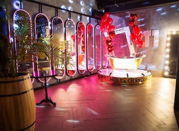
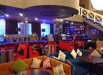
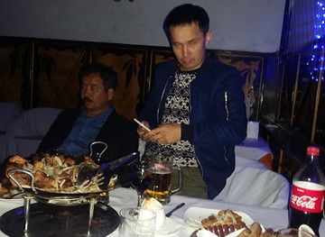
Nightlife belongs largely to Aktau, outside the plateau, where restaurants, hotel lounges, cafés and bars provide the main evening options in the region. On the plateau itself, evenings are defined by silence, camp routines and exceptionally dark skies rather than clubs or organised entertainment. Some guided trips may include a simple camp meal and informal conversation, but facilities vary and alcohol should never be treated as part of the desert experience, particularly when driving or managing emergency conditions. In Beineu and other approach settlements, evening options are modest and centred on local cafés or practical accommodation. Check current arrangements in Aktau before departure, as remote services and seasonal facilities can change.
-
Tourist attraction
Arbat G. Almaty
Explore Arbat G. Almaty: A lively pedestrian street filled with shops, eateries, and cultural experiences in the heart of Kazakhstan's largest city.
-
Hotel
InterContinental Almaty, an IHG Hotel
Experience unmatched luxury and comfort at InterContinental Almaty, where elegance meets modern hospitality in Kazakhstan's vibrant capital.
-
Pub
Harat's Pub on Panfilov Street
Experience the vibrant atmosphere and delicious Irish cuisine at Harat's Pub in Almaty, the perfect spot for relaxation and enjoyment.
-
Irish pub
Guinness Pub
Discover the heart of Irish culture at Guinness Pub in Almaty, where every pint tells a story and every visit is a celebration.


Best nightclubs in Ustyurt Plateau
-
Night club
Bukowski Gril' Bar
Discover Aktau's nightlife at Bukowski Grill' Bar, where delicious dining meets vibrant entertainment in a lively atmosphere.
-
Restaurant
El Divino
Experience the vibrant nightlife and exquisite cuisine at El Divino, Aktau's premier restaurant and karaoke bar, perfect for unforgettable evenings.
-
Night club
Staryy Zamok
Discover the vibrant nightlife at Staryy Zamok, Aktau's premier night club offering an unforgettable experience with music, dancing, and lively atmosphere.
-
Night club
"1001 Ночь"
Unleash your evening at 1001 Ночь, Aktau's vibrant night club, where the music is lively and the fun never stops.
Best shops in Ustyurt Plateau
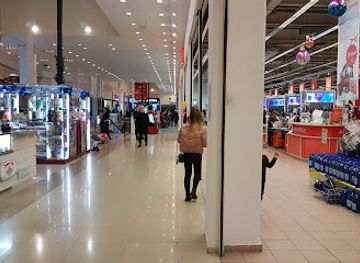
Shopping on the Ustyurt Plateau itself is effectively limited to expedition supplies, fuel and locally available provisions at approach settlements. Aktau, outside the plateau and the main gateway, is the practical place to buy food, outdoor equipment and cash before departure. For regional souvenirs, visitors may encounter Kazakh handicrafts, felt work, woven items, jewellery and small decorative pieces in Aktau or through reputable local makers, although availability is not uniform. Packaged food products and locally produced dairy or meat items may also reflect western Kazakhstan’s pastoral culture, but check transport and customs rules before carrying them internationally. Do not remove fossils, archaeological objects, stones from protected formations or artefacts from desert sites. Market and retail arrangements change, so treat shopping as a preparation task rather than a major activity of the plateau itinerary.
-
Shopping mall
MEGA Alma-Ata
Experience the ultimate shopping and entertainment destination in Almaty at MEGA Alma-Ata, where style meets culture.
-
Shopping mall
Mega Silk Way
Discover Mega Silk Way, Astana’s premier shopping mall offering a blend of luxury brands, diverse dining, and vibrant entertainment for every visitor.
-
Shopping mall
Dostyk Plaza
Discover Dostyk Plaza, Almaty's ultimate shopping destination with diverse stores, delightful dining, and vibrant entertainment.
-
Shopping mall
Keruen
Explore Keruen, Astana's premier shopping mall, where fashion, dining, and entertainment blend seamlessly for an unforgettable experience.


Get your free copy of our complete guide to Ustyurt Plateau, delivered straight to you.
Everything on this page, from attractions and restaurants to essentials and local phrases, in one PDF you can read offline, print or share.
Already have an account? Sign in
Your Ustyurt Plateau guide is ready.
We'll send it to · Not you? Sign out

Getting your guide ready…
We are putting together a fresh copy of the Ustyurt Plateau guide. This can take up to a minute.
This can take a few moments. If your browser asks, choose Allow so the download can start. You'll find the guide in your Downloads folder.
Nothing happened? Download it again
Sorry, the guide is taking longer than usual. Please try again in a minute, or get it by email instead.
Ustyurt Plateau essentials
Currency and Payment
Safety
Emergency Situations
Do's and Don'ts
Local Tips
From Eve
Local phrases worth knowing
You don't need to get them perfect. A few words go a long way, and locals appreciate the effort.
Basics
| English | Local | Say it |
|---|---|---|
| Hello | Сәлем | [Sälem] |
| Goodbye | Сау бол | [Sau bol] |
| Yes | Иә | [İä] |
| No | Жоқ | [Joq] |
| Please/You're welcome | Өтінемін | [Ötinemin] |
| Thank you | Рақмет | [Raqmet] |
| Excuse me/Sorry | Кешіріңіз | [Keshiriniz] |
| How are you? | Қалайсыз? | [Qalaysız?] |
| Fine. And you? | Жақсы. Ал сіз? | [Jaqsy. Al siz?] |
| Do you speak English? | Сіз ағылшын тілінде сөйлейсіз бе? | [Siz ağılşın tilinde söyleyısz be?] |
| I don't understand | Мен түсінбеймін | [Men tüsinbeýmin] |
Eating & Drinking
| English | Local | Say it |
|---|---|---|
| I'd like to see the menu, please | Мәзірді көргім келеді, өтінемін | [Mäzirdi körgim keledi, ötinemin] |
| I don't eat meat | Мен ет жемеймін | [Men et jemeýmin] |
| Cheers! | Сәттілік! | [Sättilik!] |
| I would like to pay, please | Мен төлеуді қалаймын, өтінемін | [Men töleýdi qalaymın, ötinemin] |
Emergencies
| English | Local | Say it |
|---|---|---|
| Help! | Көмектесіңіз! | [Kömektesiñiz!] |
| Go away! | Кетіңіз! | [Ketiñiz!] |
| Call the Police! | Полицияны шақырыңыз! | [Politsiyany şaqırıñız!] |
| Call a doctor! | Дәрігерді шақырыңыз! | [Därigerdi şaqırıñız!] |
| I'm lost | Мен жоғалып кеттім | [Men joğalyp kettim] |
| I'm ill | Мен ауырып жатырмын | [Men awırıp jatırmın] |
Shopping
| English | Local | Say it |
|---|---|---|
| I'd like to buy... | Мен сатып алғым келеді... | [Men satıp alğım keledi...] |
| I'm just looking | Мен тек қарап жатырмын | [Men tek qarap jatırmın] |
| How much is it? | Бұл қанша тұрады? | [Bul qanşa turadı?] |
| That's too expensive | Бұл тым қымбат | [Bul tym qymbat] |
| Can you lower the price? | Бағаны төмендетуге болады ма? | [Bağanı tömendeduǵe boladı ma?] |
Time & Numbers
| English | Local | Say it |
|---|---|---|
| What time is it? | Сағат қанша? | [Sağat qanşa?] |
| It's one o'clock | Бір сағат | [Bir sağat] |
| Half past (10) | Он бестен | [On besten] |
| Morning | Таң | [Tañ] |
| Afternoon | Түсте | [Tüste] |
| Evening | Кешке | [Keshke] |
| Yesterday | Кеше | [Kese] |
| Today | Бүгін | [Bügin] |
| Tomorrow | Ертең | [Erteñ] |
| 1 | Бір | [Bir] |
| 2 | Екі | [Eki] |
| 3 | Үш | [Üş] |
| 4 | Төрт | [Tört] |
| 5 | Бес | [Bes] |
| 6 | Алты | [Alty] |
| 7 | Жеті | [Jeti] |
| 8 | Сегіз | [Segiz] |
| 9 | Тоғыз | [Toğız] |
| 10 | Он | [On] |
Transport & Directions
| English | Local | Say it |
|---|---|---|
| Where's a/the...? | Қайда ...? | [Qayda ...?] |
| What's the address? | Мекенжайыңыз қандай? | [Mekenjayıñız qandayı?] |
| Can you show me (on the map)? | Маған (картадан) көрсете аласыз ба? | [Mağan (kartadan) körsete alasız ba?] |
| When's the next (bus)? | Келесі (автобус) қашан? | [Kelesі (avtobus) qaşan?] |
| A ticket (to ....) | Билет (....-қа) | [Bilet (....-qa)] |
History of Ustyurt Plateau
The Ancient Tethys Seabed
The Ustyurt Plateau is the geological remnant of landscapes shaped by the ancient Tethys Sea and later uplift, erosion and sedimentation. Its limestone and other sedimentary formations preserve the story of changing seas and arid continental environments over immense spans of time. The plateau’s escarpments, depressions and exposed strata are consequently more than scenic features: they are expressions of geological processes that shaped the wider Caspian and Aral basins. Fossils and geological formations occur in the region, although individual sites require specialist knowledge and careful protection.
Prehistoric Pastoral Landscapes
People have used the Ustyurt and adjoining Mangystau deserts since prehistoric times, adapting pastoral life to a landscape where permanent water is scarce. Archaeological evidence across the wider region includes burial monuments, stone structures, camps and traces of movement between wells and seasonal grazing grounds. These remains demonstrate that the plateau was not an empty wilderness, even though settlements were never dense. Their interpretation is complex, and many sites are vulnerable to vehicle traffic, unregulated collecting and natural erosion.
Caravan Routes between Khorezm and the Caspian
For centuries, routes across and around Ustyurt connected the oasis civilisation of Khorezm with the Caspian shore, Mangystau and trading networks extending towards the Volga, Iran and the wider Silk Roads. Travellers relied on wells and knowledge of the desert rather than on continuous roads. The plateau’s importance lay in its position between settled riverine regions and the Caspian frontier. Today, the route network survives less as a sequence of preserved monuments than as a historical explanation for wells, burial grounds and scattered archaeological traces.
Nomadic and Kazakh Pastoral Use
The wider Ustyurt and Mangystau region became part of the historical world of Kazakh pastoral communities, whose seasonal movements linked wells, wintering grounds and grazing areas. Livestock husbandry required detailed environmental knowledge, especially in a region where pasture quality and water availability vary sharply from one depression or escarpment to another. Kazakh cultural memory in western Kazakhstan also preserves traditions of desert pilgrimage, oral history and hospitality. These living connections are distinct from the geological image of Ustyurt as an uninhabited wilderness.
Russian Imperial and Soviet Mapping
From the nineteenth century, Russian imperial expeditions and later Soviet institutions surveyed the plateau for geography, geology, transport planning and natural resources. Soviet-era mapping made the region more legible to administrators and scientists, while roads, wells and exploration infrastructure altered selected routes through the desert. The period also brought stronger incorporation of western Kazakhstan into centrally managed economic systems. Much of the plateau nevertheless remained remote, with distances and water scarcity limiting permanent development.
Resource Exploration and Protected Landscapes
Oil, gas and mineral exploration expanded across western Kazakhstan during the Soviet period and continued after independence, especially in the broader Mangystau and Caspian regions. Resource development exists alongside major conservation efforts, including the establishment of Ustyurt State Nature Reserve in 1984 to protect representative desert habitats and rare wildlife. The modern history of the plateau is therefore shaped by an ongoing balance between extraction, transport infrastructure, pastoral use, scientific research and the need to safeguard a fragile ecosystem.
Ustyurt Plateau in Photos
Browse through our photo collection highlighting the charm and character of the destination.
Neighbouring regions of Ustyurt Plateau
The closest regions to Ustyurt Plateau, if you have time for more than one.
-

-

-

-

-


Swipe for more regions
Explore more

Explore more of Kazakhstan
Explore Kazakhstan's rich culture, modern cities, and stunning natural landscapes. From the Caspian Sea to the Altai Mountains, find adventure and beauty in Central Asia.
Explore Kazakhstan