

Ruta Independencia (Oaxaca) Travel Guide - Free
Explore Ruta Independencia in Oaxaca with Evendo's free guide. Find the best shops, historic streets, restaurants, and gems on web or mobile.


Ruta Independencia in Oaxaca links the Zócalo, Santo Domingo, museums, markets, historic churches, cafés and central streets on one cultural walk.
A Street Between Oaxaca’s Cultural Anchors
Ruta Independencia is best understood as a historic east–west corridor through central Oaxaca rather than a formally bounded neighbourhood. Its route links the monumental core around the Zócalo with the cultural institutions, churches and public spaces surrounding Santo Domingo de Guzmán, passing through a dense cityscape of colourful façades, arcaded buildings, cafés, shops and busy local thoroughfares. The route offers a useful way to read Oaxaca: colonial landmarks stand beside working businesses, residential doorways and the everyday movement of taxis, pedestrians and vendors.Read more about Ruta Independencia
Architecture, Culture and Street Life
Exploring the Corridor
Best attractions in Ruta Independencia
Ruta Independencia’s attractions are concentrated within Oaxaca’s historic centre and its northern approach to Santo Domingo. The route provides access to the Zócalo and Alameda de León, whose arcades, trees and surrounding civic buildings form the city’s principal public setting, while nearby streets lead to the Templo de Santo Domingo de Guzmán and the Museo de las Culturas de Oaxaca in the former convent complex. The Jardín Etnobotánico de Oaxaca, beside Santo Domingo, offers a carefully curated presentation of plants from Oaxaca’s diverse landscapes and is generally visited through guided entry. Macedonio Alcalá adds a pedestrian route lined with galleries, cafés and historic façades. Markets around the central core, including Benito Juárez and the adjoining 20 de Noviembre market area, bring a more everyday dimension through food stalls, regional products and local commerce.
-
Basilica
Basílica de Nuestra Señora de la Soledad
Discover the architectural marvel and spiritual heart of Oaxaca at the Basilica de Nuestra Señora de la Soledad, a cultural treasure of Mexico.
12 min walk · 0.9 km from neighbourhood centre
-
Cultural center
Centro Cultural San Pablo
Explore Oaxaca’s vibrant culture at Centro Cultural San Pablo, a stunning center for art, history, and community engagement in a restored convent.
5 min drive · 1.7 km from neighbourhood centre
-
Museum
MUSEO DE ARTE CONTEMPORANEO DE OAXACA
Discover the vibrant pulse of modern artistry at Museo de Arte Contemporáneo de Oaxaca, where tradition meets contemporary expression.
5 min drive · 1.6 km from neighbourhood centre
-
Art museum
Museo de Arte Prehispánico de México Rufino Tamayo
Discover Oaxaca's ancient treasures at the Museo de Arte Prehispánico de México Rufino Tamayo, a showcase of Mexico's rich pre-Hispanic heritage.
16 min walk · 1.3 km from neighbourhood centre


Best landmarks in Ruta Independencia
The principal landmark associated with Ruta Independencia is the Templo de Santo Domingo de Guzmán, whose richly ornamented interior and monumental presence make it one of Oaxaca’s defining religious buildings. Its former convent now houses the Museo de las Culturas de Oaxaca and Centro Cultural Santo Domingo, giving the complex continuing cultural significance beyond its ecclesiastical origins. Nearby, the Jardín Etnobotánico occupies former convent grounds and connects the city’s built heritage with Oaxaca’s botanical diversity. Towards the central plaza, the Zócalo, Alameda de León and surrounding arcades express the historic centre’s civic structure, while market buildings and older commercial façades reveal its continuing role as a working centre. The stone churches, low-rise streets and carved portals along the corridor are important collectively, preserving the scale and visual rhythm of historic Oaxaca.
-
City park
Zócalo (Plaza de la Constitución)
Discover the vibrant Zócalo, the cultural heart of Oaxaca, where history, art, and community converge in a picturesque city park setting.
5 min drive · 1.5 km from neighbourhood centre
-
Catholic cathedral
Templo de Santo Domingo de Guzmán
Discover the stunning Templo de Santo Domingo de Guzmán, a must-visit Catholic cathedral in Oaxaca, showcasing exquisite colonial architecture and rich cultural heritage.
5 min drive · 1.7 km from neighbourhood centre
-
City park
Plaza de la Danza
Explore Plaza de la Danza, a charming city park in Oaxaca that blends cultural heritage with breathtaking natural beauty.
12 min walk · 1.0 km from neighbourhood centre
-
Botanical garden
Jardín Etnobotánico de Oaxaca
Discover the lush biodiversity and cultural heritage at Jardín Etnobotánico de Oaxaca, a serene botanical garden in the heart of Oaxaca.
5 min drive · 1.8 km from neighbourhood centre


Explore Ruta Independencia on the map
A handpicked selection of must-see spots in Ruta Independencia, mapped for you.
Best hotels in Ruta Independencia
Best restaurants in Ruta Independencia
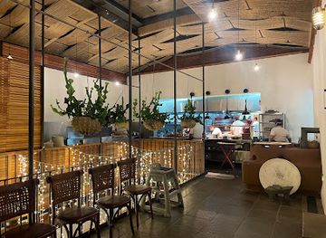
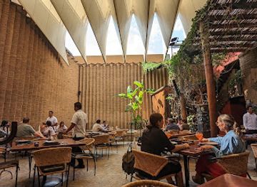
Dining along and around Ruta Independencia reflects Oaxaca’s position as a regional food capital, although the corridor ranges from quick local meals to polished restaurants aimed at visitors. Around the central streets and markets, visitors encounter tlayudas, memelas, tamales, moles, grilled meats, chocolate drinks and tejate, alongside cafés, bakeries and contemporary kitchens. The Mercado 20 de Noviembre area is particularly associated with prepared Oaxacan food, while restaurants and mezcalerías extend towards Macedonio Alcalá and the Santo Domingo precinct. Menus often draw on ingredients and techniques from the wider state rather than a narrowly defined neighbourhood tradition. Prices, formality and portion sizes vary considerably, so market counters, family-run eateries and reservation-oriented dining should be treated as different experiences rather than interchangeable versions of Oaxacan cuisine.
-
Mexican
Casa Oaxaca el Restaurante
Experience authentic Oaxacan flavors at Casa Oaxaca el Restaurante - where tradition meets innovation in every dish.
5 min drive · 1.8 km from neighbourhood centre
-
Oaxacan restaurant
Las Quince Letras Restaurante
Experience the rich flavors of Oaxacan cuisine at Las Quince Letras Restaurante – a culinary treasure in Oaxaca.
6 min drive · 1.9 km from neighbourhood centre
-
Mexican
Los Danzantes
Discover Oaxacan culinary artistry at Los Danzantes, where tradition meets innovation in every dish.
5 min drive · 1.6 km from neighbourhood centre
-
Mexican
Catedral Restaurant
Discover authentic Mexican cuisine at Catedral Restaurant in Oaxaca, where traditional flavors meet modern dining experiences.
18 min walk · 1.4 km from neighbourhood centre


Best bars in Ruta Independencia
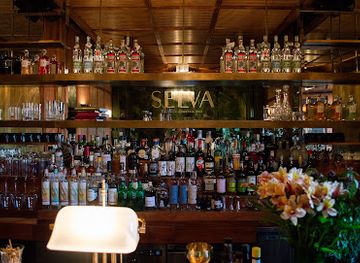
Evenings on Ruta Independencia are generally shaped by restaurants, mezcalerías, cafés and cultural venues rather than a concentrated nightclub strip. The central blocks and the streets leading towards Santo Domingo offer opportunities to taste agave spirits from Oaxaca, listen to music and sit on terraces, while bars around Macedonio Alcalá tend to attract a mixture of residents and visitors. Some venues are intimate and conversation-focused; others become livelier later, especially around weekends and festival periods. Nightlife is interwoven with the historic centre’s residential and religious fabric, so noise and street behaviour matter near homes and churches. Visitors should check current arrangements locally, as opening patterns, live performances and temporary events change more readily than the architecture around them.
-
Bar
La Mezcalerita
Discover the essence of Oaxaca at La Mezcalerita, where mezcal and authentic cuisine unite in a vibrant bar setting.
5 min drive · 1.7 km from neighbourhood centre
-
Cocktail bar
DESESTRESSE OAXACA, Drinks & Cocktails
Discover DESESTRESSE OAXACA, a vibrant cocktail bar offering exquisite drinks, delicious food, and a lively nightlife experience in the heart of Oaxaca.
5 min drive · 1.6 km from neighbourhood centre
-
Bar
Selva Oaxaca Cocktail Bar
Experience innovative cocktails and vibrant nightlife at Selva Oaxaca Cocktail Bar, a must-visit spot for tourists in the heart of Oaxaca.
5 min drive · 1.6 km from neighbourhood centre
-
Grill
ALAMBIQUE-OAXACA, Gastropub Mexicano
Experience the vibrant culinary scene of Oaxaca at ALAMBIQUE-OAXACA, a gastropub serving exceptional food, drinks, and live music.
5 min drive · 1.6 km from neighbourhood centre



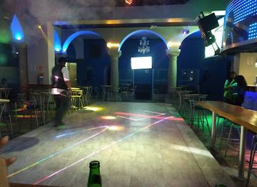
Best nightclubs in Ruta Independencia
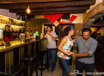
Evenings on Ruta Independencia are generally shaped by restaurants, mezcalerías, cafés and cultural venues rather than a concentrated nightclub strip. The central blocks and the streets leading towards Santo Domingo offer opportunities to taste agave spirits from Oaxaca, listen to music and sit on terraces, while bars around Macedonio Alcalá tend to attract a mixture of residents and visitors. Some venues are intimate and conversation-focused; others become livelier later, especially around weekends and festival periods. Nightlife is interwoven with the historic centre’s residential and religious fabric, so noise and street behaviour matter near homes and churches. Visitors should check current arrangements locally, as opening patterns, live performances and temporary events change more readily than the architecture around them.
-
Bar
Txalaparta
Discover the vibrant nightlife of Oaxaca at Txalaparta, a lively bar offering great drinks, music, and a fun atmosphere.
17 min walk · 1.4 km from neighbourhood centre
-
Night club
DESESTRESSE OAXACA, Drinks & Cocktails
Experience the vibrant nightlife of Oaxaca at Desestresse, a premier destination for drinks, delicious food, and unforgettable moments.
5 min drive · 1.6 km from neighbourhood centre
-
Bar
Bar La Tentación
Discover the vibrant nightlife at Bar La Tentación, where live music and salsa dancing create an unforgettable experience in Oaxaca.
5 min drive · 1.5 km from neighbourhood centre
-
Bar
Blackcherry Club
Dive into the lively nightlife of Oaxaca at Blackcherry Club, where dance and music create unforgettable memories.
5 min drive · 1.7 km from neighbourhood centre


Best shops in Ruta Independencia
Shopping around Ruta Independencia combines the central markets with craft shops, galleries, clothing stores, bookshops and contemporary design businesses scattered through the historic centre. Mercado Benito Juárez and the adjoining Mercado 20 de Noviembre are the most concentrated places for food products, drink, souvenirs and regional specialities, while streets near Santo Domingo contain retailers and galleries presenting textiles, ceramics, jewellery, leather goods and other work associated with Oaxaca and the wider state. Quality, provenance and prices vary, so visitors interested in crafts should ask where an item was made and compare pieces before purchasing. The corridor is not a single enclosed shopping district: its appeal lies in moving between market stalls, independent storefronts and cultural spaces while observing the difference between everyday provisions and goods marketed primarily to visitors.
-
Youth clothing store
El Cuarzo Store (Smoke shop, Tabaqueria, vape, Skate shop, Graffiti shop, Street wear store)
Discover El Cuarzo Store in Oaxaca: Your go-to destination for streetwear, skate gear, and vaping products, all wrapped in vibrant local culture.
5 min drive · 1.6 km from neighbourhood centre
-
Clothing store
Marchanta
Explore Marchanta in Oaxaca, where unique clothing meets local craftsmanship and culture for an unforgettable shopping experience.
5 min drive · 1.6 km from neighbourhood centre
-
Souvenir store
OAXAQUIANDO
Explore Oaxaquiano for authentic Oaxacan souvenirs and handcrafted treasures in the heart of Oaxaca's vibrant cultural scene.
5 min drive · 1.6 km from neighbourhood centre
-
Clothing store
Benshap Galería
Discover the vibrant artistry and handcrafted fashion at Benshap Galería, a gem in the heart of Oaxaca that showcases local talent and culture.
5 min drive · 1.8 km from neighbourhood centre


Ruta Independencia essentials
Getting There
Getting Around
Safety
Emergency Situations
Do's and Don'ts
Local Tips

From Eve
Local phrases worth knowing
You don't need to get them perfect. A few words go a long way, and locals appreciate the effort.
Basics
| English | Local | Say it |
|---|---|---|
| Hello | Hola | [oh-lah] |
| Goodbye | Adiós | [ah-dee-ohs] |
| Yes | Sí | [see] |
| No | No | [noh] |
| Please/You're welcome | Por favor/De nada | [por fah-vor/deh nah-dah] |
| Thank you | Gracias | [grah-see-ahs] |
| Excuse me/Sorry | Perdón/Lamento | [pair-dohn/lah-men-toh] |
| How are you? | ¿Cómo estás? | [koh-moh ehs-tahs] |
| Fine. And you? | Bien. ¿Y tú? | [bee-ehn. ee too] |
| Do you speak English? | ¿Hablas inglés? | [ah-blahs een-glehs] |
| I don't understand | No entiendo | [noh ehn-tee-ehn-doh] |
Eating & Drinking
| English | Local | Say it |
|---|---|---|
| I'd like to see the menu, please | Quisiera ver el menú, por favor | [kee-see-eh-rah vehr ehl meh-noo, por fah-vor] |
| I don't eat meat | No como carne | [noh koh-moh kahr-neh] |
| Cheers! | ¡Salud! | [sah-loohd] |
| I would like to pay, please | Quisiera pagar, por favor | [kee-see-eh-rah pah-gahr, por fah-vor] |
Emergencies
| English | Local | Say it |
|---|---|---|
| Help! | ¡Ayuda! | [ah-yoo-dah] |
| Go away! | ¡Vete! | [veh-teh] |
| Call the Police! | ¡Llama a la policía! | [yah-mah ah lah poh-lee-see-ah] |
| Call a doctor! | ¡Llama a un doctor! | [yah-mah ah oon dohk-tohr] |
| I'm lost | Estoy perdido | [ehs-toy pair-dee-doh] |
| I'm ill | Estoy enfermo | [ehs-toy ehn-fehr-moh] |
Shopping
| English | Local | Say it |
|---|---|---|
| I'd like to buy... | Quisiera comprar... | [kee-see-eh-rah kohm-prar] |
| I'm just looking | Sólo estoy mirando | [soh-loh ehs-toy mee-rahn-doh] |
| How much is it? | ¿Cuánto cuesta? | [kwan-toh kwehs-tah] |
| That's too expensive | Eso es muy caro | [eh-soh ehs mwee kah-roh] |
| Can you lower the price? | ¿Puedes bajar el precio? | [pweh-dehs bah-har ehl preh-see-oh] |
Time & Numbers
| English | Local | Say it |
|---|---|---|
| What time is it? | ¿Qué hora es? | [keh oh-rah ehs] |
| It's one o'clock | Es la una | [ehs lah oo-nah] |
| Half past (10) | Media hora (10) | [meh-dee-ah oh-rah (deez)] |
| Morning | Mañana | [mah-nyah-nah] |
| Afternoon | Tarde | [tahr-deh] |
| Evening | Noche | [noh-cheh] |
| Yesterday | Ayer | [ah-yehr] |
| Today | Hoy | [oy] |
| Tomorrow | Mañana | [mah-nyah-nah] |
| 1 | Uno | [oo-noh] |
| 2 | Dos | [dohs] |
| 3 | Tres | [trehs] |
| 4 | Cuatro | [kwah-troh] |
| 5 | Cinco | [seen-koh] |
| 6 | Seis | [sehs] |
| 7 | Siete | [syeh-teh] |
| 8 | Ocho | [oh-choh] |
| 9 | Nueve | [nweh-veh] |
| 10 | Diez | [dyehs] |
Transport & Directions
| English | Local | Say it |
|---|---|---|
| Where's a/the...? | ¿Dónde está un/el...? | [dohn-deh ehs-tah oon/ehl] |
| What's the address? | ¿Cuál es la dirección? | [kwal ehs lah dee-rehk-syohn] |
| Can you show me (on the map)? | ¿Puedes mostrarme (en el mapa)? | [pweh-dehs mohs-trar-meh (ehn ehl mah-pah)] |
| When's the next (bus)? | ¿Cuándo es el próximo (autobús)? | [kwan-doh ehs ehl prohk-see-moh (ow-toh-boos)] |
| A ticket (to ....) | Un boleto (a ....) | [oon boh-leh-toh (ah)] |
History of Ruta Independencia
A Colonial Street Framework
Ruta Independencia follows a central route within Oaxaca’s historic urban grid, whose colonial form developed around the main civic and religious institutions established after the Spanish conquest. Churches, convent complexes, administrative buildings and residential properties shaped the streets leading between the central plaza and the northern religious precinct. The corridor’s importance came less from a single isolated monument than from its position within the network connecting government, commerce and worship. Its buildings preserve the low-rise scale, masonry construction and street-facing façades characteristic of Oaxaca’s historic centre, while later adaptations converted many former residences into shops, restaurants, offices and cultural venues.
Churches and Civic Institutions
As Oaxaca expanded, the streets around the central plaza and Santo Domingo became an institutional spine for religious, educational and civic life. The Templo de Santo Domingo de Guzmán and its former convent complex were among the most influential architectural presences in the northern part of the route, while other churches and public buildings reinforced the corridor’s ceremonial character. The convent complex later acquired a new cultural role as the Museo de las Culturas de Oaxaca and Centro Cultural Santo Domingo, placing archaeology, history and public education within buildings once governed by religious institutions.
Modern Oaxaca Within the Historic Centre
The nineteenth and twentieth centuries brought administrative change, new commercial uses and altered transport patterns without erasing the historic street plan. Oaxaca’s central avenues became places where established families, shopkeepers, public workers and visitors shared a compact urban environment. The corridor’s architecture was repeatedly adapted rather than replaced wholesale, allowing older façades and churches to coexist with later commercial interiors. The growth of tourism in the historic centre subsequently encouraged hotels, restaurants, galleries and craft-oriented businesses, making the area more visitor-facing while retaining its role as an everyday city centre.
Heritage and Contemporary Cultural Life
Oaxaca’s historic centre was inscribed on the UNESCO World Heritage List in 1987, recognising its colonial urban form and the nearby archaeological significance of Monte Albán. Within Ruta Independencia, heritage protection has helped preserve the scale and appearance of streets around the Zócalo and Santo Domingo, although conservation has also accompanied rising commercial and cultural interest. Today the route connects established museums and religious buildings with restaurants, independent shops, galleries and mezcal-focused venues. Its contemporary identity therefore rests on an ongoing negotiation between monumental heritage, local commerce, public life and the demands of tourism.
Ruta Independencia in Photos
Browse through our photo collection highlighting the charm and character of the destination.
Neighbourhoods near Ruta Independencia
The closest neighbourhoods to Ruta Independencia, if you have time for more than one stop.

Swipe for more neighbourhoods
Explore more

Explore more of Oaxaca
Oaxaca, Mexico, blends Zapotec heritage, colonial architecture, celebrated cuisine, lively markets and memorable cultural experiences in the Central Valleys.
Explore Oaxaca