

Tombigbee National Forest Travel Guide - Free Web & App
Your ultimate guide to Tombigbee National Forest. Discover top landmarks, proposed trips, and local tips. Free on the web or via the Evendo companion app.


Tombigbee National Forest in Mississippi offers quiet lakes, pine woods, wildlife habitats, camping, fishing and scenic outdoor escapes near Starkville and Tupelo.
Forest, Water and Prairie Country
Tombigbee National Forest occupies a broad area of north-eastern Mississippi, where pine and hardwood woodland, small streams, reservoirs and remnants of the region’s prairie country create a landscape shaped as much by water management and working forests as by wilderness. The forest is not a single compact park: its lands are spread across several counties and are reached from communities including Ackerman, Houston, Starkville, Columbus and Tupelo. Roads, recreation areas and dispersed forest tracts give the destination a distinctly spacious character, with relatively little built development inside the forest itself.Read more about Tombigbee National Forest
Lakes and Outdoor Recreation
A Rural North Mississippi Setting
When is the best time to visit Tombigbee National Forest?
Best: May, September–October · 22–29°C| Month | High (°C) | Rainfall (mm) |
|---|---|---|
| January | 13 | 117 |
| February | 15 | 110 |
| March | 18 | 135 |
| April | 24 | 119 |
| May (best) | 28 | 99 |
| June | 32 | 95 |
| July | 33 | 105 |
| August | 32 | 103 |
| September (best) | 29 | 87 |
| October (best) | 22 | 78 |
| November | 18 | 112 |
| December | 14 | 123 |
Getting to and around Tombigbee National Forest
How to get there
Transportation
Best attractions in Tombigbee National Forest
Tombigbee National Forest’s principal attractions are its lakes, woodland roads and quiet public recreation areas rather than a dense collection of monuments. Choctaw Lake provides a large open-water setting within the forest, with opportunities for fishing, boating, picnicking and camping where facilities and regulations allow. Davis Lake, near the Tupelo side of the forest, offers another water-based landscape framed by pine and hardwood woodland. Across the wider forest, visitors encounter streams, managed timber stands, wildlife openings and rural Mississippi scenery that changes between upland woodland and more open agricultural country. The forest’s dispersed nature encourages short visits to several locations rather than one continuous sightseeing route. Nearby Starkville, Columbus, Ackerman and Tupelo can supply cultural attractions, museums, food and accommodation, but they are gateway communities rather than attractions within the national forest itself. The Natchez Trace Parkway is also a significant nearby regional route, though it should be treated as separate from Tombigbee National Forest.
-
Park
Witch Dance
Discover the serene beauty of Witch Dance, a hidden gem in Mississippi, offering hiking trails and stunning landscapes perfect for nature lovers.
-
Park
Joe Brigance Memorial Park
Experience the tranquility of Joe Brigance Memorial Park, a perfect escape in Houston, Mississippi for nature lovers and families alike.
-
Campground
Stinkin Jims
Explore the serene beauty of Stinkin Jims Campground in Houston, Mississippi, where outdoor adventures meet peaceful relaxation.
-
Park
Witch Dance Picnic Area
Experience the enchanting beauty of Witch Dance Picnic Area along the Natchez Trace Parkway, a serene spot for picnicking and nature exploration.


Best landmarks in Tombigbee National Forest
The most defining landmarks of Tombigbee National Forest are natural and water-based. Choctaw Lake and Davis Lake are prominent managed reservoirs whose open surfaces contrast with surrounding pine and hardwood woodland, making them important recreation and landscape features. The forest’s streams, wet areas, timber stands and wildlife openings reveal the character of north-eastern Mississippi’s working countryside, where woodland management and public recreation exist alongside agriculture. The Tombigbee River gives the wider region its name and cultural geography, although not every forest tract lies directly beside the river. Nearby historic and cultural landmarks are concentrated in gateway communities such as Columbus, Starkville, Ackerman and Tupelo rather than inside the forest. The Natchez Trace Parkway, with its own historic route and protected landscape, is a nearby regional landmark but is not part of Tombigbee National Forest.
-
Park
Witch Dance
Explore the legendary Witch Dance campground on the Natchez Trace Parkway, where history, nature, and folklore converge.

Explore Tombigbee National Forest on the map
Plan your trip on one map. See where the top attractions, landmarks, restaurants and hotels are, and book hotels and experiences in a few clicks.
Best hotels in Tombigbee National Forest
Best restaurants in Tombigbee National Forest
Tombigbee National Forest has very limited dining infrastructure within its wooded recreation areas, so visitors normally eat at campsites, prepare supplies for the day or return to surrounding communities. Starkville and Columbus provide the broadest choice of restaurants in the region, while Tupelo is a useful base for the forest’s north-western side. Ackerman and Houston offer smaller-town options, including locally oriented cafés, family restaurants and traditional Southern cooking, although individual businesses and opening patterns can change. Regional food culture draws on Mississippi staples such as catfish, fried chicken, barbecue, cornbread, greens and seasonal produce, with farm shops and groceries useful for picnics or self-catering. Visitors spending time around Choctaw Lake or Davis Lake should shop before departure rather than expecting a restaurant, café or extensive convenience service at the recreation areas.
-
Sandwich
Subway
Discover quick and tasty meals at Subway in Houston - perfect for travelers seeking fresh sandwiches and healthy options.
-
Barbecue
Big Smooth BBQ and Catering
Experience authentic Southern barbecue at Big Smooth BBQ and Catering in Pontotoc - where smoky flavors meet warm hospitality.
-
Restaurant
Cabistros Palace
Discover exquisite southern cuisine at Cabistros Palace in Houston, MS – where culinary traditions meet modern flavors.


Best bars in Tombigbee National Forest
Evenings in Tombigbee National Forest are generally quiet, with the emphasis on campfires where authorised, dark skies, lakeside stillness and the sounds of woodland rather than organised nightlife. The forest itself does not contain a recognised nightclub district or concentrated bar scene. Traditional pubs, casual bars and evening restaurants are more likely to be found in gateway communities, particularly Starkville and Columbus, which have the most developed hospitality environments in the surrounding region. Tupelo also provides a broader choice of evening entertainment for visitors based north-west of the forest, while Ackerman and Houston offer a smaller-town atmosphere. Live music, university events and seasonal community gatherings may occur in nearby towns, but schedules vary and should be checked locally rather than assumed.
-
Bar
End of the Alley
Discover End of the Alley, a cozy bar in Houston, Mississippi, offering local brews and cocktails in a charming atmosphere perfect for relaxation.
-
Restaurant
Selina’s Bar & Grill
Experience the warm hospitality and delicious Southern cuisine of Selina’s Bar & Grill in Houston, MS, a perfect stop for every traveler.


Best shops in Tombigbee National Forest
Shopping within Tombigbee National Forest is limited to the practical needs of visitors, and there is no extensive retail centre or continuous craft market inside the forest. Food, fuel, outdoor supplies and camping provisions are most conveniently obtained in Starkville, Columbus, Tupelo, Ackerman or Houston before heading to a recreation area. Independent shops and regional producers in the surrounding communities may offer Mississippi food products, seasonal produce, local art, books, clothing and practical outdoor equipment, while farm shops reflect the agricultural character of the wider countryside. Starkville and Columbus provide the largest concentration of general retail, and Tupelo is particularly useful for visitors approaching from the north-west. Availability differs between small communities and larger towns, so remote forest visits are best planned with supplies already secured.
-
Department store
Walmart
Discover Walmart in Houston, Mississippi, the ultimate department store offering everything from groceries to clothing at unbeatable prices.
-
Grocery store
Save A Lot
Shop smart and save big at Save A Lot, your affordable grocery destination in Houston, MS, offering fresh produce and everyday essentials.
-
Outlet store
Diamond O Western Outlet
Explore unique western apparel and accessories at Diamond O Western Outlet, where Southern charm meets unbeatable prices for every traveler.
-
Grocery store
Food Shop
Experience the heart of Mississippi with local ingredients and warm hospitality at New Houlka's charming grocery store.


Get your free copy of our complete guide to Tombigbee National Forest, delivered straight to you.
Everything on this page, from attractions and restaurants to essentials and local phrases, in one PDF you can read offline, print or share.
Already have an account? Sign in
Your Tombigbee National Forest guide is ready.
We'll send it to · Not you? Sign out

Getting your guide ready…
We are putting together a fresh copy of the Tombigbee National Forest guide. This can take up to a minute.
This can take a few moments. If your browser asks, choose Allow so the download can start. You'll find the guide in your Downloads folder.
Nothing happened? Download it again
Sorry, the guide is taking longer than usual. Please try again in a minute, or get it by email instead.
Tombigbee National Forest essentials
Currency and Payment
Safety
Emergency Situations
Do's and Don'ts
Local Tips
From Eve
Local phrases worth knowing
You don't need to get them perfect. A few words go a long way, and locals appreciate the effort.
Basics
| English | Local | Say it |
|---|---|---|
| Hello | Howdy | [haʊ-di] |
| Goodbye | See ya | [siː jə] |
| Yes | Yep | [jɛp] |
| No | Nah | [nɑː] |
| Please/You're welcome | Please/No problem | [pliːz/nəʊ ˈprɑbləm] |
| Thank you | Thanks | [θæŋks] |
| Excuse me/Sorry | Pardon me/My bad | [ˈpɑːrdn mi/maɪ bæd] |
| How are you? | How y'all doin'? | [haʊ jɔːl ˈduɪn] |
| Fine. And you? | Fine. And you? | [faɪn. ænd jə] |
| Do you speak English? | Y'all speak English? | [jɔːl spiːk ˈɪŋɡlɪʃ] |
| I don't understand | I don't get it | [aɪ doʊnt ˈɡɛt ɪt] |
Eating & Drinking
| English | Local | Say it |
|---|---|---|
| I'd like to see the menu, please | I'd like to see the menu, please | [aɪd laɪk tuː siː ðə ˈmɛnjuː pliːz] |
| I don't eat meat | I don't eat meat | [aɪ doʊnt iːt mit] |
| Cheers! | Cheers! | [ʧɪrz] |
| I would like to pay, please | I would like to pay, please | [aɪ wʊd laɪk tuː peɪ pliːz] |
Emergencies
| English | Local | Say it |
|---|---|---|
| Help! | Help! | [hɛlp] |
| Go away! | Git! | [ɡɪt] |
| Call the Police! | Call the Sheriff! | [kɔːl ðə ˈʃɛrɪf] |
| Call a doctor! | Call a doc! | [kɔːl ə ˈdɑk] |
| I'm lost | I'm lost | [aɪm lɔst] |
| I'm ill | I'm feelin' bad | [aɪm ˈfiːlɪn bæd] |
Shopping
| English | Local | Say it |
|---|---|---|
| I'd like to buy... | I'd like to buy... | [aɪd laɪk tuː baɪ] |
| I'm just looking | I'm just lookin' | [aɪm ʤʌst ˈlʊkɪn] |
| How much is it? | How much is it? | [haʊ mʌʧ ɪz ɪt] |
| That's too expensive | That's too pricey | [ðæts tuː ˈpraɪsi] |
| Can you lower the price? | Can y'all lower the price? | [kæn jɔːl ˈloʊər ðə praɪs] |
Time & Numbers
| English | Local | Say it |
|---|---|---|
| What time is it? | What time is it? | [wɑːt taɪm ɪz ɪt] |
| It's one o'clock | It's one o'clock | [ɪts wʌn əˈklɑk] |
| Half past (10) | Half past ten | [hæf pæst tɛn] |
| Morning | Mornin' | [ˈmɔrnɪn] |
| Afternoon | Afternoon | [ˌæftərˈnun] |
| Evening | Evenin' | [ˈivnɪn] |
| Yesterday | Yestiddy | [ˈjɛstɪdi] |
| Today | Today | [təˈdeɪ] |
| Tomorrow | Tomorry | [təˈmɔri] |
| 1 | One | [wʌn] |
| 2 | Two | [tuː] |
| 3 | Three | [θriː] |
| 4 | Four | [fɔːr] |
| 5 | Five | [faɪv] |
| 6 | Six | [sɪks] |
| 7 | Seven | [ˈsɛvən] |
| 8 | Eight | [eɪt] |
| 9 | Nine | [naɪn] |
| 10 | Ten | [tɛn] |
Transport & Directions
| English | Local | Say it |
|---|---|---|
| Where's a/the...? | Where's a/the...? | [wɛrz ə/ðə] |
| What's the address? | What's the address? | [wɑːts ðə əˈdrɛs] |
| Can you show me (on the map)? | Can y'all show me (on the map)? | [kæn jɔːl ʃoʊ miː (ɒn ðə mæp)] |
| When's the next (bus)? | When's the next (bus)? | [wɛnz ðə nɛkst (bʌs)] |
| A ticket (to ....) | A ticket (to ....) | [ə ˈtɪkɪt (tuː ....)] |
History of Tombigbee National Forest
A Landscape of Forests and Prairies
Before modern settlement, north-eastern Mississippi contained a varied mosaic of hardwood forest, pine woodland, wetlands and prairie openings. The region’s soils, streams and changing relief supported abundant plant and animal life, while fire, flooding and human land management helped shape the appearance of the countryside. The forest’s present character is therefore not a completely untouched landscape but the result of natural processes combined with generations of cultivation, timber use and water management.
Chickasaw Homeland and Forced Removal
The wider north-eastern Mississippi region formed part of the historic homeland of the Chickasaw people, whose communities used the area’s forests, streams and fertile lands before European-American expansion. During the early nineteenth century, United States pressure, treaty-making and forced removal transformed Indigenous control of the region. The 1830 Treaty of Pontotoc transferred extensive Chickasaw lands, and the Chickasaw were subsequently removed west of the Mississippi River. This history remains essential to understanding the landscape around the modern forest.
Agriculture, Timber and Changing Land Use
After Indigenous removal, land in the surrounding counties was increasingly converted to farms, pasture and commercial timber holdings. Cotton agriculture influenced the wider economy, while railways and roads connected rural communities with regional markets. Woodland was cleared in some locations and managed intensively in others, producing the mixture of agricultural openings, pine stands and hardwood corridors visible today. Reservoirs later added a recreational and water-management dimension to the working landscape.
The National Forest Era
Tombigbee National Forest was established in 1959 as part of the United States national forest system. Its management has combined timber production, habitat protection, watershed care, hunting, fishing and public recreation rather than pursuing a single land use. Recreation areas around lakes such as Choctaw and Davis helped make public access to water and woodland a central part of the forest’s identity. Today, the United States Forest Service continues to manage a fragmented, multi-use landscape in partnership with wider regional conservation and rural-development interests.
Tombigbee National Forest in Photos
Browse through our photo collection highlighting the charm and character of the destination.
Neighbouring destination travel guides
The closest destinations to Tombigbee National Forest, if you have time for more than one.
-
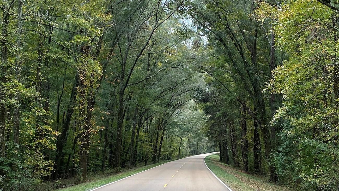 Natchez Trace Parkway
Explore the scenic, historic, and cultural wonders of the Natchez Trace Parkway, a 444-mile journey through the heart of the American South.
-
-
-

-


Swipe for more destinations
Explore more
Explore more of The Black Prairie
Explore Mississippi’s Black Prairie for historic Columbus, university culture in Starkville, fertile farmland, wildlife refuges and distinctive Southern food.
Explore The Black Prairie
Explore more of Mississippi
Discover Mississippi: A treasure trove of Southern culture, blues music heritage, and stunning natural landscapes perfect for every kind of traveler.
Explore Mississippi