

Free The Absaroka-Beartooth Wilderness Travel Guide & Mobile App
Explore The Absaroka-Beartooth Wilderness with free travel guides. Discover regional history, expert tips, proposed trips, and audio guides on web or mobile app.


Explore Montana’s Absaroka-Beartooth Wilderness for granite peaks, alpine lakes, demanding trails and vast roadless landscapes near Red Lodge and Cooke City.
Read more about The Absaroka-Beartooth Wilderness
Getting to and around The Absaroka-Beartooth Wilderness
How to get there
Transportation
Destinations in The Absaroka-Beartooth Wilderness
Resorts, valleys and scenic spots worth a trip of their own.
-

-

-


Swipe for more destinations
Best attractions in The Absaroka-Beartooth Wilderness
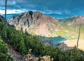
The principal attraction is the wilderness itself: a broad, roadless mountain environment rather than a collection of developed sights. Backpackers and day hikers explore trail systems from West Rosebud, East Rosebud, Stillwater, Rock Creek, Lake Fork and other surrounding approaches, with routes leading to alpine lakes, granite basins, forested valleys and high passes. The Beaten Path is one of the best-known long-distance routes, while areas around Mystic Lake and the Beartooth Plateau offer demanding scenery for experienced walkers. Mountaineers are drawn to Granite Peak and other technical summits, although climbing requires serious preparation. Anglers find cold-water lakes and streams, subject to current Montana regulations, and horse parties use established backcountry routes. Nearby, but outside the wilderness, the Beartooth Highway provides a road-based introduction to the surrounding high country, while Red Lodge and Cooke City offer museums, historic buildings, outfitting services and interpretation of mining and mountain life. There are no developed family attractions, restaurants or sightseeing facilities inside the boundary, and wildlife viewing is a matter of patience and distance rather than guaranteed encounters.
-
Recreation center
Yellowstone Hot Springs
Discover tranquility at Yellowstone Hot Springs, a serene retreat featuring natural hot springs, spa services, and stunning views near Yellowstone National Park.
-
Nature preserve
Absaroka-Beartooth Wilderness
Discover the breathtaking beauty and adventure that awaits in the Absaroka-Beartooth Wilderness of Montana, a nature lover's paradise.
-
Ravine
Yankee Jim Canyon
Experience the breathtaking beauty of Yankee Jim Canyon, a stunning ravine in Montana perfect for hiking, photography, and nature exploration.

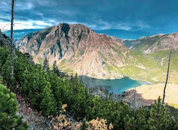

Best landmarks in The Absaroka-Beartooth Wilderness
Granite Peak is the defining natural landmark of the Absaroka-Beartooth Wilderness and the highest point in Montana, rising to 12,799 feet within a complex of steep granite ridges and technical climbing terrain. The Beartooth Plateau forms another signature feature: a high, glaciated tableland of exposed rock, alpine lakes and lingering snowfields that demonstrates the scale and severity of the range. Mystic Lake and the East Rosebud Valley are prominent geographic reference points, combining large mountain water bodies with forested approaches and dramatic surrounding relief. The Absaroka Range contributes a contrasting landscape of volcanic and sedimentary peaks, particularly towards the eastern and northern sides of the wilderness. There are no civic monuments or historic buildings within the roadless core; its significance lies in intact geology, watersheds, wildlife habitat and uninterrupted mountain scenery. The nearby Beartooth Highway is an important visual gateway, but it remains outside the wilderness boundary and should not be confused with an internal landmark.
-
Monument
Roosevelt Arch
Discover the historic Roosevelt Arch, the majestic gateway to Yellowstone National Park, where nature and adventure await your exploration.
-
Historical landmark
Absaroka-Beartooth Wilderness Historical Marker
Explore the Absaroka-Beartooth Wilderness Historical Marker for a unique blend of history and stunning natural beauty in the heart of Montana.


Explore The Absaroka-Beartooth Wilderness on the map
Plan your trip on one map. See where the top cities, national parks and sights are, and book hotels and experiences in a few clicks.
Best hotels in The Absaroka-Beartooth Wilderness
Best restaurants in The Absaroka-Beartooth Wilderness
There are no restaurants, cafés or food concessions inside the Absaroka-Beartooth Wilderness, so meals must be carried in and all rubbish packed out. Dining is concentrated in gateway communities, particularly Red Lodge and Cooke City-Silver Gate, where visitors find breakfast cafés, bakeries, casual restaurants, bars serving food, and establishments catering to hikers, climbers and road travellers. Menus generally reflect the broader cuisine of the Rocky Mountain West, with burgers, steaks, trout, soups, sandwiches and locally influenced seasonal cooking more common than a narrowly defined wilderness cuisine. Groceries, trail food and packed lunches can be obtained in surrounding towns, but rural choice and opening arrangements vary. Montana-produced beef, game where legally and commercially available, craft beer and baked goods may feature in regional dining, while picnic food is essential for routes beyond the road network. Visitors undertaking multi-day trips should purchase provisions before reaching remote trailheads rather than expecting backcountry resupply.
-
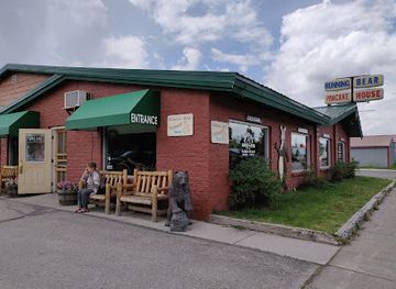
Pancake
Running Bear Pancake House
Experience delicious pancakes and hearty breakfasts at Running Bear Pancake House in West Yellowstone - perfect start to your adventure!
-
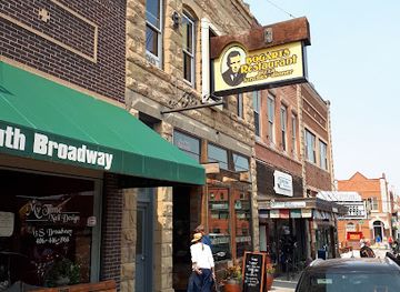
Mexican
Bogart's Restaurant
Discover the delicious fusion of Mexican and pizza cuisine at Bogart's Restaurant, your go-to dining spot in Red Lodge, Montana.
-
Restaurant
Wonderland Cafe & Lodge
Experience delightful dining and cozy lodging at Wonderland Cafe & Lodge near Yellowstone National Park in Gardiner, Montana.
-
Restaurant
The CORRAL
Experience delightful dining at The CORRAL in Gardiner, Montana – where local flavors meet warm hospitality amidst breathtaking landscapes.


Best bars in The Absaroka-Beartooth Wilderness
Evening life is limited and concentrated outside the wilderness, mainly in Red Lodge and Cooke City-Silver Gate. Traditional pubs, hotel bars, casual restaurants and small local venues provide places to eat, meet other travellers and hear occasional live music, while the atmosphere is oriented towards outdoor recreation and community life rather than late-night clubbing. Larger nightlife choices are available in Billings, which is a gateway city outside the region, but it is not a practical evening destination after a day at a remote trailhead. In the wilderness itself, nights are defined by darkness, weather, wildlife precautions and quiet; campfires are subject to current restrictions and may be prohibited. Plan transport carefully after drinking, especially on mountain roads, and avoid treating alcohol as part of backcountry recreation.
-
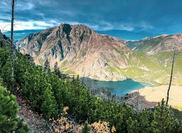
Nature preserve
Absaroka-Beartooth Wilderness
Discover the breathtaking landscapes and adventurous spirit of Absaroka-Beartooth Wilderness, a top destination for outdoor enthusiasts.
Best nightclubs in The Absaroka-Beartooth Wilderness
Evening life is limited and concentrated outside the wilderness, mainly in Red Lodge and Cooke City-Silver Gate. Traditional pubs, hotel bars, casual restaurants and small local venues provide places to eat, meet other travellers and hear occasional live music, while the atmosphere is oriented towards outdoor recreation and community life rather than late-night clubbing. Larger nightlife choices are available in Billings, which is a gateway city outside the region, but it is not a practical evening destination after a day at a remote trailhead. In the wilderness itself, nights are defined by darkness, weather, wildlife precautions and quiet; campfires are subject to current restrictions and may be prohibited. Plan transport carefully after drinking, especially on mountain roads, and avoid treating alcohol as part of backcountry recreation.
-
Nature preserve
Absaroka-Beartooth Wilderness
Discover the stunning landscapes and diverse wildlife of Absaroka-Beartooth Wilderness, a serene natural preserve in Montana.
Best shops in The Absaroka-Beartooth Wilderness
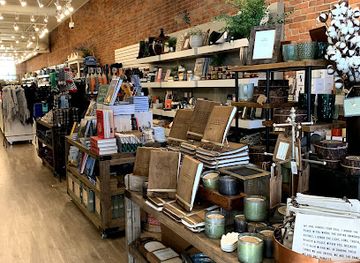
Shopping is a pre-trip activity rather than an experience within the wilderness. Red Lodge and Cooke City-Silver Gate, both outside the boundary, provide the most relevant places to buy fuel, groceries, maps, outdoor equipment, clothing, souvenirs and locally made items before entering the backcountry. Independent shops and galleries may sell mountain-themed art, photography, books, crafts and regional products, while food shops are useful for assembling packed lunches and trail rations. Red Lodge has a broader high-street selection because of its larger year-round community and visitor economy; Cooke City is smaller and more closely tied to seasonal road travel, guiding and outdoor recreation. Expect limited choice in remote areas and check supplies before driving to a trailhead. There is no merchandise outlet, visitor centre or gift shop inside the wilderness, and natural objects, archaeological material and plants must not be removed.
-
Gift shop
Heyday
Discover unique gifts and local treasures at Heyday, the charming gift shop in the heart of Bozeman, Montana.
-
Jewelry store
Kehoe's Agate Shop
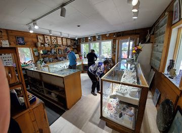
Explore Kehoe's Agate Shop in Bigfork, Montana - a gem lover's paradise showcasing exquisite agate jewelry and unique rock specimens.
-
Gift shop
Obsidian Collection
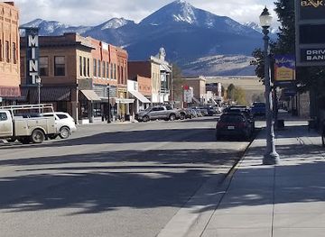
Explore the Obsidian Collection in Livingston, Montana, for a delightful selection of unique gifts and local treasures that capture the spirit of the region.
-
Women's clothing store
Cosmica World Boutique - Women's Clothing Store
Explore Cosmica World Boutique in Bozeman, Montana, for unique women's fashion that reflects local style and creativity.
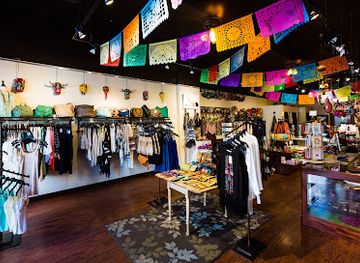
Get your free copy of our complete guide to The Absaroka-Beartooth Wilderness, delivered straight to you.
Everything on this page, from attractions and restaurants to essentials and local phrases, in one PDF you can read offline, print or share.
Already have an account? Sign in
Your The Absaroka-Beartooth Wilderness guide is ready.
We'll send it to · Not you? Sign out

Getting your guide ready…
We are putting together a fresh copy of the The Absaroka-Beartooth Wilderness guide. This can take up to a minute.
This can take a few moments. If your browser asks, choose Allow so the download can start. You'll find the guide in your Downloads folder.
Nothing happened? Download it again
Sorry, the guide is taking longer than usual. Please try again in a minute, or get it by email instead.
The Absaroka-Beartooth Wilderness essentials
Currency and Payment
Safety
Emergency Situations
Do's and Don'ts
Local Tips
From Eve
Local phrases worth knowing
You don't need to get them perfect. A few words go a long way, and locals appreciate the effort.
Basics
| English | Local | Say it |
|---|---|---|
| Hello | Howdy | [HAO-dee] |
| Goodbye | See ya | [SEE ya] |
| Yes | Yep | [YEP] |
| No | Nah | [NAH] |
| Please/You're welcome | Please | [PLEEZ] |
| Thank you | Thanks | [THANKS] |
| Excuse me/Sorry | Pardon me | [PAR-don mee] |
| How are you? | How ya doin'? | [HAO ya DOO-in?] |
| Fine. And you? | Good. And you? | [GOOD. And you?] |
| Do you speak English? | Do ya speak English? | [DO ya SPEEK ING-glish?] |
| I don't understand | I ain't got it | [I AIN'T GOT it] |
Eating & Drinking
| English | Local | Say it |
|---|---|---|
| I'd like to see the menu, please | Can I see the menu? | [CAN I SEE the MEN-yoo?] |
| I don't eat meat | I don't eat meat | [I DON'T EAT MEAT] |
| Cheers! | Cheers! | [CHEERS!] |
| I would like to pay, please | Can I pay, please? | [CAN I PAY, PLEEZ?] |
Emergencies
| English | Local | Say it |
|---|---|---|
| Help! | Help! | [HELP!] |
| Go away! | Get lost! | [GET LOST!] |
| Call the Police! | Call the cops! | [CALL the COPS!] |
| Call a doctor! | Get a doctor! | [GET a DOCTOR!] |
| I'm lost | I'm lost | [I'M LOST] |
| I'm ill | I'm sick | [I'M SICK] |
Shopping
| English | Local | Say it |
|---|---|---|
| I'd like to buy... | I wanna buy... | [I WAN-na BUY...] |
| I'm just looking | Just browsing | [JUST BROW-sing] |
| How much is it? | What’s the price? | [WUT'S the PRICE?] |
| That's too expensive | That's pricey | [THAT'S PRICE-ee] |
| Can you lower the price? | Can ya make it cheaper? | [CAN ya MAKE it CHEE-per?] |
Time & Numbers
| English | Local | Say it |
|---|---|---|
| What time is it? | What time? | [WUT TIME?] |
| It's one o'clock | It's one | [IT'S ONE] |
| Half past (10) | Half past ten | [HAHF PAST TEN] |
| Morning | Morning | [MOR-ning] |
| Afternoon | Afternoon | [AF-ter-NOON] |
| Evening | Evening | [EEV-ning] |
| Yesterday | Yesterday | [YES-ter-day] |
| Today | Today | [TO-day] |
| Tomorrow | Tomorrow | [TO-mor-row] |
| 1 | One | [ONE] |
| 2 | Two | [TWO] |
| 3 | Three | [THREE] |
| 4 | Four | [FOUR] |
| 5 | Five | [FIVE] |
| 6 | Six | [SIX] |
| 7 | Seven | [SEV-en] |
| 8 | Eight | [ATE] |
| 9 | Nine | [NINE] |
| 10 | Ten | [TEN] |
Transport & Directions
| English | Local | Say it |
|---|---|---|
| Where's a/the...? | Where's the...? | [WEAR'S the...?] |
| What's the address? | What’s the address? | [WUT'S the AD-dress?] |
| Can you show me (on the map)? | Can you point it out? | [CAN you POINT it OUT?] |
| When's the next (bus)? | When’s the next bus? | [WEN'S the NEXT BUS?] |
| A ticket (to ....) | One ticket to... | [ONE TICKET to...] |
History of The Absaroka-Beartooth Wilderness
Indigenous Homelands and Seasonal Travel
The Absaroka and Beartooth ranges form part of the long-established cultural and travel geography of Indigenous peoples, including the Apsáalooke, Northern Cheyenne, Shoshone and Bannock. Mountain valleys, passes, lakes and hunting grounds were connected to seasonal movement, trade and cultural knowledge rather than divided according to modern wilderness boundaries. Visitors should understand that the area's designation as public land does not erase these enduring relationships. Place names, oral histories and modern tribal perspectives remain important to interpreting the landscape.
Exploration of the Northern Rockies, 1860s–1870s
Euro-American mapping and scientific exploration increased after the Civil War, as survey parties travelled through the northern Rocky Mountains and recorded peaks, valleys, geology and routes. The 1871 Hayden Geological Survey helped bring the broader Yellowstone and Absaroka region to national attention, although the mountains had long been known and used by Indigenous communities. Subsequent maps and reports encouraged mineral prospecting, commercial travel and later tourism in valleys surrounding what is now the wilderness.
Mining and Settlement around Cooke City and Red Lodge
Gold, silver, copper and other minerals drew prospectors to the surrounding mountains during the late nineteenth century. Cooke City developed as a mining settlement near the north-eastern approach, while Red Lodge and the Carbon County valleys became associated with mining, ranching and transport. Most intensive development occurred outside the present wilderness boundary, but its history explains the old roads, claims, cemeteries and industrial traces found in gateway communities and neighbouring national-forest lands.
National Forest Administration, 1890s–1900s
Federal forest reserves were established in the northern Rocky Mountains during the conservation reforms of the late nineteenth and early twentieth centuries. Their purposes included regulating timber, watersheds, grazing and mineral use, creating an administrative framework that eventually shaped the Absaroka-Beartooth area. The modern wilderness lies largely within the Custer Gallatin National Forest on the Montana side, while adjoining lands are managed under different designations and rules. This layered public-land history is why roadless country sits beside working forests, highways and historic mining districts.
The Beartooth Highway and Scenic Access
The Beartooth Highway, designated US 212, was constructed across the high country between Red Lodge and Cooke City in the twentieth century and later became renowned as a dramatic mountain road. It does not run through the wilderness itself, but it transformed access to the surrounding ranges and made alpine scenery available to visitors who were not undertaking a backpacking journey. Seasonal snow clearance, severe weather and its high elevation remain central to the road's character.
Wilderness Protection in 1978
The Absaroka-Beartooth Wilderness was created in 1978 through the Endangered American Wilderness Act, protecting a large expanse of roadless country in Montana and a connected portion extending into Wyoming. The designation limits roads, mechanised access and commercial development while allowing carefully regulated traditional uses such as hiking, horseback travel, fishing and hunting. It represents the outcome of a wider American conservation movement that sought to preserve intact ecosystems and natural quiet for future generations.
Modern Conservation and Recreation
Today the wilderness is managed as part of a broader network of public lands surrounding Yellowstone National Park, the Custer Gallatin National Forest and the Shoshone National Forest. Management balances ecological protection with backpacking, climbing, horse use, fishing, hunting and scientific monitoring. Climate change, wildfire, shrinking snow seasons, trail erosion and pressure at popular trailheads have made low-impact travel increasingly important. The region's contemporary history is therefore shaped as much by stewardship and access decisions as by earlier mining and exploration.
The Absaroka-Beartooth Wilderness in Photos
Browse through our photo collection highlighting the charm and character of the destination.
Neighbouring regions of The Absaroka-Beartooth Wilderness
The closest regions to The Absaroka-Beartooth Wilderness, if you have time for more than one.
-
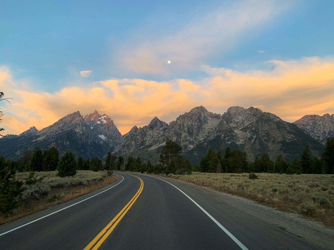 The Beartooth Mountains
Explore Montana’s Beartooth Mountains for alpine highways, granite peaks, wilderness trails, wildlife and small mountain communities near Yellowstone.
-

-

-

-


Swipe for more regions
Explore more
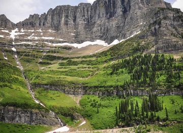
Explore more of Montana
Discover Montana: A Treasure State of majestic landscapes, outdoor adventures, and rich cultural heritage. Explore Glacier and Yellowstone, charming towns, and historic sites.
Explore Montana