

Free Mahakali Zone Travel Guide & Mobile App
Explore Mahakali Zone with free travel guides. Discover regional history, expert tips, proposed trips, and audio guides on web or mobile app.


Explore Mahakali Zone in far-western Nepal for Shuklaphanta’s wildlife, hill temples, borderland culture and remote Himalayan landscapes.
Read more about Mahakali Zone
When is the best time to visit Mahakali Zone?
Best: March–April, October · 20–24°C| Month | High (°C) | Rainfall (mm) |
|---|---|---|
| January | 15 | 10 |
| February | 17 | 12 |
| March (best) | 20 | 15 |
| April (best) | 23 | 25 |
| May | 27 | 55 |
| June | 30 | 105 |
| July | 31 | 205 |
| August | 30 | 185 |
| September | 28 | 105 |
| October (best) | 24 | 55 |
| November | 20 | 15 |
| December | 16 | 10 |
Getting to and around Mahakali Zone
How to get there
Transportation
Best attractions in Mahakali Zone
The former Mahakali Zone offers three distinctly different types of attraction. In lowland Kanchanpur, Shuklaphanta National Park is the outstanding draw, combining open grassland, sal forest, wetlands and productive bird habitat with opportunities to see swamp deer, rhinoceros and other wildlife. The middle hills around Dadeldhura and Baitadi are better suited to visitors interested in temples, historic routes, village landscapes, panoramic ridges and everyday rural life. Religious sites such as Ugratara Temple near Dadeldhura and Malikarjun Temple in Darchula remain important pilgrimage destinations as well as cultural landmarks. In the north, Api Nampa Conservation Area provides a gateway to high mountain scenery, alpine valleys and demanding trekking routes, though facilities are limited and arrangements should be made locally. River journeys are not a conventional tourist activity, but the Mahakali and its tributary valleys shape the region’s landscapes and settlements. Walking, birdwatching, wildlife excursions, photography and cultural visits are more realistic pursuits than a fast-moving checklist of sights.
-
Park
Tikapur Park
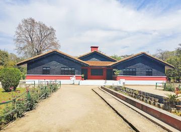
Experience the serene beauty of Tikapur Park, a lush green oasis in Tikapur, perfect for family outings, picnics, and outdoor activities amidst nature.
-
Tourist attraction
Sales manager
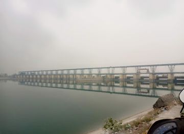
Discover the breathtaking views and cultural richness of Sarda Chungi, a scenic gem near the India-Nepal border, perfect for nature lovers and adventure seekers.
-
Historical landmark
Nasal Chowk
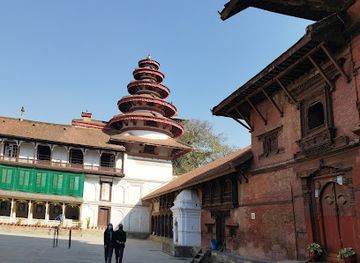
Explore the historical depths of Nasal Chowk in Kathmandu, where rich culture and stunning architecture come together to create an unforgettable experience.
-
National park
Khaptad National Park
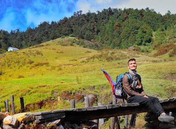
Experience the serene landscapes and rich biodiversity of Khaptad National Park, a hidden treasure in northwestern Nepal, perfect for adventure and tranquility.
Best landmarks in Mahakali Zone
The Mahakali River is the region’s defining geographical landmark, forming much of Nepal’s western boundary and giving the former zone its name. Its valley narrows dramatically towards Darchula, where bridges, crossings and riverside settlements express the area’s long-standing borderland character. In Dadeldhura, Amargadhi Fort recalls the strategic importance of the western hills during the period of Gorkha expansion and later frontier politics. Ugratara Temple, associated with the town of Dadeldhura, is among the region’s significant religious landmarks and draws pilgrims from surrounding districts. The temple complex of Malikarjun in Darchula holds comparable spiritual importance in the mountain north. Kanchanpur’s most recognisable natural landmark is the broad grassland and forest landscape of Shuklaphanta National Park, whose open habitats differ sharply from the densely settled Terai outside the protected area. In the high north, the Api and Nampa mountain landscapes provide a more remote monumental setting, visible through arduous journeys rather than easy roadside viewpoints.
-
Hindu temple
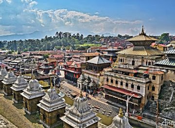
Pashupatinath Temple
Explore the spiritual heart of Nepal at Pashupatinath Temple, a UNESCO World Heritage Site renowned for its stunning architecture and vibrant rituals.
-
Plaza
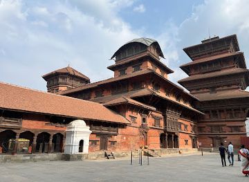
Kathmandu Durbar Square
Explore the historical and cultural heart of Kathmandu at Durbar Square, a UNESCO World Heritage Site filled with stunning architecture and vibrant local culture.
-
Historical landmark
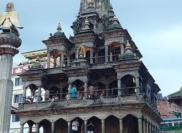
Patan Darbar Square
Explore Patan Darbar Square, a UNESCO World Heritage Site reflecting the grandeur of medieval Nepal with intricate architecture and rich cultural heritage.
-
Tourist attraction
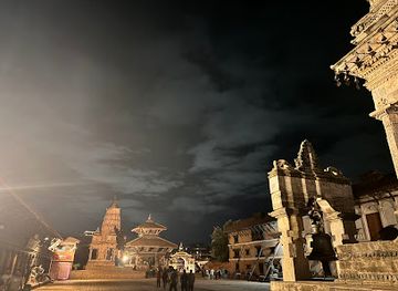
Bhaktapur Durbar Square
Explore the historic charm and cultural richness of Bhaktapur Durbar Square, a UNESCO World Heritage site that celebrates Nepal's architectural beauty.
Explore Mahakali Zone on the map
Plan your trip on one map. See where the top cities, national parks and sights are, and book hotels and experiences in a few clicks.
Best hotels in Mahakali Zone
Best restaurants in Mahakali Zone
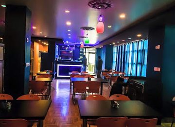
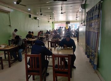
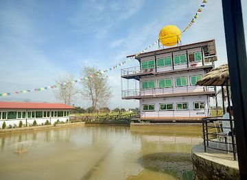
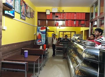
Food in the former Mahakali Zone is primarily regional and home-style, with rice, lentils, vegetables, pickles, flatbreads and seasonal greens forming the basis of many meals. In Kanchanpur and Bhimdatta, visitors will find a wider choice of Nepali restaurants, Indian-influenced cooking, tea shops and simple eateries than in the hill districts. Local menus may include dal bhat, tarkari, roti, momo and snacks made from grains or pulses, while food in mountain communities is shaped by altitude, farming conditions and availability. Small roadside restaurants and family-run establishments are useful for experiencing everyday food, although menus can be limited and service times unhurried. In the Terai, fresh produce and borderland culinary influences are more apparent; in Dadeldhura, Baitadi and Darchula, meals are often simpler and more dependent on locally available ingredients. Bottled or treated water is advisable, particularly when travelling beyond established towns, and visitors should carry snacks on long road journeys.
-
Restaurant
Galaxy Cafe
Experience delightful dining at Galaxy Cafe in Dhangadhi—where local flavors meet global cuisine in a cozy atmosphere.
-
Restaurant
Hotel Raino
Discover the authentic flavors of Nepal at Hotel Raino – where traditional cuisine meets warm hospitality.
-
Restaurant
Pokhari cottage
Experience authentic Nepalese cuisine at Pokhari Cottage in Bhimdatta - where flavor meets tranquility.
-
Restaurant
Mahabir Bhojanalaya
Discover authentic Nepalese flavors at Mahabir Bhojanalaya in Dhangadhi—where every meal tells a story.
Best bars in Mahakali Zone
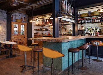
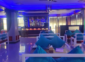
Evening life in the former Mahakali Zone is generally low-key and centred on tea shops, family restaurants, hotel dining rooms and traditional local gathering places rather than a large nightclub scene. Kanchanpur and Bhimdatta have the broadest choice of cafés, casual restaurants and places serving beer, while Dadeldhura and the district towns offer a smaller selection of hotel bars and social venues. In Baitadi and Darchula, evenings are more likely to revolve around conversation, food and local community life than late-night entertainment. Seasonal fairs, temple festivals and cultural programmes can bring music and public activity to towns, but dates and arrangements vary. Visitors should respect local religious observance, avoid assuming that alcohol is available everywhere and plan transport back to rural accommodation before dark.
-
Bar
OLI RESTAURANT & HOOKAH BAR
Discover OLI Restaurant & Hookah Bar in Bhimdatta—where culinary excellence meets vibrant nightlife and a relaxed hookah experience.
-
Pub
The CobraZ Dance Bar
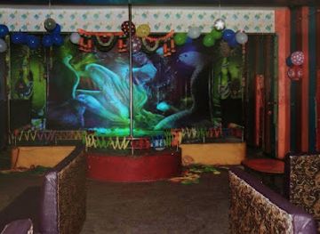
Discover an electrifying nightlife experience at The CobraZ Dance Bar in Bhimdatta, where vibrant music meets a fun-loving atmosphere.
-
Bar
Chicken station
Discover the vibrant flavors of Nepal at Chicken Station, a beloved bar in Bhimdatta offering delicious chicken dishes in a welcoming setting.
-
 Bar
BarAman hotel
Discover the luxurious Aman Hotel in Daijee, where elegance meets relaxation amidst stunning surroundings and top-tier service.
Best nightclubs in Mahakali Zone
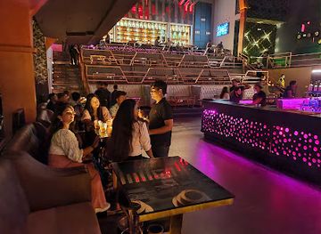
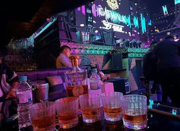
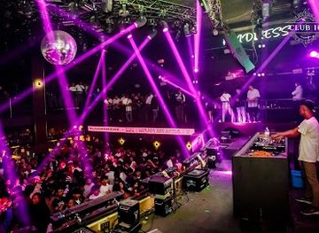
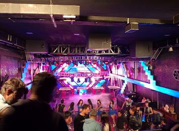
Evening life in the former Mahakali Zone is generally low-key and centred on tea shops, family restaurants, hotel dining rooms and traditional local gathering places rather than a large nightclub scene. Kanchanpur and Bhimdatta have the broadest choice of cafés, casual restaurants and places serving beer, while Dadeldhura and the district towns offer a smaller selection of hotel bars and social venues. In Baitadi and Darchula, evenings are more likely to revolve around conversation, food and local community life than late-night entertainment. Seasonal fairs, temple festivals and cultural programmes can bring music and public activity to towns, but dates and arrangements vary. Visitors should respect local religious observance, avoid assuming that alcohol is available everywhere and plan transport back to rural accommodation before dark.
-
Night club
LOD - Lord of the Drinks
Explore the vibrant nightlife at Lord of the Drinks, Bhagwatisthan's premier night club offering exquisite cocktails and unforgettable parties.
-
Night club
Club Catwalk
Discover the vibrant nightlife of Pokhara at Club Catwalk, where music, dance, and delicious cuisine come together for an unforgettable experience.
-
Night club
Club Sixteen
Experience the vibrant nightlife at Club Sixteen, the ultimate destination for fun and entertainment in Pokhara.
-
Disco club
Club Omnia
Discover the electrifying nightlife of Club Omnia in Kathmandu's Thamel district, where vibrant music and a lively atmosphere come alive.
Best shops in Mahakali Zone
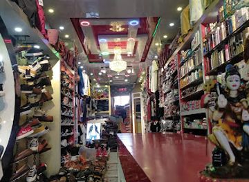
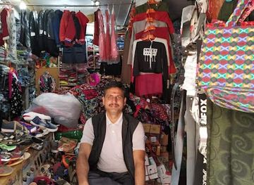
Shopping is practical and locally focused rather than centred on large retail districts. Bhimdatta and other Kanchanpur market areas offer clothing, household goods, snacks, spices, mobile services and everyday supplies, while Dadeldhura and Baitadi serve as commercial hubs for surrounding hill villages. In Darchula, markets reflect the needs of a remote mountain and border district, with a limited but useful range of provisions and travel equipment. Visitors can look for locally produced pickles, dried foods, grains, spices and small household crafts, although availability varies by season and town. Weekly markets and festival gatherings may provide better opportunities to see regional produce and traditional goods than permanent souvenir shops. Purchases should be modest and practical: textiles, handmade items or packaged foods are more appropriate regional mementoes than wildlife products or antiquities. Carry cash for smaller vendors, check the legality of anything made from plants or animals, and do not remove religious objects or archaeological material.
-
Electronics store
Bagbazar
Explore the heart of Amargadhi's electronics scene at Bagbazar, offering a diverse range of gadgets and accessories for every tech enthusiast.
-
Furniture store
Shivshakti Furniture Industry
Discover exquisite handcrafted furniture and rich artistry at Shivshakti Furniture Industry in Patan, Nepal.
-
Store
Sahastraling trade and supliers
Explore Amargadhi's vibrant fashion scene at Sahastraling Trade and Suppliers, your go-to destination for unique clothing and accessories.
-
Home goods store
Pant Steel Bhandar
Explore unique home goods at Pant Steel Bhandar in Amargadhi, offering a blend of quality craftsmanship and local culture.
Get your free copy of our complete guide to Mahakali Zone, delivered straight to you.
Everything on this page, from attractions and restaurants to essentials and local phrases, in one PDF you can read offline, print or share.
Already have an account? Sign in
Your Mahakali Zone guide is ready.
We'll send it to · Not you? Sign out

Getting your guide ready…
We are putting together a fresh copy of the Mahakali Zone guide. This can take up to a minute.
This can take a few moments. If your browser asks, choose Allow so the download can start. You'll find the guide in your Downloads folder.
Nothing happened? Download it again
Sorry, the guide is taking longer than usual. Please try again in a minute, or get it by email instead.
Mahakali Zone essentials
Currency and Payment
Safety
Emergency Situations
Do's and Don'ts
Local Tips
From Eve
Local phrases worth knowing
You don't need to get them perfect. A few words go a long way, and locals appreciate the effort.
Basics
| English | Local | Say it |
|---|---|---|
| Hello | नमस्ते | [Namaste] |
| Goodbye | बिदाई | [Bidaai] |
| Yes | हो | [Ho] |
| No | होइन | [Hoin] |
| Please/You're welcome | कृपया/स्वागतम् | [Kripaya/Swagatam] |
| Thank you | धन्यवाद | [Dhanyavad] |
| Excuse me/Sorry | माफ गर्नुहोस् | [Maaf Garnuhos] |
| How are you? | तिमीलाई कस्तो छ? | [Timilai Kasto Chha?] |
| Fine. And you? | ठिक छ। र तिमी? | [Thik Chha. Ra Timi?] |
| Do you speak English? | तिमीलाई अङ्ग्रेजी बोल्न आउँछ? | [Timilai Angreji Bolna Aunchha?] |
| I don't understand | म बुझ्दिन | [Ma Bujhdina] |
Eating & Drinking
| English | Local | Say it |
|---|---|---|
| I'd like to see the menu, please | म मेनु देख्न चाहन्छु, कृपया | [Ma Menu Dekhna Chahanchhu, Kripaya] |
| I don't eat meat | म मासु खाँदैन | [Ma Maasu Khandaina] |
| Cheers! | सुप्रभात! | [Suprabhat!] |
| I would like to pay, please | म तिर्न चाहन्छु, कृपया | [Ma Tirna Chahanchhu, Kripaya] |
Emergencies
| English | Local | Say it |
|---|---|---|
| Help! | मदद गर! | [Madad Gar!] |
| Go away! | दूर जाऊ! | [Dur Jau!] |
| Call the Police! | पुलिसलाई फोन गर्नुहोस्! | [Polislai Phone Garnuhos!] |
| Call a doctor! | डाक्टरलाई फोन गर्नुहोस्! | [Daktar Lai Phone Garnuhos!] |
| I'm lost | म हराएको छु | [Ma Harayeko Chu] |
| I'm ill | म बिरामी छु | [Ma Birami Chu] |
Shopping
| English | Local | Say it |
|---|---|---|
| I'd like to buy... | म किन्न चाहन्छु... | [Ma Kinna Chahanchhu...] |
| I'm just looking | म त केवल हेरिरहेको छु | [Ma Ta Keval Herirahi Chu] |
| How much is it? | यो कति मूल्यको छ? | [Yo Kati Mulyako Chha?] |
| That's too expensive | यो धेरै महँगो छ | [Yo Dherai Mahango Chha] |
| Can you lower the price? | तपाईं मूल्य घटाउन सक्नुहुन्छ? | [Tapai Muly Ghatna Saknuhunchha?] |
Time & Numbers
| English | Local | Say it |
|---|---|---|
| What time is it? | यो कति बजेको छ? | [Yo Kati Bajeko Chha?] |
| It's one o'clock | यो एक बज्यो | [Yo Ek Bajyo] |
| Half past (10) | साढे (१०) | [Saadhe (10)] |
| Morning | बिहान | [Bihan] |
| Afternoon | दिउँसो | [Diu'nsu] |
| Evening | साँझ | [Sanjha] |
| Yesterday | हिजो | [Hijo] |
| Today | आज | [Aaja] |
| Tomorrow | भोली | [Bholi] |
| 1 | १ | [1] |
| 2 | २ | [2] |
| 3 | ३ | [3] |
| 4 | ४ | [4] |
| 5 | ५ | [5] |
| 6 | ६ | [6] |
| 7 | ७ | [7] |
| 8 | ८ | [8] |
| 9 | ९ | [9] |
| 10 | १० | [10] |
Transport & Directions
| English | Local | Say it |
|---|---|---|
| Where's a/the...? | कहाँ छ ...? | [Kahaan Chha...?] |
| What's the address? | ठेगाना के हो? | [Thegana Ke Ho?] |
| Can you show me (on the map)? | तपाईं मलाई देखाउन सक्नुहुन्छ (नक्सामा)? | [Tapai Malai Dekhauna Saknuhunchha (Naksama)?] |
| When's the next (bus)? | अर्को (बस) कहिले छ? | [Arko (Bas) Kahile Chha?] |
| A ticket (to ....) | एक टिकट (लाई ...) | [Ek Ticket (Lai...)] |
History of Mahakali Zone
Early Settlement and Himalayan Trade Routes
The valleys and ridges of far-western Nepal have long been inhabited by communities whose livelihoods combined agriculture, pastoralism, forest use and regional exchange. The Mahakali River corridor connected the hills with the plains and provided routes towards Kumaon and other parts of the western Himalaya. Archaeological knowledge is less extensive than in Nepal’s major urban centres, but the region’s temples, settlement patterns and oral traditions point to long-established cultural links across the present-day Nepal–India frontier.
Medieval Hill Principalities and the Doti Tradition
Before the expansion of the Gorkha kingdom, much of western Nepal was associated with the Doti kingdom and related small hill principalities. Their influence extended across parts of the region through local rulers, landholding families, religious institutions and fortified settlements. The legacy survives in the Doteli language and cultural traditions, in temple networks and in the historic importance of places such as Dadeldhura and Baitadi. Political authority was often dispersed, shaped by difficult terrain and valley-to-valley connections.
Gorkha Expansion and Incorporation into Nepal
During the late eighteenth century, the expanding Gorkha state brought the western hill territories into the kingdom that became modern Nepal. This process altered systems of taxation, military recruitment and administration while incorporating existing local elites and religious institutions into a wider state structure. The far west became strategically important because of its proximity to Kumaon and the routes leading towards the western frontier. Fortified positions and ridge settlements reflect the political and military pressures of this period.
The Anglo-Nepalese War and the Sugauli Settlement
The Anglo-Nepalese War of 1814–16 had major consequences for Nepal’s western frontier. Following the war, the Treaty of Sugauli required Nepal to surrender extensive territory west of the Mahakali River, including areas that are now in India. The river consequently became an especially significant boundary, although cultural and family ties continued across it. The settlement helped define the territorial context in which modern Darchula, Kanchanpur and the adjoining Indian borderlands developed.
Rana Rule, Administration and Labour Migration
Under the Rana system, the far-western hills remained distant from Nepal’s political centre, with limited roads, formal education and state infrastructure. Seasonal movement for work, military service and trade became important sources of income, and migration across the open Nepal–India border shaped household economies and cultural exchange. This history remains visible in remittance-supported buildings, family networks spanning both sides of the frontier and the continuing movement between hill villages, the Terai and Indian towns.
Road Building and the Changing Far West
Road construction and the expansion of public services accelerated during the twentieth and early twenty-first centuries, linking the Terai more closely with the western hills. Kanchanpur became an important transport and commercial gateway, while roads progressively reached towns in Dadeldhura, Baitadi and Darchula. These connections improved access to markets, schools and healthcare but also exposed steep terrain to landslides and environmental pressure. The contrast between new roads and older foot trails is one of the region’s defining modern features.
From Development Zone to Federal Province
Mahakali Zone was one of Nepal’s former fourteen administrative zones, a system used until the country’s federal restructuring. The 2015 Constitution replaced zones with provinces, and the four districts formerly grouped within Mahakali became part of Sudurpashchim Province. The historic name still appears in older maps, local references and public memory, but travellers should use current district and provincial administration when arranging permits, transport or official services.
Mahakali Zone in Photos
Browse through our photo collection highlighting the charm and character of the destination.
Neighbouring regions of Mahakali Zone
The closest regions to Mahakali Zone, if you have time for more than one.
-

-

-

-

-


Swipe for more regions
Explore more

Explore more of Nepal
Discover Nepal: A land of towering peaks, spiritual harmony, and vibrant culture, offering endless adventures and serene escapes for every traveler.
Explore Nepal