

Free Seti Zone Travel Guide & Mobile App
Explore Seti Zone with free travel guides. Discover regional history, expert tips, proposed trips, and audio guides on web or mobile app.


Explore Seti Zone in western Nepal for Khaptad’s hills, Tharu culture, river plains, pilgrimage sites and remote Himalayan journeys.
Read more about Seti Zone
When is the best time to visit Seti Zone?
Best: March–April, October · 23–27°C| Month | High (°C) | Rainfall (mm) |
|---|---|---|
| January | 15 | 20 |
| February | 17 | 24 |
| March (best) | 23 | 29 |
| April (best) | 27 | 38 |
| May | 32 | 52 |
| June | 34 | 69 |
| July | 34 | 85 |
| August | 33 | 82 |
| September | 31 | 69 |
| October (best) | 27 | 52 |
| November | 21 | 35 |
| December | 15 | 26 |
Getting to and around Seti Zone
How to get there
Transportation
Destinations in Seti Zone
Resorts, valleys and scenic spots worth a trip of their own.

Swipe for more destinations
Best attractions in Seti Zone
Seti’s attractions range from lowland wetlands and river landscapes to forested ridges and high pilgrimage country. Around Kailali, Ghodaghodi Lake is a notable wetland complex with birdlife and cultural importance, while Dhangadhi offers markets, local food and a practical introduction to far-western urban life. The plains and foothills are also a useful setting for learning about Tharu culture, particularly through community-led visits and locally interpreted traditions. In the hills, Khaptad National Park is the region’s principal protected landscape, combining open meadows, forests, seasonal flowers and spiritual associations. Walking routes are generally quieter and more self-sufficient than Nepal’s famous trekking circuits. Bajura’s Badimalika area is important for pilgrimage and dramatic mountain scenery, while Bajhang provides access to remote highland landscapes and routes towards the Himalayan frontier. Historic temples, district bazaars, terraced farms and roadside viewpoints add texture to journeys between the main centres. Facilities are modest outside Dhangadhi, so the region suits visitors prepared for long road transfers, basic accommodation and locally organised outdoor travel.
-
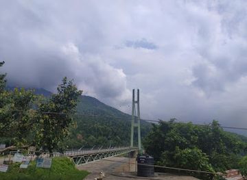
Bridge
Karnali Bridge
Discover the breathtaking Karnali Bridge in Lamki Chuha, where stunning views meet rich cultural experiences, all set against the backdrop of Nepal's natural beauty.
-
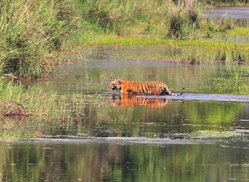
National park
Bardiya National Park
Explore the majestic Bardiya National Park in Nepal, a wildlife haven with diverse ecosystems, thrilling safaris, and cultural experiences.
-
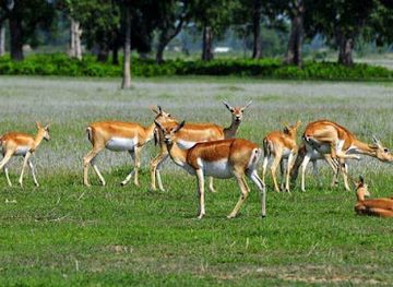
National park
Shuklaphanta National Park
Explore the breathtaking landscapes and diverse wildlife of Shuklaphanta National Park, a hidden gem in Nepal’s wilderness.
-
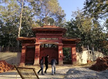
Historical landmark
Kankre Bihar Surkhet
Discover the serene beauty and spiritual significance of Kankre Bihar Surkhet, a must-visit historical landmark for cultural enthusiasts.
Best landmarks in Seti Zone
The open ridges and meadows of Khaptad are Seti’s most recognisable natural landmark, combining highland scenery with the spiritual legacy associated with Khaptad Baba, the Hindu spiritual teacher who spent much of his later life in the area. Badimalika in Bajura is a major pilgrimage landmark, set amid remote mountain terrain and associated with the goddess Malika; reaching it involves a demanding journey rather than a conventional roadside visit. In the lower region, Ghodaghodi Lake is an important wetland and cultural landmark, its waters and surrounding forest forming a notable contrast with the built-up environment of Dhangadhi. The Seti River and its tributary valleys provide the geographical framework for the region, while the old hill settlements around Doti, Achham and Bajhang preserve the visual character of terraced slopes, temples and compact bazaars. These landmarks are significant less for monumental architecture than for the relationship between landscape, belief, settlement and travel routes.
-
Plaza
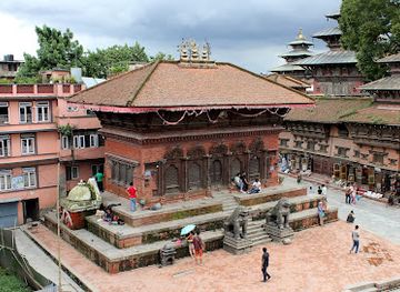
Kathmandu Durbar Square
Explore the enchanting Kathmandu Durbar Square, a UNESCO World Heritage Site showcasing ancient temples, vibrant culture, and rich history in the heart of Nepal.
-
Historical landmark
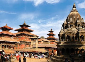
Patan Darbar Square
Explore the exquisite architectural heritage and vibrant culture of Patan Darbar Square, a highlight of Nepal's historical landmarks.
-
Tourist attraction
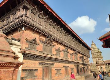
Bhaktapur Durbar Square
Discover the rich cultural tapestry and historical splendor of Bhaktapur Durbar Square, a UNESCO World Heritage Site in Nepal, filled with stunning architecture and local traditions.
-
Buddhist temple
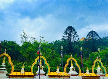
Swoyambhu Mahachaitya
Discover the ancient spiritual heart of Nepal at Swoyambhu Mahachaitya, a stunning Buddhist temple that offers breathtaking views and rich cultural experiences.
Explore Seti Zone on the map
Plan your trip on one map. See where the top cities, national parks and sights are, and book hotels and experiences in a few clicks.
Best hotels in Seti Zone
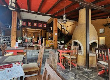
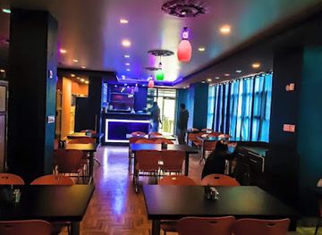
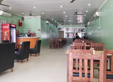
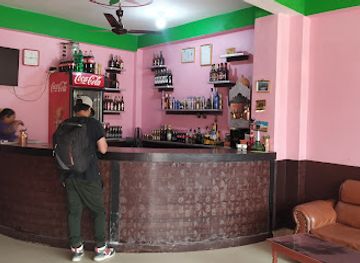
Best restaurants in Seti Zone
Dining in Seti reflects the contrast between the Terai and the hills. Dhangadhi has the broadest selection, from Nepalese restaurants and cafés to Indian-influenced and everyday South Asian cooking. Dal bhat remains the dependable staple, while hill households may serve dhido, buckwheat or millet preparations, gundruk, pickles, beans, leafy greens and seasonal vegetables. Sel roti and other festival or snack foods are common across Nepal, though preparation varies from place to place. In Kailali, Tharu culinary traditions add distinctive dishes and ingredients, including locally prepared fish, forest produce and, in some communities, ghonghi or freshwater snails. Availability is seasonal and not every visitor will encounter the same menu. Rural eating is usually simple and home-style, with tea, rice, lentils and vegetable dishes forming the basis of meals. Markets and small eateries are often more revealing than formal dining rooms, while visitors heading into Khaptad or Badimalika should carry snacks and confirm food arrangements in advance.
-
Italian
Caffe Concerto
Experience authentic Italian cuisine at Caffe Concerto in Pokhara – where every dish tells a story!
-
Restaurant
Galaxy Cafe
Discover the flavors of Nepal at Galaxy Cafe, where cozy ambiance meets delicious cuisine in the heart of Dhangadhi.
-
Restaurant
Hotel Raino
Experience authentic Nepalese flavors at Hotel Raino in Dhangadhi—home of the unique industrialized thali system.
-
Restaurant
Best dish of chisapani , karnali
Experience authentic Nepali cuisine at Best Dish of Chisapani in Karnali - where every bite tells a story.
Best bars in Seti Zone
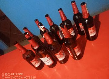
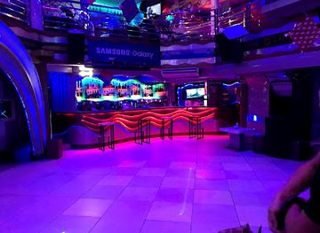
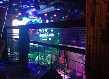
Seti does not have a large, concentrated club scene. Dhangadhi provides the most developed evening life, with hotel lounges, cafés, restaurants, informal bars and occasional live music, while local markets and busy streets are more prominent than purpose-built nightlife districts. In hill towns such as Dipayal Silgadhi, Mangalsen, Martadi and Chainpur, evenings generally centre on tea shops, family restaurants and small local gathering places rather than late-night venues. Rural areas become quiet after dark, particularly near protected landscapes and pilgrimage routes. Visitors should expect limited choice, earlier closing times and reduced services outside Dhangadhi. Alcohol is available in some establishments, but it is not necessary for engaging with local culture; respectful conversation, food and community events are often more characteristic of the region’s evening experience.
-
Wine bar
Dajubhai wine shop
Discover the rich flavors of local wines at Dajubhai Wine Shop in Dhangadhi, a cozy bar perfect for unwinding and socializing.
-
Bar
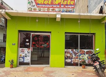
HOT PLATE RESTURANT AND CAFE
Experience the local flavors and vibrant atmosphere at Hot Plate Restaurant and Cafe in Attariya, where food and fun come together.
-
Bar
Palainte
Experience the lively bar scene in Palainte, where great drinks and a welcoming atmosphere come together for an unforgettable night out.
-
Bar
Chansen wine shop
Discover the vibrant wine culture of Nepal at Chansen Wine Shop in Malatikot, offering a unique selection of local and international wines.

Best nightclubs in Seti Zone
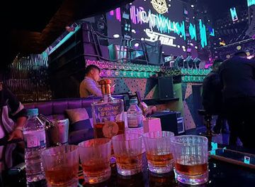
Seti does not have a large, concentrated club scene. Dhangadhi provides the most developed evening life, with hotel lounges, cafés, restaurants, informal bars and occasional live music, while local markets and busy streets are more prominent than purpose-built nightlife districts. In hill towns such as Dipayal Silgadhi, Mangalsen, Martadi and Chainpur, evenings generally centre on tea shops, family restaurants and small local gathering places rather than late-night venues. Rural areas become quiet after dark, particularly near protected landscapes and pilgrimage routes. Visitors should expect limited choice, earlier closing times and reduced services outside Dhangadhi. Alcohol is available in some establishments, but it is not necessary for engaging with local culture; respectful conversation, food and community events are often more characteristic of the region’s evening experience.
-
Night club
LOD - Lord of the Drinks
Discover the vibrant nightlife at LOD - Lord of the Drinks, a premier night club in Thamel, Kathmandu, offering unforgettable experiences and exquisite drinks.
-
Night club
Club Catwalk
Dive into the ultimate nightlife experience at Club Catwalk, Pokhara's premier night club known for its electrifying ambiance and diverse crowd.
-
Disco club
Ibyza Lounge & Disco
Discover the vibrant nightlife of Kathmandu at Ibyza Lounge & Disco, where live music, delicious cuisine, and an electrifying atmosphere await.
-
Night club
The Treasure Lounge
Experience the vibrant nightlife of Pokhara at The Treasure Lounge, where music and good vibes unite for an unforgettable evening.

Best shops in Seti Zone
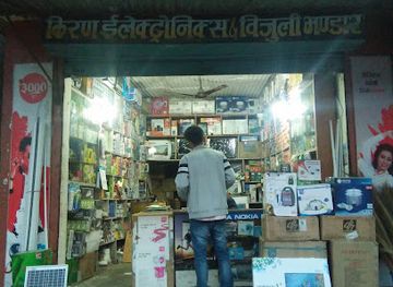
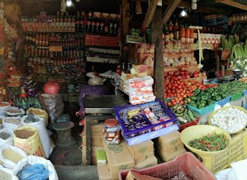
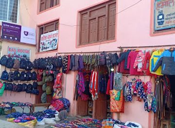
Dhangadhi is Seti’s main shopping centre, with busy commercial streets, department-style stores, clothing shops, pharmacies, mobile retailers and markets serving customers from Kailali and the hill districts. It is the most practical place to buy trekking supplies, basic medicines, snacks and cash before travelling north. Smaller district headquarters such as Dipayal Silgadhi, Mangalsen, Martadi and Chainpur have utilitarian markets rather than dedicated tourist retail areas. Look for local grains, pulses, spices, pickles, tea, bamboo or woven goods and seasonal agricultural produce, though quality and availability vary. Tharu-inspired crafts and locally made textiles may be found through community organisations or cultural programmes rather than permanent souvenir shops. Visitors should distinguish genuinely local products from mass-produced Nepalese souvenirs and should not buy old religious objects or anything presented as archaeological. Bargaining is common in some markets but should be conducted politely, while fixed-price shops and pharmacies generally offer less scope for negotiation.
-
Electronics store
Kiran Electronics & Bijuli Bhandar
Explore Kiran Electronics & Bijuli Bhandar in Dipayal Silgadhi for the latest in electronics, expert advice, and competitive prices.
-
Market
K Darsyu Gaupalika 5 Sedikhola bajhang
Discover the vibrant K Darsyu Gaupalika Market in Sedikhola Banjh, a hub for school supplies and local culture, perfect for tourists seeking authenticity.
-
Fruit and vegetable store
Jessika Vegetable And Fruits Shop
Discover fresh produce and local flavors at Jessika Vegetable and Fruits Shop in Badimalika - a vibrant market experience for every traveler.
-
Shopping mall
Saarika Bag House
Discover the unique charm of Saarika Bag House, a must-visit shopping destination in Jayaprithvi, offering exquisite bags and accessories.
Get your free copy of our complete guide to Seti Zone, delivered straight to you.
Everything on this page, from attractions and restaurants to essentials and local phrases, in one PDF you can read offline, print or share.
Already have an account? Sign in
Your Seti Zone guide is ready.
We'll send it to · Not you? Sign out

Getting your guide ready…
We are putting together a fresh copy of the Seti Zone guide. This can take up to a minute.
This can take a few moments. If your browser asks, choose Allow so the download can start. You'll find the guide in your Downloads folder.
Nothing happened? Download it again
Sorry, the guide is taking longer than usual. Please try again in a minute, or get it by email instead.
Seti Zone essentials
Currency and Payment
Safety
Emergency Situations
Do's and Don'ts
Local Tips
From Eve
Local phrases worth knowing
You don't need to get them perfect. A few words go a long way, and locals appreciate the effort.
Basics
| English | Local | Say it |
|---|---|---|
| Hello | नमस्ते | [namaste] |
| Goodbye | अलविदा | [alvida] |
| Yes | हो | [ho] |
| No | होइन | [hoina] |
| Please/You're welcome | कृपया/स्वागतम् | [kripaya/swagatam] |
| Thank you | धन्यवाद | [dhanyabad] |
| Excuse me/Sorry | माफ गर्नुहोस्/सरी | [maaf garnuhos/sari] |
| How are you? | तपाईँलाई कस्तो छ? | [tapaai lai kasto cha?] |
| Fine. And you? | ठिक छ। र तपाईँलाई? | [thik cha. ra tapaai lai?] |
| Do you speak English? | के तपाईँ अङ्ग्रेजी बोल्नुहुन्छ? | [ke tapaai angreji bolnuhunchha?] |
| I don't understand | म बुझ्दिन | [ma bujhdina] |
Eating & Drinking
| English | Local | Say it |
|---|---|---|
| I'd like to see the menu, please | कृपया मीनु देखाउनुस् | [kripaya menu dekhaunus] |
| I don't eat meat | म मांस खाँदिन | [ma maans khadina] |
| Cheers! | चियर्स! | [cheers] |
| I would like to pay, please | कृपया म तिर्न चाहन्छु | [kripaya ma tirna chahanchhu] |
Emergencies
| English | Local | Say it |
|---|---|---|
| Help! | सहायता! | [sahayata] |
| Go away! | दूर जानुहोस्! | [dur jaanuhos] |
| Call the Police! | पुलिसलाई बोलाउनुहोस्! | [pulis lai bolaunuhos] |
| Call a doctor! | डॉक्टरलाई बोलाउनुहोस्! | [doctor lai bolaunuhos] |
| I'm lost | म हराएँ | [ma harae] |
| I'm ill | म बिरामी छु | [ma birami chu] |
Shopping
| English | Local | Say it |
|---|---|---|
| I'd like to buy... | म किन्न चाहन्छु... | [ma kinna chahanchhu] |
| I'm just looking | म केवल हेरिरहेको छु | [ma keval heriraheko chu] |
| How much is it? | यो कति हो? | [yo kati ho?] |
| That's too expensive | त्यो धेरै महँगो छ | [tyo dherai mahango cha] |
| Can you lower the price? | के तपाईँले मूल्य घटाउन सक्नुहुन्छ? | [ke tapaai le moolya ghataun saknuhunchha?] |
Time & Numbers
| English | Local | Say it |
|---|---|---|
| What time is it? | यस समयमा कति भयो? | [yas samaima kati bhayo?] |
| It's one o'clock | यो एक बजे हो | [yo ek baje ho] |
| Half past (10) | साढे (10) | [saadhe (10)] |
| Morning | बिहान | [bihan] |
| Afternoon | मध्याह्न | [madhyahn] |
| Evening | साँझ | [saanjh] |
| Yesterday | हिजो | [hijo] |
| Today | आज | [aaja] |
| Tomorrow | भोलि | [bholi] |
| 1 | १ | [1] |
| 2 | २ | [2] |
| 3 | ३ | [3] |
| 4 | ४ | [4] |
| 5 | ५ | [5] |
| 6 | ६ | [6] |
| 7 | ७ | [7] |
| 8 | ८ | [8] |
| 9 | ९ | [9] |
| 10 | १० | [10] |
Transport & Directions
| English | Local | Say it |
|---|---|---|
| Where's a/the...? | कहाँ छ ...? | [kahan cha ...?] |
| What's the address? | ठेगाना के हो? | [thegana ke ho?] |
| Can you show me (on the map)? | के तपाईँ मलाई देखाउन सक्नुहुन्छ (नक्सामा)? | [ke tapaai malai dekhaun saknuhunchha (naksama)?] |
| When's the next (bus)? | अर्को (बस) कहिले छ? | [arko (bus) kahile cha?] |
| A ticket (to ....) | एक टिकट (....लाई) | [ek ticket (....lai)] |
History of Seti Zone
Early Himalayan and Karnali Cultural Networks
The hills and valleys of Seti have long been connected to wider exchange routes running through western Nepal and the adjoining Himalayan regions. Communities moved between river valleys, forest uplands and trans-Himalayan passes, exchanging salt, grain, wool and other goods. Archaeological evidence and local traditions point to an old pattern of settlement shaped by fertile terraces, water access and pilgrimage routes. Much of the early history is preserved through oral traditions, religious sites and the distribution of older settlements rather than through large monumental remains.
Khas and Medieval Western Kingdoms
During the medieval period, the western hills were influenced by the Khasa-Malla political world associated with the Karnali basin and later by smaller successor kingdoms. Political authority was dispersed among local rulers, landed elites and religious institutions, while fortified settlements and valley routes helped control movement. The legacy of this period can be seen in the use of Nepali language and customs across the hills, in local genealogies and in the many temples and sacred landscapes that remain important to contemporary communities.
The Doti Kingdom and Far-Western Identity
Doti emerged as an important medieval and early modern centre in the far west, with influence extending through parts of the Seti and adjoining regions. Its political history was linked to the wider network of small hill states that existed before the unification of Nepal. Dipayal and surrounding areas retain the strongest historical association with Doti, while regional speech, ritual practices and local traditions continue to reflect a distinct far-western identity. The kingdom’s history is best understood through its relationship with neighbouring states and mountain trade routes.
Gorkha Expansion and Incorporation into Nepal
The expansion of the Gorkha state across western Nepal in the late eighteenth and early nineteenth centuries gradually brought the Seti region into the political framework of modern Nepal. This process altered local systems of authority and connected the hill states more closely to a central administration. Later administrative arrangements grouped the districts into zones and development regions, including Seti Zone with its headquarters at Dhangadhi. Older political identities did not disappear, however, and remain visible in local histories, religious traditions and regional loyalties.
Tharu Communities and the Terai Frontier
The lowland part of Seti, particularly Kailali, has been shaped by Tharu communities whose settlement, farming practices, architecture and social traditions developed in the Terai environment. Forest clearance, agriculture and the creation of roads and towns transformed the plains during the modern period, bringing increased migration from the hills and other parts of Nepal. This has made Kailali culturally diverse while also placing pressure on wetlands, forests and traditional land-use systems. Tharu cultural life remains an important part of the region’s identity.
Modern Roads, Dhangadhi and Regional Change
The twentieth and early twenty-first centuries brought roads, air links, schools, government offices and expanding markets to a region previously separated by difficult terrain. Dhangadhi developed into the principal commercial and administrative centre of far-western Nepal, while roads gradually reached the hill district headquarters. These connections improved access to health care and education but also increased exposure to landslides, traffic disruption and unplanned urban growth. The region’s contemporary economy combines agriculture, government services, trade, migration and cross-border commerce.
From Seti Zone to the Federal Structure
Nepal’s constitutional and administrative restructuring in the 2010s replaced the former zone system with provinces and local governments. The districts historically associated with Seti became part of Sudurpashchim Province, while the zone name continued in everyday geographical and historical usage. This change shifted administrative terminology without erasing regional identities. For travellers, understanding the older name is useful when reading guidebooks, local histories and transport information, even though current official services generally use district, municipality and provincial designations.
Seti Zone in Photos
Browse through our photo collection highlighting the charm and character of the destination.
Neighbouring regions of Seti Zone
The closest regions to Seti Zone, if you have time for more than one.
-

-

-

-

-


Swipe for more regions
Explore more

Explore more of Nepal
Discover Nepal: A land of towering peaks, spiritual harmony, and vibrant culture, offering endless adventures and serene escapes for every traveler.
Explore Nepal