

Manang Travel Guide - Free Web & App
Your ultimate guide to Manang. Discover top landmarks, proposed trips, and local tips. Free on the web or via the Evendo companion app.


Manang, Nepal reveals high Himalayan valleys, Tibetan-influenced villages, Tilicho Lake, Annapurna trekking routes and mountain culture above the Marshyangdi.
Mountain Valleys and High Passes
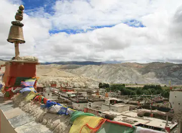
Manang occupies the upper reaches of the Marshyangdi valley in north-central Nepal, within the Annapurna region and close to the Tibetan Plateau. Its landscape rises from steep river gorges and pine forests to dry, wind-swept valleys, glacial lakes and immense mountain walls formed by the Annapurna, Gangapurna and Chulu ranges. The district is extensive rather than compact, with settlements linked by trekking routes and rough mountain roads rather than a conventional urban centre. Manang village, the principal visitor base, stands at high altitude amid fields, mani walls and traditional stone houses, while nearby Braga, Pisang, Khangsar and the remote villages of Nar and Phu each have a distinct character.Read more about Manang
Villages, Monasteries and Living Heritage
Altitude, Weather and Conservation
When is the best time to visit Manang?
Best: April–May, November · 7–19°C| Month | High (°C) | Rainfall (mm) |
|---|---|---|
| January | 2 | 16 |
| February | 5 | 27 |
| March | 8 | 51 |
| April (best) | 14 | 95 |
| May (best) | 19 | 151 |
| June | 23 | 225 |
| July | 23 | 255 |
| August | 22 | 242 |
| September | 19 | 179 |
| October | 12 | 86 |
| November (best) | 7 | 30 |
| December | 3 | 15 |
Getting to and around Manang
How to get there
Transportation
Best attractions in Manang
Manang's principal attractions are its high valleys, traditional settlements and routes into the Annapurna landscape. Manang village provides a base for acclimatisation, with stone houses, monasteries, cultivated terraces and broad views towards Gangapurna and the Chulu ranges. Nearby Braga is known for its historic Buddhist monastery and dramatic position above the valley, while Pisang offers contrasting old and new settlements beneath the Annapurna massif. Side routes lead to Gangapurna Lake and Ice Lake, both demanding high-altitude excursions, and the trail from Khangsar continues towards Tilicho Lake, one of the region's defining mountain lakes. The Nar and Phu valleys offer remote landscapes and distinctive villages for travellers with the necessary permits and preparation. The wider Annapurna Circuit passes through Manang before rising towards Thorong La, linking the district with Mustang, although the pass and its approaches require serious acclimatisation and favourable conditions.
-
Tourist attraction
Upper Pisang Buddhist Temple
Explore the serene Upper Pisang Buddhist Temple, a tranquil retreat offering breathtaking views and a deep dive into Buddhist culture in Nepal's majestic mountains.
-
Tourist attraction
Kajin Sara Lake/ singaar lake
Explore the captivating beauty of Kajin Sara Lake, a serene escape in Chame, Nepal, perfect for nature lovers and adventure seekers alike.
-
Tourist attraction
Tanki Manang
Discover the breathtaking landscapes and rich cultural heritage of Tanki Manang, a hidden gem in Nepal's Annapurna region, perfect for adventurers and nature lovers.
-
Tourist attraction
Deepwater fall
Explore the enchanting Deepwater Falls in Chame, Nepal, where nature's beauty and adventure await amidst lush landscapes and cascading waters.


Best landmarks in Manang
Manang's most significant landmarks are predominantly natural and religious. The Annapurna and Gangapurna ranges form the district's defining skyline, while Gangapurna Lake records the presence of a glacial environment close to Manang village. Tilicho Lake, reached through the Khangsar valley, is a major high-altitude landmark surrounded by steep, dry mountain terrain. Thorong La marks the celebrated high crossing on the Annapurna Circuit, connecting Manang with Mustang when conditions permit. At village level, Braga Monastery, the old settlements of Manang and Pisang, chortens, prayer flags and carved mani walls express the region's Tibetan Buddhist heritage. The narrow valleys of Nar and Phu add distinctive architectural and cultural landmarks, but access is regulated and conditions are remote. Together, these features show how natural geography, religious practice and historic trans-Himalayan movement have shaped Manang's identity.
-
Tourist attraction
Annapurna Conservation Area
Discover the breathtaking landscapes and rich biodiversity of Annapurna Conservation Area, Nepal's premier national park and trekking paradise.
-
Hindu temple
Shree Muktinath Temple
Experience spiritual serenity and breathtaking views at Shree Muktinath Temple, a sacred site for pilgrims and travelers in the heart of the Himalayas.
-
Tour operator
Annapurna Base Camp Trek
Explore the breathtaking beauty and rich culture of the Annapurna Base Camp Trek, a premier destination for adventure seekers in the heart of the Himalayas.
-
Lake
Tilicho Lake
Experience the breathtaking beauty of Tilicho Lake, one of the highest lakes in the world, surrounded by majestic Himalayan peaks.


Explore Manang on the map
Plan your trip on one map. See where the top attractions, landmarks, restaurants and hotels are, and book hotels and experiences in a few clicks.
Best hotels in Manang
Best restaurants in Manang
Dining in Manang is centred on teahouses, lodges and small family-run establishments in villages along the trekking routes rather than on a conventional restaurant scene. Menus commonly combine Nepali staples such as dal bhat, vegetable curries, noodles, soups and momos with simple trekking meals adapted to available supplies. In the higher settlements, food is shaped by altitude, transport constraints and local agriculture, including potatoes, barley, buckwheat, apples and locally produced dairy products where available. Manang and Chame offer the broadest choice, while smaller villages have fewer provisions and may depend on seasonal deliveries. Tea houses are also important social spaces, providing hot drinks and a place to warm up after walking. Travellers with dietary or medical requirements should carry suitable supplementary food and explain their needs clearly before leaving the lower valley.
-
Restaurant
Bob's Bistro & Namaste Thakali Kitchen
Discover the essence of Nepali cuisine at Bob's Bistro & Namaste Thakali Kitchen in Besisahar – where tradition meets taste.
-
Restaurant
Methlang Food Home (best restaurant)
Experience authentic Nepali flavors at Methlang Food Home in Pokhara - a culinary gem for every food lover.
-
Restaurant
Annapurna Restaurant Cafe & Bar
Discover delicious local flavors at Annapurna Restaurant Cafe & Bar in Tanki Manang - a must-visit for every traveler in Nepal's breathtaking Himalayas.
-
Restaurant
four season guest house &restaurant
Discover comfort and culinary delights at Four Season Guest House & Restaurant in Chame – where local flavors meet hospitality.


Best bars in Manang
Manang has little conventional nightlife and no established clubbing district. Evenings are generally spent in teahouse dining rooms or lodge common areas, where trekkers exchange route information, read, play cards and talk with hosts after dark. Some accommodation venues may serve beer or locally available alcoholic drinks, but supplies, licensing and availability vary considerably with altitude and transport conditions. Chame and Manang offer the most likely opportunities for a sociable drink along the trekking route, although the atmosphere remains quiet and shaped by early starts, cold temperatures and mountain travel. In remote villages such as Nar and Phu, evening entertainment is primarily community-based and respectful behaviour around monasteries and residential areas is important.
-
Restaurant
Annapurna Restaurant Cafe & Bar
Discover authentic Nepalese flavors at Annapurna Restaurant Cafe & Bar in Tanki Manang, where warm hospitality meets breathtaking mountain views.
-
Restaurant
Manang
Explore the breathtaking village of Manang, where culinary delights meet stunning Himalayan views in the heart of Nepal.
-
Bar
Lamahi Dang
Experience the lively atmosphere of Lamahi Dang, a vibrant bar in Namarjung where locals and tourists come together to unwind and socialize.
-
Restaurant
Dukki Restaurant & Cottage
Savor authentic Nepali cuisine in a cozy atmosphere at Dukki Restaurant & Cottage, the culinary highlight of Tanki Manang for travelers.


Best nightclubs in Manang
Manang has little conventional nightlife and no established clubbing district. Evenings are generally spent in teahouse dining rooms or lodge common areas, where trekkers exchange route information, read, play cards and talk with hosts after dark. Some accommodation venues may serve beer or locally available alcoholic drinks, but supplies, licensing and availability vary considerably with altitude and transport conditions. Chame and Manang offer the most likely opportunities for a sociable drink along the trekking route, although the atmosphere remains quiet and shaped by early starts, cold temperatures and mountain travel. In remote villages such as Nar and Phu, evening entertainment is primarily community-based and respectful behaviour around monasteries and residential areas is important.
-
Night club
Club Catwalk
Discover the electrifying nightlife at Club Catwalk in Pokhara with exceptional food, music, and an unforgettable atmosphere!
-
Night club
The Treasure Lounge
Discover the electrifying nightlife at The Treasure Lounge in Pokhara, where great music, delicious drinks, and an unforgettable atmosphere await.
-
Night club
Club Sixteen
Experience the electrifying nightlife of Pokhara at Club Sixteen, where vibrant music and good vibes create unforgettable memories.
-
Bar
The New Sky Palace Dance Club
Discover the nightlife of Pokhara at The New Sky Palace Dance Club, your ultimate destination for dancing and entertainment.


Best shops in Manang
Shopping in Manang is limited and practical, with small village shops and trekking lodges supplying snacks, drinks, basic toiletries, batteries, warm clothing and occasional equipment. Manang village and Chame provide the greatest choice, but neither should be treated as a full retail centre, and specialist gear is better purchased in Kathmandu or Pokhara before departure. Visitors may find locally made woollen items, simple handicrafts, dried produce, apples or regional dairy products, although selection and availability are seasonal rather than guaranteed. Buying directly from local producers or small businesses can support mountain households, provided purchases are made respectfully and goods are transported responsibly. Remote valleys such as Nar and Phu have very little retail infrastructure, so food, medicines, cash and equipment should be arranged before entering them.
-
 Electronics store
Maa Computer Mejorganj
Explore the latest in electronics at Maa Computer Mejorganj, a tech haven in Namarjung, Nepal, perfect for all your gadget needs.
-
Store
Annapurna trekking shop
Explore the Annapurna region with confidence - gear up at the Annapurna Trekking Shop in Manang, your adventure starts here!
-
Grocery store
Maina Stores
Maina Stores: Your go-to grocery shop in Pokhara for fresh produce, local snacks, and all your travel essentials.
-
Buddhist supplies store
Nepal Kathmandu Pokhara
Experience the spiritual journey through Kathmandu and Pokhara, where culture and nature intertwine in the heart of Nepal.


Get your free copy of our complete guide to Manang, delivered straight to you.
Everything on this page, from attractions and restaurants to essentials and local phrases, in one PDF you can read offline, print or share.
Already have an account? Sign in
Your Manang guide is ready.
We'll send it to · Not you? Sign out

Getting your guide ready…
We are putting together a fresh copy of the Manang guide. This can take up to a minute.
This can take a few moments. If your browser asks, choose Allow so the download can start. You'll find the guide in your Downloads folder.
Nothing happened? Download it again
Sorry, the guide is taking longer than usual. Please try again in a minute, or get it by email instead.
Manang essentials
Currency and Payment
Safety
Emergency Situations
Do's and Don'ts
Local Tips
From Eve
Local phrases worth knowing
You don't need to get them perfect. A few words go a long way, and locals appreciate the effort.
Basics
| English | Local | Say it |
|---|---|---|
| Hello | नमस्ते | [namaste] |
| Goodbye | फेरि भेटौं | [pheri bhetou] |
| Yes | हो | [ho] |
| No | होइन | [hoin] |
| Please/You're welcome | कृपया/स्वागत छ | [krupaya/swagat cha] |
| Thank you | धन्यवाद | [dhanyabad] |
| Excuse me/Sorry | माफ गर्नुहोस् | [maaf garnuhos] |
| How are you? | तपाईंलाई कस्तो छ? | [tapailai kasto cha?] |
| Fine. And you? | राम्रो छ। तिमीलाई? | [ramro cha. timilai?] |
| Do you speak English? | तिमी अंग्रेजी बोल्नुहुन्छ? | [timi angreji bolnuhunchha?] |
| I don't understand | मैले सम्झिन | [maile samjhin] |
Eating & Drinking
| English | Local | Say it |
|---|---|---|
| I'd like to see the menu, please | कृपया मेनु हेर्न चाहन्छु | [krupaya menu hern chaahanchu] |
| I don't eat meat | म मासु खाँदिन | [ma masu khandin] |
| Cheers! | चियर्स! | [cheers!] |
| I would like to pay, please | कृपया भुक्तानी गर्न चाहन्छु | [krupaya bhuktani garn chaahanchu] |
Emergencies
| English | Local | Say it |
|---|---|---|
| Help! | मदद! | [madad!] |
| Go away! | दूर जानुहोस्! | [door januhos!] |
| Call the Police! | पुलिसलाई बोलाउनुहोस्! | [polis lai bolaunuhos!] |
| Call a doctor! | एक डाक्टरलाई बोलाउनुहोस्! | [ek doctor lai bolaunuhos!] |
| I'm lost | मलाई हेर्न सक्दैन | [malai hern sakdain] |
| I'm ill | मलाई बिमारी छ | [malai bimari cha] |
Shopping
| English | Local | Say it |
|---|---|---|
| I'd like to buy... | म किन्न चाहन्छु... | [ma kinn chaahanchu...] |
| I'm just looking | म सिर्जना गर्दैछु | [ma sirjana gardaichu] |
| How much is it? | यो कति हो? | [yo kati ho?] |
| That's too expensive | यो धेरै महँगो छ | [yo dherai mahango cha] |
| Can you lower the price? | के तपाईं मुल्य कम गर्न सक्नुहुन्छ? | [ke tapailai mulya kam garn saknuhunchha?] |
Time & Numbers
| English | Local | Say it |
|---|---|---|
| What time is it? | कति बज्यो? | [kati bajyo?] |
| It's one o'clock | बज्यो एक | [bajyo ek] |
| Half past (10) | दसबज्या सम्मको समय | [das bajya sammako samaya] |
| Morning | बिहान | [bihaan] |
| Afternoon | दिउँसो | [diunso] |
| Evening | साँझ | [saanjh] |
| Yesterday | हिजो | [hijo] |
| Today | आज | [aaj] |
| Tomorrow | भोलि | [bholi] |
| 1 | एक | [ek] |
| 2 | दुई | [dui] |
| 3 | तीन | [tin] |
| 4 | चार | [chaar] |
| 5 | पाँच | [paanch] |
| 6 | छ | [chha] |
| 7 | सात | [saat] |
| 8 | आठ | [aath] |
| 9 | नौ | [nau] |
| 10 | दश | [dash] |
Transport & Directions
| English | Local | Say it |
|---|---|---|
| Where's a/the...? | ...कहाँ छ? | [...kaha chha?] |
| What's the address? | ठेगाना के हो? | [thegana ke ho?] |
| Can you show me (on the map)? | के तिमीले मलाई देखाउन सक्नुहुन्छ? | [ke timile malai dekhaun saknuhunchha?] |
| When's the next (bus)? | अर्को कति बज्यो? | [arko kati bajyo?] |
| A ticket (to ....) | एक टिकट (... सम्म) | [ek ticket (... samm)] |
History of Manang
A Landscape Shaped by Ice and Rivers
Manang's valleys occupy the rain-shadowed northern side of the Annapurna massif, where the Marshyangdi and its tributaries have cut routes through high mountain terrain. Glacial action, erosion and seasonal snow continue to shape the lakes, moraines, slopes and river corridors that define the district. The sharp environmental contrast between greener lower valleys and the dry uplands is central to Manang's history, influencing settlement, agriculture, trade and seasonal movement.
Early Settlement and Trans-Himalayan Links
The communities of Manang developed within a cultural and commercial world connected to Tibet and the wider Himalayan highlands. Villages such as Manang, Braga, Pisang, Nar and Phu were established in locations suited to cultivation, herding and movement through difficult terrain. Trade in salt, wool and other goods historically connected the region with Tibet and the middle hills of Nepal, while Buddhism shaped religious practice, architecture and the ritual landscape of monasteries, chortens and mani walls.
Village Society and Mountain Trade
Manang's historic communities combined high-altitude agriculture with pastoral activity and long-distance commerce. Barley, buckwheat, potatoes and livestock were adapted to a short growing season, while family and village networks supported travel and trade beyond the valley. Local houses, stone enclosures, irrigation channels and monasteries preserve elements of this relationship with the environment, although modern roads, education, migration and changing livelihoods have altered the pattern of daily life.
The Annapurna Conservation Area
The Annapurna Conservation Area was established in 1985 and includes large parts of Manang. Its approach linked environmental protection with local participation, sustainable resource use and tourism management rather than treating the landscape as an uninhabited wilderness. Conservation has become increasingly important as trekking, road building and climate-related changes place pressure on fragile slopes, water resources and alpine habitats. The district's villages remain working communities within the protected landscape.
Trekking, Roads and Modern Access
The Annapurna Circuit brought Manang into international trekking networks, with the villages becoming important acclimatisation and supply points before the crossing of Thorong La. Road construction along the Marshyangdi corridor has improved motor access towards Manang while changing parts of the traditional trekking experience and increasing exposure to landslides and traffic. Air links through Humde have also been intermittent and seasonal. Tourism now contributes substantially to local livelihoods, alongside farming, trade, public services and migration.
Manang in Photos
Browse through our photo collection highlighting the charm and character of the destination.
Cities in Manang
The towns and cities of Manang, and the easiest places to base yourself.

Swipe for more cities
Neighbouring destination travel guides
The closest destinations to Manang, if you have time for more than one.
-

-

-
-

-


Swipe for more destinations
Explore more

Explore more of Himalayan
Explore Himalayan Nepal through Everest and Annapurna trails, high valleys, Buddhist heritage, conservation areas and mountain communities.
Explore Himalayan
Explore more of Nepal
Discover Nepal: A land of towering peaks, spiritual harmony, and vibrant culture, offering endless adventures and serene escapes for every traveler.
Explore Nepal