Discover the Breathtaking Preikestolen Trail
Experience the stunning Preikestolen Trail, Norway's iconic hike with breathtaking views of the Lysefjord and surrounding landscapes.
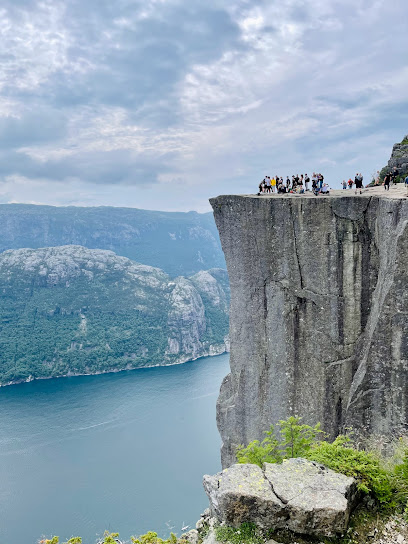
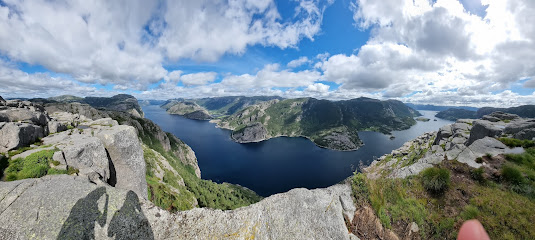
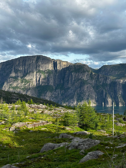
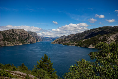
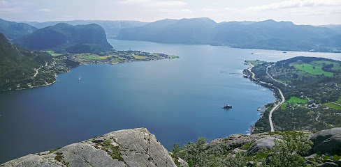
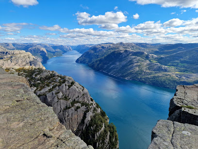
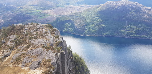
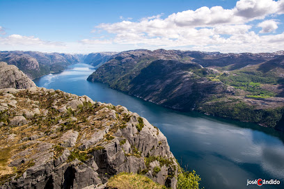
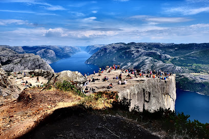
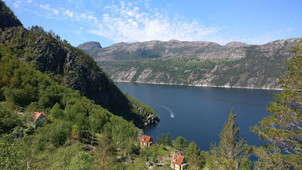
Embark on an unforgettable journey along the Preikestolen Trail, a stunning hike that leads you to one of Norway's most iconic viewpoints. Towering 604 meters above the Lysefjord, this natural marvel offers awe-inspiring views that are not to be missed. Perfect for adventure seekers and nature lovers alike, Preikestolen is a must-visit destination when exploring Norway's picturesque landscapes.
A brief summary to Preikestolen Trail - Platået
- Preikestolvegen 498, Jørpeland, 4105, NO
Local tips
- Start your hike early in the morning to enjoy fewer crowds and a peaceful atmosphere.
- Wear sturdy hiking shoes, as some parts of the trail can be steep and rocky.
- Bring plenty of water and snacks to stay energized during your hike.
- Check the weather forecast before your trip, as conditions can change quickly.
- Don’t forget your camera; the views from the top are unforgettable!
Getting There
-
Car
If you're traveling by car, start your journey in the town of Jørpeland. Head towards Preikestolvegen, which is the main road leading to the Preikestolen trailhead. Follow Preikestolvegen for approximately 7 kilometers until you reach the parking area for Preikestolen, which is well-marked. The GPS coordinates for the parking lot are 58.9916571, 6.1419169. There is a parking fee of around 200 NOK for a full day, so be sure to have cash or a card ready.
-
Public Transportation
To reach Preikestolen using public transportation, take a bus from Stavanger to Jørpeland. The bus terminal in Stavanger is located near the city center. From there, you can catch a bus that services the route to Jørpeland. Once you arrive in Jørpeland, you will need to transfer to a local bus that goes to the Preikestolen parking area. The total travel time from Stavanger is approximately 1.5 to 2 hours depending on connections and the bus schedule. Be sure to check the latest bus schedules as they can vary based on the time of year.
-
Hiking
Once you have reached the Preikestolen parking area, you will find the trailhead for the Preikestolen hike. The hike to the Platået takes approximately 2 hours one way and is about 3.8 kilometers long. The trail is well-marked and offers stunning views along the way. Be sure to wear sturdy hiking shoes and bring water and snacks for the journey. The trail can be steep in places, so be prepared for a moderately challenging hike.
Discover more about Preikestolen Trail - Platået
Iconic landmarks you can’t miss
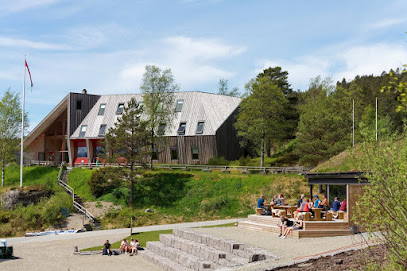
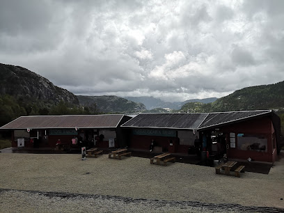
Preikestolen Fjellstue
0.3 km
Discover Norway's breathtaking landscapes at Preikestolen Fjellstue, your gateway to iconic hikes and local culinary delights.
Prædikestolen
2.8 km
Experience the breathtaking views and thrilling hikes at Preikestolen, Norway's iconic Pulpit Rock overlooking the stunning Lysefjord.
Hatten
3.9 km
Explore Hatten, a breathtaking hiking area in Forsand, Norway, where stunning landscapes and diverse trails await outdoor enthusiasts.
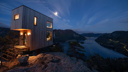
The Bolder Skylodge
5.1 km
Discover the breathtaking beauty of Norway at The Bolder Skylodge, where luxury meets nature in the stunning landscapes of Forsand.
Skrøylå
6.1 km
Experience the breathtaking trails and stunning views of Skrøylå, Norway's hidden hiking gem perfect for outdoor adventure and nature lovers.
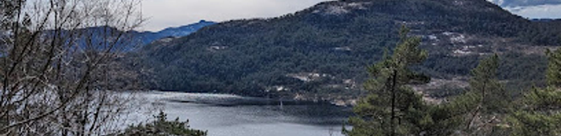
Utsiktspunkt Lysefjorden
6.9 km
Discover stunning panoramic views of Lysefjord at Utsiktspunkt Lysefjorden, a must-visit scenic spot in Norway.
Høllesli viewpoint
6.9 km
Discover the stunning beauty of Høllesli Viewpoint in Norway, where breathtaking landscapes and serene fjord views await every visitor.
Sokkaknuten
7.8 km
Explore the breathtaking vistas of Sokkaknuten, a premier hiking area in Forsand, Norway, where adventure meets stunning natural beauty.
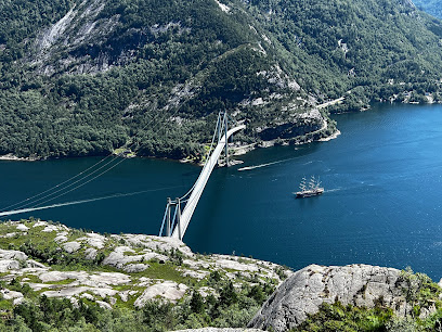
Lysefjord Bridge
8.0 km
Discover the stunning views and natural beauty of the Lysefjord Bridge, an architectural marvel in Norway's breathtaking landscape.
Bakken kai
8.8 km
Explore Bakken Kai, a stunning hiking area in Lysbotn, Norway, where breathtaking views and serene trails await every adventure seeker.
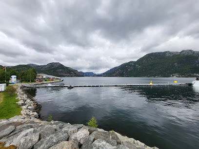
Lysefjorden Marina
9.9 km
Experience the breathtaking beauty and outdoor adventures at Lysefjorden Marina, a serene gateway to Norway's stunning fjord landscapes.
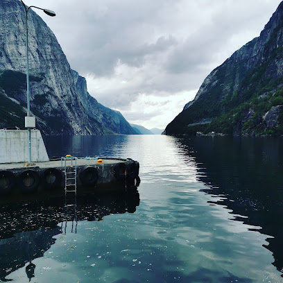
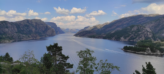
Explore Lysefjorden
10.2 km
Experience the breathtaking landscapes and thrilling outdoor adventures at Lysefjorden, Norway's stunning natural wonder.

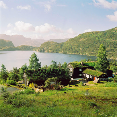
Gøysa Gard - Lysefjord
10.2 km
Explore the breathtaking Lysefjord at Gøysa Gard, where comfort and adventure meet in a stunning natural setting.
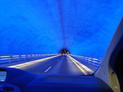
Ryfast Tunnel
18.6 km
Experience the breathtaking Ryfast Tunnel, one of the world's longest subsea tunnels, connecting Norway's stunning landscapes with engineering brilliance.
Mariakirken remains
23.0 km
Discover Stavanger's Mariakirken remains, a historical landmark that offers a glimpse into Norway's rich architectural heritage and cultural history.
Unmissable attractions to see
Preikestolen hiking starting point
0.2 km
Experience the breathtaking views and exhilarating trails at Preikestolen, Norway's iconic hiking destination overlooking the stunning Lysefjord.
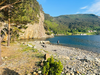
Revsvatnet Beach
0.2 km
Discover the tranquility and stunning views at Revsvatnet Beach in Jørpeland, Norway – a perfect escape for nature lovers and beachgoers.
Preikestolen Trail - Urskar
0.7 km
Experience breathtaking views and adventure at the iconic Preikestolen Trail, a must-visit destination for nature lovers and thrill-seekers in Norway.
Rindatrollet
0.7 km
Explore the breathtaking natural beauty of Rindatrollet in Jørpeland, Norway, where adventure and stunning views await every traveler.
Torsnes gård
0.9 km
Explore Torsnes Gård, a stunning hiking area in Jørpeland, Norway, perfect for outdoor adventures and breathtaking views of nature.

Preikestolen Trail - Neverdalsskaret
1.5 km
Experience the awe-inspiring beauty of Preikestolen Trail, a must-visit hiking destination in Norway with breathtaking views of Lysefjord and nature's wonders.
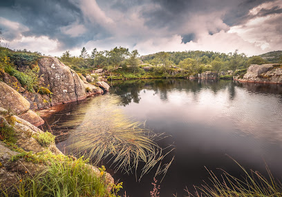
Tjødnane
1.8 km
Experience the serene beauty of Tjødna, a stunning swimming lake in Norway, perfect for relaxation and outdoor fun amidst nature's splendor.
Preikestolen nødbu
1.9 km
Explore Preikestolen, an iconic cliff offering breathtaking views of Lysefjord, perfect for hiking and experiencing Norway's natural beauty.
Revså fossefall
2.2 km
Experience the breathtaking beauty of Revså Fossefall, a stunning waterfall in Forsand, Norway, surrounded by lush nature and dramatic landscapes.
Revsånå
2.4 km
Experience the breathtaking trails and stunning views at Revsånaå, a top hiking destination in Forsand, Norway, perfect for all adventure seekers.
Preikestolen
2.7 km
Explore Preikestolen, Norway's iconic Pulpit Rock, offering breathtaking views and an unforgettable hiking experience in the heart of nature.
Pulpit Rock
2.8 km
Discover the breathtaking views and adventure of Pulpit Rock, Norway's iconic cliff offering stunning scenery and outdoor activities.

Fantahålå
3.0 km
Explore the breathtaking beauty and rich history of Fantahålå in Forsand, Norway – a must-visit destination for nature lovers and adventurers alike.
Fantapytten "infinitypool"
3.2 km
Discover the breathtaking Fantapytten Infinity Pool, a serene oasis in Norway's Lysefjord, perfect for relaxation and stunning views.
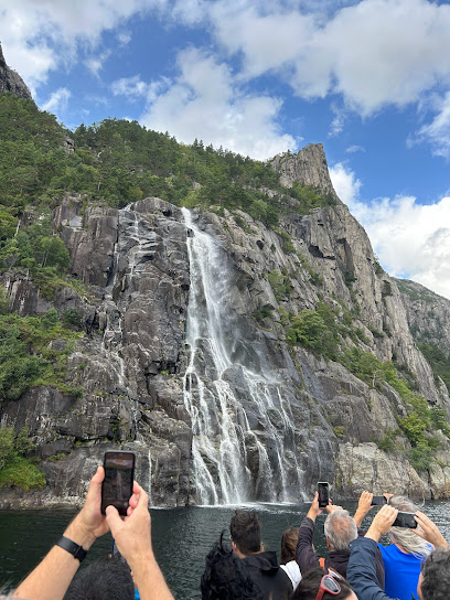
Hengjanefossen waterfall
5.1 km
Discover the breathtaking Hengjanefossen Waterfall in Forsand, Norway, a natural wonder surrounded by stunning landscapes and hiking trails.
Essential places to dine
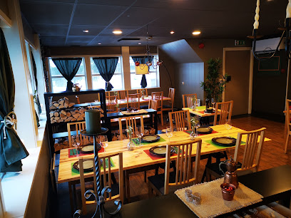
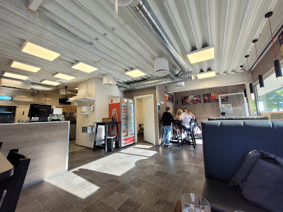
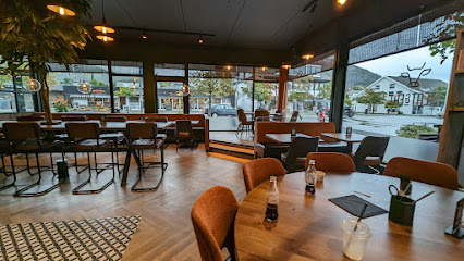
Matsalen
0.3 km
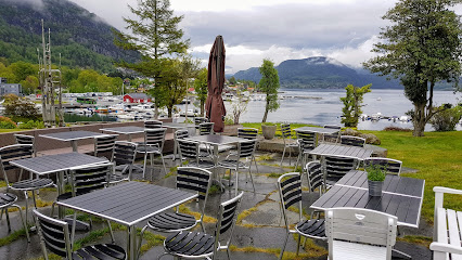
Experience authentic Norwegian cuisine with breathtaking views at Matsalen in Jørpeland - a must-visit dining destination.
fjord restaurant Lysefjord-Helleren
4.9 km
Experience the essence of Norwegian cuisine at Fjord Restaurant Lysefjord-Helleren while enjoying breathtaking views of the majestic Lysefjord.
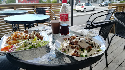
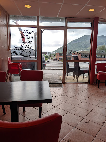
Preikestolen Kebab &Pizza
6.5 km
Discover delicious kebabs and pizzas at Preikestolen Kebab & Pizza in Jørpeland - a must-visit dining spot for travelers exploring Norway's stunning landscapes.
Jørpeland Pizza Kafé
6.6 km
Experience delightful pizzas and local flavors at Jørpeland Pizza Kafé – where every bite tells a story of Norwegian hospitality.
Villa Rosehagen
6.6 km
Experience exquisite local cuisine at Villa Rosehagen in Jørpeland, where charm meets flavor amidst stunning natural beauty.
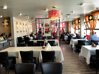
Peking House
6.6 km
Experience authentic Chinese cuisine at Peking House in Jørpeland, where delicious flavors meet warm hospitality.
Chen AS
6.6 km
Experience authentic Chinese cuisine at Chen AS in Jørpeland - where every dish tells a story.
Taco Sushi
6.7 km
Discover an extraordinary fusion of Mexican and Japanese cuisine at Taco Sushi in Jørpeland - A unique culinary experience awaits!
Kebab House Pizzeria Jørpeland
6.7 km
Discover Kebab House Pizzeria Jørpeland - where delicious kebabs meet fresh pizzas in a cozy fast food setting.
Meat & Eat Jørpeland
6.8 km
Discover the culinary delights at Meat & Eat Jørpeland, where succulent meats meet artisan pizzas in a warm and inviting atmosphere.
Lysefjordsenteret AS
9.6 km
Experience exquisite Norwegian cuisine amidst breathtaking fjord views at Lysefjordsenteret AS.
Flørli Cafe
16.6 km
Discover Flørli Cafe: A cozy restaurant offering authentic Norwegian cuisine with stunning fjord views in beautiful Flørli.
Fortou
22.1 km
Discover Fortou in Stavanger: A must-visit takeout restaurant serving delicious fast food with local flavors and international flair.
Brøl
22.3 km
Discover Brøl in Stavanger: A vibrant restaurant and bar offering local cuisine and crafted cocktails for an unforgettable dining experience.

Spildr
22.4 km
Experience Stavanger's finest seafood at Spildr - where local ingredients meet culinary artistry.
Markets, malls and hidden boutiques
Souvenir shop
0.2 km
Explore a delightful souvenir shop in Jørpeland, showcasing unique Norwegian crafts and gifts that capture the essence of local culture.
Rental Gear & Wear
0.3 km
Explore Norway’s breathtaking landscapes with quality outdoor gear and apparel from Rental Gear & Wear in Jørpeland.
Imprint DA
6.0 km
Explore Imprint DA in Jørpeland for a taste of local craftsmanship and unique souvenirs that reflect Norway's rich heritage.
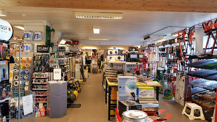
Fargerike Hjertenes Jernvare
6.4 km
Explore Fargerike Hjertenes Jernvare for a delightful selection of paints, flooring, and home goods in the heart of Jørpeland, Norway.
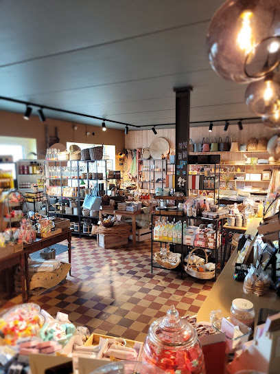
Skafferiet Butikk & Isbar
6.5 km
Discover the charm of Jørpeland at Skafferiet Butikk & Isbar, your go-to spot for local products and delightful ice cream treats.
Strand Solskjerming
6.5 km
Explore authentic Norwegian treasures at Strand Solskjerming, a vibrant store in Jørpeland offering unique souvenirs and local products.
Antik og Brukt
6.5 km
Explore Antik og Brukt in Jørpeland, Norway: A hidden gem for antique enthusiasts and treasure seekers alike, showcasing unique vintage items and local crafts.
Oldeidegården
6.5 km
Discover unique shopping and dining at Oldeidegården in Jørpeland, a vibrant hub for tourists and locals alike in stunning Norway.

SPAR Jørpeland
6.5 km
Experience local charm and quality products at SPAR Jørpeland, your go-to grocery store in the heart of Norway's stunning Ryfylke region.
Fagmøbler Jørpeland
6.6 km
Explore Fagmøbler Jørpeland for high-quality furniture that combines style and comfort, perfect for enhancing your home decor.
City Outlet
6.6 km
Explore City Outlet: Your Ultimate Shopping Destination for Fashion in Jørpeland, Norway.
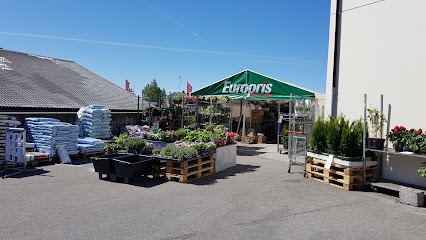
Europris Jørpeland/Strand
6.7 km
Explore Europris Jørpeland/Strand for a diverse shopping experience featuring groceries, home goods, and unique souvenirs in Norway's charming Jørpeland.
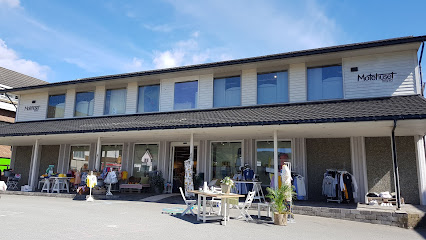
Motehuset Byberg AS
6.7 km
Explore local fashion and quality garments at Motehuset Byberg AS in Jørpeland, a unique clothing store that reflects the essence of Norwegian style.
Zavanna
6.7 km
Explore Zavanna in Jørpeland for trendy women's fashion that captures the essence of Norwegian style and charm.

Normal Jørpeland
6.7 km
Discover the unique offerings of Normal Jørpeland, a charming store in Norway showcasing local artistry and authentic souvenirs.
Essential bars & hidden hideouts
Preikestolen Café
0.2 km
Experience breathtaking views and delicious refreshments at Preikestolen Café, your perfect stop near the iconic Pulpit Rock in Norway.
Radlaren Pub
6.6 km
Discover the lively essence of Jørpeland at Radlaren Pub, where good drinks and great company await every visitor.
Resepsjonen
22.1 km
Discover Resepsjonen: A lively bar and café in Stavanger offering delicious drinks and a welcoming atmosphere for every visitor.
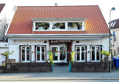
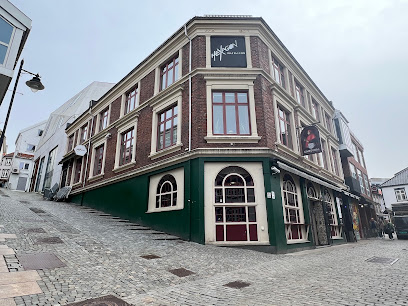
Martinique
23.2 km
Experience the beauty and culture of Martinique, a Caribbean paradise filled with stunning beaches, vibrant towns, and exquisite flavors.
Piren pub
23.2 km
Discover the vibrant atmosphere of Piren Pub in Stavanger, where delightful drinks and friendly locals create the perfect unwinding experience.
Patrioten Bar
23.3 km
Discover the vibrant atmosphere of Patrioten Bar in Hillevåg, Stavanger, where local culture meets a lively nightlife experience.

Miss Pil
23.5 km
Experience the vibrant nightlife of Stavanger at Miss Pil, where delicious drinks, live music, and a friendly atmosphere await you.
BlygeHarry
23.5 km
Immerse yourself in Stavanger's nightlife at BlygeHarry, where live music and a vibrant atmosphere create unforgettable experiences.
The Irishman
23.5 km
Experience the vibrant spirit of Ireland at The Irishman in Stavanger, where delicious food and lively atmosphere create unforgettable memories.
Valhalla Bar
23.5 km
Discover the lively Valhalla Bar in Stavanger, where creative cocktails meet a warm, welcoming atmosphere perfect for tourists and locals alike.
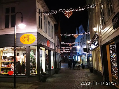
FRI Bar - Fargegaten
23.5 km
Discover FRI Bar - Fargegaten in Stavanger, where vibrant nightlife meets cozy café culture, perfect for relaxation and socializing.
Hanekam
23.5 km
Experience the vibrant atmosphere of Hanekam, the trendy bar in Stavanger known for its great drinks and friendly service.
Pjolter & Punsj
23.5 km
Discover Stavanger's vibrant nightlife at Pjolter & Punsj, renowned for its unique cocktails and welcoming atmosphere, perfect for every occasion.
CIRKUS
23.5 km
Discover the lively atmosphere and unique cocktails at CIRKUS, Stavanger's vibrant bar that promises an unforgettable nightlife experience.
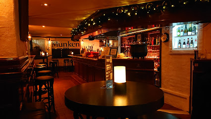
Munken
23.6 km
Discover Munken Bar in Stavanger - a lively pub known for its local charm, extensive drink menu, and vibrant nightlife.
Nightclubs & after hour spots
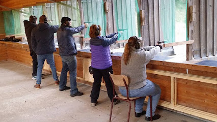
Preikestolen Pistolklubb
7.1 km
Discover the thrill of shooting at Preikestolen Pistolklubb, where precision meets the beauty of Norway's landscapes.
LOFT
23.6 km
Discover the vibrant atmosphere of LOFT, Stavanger's premier bar offering innovative cocktails and a lively social scene.

Hexagon nattklubb
23.6 km
Experience the vibrant nightlife of Stavanger at Hexagon Nattklubb, where music and dance come alive every weekend.
Backstage
23.6 km
Unleash your night at Backstage, Stavanger's premier night club, where vibrant music and a lively atmosphere create unforgettable nightlife experiences.

LOULOU
23.7 km
Experience the vibrant nightlife of Stavanger at LOULOU, where music, cocktails, and fun come together to create unforgettable memories.

Alf & Werner
23.7 km
Experience the vibrant nightlife of Stavanger at Alf & Werner, where live music and a lively bar scene create unforgettable moments.

Pure Lounge & Club
23.8 km
Discover the electrifying nightlife of Stavanger at Pure Lounge & Club, where unforgettable experiences and vibrant energy await every visitor.
Tom And Lello
23.8 km
Experience the vibrant nightlife of Stavanger at Tom And Lello, where great music and a lively atmosphere await you.

HUB by Tom & Lello
27.9 km
Discover HUB by Tom & Lello, Sandnes' vibrant night club offering an electric atmosphere, exceptional service, and unforgettable nightlife experiences.

Spot - Bar & Nattklubb
28.0 km
Discover the vibrant nightlife at Spot - Bar & Nattklubb in Sandnes, where music and dance create unforgettable memories.

Burlesque Bar & Club
68.2 km
Unveil the magic of nightlife at Burlesque Bar & Club in Haugesund, where captivating performances and vibrant energy collide for an unforgettable experience.

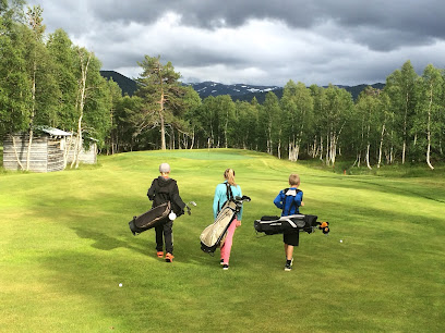
Hovden Golfklubb
90.3 km
Discover Hovden Golfklubb, where breathtaking landscapes meet exceptional golfing in the heart of Norway’s natural beauty.
Fjellgarden Hovden AS
92.4 km
Experience the rich cultural heritage and breathtaking landscapes at Fjellgarden Hovden AS, a premier cultural center in Hovden i Setesdal.

Vinmonopolet
93.5 km
Discover Norway's exclusive alcohol retail monopoly, Vinmonopolet, and explore a curated selection of wines, spirits, and local brews.
RusticO Hovden
93.6 km
Experience the essence of Norwegian cuisine in the charming RusticO Hovden amidst the breathtaking landscapes of Setesdal.