

Preikestolen Travel Guide - Free Web & App
Your ultimate guide to Preikestolen. Discover top landmarks, proposed trips, and local tips. Free on the web or via the Evendo companion app.




Preikestolen, Norway: hike to the iconic Pulpit Rock above Lysefjord, with dramatic views, practical trail advice and access from nearby Stavanger.
The Pulpit Rock Landscape
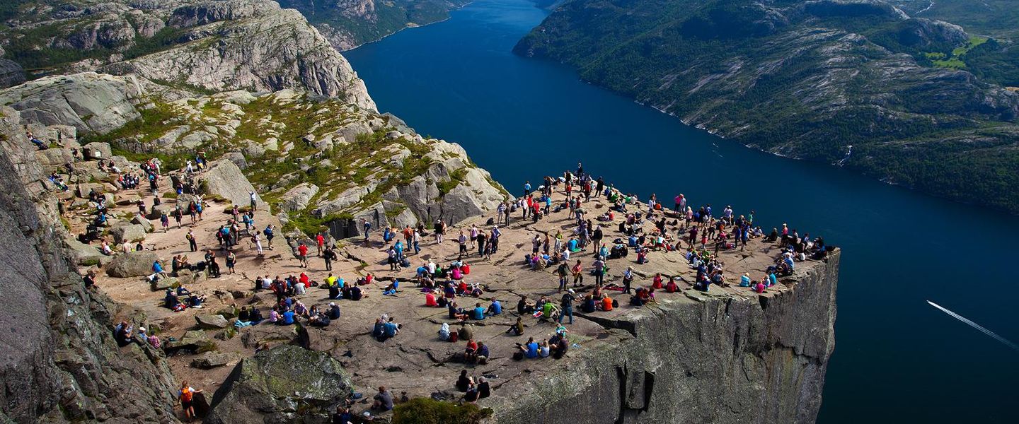
Preikestolen, known internationally as Pulpit Rock, is a near-vertical granite plateau rising about 604 metres above Lysefjorden in south-western Norway. The flat-topped cliff is the destination’s defining feature, but the experience begins well below the viewpoint, on a marked mountain trail that crosses forest, exposed rock, small lakes and uneven upland terrain. The summit’s broad platform has no protective railing, allowing the scale of the fjord and surrounding mountains to remain fully apparent; visitors should keep well back from the edge, particularly in wet, windy or crowded conditions.Read more about Preikestolen
A Gateway to Lysefjorden
Nature, Weather and Outdoor Appeal
When is the best time to visit Preikestolen?
Best: June–August · 18–20°C| Month | High (°C) | Rainfall (mm) |
|---|---|---|
| January | 1 | 81 |
| February | 1 | 80 |
| March | 4 | 60 |
| April | 8 | 50 |
| May | 13 | 41 |
| June (best) | 18 | 30 |
| July (best) | 20 | 35 |
| August (best) | 20 | 40 |
| September | 15 | 50 |
| October | 11 | 70 |
| November | 6 | 81 |
| December | 3 | 80 |
Getting to and around Preikestolen
How to get there
Transportation
Best attractions in Preikestolen
-
Tourist attraction
Revsvatnet Beach
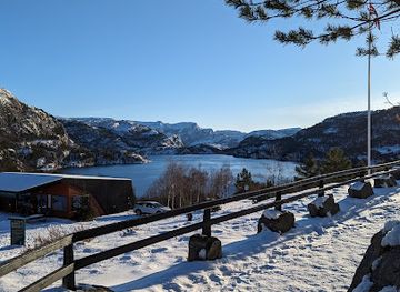
Discover the tranquility and stunning views at Revsvatnet Beach in Jørpeland, Norway – a perfect escape for nature lovers and beachgoers.
Explore Preikestolen on the map
Plan your trip on one map. See where the top attractions, landmarks, restaurants and hotels are, and book hotels and experiences in a few clicks.
Best hotels in Preikestolen
Get your free copy of our complete guide to Preikestolen, delivered straight to you.
Everything on this page, from attractions and restaurants to essentials and local phrases, in one PDF you can read offline, print or share.
Already have an account? Sign in
Your Preikestolen guide is ready.
We'll send it to · Not you? Sign out

Getting your guide ready…
We are putting together a fresh copy of the Preikestolen guide. This can take up to a minute.
This can take a few moments. If your browser asks, choose Allow so the download can start. You'll find the guide in your Downloads folder.
Nothing happened? Download it again
Sorry, the guide is taking longer than usual. Please try again in a minute, or get it by email instead.
Preikestolen essentials
Currency and Payment
Safety
Emergency Situations
Do's and Don'ts
Local Tips
From Eve
Local phrases worth knowing
You don't need to get them perfect. A few words go a long way, and locals appreciate the effort.
Basics
| English | Local | Say it |
|---|---|---|
| Hello | Hei | [hay] |
| Goodbye | Ha det bra | [ha deh bra] |
| Yes | Ja | [ya] |
| No | Nei | [nay] |
| Please/You're welcome | Vær så god | [vair so goh] |
| Thank you | Takk | [tahk] |
| Excuse me/Sorry | Unnskyld | [oon-skyld] |
| How are you? | Hvordan har du det? | [vohr-dan har doo deh] |
| Fine. And you? | Bra. Og du? | [bra oh doo] |
| Do you speak English? | Snakker du engelsk? | [snahk-ker doo eng-elsk] |
| I don't understand | Jeg forstår ikke | [yay for-stor eek-eh] |
Eating & Drinking
| English | Local | Say it |
|---|---|---|
| I'd like to see the menu, please | Jeg vil gjerne se menyen, takk | [yay vil yer-neh se meh-nyen tahk] |
| I don't eat meat | Jeg spiser ikke kjøtt | [yay spee-ser ee-keh shøt] |
| Cheers! | Skål! | [skohl] |
| I would like to pay, please | Jeg vil gjerne betale, takk | [yay vil yer-neh beh-tah-leh tahk] |
Emergencies
| English | Local | Say it |
|---|---|---|
| Help! | Hjelp! | [yel-p] |
| Go away! | Gå bort! | [goh bort] |
| Call the Police! | Ring politiet! | [ring po-lee-teet] |
| Call a doctor! | Ring en lege! | [ring en leh-geh] |
| I'm lost | Jeg er lost | [yay ehr lost] |
| I'm ill | Jeg er syk | [yay ehr sook] |
Shopping
| English | Local | Say it |
|---|---|---|
| I'd like to buy... | Jeg vil kjøpe... | [yay vil shø-peh] |
| I'm just looking | Jeg bare ser | [yay bah-reh sair] |
| How much is it? | Hvor mye koster det? | [vor myeh kost-er deh] |
| That's too expensive | Det er for dyrt | [deh ehr for deert] |
| Can you lower the price? | Kan du senke prisen? | [kan doo sen-keh pree-sen] |
Time & Numbers
| English | Local | Say it |
|---|---|---|
| What time is it? | Hva er klokka? | [vah ehr klok-ah] |
| It's one o'clock | Det er ett | [deh ehr et] |
| Half past (10) | Halv ti | [halv tee] |
| Morning | Morgen | [mor-gen] |
| Afternoon | Ettermiddag | [et-ter-mee-dahg] |
| Evening | Kveld | [kvel] |
| Yesterday | I går | [ee gor] |
| Today | I dag | [ee dahg] |
| Tomorrow | I morgen | [ee mor-gen] |
| 1 | En | [en] |
| 2 | To | [too] |
| 3 | Tre | [treh] |
| 4 | Fire | [feer-eh] |
| 5 | Fem | [fem] |
| 6 | Seks | [seks] |
| 7 | Syv | [soov] |
| 8 | Åtte | [ot-teh] |
| 9 | Ni | [nee] |
| 10 | Ti | [tee] |
Transport & Directions
| English | Local | Say it |
|---|---|---|
| Where's a/the...? | Hvor er... | [vor ehr] |
| What's the address? | Hva er adressen? | [vah ehr ad-ress-en] |
| Can you show me (on the map)? | Kan du vise meg (på kartet)? | [kan doo vee-seh may (poh kar-teh)] |
| When's the next (bus)? | Når går neste (buss)? | [nar gor nes-teh (boos)] |
| A ticket (to ....) | En billett (til ....) | [en bee-let (teel)] |
History of Preikestolen
Ice-Shaped Lysefjorden
Preikestolen is part of a landscape formed by major glacial erosion. During successive ice ages, moving ice deepened and widened the Lysefjorden valley, leaving steep rock walls and high plateaux on either side. The cliff itself is a resistant section of Precambrian granite and gneiss, while the remarkably level top reflects natural fractures in the bedrock and the action of glacial and post-glacial processes. These geological forces created the dramatic relationship between the plateau and the fjord that defines the site today.
Farms and Fjord Communities
Long before Preikestolen became an international attraction, the surrounding Ryfylke region was shaped by small farming and seafaring communities. Farms occupied pockets of cultivable land around the fjord and on lower mountain slopes, while waterways provided important routes between isolated settlements. Jørpeland developed as a local centre in Strand, supported by agriculture, commerce and later industry. The fjord landscape was therefore not an empty wilderness but a working environment in which transport, land use and seasonal conditions governed everyday life.
The Rise of Mountain Tourism
Improved transport and growing interest in Norwegian mountain scenery gradually brought more visitors to the cliff during the nineteenth and twentieth centuries. Preikestolen became one of the most recognisable viewpoints in the Stavanger and Ryfylke region, helped by access from the city and by the dramatic visual language of the fjord. The destination’s modern name reflects its resemblance to a pulpit, while the English expression Pulpit Rock has helped establish it in international travel culture. Increased visitation also created a need for more organised access and responsible visitor management.
Improving the Trail
The route from the Preikestolen mountain area to the plateau has been progressively improved to cope with heavy foot traffic and difficult terrain. Stone steps, drainage work and path construction, including work by experienced Nepalese trail builders, have helped reduce erosion and make the route more durable without turning it into an urban-style walkway. These interventions reflect a continuing balance between access and conservation: the landscape must accommodate large numbers of hikers while retaining its character as a mountain environment exposed to weather and natural wear.
A Modern Norwegian Icon
In the contemporary tourism era, Preikestolen has become one of Norway’s most widely recognised natural landmarks and an important attraction for the Stavanger region. Its appearance in international travel imagery and the 2018 film Mission: Impossible – Fallout increased its global visibility, although the cliff’s significance rests primarily on its landscape and long-standing outdoor appeal. Visitor facilities at the approach, clearer trail management and transport links from Stavanger and Jørpeland now support access, while safety messaging emphasises responsible behaviour around the unguarded plateau.
Preikestolen in Photos
Browse through our photo collection highlighting the charm and character of the destination.
Neighbouring destination travel guides
The closest destinations to Preikestolen, if you have time for more than one.
-

-

-

-

-


Swipe for more destinations
Explore more
Explore more of Rogaland
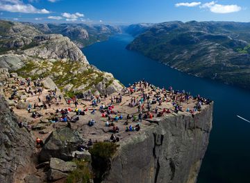
Explore the stunning landscapes and rich cultural heritage of Rogaland, Norway’s coastal gem, from the iconic Preikestolen to the charming streets of Stavanger.
Explore Rogaland
Explore more of Norway
Explore Norway's spectacular fjords, vibrant cities, and natural wonders. Experience the Northern Lights, Midnight Sun, and rich cultural heritage in this Scandinavian gem.
Explore Norway