

Free Ouachita Mountains Travel Guide & Mobile App
Explore Ouachita Mountains with free travel guides. Discover regional history, expert tips, proposed trips, and audio guides on web or mobile app.


Explore Oklahoma’s Ouachita Mountains for forested ridges, Talimena views, Choctaw heritage, hiking, lakes and quiet outdoor escapes.
Read more about Ouachita Mountains
Getting to and around Ouachita Mountains
How to get there
Transportation
Destinations in Ouachita Mountains
Resorts, valleys and scenic spots worth a trip of their own.
-

-

-


Swipe for more destinations
Best attractions in Ouachita Mountains
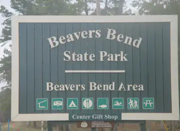
The Oklahoma Ouachita Mountains offer a combination of scenic driving, public forest, lakes and outdoor recreation rather than a dense collection of urban attractions. The Talimena National Scenic Byway is the signature experience, crossing Winding Stair Mountain and linking overlooks, picnic areas and short walks along the ridge. The Oklahoma section begins near Talihina and reaches the Arkansas boundary, where the route continues outside the state. In the southern part of the region, Beavers Bend State Park and Broken Bow Lake provide opportunities for boating, fishing, canoeing, hiking, wildlife watching and woodland camping. The Mountain Fork River adds moving water and forest scenery, while nearby accommodation ranges from campsites to cabins. Heavener Runestone State Park combines a wooded setting with a controversial inscribed stone and interpretive history. The Ouachita National Forest supplies the broader framework for hiking, hunting, riding, camping and quiet road exploration, with conditions varying by season and location. Visitors should distinguish scenic viewpoints and developed park facilities from more remote forest recreation, where navigation, supplies and self-sufficiency matter.
-
Tour agency
Rugaru Adventures Ziplining Tour
Explore the breathtaking heights of Hochatown with Rugaru Adventures Ziplining Tour, where adventure meets stunning natural beauty in Oklahoma.
-
State park
Lake Wister State Park
Explore the breathtaking landscapes and outdoor adventures at Lake Wister State Park, a must-visit for nature lovers and outdoor enthusiasts in Oklahoma.
-
Museum
Beavers Bend Wildlife Museum
Explore the incredible wildlife and interactive exhibits at Beavers Bend Wildlife Museum, a unique destination in Broken Bow, Oklahoma.
-
Amusement center
Hochatown Amusements
Experience family fun and sweet treats at Hochatown Amusements in Broken Bow, Oklahoma, a perfect destination for all ages.


Best landmarks in Ouachita Mountains
The Talimena National Scenic Byway is the Oklahoma Ouachitas’ most recognisable landscape landmark, following the folded crest of the mountains and opening broad views across ridges cloaked in forest. Winding Stair Mountain gives the route its strongest sense of elevation and separation from the surrounding lowlands. At the southern edge of the region, Broken Bow Lake and the Mountain Fork River form a defining water-and-woodland landscape, with Beavers Bend State Park protecting much of the developed recreational setting. Heavener Runestone State Park is notable for the inscribed stone that inspired its name; interpretations of its origins have long been debated, so it is best approached as a historical curiosity rather than definitive proof of a pre-Columbian Norse presence. The forested ridges and valleys of the Ouachita National Forest are themselves important geographical landmarks, representing one of Oklahoma’s clearest departures from prairie scenery. Talihina’s position beneath the mountain crest also gives it a strong symbolic role as a gateway to the scenic route and the surrounding Choctaw Nation landscape.
-
State park
Beavers Bend State Park - Hochatown Area
Discover the breathtaking landscapes and outdoor adventures at Beavers Bend State Park in Hochatown, Oklahoma, a perfect getaway for nature lovers.
-
Historical place
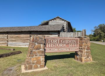
Fort Gibson Historic Site
Explore the historical significance of Fort Gibson, showcasing Oklahoma's frontier life and archaeological wonders at this captivating tourist attraction.
-
Historical place
Fort Washita Historic Site
Explore the historical wonders and scenic trails at Fort Washita Historic Site in Durant, Oklahoma, where history and nature come together.
-
Museum
Sequoyah's Cabin Museum
Explore Sequoyah's Cabin Museum and delve into the rich history of the Cherokee Nation, celebrating the legacy of its remarkable inventor and linguist.


Explore Ouachita Mountains on the map
Plan your trip on one map. See where the top cities, national parks and sights are, and book hotels and experiences in a few clicks.
Best hotels in Ouachita Mountains
Best restaurants in Ouachita Mountains
Dining in the Oklahoma Ouachitas is shaped by small-town restaurants, cafés, barbecue establishments, family diners, cabin-area eateries and traditional American cooking rather than a concentrated fine-dining scene. Talihina, Heavener, Broken Bow and Idabel provide the most useful clusters of everyday food, while the Beavers Bend and Broken Bow Lake area has seasonal and visitor-oriented options serving people staying in cabins or using the parks. Menus commonly reflect Oklahoma and southern United States influences, including smoked meats, burgers, fried dishes, biscuits, catfish and generous side dishes, with regional produce appearing more often in seasonal or independent kitchens. Coffee shops and bakeries are useful stops before entering the more remote forest roads. Visitors staying in cabins often shop for provisions and cook, particularly when exploring remote parts of the Ouachita National Forest. Local farmers' markets and community food events vary by season, so current arrangements should be checked locally rather than assumed.
-
American
Eskimo Joe's
Discover Eskimo Joe's - A Unique Blend of Delicious American Cuisine, Live Music, and Iconic Souvenirs in Stillwater, Oklahoma.
-
Seafood
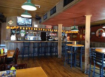
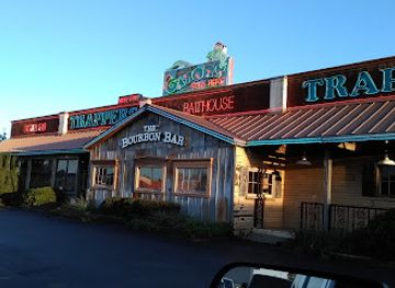
Trapper's Fishcamp & Grill
Discover Trapper's Fishcamp & Grill: where fresh seafood meets unique decor in Oklahoma City.
-
American
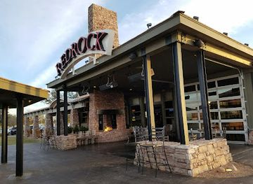
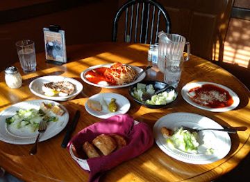
Redrock Canyon Grill
Discover the exquisite taste of American cuisine at Redrock Canyon Grill – where every meal is a memorable occasion.
-
Restaurant
Pete's Place Restaurant
Experience authentic Italian cuisine at Pete's Place Restaurant in Krebs, Oklahoma - where every meal is a celebration of flavor.
Best bars in Ouachita Mountains
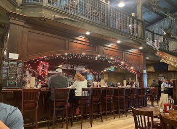
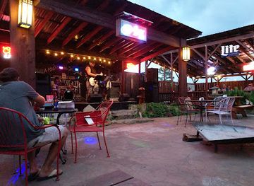
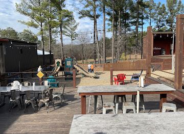
Evening life in the Oklahoma Ouachitas is primarily based around restaurants, local bars, relaxed pubs, live music and the social spaces attached to lakeside or cabin-area accommodation. Talihina and Broken Bow are the most practical places to look for evening food and drinks, while the Beavers Bend and Hochatown area has a larger visitor-oriented hospitality scene than the more remote mountain communities. There is no continuous nightclub district across the region, and nightlife becomes sparse once visitors leave the towns and developed lake areas. Some venues feature country, roots or regional live music, but schedules are changeable and should be checked before travelling. In the forest and along the Talimena route, the evening experience is more often a quiet meal, a campfire where permitted, or stargazing than late-night entertainment; visitors should observe park, forest and fire regulations.
-
Grill
Hochatown Saloon
Experience the vibrant atmosphere of Hochatown Saloon, where delicious grill favorites meet live music and unique local gifts.
-
Bar
Abendigo's
Experience the vibrant atmosphere and diverse offerings at Abendigo's, Broken Bow's premier bar and steakhouse, featuring live music and delightful dining.
-
Mexican
Papa Poblanos Broken Bow
Experience the rich flavors of Mexico at Papa Poblanos in Broken Bow, Oklahoma, offering a diverse menu for every taste.
-
Brewpub
Mountain Fork Brewery
Experience the best of local craft beer and American cuisine at Mountain Fork Brewery in Broken Bow, Oklahoma.

Best nightclubs in Ouachita Mountains
Evening life in the Oklahoma Ouachitas is primarily based around restaurants, local bars, relaxed pubs, live music and the social spaces attached to lakeside or cabin-area accommodation. Talihina and Broken Bow are the most practical places to look for evening food and drinks, while the Beavers Bend and Hochatown area has a larger visitor-oriented hospitality scene than the more remote mountain communities. There is no continuous nightclub district across the region, and nightlife becomes sparse once visitors leave the towns and developed lake areas. Some venues feature country, roots or regional live music, but schedules are changeable and should be checked before travelling. In the forest and along the Talimena route, the evening experience is more often a quiet meal, a campfire where permitted, or stargazing than late-night entertainment; visitors should observe park, forest and fire regulations.
-
Casino
Choctaw Casino Broken Bow
Discover the excitement of gaming, dining, and live entertainment at Choctaw Casino Broken Bow, Oklahoma’s ultimate entertainment destination.
-
Night club
Redneck Dance Hall
Discover the lively spirit of country music and dance at Redneck Dance Hall, Oklahoma City's favorite nightlife destination.
-
Night club
One15 Nightclub
Discover the pulse of Oklahoma City's nightlife at One15 Nightclub, where music, drinks, and unforgettable moments await.
-
Night club
Club Majestic
Dive into Tulsa's nightlife at Club Majestic – a vibrant night club with great drinks and an unforgettable atmosphere.




Best shops in Ouachita Mountains
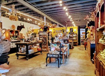
Shopping in the Oklahoma Ouachitas is centred on practical small-town high streets, provisions for outdoor trips, local food and regional crafts rather than large retail complexes. Talihina, Heavener, Broken Bow and Idabel are useful for fuel, groceries, outdoor supplies and everyday necessities, while the Broken Bow and Beavers Bend area has more tourism-focused shops selling cabin goods, clothing, souvenirs and recreational equipment. Visitors looking for distinctive purchases should consider locally produced food, handmade woodwork, pottery, artwork, books about the region and items connected with Oklahoma and Choctaw culture, buying from reputable makers and official cultural outlets where appropriate. Farmers' markets and craft events are seasonal and may rotate between communities, so their dates should be confirmed locally. Stock up before travelling along the Talimena route or into remote forest areas, since retail services become limited once the mountain roads leave the towns.
-
Gift shop
Craig's Curious Emporium
Explore Craig's Curious Emporium in Oklahoma City for a unique shopping experience filled with eclectic gifts, books, and metaphysical treasures.
-
Animal feed store
Atwoods
Discover Atwoods in Mena, Arkansas – your go-to destination for pet supplies, hardware, and charming western apparel.
-
Variety store
Bargain Shack
Explore a treasure trove of unique items at Bargain Shack, the top variety store in Poteau, Oklahoma, perfect for local souvenirs and great deals.
-
Gift shop
Black Moth
Explore a unique blend of gifts, collectibles, and natural wonders at Black Moth, Tulsa's must-visit shop for curious travelers.


Get your free copy of our complete guide to Ouachita Mountains, delivered straight to you.
Everything on this page, from attractions and restaurants to essentials and local phrases, in one PDF you can read offline, print or share.
Already have an account? Sign in
Your Ouachita Mountains guide is ready.
We'll send it to · Not you? Sign out

Getting your guide ready…
We are putting together a fresh copy of the Ouachita Mountains guide. This can take up to a minute.
This can take a few moments. If your browser asks, choose Allow so the download can start. You'll find the guide in your Downloads folder.
Nothing happened? Download it again
Sorry, the guide is taking longer than usual. Please try again in a minute, or get it by email instead.
Ouachita Mountains essentials
Currency and Payment
Safety
Emergency Situations
Do's and Don'ts
Local Tips
From Eve
Local phrases worth knowing
You don't need to get them perfect. A few words go a long way, and locals appreciate the effort.
Basics
| English | Local | Say it |
|---|---|---|
| Hello | Howdy | [Ha-dee] |
| Goodbye | See ya later | [See ya lay-ter] |
| Yes | Yep | [Yep] |
| No | Nah | [Nah] |
| Please/You're welcome | No problem | [No prob-lem] |
| Thank you | Thanks a bunch | [Thanks a bunch] |
| Excuse me/Sorry | Pardon me | [Par-don me] |
| How are you? | How ya doin'? | [How ya doin'?] |
| Fine. And you? | I’m good. And you? | [I’m good. And you?] |
| Do you speak English? | Can ya speak English? | [Can ya speak English?] |
| I don't understand | I don’t get it | [I don’t get it] |
Eating & Drinking
| English | Local | Say it |
|---|---|---|
| I'd like to see the menu, please | Can I see the menu, please? | [Can I see the menu, please?] |
| I don't eat meat | I’m a vegetarian | [I’m a ve-ge-ta-rian] |
| Cheers! | Cheers! | [Cheers!] |
| I would like to pay, please | Could I get the check, please? | [Could I get the check, please?] |
Emergencies
| English | Local | Say it |
|---|---|---|
| Help! | Help! | [Help!] |
| Go away! | Leave me be! | [Leave me be!] |
| Call the Police! | Call the cops! | [Call the cops!] |
| Call a doctor! | Get a doc! | [Get a doc!] |
| I'm lost | I can’t find my way | [I can’t find my way] |
| I'm ill | I ain't feelin' well | [I ain't feelin' well] |
Shopping
| English | Local | Say it |
|---|---|---|
| I'd like to buy... | I wanna buy... | [I wanna buy...] |
| I'm just looking | Just browsin' | [Just browsin'] |
| How much is it? | What’s the price? | [What’s the price?] |
| That's too expensive | That’s a bit pricey | [That’s a bit pricey] |
| Can you lower the price? | Can ya bring down the price? | [Can ya bring down the price?] |
Time & Numbers
| English | Local | Say it |
|---|---|---|
| What time is it? | What time ya got? | [What time ya got?] |
| It's one o'clock | It's one o'clock | [It's one o'clock] |
| Half past (10) | Half past ten | [Half past ten] |
| Morning | Mornin' | [Mornin'] |
| Afternoon | Afternoon | [Afternoon] |
| Evening | Evenin' | [Evenin'] |
| Yesterday | Yesterd’y | [Yesterd’y] |
| Today | Today | [Today] |
| Tomorrow | Tomor-row | [Tomor-row] |
| 1 | One | [One] |
| 2 | Two | [Two] |
| 3 | Three | [Three] |
| 4 | Four | [Four] |
| 5 | Five | [Five] |
| 6 | Six | [Six] |
| 7 | Seven | [Seven] |
| 8 | Eight | [Eight] |
| 9 | Nine | [Nine] |
| 10 | Ten | [Ten] |
Transport & Directions
| English | Local | Say it |
|---|---|---|
| Where's a/the...? | Where's the nearest...? | [Where's the nearest...?] |
| What's the address? | What’s the address? | [What’s the address?] |
| Can you show me (on the map)? | Can ya point it out? | [Can ya point it out?] |
| When's the next (bus)? | When's the next bus? | [When's the next bus?] |
| A ticket (to ....) | A ticket to.... | [A ticket to....] |
History of Ouachita Mountains
Caddoan and Earlier Indigenous Landscapes
The Ouachita region has been inhabited by Indigenous peoples for thousands of years, with earlier archaeological traditions followed by Caddoan-speaking communities and other Native groups. They used the forests, rivers and valleys for hunting, gathering, farming and travel, and maintained extensive cultural connections across what is now southeastern Oklahoma and western Arkansas. The mountains were not an isolated wilderness but part of a lived landscape shaped by movement, trade and seasonal knowledge. Archaeological evidence and surviving Indigenous communities provide important context for understanding the region beyond its later identities as timber country or a recreation destination.
Choctaw Removal and Settlement
During the nineteenth century, the United States removal policy forced many Choctaw people from Mississippi and Alabama to Indian Territory, present-day Oklahoma. The mountainous southeast became part of the Choctaw Nation’s new homeland, and Choctaw communities, farms, schools and political institutions developed across the region. Removal brought profound suffering and disruption, yet Choctaw people rebuilt national and community life in Indian Territory. The Choctaw Nation remains a major cultural and civic presence in southeastern Oklahoma, making its history essential to any account of the Ouachita Mountains.
Timber, Rivers and Mountain Settlement
The Ouachitas’ dense forests and rugged terrain shaped nineteenth- and early twentieth-century settlement. Small communities grew around timber cutting, mills, farming and transport routes, while rivers and creeks supported local economies without making the mountains easy to cross. Commercial timber extraction altered large areas of woodland, and railway development connected some settlements to markets beyond the region. Many current roads, town patterns and working landscapes reflect this period, even though modern recreation and conservation now play a larger role in the regional economy.
Conservation in the Ouachita Forests
Federal forest conservation transformed parts of the mountain region during the twentieth century. The Ouachita National Forest, established in stages from the early 1900s, brought public management to extensive forest lands in Oklahoma and Arkansas. Conservation did not end timber production, but it introduced long-term approaches to woodland management, watershed protection and public recreation. Trails, campgrounds, roads and scenic viewpoints later developed within this framework. The forest today is therefore both an ecological resource and a historical record of changing American attitudes towards public land.
State Parks and Outdoor Recreation
Oklahoma’s state-park system helped make the southeastern mountains accessible to visitors seeking camping, fishing and woodland recreation. Beavers Bend State Park, created around the Mountain Fork River and Broken Bow Lake area, became a major destination for boating, cabins and forest activities. Heavener Runestone State Park and other protected sites added historical and scenic interests. These developments shifted the region’s public image from a remote timber landscape towards a destination based on nature, family recreation and scenic travel, while leaving the area’s rural character largely intact.
The Talimena Scenic Byway
The Talimena Scenic Drive was developed across the crest of the Ouachita Mountains in the late twentieth century, linking Talihina in Oklahoma with the Arkansas border and the continuing route towards Mena. Its elevated course made the folded structure of the mountains legible to visitors through overlooks, interpretive stops and long views over the forest. The byway remains the region’s defining scenic journey and an important example of how road building, conservation and tourism combined to create a modern landscape experience without removing the area’s sense of remoteness.
Ouachita Mountains in Photos
Browse through our photo collection highlighting the charm and character of the destination.
Neighbouring regions of Ouachita Mountains
The closest regions to Ouachita Mountains, if you have time for more than one.
-

-
-

-

-


Swipe for more regions
Explore more
Explore more of Oklahoma
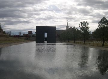
Discover Oklahoma: Where the spirit of the Old West meets modern charm, offering a rich mix of history, nature, and vibrant culture in the heart of the United States.
Explore Oklahoma