

Free Ozark Plateau Travel Guide & Mobile App
Explore Ozark Plateau with free travel guides. Discover regional history, expert tips, proposed trips, and audio guides on web or mobile app.


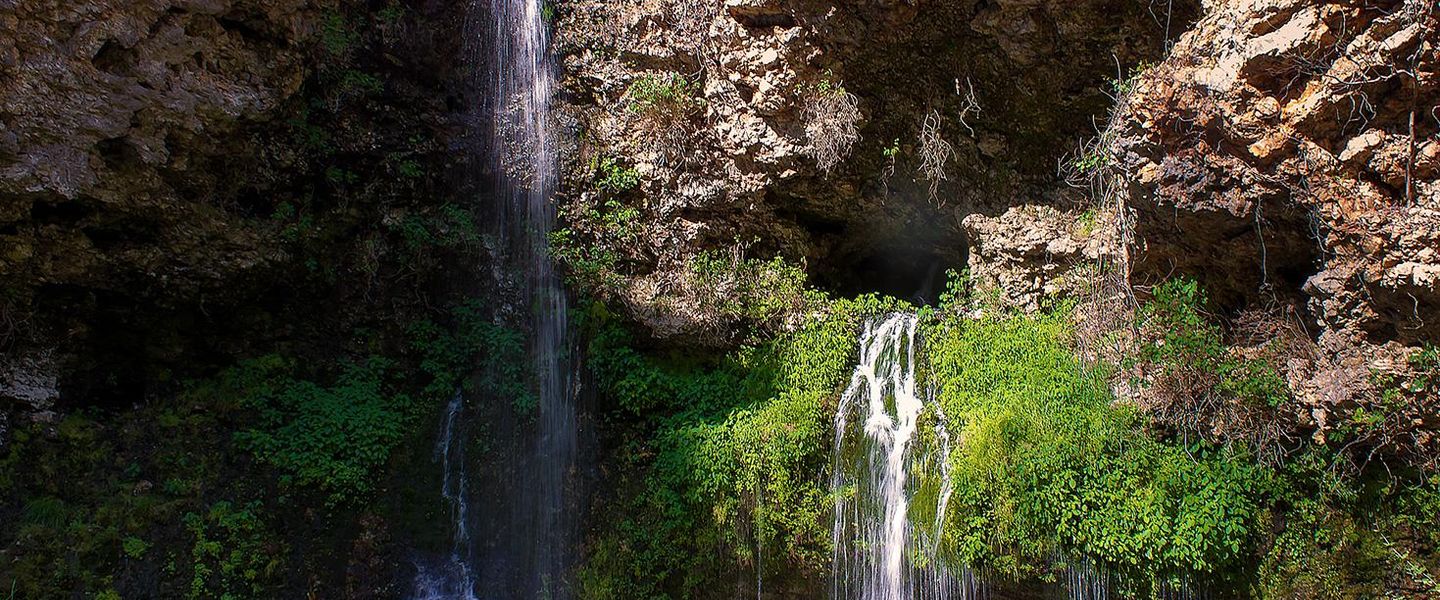


Explore Oklahoma’s Ozark Plateau for forested hills, clear rivers, Cherokee heritage, waterfalls, lakes and outdoor adventures near Tahlequah.
Read more about Ozark Plateau
When is the best time to visit Ozark Plateau?
Best: March–April, October · 18–23°C| Month | High (°C) | Rainfall (mm) |
|---|---|---|
| January | 9 | 41 |
| February | 12 | 46 |
| March (best) | 18 | 61 |
| April (best) | 23 | 76 |
| May | 28 | 112 |
| June | 33 | 97 |
| July | 36 | 76 |
| August | 34 | 86 |
| September | 30 | 86 |
| October (best) | 23 | 71 |
| November | 16 | 61 |
| December | 11 | 51 |
Getting to and around Ozark Plateau
How to get there
Transportation
Top city travel guides in Ozark Plateau
The cities of Ozark Plateau, and the easiest places to base yourself.
-

-


Swipe for more cities
Destinations in Ozark Plateau
Resorts, valleys and scenic spots worth a trip of their own.

Swipe for more destinations
Best attractions in Ozark Plateau
The Oklahoma Ozark Plateau offers a closely connected range of water, woodland and cultural attractions. Around Tahlequah, visitors can combine the Cherokee National Research Center and other Cherokee heritage institutions with the Illinois River, where canoeing, kayaking and fishing are popular on suitable stretches. Tenkiller State Park and Lake Tenkiller provide camping, hiking, boating, swimming and scuba-diving opportunities amid forested hills. Natural Falls State Park, near West Siloam Springs, centres on a 77-foot waterfall reached by wooded trails and overlooks. Grand Lake O’ the Cherokees supports boating, fishing and lakeside recreation, with marinas and communities spread around its irregular shoreline. In the northeast, Miami introduces the history of the Tri-State Mining District and Route 66, while local museums and historic commercial buildings add an industrial and transport perspective. The region is best experienced through a combination of outdoor activities, Native cultural history, small-town exploration and scenic drives rather than through a single concentrated attraction district.
-
Museum
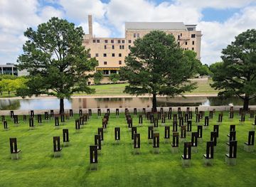
Oklahoma City National Memorial & Museum
Discover the Oklahoma City National Memorial & Museum, a poignant tribute to resilience and healing, honoring lives lost in the 1995 bombing.
-
Heritage museum
National Cowboy & Western Heritage Museum
Discover the spirit of the American West at the National Cowboy & Western Heritage Museum, a cultural gem in Oklahoma City showcasing art, history, and heritage.
-
Wildlife refuge
Wichita Mountains National Wildlife Refuge
Explore the breathtaking landscapes and diverse wildlife at Wichita Mountains National Wildlife Refuge, a top destination for nature lovers and adventure seekers.
-
Tourist attraction
Blue Whale of Catoosa
Discover the oversized charm of the Blue Whale of Catoosa, a whimsical roadside attraction along Route 66 that delights visitors of all ages.
Best landmarks in Ozark Plateau
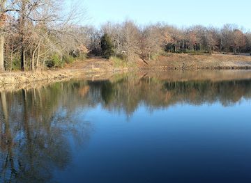
The most recognisable landmarks of the Oklahoma Ozark Plateau combine Cherokee history with the region’s limestone, wooded and water-shaped terrain. Tahlequah’s historic Cherokee institutions and the Cherokee National Capitol give the city particular political and cultural significance as the capital of the Cherokee Nation. In nearby Park Hill, the Murrell Home represents the complicated history of Cherokee society, plantation life, slavery and nineteenth-century settlement. Natural Falls is the region’s most evident natural landmark, dropping through a deep forested ravine at Natural Falls State Park. The Illinois River provides a defining geographical corridor, cutting through uplands that are closely associated with canoeing and river recreation. Lake Tenkiller and Grand Lake O’ the Cherokees are modern landmarks created by twentieth-century dams, their broad waters contrasting with the narrower river valleys. In Miami, surviving commercial and industrial traces recall the Tri-State Mining District and the Route 66 era, linking the plateau’s natural scenery to its more recent economic history.
-
Historical landmark
Ozark Trail Obelisk
Discover the Ozark Trail Obelisk: A Historical Landmark in Stroud, Oklahoma, Perfect for History Buffs and Nature Lovers Alike.

Explore Ozark Plateau on the map
Plan your trip on one map. See where the top cities, national parks and sights are, and book hotels and experiences in a few clicks.
Best hotels in Ozark Plateau
Best restaurants in Ozark Plateau
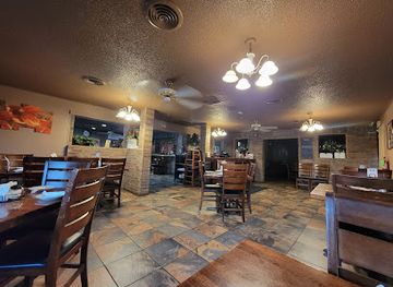
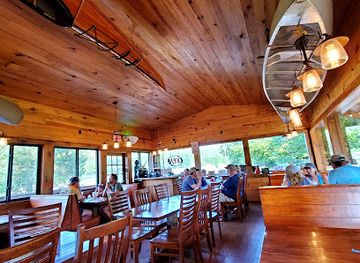
Dining in the Oklahoma Ozark Plateau reflects the broader food traditions of Oklahoma and the American South, with local variation between small towns, lake communities and Tahlequah. Barbecue, fried catfish, chicken-fried steak, burgers, biscuits, pies and hearty breakfasts are common at independent cafés, diners and family-run restaurants. Near the lakes and rivers, menus often include freshwater fish, sandwiches and casual food suited to boating and camping days, while Tahlequah offers a broader selection of American, Mexican and contemporary cooking. Farmers’ markets and roadside stands may offer seasonal tomatoes, peaches, berries and other produce, particularly in warmer months. Cherokee foodways and community traditions are important to the region’s cultural identity, although they should not be reduced to a standard restaurant menu. Craft beer and locally made products may appear in town, but the region’s most characteristic dining remains informal, generous and closely tied to small-town and rural life.
-
Italian
Roma Italian Restaurant
Indulge in authentic Italian cuisine at Roma Italian Restaurant in Ozark—where every meal is a culinary journey through Italy's rich flavors.
-
American
Byrd's Mulberry Riverfront Restaurant
Discover Byrd's Mulberry Riverfront Restaurant: where classic American cuisine meets breathtaking riverside views in Ozark, Arkansas.
Best bars in Ozark Plateau
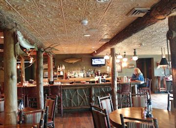
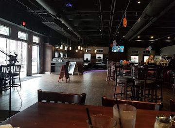
Evening life on the Oklahoma Ozark Plateau is concentrated in Tahlequah, Miami, Grove and other larger communities rather than organised around a major nightclub district. Traditional bars, grills, sports establishments, cafés and live-music settings provide the principal social venues, while lake towns become busier during the summer recreation season. Tahlequah’s student population contributes a more active evening scene than the surrounding rural areas, though it remains modest compared with Oklahoma City or Tulsa. In smaller communities, evenings often centre on restaurants, local events and informal gatherings rather than late-night clubs. Visitors should expect opening arrangements to vary and should not rely on finding extensive nightlife near remote parks, river access points or campgrounds. Breweries and other drinks-focused venues may be present in the larger towns, but alcohol is not necessary to engage with the region’s evening culture.
-
Restaurant
Cherokee Casino Tahlequah
Experience the thrill of gaming, delightful dining, and live entertainment at Cherokee Casino Tahlequah, a premier tourist attraction in Oklahoma.
-
American
Devil's Pool Restaurant
Experience exquisite American cuisine amidst stunning natural beauty at Devil's Pool Restaurant in the Ozarks.
-
Bar
Chili's Grill & Bar
Experience the vibrant flavors of American and Tex-Mex cuisine at Chili's Grill & Bar in Tahlequah, where family fun meets delicious dining.
-
Bar
JJ's Alley
Discover the lively spirit of Bricktown at JJ's Alley, a vibrant bar and grill with live music, delicious food, and a friendly atmosphere.


Best nightclubs in Ozark Plateau
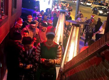
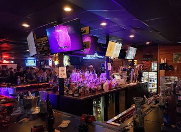
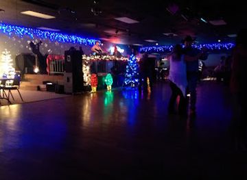
Evening life on the Oklahoma Ozark Plateau is concentrated in Tahlequah, Miami, Grove and other larger communities rather than organised around a major nightclub district. Traditional bars, grills, sports establishments, cafés and live-music settings provide the principal social venues, while lake towns become busier during the summer recreation season. Tahlequah’s student population contributes a more active evening scene than the surrounding rural areas, though it remains modest compared with Oklahoma City or Tulsa. In smaller communities, evenings often centre on restaurants, local events and informal gatherings rather than late-night clubs. Visitors should expect opening arrangements to vary and should not rely on finding extensive nightlife near remote parks, river access points or campgrounds. Breweries and other drinks-focused venues may be present in the larger towns, but alcohol is not necessary to engage with the region’s evening culture.
-
Night club
Redneck Dance Hall
Discover the vibrant nightlife at Redneck Dance Hall, Oklahoma City's premier spot for dancing, live music, and Southern hospitality.
-
Night club
One15 Nightclub
Dive into the electrifying atmosphere of One15 Nightclub in Oklahoma City, where vibrant music and expertly crafted cocktails fuel an unforgettable nightlife experience.
-
Bar
Katt's Cove
Discover Katt's Cove, where karaoke, live music, and friendly competition meet in an inviting Oklahoma City bar atmosphere.
-
Night club
Starlite Club
Discover the vibrant nightlife and energetic atmosphere at Starlite Club, Ardmore's top destination for music, dancing, and socializing.

Best shops in Ozark Plateau
Shopping in the Oklahoma Ozark Plateau is centred on small-town commercial streets, practical retail areas, antique shops, galleries, farmers’ markets and outlets associated with lake recreation rather than large luxury centres. Tahlequah is the best place to look for Cherokee-related books, art, language materials and culturally informed gifts, particularly through established heritage institutions and local makers. Markets and roadside stalls may offer seasonal fruit, vegetables, preserves and baked goods, while independent shops in towns such as Miami and Grove reflect local history and everyday community trade. Antiques, vintage goods, regional art, Native-made work and outdoor equipment are more characteristic purchases than mass-market fashion. Visitors should distinguish authentic Cherokee cultural products from generic designs using Native imagery, and should buy directly from reputable artists or recognised cultural institutions where possible. Rural shopping hours can be limited, so purchase food, fuel and outdoor supplies before travelling to remote lakes or river areas.
-
Store
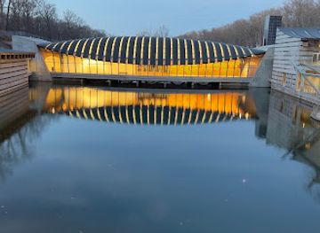
Crystal Bridges Museum of American Art
Discover the intersection of art and nature at Crystal Bridges Museum of American Art in Bentonville, Arkansas.
-
Shopping mall
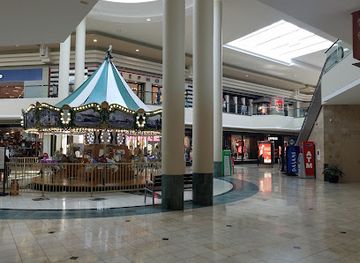
Woodland Hills Mall
Discover the ultimate shopping and dining experience at Woodland Hills Mall in Tulsa, where style meets comfort in a vibrant atmosphere.
-
National forest
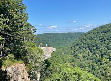
Ozark - St. Francis National Forest
Explore the enchanting Ozark - St. Francis National Forest, where nature's beauty and outdoor adventures await every traveler.
-
Outlet mall
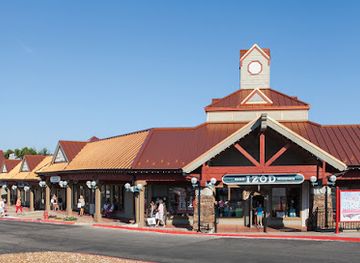
Osage Beach Outlet Marketplace
Explore the Osage Beach Outlet Marketplace for unbeatable deals, stunning views, and a fun-filled shopping experience in Missouri.
Get your free copy of our complete guide to Ozark Plateau, delivered straight to you.
Everything on this page, from attractions and restaurants to essentials and local phrases, in one PDF you can read offline, print or share.
Already have an account? Sign in
Your Ozark Plateau guide is ready.
We'll send it to · Not you? Sign out

Getting your guide ready…
We are putting together a fresh copy of the Ozark Plateau guide. This can take up to a minute.
This can take a few moments. If your browser asks, choose Allow so the download can start. You'll find the guide in your Downloads folder.
Nothing happened? Download it again
Sorry, the guide is taking longer than usual. Please try again in a minute, or get it by email instead.
Ozark Plateau essentials
Currency and Payment
Safety
Emergency Situations
Do's and Don'ts
Local Tips
From Eve
Local phrases worth knowing
You don't need to get them perfect. A few words go a long way, and locals appreciate the effort.
Basics
| English | Local | Say it |
|---|---|---|
| Hello | Howdy | [Hao-dee] |
| Goodbye | See ya later | [See ya lay-ter] |
| Yes | Yup | [Yup] |
| No | Nope | [Nope] |
| Please/You're welcome | Please/No problem | [Please/No prob-lem] |
| Thank you | Thank ya | [Thank ya] |
| Excuse me/Sorry | Pardon me/Sorry | [Par-don me/Sor-ree] |
| How are you? | How ya doin'? | [How ya doin'?] |
| Fine. And you? | I’m good. How 'bout you? | [I’m good. How 'bout you?] |
| Do you speak English? | Do ya speak English? | [Do ya speak English?] |
| I don't understand | I ain't followin' | [I ain't fol-lowin'] |
Eating & Drinking
| English | Local | Say it |
|---|---|---|
| I'd like to see the menu, please | Can I see the menu, please? | [Can I see the men-u, please?] |
| I don't eat meat | I don’t eat no meat | [I don’t eat no meat] |
| Cheers! | Cheers! | [Cheers!] |
| I would like to pay, please | I’d like to settle up, please | [I’d like to set-tle up, please] |
Emergencies
| English | Local | Say it |
|---|---|---|
| Help! | Help! | [Help!] |
| Go away! | You best get on! | [You best get on!] |
| Call the Police! | Call the cops! | [Call the cops!] |
| Call a doctor! | Get a doctor! | [Get a doc-tor!] |
| I'm lost | I’m lost | [I’m lost] |
| I'm ill | I’m feelin' poorly | [I’m feelin' poor-ly] |
Shopping
| English | Local | Say it |
|---|---|---|
| I'd like to buy... | I wanna buy... | [I wanna buy...] |
| I'm just looking | Just lookin' | [Just look-in'] |
| How much is it? | How much’s that cost? | [How much’s that cost?] |
| That's too expensive | That costs too much | [That costs too much] |
| Can you lower the price? | Can ya make it cheaper? | [Can ya make it cheap-er?] |
Time & Numbers
| English | Local | Say it |
|---|---|---|
| What time is it? | What time's it? | [What time's it?] |
| It's one o'clock | It’s one o'clock | [It’s one o'clock] |
| Half past (10) | Half past ten | [Half past ten] |
| Morning | Mornin' | [Mornin'] |
| Afternoon | Afternoon | [Af-ter-noon] |
| Evening | Evenin' | [Evenin'] |
| Yesterday | Yestidy | [Yes-ti-dy] |
| Today | Today | [To-day] |
| Tomorrow | Tomorrah | [To-mor-rah] |
| 1 | One | [One] |
| 2 | Two | [Two] |
| 3 | Three | [Three] |
| 4 | Four | [Four] |
| 5 | Five | [Five] |
| 6 | Six | [Six] |
| 7 | Seven | [Seven] |
| 8 | Eight | [Eight] |
| 9 | Nine | [Nine] |
| 10 | Ten | [Ten] |
Transport & Directions
| English | Local | Say it |
|---|---|---|
| Where's a/the...? | Where’s a...? | [Where’s a...?] |
| What's the address? | What’s the address? | [What’s the ad-dress?] |
| Can you show me (on the map)? | Can ya show me on the map? | [Can ya show me on the map?] |
| When's the next (bus)? | When’s the next bus? | [When’s the next bus?] |
| A ticket (to ....) | A ticket to... | [A tick-et to...] |
History of Ozark Plateau
Indigenous Peoples and Ancient Landscapes
The Ozark uplands of northeastern Oklahoma have been occupied and travelled by Indigenous peoples for thousands of years. Caddoan-speaking peoples, Osage communities and other Native nations maintained relationships with the region’s rivers, forests and hunting grounds before nineteenth-century resettlement transformed its political geography. Archaeological evidence across eastern Oklahoma includes ancient settlements, tools and ceremonial earthworks, although the surviving landscape has also been altered by farming, dams, roads and mining. Understanding this long Indigenous history is essential: the region was not an empty frontier awaiting settlement, but a lived landscape with established communities, trade routes and cultural traditions.
Cherokee Relocation and the Trail of Tears
During the 1830s, the United States forcibly removed Cherokee people from their southeastern homelands to Indian Territory, in an event remembered as the Trail of Tears. Many survivors settled in what is now northeastern Oklahoma, where Tahlequah became the capital of the Cherokee Nation in 1839. The region therefore became a centre of Cherokee political, educational and religious life. Churches, cemeteries, historic homes and cultural institutions around Tahlequah and Park Hill reflect the community’s efforts to rebuild sovereignty and institutions under exceptionally difficult conditions.
Cherokee Nation Institutions in Indian Territory
After relocation, the Cherokee Nation developed a government, schools, newspapers and churches in the wooded country around Tahlequah. The Cherokee National Female Seminary, established in the nineteenth century, represented the importance placed on education, while the Cherokee Advocate and other institutions supported political and cultural life. Places such as the Murrell Home at Park Hill preserve part of the complex history of Cherokee citizens, enslaved African Americans, plantation society and United States expansion. These institutions made northeastern Oklahoma one of the most significant centres of Cherokee public life.
Allotment, Statehood and Transformation
The late nineteenth and early twentieth centuries brought profound changes as federal policy dismantled communal landholding through allotment and opened former Indian Territory to non-Native settlement. Oklahoma statehood in 1907 created a new political framework, while railways, roads, schools, commercial agriculture and growing towns changed the economy of the Ozark borderlands. Cherokee political authority and land ownership were severely disrupted, but Cherokee identity and community institutions endured. The modern region’s mixture of Native nationhood, small-town settlement and agricultural landscapes is rooted in this period of upheaval.
Lead, Zinc and the Tri-State Mining District
In the far northeast, particularly around Ottawa County and Miami, lead and zinc mining became a major industry during the twentieth century. The area formed part of the Tri-State Mining District, extending across Oklahoma, Kansas and Missouri. Mines, mills, railways and company towns brought employment and commercial growth, but extraction also left environmental and public-health legacies. Miami’s historic buildings and surrounding industrial landscape retain traces of this past, while the Tar Creek area illustrates the long-term consequences of abandoned mines and contaminated water.
Dams, Lakes and the Modern Recreation Economy
From the mid-twentieth century, dam construction reshaped the region’s rivers and created large reservoirs for flood control, water supply, power generation and recreation. Tenkiller Ferry Lake, Grand Lake O’ the Cherokees and other reservoirs altered valleys and shorelines while supporting marinas, fishing, camping and holiday accommodation. The Illinois River also became an important recreational waterway. This shift added tourism to the region’s agricultural, Indigenous and extractive histories, making outdoor recreation a defining part of the contemporary Ozark Plateau economy.
Ozark Plateau in Photos
Browse through our photo collection highlighting the charm and character of the destination.
Neighbouring regions of Ozark Plateau
The closest regions to Ozark Plateau, if you have time for more than one.
-

-
-

-

-


Swipe for more regions
Explore more
Explore more of Oklahoma
Discover Oklahoma: Where the spirit of the Old West meets modern charm, offering a rich mix of history, nature, and vibrant culture in the heart of the United States.
Explore Oklahoma