

Free Al Hajar Al Gharbi Travel Guide & Mobile App
Explore Al Hajar Al Gharbi with free travel guides. Discover regional history, expert tips, proposed trips, and audio guides on web or mobile app.


Explore Al Hajar Al Gharbi for Jebel Shams, dramatic wadis, historic forts, terraced villages and Oman’s enduring mountain culture.
Read more about Al Hajar Al Gharbi
When is the best time to visit Al Hajar Al Gharbi?
Best: December–February · 23–24°C| Month | High (°C) | Rainfall (mm) |
|---|---|---|
| January (best) | 23 | 5 |
| February (best) | 24 | 6 |
| March | 27 | 8 |
| April | 32 | 5 |
| May | 37 | 3 |
| June | 40 | 1 |
| July | 41 | 6 |
| August | 41 | 10 |
| September | 38 | 5 |
| October | 33 | 3 |
| November | 28 | 4 |
| December (best) | 24 | 6 |
Getting to and around Al Hajar Al Gharbi
How to get there
Transportation
Top city travel guides in Al Hajar Al Gharbi
The cities of Al Hajar Al Gharbi, and the easiest places to base yourself.
-

-

-

-

-

-


Swipe for more cities
Best attractions in Al Hajar Al Gharbi
Al Hajar Al Gharbi offers a concentrated mixture of mountain scenery, living heritage and outdoor travel. Jebel Shams is the central draw, with high viewpoints above Wadi Nakhar and access to demanding walks along the escarpment. Wadi Bani Awf provides a contrasting journey through narrow rock corridors, terraces and scattered mountain villages, although route conditions should be checked carefully. Around Al Hamra, the old quarter and the nearby village of Misfat Al Abriyeen reveal how stone, mud brick, terraces and falaj irrigation shaped settlement in an arid environment. Rustaq and Nakhal combine historic forts with palm-filled oases and springs, making them rewarding alternatives to a purely scenic itinerary. Short village walks, canyon viewpoints, geology, birdlife and four-wheel-drive excursions are more characteristic here than formal amusement attractions. Activities are sensitive to heat and weather, and access to some valleys is seasonal or best undertaken with local knowledge. The region rewards travellers who balance ambitious mountain outings with slower visits to farms, historic neighbourhoods and small community museums or heritage spaces where available.
-
Diving center
Pearl Dimaniyat diving center
Discover the underwater wonders of Oman at Pearl Dimaniyat Diving Center, where adventure and marine beauty await every diver.
-
Tourist attraction
Sifah Beach
Discover the beauty of Sifah Beach, a tranquil oasis in Oman perfect for sunbathing, swimming, and enjoying stunning coastal views.
-
Tourist attraction
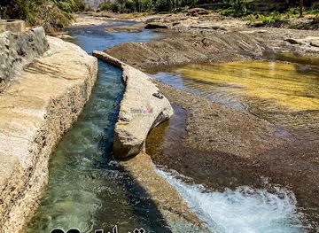
فلج القرواني Al-Qarwani Falaj
Explore Al-Qarwani Falaj, an enchanting tourist attraction in Oman showcasing the beauty of traditional irrigation and lush landscapes.
-
Tourist attraction
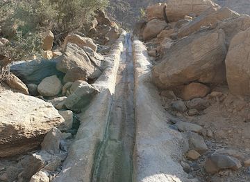
Al Hajir Falaj
Explore Al Hajir Falaj, a stunning UNESCO World Heritage site in Oman, showcasing traditional irrigation systems amidst breathtaking natural beauty.

Best landmarks in Al Hajar Al Gharbi
Jebel Shams is the defining natural landmark of Al Hajar Al Gharbi, its high limestone escarpments forming the dramatic upper rim above Wadi Nakhar. The canyon itself is a geological landmark as much as a viewpoint, revealing the immense vertical relief created by erosion and uplift. Rustaq Fort stands as one of the region's most important historic structures, associated with the town's former political prominence and its oasis setting. Nakhal Fort, positioned above a palm oasis and rocky foothills, demonstrates how defensive architecture was integrated with agriculture and water. The old houses and terraces of Misfat Al Abriyeen are less monumental but equally significant, preserving a settlement pattern adapted to a steep, dry slope. In Al Hamra, traditional earthen buildings provide a visual record of domestic architecture and village organisation. Falaj channels, watchtowers, cliff roads and the narrow passages of Wadi Bani Awf complete a landmark landscape in which human construction is closely tied to mountain geology and scarce water.
-
Mosque
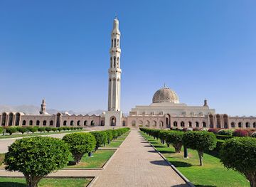
Sultan Qaboos Grand Mosque
Discover the stunning Sultan Qaboos Grand Mosque in Muscat, a masterpiece of Islamic architecture and cultural heritage.
-
Fortress
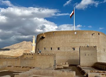
Nizwa Fort
Explore the majestic Nizwa Fort, a historical fortress in Oman that offers a glimpse into the rich culture and heritage of the region.
-
Tourist attraction
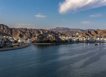
Mutrah Corniche
Experience the breathtaking views and vibrant culture at Mutrah Corniche, Muscat's picturesque waterfront promenade.
-
Historical landmark
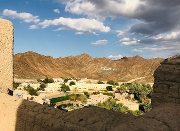
Bahla Fort
Uncover the architectural splendor and rich history of Bahla Fort, a UNESCO World Heritage Site in Oman, offering breathtaking views and cultural insights.
Explore Al Hajar Al Gharbi on the map
Plan your trip on one map. See where the top cities, national parks and sights are, and book hotels and experiences in a few clicks.
Best hotels in Al Hajar Al Gharbi
Best restaurants in Al Hajar Al Gharbi
Food in Al Hajar Al Gharbi reflects Oman's broader culinary traditions while drawing strongly on oasis agriculture and mountain hospitality. Dates, rice, spiced meat, flatbreads, lentils and strong coffee are common foundations, with shuwa appearing for special occasions rather than as an everyday restaurant dish. Mountain honey, dates and seasonal produce are important local products, while halwa and dates are customary gifts or purchases. In Rustaq, Nakhal, Al Hamra and other larger settlements, visitors will find modest cafés and restaurants serving Omani meals alongside South Asian and wider regional cooking. Guesthouses and mountain lodges may offer traditional dishes by arrangement, but food options become sparse in remote valleys. Carry snacks and water for long drives, and do not assume that every scenic viewpoint has a café. Alcohol is not part of ordinary local dining; any licensed service is generally confined to permitted hotels and should not be expected in villages or rural restaurants.
-
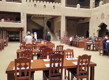
Turkish
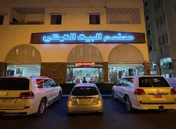
Turkish House Restaurant
Experience authentic Turkish flavors at Muscat's beloved Turkish House Restaurant, where culinary tradition meets modern dining.
-
Restaurant
Rozna Restaurant
Discover the taste of Oman at Rozna Restaurant - where authentic Omani and Zanzibari dishes await you in Muscat.
-
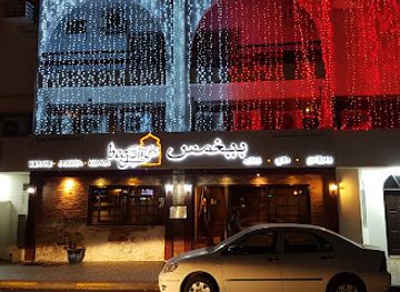
Indian
Begum's Restaurant Al Khuwair
Experience authentic Indian flavors at Begum's Restaurant Al Khuwair - where every dish tells a story.
-
Restaurant
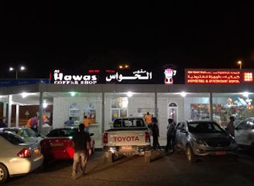
Al Hawas
Discover authentic Omani cuisine at Al Hawas in Muscat—where tradition meets taste in every delightful dish.
Best bars in Al Hajar Al Gharbi
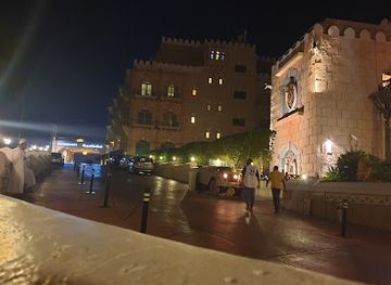
Nightlife in Al Hajar Al Gharbi is quiet and landscape-led rather than centred on clubs. Evenings in Rustaq, Nakhal, Al Hamra and the mountain resorts usually revolve around family restaurants, hotel dining rooms, cafés and conversation, with little of the late-night entertainment found in larger Omani cities. Mountain accommodation may provide a terrace for stargazing or an indoor lounge, but services vary and should be confirmed before arrival. Traditional coffee, tea and dates are more characteristic of rural social life than bar culture. Licensed alcoholic drinks, where available under Omani regulations, are generally limited to authorised hotels and resorts rather than local villages. Plan remote evenings in advance, keep fuel and drinking water available, and respect the quiet atmosphere of communities after dark.
-
Turkish
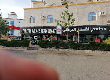
Turkish Palace Restaurant مطعم القصر التركي
Discover authentic Turkish flavors at Turkish Palace Restaurant in Seeb, where culinary excellence meets warm, inviting hospitality.
-
Lebanese
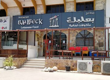
Baalbeck Lebanese Restaurant
Discover authentic Lebanese flavors at Baalbeck Lebanese Restaurant in Salalah, where every dish tells a story of culinary tradition.
-
Barbecue
Barbeque Nation - Oman Avenues Mall باربيكيو نيشن
Discover the vibrant flavors of barbecue at Barbeque Nation in Oman Avenues Mall, where every meal is a delightful feast for the senses.
-
Pakistani
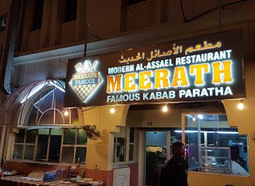
Meerath Famous Restaurant
Experience the authentic tastes of Pakistan and India at Meerath Famous Restaurant in Muscat, a must-visit for food lovers.
Best nightclubs in Al Hajar Al Gharbi
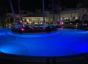
Nightlife in Al Hajar Al Gharbi is quiet and landscape-led rather than centred on clubs. Evenings in Rustaq, Nakhal, Al Hamra and the mountain resorts usually revolve around family restaurants, hotel dining rooms, cafés and conversation, with little of the late-night entertainment found in larger Omani cities. Mountain accommodation may provide a terrace for stargazing or an indoor lounge, but services vary and should be confirmed before arrival. Traditional coffee, tea and dates are more characteristic of rural social life than bar culture. Licensed alcoholic drinks, where available under Omani regulations, are generally limited to authorised hotels and resorts rather than local villages. Plan remote evenings in advance, keep fuel and drinking water available, and respect the quiet atmosphere of communities after dark.
-
Lounge
Zale Beach Club & Lounge
Experience luxury dining and vibrant nightlife at Zale Beach Club & Lounge, Muscat's premier seaside destination.
-
Night club
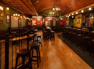
O'Malley's Irish Pub
Discover the lively spirit of Ireland at O'Malley's Irish Pub, where great food and drinks meet vibrant nightlife in Muscat.
-
Bar
Club Safari
Experience the vibrant nightlife at Club Safari, where exotic drinks and lively ambiance converge in Muscat's premier bar.
-
Disco club
Whispers Night Club
Dive into the vibrant nightlife at Whispers Night Club in Salalah, where music, dancing, and unforgettable moments await you.

Best shops in Al Hajar Al Gharbi
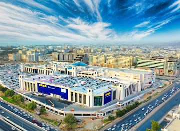
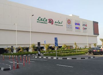
Shopping in Al Hajar Al Gharbi is concentrated in small town centres, fort-side areas, village shops and local produce outlets rather than large retail districts. Dates, Omani halwa, honey, coffee, spices and packaged mountain produce make practical food gifts, while traditional silver jewellery, khanjars, woven items and pottery may be found through specialist sellers and heritage-oriented shops. In the foothill towns, ordinary souqs and neighbourhood stores offer a more useful picture of local commerce than souvenir displays alone. Al Hamra and Misfat Al Abriyeen are suited to browsing small craft and produce outlets when open, but availability can be seasonal and limited. Ask about provenance before buying antiques or old-looking objects, and carry cash for smaller purchases. Markets and shops may close during prayer times, religious holidays or the hottest part of the day, so do not plan a remote shopping stop around a narrow timetable.
-
Shopping mall
Oman Avenues Mall
Discover Oman Avenues Mall in Muscat: your ultimate shopping and dining destination with a touch of Omani culture.
-
Shopping mall
Mall of Muscat
Experience the ultimate shopping and entertainment destination at the Mall of Muscat, where culture meets modern retail in Oman.
-
Shopping mall
Mall of Oman
Explore the Mall of Oman, the ultimate shopping and entertainment destination in Muscat, where luxury meets local culture in a stunning architectural setting.
-
Shopping mall
Al Araimi Boulevard
Explore Al Araimi Boulevard, Muscat's premier shopping mall offering top brands, delightful dining, and family-friendly entertainment.


Get your free copy of our complete guide to Al Hajar Al Gharbi, delivered straight to you.
Everything on this page, from attractions and restaurants to essentials and local phrases, in one PDF you can read offline, print or share.
Already have an account? Sign in
Your Al Hajar Al Gharbi guide is ready.
We'll send it to · Not you? Sign out

Getting your guide ready…
We are putting together a fresh copy of the Al Hajar Al Gharbi guide. This can take up to a minute.
This can take a few moments. If your browser asks, choose Allow so the download can start. You'll find the guide in your Downloads folder.
Nothing happened? Download it again
Sorry, the guide is taking longer than usual. Please try again in a minute, or get it by email instead.
Al Hajar Al Gharbi essentials
Currency and Payment
Safety
Emergency Situations
Do's and Don'ts
Local Tips
From Eve
Local phrases worth knowing
You don't need to get them perfect. A few words go a long way, and locals appreciate the effort.
Basics
| English | Local | Say it |
|---|---|---|
| Hello | مرحبا | [Marhaban] |
| Goodbye | إلى اللقاء | [Ila al-liqaa] |
| Yes | نعم | [Na'am] |
| No | لا | [La] |
| Please/You're welcome | من فضلك | [Min fadlik] |
| Thank you | شكرا | [Shukran] |
| Excuse me/Sorry | عفوا | [Afwan] |
| How are you? | كيف حالك؟ | [Kayfa halak?] |
| Fine. And you? | بخير. وأنت؟ | [Bikhayr. Wa anta?] |
| Do you speak English? | هل تتحدث الإنجليزية؟ | [Hal tatahaddath al-Ingleeziya?] |
| I don't understand | لا أفهم | [La afham] |
Eating & Drinking
| English | Local | Say it |
|---|---|---|
| I'd like to see the menu, please | أود رؤية القائمة، من فضلك | [Awad ru'yat al-qaa'ima, min fadlik] |
| I don't eat meat | لا أكل اللحم | [La akul al-lahm] |
| Cheers! | في صحتك! | [Fi sihatak!] |
| I would like to pay, please | أود الدفع، من فضلك | [Awad al-daf', min fadlik] |
Emergencies
| English | Local | Say it |
|---|---|---|
| Help! | نجدة! | [Najda!] |
| Go away! | اذهب بعيدا! | [Izhab ba'id!] |
| Call the Police! | اتصل بالشرطة! | [Ittasil bil-shurta!] |
| Call a doctor! | اتصل بطبيب! | [Ittasil bi-tabeeb!] |
| I'm lost | أنا ضائع | [Ana da'i'] |
| I'm ill | أنا مريض | [Ana marid] |
Shopping
| English | Local | Say it |
|---|---|---|
| I'd like to buy... | أود شراء... | [Awad shiraa...] |
| I'm just looking | أنا فقط أنظر | [Ana faqat anzur] |
| How much is it? | كم ثمنه؟ | [Kam thamanuh?] |
| That's too expensive | هذا مكلف جدا | [Hatha mukallaf jidan] |
| Can you lower the price? | هل يمكنك تخفيض السعر؟ | [Hal yumkinuka takhfeed al-si'r?] |
Time & Numbers
| English | Local | Say it |
|---|---|---|
| What time is it? | كم الساعة؟ | [Kam al-saa'a?] |
| It's one o'clock | الساعة واحدة | [Al-saa'a wahida] |
| Half past (10) | نصف (10) | [Nisf (10)] |
| Morning | صباح | [Sabah] |
| Afternoon | بعد الظهر | [Ba'ad al-dhuhr] |
| Evening | مساء | [Masa'] |
| Yesterday | أمس | [Ams] |
| Today | اليوم | [Al-yawm] |
| Tomorrow | غدا | [Ghadan] |
| 1 | واحد | [Wahid] |
| 2 | اثنان | [Ithnān] |
| 3 | ثلاثة | [Thalātha] |
| 4 | أربعة | [Arba'a] |
| 5 | خمسة | [Khamsa] |
| 6 | ستة | [Sitta] |
| 7 | سبعة | [Sab'a] |
| 8 | ثمانية | [Thamāniya] |
| 9 | تسعة | [Tis'a] |
| 10 | عشرة | [Ashara] |
Transport & Directions
| English | Local | Say it |
|---|---|---|
| Where's a/the...? | أين ال...؟ | [Ayna al...?] |
| What's the address? | ما هو العنوان؟ | [Ma huwa al-'unwan?] |
| Can you show me (on the map)? | هل يمكنك أن تريني (على الخريطة)؟ | [Hal yumkinuka an turini (ala al-kharita)?] |
| When's the next (bus)? | متى يأتي (الباص) التالي؟ | [Mata ya'ti (al-bus) al-tali?] |
| A ticket (to ....) | تذكرة (إلى....) | [Tadhkira (ila....)] |
History of Al Hajar Al Gharbi
Early settlement and mountain resources
The Western Hajar has supported human settlement for thousands of years because its wadis, springs and alluvial fans provide access to water and cultivable land. Archaeological remains across Oman show long-standing connections between mountain communities, the interior and the coast. Copper resources elsewhere in the Hajar helped establish Oman within Bronze Age exchange networks linking the peninsula with Mesopotamia and the wider Indian Ocean world. In the western range, the enduring historical pattern was one of small settlements adapting carefully to steep terrain, limited water and difficult movement between valleys.
Islamic Oman and the Ibadi tradition
From the early Islamic period, Oman developed a distinctive Ibadi religious and political tradition, with local communities often organised around learned leaders, elected imams and fortified settlements. Mountain oases became important centres of agriculture, scholarship and authority. Mosques, falaj systems and compact villages reflect that social order, while the survival of old settlement patterns around Rustaq, Nakhal and the Al Hamra area shows how religion, water management and local governance were closely connected.
Falaj irrigation and oasis agriculture
Falaj irrigation transformed the possibilities of life in the Hajar foothills and valleys. These channels, drawing water from underground sources or mountain springs, distributed supplies according to established communal arrangements. Dates formed the foundation of many oases, with other crops grown beneath the palms where conditions allowed. The system required maintenance, rules and cooperation, and its continued presence around mountain settlements is a practical record of generations of environmental knowledge rather than merely an archaeological curiosity.
Rustaq and the rule of the Ya'aruba imams
Rustaq became one of the most important political centres in Oman, particularly during the Ya'aruba dynasty in the seventeenth and early eighteenth centuries. Its position among productive oases and routes towards the interior helped support political authority, while Rustaq Fort and the nearby hot springs remain visible reminders of its importance. The period also saw the consolidation of Omani power and maritime expansion, linking the interior's agricultural and political centres with a wider Indian Ocean presence.
Fortified towns and regional power
Across the Western Hajar, forts and watchtowers protected water sources, settlements and routes through the mountains. Nakhal Fort, Rustaq Fort and the defensive architecture of older villages belong to a wider Omani tradition in which political influence depended on controlling oases and avenues of movement. These structures were not isolated monuments: they stood beside farms, mosques, markets and residential quarters. Their thick walls, elevated positions and restricted entrances reveal the security concerns of communities where local rivalries and changing dynastic authority shaped everyday life.
Modern roads and changing mountain economies
For much of their history, Hajar communities depended on footpaths, pack animals and valley routes. Modern roads, vehicles, electricity, schools and piped water have altered that pattern, making high villages and scenic areas accessible to visitors and allowing residents to work and study beyond their immediate settlements. Agriculture and traditional crafts remain important cultural markers, but tourism, guiding, hospitality and commuting now form part of the region's contemporary economy. The result is a landscape where old terraces and new infrastructure exist side by side.
Heritage conservation and contemporary tourism
In recent decades, Oman has placed greater emphasis on restoring forts, maintaining historic villages and presenting mountain landscapes to visitors. Jebel Shams, Wadi Bani Awf, Misfat Al Abriyeen and the Rustaq–Nakhal area have become important parts of the country's cultural and outdoor tourism offer. This development brings income and wider recognition, but it also makes responsible travel significant. Water is limited, mountain habitats are fragile and many heritage places remain working communities rather than controlled historic sites.
Al Hajar Al Gharbi in Photos
Browse through our photo collection highlighting the charm and character of the destination.
Neighbouring regions of Al Hajar Al Gharbi
The closest regions to Al Hajar Al Gharbi, if you have time for more than one.
-

-

-

-

-


Swipe for more regions
Explore more
Explore more of Oman
Discover Oman: A land of ancient forts, golden deserts, and warm hospitality, offering a perfect blend of adventure and tranquility.
Explore Oman