

Mount Liamuiga Travel Guide - Free Web & App
Your ultimate guide to Mount Liamuiga. Discover top landmarks, proposed trips, and local tips. Free on the web or via the Evendo companion app.


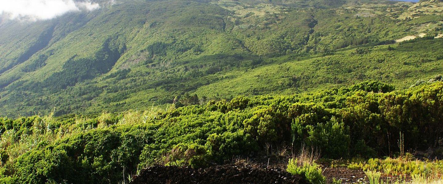


Mount Liamuiga in Saint Kitts offers rainforest hiking, volcanic landscapes, crater views and guided mountain adventures above the island’s historic coast.
A Forested Volcanic Summit
Mount Liamuiga rises to 1,156 metres at the northern end of Saint Kitts, its broad volcanic mass forming the island’s highest point. The name is associated with the island’s pre-European Kalinago heritage and is commonly interpreted as referring to a fertile place; older maps and colonial usage called the mountain Mount Misery. Its upper slopes are cloaked in humid rainforest, while the summit trail passes through changing vegetation, exposed ridges and cool cloud-forest conditions before reaching the crater rim.Read more about Mount Liamuiga
The Mountain and Its Gateways
Landscape, History and Outdoor Experience
When is the best time to visit Mount Liamuiga?
Best: June–August · 30°C| Month | High (°C) | Rainfall (mm) |
|---|---|---|
| January | 29 | 72 |
| February | 29 | 68 |
| March | 29 | 64 |
| April | 30 | 58 |
| May | 30 | 54 |
| June (best) | 30 | 49 |
| July (best) | 30 | 46 |
| August (best) | 30 | 48 |
| September | 30 | 52 |
| October | 30 | 57 |
| November | 30 | 63 |
| December | 29 | 68 |
Getting to and around Mount Liamuiga
How to get there
Transportation
Explore Mount Liamuiga on the map
Plan your trip on one map. See where the top attractions, landmarks, restaurants and hotels are, and book hotels and experiences in a few clicks.
Best hotels in Mount Liamuiga
Get your free copy of our complete guide to Mount Liamuiga, delivered straight to you.
Everything on this page, from attractions and restaurants to essentials and local phrases, in one PDF you can read offline, print or share.
Already have an account? Sign in
Your Mount Liamuiga guide is ready.
We'll send it to · Not you? Sign out

Getting your guide ready…
We are putting together a fresh copy of the Mount Liamuiga guide. This can take up to a minute.
This can take a few moments. If your browser asks, choose Allow so the download can start. You'll find the guide in your Downloads folder.
Nothing happened? Download it again
Sorry, the guide is taking longer than usual. Please try again in a minute, or get it by email instead.
Mount Liamuiga essentials
Currency and Payment
Safety
Emergency Situations
Do's and Don'ts
Local Tips
From Eve
Local phrases worth knowing
You don't need to get them perfect. A few words go a long way, and locals appreciate the effort.
Basics
| English | Local | Say it |
|---|---|---|
| Hello | Wa gwaan | [wah gwaan] |
| Goodbye | Later | [lay-ta] |
| Yes | Yeah man | [yeah man] |
| No | Nah man | [nah man] |
| Please/You're welcome | Beg yuh pardon | [beg yuh pah-dun] |
| Thank you | Thank yuh | [thank yuh] |
| Excuse me/Sorry | Sarry | [sah-ree] |
| How are you? | How yuh deh? | [how yuh deh] |
| Fine. And you? | Irie. An yuh? | [eye-ree. an yuh] |
| Do you speak English? | Yuh speak English? | [yuh speak ing-glish] |
| I don't understand | Mi nah comprehend | [me nah com-pren-d] |
Eating & Drinking
| English | Local | Say it |
|---|---|---|
| I'd like to see the menu, please | Lemme see di menu deh, please | [lem-me see dee menu deh, please] |
| I don't eat meat | Mi nah eat meat | [me nah eet meat] |
| Cheers! | Cheers! | [cheers] |
| I would like to pay, please | Mi waan pay, please | [me want pay, please] |
Emergencies
| English | Local | Say it |
|---|---|---|
| Help! | Help! | [help] |
| Go away! | Gweh! | [gweh] |
| Call the Police! | Call di Police! | [call dee police] |
| Call a doctor! | Call a doctor! | [call a doctor] |
| I'm lost | Mi loss | [me loss] |
| I'm ill | Mi sick | [me sick] |
Shopping
| English | Local | Say it |
|---|---|---|
| I'd like to buy... | Mi waan buy... | [me want buy] |
| I'm just looking | Mi jus lookin | [me just look-in] |
| How much is it? | A wha price deh? | [ah wah price deh] |
| That's too expensive | Dat too dear man | [dat too dear man] |
| Can you lower the price? | Yuh cyah drop di price? | [yuh kyah drop dee price] |
Time & Numbers
| English | Local | Say it |
|---|---|---|
| What time is it? | A wha time it be? | [ah wah time it bee] |
| It's one o'clock | A one o'clock it be | [ah one o'clock it bee] |
| Half past (10) | Half ten | [half ten] |
| Morning | Mawnin | [mawnin] |
| Afternoon | Evenin | [evenin] |
| Evening | Nite | [nite] |
| Yesterday | Yestadeh | [yes-ta-deh] |
| Today | Today | [to-day] |
| Tomorrow | Tomarruh | [tom-ah-ruh] |
| 1 | One | [wun] |
| 2 | Two | [too] |
| 3 | Tree | [tree] |
| 4 | Fo' | [fo] |
| 5 | Five | [fiv] |
| 6 | Six | [siks] |
| 7 | Seven | [sev-en] |
| 8 | Eight | [ate] |
| 9 | Nine | [nain] |
| 10 | Ten | [ten] |
Transport & Directions
| English | Local | Say it |
|---|---|---|
| Where's a/the...? | Whey di... | [way dee] |
| What's the address? | Wah di address deh? | [wah dee address deh] |
| Can you show me (on the map)? | Yuh cya show mi (pan di map)? | [yuh kyah show me (pan dee map)] |
| When's the next (bus)? | When di nex (bus) deh? | [when dee nex (bus) deh] |
| A ticket (to ....) | A ticket (to ....) | [ah ticket (to)] |
History of Mount Liamuiga
A Volcanic Island Before Settlement
Mount Liamuiga is part of Saint Kitts’s volcanic backbone, created by successive eruptions and the accumulation of volcanic rock over geological timescales. Its fertile lower slopes and varied rainfall helped shape the island’s natural environment long before written history. Indigenous peoples, including Kalinago communities, knew the island and its mountain within a landscape of forests, rivers and cultivated clearings. The name Liamuiga is linked to the island’s Indigenous heritage and is commonly understood as referring to fertility or fertile land, reflecting the importance of productive soils and abundant vegetation to life on Saint Kitts.
European Colonisation and Mount Misery
European colonisation began in the early seventeenth century, when Saint Kitts became one of the first English and French settlements in the eastern Caribbean. Plantation agriculture gradually transformed the coastal plains and lower valleys, first through tobacco and later through sugar, with enslaved African labour sustaining the plantation economy. Colonial maps and usage referred to the island’s highest mountain as Mount Misery, a name that remained in circulation for centuries. The steep, forested upper slopes were not converted to plantations on the same scale as the more accessible land below.
Sugar, Villages and the Mountain Landscape
As sugar estates expanded, villages and roads developed around the island’s productive coastal and foothill zones. St Paul’s and other northern settlements became part of a rural economy connected to estates, mills, ports and the movement of agricultural goods. Mount Liamuiga remained a prominent natural reference point above this working landscape, its forested slopes contrasting with cane fields and plantation land. The mountain’s water catchments and vegetation also formed part of the island’s environmental resources, although the wider landscape was reshaped by centuries of farming, deforestation and changing land use.
From Mount Misery to Liamuiga
The restoration of the name Mount Liamuiga reflects a broader Caribbean interest in recognising Indigenous place names and cultural history alongside colonial nomenclature. In modern Saint Kitts, the mountain is valued as a defining natural feature and an important hiking destination rather than as a site of large-scale development. Guided ascents from the St Paul’s area have brought visitors into the rainforest and crater landscape, while local awareness of weather, erosion and the fragility of upland habitats remains important to responsible access. The route’s appeal lies in experiencing a living volcanic environment within an island shaped by both Indigenous and colonial histories.
Mount Liamuiga in Photos
Browse through our photo collection highlighting the charm and character of the destination.
Neighbouring destination travel guides
The closest destinations to Mount Liamuiga, if you have time for more than one.
-

-

-

-

-


Swipe for more destinations
Explore more
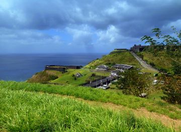
Explore more of Saint Thomas Middle Island Parish
Explore Saint Thomas Middle Island Parish for Brimstone Hill, plantation heritage, Caribbean views and the early history of Saint Kitts.
Explore Saint Thomas Middle Island Parish
Explore more of Saint Kitts and Nevis
Discover the pristine beaches, lush landscapes, and rich history of Saint Kitts and Nevis, a hidden gem in the Caribbean offering adventure and relaxation.
Explore Saint Kitts and Nevis