

Free Coteau des Prairies Travel Guide & Mobile App
Explore Coteau des Prairies with free travel guides. Discover regional history, expert tips, proposed trips, and audio guides on web or mobile app.


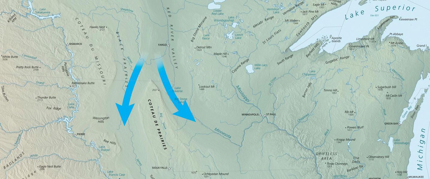


Explore South Dakota’s Coteau des Prairies for glacial lakes, open prairie, Dakota heritage, historic forts and relaxed outdoor travel.
Read more about Coteau des Prairies
Getting to and around Coteau des Prairies
How to get there
Transportation
Top city travel guides in Coteau des Prairies
The cities of Coteau des Prairies, and the easiest places to base yourself.
-

-

-

-


Swipe for more cities
Destinations in Coteau des Prairies
Resorts, valleys and scenic spots worth a trip of their own.
-
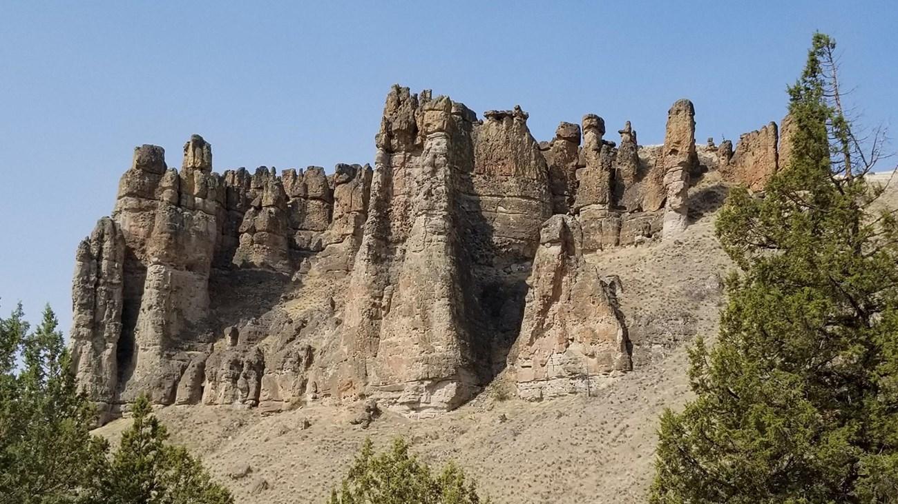 Palisades State Park
 in South Dakota features quartzite cliffs, the Split Rock River, hiking, camping, climbing and scenic landscapes near Garretson and Sioux Falls.
-


Swipe for more destinations
Best attractions in Coteau des Prairies
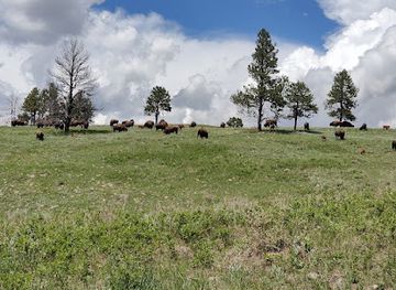
The Coteau des Prairies offers a landscape-based form of travel, with its attractions distributed among lakes, prairie roads, small towns and historic sites. Sica Hollow State Park near Sisseton protects a rare wooded ravine system whose shaded trails contrast with the open upland grassland. Fort Sisseton Historic State Park presents a preserved nineteenth-century military post, including surviving buildings and a broad historic setting. Roy Lake State Park and the lake districts around Waubay, Webster and northeastern South Dakota provide opportunities for boating, fishing, camping, birdwatching and quiet shoreline walks. Pickerel Lake Recreation Area is another important water-based destination. In and around Watertown, visitors can combine local museums, town amenities and access to nearby lakes. The region’s wildlife interest lies particularly in its wetlands, prairie remnants and migratory bird habitat, while its agricultural roads offer a close view of contemporary Great Plains farming. Activities are generally self-directed and seasonal, so visitors should expect fewer formal attractions and more emphasis on open space, local interpretation and time outdoors.
-
National park
Badlands National Park
Explore the breathtaking landscapes and unique geological features of Badlands National Park in South Dakota, a top destination for nature lovers.
-
State park
Custer State Park
Explore the breathtaking landscapes and diverse wildlife of Custer State Park, a premier destination for outdoor adventure in South Dakota.
-
Monument
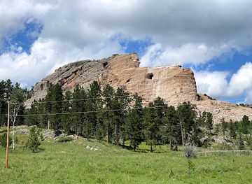
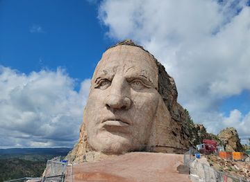
Crazy Horse Memorial
Explore the Crazy Horse Memorial, a monumental tribute to Native American heritage, culture, and the incredible artistry of mountain carving.
-
National park
Wind Cave National Park
Explore the breathtaking landscapes and unique cave formations at Wind Cave National Park, a premier destination for nature lovers in South Dakota.
Best landmarks in Coteau des Prairies
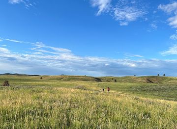
Fort Sisseton Historic State Park is the Coteau’s most prominent built landmark, preserving a rare group of nineteenth-century military buildings around a formal parade ground on the open plateau. Its location reveals why the elevated prairie was strategically important for travel and communication, while the surviving structures help explain frontier military administration. Sica Hollow is a notable natural landmark: its wooded ravines and spring-fed landscape create an unexpectedly enclosed environment within the broad, exposed prairie of northeastern South Dakota. The lakes of the Coteau, including Roy Lake, Enemy Swim Lake and Pickerel Lake, are geographical landmarks as well as recreation destinations, formed through glacial processes that define the region. In and around Watertown, historic civic and commercial buildings reflect the later development of railway-linked agricultural towns. The wider plateau itself is the essential landmark, with long views, gently rising ground, shelterbelts, wetlands and field boundaries revealing the meeting of glacial geology, Indigenous history and modern farming.
-
Cultural landmark
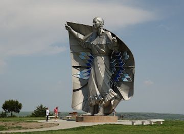
Dignity of Earth and Sky
Experience the grandeur of Dignity of Earth and Sky, a stunning tribute to Native American heritage in the heart of South Dakota's picturesque landscape.
-
Monument
Crazy Horse Memorial
Discover the rich history and culture of the Lakota Sioux at the iconic Crazy Horse Memorial in South Dakota, a breathtaking tribute to Native American heritage.
-
National reserve
Jewel Cave National Monument
Discover the underground marvels of Jewel Cave National Monument in South Dakota, where nature's artistry awaits every adventurer.
-
Visitor center
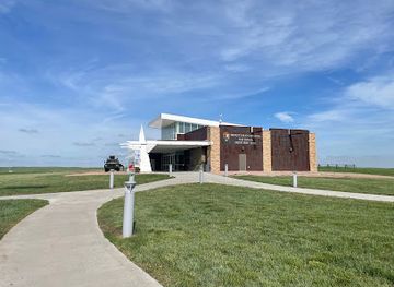
Minuteman Missile National Historic Site Visitor Center
Discover the Cold War's impact at the Minuteman Missile National Historic Site Visitor Center in South Dakota—an enlightening journey through history.
Explore Coteau des Prairies on the map
Plan your trip on one map. See where the top cities, national parks and sights are, and book hotels and experiences in a few clicks.
Best hotels in Coteau des Prairies
Best restaurants in Coteau des Prairies
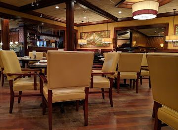
Dining across the Coteau des Prairies is rooted in small-town hospitality, farm-country ingredients and practical American regional cooking rather than a concentrated restaurant scene. Watertown provides the broadest range of cafés, diners, family restaurants and evening establishments, while Sisseton, Webster, Waubay and other communities offer local cafés, bakeries and places suited to an unhurried meal. Menus commonly draw on beef, pork, poultry, potatoes, bread, seasonal produce and freshwater fish, alongside familiar South Dakota and Midwestern dishes. Breakfasts, sandwiches, burgers, soups, pie and other baked goods are dependable features of independent eateries and diners. Farmers' markets and roadside or seasonal stands may provide vegetables, preserves and baked products when local produce is available. Visitors staying near lakes will find food options more limited outside towns, so carrying provisions is sensible. The region’s dining culture is best understood through community cafés, supper-club traditions, picnic supplies and locally sourced rural produce rather than claims of a separate, formal cuisine.
-
Inn
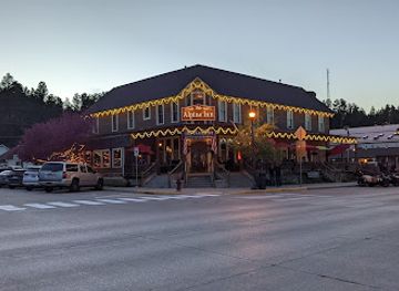
Alpine Inn
Discover comfort and culinary delight at Alpine Inn in Hill City - your gateway to exploring South Dakota's stunning Black Hills.
-
American
Tally's Silver Spoon
Experience culinary excellence at Tally's Silver Spoon in Rapid City - where American flavors meet fine dining ambiance.
-
Restaurant
Minervas Restaurant
Experience fine dining at Minervas Restaurant in Sioux Falls, where exquisite flavors meet elegant ambiance in the heart of downtown.
-
 Motel
Powder House
Discover Powder House: A charming motel and renowned steakhouse nestled in the beautiful Black Hills of South Dakota.
Best bars in Coteau des Prairies
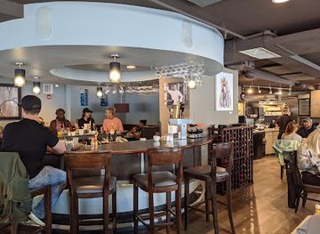
Evening life in the Coteau des Prairies is centred on small-town bars, traditional pubs, grills, cafés and restaurants rather than a large nightclub circuit. Watertown has the widest choice of places for an evening out, including casual bars and venues associated with local music or community events, while Sisseton and other county towns offer a more intimate selection. Around the lakes, evening activity often focuses on campfires, fishing, boating and informal gatherings rather than late-night entertainment. Seasonal festivals, county fairs and live music can bring additional energy, but dates and venues vary from year to year. Visitors should expect earlier closing times and longer travel distances than in a major US city, particularly in rural districts. Drink-driving laws are strictly enforced, so arrange a sober driver or remain within walking distance of accommodation. Non-alcoholic options are normally available in restaurants, cafés and convenience stores.
-
Grill
Tailgator's
Experience the vibrant atmosphere and mouthwatering dishes at Tailgator's, the premier grill and bar in Brandon, South Dakota.
-
Grill
Safari Bar And Grill
Savor the wilderness at Safari Bar And Grill, where grilled perfection meets vibrant hospitality in Renner, South Dakota.
-
Grill
212 The Boiling Point
Experience the lively atmosphere and delicious grill favorites at 212 The Boiling Point in Brandon, South Dakota.
-
Grill
Red Rock Bar & Grill
Experience the lively atmosphere of Red Rock Bar & Grill in Brandon, SD, where delicious grill cuisine meets live music and exciting casino action.


Best nightclubs in Coteau des Prairies
Evening life in the Coteau des Prairies is centred on small-town bars, traditional pubs, grills, cafés and restaurants rather than a large nightclub circuit. Watertown has the widest choice of places for an evening out, including casual bars and venues associated with local music or community events, while Sisseton and other county towns offer a more intimate selection. Around the lakes, evening activity often focuses on campfires, fishing, boating and informal gatherings rather than late-night entertainment. Seasonal festivals, county fairs and live music can bring additional energy, but dates and venues vary from year to year. Visitors should expect earlier closing times and longer travel distances than in a major US city, particularly in rural districts. Drink-driving laws are strictly enforced, so arrange a sober driver or remain within walking distance of accommodation. Non-alcoholic options are normally available in restaurants, cafés and convenience stores.
-
Bar
JL Beers
Discover the delicious burgers and local craft beers at JL Beers in Sioux Falls, the ultimate bar and grill experience.
-
Bar
Red Eye Bar & Casino
Experience the vibrant nightlife at Red Eye Bar & Casino in Sioux Falls, where gaming meets great drinks and live music.
-
Night club
Club David
Discover the electrifying nightlife at Club David in downtown Sioux Falls, where the dance floor and drinks await your arrival.
-
Lodge
Coteau des Prairies Lodge
Experience the tranquility of Coteau des Prairies Lodge, a perfect blend of adventure and relaxation in the heart of North Dakota.



Best shops in Coteau des Prairies
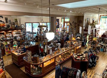
Shopping in the Coteau des Prairies is concentrated in market towns rather than large retail districts. Watertown has the region’s broadest selection of practical shops, independent businesses, galleries and everyday services, while Sisseton, Webster, Waubay and other communities provide smaller high streets where shopping is closely tied to local life. Visitors may find antiques, books, handmade goods, Native American arts and crafts, clothing, farm supplies and locally produced food, although availability varies and specialist shops may keep limited hours. Farmers' markets and seasonal community events are useful places to look for baking, preserves, vegetables, honey and other regional produce. In rural areas, farm stands and small convenience shops may be more relevant than conventional souvenir stores. A thoughtful regional purchase might be a locally made craft, prairie-themed artwork, food product or book about Dakota history and the Coteau landscape. Visitors should buy Indigenous art from reputable sources and avoid purchasing items presented ambiguously as tribal work.
-
Art gallery
Prairie Edge Trading Co & Galleries
Explore Native American art and culture at Prairie Edge Trading Co & Galleries, a premier destination for unique gifts and artistic inspiration.
-
Book store
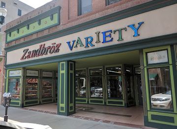
Zandbroz Variety
Discover the charm of Zandbroz Variety, an eclectic bookstore in Sioux Falls offering unique books, gifts, and a welcoming atmosphere.
-
Park
Devil's Gulch Park
Explore the enchanting landscapes and historical tales at Devil's Gulch Park, a premier destination for outdoor adventurers in South Dakota.
-
Gift shop
Corn Palace Gift Shop
Explore the Corn Palace Gift Shop for unique souvenirs and local crafts that embody the spirit of South Dakota, making your visit truly memorable.

Get your free copy of our complete guide to Coteau des Prairies, delivered straight to you.
Everything on this page, from attractions and restaurants to essentials and local phrases, in one PDF you can read offline, print or share.
Already have an account? Sign in
Your Coteau des Prairies guide is ready.
We'll send it to · Not you? Sign out

Getting your guide ready…
We are putting together a fresh copy of the Coteau des Prairies guide. This can take up to a minute.
This can take a few moments. If your browser asks, choose Allow so the download can start. You'll find the guide in your Downloads folder.
Nothing happened? Download it again
Sorry, the guide is taking longer than usual. Please try again in a minute, or get it by email instead.
Coteau des Prairies essentials
Currency and Payment
Safety
Emergency Situations
Do's and Don'ts
Local Tips
From Eve
Local phrases worth knowing
You don't need to get them perfect. A few words go a long way, and locals appreciate the effort.
Basics
| English | Local | Say it |
|---|---|---|
| Hello | Howdy | [HAW-dee] |
| Goodbye | See ya | [SEE ya] |
| Yes | Yep | [YEP] |
| No | Nope | [NOPE] |
| Please/You’re welcome | Please/No problem | [PLEEZ/NO PROB-lum] |
| Thank you | Thanks | [THANGKS] |
| Excuse me/Sorry | Excuse me/Sorry | [EX-CUSE me/SOR-ee] |
| How are you? | How ya doin'? | [HOW ya DO-in'] |
| Fine. And you? | Good. And you? | [GOOD. And you?] |
| Do you speak English? | Do ya speak English? | [DO ya SPEEK EN-glish?] |
| I don't understand | I don't get it | [I don't GET it] |
Eating & Drinking
| English | Local | Say it |
|---|---|---|
| I’d like to see the menu, please | Can I see the menu, please? | [CAN I SEE the MENU, PLEEZ?] |
| I don't eat meat | I don't eat meat | [I don't EAT meat] |
| Cheers! | Cheers! | [CHEERS!] |
| I would like to pay, please | Can I pay, please? | [CAN I PAY, PLEEZ?] |
Emergencies
| English | Local | Say it |
|---|---|---|
| Help! | Help! | [HELP!] |
| Go away! | Leave me alone! | [LEAVE me ALONE!] |
| Call the Police! | Call 911! | [CALL NINE-ONE-ONE!] |
| Call a doctor! | Get a doctor! | [GET a DOCTOR!] |
| I’m lost | I’m lost | [I’m LOST] |
| I’m ill | I’m sick | [I’m SICK] |
Shopping
| English | Local | Say it |
|---|---|---|
| I’d like to buy... | I want to buy... | [I WANT to BUY...] |
| I’m just looking | Just lookin' | [JUST lookin'] |
| How much is it? | How much? | [HOW much?] |
| That’s too expensive | That’s pricey | [THAT's PRICEY] |
| Can you lower the price? | Can you bring down the price? | [CAN you BRING down the PRICE?] |
Time & Numbers
| English | Local | Say it |
|---|---|---|
| What time is it? | What time? | [WHAT time?] |
| It’s one o’clock | It's one o'clock | [IT'S one o'CLOCK] |
| Half past (10) | Half past ten | [HALF past TEN] |
| Morning | Morning | [MORNING] |
| Afternoon | Afternoon | [AFTER-noon] |
| Evening | Evening | [EVEN-ing] |
| Yesterday | Yesterday | [YES-ter-day] |
| Today | Today | [TO-day] |
| Tomorrow | Tomorrow | [TO-mor-row] |
| 1 | One | [WUN] |
| 2 | Two | [TOO] |
| 3 | Three | [THREE] |
| 4 | Four | [FOR] |
| 5 | Five | [FIVE] |
| 6 | Six | [SIX] |
| 7 | Seven | [SEVEN] |
| 8 | Eight | [EIGHT] |
| 9 | Nine | [NINE] |
| 10 | Ten | [TEN] |
Transport & Directions
| English | Local | Say it |
|---|---|---|
| Where's a/the...? | Where's the...? | [WHERE's the...?] |
| What’s the address? | What’s the address? | [WHAT's the ADDRESS?] |
| Can you show me (on the map)? | Can you show me on the map? | [CAN you SHOW me on the MAP?] |
| When's the next (bus)? | When's the next bus? | [WHEN's the NEXT bus?] |
| A ticket (to ....) | A ticket to... | [A TICKET to...] |
History of Coteau des Prairies
Dakota Homelands and the Prairie Lakes
The Coteau des Prairies lies within the historic homeland of Dakota peoples, whose communities travelled, hunted, farmed and traded across the prairie and lake country. The plateau’s wetlands, wooded ravines and lakes were valuable sources of food and water, while its open grasslands supported seasonal movement and bison hunting. Dakota place-names and living communities remain part of the region’s cultural landscape. Visitors should understand the area not as an empty frontier awaiting settlement, but as a homeland with Indigenous histories that long predate the United States and continue today.
Glacial Formation and the Coteau Landscape
The region’s physical form was created largely by glacial activity during the Ice Age. The Coteau des Prairies is an elevated plateau of glacial drift, with depressions that became lakes and wetlands and streams that cut through the surrounding prairie. Its height relative to neighbouring river valleys influenced drainage, soils and settlement patterns. Features such as the broad lake country, wooded hollows and gently undulating fields are therefore part of a geological story as well as a modern agricultural landscape.
Frontier Military Presence, 1864–1880s
Fort Sisseton was established in 1864 on the Coteau to support the United States military presence in the northern Dakota frontier after the US–Dakota War of 1862. The post protected and monitored routes through the region and remained active until the late nineteenth century. Its surviving buildings, parade ground and open setting convey the scale and isolation of frontier military life. The fort’s history also belongs to the much wider story of displacement, military expansion and conflict involving Dakota peoples and the United States.
Treaties, Reservations and Territorial Change
During the nineteenth century, treaties and federal policies transformed Indigenous control of the northern plains and opened land to growing American settlement. The creation and later expansion of reservations, including the Lake Traverse Indian Reservation associated with the Sisseton Wahpeton Oyate, shaped the social geography of northeastern South Dakota. These changes brought profound loss and disruption for Dakota communities, while establishing political and cultural relationships that remain important in the region. Contemporary travel should recognise tribal nations as present-day communities, not solely as subjects of the past.
Homesteading, Railways and Agricultural Settlement
From the late nineteenth century, federal land policies, rail construction and commercial agriculture encouraged settlers to establish farms and towns across the plateau. Railways connected communities such as Watertown and Sisseton with larger markets, while grain, livestock and dairy production became central to the regional economy. Small towns developed around stations, county administration, schools and local trade. The road network and field patterns visible today retain much of this settlement legacy, although mechanisation and rural population change have altered the scale of agricultural life.
Modern Water Management and Lake Recreation
Twentieth-century drainage, reservoirs, conservation work and improved roads changed how residents used the Coteau’s water-rich landscape. Lakes and recreation areas became important for fishing, boating, camping and seasonal tourism, while wetlands continued to support wildlife and migratory birds. State parks and managed recreation sites such as Roy Lake helped preserve access to representative parts of the plateau. The modern region therefore balances intensive farming with public conservation areas and a growing appreciation of prairie and wetland habitats.
Preserving Prairie, Wetlands and Local Heritage
In recent decades, public agencies, tribal communities, landowners and local historical organisations have worked to protect natural and cultural resources across northeastern South Dakota. Prairie remnants, wooded ravines, lakes and historic buildings provide alternatives to an agricultural landscape dominated by large fields. Sica Hollow State Park and Fort Sisseton Historic State Park are prominent examples, but local museums, cemeteries, churches and community archives also preserve regional memory. The continuing challenge is to maintain these resources while supporting viable rural communities.
Coteau des Prairies in Photos
Browse through our photo collection highlighting the charm and character of the destination.
Neighbouring regions of Coteau des Prairies
The closest regions to Coteau des Prairies, if you have time for more than one.
-

-

-

-

-


Swipe for more regions
Explore more

Explore more of South Dakota
Discover South Dakota: From the iconic Mount Rushmore and Crazy Horse Memorial to the stunning Badlands and charming small towns, it's a land of history and natural beauty.
Explore South Dakota