

Free Glacial Lakes and Prairies Travel Guide & Mobile App
Explore Glacial Lakes and Prairies with free travel guides. Discover regional history, expert tips, proposed trips, and audio guides on web or mobile app.


Explore South Dakota's Glacial Lakes and Prairies for fishing, birdlife, open landscapes, historic towns and welcoming agricultural communities.
Read more about Glacial Lakes and Prairies
Getting to and around Glacial Lakes and Prairies
How to get there
Transportation
Top city travel guides in Glacial Lakes and Prairies
The cities of Glacial Lakes and Prairies, and the easiest places to base yourself.
-

-

-

-

-


Swipe for more cities
Destinations in Glacial Lakes and Prairies
Resorts, valleys and scenic spots worth a trip of their own.
-
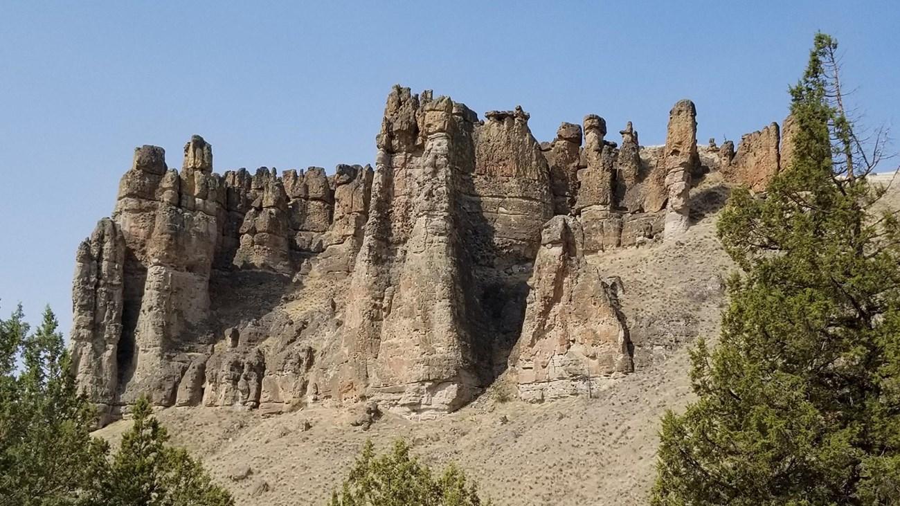 Palisades State Park
 in South Dakota features quartzite cliffs, the Split Rock River, hiking, camping, climbing and scenic landscapes near Garretson and Sioux Falls.
-

-

-

-
-


Swipe for more destinations
Best attractions in Glacial Lakes and Prairies
The attractions of Glacial Lakes and Prairies are distributed across a broad working landscape rather than concentrated in a single resort. Watertown combines Lake Kampeska recreation with the Redlin Art Center, whose paintings and landscaped setting interpret the prairie through wildlife art. Aberdeen and Brookings offer museums, galleries, parks and cultural programmes, while Huron, Webster, Redfield, Sisseton and other communities provide local history and well-preserved civic architecture. The region's glacial lakes support fishing, boating, swimming, camping and birdwatching, with Big Stone Lake, Lake Poinsett, Waubay Lake and the lakes around Watertown among the better-known recreation areas. Sand Lake National Wildlife Refuge is a significant stop for observing migratory birds and wetland habitat. Public parks, golf courses, farm-country drives and community events complete the visitor offering, with the landscape itself providing the main thread between destinations.
-
Memorial park
Mount Rushmore National Memorial
Discover the majesty of Mount Rushmore National Memorial, a stunning tribute to American history nestled in South Dakota's Black Hills.
-
National park
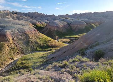
Badlands National Park
Discover the breathtaking landscapes and diverse wildlife of Badlands National Park, a stunning gem in South Dakota's natural beauty.
-
State park
Custer State Park
Discover the wild charm of Custer State Park, South Dakota's premier destination for adventure, wildlife, and breathtaking landscapes.
-
Monument
Crazy Horse Memorial
Explore the iconic Crazy Horse Memorial, a monumental tribute to Native American culture and heritage in the stunning Black Hills of South Dakota.



Best landmarks in Glacial Lakes and Prairies
The most recognisable landmarks are often linked to water, agriculture and the institutions that built prairie towns. The Redlin Art Center in Watertown is distinctive for its association with Terry Redlin and its purpose-built galleries and grounds. Lake Kampeska, Big Stone Lake and the broad waters of Lake Poinsett are geographical landmarks as well as recreation settings, marking the glacial origins of the region's landscape. In Aberdeen, the historic Northern State University campus and the city's civic core reflect the development of a major educational and commercial centre. Courthouse buildings, churches, railway remnants and grain elevators in communities such as Huron, Brookings, Redfield and Webster express the architectural history of settlement and agricultural trade. Sand Lake National Wildlife Refuge provides a different kind of landmark: a protected wetland landscape whose seasonal concentrations of waterfowl make the importance of prairie water visible. Together these places define a region where human structures remain closely tied to open land and water.
-
Monument
Crazy Horse Memorial
Explore the awe-inspiring Crazy Horse Memorial, a monumental tribute to Native American heritage nestled in South Dakota's Black Hills.
-
National park
Wind Cave National Park
Explore the natural beauty and geological wonders of Wind Cave National Park, a true gem in South Dakota's wilderness.
-
National reserve
Jewel Cave National Monument
Explore Jewel Cave National Monument, a stunning natural reserve in South Dakota known for its breathtaking underground formations and scenic hiking trails.
-
Tourist attraction
Ingalls Homestead
Immerse yourself in the life of Laura Ingalls Wilder at the Ingalls Homestead, a historical site that celebrates pioneer living and timeless stories.
Explore Glacial Lakes and Prairies on the map
Plan your trip on one map. See where the top cities, national parks and sights are, and book hotels and experiences in a few clicks.
Best hotels in Glacial Lakes and Prairies
Best restaurants in Glacial Lakes and Prairies
Dining is closely tied to the region's agricultural economy and the practical hospitality of its market towns. In Aberdeen, Watertown, Brookings, Huron and smaller communities, visitors will find American cafés, family restaurants, steakhouses, bakeries, diners and pubs, with menus commonly built around beef, burgers, sandwiches, potatoes and seasonal produce. Lake communities add the possibility of locally caught freshwater fish, although availability depends on regulations and individual kitchens rather than a single regional signature dish. German, Scandinavian and German-Russian influences can appear in home cooking, church suppers, baked goods and community celebrations, while farm stands and farmers' markets offer sweetcorn, preserves and other seasonal products. Coffee shops are useful meeting places on long drives, and larger towns provide more varied international and contemporary dining than rural communities. Tipping follows standard United States practice.
-
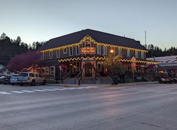
Inn
Alpine Inn
Experience comfort and culinary delight at Alpine Inn in Hill City - your gateway to South Dakota's Black Hills adventures.
-
 Motel
Powder House
Discover comfort and culinary delight at Powder House in Keystone, SD - your gateway to the Black Hills' natural wonders.
-
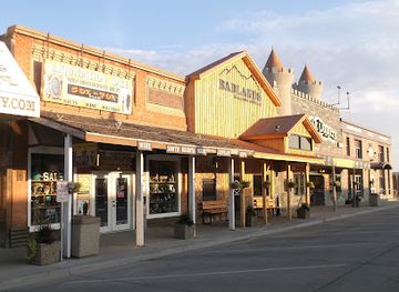
Grill
Badlands Saloon & Grille
Experience delicious grilled dishes at Badlands Saloon & Grille in Wall, SD - a perfect stop for travelers exploring the iconic Badlands.
-
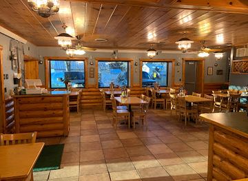
Restaurant
Red Rock
Discover Red Rock in Wall, SD - where local flavors meet cozy dining in an inviting café atmosphere.
Best bars in Glacial Lakes and Prairies
-
American
Al’s Oasis
Experience the best of American cuisine and unique shopping at Al's Oasis in Oacoma, SD, a must-visit for tourists seeking local charm.
-
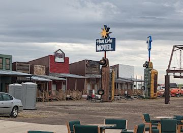
Bar
Full Throttle Saloon
Experience the thrill of Full Throttle Saloon, where bikers unite for great food, live music, and unforgettable moments in South Dakota.
-
American
Sickies Garage Burgers & Brews
Discover the ultimate burger experience at Sickies Garage Burgers & Brews, where American comfort food meets a vibrant bar atmosphere in Bismarck, ND.
-
Pub
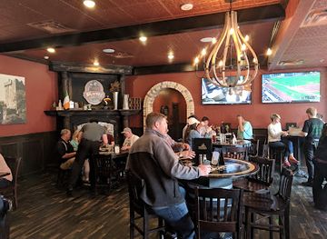
Blarney Stone Pub - Sioux Falls
Discover the heart of Irish hospitality at Blarney Stone Pub in downtown Sioux Falls, where good food and great drinks await.


Best nightclubs in Glacial Lakes and Prairies
Evening life in Glacial Lakes and Prairies is centred on neighbourhood bars, traditional pubs, restaurants, bowling venues, community events and occasional live-music performances rather than a large nightclub circuit. Watertown, Aberdeen and Brookings offer the broadest choice, with Brookings benefiting from a university population and the larger towns supporting more regular entertainment. Lake communities can become busier during the summer boating season, when outdoor patios and waterfront establishments are most active, while rural evenings are generally quieter and require checking local arrangements rather than relying on late-night public transport. Breweries and taprooms may be found in larger communities, and some restaurants provide music or seasonal events. Visitors should arrange a designated driver or taxi when travelling between towns, since distances are substantial and services outside urban centres are limited.
-
Bar
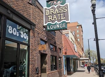
Brass Rail Lounge
Experience the lively ambiance and exceptional drinks at Brass Rail Lounge, the perfect bar for relaxation and socializing in Rapid City.
-
Lounge
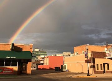
Bob's Lounge
Experience the charm of Bob's Lounge in Pierre, SD, where friendly service and affordable drinks create the perfect local escape.
-
Night club
Club David
Dive into the vibrant nightlife at Club David, Sioux Falls' premier night club, where music, drinks, and fun await every evening.
-
Night club
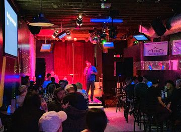
The Wild Hare
Discover the vibrant nightlife at The Wild Hare, Brookings’ favorite night club and bar, where good drinks and great company await.

Best shops in Glacial Lakes and Prairies
Shopping is concentrated in the main streets, commercial districts and larger retail areas of Aberdeen, Watertown, Brookings and Huron, with smaller towns offering practical stores, independent cafés, antique shops and locally oriented businesses. Historic downtowns are good places to look for books, gifts, clothing, homewares and regional memorabilia, while farm stands and seasonal markets provide produce, preserves, baked goods and other products from the surrounding agricultural country. Outdoor shops are useful for fishing, camping and lake recreation, particularly in communities beside the larger waters. Galleries and craft sellers may offer prairie-themed art, photography, pottery, jewellery and wildlife imagery, with Watertown especially associated with the visual world of Terry Redlin. Visitors should not expect a continuous luxury-shopping district; the appeal lies in independent retail, local produce and the chance to see how commercial life functions in small South Dakota communities.
-
Art gallery
Prairie Edge Trading Co & Galleries
Discover the heart of Native American artistry at Prairie Edge Trading Co & Galleries, a vibrant cultural hub in Rapid City, South Dakota.
-
Rock shop
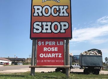
Dave's Rock Shop
Explore the wonders of geology at Dave's Rock Shop in Custer, SD, featuring unique stones, minerals, and gifts that celebrate nature's beauty.
-
Rock shop
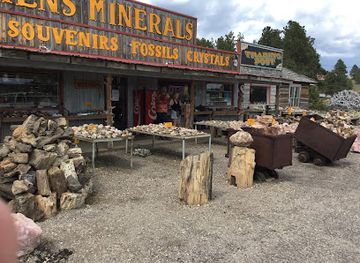
Ken's Minerals & Trading Post
Explore Ken's Minerals & Trading Post in Custer, SD, your premier destination for unique minerals, fossils, and gifts that celebrate the beauty of nature.
-
Gift shop
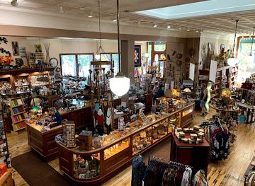
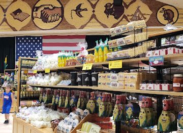
Corn Palace Gift Shop
Explore the Corn Palace Gift Shop for unique souvenirs and local treasures that capture the essence of South Dakota's vibrant culture.
Get your free copy of our complete guide to Glacial Lakes and Prairies, delivered straight to you.
Everything on this page, from attractions and restaurants to essentials and local phrases, in one PDF you can read offline, print or share.
Already have an account? Sign in
Your Glacial Lakes and Prairies guide is ready.
We'll send it to · Not you? Sign out

Getting your guide ready…
We are putting together a fresh copy of the Glacial Lakes and Prairies guide. This can take up to a minute.
This can take a few moments. If your browser asks, choose Allow so the download can start. You'll find the guide in your Downloads folder.
Nothing happened? Download it again
Sorry, the guide is taking longer than usual. Please try again in a minute, or get it by email instead.
Glacial Lakes and Prairies essentials
Currency and Payment
Safety
Emergency Situations
Do's and Don'ts
Local Tips
From Eve
Local phrases worth knowing
You don't need to get them perfect. A few words go a long way, and locals appreciate the effort.
Basics
| English | Local | Say it |
|---|---|---|
| Hello | Hi | [Hai] |
| Goodbye | See ya | [See yah] |
| Yes | Yep | [Yep] |
| No | Nope | [Nope] |
| Please/You're welcome | Sure thing | [Shur thing] |
| Thank you | Thanks | [Thangs] |
| Excuse me/Sorry | Pardon me | [Pardon me] |
| How are you? | How ya doin'? | [How yah doin'?] |
| Fine. And you? | Good. You? | [Goo d. You?] |
| Do you speak English? | You speak English? | [You speek English?] |
| I don't understand | I ain't gettin' it | [I ain't gittin' it] |
Eating & Drinking
| English | Local | Say it |
|---|---|---|
| I'd like to see the menu, please | Can I see the menu? | [Can I see thuh menu?] |
| I don't eat meat | I don't do meat | [I don't do meat] |
| Cheers! | Cheers! | [Cheers!] |
| I would like to pay, please | Can I get the check? | [Can I git thuh check?] |
Emergencies
| English | Local | Say it |
|---|---|---|
| Help! | Help! | [Help!] |
| Go away! | Get lost! | [Git lost!] |
| Call the Police! | Call the cops! | [Call thuh cops!] |
| Call a doctor! | Get a doc! | [Git a doc!] |
| I'm lost | I'm turned around | [I'm turned around] |
| I'm ill | I'm not feelin' good | [I'm not feelin' good] |
Shopping
| English | Local | Say it |
|---|---|---|
| I'd like to buy... | I wanna buy... | [I wanna buy...] |
| I'm just looking | Just lookin' | [Just lookin'] |
| How much is it? | What’s the price? | [What's thuh price?] |
| That's too expensive | That's pricy | [That's pry-see] |
| Can you lower the price? | Can ya drop the price? | [Can yah drop thuh price?] |
Time & Numbers
| English | Local | Say it |
|---|---|---|
| What time is it? | What time you got? | [What time ya got?] |
| It's one o'clock | It's one | [It's one] |
| Half past (10) | Half past ten | [Half past ten] |
| Morning | Mornin' | [Mornin'] |
| Afternoon | Afternoon | [Afternoon] |
| Evening | Evenin' | [Evenin'] |
| Yesterday | Yesterday | [Yesterday] |
| Today | Today | [Today] |
| Tomorrow | Tomorrow | [Tomorrow] |
| 1 | One | [One] |
| 2 | Two | [Two] |
| 3 | Three | [Three] |
| 4 | Four | [Four] |
| 5 | Five | [Five] |
| 6 | Six | [Six] |
| 7 | Seven | [Seven] |
| 8 | Eight | [Eight] |
| 9 | Nine | [Nine] |
| 10 | Ten | [Ten] |
Transport & Directions
| English | Local | Say it |
|---|---|---|
| Where's a/the...? | Where's the...? | [Where's thuh...?] |
| What's the address? | What’s the address? | [What's thuh address?] |
| Can you show me (on the map)? | Can ya show me on the map? | [Can yah show me on thuh map?] |
| When's the next (bus)? | When's the next bus? | [When's thuh next bus?] |
| A ticket (to ....) | A ticket to... | [A ticket to...] |
History of Glacial Lakes and Prairies
Indigenous Homelands and Prairie Lifeways
The region lies within the longstanding homelands of Dakota peoples, whose communities developed lifeways closely connected with prairie, rivers, wetlands and bison country. Seasonal movement, hunting, fishing, gathering and later agricultural practices shaped relationships with the land well before the arrival of American settlers. Dakota history remains part of South Dakota's contemporary cultural landscape, although visitors should avoid treating Indigenous traditions as merely historical subjects. The names of lakes and communities, as well as continuing tribal presence elsewhere in the state, reflect a much longer human history than the nineteenth-century settlement period.
Fur Trade, Forts and Territorial Expansion
During the nineteenth century, the wider region became increasingly connected to the fur trade, military movement and expanding United States administration. Trading routes and river corridors linked the interior prairie with markets farther east, while the creation of Dakota Territory brought new political structures and land surveys. Relationships between Indigenous nations, traders, soldiers and settlers were often unequal and conflict-affected, particularly as federal expansion restricted Indigenous land and mobility. This period established the routes and institutions that later settlement would follow.
Railways and the Founding of Prairie Towns
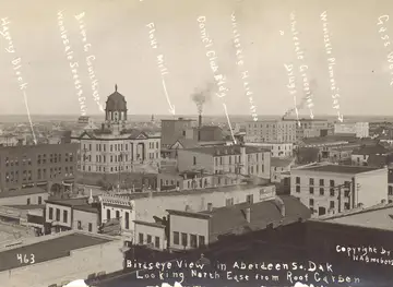
Railway construction transformed north-eastern and east-central South Dakota in the late nineteenth century. Lines provided access to national markets, encouraged the founding or rapid growth of towns and made it possible to ship grain and livestock over long distances. Aberdeen, Watertown, Brookings, Huron and many smaller communities developed as commercial, administrative or agricultural centres around this network. Railway depots, grain elevators, courthouse squares and early brick commercial buildings remain visible reminders of the era when transport connections determined the survival and prosperity of prairie towns.
Homesteading, Immigration and Agricultural Development
Federal land policies encouraged settlers to claim farms across Dakota Territory, and statehood in 1889 confirmed South Dakota's place within the Union. Migrants from other parts of the United States joined people of German, Scandinavian, German-Russian and other European backgrounds in establishing farms and communities. Wheat, corn, livestock and dairy production became central to the regional economy, supported by fertile glacial soils and the expanding railway system. Churches, schools, mutual-aid associations and local festivals helped newcomers build community while creating the cultural patterns still evident in many towns.
Drought, Depression and Rural Resilience
The agricultural economy suffered severe pressure during the 1920s and 1930s, when low commodity prices, bank failures and drought undermined farms across the Great Plains. Although the most severe Dust Bowl conditions were concentrated farther south and west, South Dakota communities experienced economic hardship and population strain. New Deal programmes supported conservation, public works and soil management, while local institutions helped rural communities endure. The period encouraged more careful approaches to water, shelterbelts, grasslands and farm management, themes that remain relevant in a region still shaped by climatic variability.
Modern Lake Recreation and Conservation
From the twentieth century onwards, the region's glacial lakes became increasingly important for camping, boating, fishing and seasonal tourism alongside their ecological value as wetlands and bird habitat. Wildlife refuges and managed public lands helped protect migration routes and prairie ecosystems, while towns developed marinas, parks and visitor services. Recreation did not replace agriculture, but added another layer to the regional economy and identity. Today, the balance between farming, water use, wildlife conservation and outdoor tourism is one of the central practical issues shaping Glacial Lakes and Prairies.
Glacial Lakes and Prairies in Photos
Browse through our photo collection highlighting the charm and character of the destination.
Neighbouring regions of Glacial Lakes and Prairies
The closest regions to Glacial Lakes and Prairies, if you have time for more than one.
-

-
-

-

-


Swipe for more regions
Explore more

Explore more of South Dakota
Discover South Dakota: From the iconic Mount Rushmore and Crazy Horse Memorial to the stunning Badlands and charming small towns, it's a land of history and natural beauty.
Explore South Dakota