

Free Cumberland Plateau Travel Guide & Mobile App
Explore Cumberland Plateau with free travel guides. Discover regional history, expert tips, proposed trips, and audio guides on web or mobile app.


Explore Tennessee’s Cumberland Plateau for sandstone gorges, waterfalls, forest trails, historic settlements and outdoor adventures across high country.
Read more about Cumberland Plateau
Getting to and around Cumberland Plateau
How to get there
Transportation
Top city travel guides in Cumberland Plateau
The cities of Cumberland Plateau, and the easiest places to base yourself.
-

-


Swipe for more cities
Destinations in Cumberland Plateau
Resorts, valleys and scenic spots worth a trip of their own.

Swipe for more destinations
Best attractions in Cumberland Plateau
The Cumberland Plateau’s attractions are predominantly outdoor and landscape-based, but they extend well beyond conventional scenic viewpoints. Fall Creek Falls State Park combines waterfalls, forest trails, a lake and high overlooks, while Cumberland Mountain State Park offers woodland recreation and a more accessible lakeside setting near Crossville. The Obed Wild and Scenic River protects a rugged gorge system suited to hiking, paddling, fishing, climbing and wildlife observation, with conditions that vary according to rainfall. Big South Fork National River and Recreation Area, on the northern plateau and extending across the Tennessee–Kentucky boundary, adds sandstone arches, river scenery, backcountry trails, horseback riding and remnants of coal-era settlement. Historic Rugby provides a contrasting cultural attraction through its Victorian buildings and interpretation of an English-founded colony. Across the uplands, smaller waterfalls, rock formations, overlooks, caves and forest roads reward careful planning, while state forests and local trail systems offer quieter walking and cycling. The region’s appeal lies in the relationship between its geology and its history: gorges explain the outdoor character, while railways, mines, farms and historic communities show how people adapted to the high, dissected terrain.
-
Park
Centennial Park
Explore Centennial Park, Nashville's urban oasis, featuring a stunning Parthenon replica, beautiful gardens, and a vibrant atmosphere for all visitors.
-
Hotel
Cumberland Falls State Resort Park
Explore the breathtaking beauty of Cumberland Falls State Resort Park, where adventure meets serenity in Kentucky's stunning nature.
-
State park
Fall Creek Falls State Park
Explore the breathtaking beauty of Fall Creek Falls State Park, home to stunning waterfalls and endless outdoor adventures in Tennessee.
-
Tourist attraction
The Lost Sea Adventure
Explore the breathtaking beauty of The Lost Sea, a stunning underground lake and geological wonder located in Sweetwater, Tennessee.


Best landmarks in Cumberland Plateau
The Cumberland Plateau is defined by geological and cultural landmarks that make its identity legible. The escarpment itself is the region’s great natural structure, marking a high tableland cut by rivers into sandstone gorges, cliffs and waterfalls. Fall Creek Falls and Cane Creek Falls are prominent water landmarks within Fall Creek Falls State Park, while the Obed River’s deep gorge expresses the erosive power of the plateau’s streams. Big South Fork country is recognised for sandstone formations, arches and high overlooks as well as its river valleys. Historic Rugby’s surviving Victorian buildings provide an architectural landmark of a different kind, preserving the layout and ambitions of the 1880 settlement. Cumberland Mountain State Park’s Byrd Lake and surrounding forest represent the planned recreational landscapes of the state-park era. In the northern plateau, former coal communities, rail alignments and mining remnants point to an industrial past often obscured by woodland. Together these places show that the plateau is not simply a scenic upland: it is a layered landscape of rock, water, settlement, conservation and extraction.
-
Historical landmark
Cumberland Caverns
Discover the breathtaking beauty of Cumberland Caverns, a historical landmark offering stunning cave formations and outdoor adventures in Tennessee.
-
Historical landmark
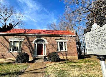
Carter House
Explore the captivating history and charm of Carter House, a key Civil War landmark in Franklin, Tennessee, rich with stories and preserved beauty.
-
Historical landmark
Historical Marker
Visit the Historical Marker in Crossville, TN, to immerse yourself in the rich history and serene beauty of this charming Tennessee town.
-
Historical place
Historic Rugby
Discover the enchanting Historic Rugby, a preserved 19th-century village brimming with Victorian charm and rich history in Tennessee.


Explore Cumberland Plateau on the map
Plan your trip on one map. See where the top cities, national parks and sights are, and book hotels and experiences in a few clicks.
Best hotels in Cumberland Plateau
Best restaurants in Cumberland Plateau
Dining on the Cumberland Plateau reflects the practical food traditions of Tennessee more than a narrowly defined plateau cuisine. In Crossville, Cookeville, Oneida and other larger communities, visitors will find cafés, family restaurants, barbecue, diners and contemporary American cooking, while rural areas are more likely to centre on country restaurants, roadside eateries and seasonal produce. Biscuits, fried chicken, pulled pork, catfish, beans, greens and sweet desserts are familiar regional choices, alongside locally produced fruit and vegetables when available. Trout and other freshwater fish may appear near river and mountain destinations, although they are not exclusive to the plateau. Farmers’ markets and farm stands provide opportunities to buy honey, preserves, baked goods and produce directly from local sellers. After a day outdoors, a traditional diner or independent café can be more representative of the region’s food culture than a formal dining room, while craft beer and other Tennessee drinks feature in some town-based venues. Opening hours and seasonal availability vary considerably outside the main communities.
-
Southern
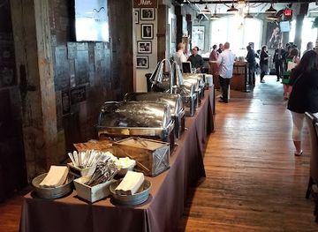
Acme Feed & Seed
Discover Southern charm at Acme Feed & Seed – where delicious cuisine meets live music in Nashville's vibrant atmosphere.
-
Restaurant
Rainforest Cafe
Immerse yourself in adventure at Rainforest Cafe - where jungle vibes meet delicious American cuisine in Nashville's Opry Mills.
-
American
The Twelve Thirty Club
Experience the best of Nashville at The Twelve Thirty Club—where exquisite American cuisine meets lively entertainment in a vibrant setting.
-
Restaurant
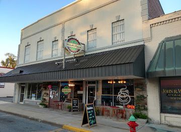
Grinder House Coffee Shop, LLC
Discover the flavors of Crossville at Grinder House Coffee Shop – your go-to spot for gourmet coffee, delightful meals, and live music.


Best bars in Cumberland Plateau
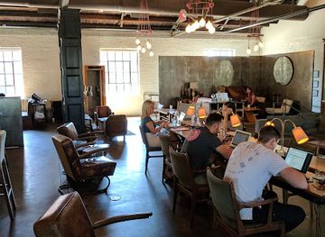
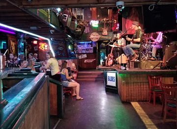
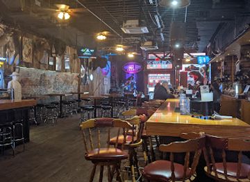
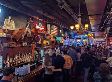
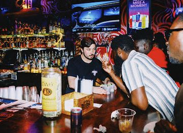
Evening life on the Cumberland Plateau is generally relaxed and town-centred rather than dominated by nightclubs. Crossville and Cookeville offer the widest choice of restaurants, pubs, breweries, live music and casual bars, with Cookeville’s larger student population giving its central area a younger evening atmosphere. Smaller communities such as Oneida and Jamestown tend to favour locally oriented restaurants, traditional bars and occasional live entertainment rather than late-night venues. Around state parks and river destinations, evenings are often spent at lodges, campsites, cabins or nearby diners, and many rural areas become quiet after dark. Visitors should arrange transport before drinking because distances are long and roads can be winding, unlit and unfamiliar. Seasonal festivals, music performances and community events may add variety, but schedules change, so confirm details locally rather than assuming a permanent nightlife programme.
-
New American
Pinewood
Experience the vibrant flavors and unique atmosphere of Pinewood, a quintessential New American restaurant in the heart of Nashville.
-
Live music bar
Robert's Western World
Discover the iconic Robert's Western World, a live music bar and restaurant in Nashville offering a taste of Southern culture and unforgettable entertainment.
-
Blues club
Bourbon Street Blues and Boogie Bar
Discover the soulful sounds and vibrant nightlife of Nashville at Bourbon Street Blues and Boogie Bar, where live music and local flavors collide.
-
Live music bar
Whiskey Bent Saloon
Discover the lively atmosphere of Whiskey Bent Saloon, Nashville's premier live music bar featuring great drinks and unforgettable performances.

Best nightclubs in Cumberland Plateau
Evening life on the Cumberland Plateau is generally relaxed and town-centred rather than dominated by nightclubs. Crossville and Cookeville offer the widest choice of restaurants, pubs, breweries, live music and casual bars, with Cookeville’s larger student population giving its central area a younger evening atmosphere. Smaller communities such as Oneida and Jamestown tend to favour locally oriented restaurants, traditional bars and occasional live entertainment rather than late-night venues. Around state parks and river destinations, evenings are often spent at lodges, campsites, cabins or nearby diners, and many rural areas become quiet after dark. Visitors should arrange transport before drinking because distances are long and roads can be winding, unlit and unfamiliar. Seasonal festivals, music performances and community events may add variety, but schedules change, so confirm details locally rather than assuming a permanent nightlife programme.
-
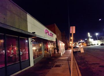
Gay night club
Play Dance Bar
Discover Play Dance Bar, Nashville's top gay nightclub for unforgettable nights filled with dancing, drag shows, and vibrant community spirit.
-
Night club
Second Fiddle
Discover the heart of Nashville's nightlife at Second Fiddle, where live music meets a vibrant atmosphere and delicious drinks.
-
Night club
Reagan's Retro Bar
Reagan's Retro Bar: A vibrant nightlife gem in Chattanooga, where nostalgia meets a lively atmosphere and unforgettable nights.
-
Night club
Dirty Little Secret
Discover Nashville's nightlife at Dirty Little Secret, a vibrant nightclub in Printers Alley with electrifying music and a captivating atmosphere.

Best shops in Cumberland Plateau
Shopping on the Cumberland Plateau is concentrated in the larger towns and market centres rather than in a continuous regional retail district. Crossville and Cookeville provide the broadest selection of supermarkets, outdoor equipment, books, clothing and everyday supplies, while Oneida, Jamestown and smaller communities offer more limited local shopping. Farmers’ markets and seasonal roadside stands are useful for produce, honey, jams, baked goods and other foods from plateau farms, although availability follows the growing season. Historic Rugby has craft, book and heritage-oriented shopping connected with the settlement’s interpretation, while galleries and independent shops in plateau towns may stock regional artwork, pottery, woodwork and Appalachian-inspired crafts. Outdoor visitors often find practical purchases such as maps, camping supplies and fishing equipment more useful than conventional souvenirs. Locally made food products, handmade objects and books about the plateau’s natural or mining history provide more meaningful mementoes than generic merchandise, but opening days and market schedules should be checked before making a special journey.
-
State park
Burgess Falls State Park
Experience the majestic beauty of waterfalls and lush hiking trails at Burgess Falls State Park, a premier destination in Tennessee's natural landscape.
-
Convenience store
Buc-ee's
Discover Buc-ee's in Crossville, TN – a unique convenience store experience with clean facilities, delicious snacks, and quirky merchandise.
-
Restaurant
Grinder House Coffee Shop, LLC
Grinder House Coffee Shop - A cozy retreat in Crossville, TN, serving delicious coffee, breakfast, and live music for a delightful experience.
-
Shopping mall
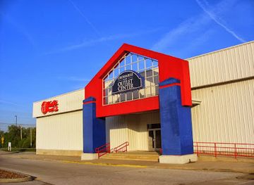
Crossville Outlet Center
Discover unbeatable deals and a variety of stores at Crossville Outlet Center, your ultimate shopping destination in Tennessee.


Get your free copy of our complete guide to Cumberland Plateau, delivered straight to you.
Everything on this page, from attractions and restaurants to essentials and local phrases, in one PDF you can read offline, print or share.
Already have an account? Sign in
Your Cumberland Plateau guide is ready.
We'll send it to · Not you? Sign out

Getting your guide ready…
We are putting together a fresh copy of the Cumberland Plateau guide. This can take up to a minute.
This can take a few moments. If your browser asks, choose Allow so the download can start. You'll find the guide in your Downloads folder.
Nothing happened? Download it again
Sorry, the guide is taking longer than usual. Please try again in a minute, or get it by email instead.
Cumberland Plateau essentials
Currency and Payment
Safety
Emergency Situations
Do's and Don'ts
Local Tips
From Eve
Local phrases worth knowing
You don't need to get them perfect. A few words go a long way, and locals appreciate the effort.
Basics
| English | Local | Say it |
|---|---|---|
| Hello | Howdy | [Hau-dee] |
| Goodbye | See ya later | [See yah lay-ter] |
| Yes | Yup | [Yup] |
| No | Naw | [Naw] |
| Please/You're welcome | Please/No problem | [Pleez/No prob-lem] |
| Thank you | Thank ya | [Thank yah] |
| Excuse me/Sorry | Pardon me/Sorry | [Par-don mee/Sor-ry] |
| How are you? | How ya doin'? | [How yah doin'?] |
| Fine. And you? | I’m good. How 'bout you? | [I’m good. How 'bout you?] |
| Do you speak English? | Ya speakin' English? | [Ya speakin' English?] |
| I don't understand | I don't get it | [I don't get it] |
Eating & Drinking
| English | Local | Say it |
|---|---|---|
| I'd like to see the menu, please | Can I see the menu, please? | [Can I see the men-yoo, pleez?] |
| I don't eat meat | I don’t eat no meat | [I don’t eat no meat] |
| Cheers! | Cheers! | [Cheers!] |
| I would like to pay, please | I’d like to pay, please | [I’d like to pay, pleez] |
Emergencies
| English | Local | Say it |
|---|---|---|
| Help! | Help! | [Help!] |
| Go away! | Get outta here! | [Get outta here!] |
| Call the Police! | Call the cops! | [Call the cops!] |
| Call a doctor! | Get a doctor! | [Get a doc-tor!] |
| I'm lost | I’m lost | [I’m lost] |
| I'm ill | I ain't feelin' good | [I ain't feelin' good] |
Shopping
| English | Local | Say it |
|---|---|---|
| I'd like to buy... | I want to buy... | [I want to buy...] |
| I'm just looking | Just lookin' | [Just lookin'] |
| How much is it? | How much is that? | [How much is that?] |
| That's too expensive | That's a bit pricey | [That's a bit pry-see] |
| Can you lower the price? | Can ya bring the price down? | [Can yah bring the pryce down?] |
Time & Numbers
| English | Local | Say it |
|---|---|---|
| What time is it? | What time is it? | [What time is it?] |
| It's one o'clock | It's one o'clock | [It's one o'clock] |
| Half past (10) | Half past ten | [Half past ten] |
| Morning | Mornin' | [Mornin'] |
| Afternoon | Afternoon | [Afternoon] |
| Evening | Evenin' | [Evenin'] |
| Yesterday | Yesterday | [Yesterday] |
| Today | Today | [Today] |
| Tomorrow | Tomorrow | [Tomorrow] |
| 1 | One | [One] |
| 2 | Two | [Two] |
| 3 | Three | [Three] |
| 4 | Four | [Four] |
| 5 | Five | [Five] |
| 6 | Six | [Six] |
| 7 | Seven | [Seven] |
| 8 | Eight | [Eight] |
| 9 | Nine | [Nine] |
| 10 | Ten | [Ten] |
Transport & Directions
| English | Local | Say it |
|---|---|---|
| Where's a/the...? | Where's a/the...? | [Where's a/the...?] |
| What's the address? | What's the address? | [What's the address?] |
| Can you show me (on the map)? | Can ya show me (on the map)? | [Can yah show me (on the map)?] |
| When's the next (bus)? | When's the next (bus)? | [When's the next (bus)?] |
| A ticket (to ....) | A ticket (to ....) | [A ticket (to ....)] |
History of Cumberland Plateau
Indigenous Landscapes Before European Settlement
The Cumberland Plateau was used by Indigenous peoples for travel, hunting and seasonal activities long before Tennessee became a European-American state. Its forests, rivers, rock shelters and escarpments formed part of wider networks linking the Tennessee Valley, Kentucky and the southern uplands. The Cherokee held important territorial connections in and around eastern Tennessee, while other Indigenous communities had long-standing relationships with the region. Archaeological evidence across the wider plateau includes traces of occupation and travel, although many sites are protected and are not presented as casual visitor attractions. Understanding this earlier history is essential to viewing the plateau as a lived cultural landscape rather than an empty wilderness.
Frontier Roads and Early Settlement
From the late eighteenth century, Euro-American settlers moved into and across the plateau, following routes that linked the Tennessee interior with Kentucky and the eastern valleys. Settlement was difficult because of thin soils, steep gorges and limited flat land, encouraging dispersed farms and small communities rather than dense towns. Early roads and later turnpikes followed ridges and stream crossings, while local economies relied on subsistence agriculture, timber and trade. The plateau’s position between major regions made it a corridor as well as a frontier, though its rugged terrain continued to limit easy movement and large-scale development.
Timber, Railways and Industrial Change
The nineteenth and early twentieth centuries brought intensified timber cutting, rail construction and commercial extraction. Railways opened remote upland areas to outside markets, carrying timber, agricultural goods and mineral products while encouraging the growth of settlements along their routes. Logging transformed large areas of forest, and sawmills became important employers in several plateau communities. The legacy remains visible in former rail alignments, altered woodlands and towns whose development was shaped by transport rather than by major river commerce. Later forest recovery has restored much of the tree cover, although the economic and ecological effects of industrial exploitation remain part of the region’s history.
Coal Mining on the Plateau
Coal seams beneath parts of the Cumberland Plateau supported underground and surface mining, particularly in the northern and eastern sections of Tennessee. Mining brought wage employment, company communities, rail links and migration, but it also involved dangerous work and substantial landscape change. Towns such as Oneida and communities around the northern plateau developed within this wider coal economy, while mines and railways connected the uplands to regional markets. As employment declined and extraction methods changed, many communities faced economic transition. Contemporary visitors encounter this history through former mining landscapes, local museums, historic buildings and the continuing debate over land, labour and environmental stewardship.
Rugby and Nineteenth-Century Utopian Settlement
Rugby was founded in 1880 in Morgan County by the English author and reformer Thomas Hughes as a planned colony intended to provide opportunities for younger sons of the British gentry and to promote an idealised rural community. The settlement struggled financially and did not develop exactly as its founders imagined, but surviving Victorian buildings and the surrounding historic landscape preserve an unusual chapter in transatlantic social history. Today Historic Rugby interprets the settlement through restored structures, exhibitions, walks and cultural programming. Its story adds architectural and intellectual depth to a region more commonly associated with forests, mining and outdoor recreation.
Conservation and the State Park Era
During the twentieth century, public conservation reshaped how Tennessee’s plateau landscapes were managed and experienced. State parks including Cumberland Mountain and Fall Creek Falls protected forests, lakes, waterfalls and recreational land while also providing roads, trails and visitor facilities. The Civilian Conservation Corps contributed to many New Deal-era park improvements across the United States, including lodge, trail and landscape work that influenced the design of Tennessee’s public recreation areas. Later protection of the Obed River and Big South Fork recognised the national importance of the plateau’s free-flowing rivers, gorges and biodiversity. Tourism today rests partly on this long shift from extraction towards conservation and recreation.
Cumberland Plateau in Photos
Browse through our photo collection highlighting the charm and character of the destination.
Neighbouring regions of Cumberland Plateau
The closest regions to Cumberland Plateau, if you have time for more than one.
-

-

-

-

-


Swipe for more regions
Explore more

Explore more of Tennessee
Discover Tennessee: A melting pot of music, history, and natural beauty, offering visitors an authentic taste of Southern hospitality and unforgettable experiences.
Explore Tennessee