

Free Big Bend Country Travel Guide & Mobile App
Explore Big Bend Country with free travel guides. Discover regional history, expert tips, proposed trips, and audio guides on web or mobile app.


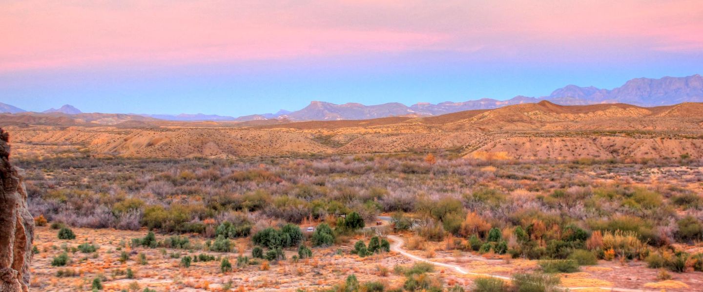


Explore Big Bend Country for desert mountains, Rio Grande canyons, dark skies, historic towns and wide-open West Texas landscapes.
Read more about Big Bend Country
Getting to and around Big Bend Country
How to get there
Transportation
Top city travel guides in Big Bend Country
The cities of Big Bend Country, and the easiest places to base yourself.
-

-


Swipe for more cities
Destinations in Big Bend Country
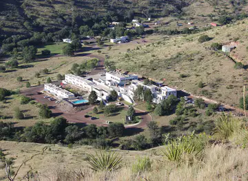
Resorts, valleys and scenic spots worth a trip of their own.
-

-


Swipe for more destinations
Best attractions in Big Bend Country
Big Bend Country’s attractions are defined by scale and environmental contrast. Big Bend National Park offers desert drives, mountain trails, fossil and geological landscapes, Rio Grande overlooks and access to the Chisos Mountains, while Big Bend Ranch State Park provides a more rugged setting for hiking, mountain biking, equestrian travel and four-wheel-drive exploration. The Davis Mountains bring cooler elevations, birdwatching and astronomical programmes at McDonald Observatory. History is represented by the preserved buildings of Fort Davis National Historic Site, the mining remains around Terlingua and museums in Alpine, Marfa and other communities. Scenic roads connect small settlements rather than a continuous chain of attractions, and distances are part of the experience. Visitors can also seek out desert wildlife, native plants, historic ranch landscapes and the changing light of the Chihuahuan Desert. The region rewards careful planning: a single day may suit a canyon walk or historic site, while several days are needed to combine the two major parks, the Davis Mountains and the Rio Grande borderlands.
-
State park
Hueco Tanks State Park & Historic Site
Explore the breathtaking landscapes and rich history of Hueco Tanks State Park, a unique outdoor paradise near El Paso, Texas.
-
State park
Big Bend Ranch State Park
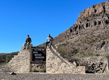
Explore the breathtaking landscapes and diverse wildlife of Big Bend Ranch State Park, a hidden gem in Texas perfect for outdoor adventures.
-
Madera Canyon Trail Parking
Experience the natural beauty of Madera Canyon in the Davis Mountains, a breathtaking hiking destination for tourists and nature lovers alike.
-
Nature preserve
Davis Mountains Preserve
Discover the breathtaking landscapes and diverse wildlife at Davis Mountains Preserve, a serene nature escape in the heart of Texas.


Best landmarks in Big Bend Country
The Rio Grande is Big Bend Country’s defining natural landmark, forming a winding international boundary through desert valleys and narrow canyons. Santa Elena Canyon in Big Bend National Park is among the region’s most recognisable formations, where high limestone walls rise directly from the river. The Chisos Mountains provide an unusual island of higher, cooler terrain within the desert, while the Davis Mountains create a distinct volcanic highland landscape around Fort Davis. Fort Davis National Historic Site preserves a large nineteenth-century military post and gives physical form to the era of frontier garrisons and westward expansion. In Terlingua, abandoned mercury-mining structures and the old cemetery recall the rise and decline of a remote industrial settlement. The McDonald Observatory’s domes on Mount Locke and Mount Fowlkes are prominent symbols of the region’s commitment to astronomy and dark skies. Marfa’s minimalist art installations and civic spaces offer a very different kind of landmark, reflecting the town’s modern cultural identity rather than its frontier past.
-
Observatory
University of Texas McDonald Observatory
Explore the cosmos at the University of Texas McDonald Observatory, where breathtaking views and educational experiences await under the starry skies.
-
Historical place museum
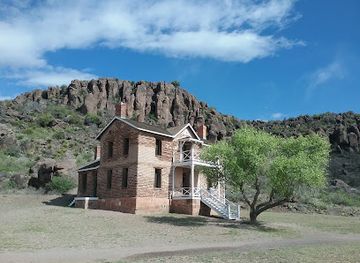
Fort Davis National Historic Site
Discover the historical significance and scenic beauty of Fort Davis National Historic Site, a top destination for history lovers and nature enthusiasts.
-
State park
Hueco Tanks State Park & Historic Site
Explore the breathtaking landscapes and rich history of Hueco Tanks State Park & Historic Site, a stunning outdoor paradise in El Paso, Texas.
-
Museum
Museum of the Big Bend
Explore the treasures of the Big Bend region at the Museum of the Big Bend, where history comes alive through fascinating exhibits and engaging stories.



Explore Big Bend Country on the map
Plan your trip on one map. See where the top cities, national parks and sights are, and book hotels and experiences in a few clicks.
Best hotels in Big Bend Country
Best restaurants in Big Bend Country
Dining in Big Bend Country reflects both West Texas ranching and the culinary influence of the Mexican borderlands. Alpine, Marfa, Fort Davis, Terlingua, Marathon and Presidio provide the main concentrations of cafés, diners, restaurants, casual grills and small bars, while options become scarce on long park drives. Menus commonly feature beef, chile-seasoned dishes, beans, tortillas, burgers and other familiar Texan fare, with Mexican and regional border traditions especially evident near Presidio and Ojinaga. Local produce, baking and craft drinks appear alongside straightforward road food, and some rural establishments make the setting part of the appeal without sacrificing practicality. Farmers’ markets and small food producers may operate seasonally, so visitors should check locally rather than assume daily availability. In the parks, picnic provisions are often essential, since dining facilities are limited and distances between settlements are considerable.
-
Restaurant
La Kiva Restaurant & Bar
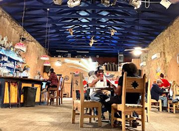
Experience the unique charm of La Kiva Restaurant & Bar in Terlingua – where rustic decor meets exceptional dining.
-
American
Chisos Mountains Lodge Restaurant
Experience delightful American cuisine at Chisos Mountains Lodge Restaurant surrounded by breathtaking views in Big Bend National Park.
-
American
Big Bend Motor Inn Store and Restaurant
Savor delicious American cuisine at Big Bend Motor Inn Store and Restaurant in Terlingua - a must-visit for travelers seeking authentic flavors.
-
Restaurant
Candelilla Cafe
Discover authentic southwestern flavors at Candelilla Cafe - where local ingredients meet warm hospitality in Terlingua.


Best bars in Big Bend Country
Nightlife in Big Bend Country is modest and dispersed, centred on relaxed pubs, historic-looking bars, restaurants, live music and conversation rather than large clubs. Alpine and Marfa have the broadest evening choice, with Marfa’s arts community supporting a changing selection of cultural events, galleries and small venues. Terlingua is known for informal desert bars and social spaces associated with outdoor travellers, while Fort Davis and Marathon offer quieter evenings in local establishments. After dark, the region’s most distinctive activity is often stargazing rather than clubbing; artificial light is limited and the night sky is a major natural asset. Check current arrangements locally, particularly outside the main towns, and plan a safe return because roads are long, dark and sometimes without mobile coverage. Alcohol is not necessary to enjoy the area’s evening culture, and designated-driver planning is important when distances are substantial.
-
Mexican
Starlight Theatre
Discover Starlight Theatre in Terlingua, TX – a vibrant Mexican dining experience with live music and eclectic decor.
-
Lodge
Chisos Mountains Lodge
Experience the rustic charm of Chisos Mountains Lodge in Big Bend National Park, where comfort meets breathtaking natural beauty.
-
Coffee shop
Espresso Y Poco Mas
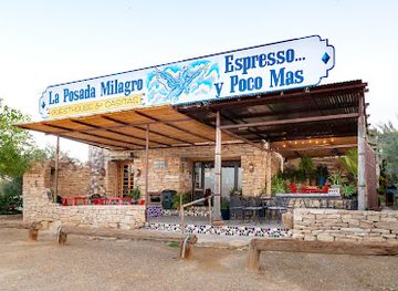
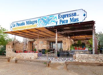
Discover the delightful flavors of Terlingua at Espresso Y Poco Mas, your go-to coffee shop for gourmet brews and hearty breakfasts.
-
State park
Big Bend Ranch State Park
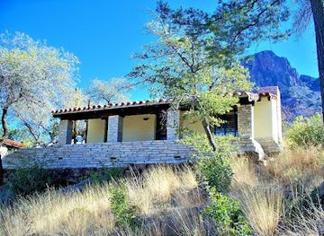
Discover the breathtaking landscapes of Big Bend Ranch State Park in Texas, a paradise for outdoor enthusiasts and nature lovers.
Best nightclubs in Big Bend Country
Nightlife in Big Bend Country is modest and dispersed, centred on relaxed pubs, historic-looking bars, restaurants, live music and conversation rather than large clubs. Alpine and Marfa have the broadest evening choice, with Marfa’s arts community supporting a changing selection of cultural events, galleries and small venues. Terlingua is known for informal desert bars and social spaces associated with outdoor travellers, while Fort Davis and Marathon offer quieter evenings in local establishments. After dark, the region’s most distinctive activity is often stargazing rather than clubbing; artificial light is limited and the night sky is a major natural asset. Check current arrangements locally, particularly outside the main towns, and plan a safe return because roads are long, dark and sometimes without mobile coverage. Alcohol is not necessary to enjoy the area’s evening culture, and designated-driver planning is important when distances are substantial.
-
Restaurant
La Kiva Restaurant & Bar
Discover La Kiva Restaurant & Bar in Terlingua, TX - a unique dining experience blending Tex-Mex flavors with an eclectic atmosphere.
-
Bar
The Boathouse
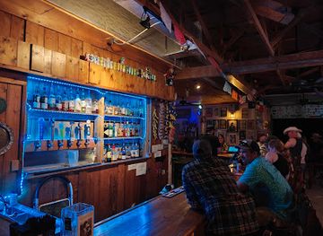
Discover the charm of The Boathouse in Terlingua, Texas, where rustic elegance meets vibrant nightlife and stunning natural beauty.
Best shops in Big Bend Country
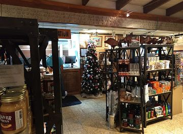
Shopping in Big Bend Country is concentrated in the small town centres rather than large retail districts. Alpine, Marfa and Fort Davis have independent galleries, bookshops, clothing stores, craft outlets and local food businesses, with Marfa particularly associated with contemporary art, design and carefully curated independent retail. Terlingua and other park gateways focus more on practical outdoor supplies, regional souvenirs and desert-themed crafts. Presidio and the wider Rio Grande valley offer a borderlands perspective, including locally produced food and goods influenced by cross-border culture. Visitors may find pottery, jewellery, textiles, paintings, photography, books about the desert and regional products such as sauces, dried foods or coffee. Markets and gallery openings can be seasonal or occasional, so opening arrangements vary. Buying directly from artists and small producers supports the communities that maintain the region’s distinctive creative and agricultural economy.
-
National park
Big Bend National Park
Discover the breathtaking landscapes and rich biodiversity of Big Bend National Park, a true gem in Texas for outdoor enthusiasts and nature lovers.
-
Visitor center
Panther Junction Visitor Center
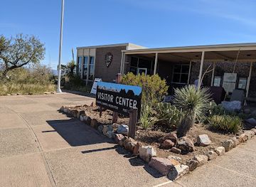
Explore the heart of Big Bend National Park at Panther Junction Visitor Center, where adventure begins with expert guidance and stunning desert vistas.
-
 Lodge
Chisos Mountains Lodge
Discover the serene beauty of Big Bend National Park at Chisos Mountains Lodge, your perfect retreat for adventure and relaxation.
-
Coffee shop
Espresso Y Poco Mas
Discover a cozy coffee shop and breakfast gem in Terlingua, TX, offering rich brews and delicious bites in a welcoming atmosphere.
Get your free copy of our complete guide to Big Bend Country, delivered straight to you.
Everything on this page, from attractions and restaurants to essentials and local phrases, in one PDF you can read offline, print or share.
Already have an account? Sign in
Your Big Bend Country guide is ready.
We'll send it to · Not you? Sign out

Getting your guide ready…
We are putting together a fresh copy of the Big Bend Country guide. This can take up to a minute.
This can take a few moments. If your browser asks, choose Allow so the download can start. You'll find the guide in your Downloads folder.
Nothing happened? Download it again
Sorry, the guide is taking longer than usual. Please try again in a minute, or get it by email instead.
Big Bend Country essentials
Currency and Payment
Safety
Emergency Situations
Do's and Don'ts
Local Tips
From Eve
Local phrases worth knowing
You don't need to get them perfect. A few words go a long way, and locals appreciate the effort.
Basics
| English | Local | Say it |
|---|---|---|
| Hello | Howdy | [Hau-dee] |
| Goodbye | See ya later | [See ya lay-ter] |
| Yes | Yep | [Yep] |
| No | Nah | [Nah] |
| Please/You're welcome | Please/No problem | [Pleez/No prob-lum] |
| Thank you | Thanks a bunch | [Thanks a bun-ch] |
| Excuse me/Sorry | Pardon me/Sorry 'bout that | [Par-don mee/Sor-ree 'bout that] |
| How are you? | How ya doin'? | [How ya doin'?] |
| Fine. And you? | I’m good. And you? | [I’m good. And you?] |
| Do you speak English? | Ya speakin' English? | [Ya speak-in' Eng-lish?] |
| I don't understand | I ain't gettin' it | [I ain't get-tin' it] |
Eating & Drinking
| English | Local | Say it |
|---|---|---|
| I'd like to see the menu, please | Can I see the menu, please? | [Can I see the men-u, pleez?] |
| I don't eat meat | I don’t eat meat | [I don’t eat meat] |
| Cheers! | Cheers! | [Cheers!] |
| I would like to pay, please | Can I pay, please? | [Can I pay, pleez?] |
Emergencies
| English | Local | Say it |
|---|---|---|
| Help! | Help! | [Help!] |
| Go away! | Beat it! | [Beat it!] |
| Call the Police! | Call the cops! | [Call the cops!] |
| Call a doctor! | Get a doctor! | [Get a doc-tor!] |
| I'm lost | I’m lost | [I’m lost] |
| I'm ill | I ain't feelin' well | [I ain't feel-in' well] |
Shopping
| English | Local | Say it |
|---|---|---|
| I'd like to buy... | I wanna buy... | [I wanna buy...] |
| I'm just looking | Just browsin' | [Just brow-zin'] |
| How much is it? | What’s the price? | [What’s the price?] |
| That's too expensive | That’s too pricey | [That’s too pri-cy] |
| Can you lower the price? | Can ya knock down the price? | [Can ya knock down the price?] |
Time & Numbers
| English | Local | Say it |
|---|---|---|
| What time is it? | What time is it? | [What time is it?] |
| It's one o'clock | It's one o'clock | [It's one o'clock] |
| Half past (10) | Half past ten | [Half past ten] |
| Morning | Mornin' | [Mornin'] |
| Afternoon | Afternoon | [Afternoon] |
| Evening | Evenin' | [Evenin'] |
| Yesterday | Yesterday | [Yesterday] |
| Today | Today | [Today] |
| Tomorrow | Tomorrow | [Tomorrow] |
| 1 | One | [One] |
| 2 | Two | [Two] |
| 3 | Three | [Three] |
| 4 | Four | [Four] |
| 5 | Five | [Five] |
| 6 | Six | [Six] |
| 7 | Seven | [Seven] |
| 8 | Eight | [Eight] |
| 9 | Nine | [Nine] |
| 10 | Ten | [Ten] |
Transport & Directions
| English | Local | Say it |
|---|---|---|
| Where's a/the...? | Where's the...? | [Where's the...?] |
| What's the address? | What's the address? | [What's the ad-dress?] |
| Can you show me (on the map)? | Can ya show me (on the map)? | [Can ya show me (on the map)?] |
| When's the next (bus)? | When's the next bus? | [When's the next bus?] |
| A ticket (to ....) | A ticket (to ...) | [A ticket (to ...)] |
History of Big Bend Country
Indigenous Borderlands Before European Settlement
The landscapes of Big Bend Country have long been occupied and travelled by Indigenous peoples, including ancestors of the Chisos, Jumano, Apache and Comanche communities associated with the wider region. Archaeological evidence records hunting, gathering, seasonal movement and the use of desert springs and river corridors. The mountains and canyons were not empty wilderness but part of a network of knowledge and movement. Later colonial and national histories often obscured these earlier connections, although rock shelters, artefacts and place-based traditions remain important reminders of the region’s deep human past.
Spanish Exploration and the Rio Grande Borderlands
Spanish expeditions and missionaries entered the far west of present-day Texas from the seventeenth century onwards, using the Rio Grande as a route through an arid borderland. Settlements and missions were established more consistently around river junctions such as La Junta de los Ríos, near modern Presidio, than in the remote mountain desert. The river subsequently became a political boundary as Spanish, Mexican and later United States authorities asserted competing claims. This layered borderlands history still shapes the communities, languages and cultural relationships of the region.
Apache, Comanche and Military Conflict
During the eighteenth and nineteenth centuries, Apache and Comanche power, trade and warfare strongly influenced movement across the Trans-Pecos. Following the establishment of the United States presence in Texas, the army built posts to protect routes, settlers and commercial interests. Fort Davis, founded in 1854 near the Davis Mountains, became one of the most important military installations in the region. Its preserved buildings and landscape illustrate the logistical difficulty of maintaining a frontier garrison far from major population centres and the conflict surrounding Indigenous dispossession.
Ranching, Mining and the Arrival of the Railway
Cattle ranching expanded across the Trans-Pecos during the late nineteenth century, adapting to scarce water and enormous distances. Mining also shaped settlements, most notably at Terlingua, where cinnabar mining for mercury created a company community and a busy local economy. The arrival of the Southern Pacific railway through Alpine, Marathon and nearby communities in the 1880s connected the area to wider markets and encouraged durable town development. Ranching, transport and mineral extraction left a strong imprint on local buildings, roads and regional identity.
Presidio and the Modern International Boundary
Presidio, on the Rio Grande opposite Ojinaga in Mexico, developed from a long-established river settlement into an important agricultural, commercial and border community. The modern international boundary divided older patterns of movement without eliminating cultural and economic links across the river. Irrigated farming, cross-border trade and family connections remain important to the town’s identity. The Presidio-Ojinaga area also demonstrates that Big Bend Country is not simply a desert recreation destination but a lived border region with its own history and contemporary relationships.
National Park and Conservation Era
Big Bend National Park was established in 1944 after sustained efforts to protect the landscapes and ecosystems along the Rio Grande and in the Chisos Mountains. Its creation preserved an extensive area of desert, mountain and river habitat while also changing patterns of land ownership and local economic activity. Big Bend Ranch State Park, created later along the river west of the national park, added another major conservation landscape. Together they made the region a centre for wilderness travel, geological study, wildlife observation and dark-sky conservation.
Arts, Astronomy and Contemporary Regional Identity
The region’s cultural profile widened during the twentieth and early twenty-first centuries. The University of Texas at Austin’s McDonald Observatory, established near Fort Davis in the 1930s, made the Davis Mountains an important site for astronomical research and public education. Marfa developed an international reputation for contemporary art after artists and institutions established a lasting presence there, while nearby communities increasingly combined ranching heritage with tourism, galleries, lodging and outdoor recreation. These developments have brought new attention without erasing the area’s older borderlands and working-landscape traditions.
Big Bend Country in Photos
Browse through our photo collection highlighting the charm and character of the destination.
Neighbouring regions of Big Bend Country
The closest regions to Big Bend Country, if you have time for more than one.
-

-

-

-

-


Swipe for more regions
Explore more
Explore more of Texas
Discover the diverse landscapes, rich history, vibrant cities, and culinary delights of Texas, the Lone Star State, where adventure and culture await at every turn.
Explore Texas