

Big Bend National Park Travel Guide - Free Web & App
Your ultimate guide to Big Bend National Park. Discover top landmarks, proposed trips, and local tips. Free on the web or via the Evendo companion app.


Big Bend National Park in Texas offers desert trails, Chisos Mountain views, Rio Grande canyons, dark skies, wildlife and borderland history.
Desert Landscapes and Mountain Country
Big Bend National Park occupies more than 800,000 acres in the far west of Texas, where the Rio Grande makes its great bend along the international boundary with Mexico. It is a remote, expansive landscape of Chihuahuan Desert, limestone canyons, volcanic formations and the forested high country of the Chisos Mountains. Elevation changes create striking contrasts: creosote and ocotillo dominate the lower desert, while pinyon, juniper and oak appear in the cooler mountains. The park's scale and isolation are central to its character, with long distances between facilities and limited mobile coverage in many areas.Read more about Big Bend National Park
Canyons, River and Wildlife
History and Gateway Communities
When is the best time to visit Big Bend National Park?
Best: March–April, October · 23–27°C| Month | High (°C) | Rainfall (mm) |
|---|---|---|
| January | 17 | 10 |
| February | 19 | 13 |
| March (best) | 23 | 11 |
| April (best) | 27 | 10 |
| May | 32 | 20 |
| June | 35 | 27 |
| July | 35 | 43 |
| August | 34 | 48 |
| September | 31 | 42 |
| October (best) | 27 | 35 |
| November | 20 | 16 |
| December | 16 | 14 |
Getting to and around Big Bend National Park
How to get there
Transportation
Best attractions in Big Bend National Park
Big Bend's principal attractions are spread across several distinct districts. In the Chisos Basin, trails lead into a mountain amphitheatre surrounded by Casa Grande, the Window and Emory Peak, the park's highest summit. The Ross Maxwell Scenic Drive crosses desert scenery towards the dramatic walls of Santa Elena Canyon, where the Rio Grande cuts through limestone. Boquillas Canyon and Rio Grande Village offer a different perspective on the river, with views towards Mexico and access to historic and riparian landscapes. The Rio Grande also shapes the Hot Springs Historic District, where visitors can see remains of an early settlement beside the river. Panther Junction and the Fossil Discovery Exhibit provide useful interpretation of the park's natural history, while the Chihuahuan Desert itself remains the dominant attraction, changing character with elevation, season and light.
-
Visitor center
Panther Junction Visitor Center
Discover the essential hub for exploring Big Bend National Park at Panther Junction Visitor Center, your gateway to adventure and natural beauty.
-
Visitor center
Panther Junction Visitor Center
Explore Big Bend National Park's Panther Junction Visitor Center, your gateway to adventure and knowledge in the heart of Texas's stunning landscapes.
-
Chisos Mountains Lodge
Experience the breathtaking beauty of Big Bend National Park from the comfort of Chisos Mountains Lodge, the perfect retreat for outdoor enthusiasts.
-
Visitor center
Chisos Basin Visitor Center
Explore the Chisos Basin Visitor Center, your gateway to the breathtaking landscapes and rich wildlife of Big Bend National Park.


Explore Big Bend National Park on the map
Plan your trip on one map. See where the top attractions, landmarks, restaurants and hotels are, and book hotels and experiences in a few clicks.
Best hotels in Big Bend National Park
Best restaurants in Big Bend National Park
Dining inside Big Bend National Park is limited and concentrated around established facilities, notably the restaurant associated with Chisos Mountains Lodge, while small stores may provide basic provisions rather than a full choice of meals. Visitors commonly supplement park facilities with restaurants, cafés, food trucks and informal eateries in Study Butte and Terlingua, or plan meals in Marathon, Alpine and Presidio outside the park. The regional food culture reflects the borderland setting, with Tex-Mex and Mexican-influenced cooking, chilli, beans, grilled meats, tacos and other practical dishes suited to a remote high-desert environment. Supplies for self-catering should be purchased before entering the park, especially when travelling into remote districts. Local establishments vary in opening patterns and seasonal operation, so visitors should avoid assuming that food will be available at every trailhead or scenic area.
-
American
Chisos Mountains Lodge Restaurant
Discover the perfect blend of scenic views and delectable American cuisine at Chisos Mountains Lodge Restaurant in Big Bend National Park.

Best bars in Big Bend National Park
Big Bend has no concentrated nightlife district, and evening entertainment is generally quiet, informal and tied to small gateway communities rather than the national park itself. Terlingua and Study Butte have the strongest association with rustic bars, local music and social gatherings, while Marathon and Alpine offer additional pubs, bars and community venues outside the park. In the park, evenings are more commonly spent at a campsite, lodge or picnic area, subject to current rules and weather conditions. The region's dark skies are a major part of its after-dark character, with stargazing replacing club-oriented entertainment for many visitors. Seasonal music, arts and community events may occur in surrounding settlements, but schedules and venue availability should be checked locally rather than assumed.
-
National park
Big Bend National Park
Explore the breathtaking landscapes and rich history of Big Bend National Park, a true natural wonder in Texas offering endless adventure.
-
Mexican
Starlight Theatre
Savor the rich flavors of Mexico at Starlight Theatre, Terlingua's premier Mexican restaurant with live entertainment and vibrant atmosphere.
-
Mexican
Chili Pepper Cafe
Experience authentic Mexican cuisine at Chili Pepper Cafe in Terlingua, where every meal bursts with flavor and warmth.
-
 Lodge
Chisos Mountains Lodge
Discover the stunning beauty of Big Bend National Park at Chisos Mountains Lodge, where comfort meets adventure in a breathtaking natural setting.


Best shops in Big Bend National Park
Shopping within Big Bend National Park is confined mainly to basic visitor supplies, books, maps and practical goods available at established facilities, so it is not a destination for extensive retail browsing. More varied opportunities are found in Terlingua, Study Butte, Marathon, Alpine and Presidio, where independent shops and galleries may offer regional art, photography, pottery, jewellery, textiles and other desert- and borderland-inspired crafts. Food shops in the surrounding towns are important for provisions, particularly before a multi-day park visit. Local products reflect the area's ranching, Mexican-American and high-desert traditions, although stock and opening patterns can vary widely. Visitors should distinguish genuine locally made work from generic souvenirs and avoid removing natural materials, fossils or archaeological objects from the park.
-
Visitor center
Panther Junction Visitor Center
Discover the beauty of Big Bend National Park at Panther Junction Visitor Center, your essential hub for exploration and adventure.
-
Lodge
Chisos Mountains Lodge
Experience the natural beauty of Big Bend National Park from the comfort of Chisos Mountains Lodge, your gateway to adventure and relaxation.
-
Visitor center
Chisos Basin Visitor Center
Explore the Chisos Basin Visitor Center, the ideal starting point for your adventure in Big Bend National Park, rich in nature and history.
-
Coffee shop
Espresso Y Poco Mas
Discover the charming Espresso Y Poco Mas, where exceptional coffee meets delightful breakfasts in the heart of Terlingua, Texas.


Get your free copy of our complete guide to Big Bend National Park, delivered straight to you.
Everything on this page, from attractions and restaurants to essentials and local phrases, in one PDF you can read offline, print or share.
Already have an account? Sign in
Your Big Bend National Park guide is ready.
We'll send it to · Not you? Sign out

Getting your guide ready…
We are putting together a fresh copy of the Big Bend National Park guide. This can take up to a minute.
This can take a few moments. If your browser asks, choose Allow so the download can start. You'll find the guide in your Downloads folder.
Nothing happened? Download it again
Sorry, the guide is taking longer than usual. Please try again in a minute, or get it by email instead.
Big Bend National Park essentials
Currency and Payment
Safety
Emergency Situations
Do's and Don'ts
Local Tips
From Eve
Local phrases worth knowing
You don't need to get them perfect. A few words go a long way, and locals appreciate the effort.
Basics
| English | Local | Say it |
|---|---|---|
| Hello | Howdy | [haw-dee] |
| Goodbye | Adios | [ah-dee-ohs] |
| Yes | Yep | [yep] |
| No | Nope | [nohp] |
| Please/You're welcome | Please/You're welcome | [Please/You're welcome] |
| Thank you | Thank you | [Thank you] |
| Excuse me/Sorry | Pardon me | [par-dn me] |
| How are you? | Howdy | [haw-dee] |
| Fine. And you? | Fine. And you? | [Fine. And you?] |
| Do you speak English? | Do you speak English? | [Do you speak English?] |
| I don't understand | I don't understand | [I don't understand] |
Eating & Drinking
| English | Local | Say it |
|---|---|---|
| I'd like to see the menu, please | I'd like to see the menu, please | [I'd like to see the menu, please] |
| I don't eat meat | I don't eat meat | [I don't eat meat] |
| Cheers! | Cheers! | [Cheers!] |
| I would like to pay, please | I would like to pay, please | [I would like to pay, please] |
Emergencies
| English | Local | Say it |
|---|---|---|
| Help! | Help! | [Help!] |
| Go away! | Go away! | [Go away!] |
| Call the Police! | Call the Sheriff! | [Call the Sheriff!] |
| Call a doctor! | Call a doctor! | [Call a doctor!] |
| I'm lost | I'm lost | [I'm lost] |
| I'm ill | I'm sick | [I'm sick] |
Shopping
| English | Local | Say it |
|---|---|---|
| I'd like to buy... | I'd like to buy... | [I'd like to buy...] |
| I'm just looking | I'm just looking | [I'm just looking] |
| How much is it? | How much is it? | [How much is it?] |
| That's too expensive | That's too expensive | [That's too expensive] |
| Can you lower the price? | Can you lower the price? | [Can you lower the price?] |
Time & Numbers
| English | Local | Say it |
|---|---|---|
| What time is it? | What time is it? | [What time is it?] |
| It's one o'clock | It's one o'clock | [It's one o'clock] |
| Half past (10) | Half past (10) | [Half past (10)] |
| Morning | Morning | [Morning] |
| Afternoon | Afternoon | [Afternoon] |
| Evening | Evening | [Evening] |
| Yesterday | Yesterday | [Yesterday] |
| Today | Today | [Today] |
| Tomorrow | Tomorrow | [Tomorrow] |
| 1 | 1 | [1] |
| 2 | 2 | [2] |
| 3 | 3 | [3] |
| 4 | 4 | [4] |
| 5 | 5 | [5] |
| 6 | 6 | [6] |
| 7 | 7 | [7] |
| 8 | 8 | [8] |
| 9 | 9 | [9] |
| 10 | 10 | [10] |
Transport & Directions
| English | Local | Say it |
|---|---|---|
| Where's a/the...? | Where's a/the...? | [Where's a/the...?] |
| What's the address? | What's the address? | [What's the address?] |
| Can you show me (on the map)? | Can you show me (on the map)? | [Can you show me (on the map)?] |
| When's the next (bus)? | When's the next (bus)? | [When's the next (bus)?] |
| A ticket (to ....) | A ticket (to ....) | [A ticket (to ....)] |
History of Big Bend National Park
Geological Formation of the Bend
Big Bend's foundations were shaped over immense geological timescales by sedimentation, uplift, faulting, volcanism and erosion. The Chisos Mountains contain some of the park's most prominent volcanic and igneous features, while limestone formations record ancient marine environments. The Rio Grande and its tributary canyons later cut through these rocks, exposing layers that help explain the area's changing landscapes. Fossils found in the region include evidence of prehistoric marine life and dinosaurs, and the Fossil Discovery Exhibit near the park's northern entrance interprets this geological record. These processes created the sharply varied desert, mountain and canyon environments that define the park today.
Indigenous Homelands and Archaeology
People have lived in the Big Bend region for thousands of years, using river corridors, springs, desert plants and mountain resources. Archaeological evidence includes tools, hearths, shelters and rock art, while historic records connect the broader region with Indigenous peoples including the Chisos, Apache and Comanche. The Rio Grande was a route through an otherwise difficult desert, and seasonal movement shaped patterns of occupation and exchange. Many archaeological sites remain protected and are not promoted as public attractions. Their presence demonstrates that Big Bend was never an empty wilderness, but a lived and travelled borderland long before the creation of the national park.
Spanish, Mexican and Borderland History
Spanish exploration and later Mexican settlement brought new political and economic relationships to the Big Bend, although the area's remoteness limited sustained development. Following the establishment of the United States–Mexico boundary in the nineteenth century, the Rio Grande became an international border while communities on both sides continued to share family, commercial and cultural connections. Historic routes crossed the river and desert, linking isolated settlements and ranches. The remains of the Hot Springs settlement and the old river communities preserve fragments of this borderland history, where water, transport and access to distant markets determined the possibilities for permanent settlement.
Ranching, Mining and Settlement
During the late nineteenth and early twentieth centuries, ranching became an important use of the Big Bend landscape, while small-scale mining sought mercury, silver and other mineral resources. The Chisos Mining Company operated in the Chisos Mountains, and traces of mining activity can still be seen in the vicinity of the Basin and nearby historic areas. Terlingua and Study Butte developed partly through mining and ranching economies outside the present park boundary. Harsh conditions, scarce water and difficult transport limited development, leaving scattered buildings, roads and ruins rather than a dense settlement pattern.
From State Park Proposal to National Park
The idea of protecting the Big Bend landscape gained momentum in the twentieth century as residents and state officials promoted its scenic and scientific value. Texas acquired land for a state park, and further efforts led to the transfer of land to the federal government. Big Bend National Park was established in 1944, creating a framework for protecting its desert, mountain and river environments while allowing carefully managed public access. Subsequent conservation work has included preserving historic resources, protecting archaeological sites, maintaining wilderness character and interpreting the park's night sky. The modern park reflects both the region's earlier working landscapes and a long-term shift towards national conservation.
Big Bend National Park in Photos
Browse through our photo collection highlighting the charm and character of the destination.
Neighbouring destination travel guides
The closest destinations to Big Bend National Park, if you have time for more than one.
-
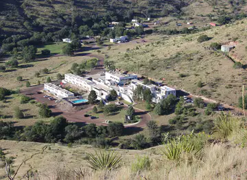
-

-
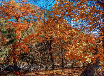
-
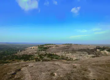
-


Swipe for more destinations
Explore more

Explore more of Trans-Pecos
Explore Trans-Pecos Texas for desert parks, mountain trails, borderland culture, contemporary art and some of the darkest skies in the United States.
Explore Trans-Pecos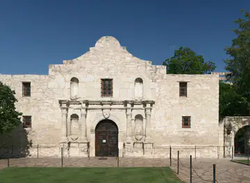
Explore more of Texas
Discover the diverse landscapes, rich history, vibrant cities, and culinary delights of Texas, the Lone Star State, where adventure and culture await at every turn.
Explore Texas