

Free West Texas Travel Guide & Mobile App
Explore West Texas with free travel guides. Discover regional history, expert tips, proposed trips, and audio guides on web or mobile app.


West Texas combines desert parks, mountain towns, oil-country history, dark skies, contemporary art and borderland food across immense open landscapes.
Read more about West Texas
Getting to and around West Texas
How to get there
Transportation
Top city travel guides in West Texas
The cities of West Texas, and the easiest places to base yourself.
-

-
-

-


Swipe for more cities
Destinations in West Texas
Resorts, valleys and scenic spots worth a trip of their own.
-

-


Swipe for more destinations
Best attractions in West Texas
West Texas offers attractions shaped as much by distance and geology as by conventional museums and historic sites. Big Bend National Park provides canyon hikes, desert roads, river landscapes and wildlife viewing, while neighbouring Big Bend Ranch State Park is known for rugged terrain and remote outdoor recreation. Guadalupe Mountains National Park protects the highest point in Texas, the dramatic Guadalupe Peak, as well as the geological story of an ancient marine reef. In the Davis Mountains, Fort Davis National Historic Site explains frontier military history, and McDonald Observatory presents astronomy in one of the region's clearest night skies. El Paso combines art museums, historic neighbourhoods and the Franklin Mountains, while Marfa is associated with contemporary art and the surrounding high-desert landscape. Midland's petroleum museums and Lubbock's cultural institutions interpret oil, agriculture, transport, regional archaeology and life on the South Plains. State parks such as Balmorhea and Monahans Sandhills add contrasting experiences, from spring-fed water to wind-shaped dunes. Across the region, hiking, birdwatching, scenic driving, stargazing and geological observation are often the main attractions rather than large commercial developments.
-
Museum
Dr Pepper Museum
Discover the fizzing history of Dr Pepper in Waco, Texas, at the museum dedicated to America's iconic soft drink.
-
Zoo
Cameron Park Zoo
Explore Cameron Park Zoo, a beautiful 52-acre sanctuary in Waco, Texas, where over 1,700 animals await your discovery in stunning natural habitats.
-
Park
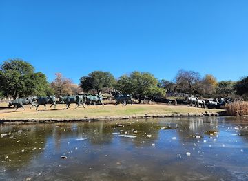
Pioneer Plaza
Explore the iconic Pioneer Plaza in Dallas, a unique park featuring stunning cattle sculptures and serene landscapes, perfect for leisurely strolls and photography.
-
Science museum
Waco Mammoth National Monument
Explore the Waco Mammoth National Monument - a unique archaeological site that showcases ancient mammoth fossils in a beautiful natural setting in Waco, Texas.


Best landmarks in West Texas
The Franklin Mountains form a prominent natural landmark within El Paso, rising directly above the city and creating a distinctive urban-desert setting. Farther east, Guadalupe Peak is the highest point in Texas and the most recognisable summit in Guadalupe Mountains National Park; the surrounding escarpment also preserves the uplifted remains of an ancient marine reef. In Big Bend National Park, the Santa Elena Canyon walls and the Rio Grande express the region's dramatic geological and international character, while the Chisos Mountains provide a rare highland centre within the desert. Fort Davis National Historic Site is one of the best-preserved frontier military landscapes in the United States, with parade grounds and historic structures set in the Davis Mountains. The Marfa Prada installation, located outside the town on the rural highway, has become a widely recognised contemporary-art landmark, although it is a permanent art work rather than an operating shop. In the Permian Basin, oil pumps, drilling infrastructure and the Petroleum Museum landscape represent a different kind of regional monument: the industrial transformation that reshaped modern West Texas.
-
 Historical place
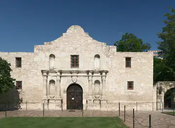
The Alamo
Explore the rich history of The Alamo, a must-see historical landmark in San Antonio, Texas, symbolizing courage and independence.
-
Historical landmark
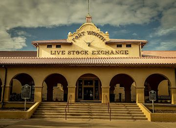
Fort Worth Stockyards
Discover the vibrant history and culture of the Old West at Fort Worth Stockyards, a premier destination for immersive Texan experiences.
-
State park
Palo Duro Canyon State Park
Experience the breathtaking beauty and rich history of Palo Duro Canyon State Park, Texas' stunning natural gem and outdoor adventure hub.
-
Historical place
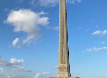
San Jacinto Battleground State Historic Site
Discover Texas history at the San Jacinto Battleground, where the fight for independence shaped a nation. Experience the monuments and stories that define Texas pride.

Explore West Texas on the map
Plan your trip on one map. See where the top cities, national parks and sights are, and book hotels and experiences in a few clicks.
Best hotels in West Texas
Best restaurants in West Texas
West Texas dining reflects borderland history, ranching, agriculture and the practical traditions of a large rural region. El Paso is particularly noted for its Mexican and Tex-Mex food culture, including chile-based dishes, enchiladas, tacos and flour tortillas, while family-owned cafés and bakeries contribute to the city's distinctive food identity. Barbecue, steaks, burgers and hearty breakfasts are common across ranching and oil-country towns, with local interpretations varying from one community to another. Around Lubbock and the High Plains, cotton-country agriculture is joined by vineyards, wineries and produce from irrigated farming. In Marfa, Alpine and other smaller towns, cafés, diners, restaurants and food trucks serve visitors alongside long-established local businesses. Food markets and farm stands can offer seasonal produce, pecans and regional specialities, though availability varies by town and season. In remote areas, dining options are limited and closing times can be early, so carrying provisions is sensible. The region's strongest culinary distinction lies in the meeting of Mexican, Texan and desert-borderland traditions rather than in one single dish.
-
Steak
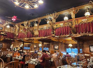
The Big Texan Steak Ranch & Brewery
Experience Texas culture at The Big Texan Steak Ranch & Brewery with legendary steaks, local brews, and a unique dining atmosphere.
-
Restaurant
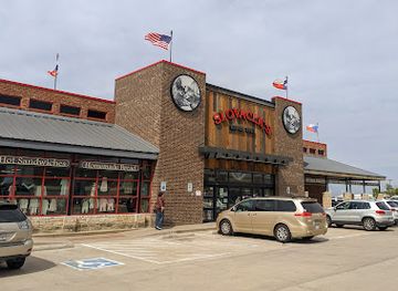
Slovacek's West
Discover authentic Texan cuisine at Slovacek's West—a delightful blend of restaurant, bakery, and convenience store in the heart of Texas.
-
Seafood
The Brazos Landing
Experience the best of seafood and Creole cuisine at The Brazos Landing in Waco, Texas—where every meal is a celebration of flavor.
-
Seafood
Tejun The Texas Cajun- Robinson
Experience authentic Cajun seafood at Tejun The Texas Cajun in Robinson – where flavor meets hospitality!


Best bars in West Texas
West Texas evening life is concentrated in its larger towns and generally favours pubs, restaurants, breweries, live music and cultural events over a dense nightclub scene. El Paso has the broadest range of bars, music venues and late-evening restaurants, with a nightlife culture influenced by its borderland setting and substantial urban population. Lubbock's Texas Tech presence supports a larger bar and live-music scene, especially around the city centre and university area, while Midland and Odessa offer bars, restaurants and venues serving energy-sector communities. In Marfa, evening activity often centres on galleries, restaurants, small bars and arts programming rather than large clubs. Alpine and Fort Davis have a quieter social rhythm, with local bars, cafés and occasional live performances. Rural West Texas becomes very dark and quiet after sunset, which is an attraction for stargazers rather than a sign of a missing entertainment industry. Visitors should check current arrangements locally, as small-town venues and seasonal events can change.
-
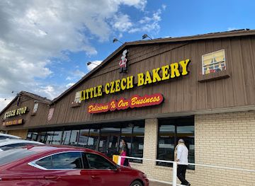
Bakery
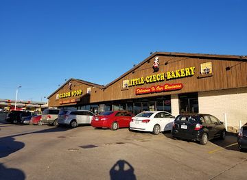
Czech Stop
Discover the rich flavors of Czech Stop, a cherished bakery and deli in West, Texas, renowned for its kolaches and local specialties.
-
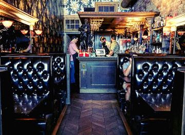
Cocktail bar
Midnight Cowboy
Discover the art of mixology at Midnight Cowboy, Austin's top cocktail bar, where every sip tells a story and every night is a celebration.
-
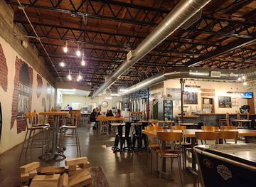
Brewpub
Southern Roots Brewing Co.
Experience the vibrant craft beer culture at Southern Roots Brewing Co. in Waco, Texas, where flavor and community come together.
-
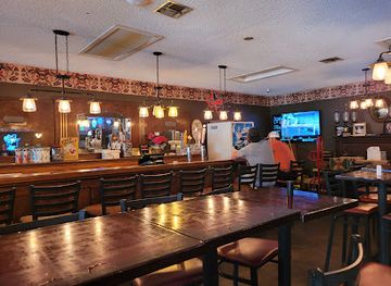
Pizza
The Pizza House
Experience the best of Texas pizza at The Pizza House, where fresh ingredients and unique flavors come together in a warm, inviting setting.
Best nightclubs in West Texas
West Texas evening life is concentrated in its larger towns and generally favours pubs, restaurants, breweries, live music and cultural events over a dense nightclub scene. El Paso has the broadest range of bars, music venues and late-evening restaurants, with a nightlife culture influenced by its borderland setting and substantial urban population. Lubbock's Texas Tech presence supports a larger bar and live-music scene, especially around the city centre and university area, while Midland and Odessa offer bars, restaurants and venues serving energy-sector communities. In Marfa, evening activity often centres on galleries, restaurants, small bars and arts programming rather than large clubs. Alpine and Fort Davis have a quieter social rhythm, with local bars, cafés and occasional live performances. Rural West Texas becomes very dark and quiet after sunset, which is an attraction for stargazers rather than a sign of a missing entertainment industry. Visitors should check current arrangements locally, as small-town venues and seasonal events can change.
-
Night club
Old School Texas
Discover the vibrant nightlife of Fort Worth at Old School Texas, a lively night club and bar offering great music and affordable drinks.
-
Bar
Smiley's Night Club
Discover the energetic nightlife of Waco at Smiley's Night Club, where dancing, drinks, and fun come together for an unforgettable evening.
-
Night club
5IVE Night Club
Experience the vibrant nightlife at 5IVE Night Club in Waco, TX, where the music is loud and the atmosphere is electric, perfect for dancing and socializing.
-
Night club
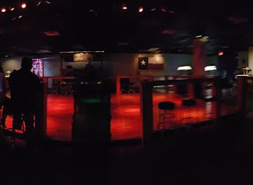
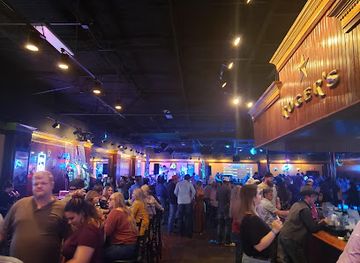
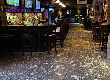
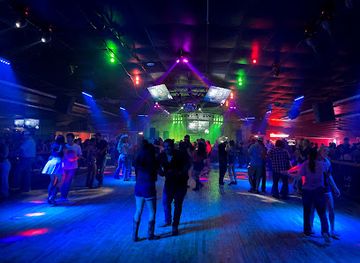
Melody Ranch
Melody Ranch: Waco's premier nightlife destination with a vibrant dance floor and a welcoming bar atmosphere.
Best shops in West Texas
Shopping in West Texas is centred on practical town centres, independent businesses, galleries and regional food rather than extensive luxury retail. El Paso has the broadest urban selection, including Mexican-influenced crafts, clothing, food products, galleries and established commercial districts. Lubbock combines conventional retail with local art, books, wine-related products and South Plains produce, while Midland and Odessa offer shops shaped by professional, family and energy-sector communities. Marfa is known for contemporary art spaces, design-led stores and galleries, although prices and opening arrangements vary. In Alpine and Fort Davis, visitors may find Western goods, books, crafts, antiques and locally made items in small independent shops. Farmers' markets and farm stands can be good places to look for pecans, preserves, chile products, wine and seasonal produce, but market schedules are not uniform across the region. Useful souvenirs include regional art, handmade ceramics, woven goods and locally produced food, with buyers advised to distinguish genuinely local work from generic Western merchandise. Rural shops may close earlier than visitors expect, particularly outside the main tourist season.
-
Restaurant
Slovacek's West
Discover Slovacek's West in Texas – a unique blend of restaurant, bakery, and boutique offering delicious local cuisine and a delightful shopping experience.
-
Bakery
Czech Stop
Discover the authentic flavors of Texas at Czech Stop, a bakery and deli known for its delightful pastries and unique local souvenirs.
-
Bakery
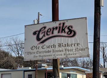
Gerik's Ole Czech Bakery & Deli
Experience authentic Czech pastries and European delicacies at Gerik's Ole Czech Bakery & Deli in West, Texas.
-
Bridal shop
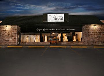
Jo Ann's Bridal
Discover exquisite bridal gowns and tuxedos at Jo Ann's Bridal in West, Texas – your one-stop shop for wedding elegance.
Get your free copy of our complete guide to West Texas, delivered straight to you.
Everything on this page, from attractions and restaurants to essentials and local phrases, in one PDF you can read offline, print or share.
Already have an account? Sign in
Your West Texas guide is ready.
We'll send it to · Not you? Sign out

Getting your guide ready…
We are putting together a fresh copy of the West Texas guide. This can take up to a minute.
This can take a few moments. If your browser asks, choose Allow so the download can start. You'll find the guide in your Downloads folder.
Nothing happened? Download it again
Sorry, the guide is taking longer than usual. Please try again in a minute, or get it by email instead.
West Texas essentials
Currency and Payment
Safety
Emergency Situations
Do's and Don'ts
Local Tips
From Eve
Local phrases worth knowing
You don't need to get them perfect. A few words go a long way, and locals appreciate the effort.
Basics
| English | Local | Say it |
|---|---|---|
| Hello | Howdy | [haʊdi] |
| Goodbye | See ya later | [si jə ˈleɪtər] |
| Yes | Yup | [jʌp] |
| No | Nah | [nɑ] |
| Please/You’re welcome | Sure thing | [ʃʊr θɪŋ] |
| Thank you | Thanks a bunch | [θæŋks ə bʌnʧ] |
| Excuse me/Sorry | Pardon me | [ˈpɑrdən mi] |
| How are you? | How ya doin'? | [haʊ jə ˈduɪn] |
| Fine. And you? | Good. And you? | [ɡʊd. ənd ju] |
| Do you speak English? | Do ya speak English? | [du jə spiːk ˈɪŋɡlɪʃ] |
| I don't understand | I ain't got it | [aɪ eɪnt ɡɑt ɪt] |
Eating & Drinking
| English | Local | Say it |
|---|---|---|
| I'd like to see the menu, please | Can I see the menu, please? | [kæn aɪ si ðə ˈmɛnjuː pliːz] |
| I don't eat meat | I don’t eat meat | [aɪ doʊnt it miːt] |
| Cheers! | Cheers! | [ʧɪrz] |
| I would like to pay, please | Can I get the check, please? | [kæn aɪ ɡɛt ðə ʧɛk pliːz] |
Emergencies
| English | Local | Say it |
|---|---|---|
| Help! | Help! | [hɛlp] |
| Go away! | Get lost! | [ɡɛt lɔst] |
| Call the Police! | Call the cops! | [kɔl ðə kɑps] |
| Call a doctor! | Call a doctor! | [kɔl ə ˈdɑktər] |
| I'm lost | I’m lost | [aɪm lɔst] |
| I'm ill | I ain't feelin' so good | [aɪ eɪnt ˈfiːlɪn soʊ ɡʊd] |
Shopping
| English | Local | Say it |
|---|---|---|
| I'd like to buy... | I wanna buy... | [aɪ ˈwɑnə baɪ] |
| I'm just looking | Just browsin' | [dʒʌst ˈbraʊzɪn] |
| How much is it? | What’s the damage? | [wʌts ðə ˈdæmɪdʒ] |
| That's too expensive | That’s way too high | [ðæts weɪ tu haɪ] |
| Can you lower the price? | Can ya bring down the price? | [kæn jə brɪŋ daʊn ðə praɪs] |
Time & Numbers
| English | Local | Say it |
|---|---|---|
| What time is it? | What time is it? | [wʌt taɪm ɪz ɪt] |
| It's one o'clock | It's one o'clock | [ɪts wʌn əˈklɑk] |
| Half past (10) | Half past ten | [hæf pæst tɛn] |
| Morning | Mornin' | [ˈmɔrnɪn] |
| Afternoon | Afternoon | [ˌæftərˈnun] |
| Evening | Evenin' | [ˈivnɪn] |
| Yesterday | Yesterday | [ˈjɛstərdeɪ] |
| Today | Today | [təˈdeɪ] |
| Tomorrow | Tomorrow | [təˈmɔroʊ] |
| 1 | One | [wʌn] |
| 2 | Two | [tu] |
| 3 | Three | [θri] |
| 4 | Four | [fɔr] |
| 5 | Five | [faɪv] |
| 6 | Six | [sɪks] |
| 7 | Seven | [ˈsɛvən] |
| 8 | Eight | [eɪt] |
| 9 | Nine | [naɪn] |
| 10 | Ten | [tɛn] |
Transport & Directions
| English | Local | Say it |
|---|---|---|
| Where's a/the...? | Where's the...? | [wɛrz ðə] |
| What's the address? | What's the address? | [wʌts ði əˈdrɛs] |
| Can you show me (on the map)? | Can you point it out on the map? | [kæn jə pɔɪnt ɪt aʊt ɑn ðə mæp] |
| When's the next (bus)? | When's the next bus? | [wɛn's ðə nɛkst bʌs] |
| A ticket (to ....) | A ticket to ... | [ə ˈtɪkɪt tu] |
History of West Texas
Indigenous Homelands and Ancient Desert Communities
West Texas has been inhabited for thousands of years by peoples who adapted to deserts, grasslands, mountain valleys and river corridors. The region includes ancestral landscapes associated with Apache and Comanche communities, as well as earlier societies whose archaeological remains record hunting, gathering, farming and trade. The Hueco Tanks area near El Paso preserves rock art and evidence of long human use, while sites across the Big Bend reveal changing relationships with the Rio Grande and Chihuahuan Desert. Indigenous history remains central to understanding the region, even where later settlement has obscured earlier landscapes.
Spanish and Mexican Borderlands
Spanish exploration and mission activity reached the region from the seventeenth century onwards, although effective control was limited by distance, terrain and Indigenous resistance. El Paso grew around settlements on the Río Grande and developed as a significant crossing and agricultural centre. After Mexican independence in 1821, the area remained part of northern Mexico until the Texas Revolution and the later transfer of territory to the United States. The borderlands' language, foodways, religious traditions and family connections still reflect this layered Spanish, Mexican and Indigenous history.
The Comanche Frontier and Forts
During the nineteenth century, Comanche power shaped movement across the plains and desert margins, while expanding American settlement brought military campaigns, trading posts and new transport routes. Fort Davis, established in 1854 in the Davis Mountains, protected a strategically important route and later served the Buffalo Soldiers, African American troops of the United States Army. Forts and military roads formed part of a wider frontier system, but their history must be understood alongside the displacement and violence experienced by Indigenous peoples.
Ranching, Railways and the Cattle Frontier
Railway construction in the late nineteenth century connected isolated West Texas settlements with national markets and encouraged cattle ranching, commercial agriculture and town development. Fencing and water infrastructure transformed open-range systems, while courthouse towns and rail depots became enduring features of the built landscape. The arrival of rail service also accelerated migration and the movement of goods through places such as El Paso, Pecos, Midland and the South Plains. Ranching remains culturally important, although modern West Texas economies are considerably more diverse than the frontier image suggests.
Oil and the Permian Basin
The discovery and development of petroleum in the Permian Basin during the twentieth century transformed Midland, Odessa and surrounding communities. Oil production brought investment, population growth, improved roads and a powerful regional identity tied to drilling and energy expertise. The industry has experienced repeated booms and downturns, shaping local employment, housing and public life. Museums in Midland and nearby communities interpret geology, drilling technology and the social effects of petroleum, while the basin continues to be one of the United States' major oil-producing areas.
Agriculture on the High Plains
The South Plains around Lubbock became a major cotton-producing area after irrigation, mechanisation and improved transport made large-scale farming more viable. The Ogallala Aquifer supported agricultural expansion, but declining groundwater levels have made water management an important modern concern. Texas Tech University, founded in Lubbock in 1923, added education, research and cultural institutions to the agricultural economy. Today, vineyards, wineries, renewable energy and food processing complement cotton and livestock, while the flat plain retains a strong agricultural character.
Conservation, Science and Contemporary Culture
The twentieth and twenty-first centuries brought a growing emphasis on protecting West Texas landscapes and interpreting their scientific value. Big Bend National Park was established in 1944, Guadalupe Mountains National Park in 1972, and other state parks and conservation areas have preserved desert, mountain and canyon habitats. The region's exceptionally dark skies support astronomical research at McDonald Observatory and public stargazing. Marfa's art institutions and installations introduced another international dimension, showing how remote landscapes can attract scientific, creative and cultural communities.
West Texas in Photos
Browse through our photo collection highlighting the charm and character of the destination.
Neighbouring regions of West Texas
The closest regions to West Texas, if you have time for more than one.
-

-

-

-

-


Swipe for more regions
Explore more
Explore more of Texas
Discover the diverse landscapes, rich history, vibrant cities, and culinary delights of Texas, the Lone Star State, where adventure and culture await at every turn.
Explore Texas