

Kunta Kinteh Island Travel Guide - Free Web & App
Your ultimate guide to Kunta Kinteh Island. Discover top landmarks, proposed trips, and local tips. Free on the web or via the Evendo companion app.


Kunta Kinteh Island in The Gambia reveals Atlantic history through riverside ruins, UNESCO-listed heritage, Albreda and Juffureh visits, and boat trips.
Island and River Landscape
Kunta Kinteh Island is a small, historically important island in the River Gambia, approximately 30 kilometres inland from the river mouth in The Gambia. Its weathered ruins stand amid mangroves, mudflats and broad tidal waters, and the island is reached by boat rather than by road. The surrounding river landscape is quiet and expansive, with changing light, birdlife and currents shaping the character of a visit. The island itself has limited facilities, so most excursions are organised from the nearby settlements of Albreda and Juffureh or as part of a wider river journey.Read more about Kunta Kinteh Island
A Place of Atlantic History
Visiting the Island
When is the best time to visit Kunta Kinteh Island?
Best: January–March · 26–27°C| Month | High (°C) | Rainfall (mm) |
|---|---|---|
| January (best) | 26 | 0 |
| February (best) | 26 | 0 |
| March (best) | 27 | 0 |
| April | 27 | 0 |
| May | 28 | 0 |
| June | 29 | 0 |
| July | 30 | 0 |
| August | 30 | 0 |
| September | 30 | 0 |
| October | 29 | 0 |
| November | 28 | 0 |
| December | 27 | 0 |
Getting to and around Kunta Kinteh Island
How to get there
Transportation
Best attractions in Kunta Kinteh Island
-
Park
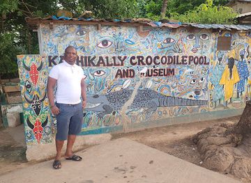
Crocodile Pool
Explore the enchanting Crocodile Pool in Bakau, a serene park offering a unique glimpse into the lives of Nile crocodiles amidst lush surroundings.
-
Tourist attraction
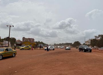
Senegambia Road
Experience the lively culture and vibrant atmosphere of Senegambia Road, a must-visit tourist attraction in the heart of Serrekunda, Gambia.
-
 Tourist attraction
Banni swamp area
Explore the enchanting Banni Swamp Area, a haven for wildlife and nature lovers showcasing breathtaking landscapes and rich biodiversity.
Explore Kunta Kinteh Island on the map
Plan your trip on one map. See where the top attractions, landmarks, restaurants and hotels are, and book hotels and experiences in a few clicks.
Best hotels in Kunta Kinteh Island
Get your free copy of our complete guide to Kunta Kinteh Island, delivered straight to you.
Everything on this page, from attractions and restaurants to essentials and local phrases, in one PDF you can read offline, print or share.
Already have an account? Sign in
Your Kunta Kinteh Island guide is ready.
We'll send it to · Not you? Sign out

Getting your guide ready…
We are putting together a fresh copy of the Kunta Kinteh Island guide. This can take up to a minute.
This can take a few moments. If your browser asks, choose Allow so the download can start. You'll find the guide in your Downloads folder.
Nothing happened? Download it again
Sorry, the guide is taking longer than usual. Please try again in a minute, or get it by email instead.
Kunta Kinteh Island essentials
Currency and Payment
Safety
Emergency Situations
Do's and Don'ts
Local Tips
From Eve
Local phrases worth knowing
You don't need to get them perfect. A few words go a long way, and locals appreciate the effort.
Basics
| English | Local | Say it |
|---|---|---|
| Hello | Salut | [sah-loo] |
| Goodbye | Ba beneen | [bah beh-neen] |
| Yes | Waaw | [wah-oh] |
| No | Déedéet | [deh-deh] |
| Please/You're welcome | Jërejëf | [jay-ray-jayf] |
| Thank you | Jërëjëf | [jay-ray-jayf] |
| Excuse me/Sorry | Ba beneen | [bah beh-neen] |
| How are you? | Nanga def? | [nahn-gah dehf] |
| Fine. And you? | Jam rek. Nopp ci? | [jahm rehk. nop-chi] |
| Do you speak English? | Benn laa ñu Angalee? | [beh-n lah noo ahn-gah-lee] |
| I don't understand | Déedéet | [deh-deh] |
Eating & Drinking
| English | Local | Say it |
|---|---|---|
| I'd like to see the menu, please | Nopp nga am menu, dafa ba beneen | [nop-ngah ahm meh-noo, dah-fah bah beh-neen] |
| I don't eat meat | Déedéet | [deh-deh] |
| Cheers! | Ba beneen | [bah beh-neen] |
| I would like to pay, please | Nopp nga amul, dafa ba beneen | [nop-ngah ah-mool, dah-fah bah beh-neen] |
Emergencies
| English | Local | Say it |
|---|---|---|
| Help! | Ndank | [n-dah-nk] |
| Go away! | Bara la | [bah-rah lah] |
| Call the Police! | Nopp nga wax Police | [nop-ngah wakh poh-leece] |
| Call a doctor! | Nopp nga wax dokter | [nop-ngah wakh dohk-tehr] |
| I'm lost | Déedéet | [deh-deh] |
| I'm ill | Déedéet | [deh-deh] |
Shopping
| English | Local | Say it |
|---|---|---|
| I'd like to buy... | Nopp nga jëkk... | [nop-ngah jayk] |
| I'm just looking | Déedéet | [deh-deh] |
| How much is it? | Samaa laa? | [sah-mah lah] |
| That's too expensive | Samaa bu baax | [sah-mah boo bah] |
| Can you lower the price? | Baax naa la? | [bah bah lah] |
Time & Numbers
| English | Local | Say it |
|---|---|---|
| What time is it? | Waar naa la? | [wah-nah lah] |
| It's one o'clock | Ñaari yow | [nyah-ree yoh] |
| Half past (10) | Déedéet | [deh-deh] |
| Morning | Kër gi | [kehr gee] |
| Afternoon | Peleer gi | [peh-lehr gee] |
| Evening | Jëm gi | [jaym gee] |
| Yesterday | Déedéet | [deh-deh] |
| Today | Déedéet | [deh-deh] |
| Tomorrow | Déedéet | [deh-deh] |
| 1 | Një | [n-jeh] |
| 2 | Ñaar | [nyar] |
| 3 | Tàttu | [taht-too] |
| 4 | Nènti | [nehn-tee] |
| 5 | Juróom | [joo-room] |
| 6 | Jàmm | [jahm] |
| 7 | Jàmm | [jahm] |
| 8 | Jàmm | [jahm] |
| 9 | Jàmm | [jahm] |
| 10 | Fukk | [fook] |
Transport & Directions
| English | Local | Say it |
|---|---|---|
| Where's a/the...? | Nopp nga am... | [nop-ngah ahm] |
| What's the address? | Nopp nga amul adres | [nop-ngah ah-mool ah-drehs] |
| Can you show me (on the map)? | Baax naa la? | [bah bah lah] |
| When's the next (bus)? | Déedéet | [deh-deh] |
| A ticket (to ....) | Déedéet | [deh-deh] |
History of Kunta Kinteh Island
A River Shaped by Tides
The River Gambia has long functioned as a natural route into the interior of West Africa, linking coastal waters with settlements and trading communities farther upriver. Kunta Kinteh Island's position within the navigable river made it strategically valuable to European powers seeking to control commerce and movement. The island's importance therefore arose less from its size than from its location: vessels could use the river channel while the fort served as a point of surveillance, exchange and contested authority. The wider landscape of islands, creeks and mangroves also influenced how people, goods and ideas moved through the region.
European Forts and Rival Powers
The island was first occupied by the Duchy of Courland in the seventeenth century and was subsequently taken by the English, who developed the settlement known as James Island and established Fort James. Control of the River Gambia was contested among European powers, including the English and French, as trading interests expanded along the river. Albreda on the north bank became an important French presence, creating a close historical relationship between the island and the mainland trading post. The surviving ruins reflect repeated alteration, conflict and abandonment rather than a single, unchanged colonial occupation.
The Transatlantic Slave Trade
During the period of the transatlantic slave trade, Fort James and other river settlements formed part of a network through which enslaved Africans were detained, exchanged and transported towards the Atlantic coast. Kunta Kinteh Island was one element in this system, alongside mainland sites such as Albreda and Juffureh. The island's remains cannot convey the full human history of those who passed through the network, but they provide a physical setting for understanding the coercive commercial structures that affected communities across the region. The site's significance today rests in part on preserving and interpreting this difficult history.
Destruction and Abandonment
Fort James was repeatedly affected by the rivalry between European powers and was destroyed by French forces in 1779. The settlement was subsequently abandoned, leaving ruins exposed to river weather, erosion and the passage of time. As the fort lost its military and commercial purpose, the island became a historical remnant within a working river landscape rather than a continuing colonial centre. Its ruined walls, foundations and remaining fragments are consequently valuable as archaeological evidence, while also requiring careful protection from instability and the natural processes acting on the island.
Heritage and the Roots Association
In the modern period, the island and the nearby sites of Albreda and Juffureh became increasingly important to heritage tourism and public discussion of the transatlantic slave trade. The island was officially renamed Kunta Kinteh Island, and Kunta Kinteh Island and Related Sites were inscribed on the UNESCO World Heritage List in 2003. The name is closely connected with the account of Kunta Kinteh popularised through Alex Haley's Roots, although the precise relationship between literary genealogy and independently documented history remains a subject requiring careful interpretation. The connected sites are now approached as a shared cultural landscape rather than as isolated ruins.
Kunta Kinteh Island in Photos
Browse through our photo collection highlighting the charm and character of the destination.
Neighbouring destination travel guides
The closest destinations to Kunta Kinteh Island, if you have time for more than one.
-

-

-

-

-


Swipe for more destinations
Explore more

Explore more of Foni Brefet
Explore Foni Brefet in southern The Gambia for rural landscapes, village culture, seasonal wetlands and a slower journey beyond the resort coast.
Explore Foni Brefet
Explore more of The Gambia
Discover The Gambia: a treasure trove of cultural richness, stunning beaches, and diverse wildlife. An unforgettable journey awaits you in Africa's Smiling Coast.
Explore The Gambia