

Free Dnieper Ukraine Travel Guide & Mobile App
Explore Dnieper Ukraine with free travel guides. Discover regional history, expert tips, proposed trips, and audio guides on web or mobile app.


Explore Dnieper Ukraine through Kyiv’s heritage, central river landscapes, Cossack history, industrial cities and changing steppe scenery.
Read more about Dnieper Ukraine
When is the best time to visit Dnieper Ukraine?
Best: June–August · 24–26°C| Month | High (°C) | Rainfall (mm) |
|---|---|---|
| January | 0 | 31 |
| February | 1 | 30 |
| March | 7 | 35 |
| April | 15 | 40 |
| May | 20 | 52 |
| June (best) | 24 | 62 |
| July (best) | 26 | 56 |
| August (best) | 26 | 50 |
| September | 20 | 41 |
| October | 14 | 36 |
| November | 6 | 36 |
| December | 2 | 37 |
Getting to and around Dnieper Ukraine
How to get there
Transportation
Top city travel guides in Dnieper Ukraine
The cities of Dnieper Ukraine, and the easiest places to base yourself.
-

-

-

-

-


Swipe for more cities
Destinations in Dnieper Ukraine
Resorts, valleys and scenic spots worth a trip of their own.
-

-


Swipe for more destinations
Best attractions in Dnieper Ukraine
Dnieper Ukraine’s attractions follow the changing character of the river. Kyiv offers the deepest concentration of museums, historic churches, monasteries and civic landmarks, while the river hills and embankments provide broad views across the water. In the Middle Dnipro, Kaniv is associated with the Taras Shevchenko National Reserve, and the reservoir landscapes around Cherkasy combine woodland, open water and protected natural areas. These destinations are suited to cultural visits and carefully planned outdoor excursions, subject to local conditions. Dnipro presents the story of twentieth-century engineering, science and industry through museums, public spaces and its long riverside setting. Zaporizhzhia’s Khortytsia island interprets Cossack history and the lower Dnipro landscape through cultural displays, walking areas and natural habitats. River reservoirs, islands and steppe scenery create opportunities for birdwatching, photography and quiet walks, although access is not uniform and some areas may be restricted because of the war. Southern attractions near active military zones should not be approached without explicit official confirmation that they are open and safe.
-
Park
Park of Eternal Glory
Explore the Park of Eternal Glory in Kyiv, where nature meets history amidst stunning views of the Dnieper River.
-
Bridge
Park Bridge
Discover the breathtaking views and vibrant atmosphere of Park Bridge in Kyiv, a must-visit landmark over the Dnipro River.
-
Tourist attraction
Kulia bazhan
Discover the vibrant atmosphere and stunning views at Kulia Bazhan, Dnipro's premier riverside tourist attraction, perfect for relaxation and exploration.
-
City park
Lazar Globa Park
Explore the lush landscapes and serene atmosphere of Lazar Globa Park, a perfect retreat in the heart of Dnipro, Ukraine.


Best landmarks in Dnieper Ukraine
The Dnipro corridor is marked by places that express Ukraine’s religious, cultural, military and industrial history. Kyiv’s skyline is defined by the golden domes and historic architecture of St Sophia’s Cathedral and the Kyiv-Pechersk Lavra complex, while the steep river hills create one of the country’s most recognisable urban landscapes. At Kaniv, the Taras Shevchenko National Reserve on Chernecha Hora is both a national commemorative site and a major viewpoint over the Middle Dnipro. Khortytsia in Zaporizhzhia is the river’s most powerful Cossack-associated landmark, an extensive island whose position shaped the history of the lower Dnipro. Dnipro’s river embankment and the surviving infrastructure associated with the Dnipro Hydroelectric Station illustrate the scale of Soviet industrial modernisation, although access to strategic infrastructure is restricted and it should not be treated as a sightseeing site. Reservoirs, wooded banks and open steppe form natural landmarks of equal importance, but views and access can be altered by security measures, water management and wartime restrictions.
-
Historical landmark
Ukrainian Motherland Monument
Explore the iconic Ukrainian Motherland Monument, a tribute to resilience and history with stunning views of Kyiv and the Dnipro River.
-
Bridge
Park Bridge
Discover the breathtaking views and architectural beauty of Park Bridge, a must-visit tourist attraction in Kyiv that connects nature with urban life.
-
River
Dnipro River
Explore the breathtaking Dnipro River in Ukraine, a serene escape known for its stunning views and rich cultural history.
-
City park
Lazar Globa Park
Discover the tranquil beauty of Lazar Globa Park in Dnipro, a perfect escape for relaxation, family fun, and nature appreciation.


Explore Dnieper Ukraine on the map
Plan your trip on one map. See where the top cities, national parks and sights are, and book hotels and experiences in a few clicks.
Best hotels in Dnieper Ukraine
Best restaurants in Dnieper Ukraine
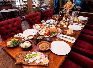
Dining along the Dnipro reflects the broader food culture of Ukraine while taking on local variations between capital, industrial city and countryside. Kyiv has the widest choice, from contemporary Ukrainian restaurants and bakeries to traditional cafés serving borshch, varenyky, deruny and seasonal preserves. In central towns, look for soups, buckwheat, cabbage dishes, fresh bread, dairy products and market produce rather than a single defining river cuisine. Fish from the Dnipro and its reservoirs may appear on menus, but visitors should choose reputable establishments and avoid assuming that all catches are safe or legally sourced. Around Cherkasy and Kaniv, local markets and rural eateries offer produce from the forest-steppe, while Dnipro and Zaporizhzhia combine Ukrainian cooking with the practical, multicultural character of large industrial cities. During wartime, restaurant opening and supply arrangements can change quickly, so rely on current local information rather than pre-war listings.
-
Ukrainian
Hutorets na Dnipri
Experience authentic Ukrainian flavors at Hutorets na Dnipri, where exquisite cuisine meets stunning riverside views in Kyiv.
-
Gastropub
Varburger
Experience gourmet burgers like never before at Varburger, Dnipro's top gastropub blending quality ingredients with a vibrant atmosphere.
-
Restaurant
Coast Restaurant & Lounge
Experience exquisite dining at Coast Restaurant & Lounge in Dnipro - where culinary excellence meets breathtaking river views.


Best bars in Dnieper Ukraine
Evening life in Dnieper Ukraine depends heavily on security conditions and curfews. Kyiv has the broadest range of cafés, wine bars, breweries, live-music venues and cultural events, while Cherkasy, Dnipro and Zaporizhzhia offer more concentrated scenes centred on central streets and riverside districts. Traditional pubs and contemporary Ukrainian bars coexist with coffee houses and restaurants that remain important meeting places when late-night activity is restricted. In smaller towns and rural areas, evenings are quieter and are more likely to revolve around a restaurant, family café or local cultural event than a nightclub. Visitors should check whether venues are operating, note the required closing time, and leave promptly when an air-raid alert or official instruction requires it. Alcohol should never be taken into shelters where prohibited, and nightlife plans must remain secondary to local safety guidance.
-
Restaurant
Bartolomeo
Bartolomeo: A Culinary Gem in Dnipro Offering Gastronomic Delights, Comfortable Accommodations, and Sports Activities.
-
Brewpub
Starhorod
Discover the vibrant flavors of Dnipro at Starhorod, a renowned brewpub offering craft beers and gourmet dining experiences.
-
Pub
MakhnoPUB
Discover MakhnoPUB in Dnipro: a lively pub offering craft beers, local delicacies, and an unforgettable atmosphere for tourists and locals alike.
-
Gastropub
Varburger
Savor exquisite burgers and vibrant atmosphere at Varburger, Dnipro's top gastropub, blending modern Ukrainian flavors with a lively dining experience.


Best nightclubs in Dnieper Ukraine
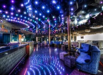
Evening life in Dnieper Ukraine depends heavily on security conditions and curfews. Kyiv has the broadest range of cafés, wine bars, breweries, live-music venues and cultural events, while Cherkasy, Dnipro and Zaporizhzhia offer more concentrated scenes centred on central streets and riverside districts. Traditional pubs and contemporary Ukrainian bars coexist with coffee houses and restaurants that remain important meeting places when late-night activity is restricted. In smaller towns and rural areas, evenings are quieter and are more likely to revolve around a restaurant, family café or local cultural event than a nightclub. Visitors should check whether venues are operating, note the required closing time, and leave promptly when an air-raid alert or official instruction requires it. Alcohol should never be taken into shelters where prohibited, and nightlife plans must remain secondary to local safety guidance.
-
Restaurant
Rio Club
Experience the perfect blend of fine dining and electrifying nightlife at Rio Club in Dnipro - where every visit becomes a memorable adventure.
-
Night club
Caribbean Club
Discover the ultimate nightlife experience at Caribbean Club in Kyiv, where dining, music, and dancing come together in a vibrant atmosphere.
-
Night club
Forsage
Discover the heartbeat of Kyiv's nightlife at Forsage, an upscale night club offering electrifying music, stylish ambiance, and unforgettable experiences.
-
Night club
Skybar
Discover the vibrant nightlife of Kyiv at Skybar, a rooftop club offering stunning views, delicious cocktails, and an electrifying atmosphere.



Best shops in Dnieper Ukraine
Shopping in Dnieper Ukraine ranges from Kyiv’s established central streets and galleries to the practical markets and independent shops of regional cities. Kyiv is the best place for Ukrainian books, contemporary crafts, ceramics, textiles, design goods and packaged regional foods, while Cherkasy, Kaniv, Dnipro and Zaporizhzhia offer local produce, bakeries, small craft businesses and traditional markets. Useful purchases include honey, preserves, herbal teas, chocolate, ceramics and embroidered or contemporary textile work, provided items are bought from legitimate sellers. Market shopping is more about seasonal fruit, vegetables, pickles, dairy products and everyday goods than a formal tourist experience. Check provenance and customs rules before buying antiques, icons, archaeological objects or military memorabilia, and never remove items from historic or archaeological sites. Retail hours, stock and payment facilities may change during wartime, so carry a practical payment alternative and confirm that shops are operating before making a special journey.
-
Shopping mall
Ocean Plaza
Explore Ocean Plaza in Kyiv: a shopping haven with diverse stores, dining options, and entertainment for the whole family.
-
Shopping mall
Lavina Mall
Discover Lavina Mall in Kyiv: A premier shopping destination with diverse stores, dining options, and family-friendly entertainment.
-
Shopping mall
MOST-City
Experience shopping, dining, and entertainment in the heart of Dnipro at MOST-City, a premier shopping destination.
-
Shopping mall
Cosmo Multimall
Discover the vibrant shopping and entertainment experience at Cosmo Multimall in Kyiv, where every visit offers endless fun and unique finds.




Get your free copy of our complete guide to Dnieper Ukraine, delivered straight to you.
Everything on this page, from attractions and restaurants to essentials and local phrases, in one PDF you can read offline, print or share.
Already have an account? Sign in
Your Dnieper Ukraine guide is ready.
We'll send it to · Not you? Sign out

Getting your guide ready…
We are putting together a fresh copy of the Dnieper Ukraine guide. This can take up to a minute.
This can take a few moments. If your browser asks, choose Allow so the download can start. You'll find the guide in your Downloads folder.
Nothing happened? Download it again
Sorry, the guide is taking longer than usual. Please try again in a minute, or get it by email instead.
Dnieper Ukraine essentials
Currency and Payment
Safety
Emergency Situations
Do's and Don'ts
Local Tips
From Eve
Local phrases worth knowing
You don't need to get them perfect. A few words go a long way, and locals appreciate the effort.
Basics
| English | Local | Say it |
|---|---|---|
| Hello | Привіт | [Pryvit] |
| Goodbye | До побачення | [Do pobachennya] |
| Yes | Так | [Tak] |
| No | Ні | [Ni] |
| Please/You're welcome | Будь ласка | [Budʹ laska] |
| Thank you | Дякую | [Dyakuyu] |
| Excuse me/Sorry | Вибачте | [Vybachte] |
| How are you? | Як справи? | [Yak spravy?] |
| Fine. And you? | Добре. А ти? | [Dobre. A ty?] |
| Do you speak English? | Ви говорите англійською? | [Vy hovoryte anhliyskoyu?] |
| I don't understand | Я не розумію | [Ya ne rozumiyu] |
Eating & Drinking
| English | Local | Say it |
|---|---|---|
| I'd like to see the menu, please | Я хотів би побачити меню, будь ласка | [Ya khotiv by pobachyty menyu, budʹ laska] |
| I don't eat meat | Я не їм м'ясо | [Ya ne yim m'yaso] |
| Cheers! | На здоров'я! | [Na zdorov'ya!] |
| I would like to pay, please | Я хотів би заплатити, будь ласка | [Ya khotiv by zaplatyty, budʹ laska] |
Emergencies
| English | Local | Say it |
|---|---|---|
| Help! | Допоможіть! | [Dopomozhitʹ!] |
| Go away! | Ідіть геть! | [Iditʹ hetʹ!] |
| Call the Police! | Викликайте поліцію! | [Vyklikayte politsiyu!] |
| Call a doctor! | Викликайте лікаря! | [Vyklikayte likarya!] |
| I'm lost | Я загубився | [Ya zahubyvsyasʹ] |
| I'm ill | Я хворий | [Ya khvoryy] |
Shopping
| English | Local | Say it |
|---|---|---|
| I'd like to buy... | Я хотів би купити... | [Ya khotiv by kupyty...] |
| I'm just looking | Я просто дивлюсь | [Ya prosto dyvlyus'] |
| How much is it? | Скільки це коштує? | [Skilʹky tse koshtuye?] |
| That's too expensive | Це занадто дорого | [Tse zanadto dorogo] |
| Can you lower the price? | Можете знизити ціну? | [Mozhete znyzyty tsinu?] |
Time & Numbers
| English | Local | Say it |
|---|---|---|
| What time is it? | Котра година? | [Kotra hodyna?] |
| It's one o'clock | Одна година | [Odna hodyna] |
| Half past (10) | Пів на (десяту) | [Piv na (desyatu)] |
| Morning | Ранок | [Ranok] |
| Afternoon | День | [Denʹ] |
| Evening | Вечір | [Vechir] |
| Yesterday | Вчора | [Vchora] |
| Today | Сьогодні | [Sʹohodni] |
| Tomorrow | Завтра | [Zavtra] |
| 1 | Один | [Odin] |
| 2 | Два | [Dva] |
| 3 | Три | [Try] |
| 4 | Чотири | [Chotyry] |
| 5 | П'ять | [P'yatʹ] |
| 6 | Шість | [Shistʹ] |
| 7 | Сім | [Sim] |
| 8 | Вісім | [Visim] |
| 9 | Дев'ять | [Dev'yatʹ] |
| 10 | Десять | [Desyatʹ] |
Transport & Directions
| English | Local | Say it |
|---|---|---|
| Where's a/the...? | Де знаходиться...? | [De znakhodytsya...?] |
| What's the address? | Яка адреса? | [Yaka adresa?] |
| Can you show me (on the map)? | Можете показати мені (на карті)? | [Mozhete pokazaty meni (na karti)?] |
| When's the next (bus)? | Коли наступний (автобус)? | [Koly nastupnyy (avtobus)?] |
| A ticket (to ....) | Квиток (до ...) | [Kvytoк (do ...)] |
History of Dnieper Ukraine
The Dnipro in Early European History
The Dnipro has long been one of Eastern Europe’s major transport and settlement routes. In antiquity, communities along its banks traded across the forest-steppe and supported farming, fishing and craft production. Greek writers described peoples living in the wider region, while later routes linked the Baltic and Black Sea worlds. The river’s rapids once made navigation difficult in the lower reaches, but its overall north–south course enabled movement of goods, armies and ideas. Archaeological evidence across the Dnipro corridor reflects successive Scythian, Sarmatian, Slavic and other cultural influences.
Kyivan Rus and the River Route
During the medieval period, the Dnipro was central to the political and commercial importance of Kyivan Rus. The route often described as running from the Varangians to the Greeks connected the Baltic region with Byzantium, with Kyiv occupying a strategically important position on the river. Christianisation under Volodymyr the Great in 988 strengthened Kyiv’s links with the Byzantine world. Although political power later fragmented and invasions transformed the region, churches, chronicles and archaeological remains preserve the river’s importance in the formation of Ukrainian historical identity.
Lithuanian, Polish and Cossack Frontiers
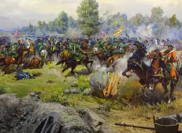
From the late medieval period, much of central Ukraine came under the influence or rule of the Grand Duchy of Lithuania and later the Polish–Lithuanian Commonwealth. The steppe frontier to the south remained contested, and fortified settlements developed beside routes leading towards the Black Sea. From the sixteenth century, the Zaporizhzhian Cossacks became closely associated with the lower Dnipro and the river islands known as the Great Meadow. Their military communities, elected leadership and frontier life occupy a prominent place in Ukrainian historical memory.
The Hetmanate and Early Modern Towns
The seventeenth century brought the Cossack uprising led by Bohdan Khmelnytsky and the creation of the Cossack Hetmanate, a polity whose political geography included important parts of the Middle Dnipro. Pereiaslav, Kyiv, Cherkasy and other towns were involved in the period’s shifting alliances and conflicts. Over the following century, increasing Russian imperial control reduced Cossack autonomy and reorganised local administration. Monasteries, churches, historic settlements and surviving written traditions provide some of the clearest reminders of this formative period.
Imperial Expansion and the New Steppe Cities
During the eighteenth and nineteenth centuries, the Russian Empire consolidated control over the Dnipro corridor and promoted settlement, agriculture, mining and trade. New administrative and industrial centres developed in the southern steppe, while older towns were reshaped by imperial institutions and commercial networks. The river served both local agriculture and long-distance transport. The expansion of roads, railways and river shipping connected inland production with Black Sea ports and helped establish the economic geography that later supported Dnipro, Zaporizhzhia and other major urban centres.
Industrialisation and the Dnipro Hydroelectric Dam
The twentieth century transformed the river through rapid industrialisation, urban growth and large engineering projects. The Dnipro Hydroelectric Station at Zaporizhzhia, completed during the Soviet period, became a landmark of electrification and heavy industry, while dams and reservoirs altered navigation, fisheries, settlements and river habitats along the middle and lower course. Factories producing metals, machinery and energy-intensive goods expanded cities such as Dnipro and Zaporizhzhia. The period also brought repression, famine, wartime destruction and extensive social upheaval.
The Dnipro in Independent Ukraine
With Ukraine’s independence in 1991, the river remained a central ecological, economic and cultural resource. Kyiv, Cherkasy, Dnipro and Zaporizhzhia developed distinct civic identities while sharing connections through transport, industry and Ukrainian cultural memory. Museums, memorials and restored historic sites increasingly present the river from Ukrainian perspectives, including the heritage of the Cossacks, the Holodomor and twentieth-century industrialisation. Since 2014, and especially after Russia’s full-scale invasion in 2022, the Dnipro has also been a strategic military line, making parts of the southern corridor unsuitable for normal tourism.
Dnieper Ukraine in Photos
Browse through our photo collection highlighting the charm and character of the destination.
Neighbouring regions of Dnieper Ukraine
The closest regions to Dnieper Ukraine, if you have time for more than one.
-

-

-

-

-


Swipe for more regions
Explore more

Explore more of Ukraine
Explore Ukraine: From Kyiv's golden domes to the Carpathian Mountains, discover a country rich in history, culture, and natural beauty in the heart of Eastern Europe.
Explore Ukraine