Moel y Gaer, Rhosesmor: A Timeless Iron Age Hillfort with Panoramic Views
Explore Moel y Gaer, a commanding Iron Age hillfort with ancient earthworks and sweeping views across North Wales and beyond.
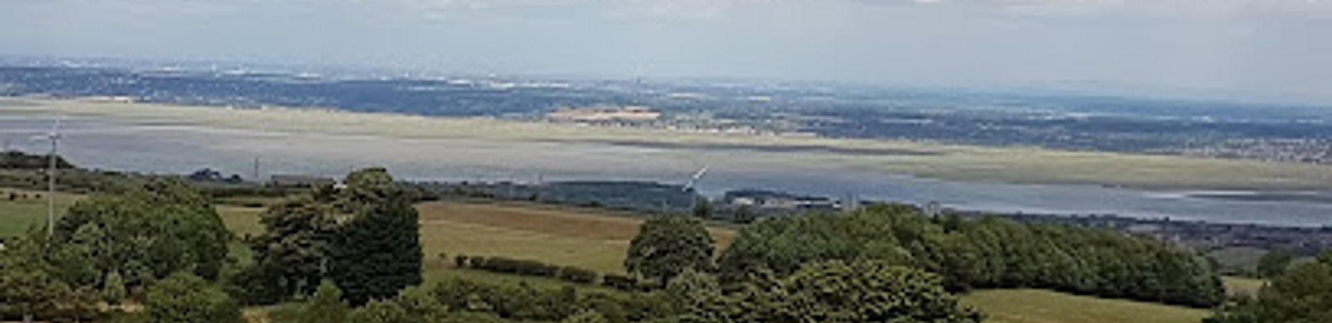
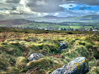
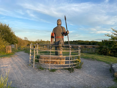
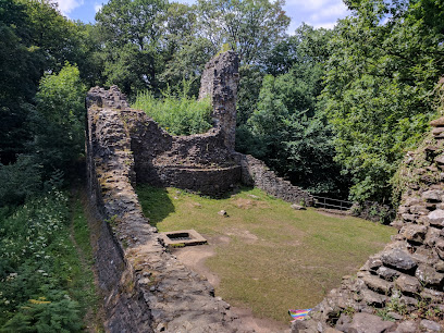
Moel y Gaer is an Iron Age hillfort perched atop Halkyn Mountain near Rhosesmor, Flintshire, Wales. This well-preserved site features ancient earth ramparts and offers sweeping 360-degree views over the Dee Estuary, Wirral, Cheshire, and the Clwydian Range. With evidence of Neolithic, Bronze Age, and Iron Age occupation, it is a significant archaeological landmark rich in history and legend.
A brief summary to Moel y Gaer
- Mold, Halkyn, GB
- Visit website
- Duration: 1 to 3 hours
- Free
-
 Outdoor
- Mobile reception: 4 out of 5
- Monday 12 am-12 am
- Tuesday 12 am-12 am
- Wednesday 12 am-12 am
- Thursday 12 am-12 am
- Friday 12 am-12 am
- Saturday 12 am-12 am
- Sunday 12 am-12 am
Local tips
- Bring binoculars to enjoy panoramic views stretching to Liverpool, the Wirral, and the Clwydian Range.
- Wear sturdy shoes for the easy 20-minute uphill walk along a well-defined footpath from Rhosesmor.
- Visit during clear weather for the best visibility and photo opportunities of the surrounding landscape.
- Respect the grazing sheep and stay on marked paths to help preserve the site’s delicate earthworks.
For the on-the-go comforts that matter to you
- Restrooms
- Drink Options
- Food Options
- Seating Areas
- Information Boards
Getting There
-
Car
Driving from Mold, take the A541 towards Denbigh, then the B5123 to Rhosesmor. Park at the community centre car park near St Paul’s church. The drive takes approximately 15-20 minutes. Note that parking spaces may be limited during peak times.
-
Walking
From Rhosesmor village, follow the well-marked footpath to Moel y Gaer summit. The 0.5-mile walk takes about 20 minutes over easy terrain with some gentle uphill sections, suitable for most fitness levels.
-
Public Transport
Bus services connect Mold to nearby villages including Rhosesmor, with variable frequency. From the bus stop in Rhosesmor, the hillfort is a 20-minute walk. Check local bus schedules in advance as services may be limited on weekends.
Moel y Gaer location weather suitability
-
 Any Weather
-
 Clear Skies
-
 Mild Temperatures
-
 Windy Conditions
-
 Rain / Wet Weather
Discover more about Moel y Gaer
Ancient Origins and Archaeological Significance
Moel y Gaer stands as a remarkable testament to prehistoric settlement, with evidence of human activity dating back over 5,000 years. Excavations have revealed a Neolithic rectangular building, Bronze Age cairns, and a sequence of Iron Age fortifications. The hillfort’s earliest phase featured a wooden palisade, later replaced by substantial earth ramparts and ditches around the 6th century BC. These defensive structures enclose an area of approximately 2.7 hectares, with 21 roundhouses and later rectangular buildings uncovered during archaeological digs. The site’s layered history provides invaluable insight into the lives and societal structures of late Bronze Age and Iron Age communities in Wales.Strategic Location and Spectacular Vistas
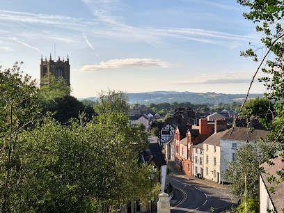
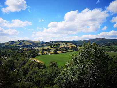
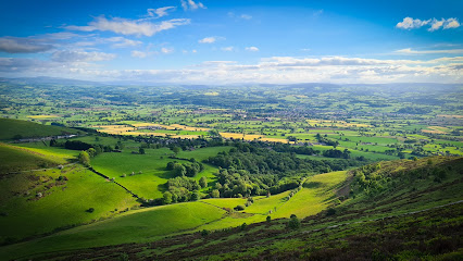
Situated at 984 feet (300 meters) above sea level on a limestone knoll, Moel y Gaer commands commanding views across the surrounding landscape. From the summit, visitors can gaze north towards Liverpool and the Wirral, spot the Cheshire Plain and Beeston Castle to the east, and admire the Clwydian Range and Moel Famau to the south. The fort’s elevated position historically offered strategic oversight of approaches from the south and the Dee Estuary, making it a vital defensive site. Today, the panoramic views remain a major draw for visitors, providing a breathtaking natural backdrop to the ancient earthworks.Historical Layers and Cultural Resonance
Beyond its prehistoric roots, Moel y Gaer is entwined with Welsh history and legend. It is reputedly linked to the uprising of Owain Glyndŵr in the early 15th century, when Howel Gwynedd used the site as a stronghold against English forces. The hillfort’s long occupation and strategic importance have sparked theories connecting it to the legendary Avalon of Arthurian myth. In more recent centuries, it played a role during the Napoleonic Wars as a fire beacon site to warn of invasion. This rich tapestry of historical and mythical associations imbues the site with a deep cultural resonance.Visitor Experience and Natural Setting
Accessed by a well-defined 0.5-mile (0.8 km) footpath from the village of Rhosesmor, the walk to Moel y Gaer is relatively easy and suitable for most visitors. The summit area, covered in rough pasture and gorse scrub, invites picnics and quiet contemplation amid the earth ramparts. The site is popular with dog walkers and local sheep grazing continues, blending natural and historical elements. The presence of a modern water reservoir and a communications mast atop the hill subtly contrasts with the ancient surroundings. Visitors are encouraged to bring binoculars to fully appreciate the extensive views and to explore the visible archaeological features such as the ramparts and entrance.Preservation and Archaeological Research
Moel y Gaer has benefited from extensive archaeological investigation, particularly in the 1970s, which uncovered key insights into its multiple phases of occupation. The construction of a covered reservoir on the summit prompted detailed excavations that revealed the complexity of the site’s development. Despite the acidic sub-soil limiting metal artifact preservation, finds such as pottery shards, stone tools, and loom weights have enriched understanding of the site’s past. The earthworks remain well-preserved, and the site is managed to balance public access with conservation, ensuring this remarkable hillfort endures as a window into Wales’s ancient past.Local Context and Surrounding Landscape
Moel y Gaer is part of a wider landscape rich in archaeological and natural interest. The surrounding Halkyn Mountain area has a history of lead mining and limestone quarrying, which shaped local communities over centuries. Nearby hills like Moel Arthur and Penycloddiau form part of the Clwydian Range, a chain of hillforts that collectively illustrate the region’s Iron Age heritage. The village of Rhosesmor, nestled below the hillfort, offers a glimpse into rural Welsh life, with local amenities including pubs and community facilities. The blend of cultural heritage, natural beauty, and accessible terrain makes Moel y Gaer a rewarding destination for history enthusiasts and nature lovers alike.Iconic landmarks you can’t miss
Naid Y March
7.6 km
Discover the ancient mystery of Naid Y March, the Bronze Age standing stones steeped in legend and Welsh heritage near Holywell.
Dyfed Drive
10.6 km
Discover Deeside with ease from Dyfed Drive, your essential bus stop connecting you to local attractions and scenic landscapes.
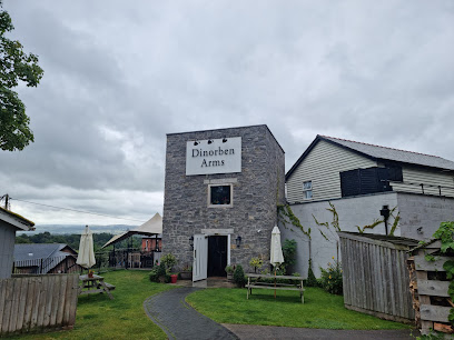
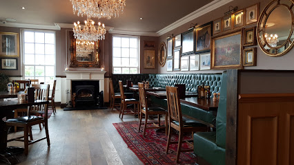
The Dinorben Arms
11.8 km
Experience authentic Welsh hospitality at The Dinorben Arms, a charming pub in Bodfari, offering delicious local cuisine and a warm atmosphere.
Tom Pryce Memorial
13.9 km
A poignant tribute in Ruthin to Tom Pryce, Wales’ only Formula 1 Grand Prix winner and a motorsport legend remembered for his talent and tragic fate.
Old Spital Pinfold
18.5 km
Discover the quiet charm of Old Spital Pinfold, a preserved historic livestock enclosure nestled in the peaceful suburb of Bebington, Wirral.
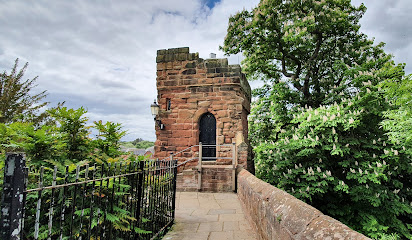
Bonewaldesthorne's Tower
19.0 km
Medieval gatehouse controlling Chester's western defenses, standing sentinel on Britain's most complete city walls.
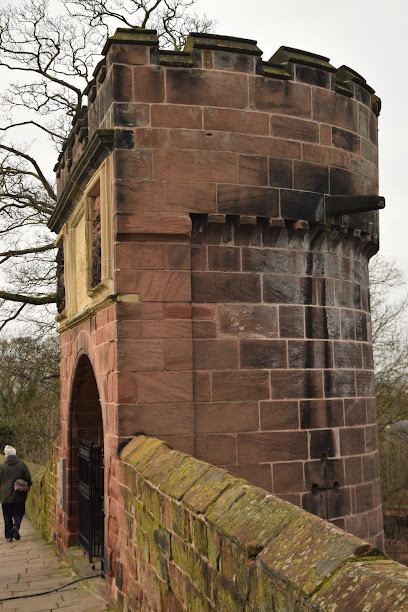
Pemberton's Parlour
19.1 km
Explore Pemberton's Parlour, a striking red sandstone tower on Chester’s historic city walls, revealing centuries of medieval and Victorian heritage.
Bridge Of Sighs
19.4 km
A haunting 1793 stone bridge where condemned prisoners took their final steps before execution—Chester's most poignant historical crossing.
Northgate St & Little Abbey Gateway
19.5 km
Discover the charm and history at Northgate Street & Little Abbey Gateway in Chester, a vibrant crossroads of culture and heritage.
Ancient Roman Columns, Chester
19.5 km
Roman column bases marking Chester's legacy as a major legionary fortress and potential capital of Britannia.
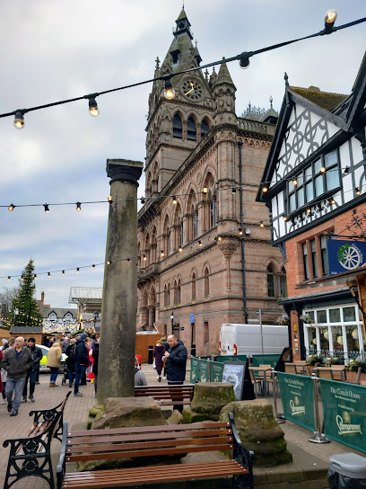
Town Hall
19.5 km
Explore the stunning Victorian architecture and rich history of Chester Town Hall, a vibrant hub for culture and community in the heart of Chester.
Edwardian Lady Tour
19.5 km
Discover Chester's Edwardian era charm with the Edwardian Lady Tour, a captivating journey through history and architecture.
Chester Town Hall
19.5 km
A stunning Victorian Gothic Revival landmark, Chester Town Hall is the historic heart of Chester’s civic and cultural life.

Chester Free Walking Tours
19.5 km
Experience the rich history of Chester with engaging local guides on Chester Free Walking Tours, the perfect exploration of this historic city.
Chester Visitor Information Centre
19.5 km
Explore Chester's rich history and vibrant culture at the Visitor Information Centre, your essential resource for navigating this historic city.

Unmissable attractions to see
Theatr Clwyd
4.8 km
Discover Theatr Clwyd, Mold’s vibrant performing arts theatre blending Welsh culture, dynamic performances, and scenic beauty in North Wales.
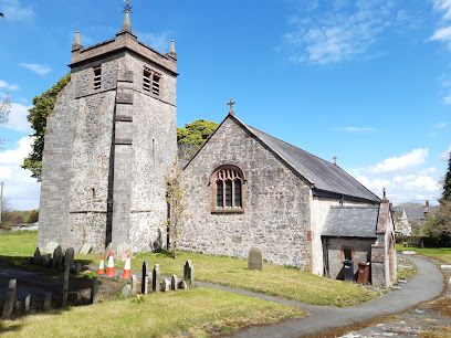
St Mary's Church
5.2 km
Discover the medieval charm and historic roof artistry of St Mary's Church, a spiritual and architectural gem in the heart of Cilcain village.
Mold Castle
5.3 km
Explore the historic Norman earthworks of Mold Castle, a serene memorial garden blending medieval heritage with community spirit in Flintshire.
Bryn Griffiths W M Social Club
5.4 km
A welcoming community club in Mold offering casual fun, pool, and affordable drinks in a lively, friendly atmosphere.
Clwydian Range
5.5 km
Explore North Wales’ breathtaking uplands where ancient hillforts meet heather moorlands and scenic trails invite discovery.
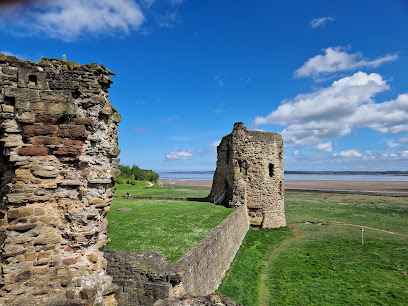
Flint Castle - Castell y Fflint
5.6 km
Explore Flint Castle’s pioneering 13th-century fortress with free entry, scenic estuary views, and rich medieval history on Wales’ North coast.
Hungry Cow
5.7 km
Savor fresh, flavorful burgers in a lively, welcoming setting at Mold’s favorite casual dining spot on High Street.

Flintshire Guardian
5.8 km
A towering timber sentinel at Flint Point, guarding the River Dee estuary with a gaze fixed on Hilbre Island.
Loggerheads Country Park
6.3 km
Explore dramatic cliffs, lush woodlands, and rich heritage at Loggerheads Country Park, the scenic gateway to the Clwydian Range.
The Woodworks Garden Centre & Café
7.0 km
A family-run garden centre and award-winning café near Mold, North Wales, where plants, gifts, and hearty British food come together in a relaxed, timber-clad setting.

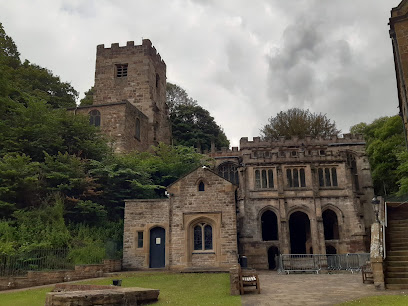
The National Catholic Shrine of St Winefride.
7.7 km
Explore Wales’ oldest pilgrimage site where sacred waters and medieval heritage inspire spiritual reflection and healing.
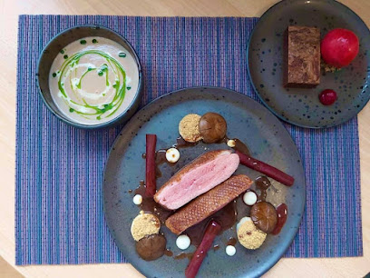
Ambermaze Fine Dining
7.8 km
Elegant fine dining in Holywell blending culinary artistry with impeccable service in a refined setting.
Castell Ewloe
7.8 km
Discover Castell Ewloe, a rare woodland castle of Welsh princes nestled in serene forest near Deeside, rich with medieval history and native architecture.
Wildwood Quarry
8.1 km
Secluded woodland cabins with mountain views, open-air hot bath, and year-round comfort near Mold in North Wales.
Jubilee Tower
8.1 km
Historic Egyptian-style Jubilee Tower ruins atop Moel Famau offer breathtaking views and a deep connection to Welsh heritage.
Essential places to dine
The Celtic Arms
4.1 km
A welcoming countryside restaurant and bar offering freshly cooked British cuisine, extensive drinks, and a charming setting at Northop Country Park.
The Cherry Pie Inn
5.1 km
Traditional British hospitality and homemade classics await at The Cherry Pie Inn near Mold, a cozy family-run gem with a welcoming atmosphere.
Thaidee Flint
5.2 km
Experience authentic Thai cuisine with fresh ingredients and generous portions in a welcoming Flint restaurant with vegan options.

Just Steak
5.6 km
Savor expertly grilled steaks and vibrant flavors in the heart of Mold’s bustling High Street at Just Steak.
The Crooked Horn & rae's restaurant
5.6 km
Experience modern British cuisine at The Crooked Horn & Rae's Restaurant – where tradition meets innovation in a cozy gastropub setting.
Y Delyn
5.7 km
Experience the charm of Y Delyn, Mold's premier wine bar offering an exquisite selection of wines and delightful small plates in a cozy atmosphere.
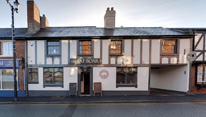
The Fat Boar Mold
5.8 km
A stylish gastro pub in Mold blending hearty British fare with a lively atmosphere and friendly service in a cozy, contemporary setting.
Primo Amore Italian Restaurant Mold
5.8 km
Authentic Southern Italian flavors and lively ambiance await at Primo Amore, Mold’s beloved Italian dining destination.
Belvedere
6.1 km
Authentic Italian flavors and warm ambiance await you at Belvedere, Mold’s cherished Italian restaurant on Wrexham Street.
OK Diner
7.1 km
Classic American diner fare with a 1950s vibe, serving hearty breakfasts, burgers, and shakes daily in Northop Hall, Mold.
Edenshine Restaurant
8.4 km
Traditional Welsh and English cuisine served fresh in a charming antique centre setting near Mold, North Wales.
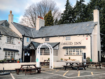
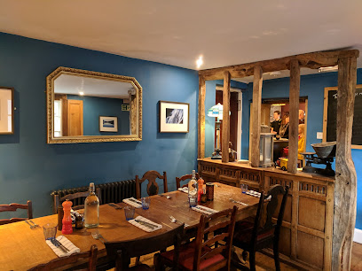
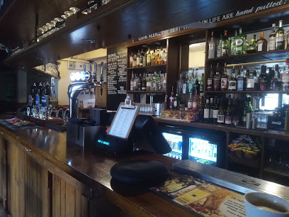
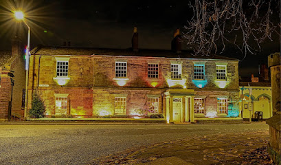
Druid Inn
8.8 km
A cozy country pub and guesthouse in Llanferres offering hearty Welsh fare, local ales, and warm hospitality amid stunning rural landscapes.
The White Horse Restaurant
10.5 km
Cozy countryside dining in Hendrerwydd offering hearty British classics and renowned Sunday lunches in a warm, welcoming setting.
Fox & Grapes
10.9 km
Historic 400-year-old pub in Hawarden serving real ales and homemade English-Greek dishes in a cozy, traditional setting.
The Glynne Arms
11.0 km
Historic coaching inn in Hawarden village serving seasonal local cuisine with Welsh wines, craft beers, and a welcoming atmosphere.
Markets, malls and hidden boutiques
MijMoj Design Ltd
4.8 km
Hand-crafted Welsh wooden gifts and bespoke furniture where traditional craftsmanship meets modern design innovation.
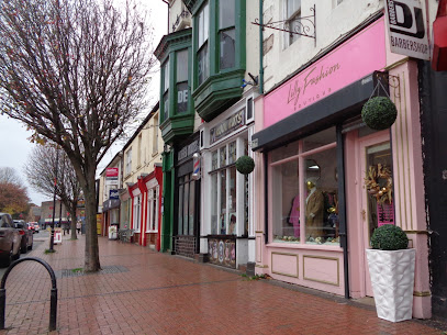
Lilly Fashion Boutique
5.1 km
Explore Lilly Fashion Boutique in Flint for a unique shopping experience with high-quality clothing and personalized service.
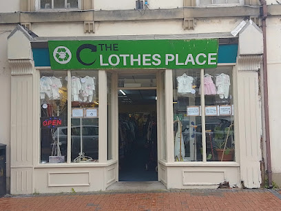
The clothes place
5.2 km
Independent fashion boutique offering quality clothing and personalized service in Flint town center.
Flintshire Retail Park
5.3 km
A convenient and diverse shopping centre in Flint offering essential retailers, ample parking, and a practical shopping experience for all visitors.
Yarn O'clock
5.6 km
Discover quality yarns and warm community spirit at Mold’s cozy wool shop, Yarn O'clock.
The Craft Shack
5.7 km
Independent craft shop celebrating local artisans and creative inspiration in Mold's heart.
Rock Bottom
5.7 km
Independent women's fashion boutique offering quality styles at accessible prices in Mold town centre.
Daniel Owen Shopping Centre
5.7 km
A vibrant indoor market and shopping hub in Mold blending local culture, diverse retail, and community spirit under one roof.

Staggered boutique interiors
5.7 km
Explore Staggered Boutique Interiors in Mold, where style meets comfort in exquisite bedding and decor, perfect for enhancing your home.
Peacocks
5.7 km
Affordable, trendy fashion for the whole family in the heart of Mold’s Daniel Owen Shopping Centre.
Florence & company
5.7 km
Discover unique fashion treasures at Florence & Company, a charming clothing boutique in the heart of Mold, perfect for local styles and personalized service.
Direct Outdoors
5.7 km
Your friendly local shop for quality outdoor clothing and equipment, located inside Mold’s Indoor Market.

Simmi
5.8 km
A cozy boutique in Mold offering stylish ladies' clothing, jewellery, and gifts with friendly service and on-trend brands.

Siop Y Siswrn
5.8 km
Independent Welsh bookshop and art gallery celebrating language, literature, and local creativity in historic Mold.
Jane Davies
5.8 km
Independent designer boutique in Mold offering curated fashion with personal service and timeless style.
Essential bars & hidden hideouts
Blue Bell Inn, Halkyn
1.3 km
A cozy, welcoming pub on Halkyn Mountain offering fine ales, hearty food, and scenic North Wales charm.
The Coach & Horses Flint Mountain
3.1 km
A cozy traditional pub in Flint Mountain offering hearty meals, friendly service, and a warm, inviting atmosphere with a classic Welsh charm.
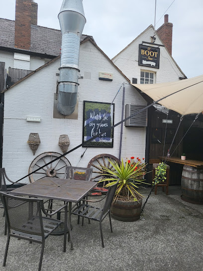
Boot Inn
3.4 km
Historic 18th-century pub in Northop offering hearty home-cooked meals, friendly service, and a cozy family-friendly atmosphere year-round.
The Cross Keys
4.1 km
Experience authentic Welsh pub culture with hearty meals, local ales, and a warm community atmosphere at The Cross Keys in Sychdyn.
The Mill Tavern
4.4 km
A vibrant community pub in Flint offering hearty food, live sports, and lively entertainment in a welcoming atmosphere.
Cross Foxes
4.5 km
Experience authentic Welsh hospitality and hearty local fare at Cross Foxes, Nannerch’s beloved historic village pub.
Glasfryn
4.8 km
Charming Mold pub with seasonal menus, local ales, cozy fires, and a scenic garden terrace for a welcoming dining experience.
Crown Inn Lixwm
4.8 km
A classic British village pub in Lixwm offering hearty food, real ales, and a warm, welcoming atmosphere in the heart of North Wales.
The Drovers Arms - Mold - Als Smokehouse
5.0 km
A lively smokehouse pub in Mold offering hearty barbecue dishes, live entertainment, and a warm, family-friendly atmosphere.
George & Dragon
5.2 km
A vibrant and welcoming pub in Flint offering great drinks, a lively atmosphere, and a cozy beer garden for locals and visitors alike.
The Griffin, High Street, Mold
5.6 km
A welcoming traditional pub on Mold’s High Street, offering classic fare, lively events, and a true community spirit.
Mold Alehouse
5.7 km
Discover Mold Alehouse, a cozy micropub in Mold offering ever-changing cask ales and craft beers in a welcoming, conversation-friendly space.
Y Pentan
5.8 km
Experience the heart of Mold’s social life at Y Pentan, a traditional pub known for friendly vibes and classic British fare.
The Ruthin Castle
5.8 km
A welcoming pub in Mold’s vibrant center, blending local history with lively community spirit and traditional charm.
The Top Monkey, Northop Hall
5.9 km
A warm, family- and dog-friendly village pub in Northop Hall with lively quiz nights, a spacious beer garden, and a welcoming community vibe.
Nightclubs & after hour spots
North Wales Celebrations Wedding & Party Disco DJ
4.8 km
Elevate your celebrations with North Wales Celebrations - the premier mobile disco DJ service for unforgettable weddings and parties.
Flint Royal British Legion Social Club
4.9 km
A welcoming social hub in Flint supporting veterans and community through camaraderie, remembrance, and local events.
Dj Tony B Disco Karaoke & video Roadshow
12.4 km
Dive into a night of music and fun at Dj Tony B Disco Karaoke & Video Roadshow, where every guest gets to shine on stage!
Live Lounge
18.9 km
Experience lively evenings with live music and entertainment at Presthaven’s vibrant Live Lounge, set within a family-friendly coastal resort.
Chester City Club
19.4 km
Experience Chester’s vibrant nightlife at City Club, where modern beats meet historic charm in the heart of St Peters Churchyard.
Rosies - Chester
19.6 km
Experience Chester’s vibrant nightlife at Rosies, a multiroom club with rooftop terrace, VIP lounges, and cutting-edge sound over three lively floors.

Cruise
19.8 km
A multi-floor nightclub in Chester offering vibrant music, premium drinks, and lively nightlife across seven bars.

BONOBO Bar & Canteen
19.8 km
A vibrant two-floor bar and canteen in Chester blending American eats, cocktails, video games, and lively music for a unique nightlife experience.
Revolution Chester
20.1 km
Experience vibrant nightlife, creative cocktails, and lively music at Revolution Chester, the city’s premier lounge and party venue.
The Live Rooms
20.1 km
Discover Chester's vibrant nightlife at The Live Rooms, where live music, comedy, and unforgettable experiences await.
Pendyffryn Club
20.7 km
A cosy and tranquil social club in Prestatyn offering a friendly atmosphere to enjoy a pint and good company without distractions.
Central Beach Club
20.8 km
Discover Central Beach Club in Prestatyn, where local charm meets coastal views, offering delicious food, refreshing drinks, and a vibrant atmosphere.
Mandy & Graham’s
20.9 km
Experience Chester’s vibrant nightlife at Mandy & Graham’s, where pulsating beats and lively crowds create unforgettable party nights.
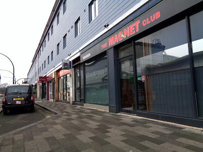
The Magnet Club
22.1 km
Wrexham’s independent venue since 1984, The Magnet Club blends live music, sports, and social games in a welcoming, refurbished space on King Street.
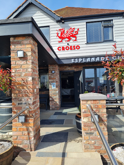
Esplanade Social Club
23.0 km
A lively coastal social club in Rhyl offering themed nights, local ales, and a welcoming community atmosphere near the beach.
For the vibe & atmosphere seeker
- Scenic
- Tranquil
- Relaxing
- Unique
For the design and aesthetic lover
- Rustic Designs
For the architecture buff
- Historic
- Landmarks
For the view chaser and sunset hunter
- Iconic Views
- Panoramas
- Sunrise Spots
- Sunset Spots
For the social media creator & influencer
- Instagrammable
- Photo Spots
- Selfie Spots
For the eco-conscious traveler
- Low Impact
- Public-Transport Accessible
- Leave-No-Trace Critical
For the kind of experience you’re after
- Cultural Heritage
- Photowalk
- Nature Escape
- Day Trip
- Weekend Getaway
- Myth & Legends
For how adventurous you want the journey to be
- Easy Access
Location Audience
- Family Friendly
- Senior Friendly
- Child Friendly
- Teen Friendly
- Wheelchair Access
- Pet Friendly
- Solo Friendly
- Couple Friendly
- Vegetarian Friendly
- Vegan Friendly


