Berwick-upon-Tweed Elizabethan Walls
Britain's only complete Elizabethan bastioned walls—a mile-long circuit of 16th-century military genius with panoramic estuary views.
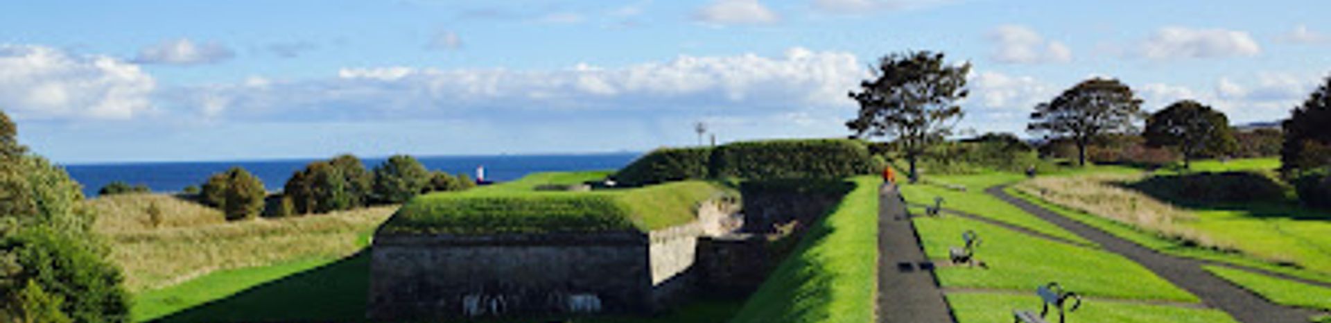
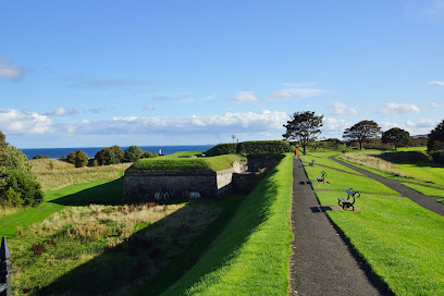
Walk the only complete Elizabethan bastioned town walls in Britain, a 1.25-mile circuit of 16th-century military architecture surrounding this historic border town. Built in 1558 with Italian-inspired design, these remarkably preserved fortifications offer panoramic views of the Tweed Estuary, North Sea beaches, and Northumberland coastline. A leisurely 45-minute walk reveals centuries of English-Scottish border conflict and showcases one of Europe's finest examples of post-medieval defensive engineering.
A brief summary to Berwick Town Walls
- 9 Palace St, Berwick-upon-Tweed, TD15 1HN, GB
- Visit website
- Duration: 0.75 to 2 hours
- Free
-
 Outdoor
- Mobile reception: 4 out of 5
Local tips
- Allow 45 minutes for a complete circuit, but plan extra time to stop at key bastions and read interpretation boards detailing the fortifications' history and strategic design.
- Visit during clear weather for optimal views across the Tweed Estuary and toward the North Sea; the elevated ramparts offer excellent photography opportunities, especially at golden hour.
- Wear comfortable walking shoes with good grip, as the stone surfaces can be uneven and slippery when wet; the walk is mostly level but involves some gentle inclines.
- Combine your visit with the nearby Barracks Museum and other town attractions; many Lowry Trail panels are positioned along the walls, offering artistic and historical context.
- Bring binoculars to spot mute swans and other wildlife in the estuary, and consider visiting in spring or autumn when light conditions enhance the architectural details and landscape views.
For the on-the-go comforts that matter to you
- Information Boards
- Seating Areas
- Nearby Food Options
- Nearby Restrooms
Getting There
-
Walking from Berwick town centre
From the town centre, access the walls at multiple points including Scots Gate or Palace Green. The walk is entirely on foot along the stone ramparts, which form a complete circuit around the town. No vehicle access is available on the walls themselves. The terrain is mostly level with some gentle inclines; allow 45 minutes for the full circuit. Suitable for most fitness levels, though the stone surfaces can be uneven and slippery in wet conditions.
-
Public transport from Edinburgh
Direct train services operate from Edinburgh Waverley to Berwick-upon-Tweed, taking approximately 50 minutes. Trains run several times daily. From Berwick railway station, the town centre and wall access points are within a 10-minute walk. A single adult fare costs approximately £15–25 depending on advance booking. The station is well-signposted with clear pedestrian routes to the historic town centre.
-
Driving from Newcastle
Berwick-upon-Tweed is approximately 65 kilometres north of Newcastle via the A1(M) and A6105, taking around 1 hour 15 minutes. Ample car parking is available in the town centre near Palace Green and other locations within walking distance of the walls. Parking charges typically apply during daytime hours; several pay-and-display car parks serve the historic area. The walls themselves are not accessible by vehicle.
-
Bus services from regional towns
Regular coach and local bus services connect Berwick to Edinburgh, Newcastle, and other regional centres. Journey times vary from 1–2 hours depending on origin. Services operate daily with multiple departures. Fares typically range from £8–18 for regional connections. The bus station is centrally located, with the walls accessible within a 5–10 minute walk.
Berwick Town Walls location weather suitability
-
 Clear Skies
-
 Mild Temperatures
-
 Any Weather
Discover more about Berwick Town Walls
Centuries of Border Defence and Strategic Importance
Berwick-upon-Tweed's fortifications tell a story spanning over 700 years of conflict between England and Scotland. The town's strategic position at the mouth of the River Tweed made it one of the most contested territories in medieval Britain, changing hands repeatedly as control shifted between the two kingdoms. The earliest defensive walls were constructed in the early 14th century under Edward I following his capture of the town from the Scots, stretching approximately two miles in length and standing up to 22 feet high. However, by the early 16th century, these medieval fortifications had fallen into considerable disrepair, proving inadequate against modern artillery threats.The Elizabethan Transformation: Revolutionary Military Engineering
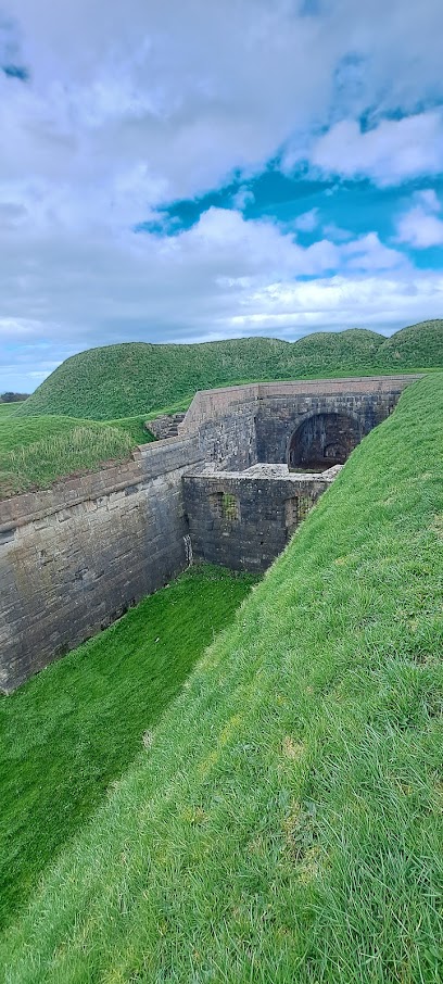
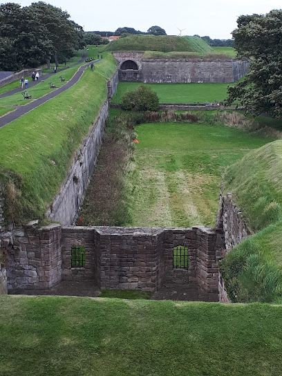
In 1558, recognising the vulnerability of England's northern border following the loss of Calais to the French and fearing Scottish aggression encouraged by the Auld Alliance with France, the Crown commissioned a complete redesign of Berwick's defences. Sir Richard Lee, a pioneering military engineer, was tasked with replacing the obsolete medieval walls with a cutting-edge bastioned fortification system inspired by Italian defensive innovations. This represented one of the most expensive undertakings of England's Golden Age, reflecting the town's critical importance to national security. The new walls were constructed on a smaller footprint than their medieval predecessors, enclosing only two-thirds of the original area but incorporating five large stone bastions, wide water-filled ditches, and substantial earthworks designed to absorb artillery fire. The bastions projected outward from the main wall, enabling defenders to direct gunfire across every section of the perimeter and repel attackers from multiple angles simultaneously.Architectural Features and Strategic Design Elements
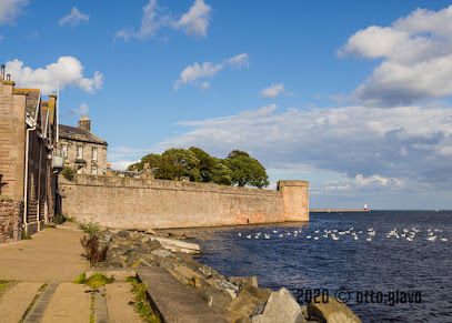
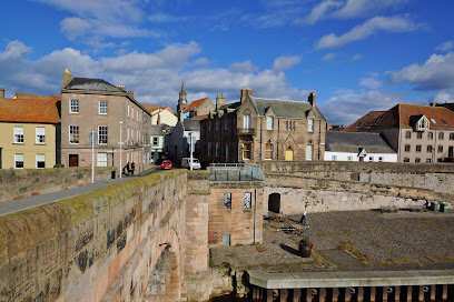
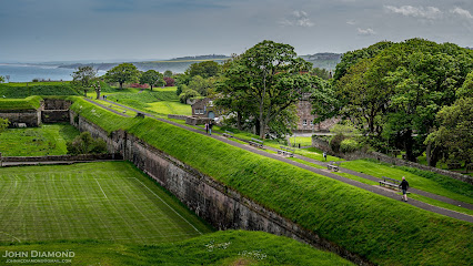
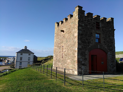
The Elizabethan walls showcase remarkable engineering sophistication for their era. The ramparts include several notable bastions, each serving specific defensive purposes. Cumberland Bastion, one of the earliest and best-preserved examples, dates largely from Elizabethan times, while Windmill Bastion represents a large regular bastion design. Brass Bastion defends the vulnerable north-east corner of the town, and Meg's Mount provides additional coverage. The walls originally included four gates, with Scots Gate being the principal entrance through which the main road to Scotland passed. The Bell Tower, a distinctive four-storey octagonal structure built in 1577, served as both a watchtower and bell tower. Beyond the stone walls and bastions, the wide ditches filled with water created an additional psychological and physical barrier against potential invaders. This multi-layered defensive approach represented the pinnacle of 16th-century military architecture.Preservation and Modern Heritage Status
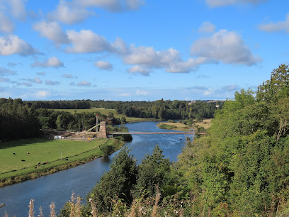
Remarkably, the Elizabethan walls survive largely intact today, making Berwick one of the most important fortified towns in Europe and the finest preserved example of town defences designed for post-medieval warfare in Britain. The ramparts were modified during the 17th century and carefully maintained through the 18th century, particularly following the alarm caused by the second Jacobite rising in 1745–46. The 19th century saw the gradual transition from military to civilian use, marked by the enlargement of Scots Gate, the removal of the Main Guard, and the creation of the pedestrian walkway along the ramparts in 1837. Today, the walls are protected as a scheduled monument and Grade I listed building, recognised as outstanding examples of European defensive engineering.The Walking Experience and Panoramic Vistas
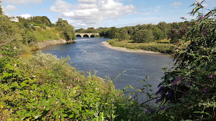
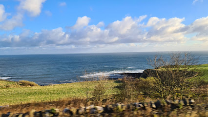
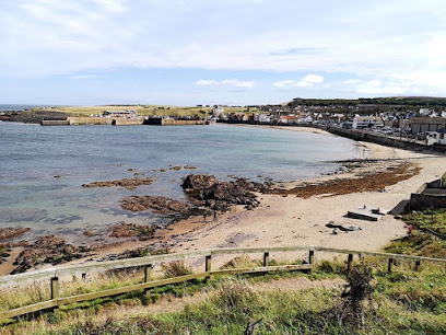
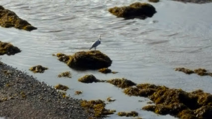
A complete circuit of the walls spans just over a mile and typically takes approximately 45 minutes at a leisurely pace, making it an accessible yet immersive historical experience. The elevated position of the ramparts provides spectacular panoramic views across multiple landscapes: eastward toward the wide sandy beaches of the North Sea and the Tweed Estuary where the river meets the sea, southward across the distinctive medieval and modern architecture of Berwick's town centre, and northward toward the rolling Northumberland countryside. The estuary is particularly notable for its colony of graceful mute swans, adding natural beauty to the historical setting. The walk passes numerous significant features, including the Powder Magazine built in 1749–50, remnants of medieval walls visible beside Northumberland Avenue, and various gun emplacements from different historical periods, each telling part of Berwick's complex defensive narrative.Iconic landmarks you can’t miss
Berwick Town Walls
0.0 km
Explore Britain’s only complete Elizabethan town walls—historic bastions offering panoramic views over Berwick and the North Sea.
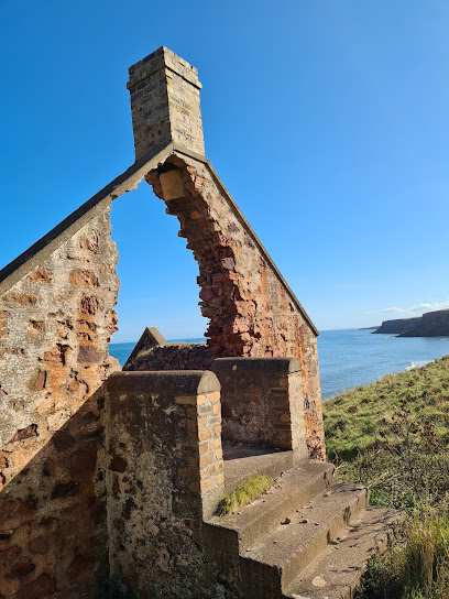
Coxon's Tower
0.1 km
Explore Coxon's Tower, a medieval sentinel transformed through centuries guarding Berwick-upon-Tweed’s iconic Elizabethan walls and river estuary.
Berwick Bridge
0.3 km
A majestic 17th-century sandstone arch bridge spanning the River Tweed, linking history, heritage, and scenic vistas in Berwick-upon-Tweed.
Town Hall
0.4 km
A majestic 18th-century neoclassical landmark, Berwick Town Hall stands as the historic heart of Berwick-upon-Tweed’s civic life and heritage.
Royal Tweed Bridge
0.5 km
A 1920s reinforced concrete arch bridge spanning the River Tweed, blending engineering innovation with scenic river views in historic Berwick-upon-Tweed.
Cumberland Bastion
0.7 km
Explore Cumberland Bastion, a striking Elizabethan fortification embodying Berwick-upon-Tweed’s turbulent border history and military heritage.
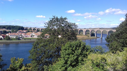
Royal Border Bridge
0.9 km
Victorian engineering triumph spanning the River Tweed—still carrying trains 175 years after Queen Victoria's opening.

Lord's Mount
1.1 km
Explore Lord’s Mount, a towering Tudor artillery fortification guarding Berwick-upon-Tweed with panoramic views and rich border history.
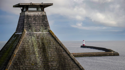
Berwick Lighthouse
1.2 km
Historic 19th-century lighthouse at Berwick Pier’s end, offering stunning coastal views and a glimpse into Berwick-upon-Tweed’s maritime heritage.
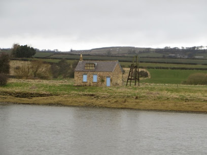
Broad Shiel
3.5 km
Historic fishing shelter on the River Tweed, offering serene views and a glimpse into Berwick-upon-Tweed’s rich border heritage.
Lamberton Skerrs
7.2 km
Explore the rugged cliffs and historic smuggling ruins of Lamberton Skerrs, where maritime history meets breathtaking North Sea views.
Visit Berwickshire Coast
13.1 km
Explore the Berwickshire Coast: A stunning blend of natural beauty, rich history, and charming coastal towns perfect for a memorable getaway.
Scoutscroft Leisure Park | Verdant Leisure
16.4 km
Relax by the stunning Berwickshire coast with cozy self-catering lodges, pet-friendly amenities, and seaside adventures at Scoutscroft Leisure Park.
Marjoribanks Monument
19.7 km
A towering tribute to Charles Marjoribanks offering stunning views and rich history at Coldstream’s eastern gateway.
Berwickshire High School
22.1 km
Discover Berwickshire High School in Duns, a charming educational institution that reflects the rich culture of the Scottish Borders.

Unmissable attractions to see
Berwick Museum and Art Gallery
0.6 km
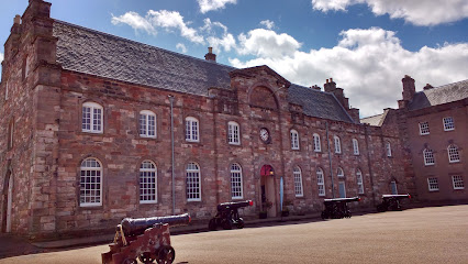
Discover Berwick’s rich history and art treasures within the atmospheric Berwick Barracks at this engaging museum and gallery.
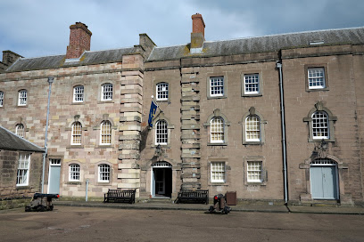
Berwick-Upon-Tweed Barracks and Main Guard
0.6 km
Explore the historic 18th-century Berwick Barracks, a fortress of England’s border heritage with panoramic views and rich military exhibitions.
King's Own Scottish Borderers Regimental Museum
0.6 km
Explore the rich military heritage of the King's Own Scottish Borderers in Berwick's historic barracks museum.
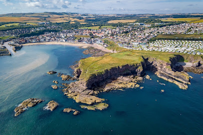
Berwick-upon-Tweed Castle and Ramparts
1.0 km
Walk the most complete Elizabethan ramparts in England, where medieval castle ruins meet panoramic views of Berwick and the River Tweed.
Red Cliffs in Berwick-upon-Tweed
2.2 km
Experience breathtaking red sandstone cliffs and stunning coastal views just north of historic Berwick-upon-Tweed.
England / Scotland Border
5.2 km
Explore the breathtaking landscapes and rich history of the England/Scotland border in Berwick-upon-Tweed, a must-visit for every tourist.
Union Bridge
6.6 km
Walk or cycle across the world’s oldest vehicular suspension bridge, a stunning 1820 engineering landmark linking England and Scotland over the River Tweed.
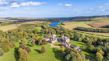
Paxton House
6.7 km
Discover the grandeur of Paxton House, a stunning 18th-century Palladian mansion with exquisite art, gardens, and riverside charm near Berwick-upon-Tweed.
Lazy Day Cottages
9.7 km
Luxury log cabins with private hot tubs and sauna, nestled in peaceful Scottish Borders countryside near Berwick-upon-Tweed.

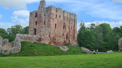
Norham Castle
10.4 km
Explore the dramatic ruins of Norham Castle, a historic 12th-century fortress guarding the River Tweed and inspiring centuries of border history.
Duddo Five Stones
11.1 km
Explore the ancient Duddo Five Stones, a mysterious Bronze Age stone circle set amidst Northumberland’s scenic border hills.
Eyemouth Museum
12.9 km
Discover Eyemouth’s rich maritime heritage and community stories in this charming coastal museum with interactive exhibits and a welcoming atmosphere.
Eyemouth Beach
13.1 km
A sandy, dog-friendly bay by Eyemouth Harbour, offering rockpools, seal watching, and dramatic North Sea waves on the scenic Scottish Borders coast.
Heritage Walks Northumberland
14.3 km
Explore Northumberland’s hidden heritage on scenic guided walks blending history, nature, and local stories in stunning countryside settings.
Twizel Castle
14.7 km
Explore Twizel Castle, a captivating medieval fortress transformed by Gothic revival, echoing centuries of border history in Northumberland.
Essential places to dine
Limoncello
0.3 km
Experience fresh, authentic Italian cuisine in a welcoming setting at Berwick’s beloved Limoncello on historic Hide Hill.
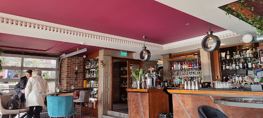
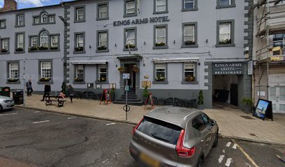
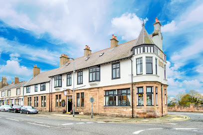
Ivy 43
0.3 km
Ivy 43 offers expertly crafted dishes and warm hospitality within the historic Kings Arms Hotel in the heart of Berwick-upon-Tweed.
Amore Restaurant
0.3 km
Authentic Italian flavors and warm hospitality in the heart of Berwick-upon-Tweed, with charming indoor and garden terrace dining.
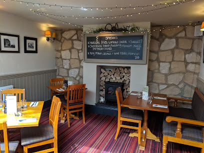
Foxtons Winebar & Restaurant
0.3 km
A cozy Berwick-upon-Tweed wine bar and restaurant offering local flavors, vegan and gluten-free options, and a welcoming atmosphere.
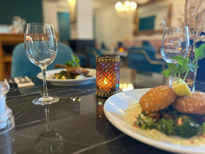
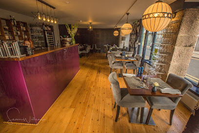
Audela
0.3 km
Experience refined modern British cuisine with fresh local ingredients in a charming historic setting on Berwick’s Bridge Street.
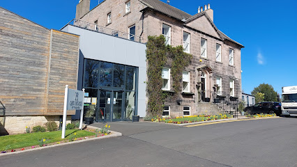
The Castle Hotel & Restaurant
1.0 km
Historic charm meets modern comfort just steps from Berwick’s railway station and town centre.
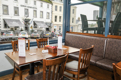
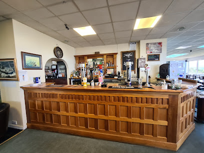
Ord House Lounge Bar & Grill
2.0 km
A welcoming family-friendly bar and grill in Berwick-upon-Tweed serving hearty homemade classics with fun for all ages.
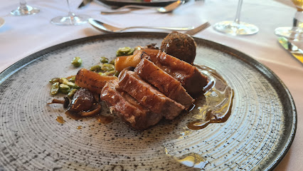
Restaurant 1782
4.5 km
Exquisite modern British dining in a historic manor with stunning sea views and seasonal local ingredients near Berwick-upon-Tweed.
The Cross Inn Pub & kitchen
6.4 km
A charming countryside pub in Paxton offering traditional British fare, warm hospitality, and a cozy, welcoming atmosphere.
The Heathers Restaurant
12.5 km
Fresh seafood and harbour views in a historic golf clubhouse overlooking Eyemouth's working waterfront.
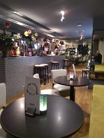
Oblo
12.9 km
Stylish harbourfront bistro in Eyemouth serving fresh seasonal dishes, cocktails, and a welcoming family-friendly atmosphere.
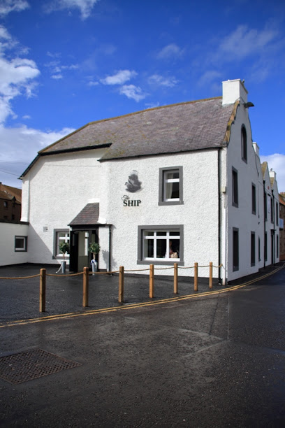
The Ship Restaurant & Bar
12.9 km
A vibrant modern British restaurant and bar in Eyemouth, serving fresh local seafood and hearty fare in a lively, dog-friendly harbour-side setting.
The Black Bull Inn
13.0 km
A charming country pub and inn in Lowick offering luxury rooms, hearty British fare, and a welcoming atmosphere amid Northumberland’s scenic beauty.
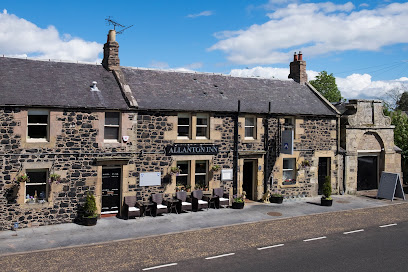
Allanton Inn
13.4 km
A charming countryside inn offering cozy rooms, exceptional local cuisine, and tranquil garden views in the heart of the Scottish Borders.
The Blue Bell Inn
16.7 km
A charming country inn blending rustic warmth with modern comfort, serving hearty meals in scenic Northumberland borders.
Markets, malls and hidden boutiques
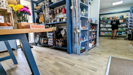
Granny's Keepsakes
0.2 km
Discover handcrafted gifts and heartfelt keepsakes in the charming, friendly boutique of Granny's Keepsakes in historic Berwick-upon-Tweed.

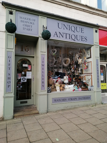
Unique Antiques
0.3 km
Discover quirky, unique antiques in the heart of historic Berwick-upon-Tweed at this charming Hide Hill shop.
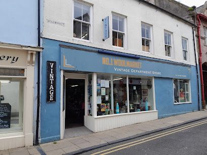
No.1 Woolmarket Vintage Department Store
0.4 km
Discover timeless vintage treasures and local heritage within Berwick-upon-Tweed’s historic Woolmarket district.
Bijoux
0.4 km
Discover unique gifts and local treasures at Bijoux, a charming gift shop in the heart of historic Berwick-upon-Tweed.
Loop Emporium
0.4 km
Discover unique vintage and upcycled fashion treasures in the heart of historic Berwick-upon-Tweed at Loop Emporium.

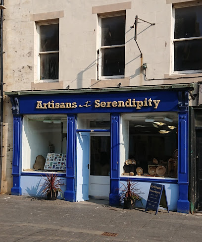
Artisans at Serendipity
0.4 km
Discover unique handmade gifts by local artists in the heart of historic Berwick-upon-Tweed.
Derrants
0.4 km
Discover unique local gifts and artisan treasures in the heart of historic Berwick-upon-Tweed at Derrants.
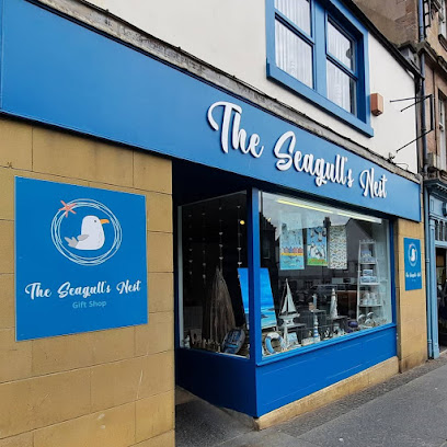
The Seagull's Nest
0.5 km
Discover Berwick-upon-Tweed’s charming seaside gift shop filled with unique nautical treasures and local crafts.
CJR Gifts & Designs
16.4 km
Handcrafted artisan treasures celebrating the creative spirit of the Scottish Borders.

The National Trust Shop
16.5 km
Discover unique local crafts and heartfelt souvenirs at The National Trust Shop in historic Berwick-upon-Tweed.
ScotlandShop
21.0 km
Discover authentic Scottish tartans and bespoke tailoring in Duns’ premier showroom, celebrating heritage with over 500 clan plaids.

Number 18 Shop
21.3 km
Explore Number 18 Shop in Duns for unique clothing, handcrafted candles, stylish handbags, and exquisite jewelry, perfect for souvenirs.
Country House Gifts & Gallery
25.3 km
Discover unique gifts and high-quality treasures in the heart of historic Bamburgh at Country House Gifts & Gallery.
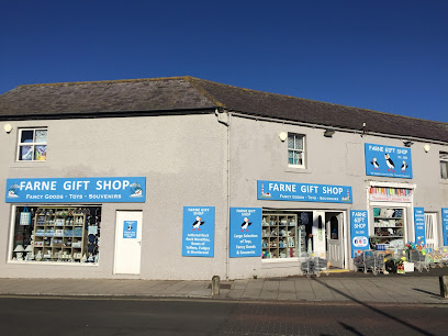
Farne Gifts
30.0 km
Discover unique local crafts and coastal treasures at Farne Gifts, Seahouses’ charming gift shop with a welcoming atmosphere and year-round appeal.
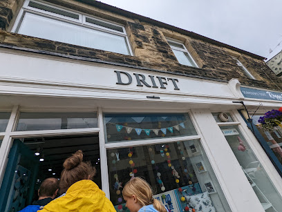
Drift
30.0 km
Discover Drift, a family-run coastal gift shop in Seahouses offering unique yarns and craft goodies inspired by Northumberland’s seaside charm.
Essential bars & hidden hideouts
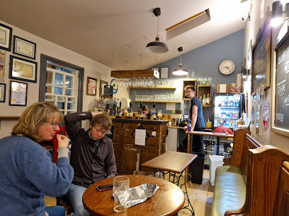
The Curfew Micropub
0.3 km
A cozy micropub in Berwick-upon-Tweed offering exceptional ales, warm hospitality, and a charming local atmosphere.
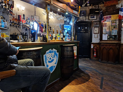
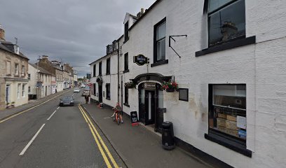
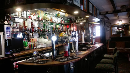
The Barrels
0.3 km
Traditional charm and award-winning ales meet lively music and local spirit in Berwick-upon-Tweed’s beloved Barrels Ale House.
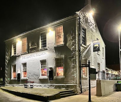
Leaping Salmon
0.5 km
A vibrant, friendly pub in Berwick-upon-Tweed offering hearty British fare, real ales, live sports, and scenic riverside views.
The Thatch
0.6 km
A friendly family-run pub in Tweedmouth offering great drinks, a games room, and a welcoming community atmosphere near Berwick’s old bridge.

The Radio Rooms
0.6 km
A lively bar and event space in Berwick-upon-Tweed, celebrated for live music, vegan snacks, and a welcoming community vibe.
The First & Last Inn
9.5 km
Cozy coastal pub and B&B in Upper Burnmouth offering hearty meals, friendly service, and scenic Scottish Borders charm.
The Lindisfarne Inn
11.8 km
Historic charm meets coastal comfort at The Lindisfarne Inn, your welcoming base in Berwick-upon-Tweed’s scenic borderland.
The Contented Sole
13.0 km
A friendly harbour-side pub offering fresh seafood and traditional Scottish fare in the heart of Eyemouth’s fishing community.
The Craw Inn
16.7 km
Charming country inn in Auchencrow offering hearty food, cozy rooms, real ales, and warm Scottish Borders hospitality.
BEST PUBLIC BAR
20.2 km
A cozy, traditional pub in Coldstream offering authentic Scottish Border hospitality in a charming rural setting.
Schooner Inn
30.2 km
A charming nautical-themed pub in Seahouses offering cozy ambiance, local ales, and a welcoming stop in this vibrant fishing village.
The Vibe
32.9 km
A vibrant late-night bar in Kelso’s heart, The Vibe offers a lively spot for drinks and socializing until the early hours.
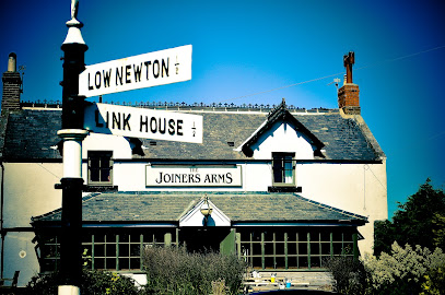
The Joiners Arms
36.1 km
A stylish 5-star boutique inn and gastropub by Northumberland’s stunning coast, blending local flavors, cozy charm, and seaside serenity.
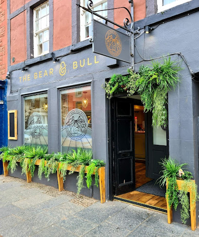
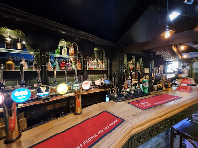
The Bear & Bull
41.4 km
A friendly, dog-welcoming bar and café on Dunbar’s High Street, offering quality food, drinks, and a warm local atmosphere.
Black Swan Alnwick
43.2 km
Historic charm meets cozy comfort at The Black Swan Alnwick, a welcoming pub and bed & breakfast in the heart of town.
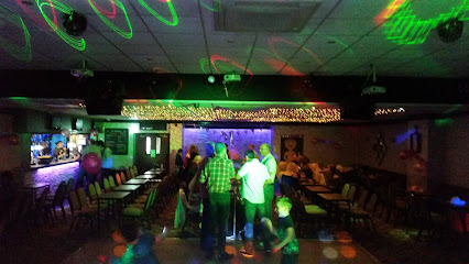
Nightclubs & after hour spots
BedRocks
0.5 km
Discover the vibrant nightlife of Berwick-upon-Tweed at BedRocks, a lively nightclub and bar known for its energetic atmosphere and affordable drinks.
GREEN HOUSE | Berwick Upon Tweed
0.5 km
Berwick-upon-Tweed’s vibrant late-night hotspot offering lively music and dancing in the heart of the historic town.

Nothing
46.8 km
Experience immersive alternative rock concerts by Nothing in the intimate, historic setting of London’s Moth Club.
Morven
49.5 km
Discover the electrifying nightlife at Morven Nightclub in Oxnam, near Melrose, where great music, vibrant atmosphere, and unforgettable memories await.
Warehouse Nightclub
53.0 km
Experience the vibrant nightlife and dynamic music scene at Warehouse Nightclub, Galashiels’ lively hub after dark.

The Indigo Rooms
53.1 km
Experience Galashiels' vibrant nightlife at The Indigo Rooms, a welcoming nightclub and bar with themed events and a lively atmosphere.
The Brick Club, Red Row Working Mens Club
59.1 km
A welcoming traditional working men's club in Morpeth offering authentic local atmosphere, classic ales, and a strong community spirit.
The Border Club
61.8 km
Experience the vibrant local culture at The Border Club, a friendly social hub in Hawick, Scotland, perfect for travelers seeking community spirit.

Base Nightclub
62.1 km
Experience Hawick’s energetic nightlife at Base Nightclub, where vibrant music and lively crowds create unforgettable Friday nights.
Square One
62.6 km
Vibrant Hawick nightclub with dynamic music floors and a welcoming atmosphere at the heart of Drumlanrig Square.

Borders Blues club
68.3 km
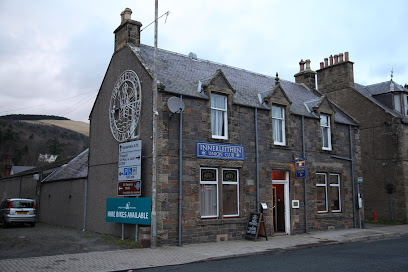
Immerse yourself in the vibrant atmosphere of Borders Blues Club, where the best of British blues music comes alive in Innerleithen.

The Vale Of Leithen Social Club
68.3 km
A friendly members' club in Innerleithen offering live music, affordable drinks, and a warm community atmosphere.
Union Club
68.6 km
A friendly, community-run social club with snooker and events, offering a welcoming and affordable night out in Innerleithen.
White House Unique Social Club
69.9 km
Discover the lively atmosphere and local culture at the White House Unique Social Club in Ashington, a must-visit bar for an unforgettable night out.
R. A. O. B Club
70.1 km
Discover the R. A. O. B Club, a vibrant bar and social club in Ashington offering friendly service, a great drink selection, and a lively atmosphere for locals and tourists alike.

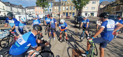
For the vibe & atmosphere seeker
- Historic
- Scenic
- Unique
- Adventurous
For the design and aesthetic lover
- Historic
- Industrial Designs
For the architecture buff
- Historic
- Landmarks
- Viewpoints
For the view chaser and sunset hunter
- Iconic Views
- Panoramas
- Waterfront
- Skyline
For the social media creator & influencer
- Instagrammable
- Photo Spots
- Architectural Shots
For the eco-conscious traveler
- Protected Area
- Public-Transport Accessible
- Car-Free Access
For the kind of experience you’re after
- Cultural Heritage
- Myth & Legends
- Photowalk
- Day Trip
For how adventurous you want the journey to be
- Easy Access
Location Audience
- Family Friendly
- Senior Friendly
- Solo Friendly
- Couple Friendly
- Wheelchair Access


