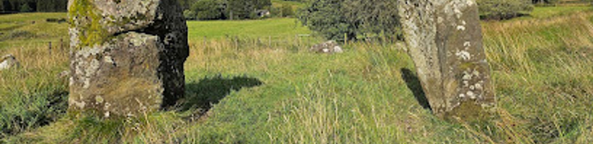
Loupin' Stanes and Girdle Stanes
Two enigmatic stone circles connected by mystery and the River Esk, spanning 4,500 years of Scottish prehistory.
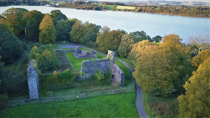
Two remarkable prehistoric stone circles situated along the River Esk near Eskdalemuir in the Scottish Borders. Loupin' Stanes features a compact circle of roughly 10 stones with distinctive entrance markers, while Girdle Stanes—a larger, partially eroded semicircle—lies 650 metres downstream. Both date to the Late Neolithic to Early Bronze Age (approximately 2500–1500 BC). The unusual proximity of these two circles, combined with mysterious recumbent stones between them, continues to intrigue archaeologists. Easily accessible from the main road with parking nearby, these ancient monuments offer a tangible connection to Scotland's prehistoric ritual landscape.
A brief summary to Loupin Stanes
- Langholm, GB
- Visit website
- Duration: 1 to 3 hours
- Free
-
 Outdoor
- Mobile reception: 3 out of 5
Local tips
- Visit during clear weather to fully appreciate the landscape context and take photographs. The stones are most visible when light angles across them in early morning or late afternoon.
- Wear sturdy footwear with good grip; the field terrain can be muddy, especially after rain, and the path alongside the river requires careful footing.
- Allow time to walk between both circles (approximately 650 metres) to appreciate the full archaeological complex and the mysterious recumbent stones connecting them.
- Bring binoculars or a camera with zoom to examine stone details and observe how erosion has shaped Girdle Stanes, particularly the precariously balanced stone at the riverbank.
- Combine your visit with other sites on the Eskdale Prehistoric Trail to deepen your understanding of Late Neolithic and Early Bronze Age settlement patterns in the region.
For the on-the-go comforts that matter to you
- Trash Bins
- Information Boards
Getting There
-
Car via A7 from Langholm
From Langholm town centre, take the A7 southbound toward Eskdalemuir for approximately 8 kilometres (15–20 minutes). A small layby is clearly marked on the roadside near the stone circle. Park here and cross the road via the stile to access the field leading to Loupin' Stanes. No entrance fee required. Parking is free and accommodates 4–6 vehicles.
-
Walking from Langholm
From Langholm town centre, follow the Eskdale Prehistoric Trail on foot heading south along the A7 for approximately 3 kilometres (45–60 minutes). The route is mostly roadside walking with some field sections. Terrain is mixed grassland and minor paths. Suitable for walkers with moderate fitness. No facilities along the route; bring water and wear appropriate footwear.
-
Minibus or coach tour from regional operators
Several heritage and outdoor tourism operators in the Scottish Borders offer guided minibus tours incorporating Loupin' Stanes and Girdle Stanes as part of the Eskdale Prehistoric Trail. Tours typically depart from Langholm or Hawick and include guided interpretation. Prices range from £25–£45 per person depending on group size and duration. Advance booking recommended; tours operate year-round subject to weather conditions.
-
Bicycle from Langholm
From Langholm, cycle south on the A7 for approximately 8 kilometres (20–30 minutes depending on fitness). The route follows the main road with variable shoulder width; exercise caution with traffic. A layby provides secure parking for bicycles. The return journey is largely flat to gently rolling terrain. Suitable for hybrid or mountain bikes.
Loupin Stanes location weather suitability
-
 Any Weather
-
 Clear Skies
Discover more about Loupin Stanes
Two Circles, One Mystery
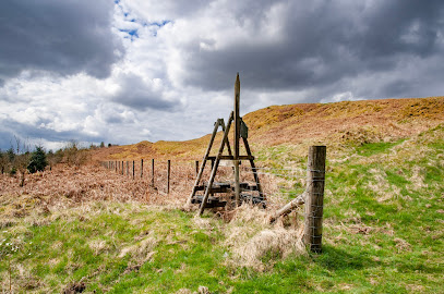
Loupin' Stanes and Girdle Stanes represent a rare archaeological puzzle: two distinct stone circles built within walking distance of each other, yet constructed in markedly different styles. Loupin' Stanes is the smaller and more compact of the pair, comprising roughly 10 stones arranged on a low platform above the River Esk. Two particularly large stones mark the southwestern entrance, spaced approximately 2.5 metres apart—a distance that inspired the site's evocative name. Local tradition holds that young people once tested their courage by leaping from one entrance stone to the other, a practice that reportedly ended after a broken leg. The name itself may derive from the Scots term 'Lowping-on-stane,' referring to a mounting block for riders, though the jumping legend remains deeply embedded in local memory.The Larger Circle and River's Toll
Following the River Esk southwestward for approximately 650 metres leads to Girdle Stanes, a substantially larger stone circle that once commanded far greater presence. Originally measuring roughly 39 metres in diameter, it likely contained between 40 and 45 stones arranged in what archaeologists believe was a more ancient pattern than its smaller neighbour. Today, only 21 to 26 stones remain in place, their reduction a direct consequence of the river's shifting course over millennia. The Esk has carved away a significant portion of the circle, leaving one stone precariously balanced on the eroding riverbank—a dramatic reminder of the landscape's dynamic forces. The original entrance is thought to have faced the southeast, though the circle's semicircular form today reflects the geological transformation it has endured.Connecting Stones and Unanswered Questions
Between the two circles lie two recumbent stones whose purpose remains enigmatic. Archaeologists have speculated whether these stones served as a symbolic or physical connection between the damaged Girdle Stanes and the smaller Loupin' Stanes circle. One prevailing theory suggests that Loupin' Stanes may have been constructed as a replacement or alternative ritual site after Girdle Stanes suffered damage, though the sequence of construction remains uncertain. The proximity of two such stylistically different circles is virtually unprecedented in the archaeological record, raising profound questions about the ritual practices and social organisation of the Late Neolithic to Early Bronze Age communities who created them.Prehistoric Chronology and Significance
Both circles are believed to date to the Late Neolithic through Early Bronze Age period, spanning roughly 2500 to 1500 BC. This era marked a transformative phase in British prehistory, characterised by the construction of monumental stone circles and the development of increasingly sophisticated ritual practices. The Loupin' Stanes and Girdle Stanes complex forms part of the broader Eskdale Prehistoric Trail, a landscape rich with evidence of ancient settlement and ceremonial activity. The monuments' survival, despite erosion and agricultural pressures, testifies to their cultural significance and the enduring power of stone as a medium for marking sacred space.The River Esk and Landscape Context
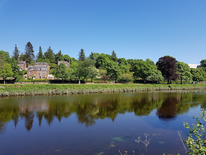
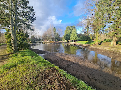
The River Esk has shaped not only the physical form of these circles but also their archaeological narrative. Flowing through a valley of considerable natural beauty, the river provided both resources and challenges to prehistoric communities. The low platform upon which Loupin' Stanes sits offers commanding views of the surrounding landscape, suggesting that visibility and sightlines may have influenced the site's placement. The river itself, with its seasonal variations and long-term geological processes, has become an active participant in the circles' ongoing story, continuously reshaping the archaeological record and presenting new interpretive challenges to those who study these ancient monuments.Iconic landmarks you can’t miss
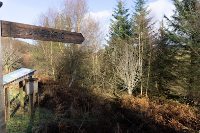
Over Rig
3.5 km
Explore Over Rig, a remarkable historical landmark in Langholm, where rich heritage meets breathtaking natural beauty in Scotland.
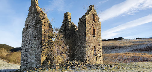
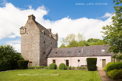
Frenchland Tower
17.7 km
Explore the evocative ruins of Frenchland Tower, a 16th-century stronghold offering panoramic views and a glimpse into Scotland’s feudal past near Moffat.
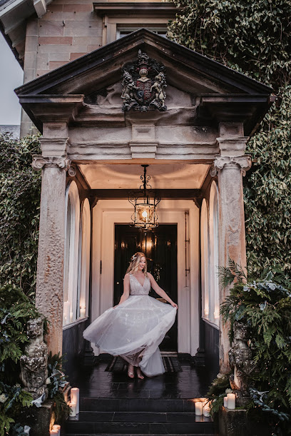
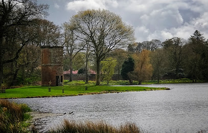
Auchen Castle
21.0 km
Historic Scottish fairytale castle and elegant wedding venue nestled in scenic Dumfries and Galloway with unique Egyptian revival architecture.
Crown of Scotland
23.1 km
Discover the breathtaking beauty of the Crown of Scotland, a stunning mountain peak offering scenic hikes and panoramic views in Moffat.

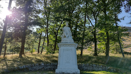
James Hogg Monument
23.9 km
A striking white monument honoring James Hogg, the Ettrick Shepherd, overlooking the serene St Mary's Loch in Scotland's Borders.
Little Dalton Kirk
27.6 km
Discover the evocative ruins of Little Dalton Kirk, a medieval parish church nestled in tranquil Scottish countryside near Lockerbie.
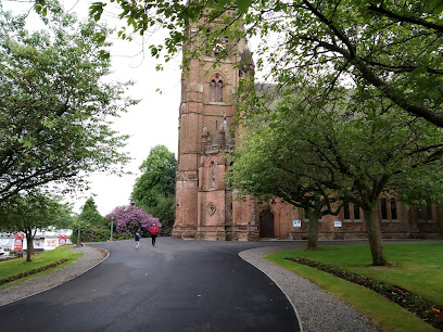
Kingdom Scotland
31.1 km
Discover tranquility at Kingdom Scotland, a serene religious institution in Dumfries that invites spiritual reflection and community connection.

Aikwood Tower
33.3 km
Experience 500 years of Scottish Borders history and luxury at Aikwood Tower, a stunning 16th-century peel tower set in breathtaking countryside.
Comyn's Tower
33.6 km
Explore Comyn's Tower near Dumfries, a medieval stronghold entwined with Scotland’s dramatic history and the legacy of the Comyn clan.
Dumfries
34.5 km
Historic and accessible Dumfries Railway Station connects Scotland’s southwest with modern amenities and rich heritage.
Dumfries Historic Buildings Trust
35.0 km
Discover the architectural heritage of Dumfries at the Dumfries Historic Buildings Trust, where history is preserved for future generations.
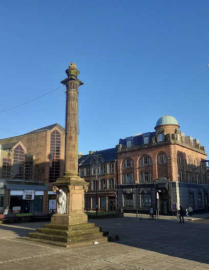
Queensberry Monument
35.0 km
An elegant 18th-century stone column in Dumfries honoring the 3rd Duke of Queensberry and the town’s noble heritage.
VisitScotland Dumfries iCentre
35.2 km
Explore Dumfries and unlock the secrets of Scotland at the VisitScotland Dumfries iCentre, your gateway to local attractions and experiences.
Dock Park
35.2 km
Discover the natural beauty and recreational charm of Dock Park in Dumfries, where serene landscapes and family-friendly activities await.
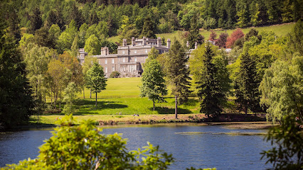
Bowhill House & Grounds
35.3 km
Explore Bowhill House & Grounds, a historical gem in the Scottish Borders, featuring stunning architecture, beautiful gardens, and rich cultural experiences.
Unmissable attractions to see
Castle O'er Hill Fort
4.1 km
Explore the ancient Iron Age stronghold of Castle O'er Hill Fort, a commanding prehistoric site with layered history and stunning Eskdale views.
Southern Uplands
18.2 km
Explore Scotland’s Southern Uplands, a stunning mountain range of rolling hills, historic trails, and tranquil rural landscapes.
Moffat Community Nature Reserve
18.3 km
A peaceful nature escape near Moffat offering diverse wildlife habitats, tranquil trails, and community conservation in Scotland’s Southern Uplands.

Moffat Mill
19.0 km
Discover Scottish heritage, shopping, and dining all under one roof at Moffat Mill in the heart of historic Moffat.

Station Park
19.1 km
A charming and accessible park in Moffat featuring boating, play areas, historic memorials, and peaceful green spaces for all ages.
Moffat Museum
19.1 km
Discover Moffat’s captivating history through interactive exhibits and volunteer-led storytelling in this charming Scottish museum.
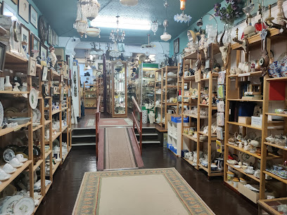
Lothlorien Antique & Collectables Emporium
19.1 km
Discover a nostalgic treasure trove of antiques, collectibles, and a free toy museum in the heart of charming Moffat.
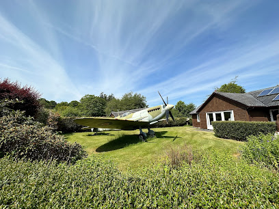
The Moffat Spitfire
19.2 km
Discover a full-size Spitfire replica in Moffat, honoring RAF hero Hugh Dowding in a unique garden tribute blending history and community spirit.
Skelfhill Pen
19.6 km
Discover the tranquil beauty and panoramic views atop Skelfhill Pen, an inviting hillwalk near Hawick in the Scottish Borders.
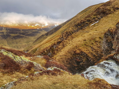
Grey Mare's Tail Waterfall
19.7 km
Experience one of the UK’s highest waterfalls cascading 60m through a stunning glacial valley rich in wildlife and history.
Eventim Apollo
21.4 km
Experience iconic live entertainment in London’s beautifully restored Art Deco gem, the Eventim Apollo in Hammersmith.
universestore
21.4 km
Your go-to camping shop in scenic Moffat, offering the latest outdoor gear for all your adventure needs.

Tushielaw Inn
21.5 km
A charming Scottish Borders inn offering cozy stays, hearty food, and lively pub nights in the tranquil Ettrick Valley.
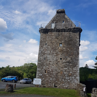
Gilnockie Tower
22.0 km
Explore Gilnockie Tower, the storied 16th-century home of the Armstrong Clan, where history, legend, and stunning Borders scenery converge.
Lochmaben Castle
22.9 km
Explore the evocative ruins of Lochmaben Castle, a medieval fortress steeped in Scottish history and set beside serene Castle Loch.
Essential places to dine
Moffat Woolen Mill restaurant
19.0 km
Experience traditional Scottish cuisine and warm hospitality in the historic charm of Moffat Woolen Mill Restaurant.
Claudios Restaurant
19.0 km
Experience authentic Italian flavors in a cozy, family-friendly setting at Claudios Restaurant, Moffat’s beloved dining spot.

Brodies
19.1 km
Warm hospitality and delicious contemporary cuisine await you at Brodies, Moffat’s beloved restaurant and bar.
Annandale Arms Hotel and Restaurant
19.2 km
Traditional Scottish charm meets modern comfort at Annandale Arms Hotel, a lively hub for dining, music, and relaxation in Moffat.
Pentonbridge Inn
27.1 km
A Michelin-starred haven blending exquisite Cumbrian cuisine with luxurious countryside charm near Carlisle.

Award-Winning The Gordon Arms Restaurant with Rooms
28.7 km
Historic Scottish Borders inn blending award-winning local cuisine with cozy rooms and tranquil valley views.
Kinmount Restaurant
29.2 km
Experience warm Scottish hospitality, delicious locally inspired cuisine, and lively entertainment at Kinmount Restaurant in Carrutherstown.
Copper Beech Restaurant
29.5 km
Experience traditional Scottish hospitality and hearty cuisine in the cozy Copper Beech Restaurant at Hetland Hall Hotel, Dumfries.
Hetland Hall Hotel
29.5 km
Elegant country house hotel near Dumfries offering spacious rooms, excellent dining, and tranquil rural charm.
The Night Safe
30.3 km
Cozy bistro and vibrant cocktail bar offering exquisite dining and friendly service in the heart of Hawick’s High Street.
Adam's Kitchen
30.3 km
A cozy British restaurant in Hawick offering hearty traditional dishes with a warm, welcoming atmosphere and attentive service.
Cross Keys Inn Ettrickbridge - Scotland's "Pub of the Year"
30.5 km
Experience authentic Scottish hospitality at Cross Keys Inn, Ettrickbridge’s award-winning pub and cozy country inn in the heart of the Borders.
The Lochar Inn
31.9 km
A friendly, lively pub and restaurant in Dumfries offering traditional fare, local charm, and a welcoming community atmosphere.
Woll Restaurant
32.3 km
A warm, family-friendly restaurant at New Woll Estate, serving hearty British and Scottish fare with golf-course views and a welcoming country feel.
Hidden River Cafe
33.0 km
A charming riverside cafe in Cumbria offering locally sourced dishes in a peaceful natural setting, perfect for families, food lovers, and nature enthusiasts.
Markets, malls and hidden boutiques
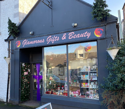
Glamorous Gifts and Beauty
19.0 km
Discover unique gifts and rejuvenating beauty services in Moffat’s charming boutique blending local craft with pampering.
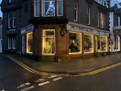
The Corner Gallery
19.2 km
Discover bespoke Scottish knitwear and designer clothing crafted with heritage and style at The Corner Gallery in Moffat.
Wildflower Designs
19.2 km
Discover unique handmade gifts and artisan crafts at Wildflower Designs, Moffat’s charming boutique on High Street.
The Flower Pot Gift Shop
19.2 km
Discover unique Scottish gifts and fine jewellery in a warm, family-run boutique nestled in the heart of Lockerbie’s High Street.
Everyday Beautiful
20.8 km
Discover unique and stylish clothing at Everyday Beautiful, the perfect shopping destination for fashion-savvy tourists.

Love & Sparkle Unique Gifts
20.8 km
Explore Love & Sparkle Unique Gifts for one-of-a-kind treasures and local craftsmanship, perfect for thoughtful souvenirs and unique gifts.

Greenpark
21.4 km
Explore Greenpark Gift Shop in Moffat for unique souvenirs and local crafts that capture the essence of Scotland's charm and creativity.
Historic Gifts
23.0 km
Discover handcrafted gifts made from historic materials, celebrating heritage and craftsmanship in peaceful Canonbie.

No. 3 Gifts
30.2 km
A cozy, independent gift shop in Hawick offering locally made crafts, Scottish souvenirs, and handcrafted candles in the heart of the Scottish Borders.

Lovely Stuff
30.7 km
Discover vintage charm and unique home accessories at Lovely Stuff, Hawick’s boutique for antiques and handcrafted treasures.
Giftsscotland.com
31.9 km
Explore unique handcrafted gifts and souvenirs at Giftsscotland.com, a charming shop in the heart of Hawick, Scotland.

Peel Centre
33.4 km
Dumfries’ premier shopping centre offering a wide range of major stores and convenient amenities in a lively retail environment.

Matalan
33.4 km
Affordable fashion and homeware for the whole family in the heart of Dumfries at The Peel Centre.

Lunar
33.8 km
Explore Lunar Gift Shop in Dumfries for unique gifts and local treasures that make perfect souvenirs from your Scottish adventure.

The Range, Dumfries
34.6 km
A versatile home and garden store in Dumfries offering extensive products for every lifestyle and living space.

Essential bars & hidden hideouts
Royal Bar
19.1 km
Cozy and friendly local bar in Lockerbie offering hearty home-cooked meals, good beer, and a welcoming atmosphere for all.
Tibbie Shiels Inn
23.9 km
Historic inn and camping by St. Marys Loch offering cosy rooms, live music, and stunning Scottish Borders scenery.
Drumlanrig Bar
30.1 km
A cozy and lively bar in Hawick’s Drumlanrig Square, perfect for local beers, live music, and a welcoming Scottish Borders atmosphere.
The Exchange Bar
30.2 km
Historic Victorian pub in Hawick with original wood panelling, ornate cornices, and a cozy lounge for live music and community gatherings.
Office Bar
30.2 km
A traditional Scottish pub in Hawick’s historic West End, offering authentic charm, quality beers, and a friendly local atmosphere.
Waverley Bar
30.6 km
A traditional, friendly Scottish pub in Hawick’s heart, famed for its lively atmosphere and welcoming community vibe.
Lockards Farm
33.1 km
A stylish and family-friendly pub in Dumfries offering classic British fare, extensive drinks, and a welcoming beer garden for all seasons.
The Five Arches
33.2 km
A welcoming traditional pub in Dumfries offering local brews, live music, and a cozy atmosphere for genuine Scottish hospitality.
The Pleuchie's Howff
34.1 km
A family-run Dumfries pub blending traditional Scottish charm with lively live music and a welcoming community vibe.
Chancers Night Club
34.9 km
Experience Dumfries nightlife at Chancers Night Club, where vibrant music and a lively atmosphere create unforgettable nights.
Dickies Bar
34.9 km
Experience warm Scottish hospitality and local craft beers in the cozy, lively setting of Dickies Bar in Dumfries.
The Imperial
35.0 km
A friendly, fair-priced bar in the heart of Dumfries, perfect for relaxed socializing and local vibes.
The Queensberry
35.0 km
A bright, comfortable bar and hotel in central Dumfries offering relaxed Scottish hospitality and cozy accommodation.
The Barrel
35.0 km
A friendly, traditional pub in Dumfries offering quality pints and a lively, welcoming atmosphere for locals and visitors alike.

The Venue Dumfries
35.0 km
A vibrant hub for live music, nightlife, and social gatherings in the heart of Dumfries.

Nightclubs & after hour spots
Square One
30.1 km
Vibrant Hawick nightclub with dynamic music floors and a welcoming atmosphere at the heart of Drumlanrig Square.

Base Nightclub
30.5 km
Experience Hawick’s energetic nightlife at Base Nightclub, where vibrant music and lively crowds create unforgettable Friday nights.
The Border Club
30.8 km
Experience the vibrant local culture at The Border Club, a friendly social hub in Hawick, Scotland, perfect for travelers seeking community spirit.

Railway Social Club
34.6 km
A friendly, community-focused social club in Dumfries offering affordable drinks, lively events, and a welcoming atmosphere near the town centre.

Union Club
40.5 km
A friendly, community-run social club with snooker and events, offering a welcoming and affordable night out in Innerleithen.
Borders Blues club
40.8 km
Immerse yourself in the vibrant atmosphere of Borders Blues Club, where the best of British blues music comes alive in Innerleithen.

The Vale Of Leithen Social Club
40.8 km
A friendly members' club in Innerleithen offering live music, affordable drinks, and a warm community atmosphere.
Black Box Music Institute
42.9 km
An intimate old-style nightclub and cultural hub in Carlisle offering live music, festivals, and art exhibitions in a vibrant setting.
Carlisle R A O B Club
43.0 km
Historic social club in Carlisle offering lively events and a welcoming atmosphere rooted in the Royal Antediluvian Order of Buffaloes tradition.
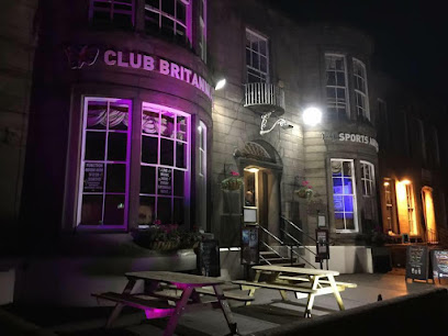
Club Britannia
43.3 km
A vibrant social club in Carlisle offering live music, friendly vibes, and affordable drinks in a smart, welcoming setting.
Secret Carlisle
43.6 km
Experience energetic nights and vibrant music at Secret Carlisle, the city centre nightclub where Carlisle’s historic charm meets modern nightlife.

The Central Bar
43.8 km
Experience the heart of Peebles at The Central Bar, where local charm and refreshing drinks await every visitor.
The Cross Keys - Peebles
43.8 km
Historic inn and cozy hotel in Peebles town centre, blending traditional charm with modern comfort and a lively pub atmosphere.
Morven
45.0 km
Discover the electrifying nightlife at Morven Nightclub in Oxnam, near Melrose, where great music, vibrant atmosphere, and unforgettable memories await.
Niki's Lounge Bar
45.3 km
Discover Niki's Lounge Bar in Galashiels: a cozy bar with a friendly atmosphere and an extensive drink menu perfect for relaxation.
For the vibe & atmosphere seeker
- Scenic
- Adventurous
- Unique
- Tranquil
For the design and aesthetic lover
- Rustic Designs
For the architecture buff
- Historic
- Landmarks
- Sacred Sites
For the view chaser and sunset hunter
- Iconic Views
- Panoramas
- Waterfront
For the social media creator & influencer
- Instagrammable
- Photo Spots
- Architectural Shots
For the eco-conscious traveler
- Protected Area
- Leave-No-Trace Critical
- Locally Managed
For the kind of experience you’re after
- Myth & Legends
- Cultural Heritage
- Photowalk
- Nature Escape
- Day Trip
For how adventurous you want the journey to be
- Easy Access
- Requires Hike
Location Audience
- Family Friendly
- Solo Friendly
- Couple Friendly
- Senior Friendly


