

Free Chesapeake Travel Guide & Mobile App
Plan your Chesapeake trip with Evendo. Get free guides to top attractions, restaurants, hotels, and bars. Web access or download the mobile app.


Chesapeake, Virginia blends Great Dismal Swamp wetlands, colonial history, waterways, parks and Southern dining across a spacious coastal city near Hampton Roads.
A City of Water and Wide Horizons
Chesapeake occupies a broad stretch of southeastern Virginia, linking the suburban landscapes of Hampton Roads with creeks, working waterways, farmland and the immense forested expanse of the Great Dismal Swamp. Unlike a compact historic city, it is a dispersed independent city whose districts have distinct characters: Greenbrier is a commercial and business centre, South Norfolk retains an older urban streetscape, and Great Bridge is associated with canals, Revolutionary history and the Chesapeake and Albemarle Canal. The scale rewards visitors who are comfortable exploring by car, with parks and natural areas spread across a landscape shaped by water.Read more about Chesapeake
History in the Landscape
Nature, Neighbourhoods and Everyday Life
When is the best time to visit Chesapeake?
Best: April–May, October · 22–26°C| Month | High (°C) | Rainfall (mm) |
|---|---|---|
| January | 10 | 80 |
| February | 12 | 70 |
| March | 16 | 90 |
| April (best) | 22 | 80 |
| May (best) | 26 | 90 |
| June | 31 | 100 |
| July | 34 | 110 |
| August | 33 | 120 |
| September | 29 | 100 |
| October (best) | 22 | 90 |
| November | 17 | 80 |
| December | 11 | 90 |
Getting to and around Chesapeake
How to get there
Transportation
Best attractions in Chesapeake
Chesapeake's attractions range from large protected wetlands to parks and sites that interpret the city's Revolutionary and canal history. The Great Dismal Swamp National Wildlife Refuge is the defining natural destination, offering a sense of the region's vast forested wetland through permitted roads, trails and the historic Washington Ditch area. At Great Bridge Battlefield and Waterway Park, exhibits and open lawns explain the 1775 battle while the adjacent canal setting adds an important layer of local history. The Chesapeake Arboretum provides wooded paths and cultivated collections close to the urban districts, and Northwest River Park combines woodland recreation with access to the river environment. Families may also find the Chesapeake Planetarium and local library cultural programmes useful, while Oak Grove Lake Park offers an accessible waterside walk. Because these places are dispersed, sightseeing is best organised geographically rather than as a single central circuit.
-
Botanical garden
Norfolk Botanical Garden
Discover the beauty of nature at Norfolk Botanical Garden, an enchanting oasis featuring themed gardens, vibrant displays, and serene landscapes.
47 min drive · 27 km from city centre
-
Zoo
Virginia Zoo
Discover the Virginia Zoo in Norfolk, where wildlife conservation meets family fun amidst lush gardens and engaging animal exhibits.
42 min drive · 22 km from city centre
-
Historical landmark
USS Wisconsin BB-64
Discover the USS Wisconsin BB-64, a maritime museum that immerses you in naval history and showcases the grandeur of one of America's last battleships.
39 min drive · 19 km from city centre
-
Tourist attraction
Chesapeake City Park
Discover the natural beauty and recreational delights of Chesapeake City Park, a serene escape in Virginia for tourists and nature lovers alike.
30 min drive · 10 km from city centre


Best landmarks in Chesapeake
Chesapeake's most meaningful landmarks are closely tied to waterways, war and community history. Great Bridge Battlefield and Waterway Park commemorates the December 1775 clash between Patriot and British forces, an early Revolutionary War action that helped secure Virginia's position. The nearby Great Bridge Lock Park and the canal structures evoke the engineered water route that connected the Dismal Swamp with the wider coastal trading network. The Dismal Swamp Canal itself remains a major historic landscape, even where its appearance is quiet and rural rather than monumental. In South Norfolk, older civic and residential streets preserve the urban identity that preceded the 1963 creation of Chesapeake. Cornland School, a restored early twentieth-century African American schoolhouse, adds an important educational and social landmark, while the Chesapeake Arboretum represents the city's continuing relationship with its native landscape.
-
Park
Chesapeake City Park
Explore the serene beauty of Chesapeake City Park, a natural oasis with recreational activities and historical significance in the heart of Virginia.
30 min drive · 10 km from city centre
-
Park
Oak Grove Lake Park
Experience the tranquility of Oak Grove Lake Park in Chesapeake, Virginia, where nature meets recreation in a picturesque setting.
28 min drive · 9.3 km from city centre
-
City park
Fun Forest Playground
Discover Fun Forest Playground in Chesapeake, a city park filled with engaging play areas, picnic spots, and scenic trails, perfect for family outings.
30 min drive · 10 km from city centre
-
Park
Northwest River Park
Discover the beauty of nature at Northwest River Park in Chesapeake, Virginia, perfect for camping, hiking, and outdoor adventures.
37 min drive · 17 km from city centre


Explore Chesapeake on the map
Plan your Chesapeake trip on one map. See where the top attractions, landmarks, restaurants, bars and hotels are, find what's near where you're staying, and book hotels and experiences in a few clicks.
Best hotels in Chesapeake
Best restaurants in Chesapeake
Chesapeake's dining scene reflects southeastern Virginia's coastal setting and its position within Hampton Roads. Seafood appears widely, including oysters, clams, crab and locally familiar preparations of fish, while Southern comfort food, barbecue, fried chicken, biscuits and Virginia-grown produce shape many casual menus. Greenbrier and Battlefield Boulevard contain the broadest concentration of restaurants, from national chains to independent establishments, whereas South Norfolk has a more neighbourhood-oriented character. Cafés, bakeries and international restaurants reflect the area's suburban diversity, and seasonal farmers' markets provide opportunities to find regional produce, baked goods and prepared foods. Virginia peanuts and seafood make distinctive edible gifts, although availability varies by season. Dining times, tipping and card practices generally follow wider United States conventions, with many restaurants suited to families and informal gatherings rather than formal destination dining.
-
Steak
Texas Roadhouse
Discover mouthwatering steaks and vibrant Texan hospitality at Texas Roadhouse in Chesapeake, Virginia - where every meal feels like a celebration!
31 min drive · 11 km from city centre
-
Breakfast
The Egg Bistro
Experience the best breakfast in Chesapeake at The Egg Bistro - where delicious meets delightful every morning.
30 min drive · 10 km from city centre
-
Breakfast
Metro Diner
Experience hearty breakfasts and Southern comfort food at Metro Diner in Chesapeake - where flavor meets family-friendly dining.
32 min drive · 12 km from city centre
-
American
Smokey Bones Chesapeake
Discover delicious American cuisine at Smokey Bones Chesapeake, featuring BBQ delights and succulent steaks in a vibrant atmosphere.
33 min drive · 13 km from city centre


Best bars in Chesapeake
Chesapeake has a relatively spread-out, low-key evening scene rather than a concentrated nightlife quarter. Greenbrier and Battlefield Boulevard offer the largest selection of casual bars, breweries, sports-oriented venues and restaurants where evenings commonly centre on food, conversation and televised events. South Norfolk contributes locally rooted bars and community entertainment, while live music and seasonal performances appear at selected venues and civic events rather than forming a single famous circuit. Visitors seeking larger clubs, waterfront nightlife or a broader programme of concerts and theatres often look across the wider Hampton Roads region, particularly in Norfolk, Virginia Beach or Portsmouth. Relying on a car or pre-arranged ride is sensible because venues are separated by busy roads, and visitors should follow US drinking-age laws and never drive after drinking.
-
Grill
Woody's Raw Bar & Grill
Experience the vibrant atmosphere and delicious flavors at Woody's Raw Bar & Grill, Chesapeake's top spot for wings, seafood, and live music.
22 min drive · 7.3 km from city centre
-
Grill
Lockside Bar and Grill
Discover the vibrant taste of Chesapeake at Lockside Bar and Grill, where delicious grilled dishes and a friendly atmosphere await.
22 min drive · 7.3 km from city centre
-
Bar
Eagles Nest Rockin' Country Bar
Discover the lively Eagles Nest Rockin' Country Bar in Chesapeake, VA - the heart of Southern hospitality, music, and delicious cuisine.
34 min drive · 14 km from city centre
-
Seafood
Red Bones Raw Bar Seafood Grille
Experience the freshest seafood and vibrant atmosphere at Red Bones Raw Bar Seafood Grille in Chesapeake, VA, a culinary delight for seafood lovers.
24 min drive · 8.1 km from city centre


Best nightclubs in Chesapeake
Chesapeake has a relatively spread-out, low-key evening scene rather than a concentrated nightlife quarter. Greenbrier and Battlefield Boulevard offer the largest selection of casual bars, breweries, sports-oriented venues and restaurants where evenings commonly centre on food, conversation and televised events. South Norfolk contributes locally rooted bars and community entertainment, while live music and seasonal performances appear at selected venues and civic events rather than forming a single famous circuit. Visitors seeking larger clubs, waterfront nightlife or a broader programme of concerts and theatres often look across the wider Hampton Roads region, particularly in Norfolk, Virginia Beach or Portsmouth. Relying on a car or pre-arranged ride is sensible because venues are separated by busy roads, and visitors should follow US drinking-age laws and never drive after drinking.
-
Bar
Eagles Nest Rockin' Country Bar
Experience the lively spirit of Southern nightlife at Eagles Nest Rockin' Country Bar in Chesapeake, where great food and live music come together.
34 min drive · 14 km from city centre
-
Grill
Buckets Bar and Grill
Discover the lively ambiance and delicious menu at Buckets Bar and Grill, a top dining destination in Chesapeake, Virginia.
22 min drive · 7.4 km from city centre
-
Bar
Images Restaurant & Entrnmnt
Experience the vibrant nightlife and delicious cuisine at Images Restaurant & Entertainment in Chesapeake, Virginia.
36 min drive · 16 km from city centre
-
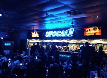
Night club
Upscale Restaurant and Lounge
Discover the lively Upscale Restaurant and Lounge in Virginia Beach, where soul food meets nightlife in a stylish and vibrant setting.
37 min drive · 17 km from city centre


Best shops in Chesapeake
Shopping in Chesapeake is concentrated in modern commercial districts rather than a single historic market centre. Greenbrier Mall and the surrounding Greenbrier area provide the broadest mix of mainstream shops, restaurants and everyday services, while Chesapeake Square serves communities in the western and southern part of the city. Battlefield Boulevard adds large retailers, specialist businesses and practical shopping along a busy regional corridor. For a more local character, seasonal farmers' markets and independent shops offer Virginia produce, baked goods, crafts and small gifts, with selection changing throughout the year. Visitors interested in edible souvenirs can look for Virginia peanuts, regional preserves and locally produced foods. Antique and second-hand businesses appear in scattered districts rather than one defined quarter, so browsing is best combined with a planned drive between neighbourhoods.
-
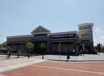
Outlet mall
Norfolk Premium Outlets
Discover unbeatable deals at Norfolk Premium Outlets, your ultimate shopping destination in Virginia with countless brand-name stores and dining options.
44 min drive · 24 km from city centre
-
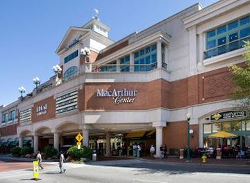
Shopping mall
MacArthur Center
Explore the MacArthur Center in Norfolk for a unique shopping experience with diverse stores, dining options, and entertainment for everyone.
39 min drive · 19 km from city centre
-
Shopping mall
Greenbrier Mall
Discover an exciting shopping experience at Greenbrier Mall in Chesapeake, Virginia, featuring over 100 stores, diverse dining, and family-friendly entertainment.
33 min drive · 13 km from city centre
-
Shopping mall
Greenbrier Market Center
Explore the Greenbrier Market Center: Chesapeake's premier shopping destination with diverse stores, dining, and family-friendly entertainment.
32 min drive · 12 km from city centre


Get your free copy of our complete guide to Chesapeake, delivered straight to you.
Everything on this page, from attractions and restaurants to essentials and local phrases, in one PDF you can read offline, print or share.
Already have an account? Sign in
Your Chesapeake guide is ready.
We'll send it to · Not you? Sign out

Getting your guide ready…
We are putting together a fresh copy of the Chesapeake guide. This can take up to a minute.
This can take a few moments. If your browser asks, choose Allow so the download can start. You'll find the guide in your Downloads folder.
Nothing happened? Download it again
Sorry, the guide is taking longer than usual. Please try again in a minute, or get it by email instead.
Chesapeake essentials
Currency and Payment
Safety
Emergency Situations
Do's and Don'ts
Local Tips
From Eve
Local phrases worth knowing
You don't need to get them perfect. A few words go a long way, and locals appreciate the effort.
Basics
| English | Local | Say it |
|---|---|---|
| Hello | Howdy | [haw-dee] |
| Goodbye | See ya | [see yuh] |
| Yes | Yup | [yuhp] |
| No | Nah | [nuh] |
| Please/You're welcome | Please and thank ya | [pleez an thangk yuh] |
| Thank you | Much obliged | [muhch uh-blahy-jed] |
| Excuse me/Sorry | Pardon me | [pahr-dn mee] |
| How are you? | How y'all doin'? | [haw yawl doo-in] |
| Fine. And you? | Fine, how 'bout y'all? | [fahyn, how bawt yawl] |
| Do you speak English? | Y'all speak English? | [yawl speek Ing-glish] |
| I don't understand | I ain't catchin' on | [ahy ent kach-in awn] |
Eating & Drinking
| English | Local | Say it |
|---|---|---|
| I'd like to see the menu, please | I reckon I'll take a gander at the menu, please | [ahy rek-uhn ayl take uh gand-er at the menu, pleez] |
| I don't eat meat | I don't touch meat | [ahy dohnt tuhch meet] |
| Cheers! | Bottoms up! | [bah-tuhms up] |
| I would like to pay, please | I'll settle up, please | [ahyl set-l up, pleez] |
Emergencies
| English | Local | Say it |
|---|---|---|
| Help! | Lord have mercy! | [lord hav mur-see] |
| Go away! | Git! | [git] |
| Call the Police! | Ring up the Law! | [ring up thuh law] |
| Call a doctor! | Fetch a doc! | [fetch uh dahk] |
| I'm lost | I'm turned around | [ahym turnd uh-round] |
| I'm ill | I ain't feelin' right | [ahy ent feel-in ryte] |
Shopping
| English | Local | Say it |
|---|---|---|
| I'd like to buy... | I reckon I'll buy... | [ahy rek-uhn ayl bahy...] |
| I'm just looking | I'm just browsin' | [ahym just brow-zin] |
| How much is it? | What's the damage? | [wuts thuh dam-ij] |
| That's too expensive | That's highfalutin' | [thats hahy-fuh-loo-tin] |
| Can you lower the price? | Can ya do me a solid on the price? | [kan yuh doh mee uh sol-id awn thuh prahys] |
Time & Numbers
| English | Local | Say it |
|---|---|---|
| What time is it? | What's the clock say? | [wuts thuh klok say] |
| It's one o'clock | It's one on the nose | [its wuhn on thuh nohz] |
| Half past (10) | Half past (10) | [haf past (10)] |
| Morning | Mornin' | [morn-in] |
| Afternoon | Afternoon | [af-ter-noon] |
| Evening | Evenin' | [eev-nin] |
| Yesterday | Yest'day | [yest-day] |
| Today | Today | [toh-day] |
| Tomorrow | Tomorrah | [tu-maw-rah] |
| 1 | One | [wuhn] |
| 2 | Two | [too] |
| 3 | Three | [three] |
| 4 | Four | [for] |
| 5 | Five | [fahyv] |
| 6 | Six | [siks] |
| 7 | Seven | [sev-uhn] |
| 8 | Eight | [ayt] |
| 9 | Nine | [nahn] |
| 10 | Ten | [ten] |
Transport & Directions
| English | Local | Say it |
|---|---|---|
| Where's a/the...? | Where's the... | [wheres thuh] |
| What's the address? | What's the street? | [whuts thuh street] |
| Can you show me (on the map)? | Can you point it out? | [kan yuh point it out] |
| When's the next (bus)? | When's the next (bus)? | [whens thuh nekst bus] |
| A ticket (to ....) | A ticket (to ....) | [a tik-it to] |
History of Chesapeake
Nansemond Country and Early Settlement
The Chesapeake area lies within the historic homeland of the Nansemond, an Indigenous people of the wider lower James and Nansemond river region whose descendants remain represented by the Nansemond Indian Nation. English colonisation expanded across southeastern Virginia during the seventeenth century, bringing plantations, farms and waterways into a colonial economy dependent on enslaved labour as well as European settlement. The region was not a single concentrated town but a rural landscape of creeks, forests and agricultural holdings. That dispersed pattern continued to shape later development, leaving Chesapeake with a wide geographic footprint and historic places scattered among modern roads, neighbourhoods and commercial districts.
The Great Bridge Battle of 1775
Great Bridge became a strategically important crossing during the opening phase of the American Revolution in Virginia. On 9 December 1775, Patriot troops defeated British forces and their allies at the Great Bridge, compelling the royal governor, Lord Dunmore, to abandon nearby Norfolk soon afterwards. The engagement helped prevent British control of a vital route into the interior and strengthened the revolutionary position in the colony. The battlefield landscape has changed considerably, but Great Bridge Battlefield and Waterway Park interprets the conflict and places it within the setting of the canal and modern community that grew around the crossing.
Canals, Timber and Inland Trade
The Dismal Swamp Canal, begun in the late eighteenth century and completed in the early nineteenth century, connected the Chesapeake Bay region with Albemarle Sound through the Great Dismal Swamp. Its construction relied heavily on difficult manual labour, including the work of enslaved people, and it opened a route for timber, agricultural goods and other trade. The canal formed part of a wider transformation in which waterways were engineered to move people and commodities through southeastern Virginia and northeastern North Carolina. Its surviving route remains one of Chesapeake's clearest reminders that transport infrastructure and environmental exploitation shaped the region long before modern highways.
Norfolk County and South Norfolk
For much of the nineteenth and early twentieth centuries, the present city consisted chiefly of Norfolk County's rural communities alongside the growing city of South Norfolk. Agriculture, timber, waterways and proximity to the port and naval economy of Hampton Roads influenced settlement and employment. South Norfolk developed a more urban character, with residential streets, commercial blocks and civic buildings that still distinguish the area from Chesapeake's newer suburban districts. The region also carried the social consequences of segregation, slavery's legacy and later civil-rights struggles, histories represented in local schools, churches, cemeteries and community institutions as well as in formal historic sites.
The Creation of Chesapeake
In 1963, Norfolk County and the city of South Norfolk consolidated to create the independent City of Chesapeake. The new municipality inherited a varied territory: older urban neighbourhoods, farms, waterways, military-adjacent employment and large undeveloped natural areas. In the decades that followed, road building and regional growth encouraged suburban expansion, particularly around Greenbrier and the corridors linking Chesapeake with Norfolk, Portsmouth, Virginia Beach and North Carolina. Chesapeake's present character therefore reflects both continuity and change: historic communities remain embedded within a city whose population, commercial areas and residential development expanded across a landscape once organised primarily around county roads, rivers and agricultural land.
Chesapeake in Photos
Browse through our photo collection highlighting the charm and character of the destination.
Cities near Chesapeake
The closest cities to Chesapeake, if you have time for more than one stop.
-

-

-

-
-


Swipe for more cities
Explore more

Explore more of Virginia
Discover Virginia: A blend of historic landmarks, natural beauty, and vibrant culture perfect for history buffs, nature lovers, and culture seekers.
Explore Virginia