

Free Great River Road Travel Guide & Mobile App
Explore Great River Road with free travel guides. Discover regional history, expert tips, proposed trips, and audio guides on web or mobile app.


Explore Wisconsin's Great River Road for Mississippi views, bluff-top parks, historic river towns, wildlife, cycling and local food.
Read more about Great River Road
Getting to and around Great River Road
How to get there
Transportation
Top city travel guides in Great River Road
The cities of Great River Road, and the easiest places to base yourself.
-

-

-


Swipe for more cities
Destinations in Great River Road
Resorts, valleys and scenic spots worth a trip of their own.

Swipe for more destinations
Best attractions in Great River Road
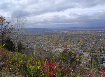
The Great River Road's attractions are distributed along a chain of river towns, parks and working landscapes rather than concentrated in one resort centre. In the north, Prescott's position at the Mississippi and St Croix rivers introduces the geography of the route, while Pepin adds literary interest through the Laura Ingalls Wilder Museum and the landscape associated with her childhood. Alma is known for its narrow river valley, lock-and-dam setting and views of islands and navigation pools. Around Trempealeau, Perrot State Park combines hiking, bluff scenery and wetlands, while La Crosse contributes museums, riverfront parks and access to Grandad Bluff. South of the city, state parks and public lands support walking, fishing, paddling, wildlife observation and scenic driving. Prairie du Chien offers historic interpretation through Villa Louis and Fort Crawford, and Wyalusing State Park overlooks the meeting of the Wisconsin and Mississippi rivers. Nelson Dewey State Park near Cassville adds woodland trails and expansive valley views. The attraction landscape is strongest when natural places, river engineering, Indigenous and colonial history, and the living communities along the route are experienced together.
-
State park
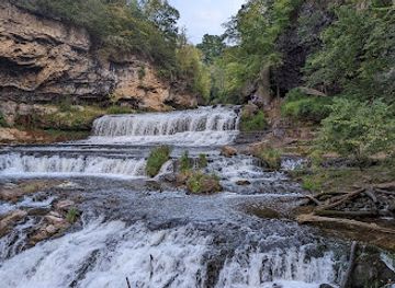
Willow River State Park
Explore the stunning landscapes and outdoor adventures at Willow River State Park, a premier state park in Wisconsin perfect for nature lovers.
-
Park
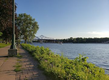
Riverside Park
Explore the scenic beauty of Riverside Park in La Crosse, Wisconsin, where nature meets recreation along the majestic Mississippi River.
-
Park
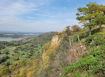
Grandad Bluff Park
Discover the stunning vistas of Grandad Bluff Park, a top tourist attraction in La Crosse, Wisconsin, offering breathtaking views of the Mississippi River Valley.
-
Park
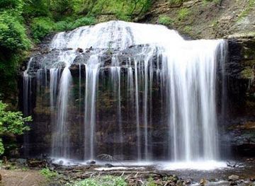
Wilke Glen and Cascade Falls
Experience the serene beauty of Wilke Glen and Cascade Falls, a breathtaking natural park in Osceola, Wisconsin, perfect for outdoor enthusiasts and nature lovers.
Best landmarks in Great River Road
The Mississippi itself is the defining landmark, but its character changes from broad navigation pools to wooded islands, wetlands and steep limestone bluffs. At Prescott, the meeting of the Mississippi and St Croix rivers gives the northern gateway a clear geographical identity. Alma is recognised for its compressed river valley, elevated town setting and lock-and-dam landscape, where navigation infrastructure is integrated into the scenery. The bluffs and island country around Trempealeau and Perrot State Park demonstrate the geological form of the upper Mississippi valley, while Grandad Bluff above La Crosse provides one of the route's most prominent city and river overlooks. Prairie du Chien's historic landmarks include Villa Louis, a preserved nineteenth-century estate, and the Fort Crawford site, which represents the military importance of the settlement. Wyalusing State Park's ridge marks the confluence of the Wisconsin and Mississippi rivers, and the lower route near Cassville is shaped by long views across the river and the wooded slopes of the Driftless Area. Together these places give the road a recognisable visual and historical structure.
-
Tourist attraction
Crystal Cave
Unearth the beauty of Crystal Cave in Spring Valley, Wisconsin, a stunning natural wonder showcasing captivating underground formations and rich geological history.
-
Historical place museum
Old World Wisconsin
Discover the rich cultural heritage of Wisconsin at Old World Wisconsin, a living history museum showcasing the daily life of 19th-century settlers.
-
Historical place museum
Taliesin Preservation: Frank Lloyd Wright Visitor Center
Explore the architectural brilliance and serene landscapes of Taliesin Preservation, home to Frank Lloyd Wright's visionary designs in Wisconsin.
-
Tourist attraction
Dickeyville Grotto & Shrines
Explore the Dickeyville Grotto & Shrines, a stunning blend of art and faith in Wisconsin, where intricate mosaics create a tranquil spiritual retreat.



Explore Great River Road on the map
Plan your trip on one map. See where the top cities, national parks and sights are, and book hotels and experiences in a few clicks.
Best hotels in Great River Road
Best restaurants in Great River Road
Dining along Wisconsin's Great River Road reflects the combination of Midwestern farming, river commerce and small-town hospitality. La Crosse and Prairie du Chien offer the broadest range of restaurants, cafés, bakeries and bars, while smaller communities tend to centre on family-run eateries, taverns, seasonal stands and restaurants attached to accommodation. Wisconsin cheese, locally produced meats, orchard fruit, baked goods and farm-market produce appear widely, alongside familiar regional fare such as fish fries, burgers and hearty soups. Freshwater fish may feature near the river, although availability is seasonal and menus vary. German and Central European influences are part of the wider Wisconsin food culture, while the Mississippi corridor also has its own traditions of supper clubs, tavern meals and informal riverfront dining. Farmers' markets and independent food shops are useful places to find local cheese, preserves, smoked products and baked goods without confusing regional produce with a single official Great River Road cuisine.
-
Grill
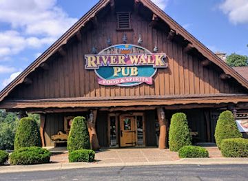
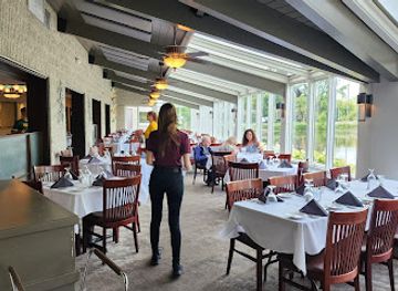
River Walk Pub
Experience riverside dining at River Walk Pub in Wisconsin Dells – where great food meets stunning views.
-
Steak
River's Bend
Experience exceptional steak dining at River's Bend in Green Bay - where culinary artistry meets stunning riverside views.
-
Grill
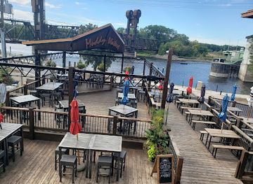
Muddy Waters Bar & Grill
Experience exquisite dining at Muddy Waters Bar & Grill with breathtaking views of two iconic rivers in Prescott, Wisconsin.
-
Pizza
Great River Roadhouse
Discover great flavors at Great River Roadhouse—your go-to pizza destination on Wisconsin's scenic route.

Best bars in Great River Road
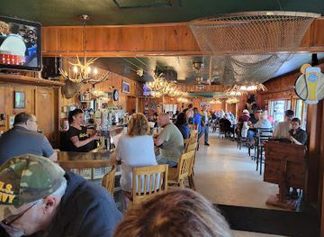
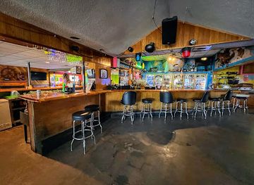
Evening life is generally relaxed and town-based rather than centred on a major nightclub scene. Traditional taverns, brewpubs, historic inns and casual restaurants provide the main social settings in smaller river communities, often with televised sport, live music or seasonal outdoor seating. La Crosse has the largest concentration of bars, breweries, restaurants and entertainment venues on the route, supported by its university population and year-round local community. Prairie du Chien also offers a selection of pubs and evening restaurants, while other towns tend to close earlier and rely on local events or summer tourism. Craft beer is part of the wider Wisconsin drinking culture, but visitors can also find non-alcoholic drinks, cafés and evening performances. Check current arrangements locally, particularly outside the larger centres and during the quieter winter season.
-
Pub
River's Edge Pub & Grub
Discover River's Edge Pub & Grub in Wisconsin Dells for delicious comfort food, local craft beers, and stunning river views.
-
Grill
Muddy Waters Bar & Grill
Enjoy breathtaking river views and delicious American cuisine at Muddy Waters Bar & Grill, a Prescott gem for food lovers and tourists alike.
-
Pizza
Great River Roadhouse
Discover the delicious flavors of Great River Roadhouse, where every pizza is a masterpiece and the views are just as tasty.
-
American
Harbor Bar, Restaurant, Marina
Experience the best of American cuisine at Harbor Bar, Restaurant, and Marina, where stunning river views meet delectable dining.
Best nightclubs in Great River Road
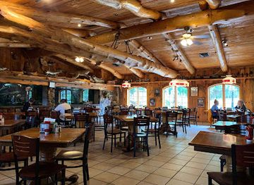
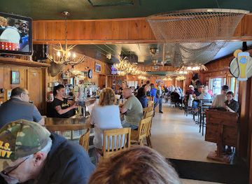
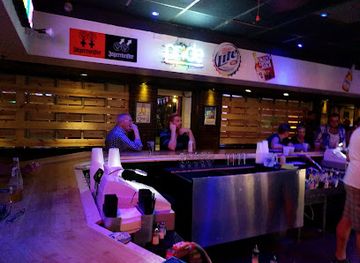
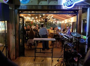
Evening life is generally relaxed and town-based rather than centred on a major nightclub scene. Traditional taverns, brewpubs, historic inns and casual restaurants provide the main social settings in smaller river communities, often with televised sport, live music or seasonal outdoor seating. La Crosse has the largest concentration of bars, breweries, restaurants and entertainment venues on the route, supported by its university population and year-round local community. Prairie du Chien also offers a selection of pubs and evening restaurants, while other towns tend to close earlier and rely on local events or summer tourism. Craft beer is part of the wider Wisconsin drinking culture, but visitors can also find non-alcoholic drinks, cafés and evening performances. Check current arrangements locally, particularly outside the larger centres and during the quieter winter season.
-
Bar
The Reef
Discover the vibrant nightlife at The Reef in Lake Delton, featuring live music, dance, and an exciting bar atmosphere for unforgettable evenings.
-
Gay night club
FIVE Nightclub
Dive into the energetic atmosphere at FIVE Nightclub, Madison's premier gay nightclub where unforgettable nights and inclusive vibes await.
-
Bar
Mud Creek Saloon
Discover the lively Mud Creek Saloon in Eagle River, a destination for live music, great drinks, and unforgettable moments in Wisconsin.
-
Gay bar
Flame Nightclub
Experience the vibrant nightlife at Flame Nightclub, a welcoming gay bar and nightclub in Superior, WI, with lively events and great drinks.


Best shops in Great River Road
Shopping along the Great River Road is strongest in historic town centres, independent main streets, farm stands and seasonal markets rather than in large retail complexes. La Crosse has the widest selection of bookshops, galleries, boutiques, outdoor retailers and specialist food shops, while Prairie du Chien combines everyday shopping with antiques, local crafts and visitor-oriented stores. Smaller communities such as Stockholm and Pepin are associated with independent galleries, craft shops, homewares, books and locally made gifts, although individual businesses and market schedules change. Useful regional purchases include Wisconsin cheese, preserves, maple products, bakery goods, smoked foods and locally produced beer, alongside pottery, textiles, artwork and Mississippi-themed books. Farmers' markets are particularly worthwhile in warmer months, but visitors should check dates locally rather than assume that every town has a year-round market. The most distinctive purchases tend to be products made or produced in the river valley rather than generic souvenirs.
-
Department store
Fleet Farm
Explore Fleet Farm in Eau Claire, WI for a unique shopping experience offering everything from farm equipment to sporting goods.
-
Sporting goods store
Scheels
Explore Eau Claire's Scheels for top-notch sporting goods, apparel, and a family-friendly experience that celebrates the outdoors.
-
Department store
Walmart
Discover Walmart in Hudson, Wisconsin, a convenient department store for all your shopping needs, from groceries to home goods, all under one roof.
-
Truck stop
Flying J Travel Center
Discover the convenience of Flying J Travel Center in Roberts, Wisconsin—fueling your adventures with quality service and essential amenities.

Get your free copy of our complete guide to Great River Road, delivered straight to you.
Everything on this page, from attractions and restaurants to essentials and local phrases, in one PDF you can read offline, print or share.
Already have an account? Sign in
Your Great River Road guide is ready.
We'll send it to · Not you? Sign out

Getting your guide ready…
We are putting together a fresh copy of the Great River Road guide. This can take up to a minute.
This can take a few moments. If your browser asks, choose Allow so the download can start. You'll find the guide in your Downloads folder.
Nothing happened? Download it again
Sorry, the guide is taking longer than usual. Please try again in a minute, or get it by email instead.
Great River Road essentials
Currency and Payment
Safety
Emergency Situations
Do's and Don'ts
Local Tips
From Eve
Local phrases worth knowing
You don't need to get them perfect. A few words go a long way, and locals appreciate the effort.
Basics
| English | Local | Say it |
|---|---|---|
| Hello | Hi | [Hai] |
| Goodbye | See ya | [See yah] |
| Yes | Yep | [Yep] |
| No | Nah | [Nah] |
| Please/You're welcome | Please/You bet | [Pleez/You bet] |
| Thank you | Thanks | [Thangs] |
| Excuse me/Sorry | Excuse me/Sorry | [Excuse me/Sorry] |
| How are you? | How's it going? | [How's it goin'?] |
| Fine. And you? | Good. And you? | [Good. An' you?] |
| Do you speak English? | You speak English? | [Yoo speek English?] |
| I don't understand | I don't get it | [I don't get it] |
Eating & Drinking
| English | Local | Say it |
|---|---|---|
| I'd like to see the menu, please | Can I see the menu, please? | [Can I see the men-yoo, pleez?] |
| I don't eat meat | I don't eat meat | [I don't eat meat] |
| Cheers! | Cheers! | [Cheers!] |
| I would like to pay, please | I'd like to settle up, please | [I'd like to settl' up, pleez] |
Emergencies
| English | Local | Say it |
|---|---|---|
| Help! | Help! | [Help!] |
| Go away! | Leave me alone! | [Leave me alone!] |
| Call the Police! | Call the cops! | [Call the cops!] |
| Call a doctor! | Get a doctor! | [Get a doctor!] |
| I'm lost | I'm lost | [I'm lost] |
| I'm ill | I'm not feeling well | [I'm not feelin' well] |
Shopping
| English | Local | Say it |
|---|---|---|
| I'd like to buy... | I want to buy... | [I want to buy...] |
| I'm just looking | Just browsing | [Just browsin'] |
| How much is it? | What's the price? | [What's the price?] |
| That's too expensive | That's too pricey | [That's too pricy] |
| Can you lower the price? | Can you drop the price? | [Can you drop the price?] |
Time & Numbers
| English | Local | Say it |
|---|---|---|
| What time is it? | What's the time? | [What's the time?] |
| It's one o'clock | It's one | [It's one] |
| Half past (10) | Half past ten | [Half past ten] |
| Morning | Morning | [Mornin'] |
| Afternoon | Afternoon | [Afternoon] |
| Evening | Evening | [Evening] |
| Yesterday | Yesterday | [Yesterday] |
| Today | Today | [Today] |
| Tomorrow | Tomorrow | [Tomorrow] |
| 1 | One | [One] |
| 2 | Two | [Two] |
| 3 | Three | [Three] |
| 4 | Four | [Four] |
| 5 | Five | [Five] |
| 6 | Six | [Six] |
| 7 | Seven | [Seven] |
| 8 | Eight | [Eight] |
| 9 | Nine | [Nine] |
| 10 | Ten | [Ten] |
Transport & Directions
| English | Local | Say it |
|---|---|---|
| Where's a/the...? | Where's a...? | [Where's a...?] |
| What's the address? | What's the address? | [What's the address?] |
| Can you show me (on the map)? | Can you point it out on the map? | [Can you point it out on the map?] |
| When's the next (bus)? | When's the next bus? | [When's the next bus?] |
| A ticket (to ....) | A ticket to ... | [A ticket to ...] |
History of Great River Road
Indigenous river cultures and ancient earthworks
The Mississippi valley has been occupied and used by Indigenous peoples for thousands of years. Earlier societies built ceremonial and burial earthworks in the wider region, while later Dakota, Ho-Chunk, Meskwaki and other peoples maintained social, trading and seasonal connections with the river and its tributaries. The waterway provided transport, fish, fertile floodplain resources and access to the interior. Contemporary visitors should understand the route not as an untouched wilderness but as a cultural landscape with a long history preceding European settlement.
French exploration and the fur trade
French explorers and traders entered the upper Mississippi region during the seventeenth and eighteenth centuries, establishing relationships and rivalries that reshaped Indigenous trade networks. Prairie du Chien became an important meeting and trading place because of its position at the junction of the Mississippi and Wisconsin river systems. French influence remains visible in some place names and in the region's early colonial history, although control and commerce later shifted as British and then American power expanded westwards.
Fort Crawford and the changing frontier
The United States established military posts at Prairie du Chien during the early nineteenth century, including Fort Crawford, to strengthen its position on the upper Mississippi. The fort played a role during the War of 1812 and in the federal government's relations with Indigenous nations. Its later history reflects the transition from frontier garrison to settled community. The reconstructed Fort Crawford Medical Museum and surrounding historic sites help explain how military administration, treaty-making and migration affected the river valley.
Steamboats, river ports and settlement
During the nineteenth century, steamboats transformed the Mississippi into a major commercial artery. River towns such as Prescott, Alma, La Crosse and Prairie du Chien developed around landings, warehouses, timber trade, grain shipments and passenger traffic. Railways later connected the valley to inland markets, reducing the river's dominance as a transport route while reinforcing the importance of the towns it had helped establish. Historic commercial buildings, port landscapes and town plans still reveal this period of rapid growth.
Farming, lumber and river engineering
The river economy was supported by agriculture on the floodplain and by lumbering in the upper valley. As settlement increased, navigation improvements, including locks and dams, altered water levels and created more predictable channels for commercial traffic. These structures also changed wetlands and habitats, producing the distinctive combination of open navigation pools, islands and backwaters seen along the modern route. Agriculture remains central in the surrounding countryside, while recreation, conservation and tourism have become increasingly important parts of the valley economy.
Conservation and the scenic byway era
Twentieth-century conservation efforts protected important bluff, wetland and woodland habitats through state parks, wildlife areas and other public lands. The Great River Road concept developed as a coordinated route linking communities and interpreting the Mississippi's landscapes and history across several states. Wisconsin's section became part of the National Scenic Byway network, giving greater recognition to its combined natural, cultural and recreational significance. Today, the route presents the river as a living corridor rather than merely a scenic backdrop.
Great River Road in Photos
Browse through our photo collection highlighting the charm and character of the destination.
Neighbouring regions of Great River Road
The closest regions to Great River Road, if you have time for more than one.
-

-

-

-

-


Swipe for more regions
Explore more

Explore more of Wisconsin
Discover Wisconsin: A Midwestern gem offering stunning natural landscapes, rich cultural experiences, and a taste of America's finest dairy products.
Explore Wisconsin