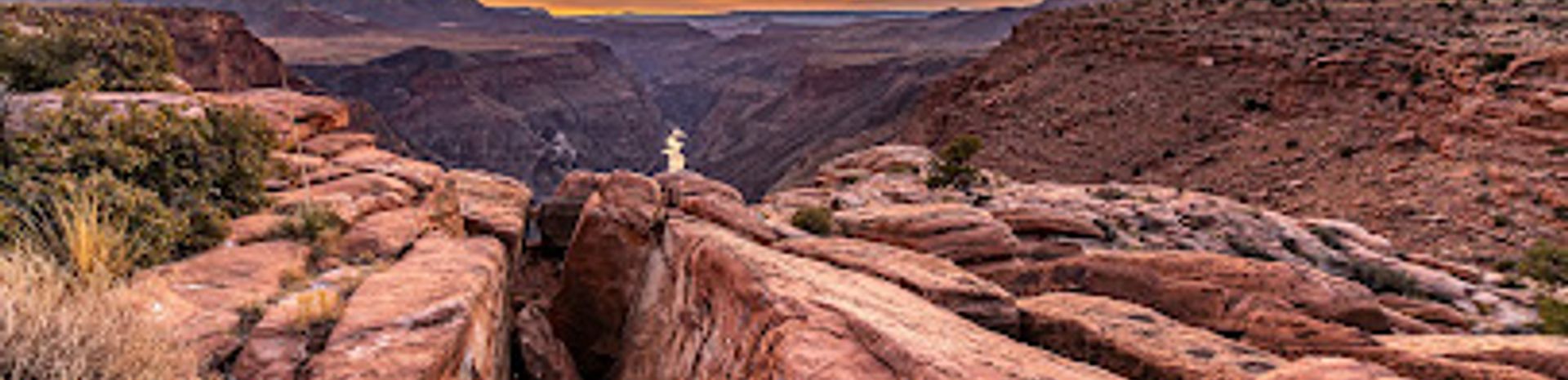
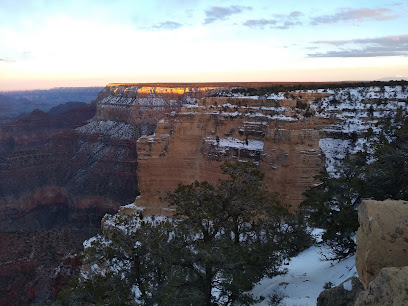
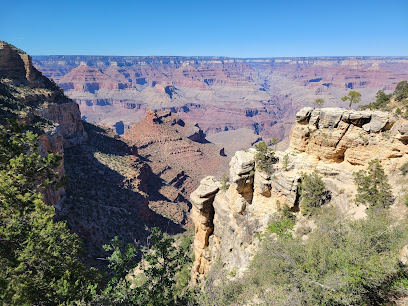
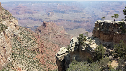
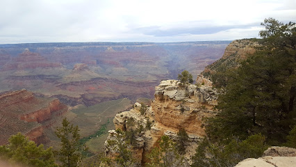
Toroweap Overlook: A Grand Canyon Vista
Experience a thrilling, unfenced view of the Grand Canyon from Toroweap Overlook, where the Colorado River lies 3,000 feet below.
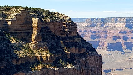
Toroweap Overlook, also known as Tuweep Overlook, provides a unique and dramatic perspective of the Grand Canyon. Located on the North Rim, it's the only viewpoint where the Colorado River can be seen vertically below, a staggering 3,000-foot drop.
A brief summary to Toroweap Overlook
- Littlefield, Arizona, 86432, US
- +1928-638-7888
- Visit website
Local tips
- A high-clearance vehicle is recommended to reach the overlook due to rough road conditions.
- Bring plenty of water, food, and a full gas tank, as there are no services available in the Tuweep area.
- Check road conditions and weather forecasts before heading out, as roads can become impassable when wet.
- Obtain the required day-use permit or backcountry permit in advance from Recreation.gov.
- Be cautious near the edge, as there are no guardrails.
Getting There
-
Driving
The final approach to Toroweap Overlook involves driving on unpaved roads. From Fredonia, Arizona, take AZ-389 west for approximately 8 miles. Turn left onto BLM Route 109 (Mt. Trumbull Road), also known as Antelope Valley Road, and follow it south for about 40 miles. Turn left onto County Road 5 and continue for 6 miles, then turn onto County Road 115. The final 14 miles on CR 115 lead to the overlook. Be prepared for rough road conditions, including washboards, sharp rocks, and potential mud. High-clearance vehicles are recommended, and 4WD may be necessary for the last few miles. A day-use permit ($2) and a Grand Canyon National Park pass ($35 for 7 days, or an $80 America the Beautiful Pass) are required. There are no services available, so bring extra supplies.
Discover more about Toroweap Overlook
Iconic landmarks you can’t miss
Sawmill Historic Monument
21.6 km
Explore the ruins of an old sawmill that provided lumber for the construction of Fort Lowell and Tucson in the mid-1800s.

Horse Valley Historic Ranch
41.3 km
Explore Arizona's ranching history at Horse Valley Ranch, a preserved 1916 homestead within the Grand Canyon-Parashant National Monument.
Pine Historic Ranch
42.3 km
Explore Pine Historic Ranch: A preserved 20th-century cattle ranch in Arizona's Grand Canyon-Parashant National Monument.
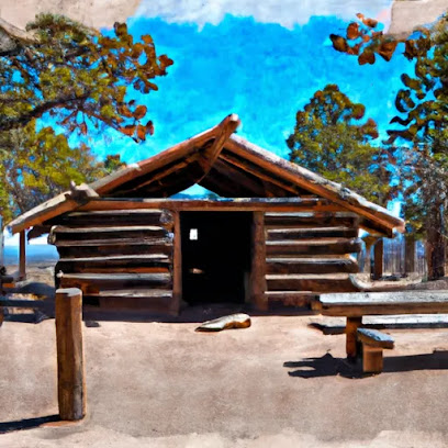
Shanley Historic Cabin
43.3 km
Step back in time at the Shanley Historic Cabin, a charming relic of Arizona's pioneering past nestled amidst breathtaking natural beauty.
Oak Grove Historic Cabin
47.7 km
Step back in time at Oak Grove Historic Cabin, a preserved early 1900s cabin in the Grand Canyon watershed, offering history and natural beauty.
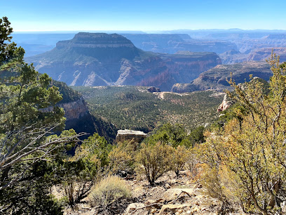
Rainbow Rim Trail
65.7 km
Discover panoramic Grand Canyon views along this unique North Rim trail, perfect for hiking, biking, and horseback riding in Kaibab National Forest.
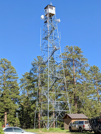
Big Springs Lookout Tower
77.1 km
Ascend to history at Big Springs Lookout Tower for panoramic views of the Kaibab National Forest. A historic fire lookout on the North Rim.
Masonic Grand Canyon Degree Memorial
82.8 km
Honoring Freemasonry with panoramic Grand Canyon views, a serene landmark blending history and natural beauty.
North Kaibab Ranger District
83.2 km
Discover the North Kaibab Ranger District: Where majestic forests meet the breathtaking vistas of the Grand Canyon's North Rim.
Kaibab Plateau HP
83.7 km
Explore the breathtaking Kaibab Plateau in Arizona, a mountain peak offering stunning views, diverse wildlife, and unforgettable hiking experiences.
Hermit Rd
83.7 km
Discover unparalleled Grand Canyon views along Hermit Road: a scenic 7-mile journey accessible by free shuttle, bike, or foot!
Bright Angel Trailhead
83.8 km
Descend into the Grand Canyon via this iconic trail, offering stunning views and access to historic sites and natural wonders.
Maswik Gift Shop
83.8 km
Discover unique Grand Canyon souvenirs and local crafts at Maswik Gift Shop, your essential stop in Grand Canyon Village.
Grand Canyon National Park - Kolb Studio
83.9 km
Explore Kolb Studio at Grand Canyon National Park, a unique blend of art and literature capturing the essence of America's natural wonder.
Lookout Studio
84.0 km
Iconic Mary Colter-designed studio offering panoramic Grand Canyon views and unique souvenirs on the South Rim.
Unmissable attractions to see
Lava Falls Trail
3.1 km
Discover the breathtaking beauty of Lava Falls Trail in Arizona, where adventure meets stunning landscapes and unforgettable hiking experiences.
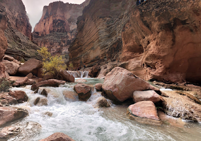
Havasu Creek & Colorado River Confluence
28.3 km
Discover the stunning beauty of Havasu Creek's turquoise waters meeting the Colorado River in this iconic Arizona destination.
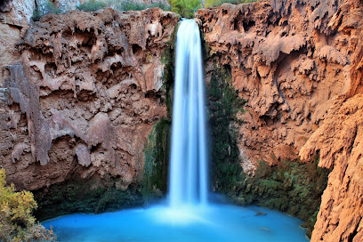
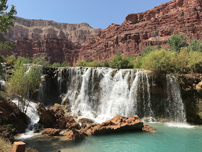
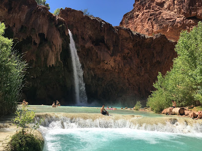
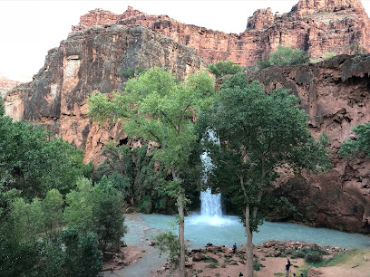
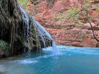
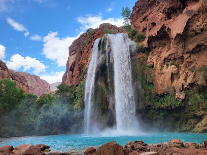
Mooney Falls
31.7 km
Discover the enchanting Mooney Falls, a breathtaking waterfall in Arizona's Havasupai Reservation, perfect for adventure seekers and nature lovers.
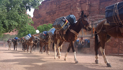
Havasupai Trailhead
31.8 km
Embark on an unforgettable backpacking adventure to the turquoise waterfalls of Havasu Canyon from the remote Havasupai Trailhead.
Bellezas de Arizona
32.0 km
Explore the breathtaking landscapes, rich culture, and serene beauty of Bellezas de Arizona, a must-visit tourist attraction in Supai, Arizona.
Fifty Foot Falls
32.1 km
Experience the breathtaking Fifty Foot Falls in Supai, Arizona - a stunning natural wonder in the heart of the Grand Canyon region.
Havasupai Campground
32.2 km
Experience the magic of Havasupai: Turquoise waterfalls, stunning canyons, and a connection to the Havasupai Tribe's ancient heritage.
Havasupai Campground Rangers Office
32.3 km
Discover the breathtaking beauty and cultural heritage of Havasupai Campground, a hidden treasure in the Grand Canyon's stunning wilderness.
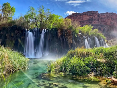
Little Navajo Falls
32.3 km
Discover the serene beauty of Little Navajo Falls, a hidden gem along Havasu Creek in the heart of the Havasupai Reservation.
Carbonate Canyon
32.6 km
Explore Carbonate Canyon in Havasupai: stunning rock formations, rich history, and the serene beauty of the Arizona wilderness.
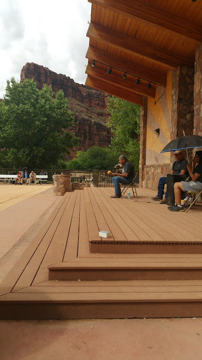
Main Havasupai Rangers Office
32.8 km
Start your Havasupai adventure at the Rangers Office: Permits, safety info, and a glimpse into Havasupai culture await!
Havasupai Tributary
32.8 km
Discover the turquoise waterfalls and ancient traditions of the Havasupai, a hidden paradise deep within the Grand Canyon.
Intersection of Havasu Falls Trail and Havasu Creek Trail
32.8 km
Explore the breathtaking intersection of Havasu Falls and Havasu Creek Trail, where turquoise waters meet stunning canyon landscapes in Arizona.
Havasu Canyon
36.7 km
Explore the stunning Havasu Canyon with its turquoise waterfalls, rich culture, and outdoor adventures in Arizona's breathtaking landscape.
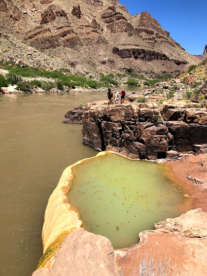
Pumpkin Spring Pool
41.5 km
Explore the serene Pumpkin Spring Pool in Supai, Arizona, a natural oasis perfect for relaxation and adventure amidst stunning landscapes.
Essential places to dine
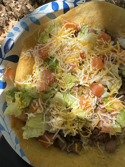
Fry Bread Tent
32.5 km
Experience authentic Native American cuisine at Fry Bread Tent along Havasu Falls Trail – a must-visit for culinary enthusiasts.
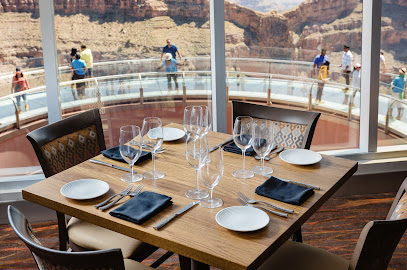
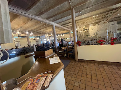
Sky View Restaurant
71.4 km
Experience breathtaking views and delectable American cuisine at Sky View Restaurant overlooking the iconic Grand Canyon.
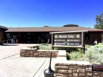
Maswik Lodge
83.9 km
Discover comfort and adventure at Maswik Lodge, your gateway to exploring the majestic Grand Canyon.
Maswik Food Court
83.9 km
Discover delicious dining at Maswik Food Court in Grand Canyon National Park—where flavor meets convenience amidst stunning scenery.
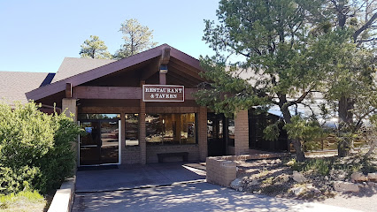
Fred Harvey Tavern
84.1 km
Experience rustic charm and local flavors at Fred Harvey Tavern in Grand Canyon Village – your perfect post-adventure dining spot.
Harvey House Cafe
84.1 km
Experience delightful dining at Harvey House Cafe in Grand Canyon Village, where good food meets stunning natural beauty.
Arizona Steakhouse
84.1 km
Experience authentic American cuisine at Arizona Steakhouse in Grand Canyon Village, where every meal comes with breathtaking views.
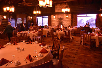
El Tovar Dining Room
84.3 km
Experience fine dining at El Tovar Dining Room amidst breathtaking views of the Grand Canyon - where culinary excellence meets historic charm.
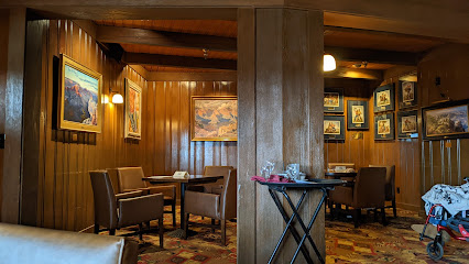
El Tovar cocktail lounge
84.4 km
Experience breathtaking views and expertly crafted cocktails at El Tovar Cocktail Lounge in Grand Canyon Village.
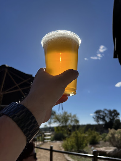
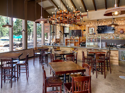
Grand Canyon Beer Garden
84.4 km
Experience unparalleled views while enjoying local brews at the Grand Canyon Beer Garden - your ultimate relaxation spot on the canyon rim.
Yavapai Lodge
86.0 km
Experience comfort and adventure at Yavapai Lodge in Grand Canyon Village – your ideal base for exploring stunning landscapes.
Yavapai Lodge Dining Hall
86.0 km
Experience delicious dining at Yavapai Lodge Dining Hall in Grand Canyon Village - where local flavors meet stunning views.
Yavapai Tavern
86.0 km
Discover Yavapai Tavern at Grand Canyon – where delicious food meets breathtaking views in an unforgettable dining experience.
Wagon Wheel Saloon
87.6 km
Experience vibrant camaraderie at Wagon Wheel Saloon in Grand Canyon Village – your go-to spot for hearty American fare and refreshing drinks.
Squire Pub + Social
87.6 km
Experience hearty meals and refreshing drinks at Squire Pub + Social, the perfect pit stop in Grand Canyon Village.
Markets, malls and hidden boutiques
Beaver Falls
30.2 km
Explore the stunning turquoise waters and breathtaking landscapes of Beaver Falls, a hidden gem in Arizona's Havasupai Reservation.
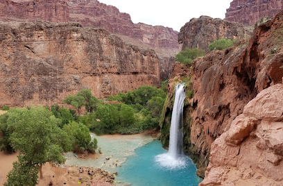
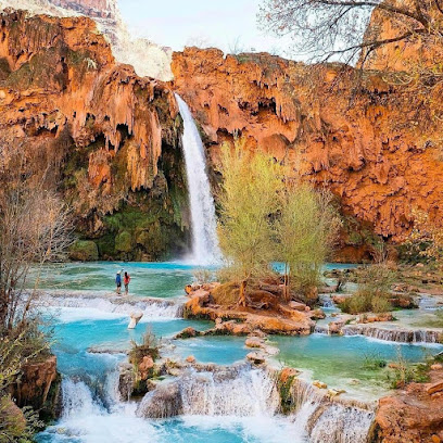
Havasu Falls
32.5 km
Experience the breathtaking beauty of Havasu Falls, an iconic waterfall in Arizona's Grand Canyon, known for its turquoise waters and stunning landscapes.
Wildlife Enterprises
33.1 km
Explore the beauty of Wildlife Enterprises in Supai, AZ—a unique blend of shopping and nature in the heart of the Grand Canyon region.
The Havasupai Tribal Cafe
33.1 km
Experience the rich flavors and warm hospitality of The Havasupai Tribal Cafe, where tradition meets breathtaking Grand Canyon vistas.
Havasupai Trading Company (Market)
33.1 km
Discover the vibrant culture and local craftsmanship at Havasupai Trading Company, your essential shopping destination in Supai Village.
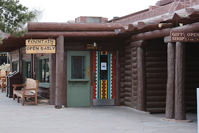
The Fountain
84.1 km
Discover The Fountain, a charming takeout restaurant in Grand Canyon Village, offering delicious meals amidst breathtaking landscapes.
Bright Angel Gift Shop
84.1 km
Explore unique souvenirs and local crafts at Bright Angel Gift Shop in Grand Canyon Village, your perfect stop for memorable keepsakes.

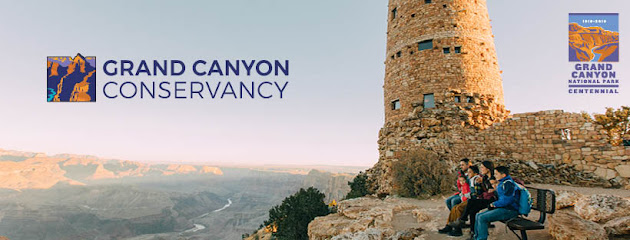
Grand Canyon Conservancy
84.5 km
Explore the Grand Canyon Conservancy - a hub of education, preservation, and unique gifts celebrating the beauty of this iconic national park.
Grand Canyon Community Recreation Center
84.6 km
Discover leisure and community spirit at the Grand Canyon Community Recreation Center, where adventure meets relaxation amidst breathtaking landscapes.
Xanterra Garage
84.6 km
Experience peace of mind at Xanterra Garage, the premier auto repair shop in Grand Canyon Village, ensuring your vehicle is road-ready for adventure.
Canyon Closet - Grand Canyon School PTA
84.7 km
Discover the heart of Grand Canyon Village at Canyon Closet, a vibrant non-profit showcasing local art, culture, and community spirit.
North Country HealthCare - Grand Canyon
85.4 km
Discover reliable healthcare at North Country HealthCare, your essential medical resource while exploring the Grand Canyon.
Shrine of the Ages
85.6 km
Discover the Shrine of the Ages in Grand Canyon Village - a stunning event venue where nature's beauty meets architectural elegance.
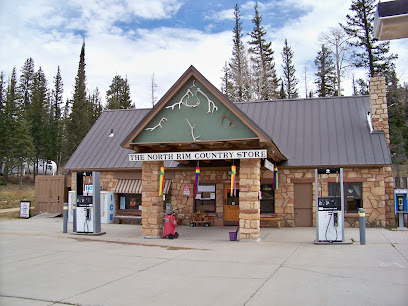
North Rim Country Store
85.8 km
Explore the North Rim Country Store: Your one-stop shop for groceries, souvenirs, and seasonal goods in the heart of Northern Arizona.
Camper Services And Camp Store
85.9 km
Explore the Grand Canyon with ease at Camper Services and Camp Store - your go-to stop for camping gear, local tips, and great coffee!
Essential bars & hidden hideouts
Kaibab Lodge
85.6 km
Experience the rustic charm and natural beauty of Kaibab Lodge, your perfect base for exploring the Grand Canyon.
Kaibab Plateau
89.5 km
Discover the stunning beauty of Kaibab Plateau in Arizona, a natural paradise offering breathtaking views and unforgettable outdoor adventures.
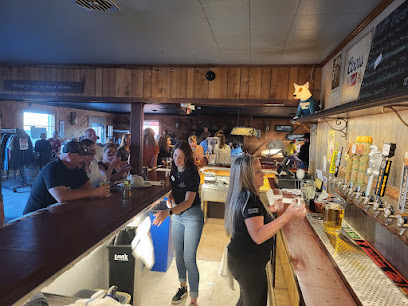
Roughrider Saloon
90.1 km
Discover the rustic charm of Roughrider Saloon, a cozy coffee shop in North Rim, Arizona, offering delightful brews and stunning canyon views.

Kaibab Camper Village
92.1 km
Discover the tranquility of Kaibab Camper Village, a serene campground in Arizona's national forest, perfect for camping and outdoor adventures.
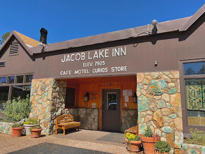
Jacob Lake Inn
93.4 km
Experience the perfect blend of comfort, local culture, and adventure at Jacob Lake Inn, your gateway to Northern Arizona's natural wonders.
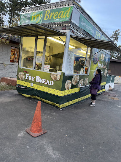
Indian Fry Bread
93.4 km
Savor the authentic taste of Native American fry bread in Fredonia, AZ, where tradition meets flavor in a picturesque setting.
Chevron
93.4 km
Discover Chevron in Fredonia, the essential pit stop for travelers exploring Northern Arizona’s breathtaking landscapes and attractions.
Buckskin Tavern
98.1 km
Discover the vibrant atmosphere of Buckskin Tavern in Fredonia, Arizona, where great drinks and local charm come together.