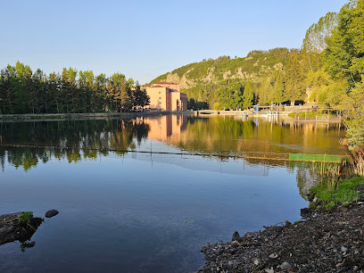
Սրտերի ջրվեժ (Srteri Dzhurvezh)
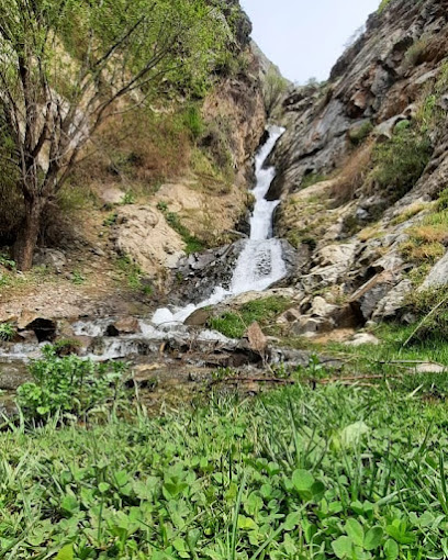
Hike to the romantic 'Waterfall of Hearts' near Tashtun, Armenia, for stunning views and a tranquil escape into nature's embrace. A hidden gem awaits!
Discover the hidden gem of Srteri Dzhurvezh, or 'Waterfall of Hearts,' near Tashtun, Armenia. This scenic hiking area offers breathtaking views and a tranquil escape into nature, perfect for adventurers seeking unspoiled beauty.
A brief summary to Սրտերի ջրվեժ
- 346Q+V5F, Tashtun, AM
Local tips
- Wear sturdy hiking boots to navigate the varied terrain comfortably.
- Bring plenty of water and snacks to stay hydrated and energized during your hike.
- Visit early in the morning to enjoy cooler temperatures and fewer crowds.
- Check the weather forecast before your visit to ensure safe hiking conditions.
Getting There
-
Walking
From Tashtun village, follow the path heading north. The hike to the waterfall is approximately 5 km, with half the journey through a forest. Be prepared for varied terrain and changing weather conditions.
-
Public Transport
To reach Tashtun by public transport, take a bus or minibus from Yerevan to Goris. Buses depart regularly from Yerevan's central bus station, with a journey time of 4-5 hours and a cost of 3,000-5,000 AMD. From Goris, take a local minibus to Kapan for around 1,000 AMD, which takes about 30 minutes. From Kapan, hire a taxi to Tashtun, with an estimated cost of 1,500-2,500 AMD. Note that shared taxis may also be available.
-
Taxi
From Kapan, a taxi to Tashtun will cost approximately 3,000-4,000 AMD. Ensure the taxi driver knows the route to Tashtun and the Waterfall of Hearts. Confirm the price before starting the journey.
Discover more about Սրտերի ջրվեժ
Iconic landmarks you can’t miss
Крепость Багаберд
20.8 km
Discover the breathtaking Baghaberd Fortress in Armenia, where history comes alive amidst stunning landscapes and ancient architecture.
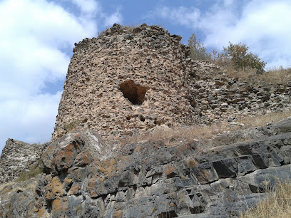
Stepan Shahumyan
22.0 km
Experience the cultural richness and awe-inspiring beauty of the Stepan Shahumyan Statue in Meghri, a symbol of Armenian resilience and history.

Bear symbol of Syunik
22.5 km
Discover the Bear Symbol of Syunik, a remarkable historical landmark in Armenia that captures the essence of local culture and breathtaking natural beauty.
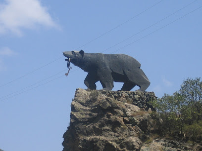
Քաղաքային հրապարակ
22.5 km
Explore Agarak's town square, a vibrant cultural hub in Armenia, where tradition meets modernity amidst charming cafes and local artisans.

Hammame Kordasht
23.2 km
Explore the historical beauty of Hammame Kordasht, an ancient bathhouse that reflects Armenia's rich cultural heritage and architectural elegance.
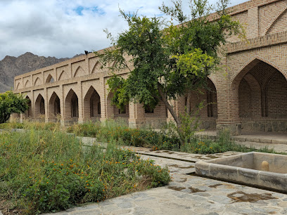
Hilltop Camping Bekh
25.9 km
Discover the tranquility of Hilltop Camping Bekh, where nature and comfort unite in the heart of Kapan's breathtaking landscapes.
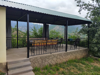
Garegin Njdeh Memorial
26.7 km
Explore the serene Garegin Njdeh Memorial in Kapan, a tribute to Armenian resilience and heritage amidst beautiful landscaping and peaceful surroundings.
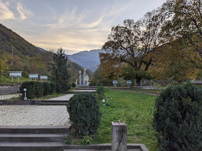
Mount Aramazd
27.9 km
Discover Mount Aramazd: Hike Armenia's majestic peak, steeped in pagan history and breathtaking natural beauty.
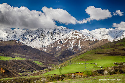
Karen Demirchyan Square
28.3 km
Explore the vibrant atmosphere of Karen Demirchyan Square in Kapan, where culture, community, and stunning architecture come together for an unforgettable experience.

Tatev Monastery
36.6 km
Discover Tatev Monastery, an ancient spiritual haven in Armenia, offering breathtaking views, rich history, and a unique cultural experience.
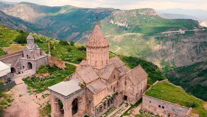
Surb Poghos Petros
36.6 km
Explore the breathtaking Surb Poghos Petros Church in Tatev, a spiritual and architectural marvel amidst stunning landscapes and rich Armenian history.
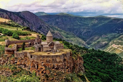
Surb Astvatsatsin
36.6 km
Discover the architectural beauty and rich history of Surb Astvatsatsin, an iconic Armenian church in the stunning landscape of Tatev.
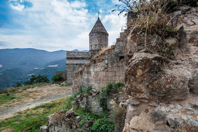
Tatev Info Cafe
36.7 km
Discover the flavors and culture of Armenia at Tatev Info Cafe, your family-friendly hub for delicious food and local insights in the heart of Tatev.

Old Tatev B&B
36.8 km
Discover the serene beauty of Tatev at Old Tatev B&B, where breathtaking mountain views and exceptional hospitality await every traveler.

Bgheno-Noravank
41.0 km
Discover Bgheno-Noravank Monastery: An ancient Armenian sanctuary with stunning architecture and serene landscapes, nestled in the heart of Syunik Province.
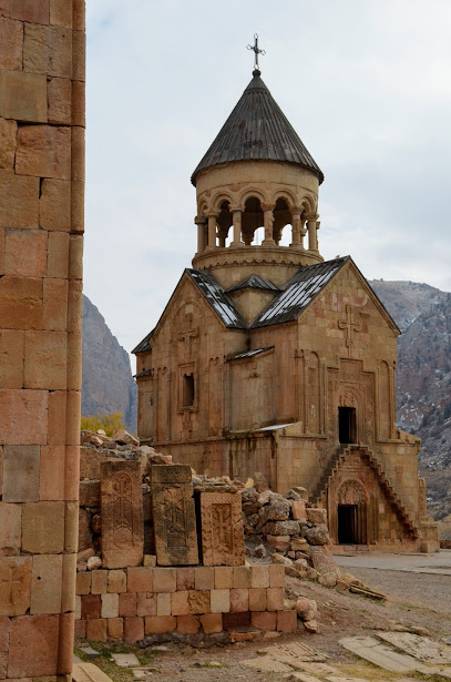
Unmissable attractions to see
hutan tropika di Syunik ԱՐևԱԴԱՐՁԱՅԻՆ ԱՆՏԱՌՆԵՐ
1.2 km
Discover a surprising subtropical-like oasis in Armenia's Syunik region, perfect for hiking and nature exploration near Lichk.

Tashtun Pass
6.3 km
Experience the breathtaking vistas and rugged terrain of Tashtun Pass, a memorable high-altitude crossing in Armenia's Syunik Province.

ԼԵՌՆԱՍԱՐ
6.4 km
Discover the natural beauty of Armenia's Syunik region at ԼԵՌՆԱՍԱՐ near Kajaran, offering scenic views and cultural experiences.

Kaputan Lake
7.4 km
Discover Kaputan Lake: A pristine alpine escape in Armenia's Syunik Province, offering breathtaking views and tranquil hiking experiences.
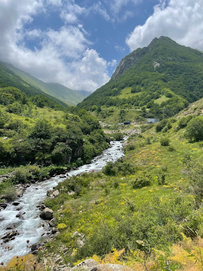
Unus Şəlaləsi (Qaplançay)
9.5 km
Discover the serene beauty of Unus Waterfall in Ordubad, Azerbaijan, a perfect escape into nature's tranquility and the region's rich history.
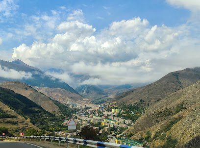
Kajaran View Point
9.8 km
Discover breathtaking panoramic views of mountains, jungles, and villages at Kajaran View Point in Armenia.
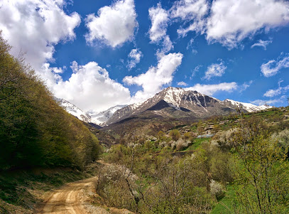
Syunik Mountains Armenia
11.5 km
Discover Armenia's wild side: Hike through dramatic landscapes, explore ancient history, and encounter rare wildlife in the Syunik Mountains.

Arevik National Park
12.8 km
Discover Armenia's wild side: Hike through diverse landscapes, spot rare wildlife, and explore the untamed beauty of Arevik National Park.
Mount Kaputjugh
15.7 km
Discover Mount Kaputjugh: Armenia's stunning border peak offering panoramic views, challenging hikes, and rich biodiversity.
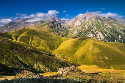
Հարավային Սյունիքի արշավային տարածք
18.1 km
Discover breathtaking landscapes and historical sites on diverse hiking trails in Southern Syunik, near Meghri, Armenia. A haven for nature lovers!

Cori jrvezh
18.2 km
Discover the serene beauty of Cori Jrvezh in Karchevan, Armenia, a perfect escape for nature lovers and cultural explorers.

Mount Khustup
18.5 km
Experience the breathtaking beauty of Mount Khustup, a top hiking destination in Armenia, offering stunning views and diverse wildlife.

Сюник Армения
18.5 km
Conquer Syunik's highest peak, Mount Khustup, for breathtaking views and a journey through Armenian history and natural beauty.

World War II Memorial
18.8 km
A solemn memorial in Karchevan, Armenia, honoring the brave Armenian soldiers and their sacrifices during World War II.

Adelyan St
19.3 km
Discover the charm of Meghri on Adelyan Street: culture, stunning views, and local experiences await in this Armenian gem.

Essential places to dine
Սյունիք Համեղ
24.4 km
Experience authentic Armenian cuisine at Syunik Hamegh in Shvanidzor, where tradition meets flavor in every dish.

Vanatour
26.9 km
Discover authentic Armenian cuisine at Vanatour in Kapan – where tradition meets taste!

Grand House Kapan, Armenia HOTEL & ZIPLINE
27.4 km
Experience thrilling adventures and cozy comforts at Grand House Kapan, Armenia's ultimate destination for family fun and relaxation.

Three Ways
27.6 km
Experience authentic Armenian cuisine in Kapan at Three Ways – where tradition meets taste in a welcoming atmosphere.

Golden Kapan
27.9 km
Experience the heart of Armenian cuisine at Golden Kapan - where tradition meets taste in a cozy setting.

Mozart restaurant
28.1 km
Savor exquisite Armenian cuisine at Mozart Restaurant in Kapan – where tradition meets modern culinary artistry.

Kapan Restaurant
28.1 km
Experience authentic Armenian flavors at Kapan Restaurant, where tradition meets taste in a cozy setting perfect for all diners.

Tasty Corner
28.2 km
Experience the best fast food in Kapan at Tasty Corner—where local flavors meet quick service in a cozy atmosphere.

Old Kapan
28.3 km
Discover authentic Armenian flavors at Old Kapan - a family-friendly Tegal restaurant in Kapan offering delicious traditional dishes.

Tashir Pizza
28.4 km
Experience authentic Italian flavors at Tashir Pizza in Kapan – where every slice tells a story of culinary excellence.

Elegant
28.4 km
Discover the essence of Armenian cuisine at Elegant Restaurant in Kapan, where tradition meets taste in every dish.

"Golden Syunik" Restaurant
31.3 km
Experience authentic Armenian cuisine at Golden Syunik Restaurant in Kapan - a must-visit for food lovers exploring Armenia.

Tatev Authentic Food
36.6 km
Discover authentic Armenian flavors at Tatev Authentic Food - where family-friendly dining meets traditional cuisine in a stunning setting.

Տաթև պանդոկ
36.7 km
Experience authentic Armenian cuisine in a family-friendly atmosphere at Tatev Pandok near the stunning Tatev Aerial Tramway.

Agnesa Tasty food
37.2 km
Experience authentic Armenian cuisine at Agnesa Tasty Food in Tatev—where tradition meets taste in every dish.

Markets, malls and hidden boutiques
Ռոմի խանութ
9.9 km
Explore the essence of Armenian culture at Ռոմի խանութ in Kajaran, where unique crafts and local products await your discovery.

Խանութ Գաղութ
10.1 km
Explore the rich culture of Armenia at Խանութ Գաղութ, a unique store in Kajaran offering local crafts and delicacies.

Lehvaz Fruits Syunik
14.8 km
Discover the vibrant flavors of Armenia at Lehvaz Fruits Syunik, your local greengrocer for fresh, seasonal produce.

Kuris Market
14.9 km
Kuris Market: Your essential stop for local goods and travel necessities in the heart of Kuris, Armenia.

Aram Shop
20.2 km
Explore Aram Shop in Meghri for authentic Armenian souvenirs, local delicacies, and a cultural shopping experience in a charming atmosphere.

Սուպերմարկետ
20.4 km
Discover fresh produce and local specialties at the vibrant supermarket in Meghri, immersing yourself in Armenia's culinary delights.

Alvank Mixed Market
22.8 km
Experience the charm of Alvank at the Mixed Market, where local flavors and crafts await you in a vibrant shopping atmosphere.

A-Optics
27.0 km
Discover the artistry of Kapan at A-Optics, where exquisite glassware meets Armenian craftsmanship in a charming setting.

3x3
27.0 km
Explore Kapan's vibrant local market at 3x3, where tradition meets creativity in a unique shopping experience.

Mountain Herbs
27.0 km
Experience the enchanting world of teas at Mountain Herbs in Kapan, where aromatic brews and local hospitality meet.

Aspar Arms
27.2 km
Explore Aspar Arms in Kapan for a unique experience in firearms and local culture amidst the picturesque Armenian landscape.

Askaryan flowers
27.4 km
Discover vibrant blooms and exquisite floral arrangements at Askaryan Flowers in Kapan, Armenia – a floral haven for every occasion.

Grand Market
27.4 km
Discover the essence of Armenian culture at Grand Market, a vibrant store in Kapan offering fresh produce, unique souvenirs, and a friendly atmosphere.

Mush Market
27.6 km
Discover the authentic flavors of Armenia at Mush Market, a local grocery store offering fresh produce and traditional delicacies in Ararat.

Kamilla
27.7 km
Explore Kamilla, Kapan's premier kitchen supply store, where culinary dreams come to life with quality tools and home improvement essentials.

Essential bars & hidden hideouts
Նավես
10.1 km
Experience authentic Armenian cuisine at Naves in Kajaran, where tradition meets flavor in a cozy dining atmosphere.

La Regina
10.1 km
Discover the flavors of Armenia at La Regina in Kajaran, where traditional cuisine meets a warm and inviting atmosphere for an unforgettable dining experience.

Restaurant Kamo
18.3 km
Savor authentic Armenian cuisine at Restaurant Kamo in Kapan, where traditional flavors meet warm hospitality in a charming setting.

Hacatun SUSO
20.1 km
Experience the authentic flavors of Armenian cuisine at Hacatun SUSO, a delightful restaurant in Meghri with a cozy atmosphere and delicious dishes.

ՓALANGA
20.1 km
Experience authentic Armenian cuisine at restaurant ՓALANGA in Meghri – a culinary gem offering a delightful taste of local flavors.

G&D
20.1 km
Discover G&D in Meghri, where a cozy bar and café atmosphere awaits with local beverages and a warm ambiance.

Merci Cafe Restaurant
20.3 km
Experience the authentic flavors of Tegal cuisine at Merci Cafe Restaurant, a charming dining spot in Meghri, Armenia, where tradition meets hospitality.

Restaurant Imper xars
20.4 km
Experience the rich flavors of Armenian cuisine at Restaurant Imper Xars in Meghri, where every meal is a delightful adventure.

Poqr Tagh Guesthouse
20.4 km
Experience authentic Tegal cuisine and warm Armenian hospitality at Poqr Tagh Guesthouse in the stunning Meghri region.

ռեստորան
22.1 km
Savor the authentic flavors of Armenian cuisine in Meghri, a perfect blend of tradition and taste for every traveler.

ԳԱՐԻԿԻ ՄՈՏ
22.4 km
Discover Gariki Mot, a delightful family-friendly restaurant in Tsav, offering a diverse menu and a warm atmosphere for all ages.

Qaravan pub
22.5 km
Explore the lively Qaravan Pub in Agarak for an authentic Armenian bar experience with local drinks and traditional snacks.

Bistro Shawarma
22.5 km
Experience the authentic flavors of Armenian shawarma at Bistro Shawarma in Agarak, a must-visit culinary stop for every tourist.

Vostan Ոստան
25.8 km
Experience the authentic flavors of Armenia at Vostan, Kapan's culinary jewel, where every dish tells a story of tradition and taste.

Royal Cafe
28.2 km
Discover the heart of Kapan through its flavors at Royal Cafe, where local meets international in a cozy dining experience.

Nightclubs & after hour spots
Fox Show Club
32.7 km
Experience the vibrant nightlife of Kapan at Fox Show Club, where music, dance, and entertainment create unforgettable memories.

Goris Press Club
52.7 km
Discover the vibrant community spirit at Goris Press Club, a cultural hub in Goris, Armenia, offering engaging events and local insights.

ƏZİZİN VİLLASI
53.6 km
Discover the electrifying nightlife of Kulus at ƏZİZİN VİLLASI, a premier night club with vibrant music and a lively atmosphere.

La Case De Mafia
63.3 km
Experience the vibrant nightlife of Nakhchivan at La Case De Mafia, a karaoke bar where every night is a musical celebration.

SVstudio
64.7 km
Discover the perfect blend of relaxation and local charm at SVstudio in Nakhchivan, an inviting lounge for every traveler.

Genclik Merkezi
64.9 km
Discover the cinematic charm of Nakhchivan at Genclik Merkezi, a must-visit movie theater offering diverse films and a welcoming atmosphere.

ES CAFE
91.8 km
Discover the vibrant atmosphere of ES CAFE in Vayk, where refreshing drinks and local charm meet for an unforgettable experience.

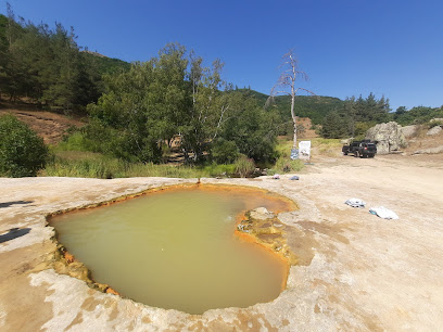
Jermuk Hot Springs
94.4 km
Experience the rejuvenating power of Jermuk Hot Springs, where healing waters meet stunning mountain vistas in Armenia.
Jermuk Hotel
94.8 km
Experience luxurious relaxation and wellness at Jermuk Hotel, nestled in Armenia's breathtaking natural landscapes.

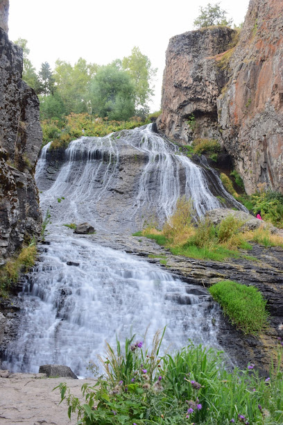
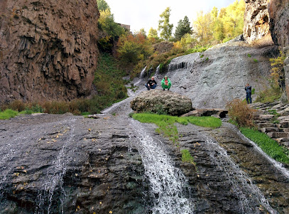
Jermuk Waterfall
95.0 km
Discover the stunning Jermuk Waterfall, a natural gem in Armenia surrounded by lush landscapes and perfect for outdoor adventures.
Olympia Sanatorium
95.3 km
Discover holistic wellness and rejuvenation at Olympia Sanatorium, a premier health resort in Jermuk, combining nature's beauty with expert care.
Jermuk restaurant
95.4 km
Experience authentic Armenian cuisine with stunning views at Jermuk Restaurant, a culinary treasure in the heart of Jermuk.

Forte restaurant
95.5 km
Discover the flavors of Armenia at Forte Restaurant, where culinary excellence meets the charm of Jermuk.

Jermuk Terrace Restaurant
95.5 km
Experience authentic Armenian cuisine with breathtaking views at Jermuk Terrace Restaurant, a culinary gem in the heart of Jermuk.
