

The Rocks (Sydney) Travel Guide - Free
Explore The Rocks in Sydney with Evendo's free guide. Find the best shops, historic streets, restaurants, and gems on web or mobile.


The Rocks in Sydney blends convict history, harbour views, museums, markets, historic lanes, restaurants and easy Harbour Bridge access for visitors.
Streets Beneath the Harbour Bridge
The Rocks occupies the western edge of Sydney Cove, where sandstone lanes, nineteenth-century terraces and broad harbour views gather beneath the southern approach to Sydney Harbour Bridge. Its compact streets sit between Circular Quay and Walsh Bay, making it one of the easiest parts of central Sydney to explore on foot, yet its atmosphere is distinct from the city’s modern commercial centre. Bridge arches, waterfront promenades and old warehouses give the area a strongly defined sense of place.Read more about The Rocks
Layers of Sydney History
Harbour Views and Local Culture
Best attractions in The Rocks
The Rocks Discovery Museum is the neighbourhood’s most direct introduction, presenting Aboriginal, colonial, maritime and contemporary stories within a restored sandstone building. Susannah Place Museum offers a more intimate view of domestic life through its preserved terrace houses, while Argyle Cut and Nurses Walk turn ordinary movement through the district into a lesson in nineteenth-century street-making. The Rocks Markets bring stalls and food activity to the historic streets on market days, and the waterfront promenade leads towards the Overseas Passenger Terminal, where harbour, Opera House and bridge views open across Circular Quay. Dawes Point Park is especially rewarding for photographs beneath Sydney Harbour Bridge, while bridge climbs and the Pylon Lookout provide elevated perspectives for visitors seeking a more active experience. The narrow lanes around Gloucester Street and Playfair Street are attractions in their own right, revealing sandstone walls, old façades and the compact scale of the former harbour quarter.
-
 Tourist attraction
BridgeClimb Sydney
Discover stunning views and exhilarating adventures at the Sydney Harbour Bridge, a must-visit attraction for all travelers.
3 min walk · 0.2 km from neighbourhood centre
-
Observatory
Sydney Observatory
Explore the cosmos and enjoy breathtaking views of Sydney at the historic Sydney Observatory, a top tourist attraction for stargazers and history buffs alike.
5 min walk · 0.4 km from neighbourhood centre
-
Historical landmark
Customs House
Explore Customs House, a historic landmark in Sydney featuring a library and cultural space, perfect for immersing in local heritage.
5 min walk · 0.4 km from neighbourhood centre
-
City park
Hickson Road Reserve
Discover Hickson Road Reserve, a scenic city park in The Rocks with stunning views of Sydney Harbour and the iconic Opera House.
6 min walk · 0.5 km from neighbourhood centre


Best landmarks in The Rocks
Sydney Harbour Bridge is The Rocks’ defining structure, with its southern approach, arches and pedestrian routes forming a dramatic architectural frame over the neighbourhood. Under and beside it, Dawes Point marks the harbour’s western entrance and contains remnants associated with the area’s early defensive history, while the former Dawes Point Battery site reinforces the strategic importance of the headland. Cadmans Cottage, near the waterfront, is one of Sydney’s oldest surviving buildings and reflects the earliest colonial harbour settlement. Argyle Cut is a major piece of nineteenth-century engineering, carved through sandstone to improve access across the district. The sandstone terraces of Gloucester Street, Cumberland Street and Nurses Walk are equally important at a smaller scale, preserving the relationship between workers’ housing, narrow lanes and the harbour economy. The Overseas Passenger Terminal adds a twentieth-century maritime layer at the water’s edge.
-
Historical landmark
Customs House
Discover the historic Customs House in Sydney, a cultural landmark blending rich heritage with modern vibrancy, perfect for all travelers.
5 min walk · 0.4 km from neighbourhood centre
-
Park
First Fleet Park
Discover the historical charm and natural beauty of First Fleet Park, a serene oasis in The Rocks, Sydney, perfect for relaxation and exploration.
2 min walk · 0.2 km from neighbourhood centre
-
Museum
Susannah Place
Immerse yourself in the 19th-century history of Sydney at Susannah Place, a captivating museum in The Rocks showcasing authentic stories and artifacts.
2 min walk · 0.2 km from neighbourhood centre
-
Historical landmark
Bridge Stairs
Experience the historic Bridge Stairs in The Rocks, Sydney, where breathtaking views meet rich cultural heritage, perfect for every traveler.
2 min walk · 0.2 km from neighbourhood centre


Explore The Rocks on the map
A handpicked selection of must-see spots in The Rocks, mapped for you.
Best hotels in The Rocks
Best restaurants in The Rocks
Dining in The Rocks is shaped by its waterfront setting, historic buildings and concentration of visitors, with choices ranging from cafés and casual meals to established restaurants in converted warehouses and terraces. The Overseas Passenger Terminal and nearby harbour edge offer views across Circular Quay, while the lanes around George Street and Playfair Street contain pubs, modern Australian cooking, international menus and familiar casual venues. Quay, located at the Overseas Passenger Terminal, represents the district’s high-end harbour dining, while Pancakes on the Rocks is a long-established casual name associated with the area. The Rocks Markets add stalls and takeaway-style food on market days, although their offer changes. The local scene is more visitor-oriented than that of a residential dining neighbourhood, but the preserved architecture, sandstone courtyards and proximity to the water make meals here closely tied to the character of the precinct.
-
Restaurant
The Squire's Landing
Experience exquisite dining at The Squire's Landing – a premier waterfront restaurant in Sydney serving craft beers and delicious local cuisine.
3 min walk · 0.2 km from neighbourhood centre
-
Japanese
Saké Restaurant & Bar The Rocks
Experience authentic Japanese cuisine at Saké Restaurant & Bar in The Rocks, where every dish is a masterpiece and every drink tells a story.
2 min walk · 0.1 km from neighbourhood centre
-
Modern Australian
Pony Dining The Rocks
Experience Modern Australian cuisine at its finest in the heart of The Rocks - a must-visit culinary gem in Sydney.
1 min walk · 0.1 km from neighbourhood centre
-
Asian
Luna Lu
Discover Luna Lu: A premier Asian restaurant offering exquisite dishes and stunning views at Circular Quay in The Rocks.
3 min walk · 0.3 km from neighbourhood centre


Best bars in The Rocks
After dark, The Rocks is generally more about pubs, restaurants, harbour walks and live or hosted entertainment than a dense nightclub circuit. Historic pubs around George Street and the lanes beneath the bridge provide the district’s traditional evening character, with old façades and compact interiors recalling its maritime past. The Glenmore, on Cumberland Street, is one of the best-known pub landmarks in the neighbourhood, while nearby venues serve a mixture of local beer, cocktails and food. Larger hotels and restaurants around the waterfront create a more polished evening atmosphere, and events at the Overseas Passenger Terminal or nearby Walsh Bay can broaden the cultural programme. Nightlife is busiest around major events and weekends; visitors seeking late-night clubs will generally find a wider choice elsewhere in central Sydney than within The Rocks itself.
-
German
Munich Brauhaus Sydney
Discover the flavors of Bavaria at Munich Brauhaus Sydney, where authentic German cuisine meets lively music and a family-friendly atmosphere.
1 min walk · 0.1 km from neighbourhood centre
-
Pub
Fortune of War
Discover the historic Fortune of War, Sydney's oldest pub, featuring live music, delicious food, and a vibrant atmosphere in The Rocks.
2 min walk · 0.1 km from neighbourhood centre
-
Pub
Harts Pub
Discover the vibrant essence of Sydney at Harts Pub, a lively spot in The Rocks offering craft beers, delicious food, and a welcoming atmosphere.
4 min walk · 0.3 km from neighbourhood centre
-
Pub
Orient Hotel
Experience the lively atmosphere and delicious flavors at the Orient Hotel in The Rocks, Sydney's premier pub and restaurant destination.
1 min walk · 0.1 km from neighbourhood centre


Best nightclubs in The Rocks
After dark, The Rocks is generally more about pubs, restaurants, harbour walks and live or hosted entertainment than a dense nightclub circuit. Historic pubs around George Street and the lanes beneath the bridge provide the district’s traditional evening character, with old façades and compact interiors recalling its maritime past. The Glenmore, on Cumberland Street, is one of the best-known pub landmarks in the neighbourhood, while nearby venues serve a mixture of local beer, cocktails and food. Larger hotels and restaurants around the waterfront create a more polished evening atmosphere, and events at the Overseas Passenger Terminal or nearby Walsh Bay can broaden the cultural programme. Nightlife is busiest around major events and weekends; visitors seeking late-night clubs will generally find a wider choice elsewhere in central Sydney than within The Rocks itself.
-
Night club
The Argyle
Experience the vibrant nightlife at The Argyle in The Rocks, Sydney's premier destination for cocktails, live music, and unforgettable nights out.
1 min walk · 0.1 km from neighbourhood centre
-
Night club
Basement Sydney
Dive into the heart of Sydney's nightlife at Basement Sydney, where electrifying music meets an unforgettable party atmosphere.
5 min walk · 0.4 km from neighbourhood centre
-
Lounge
Junk Lounge
Discover Junk Lounge, a stylish bar in Circular Quay offering stunning views, creative cocktails, and a lively atmosphere for tourists.
2 min walk · 0.1 km from neighbourhood centre
-
Lounge
Horizon Club
Experience the epitome of luxury and relaxation at Horizon Club, a premier lounge in The Rocks, Sydney, offering stunning views and exquisite beverages.
4 min walk · 0.3 km from neighbourhood centre


Best shops in The Rocks
Shopping in The Rocks is concentrated around independent stalls, heritage streets and visitor-focused retail rather than large department stores. The Rocks Markets occupy historic streets on market days, offering handmade goods, fashion, art, design pieces, jewellery and food from a changing group of sellers. Around George Street, Playfair Street and the arcades, visitors find souvenirs, Australian-themed products, galleries and small specialist shops in restored buildings. The precinct is useful for browsing local images, crafts and gifts, although stock and stallholders can change, and prices vary widely. The sandstone setting gives the retail experience a stronger sense of place than a standard shopping centre, while the close proximity of Circular Quay makes it easy to combine shopping with harbour walks and museums. Visitors interested in contemporary Australian design may also find selected galleries and design-led stores among the historic commercial spaces.
-
Duty free store
T Galleria By DFS, Sydney
Discover luxury shopping at T Galleria By DFS in Sydney, offering exclusive duty-free items, beauty products, and fashion accessories for the discerning traveler.
2 min walk · 0.2 km from neighbourhood centre
-
Aboriginal art gallery
Spirit Gallery- Aboriginal Art & Didgeridoos
Explore the Spirit Gallery in The Rocks for authentic Aboriginal art, unique gifts, and the soulful sounds of didgeridoos.
1 min walk · 0.1 km from neighbourhood centre
-
Gift shop
Hunting Hue
Discover unique gifts, exquisite silk, and local art at Hunting Hue, a vibrant shop in The Rocks, perfect for all your souvenir needs.
1 min walk · 0.1 km from neighbourhood centre
-
Souvenir store
Gifts at the Quay
Explore Gifts at the Quay in Sydney for unique souvenirs, Aboriginal art, and locally crafted gifts that embody Australian culture and charm.
5 min walk · 0.4 km from neighbourhood centre


The Rocks essentials
Getting There
Getting Around
Safety
Emergency Situations
Do's and Don'ts
Local Tips

From Eve
Local phrases worth knowing
You don't need to get them perfect. A few words go a long way, and locals appreciate the effort.
Basics
| English | Local | Say it |
|---|---|---|
| Hello | G'day | [g'day] |
| Goodbye | See ya | [see ya] |
| Yes | Yeah | [yeah] |
| No | Nah | [nah] |
| Please/You're welcome | Ta | [ta] |
| Thank you | Cheers | [cheers] |
| Excuse me/Sorry | Sorry mate | [sorry mate] |
| How are you? | How ya going? | [how ya going] |
| Fine. And you? | Good. You? | [good. you] |
| Do you speak English? | You speak English? | [you speak English] |
| I don't understand | I don't get ya | [I don't get ya] |
Eating & Drinking
| English | Local | Say it |
|---|---|---|
| I'd like to see the menu, please | Menu, please | [menu, please] |
| I don't eat meat | No meat for me | [no meat for me] |
| Cheers! | Cheers! | [cheers] |
| I would like to pay, please | Bill, please | [bill, please] |
Emergencies
| English | Local | Say it |
|---|---|---|
| Help! | Help! | [help] |
| Go away! | Bugger off! | [bugger off] |
| Call the Police! | Call the cops! | [call the cops] |
| Call a doctor! | Doctor! | [doctor] |
| I'm lost | Lost | [lost] |
| I'm ill | Sick | [sick] |
Shopping
| English | Local | Say it |
|---|---|---|
| I'd like to buy... | I wanna buy... | [I wanna buy] |
| I'm just looking | Just browsing | [just browsing] |
| How much is it? | How much? | [how much] |
| That's too expensive | Too pricey | [too pricey] |
| Can you lower the price? | Can you do a deal? | [can you do a deal] |
Time & Numbers
| English | Local | Say it |
|---|---|---|
| What time is it? | What's the time? | [what's the time] |
| It's one o'clock | It's one | [it's one] |
| Half past (10) | Half ten | [half ten] |
| Morning | Mornin' | [mornin'] |
| Afternoon | Arvo | [arvo] |
| Evening | Evenin' | [evenin'] |
| Yesterday | Yesterday | [yesterday] |
| Today | Today | [today] |
| Tomorrow | Tomorrow | [tomorrow] |
| 1 | One | [one] |
| 2 | Two | [two] |
| 3 | Three | [three] |
| 4 | Four | [four] |
| 5 | Five | [five] |
| 6 | Six | [six] |
| 7 | Seven | [seven] |
| 8 | Eight | [eight] |
| 9 | Nine | [nine] |
| 10 | Ten | [ten] |
Transport & Directions
| English | Local | Say it |
|---|---|---|
| Where's a/the...? | Where's the...? | [where's the] |
| What's the address? | What's the address? | [what's the address] |
| Can you show me (on the map)? | Show me on the map | [show me on the map] |
| When's the next (bus)? | Next bus? | [next bus] |
| A ticket (to ....) | Ticket to ... | [ticket to] |
History of The Rocks
Gadigal Country and First Contact
Before colonial settlement, the shoreline and rocky ground around Warrane, now Sydney Cove, formed part of the Country of the Gadigal people of the Eora Nation. The harbour provided food, travel routes and cultural connections, while sandstone outcrops and tidal spaces shaped movement through the area. British arrival in 1788 transformed the foreshore into the centre of the new colonial settlement, bringing ships, government stores, labourers and convicts into close contact with Gadigal communities. The Rocks developed from this early shoreline occupation rather than from a later, separately planned suburb, and its present streets remain connected to the first phase of Sydney’s colonial urban growth.
Convict Settlement and Maritime Work
During the late eighteenth and nineteenth centuries, the district became a dense working harbour quarter. The name The Rocks reflects the sandstone terrain, which was cut, levelled and built over as streets, houses, stores and public houses expanded. Convict labour contributed to early construction, while generation after generation of wharf workers, sailors, tradespeople and small shopkeepers lived close to the water. Argyle Cut, excavated through sandstone to improve movement between the cove and the western side of the settlement, illustrates the practical pressures of urban growth. The surviving terraces and lanes around Gloucester Street and Cumberland Street preserve fragments of this working-class environment.
Wharves, Industry and Public Health
By the nineteenth century, The Rocks was closely tied to Sydney’s shipping economy, with warehouses, hotels, workshops and wharf activity defining its social and physical character. Crowded housing and poor sanitation brought official scrutiny, especially during the bubonic plague outbreak that reached Sydney in 1900. Authorities responded with inspections, demolitions and changes to the waterfront, while later port redevelopment altered the relationship between homes and working wharves. Susannah Place, a row of four houses built in 1844, is an important survivor from this period because it records domestic life within the district’s dense residential fabric rather than only its maritime commerce.
The Bridge and Heritage Conservation
The opening of Sydney Harbour Bridge in 1932 reshaped The Rocks, bringing a massive transport structure over the neighbourhood and requiring extensive changes around Cumberland Street and Dawes Point. Mid-twentieth-century plans proposed further clearance and redevelopment, threatening much of the remaining historic housing and street pattern. Community campaigns in the 1960s and 1970s helped shift policy towards conservation, rehabilitation and adaptive reuse. The resulting heritage focus preserved buildings, lanes and archaeological evidence while introducing restaurants, museums, accommodation and visitor businesses. Contemporary The Rocks therefore combines a protected historic character with an active tourism and events economy.
The Rocks in Photos
Browse through our photo collection highlighting the charm and character of the destination.
Neighbourhoods near The Rocks
The closest neighbourhoods to The Rocks, if you have time for more than one stop.
-

-

-

-


Swipe for more neighbourhoods
Explore more
Explore more of Sydney
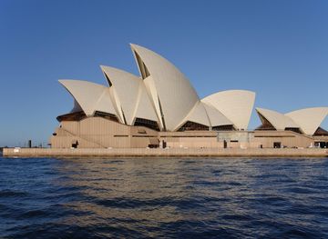
Sydney combines a glittering harbour, grand architecture, surf beaches and rich cultural life, from the Opera House to coastal walks and lively neighbourhoods.
Explore Sydney