

Hohe Tauern National Park Travel Guide - Free Web & App
Your ultimate guide to Hohe Tauern National Park. Discover top landmarks, proposed trips, and local tips. Free on the web or via the Evendo companion app.


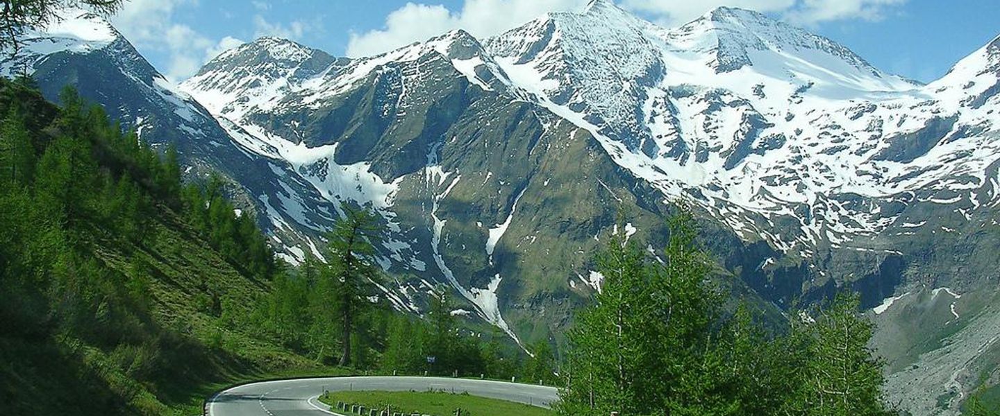


Hohe Tauern National Park in Austria combines Grossglockner peaks, Krimml Waterfalls, glacial valleys, wildlife, alpine villages and year-round hikes.
Mountain Landscapes and Natural Heritage
Hohe Tauern National Park stretches across the central Austrian Alps, covering parts of Salzburg, Tyrol and Carinthia. Its protected landscape encompasses the country’s highest summits, extensive glaciers, deep valleys, alpine meadows, rushing rivers and some of the most dramatic mountain scenery in Austria. The Grossglockner, Austria’s highest mountain at 3,798 metres, dominates the central range, while the Großvenediger, the Venediger Group, the Glockner Group and the Ankogel Group give the park its broad alpine character. Glacial features such as the Pasterze and major waterfalls including the Krimml Waterfalls reveal the continuing influence of ice, rock and water.Read more about Hohe Tauern National Park
Villages, Wildlife and Alpine Culture
Exploring the Park
When is the best time to visit Hohe Tauern National Park?
Best: June–August · 24–26°C| Month | High (°C) | Rainfall (mm) |
|---|---|---|
| January | 2 | 70 |
| February | 2 | 60 |
| March | 5 | 60 |
| April | 12 | 50 |
| May | 18 | 50 |
| June (best) | 24 | 40 |
| July (best) | 26 | 40 |
| August (best) | 25 | 40 |
| September | 19 | 50 |
| October | 13 | 60 |
| November | 8 | 70 |
| December | 3 | 70 |
Getting to and around Hohe Tauern National Park
How to get there
Transportation
Best attractions in Hohe Tauern National Park
Hohe Tauern National Park’s attractions are spread through a series of distinctive valleys rather than concentrated around one visitor centre. The Grossglockner and the Pasterze glacier form the best-known high-mountain landscape, approached from the north through the Großglockner High Alpine Road or from the south around Heiligenblut and the Möll Valley. In the northwest, the Krimml Waterfalls descend in three major stages and are among the region’s defining sights. The Rauris Valley combines alpine scenery with traces of its former gold-mining history, while the valleys around Kals, Matrei and the Großvenediger provide access to viewpoints, pasture landscapes and high mountain routes. Mallnitz is associated with the Mallnitz and Seebachtal valleys and offers a strong base for nature interpretation and walking. Mittersill’s Nationalparkzentrum presents the park’s wildlife, geology and cultural heritage, helping visitors understand the landscapes they encounter outdoors.
-
Tourist attraction
Edelweißspitze
Discover the breathtaking views and rich history at Edelweissspitze, the stunning summit of the Austrian Alps.
-
Tourist attraction
Gipfelwelt 3000
Discover breathtaking views and thrilling adventures at Gipfelwelt 3000, the ultimate alpine attraction in Austria's stunning Kitzsteinhorn region.
-
Tourist attraction
Hochmais
Experience the breathtaking beauty and outdoor adventures at Hochmais, a premier tourist attraction in the Austrian Alps, perfect for nature lovers and adventurers.
-
Tourist attraction
Energiedusche Wasserfall
Discover the breathtaking Energiedusche Wasserfall, a hidden gem in the Austrian Alps offering stunning views and refreshing experiences.


Best landmarks in Hohe Tauern National Park
The Grossglockner, Austria’s highest mountain, is the park’s commanding natural landmark, while the nearby Pasterze provides a striking example of a valley glacier and the effects of changing climate. The Großglockner High Alpine Road is both an engineering achievement and a celebrated route through the central mountain landscape, with views towards the Glockner Group. At the opposite end of the park’s northern valleys, the Krimml Waterfalls are a major landmark where the Krimmler Ache plunges through a steep valley in successive cascades. The Großvenediger and the ridges of the Venediger Group define the skyline around Neukirchen, Prägraten and the eastern valleys. Human landmarks include historic village churches, alpine farms, mountain huts and mining traces in areas such as Rauris, reflecting the long relationship between settlement, pasture and high-mountain resources.
-
Tourist attraction
Krimml Waterfalls
Experience the breathtaking beauty of Krimml Waterfalls, Europe's highest waterfalls, surrounded by stunning alpine landscapes and hiking trails.
-
Tourist attraction
Großglockner Hochalpenstraße
Experience the breathtaking beauty of the Großglockner Hochalpenstraße, a scenic alpine road in Austria, ideal for adventure and nature lovers.
-
Tourist attraction
Sigmund Thun Klamm
Explore the breathtaking Sigmund Thun Klamm in Kaprun, a stunning gorge filled with waterfalls, cliffs, and natural beauty that enchants every visitor.
-
Observation deck
Gipfelwelt 3000
Experience the breathtaking views and outdoor adventures at Gipfelwelt 3000, the ultimate alpine destination in Austria's Kitzsteinhorn region.


Explore Hohe Tauern National Park on the map
Plan your trip on one map. See where the top attractions, landmarks, restaurants and hotels are, and book hotels and experiences in a few clicks.
Best hotels in Hohe Tauern National Park
Best restaurants in Hohe Tauern National Park
Dining in and around Hohe Tauern National Park follows the character of its valleys, with most full-service options found in gateway towns and village settlements rather than beside remote trailheads. Traditional inns and mountain huts commonly serve substantial Austrian dishes such as soups, dumplings, schnitzel, goulash and Kaiserschmarrn, alongside bread, dairy products and other produce associated with alpine farming. Local menus may also feature trout from regional waters and seasonal ingredients, while farm shops and small producers offer cheese, cured meats, bread, honey and spirits. Mittersill, Neukirchen, Krimml, Rauris, Mallnitz, Heiligenblut, Matrei and Kals provide different concentrations of restaurants, cafés and inns. Mountain huts are important for walkers, but their food service is seasonal and their opening arrangements vary, so remote-day itineraries should not depend on finding a meal en route.
-
Restaurant
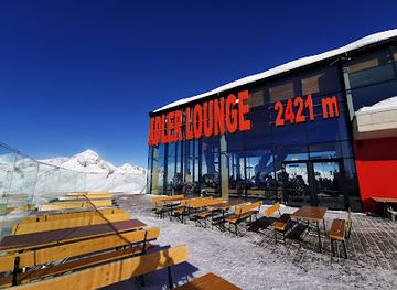
Adler Lounge
Experience gourmet dining at Adler Lounge amidst breathtaking alpine scenery in Kals am Großglockner.
-
Restaurant
Gasthof Siggen
Discover unparalleled Alpine hospitality at Gasthof Siggen—your perfect retreat for delicious cuisine and cozy accommodations amidst breathtaking landscapes.
-
Inn
Alpengasthof Stockenbaum
Experience authentic Austrian hospitality and delicious local cuisine at Alpengasthof Stockenbaum amidst breathtaking alpine scenery.
-
Inn
Matreier Tauernhaus
Discover alpine charm at Matreier Tauernhaus – your gateway to breathtaking scenery and authentic Austrian cuisine.


Best bars in Hohe Tauern National Park
Evenings in Hohe Tauern National Park are generally quiet and village-based rather than centred on clubs or a large nightlife scene. Traditional inns, hotel bars and local pubs in places such as Mittersill, Matrei, Mallnitz, Heiligenblut, Rauris and the Krimml area provide opportunities for a drink and conversation, with the atmosphere often shaped by residents, walkers and seasonal visitors. Some larger gateway communities may host occasional music, cultural events or seasonal festivities, but programmes and venues change. After dark, the valleys offer a more natural form of entertainment: clear mountain air, dramatic silhouettes and, away from settlements, dark skies. Visitors staying in remote accommodation should expect limited late-night transport and should confirm evening dining and drink options locally rather than assuming resort-style opening hours.
-
Restaurant
Adler Lounge
Experience exquisite dining with stunning mountain views at Adler Lounge, Kals am Großglockner's premier culinary destination.
-
Restaurant
Felbertauernstüberl Huber Elmar
Experience the best of traditional Austrian cuisine at Felbertauernstüberl Huber Elmar in Matrei in Osttirol, where warmth and flavor unite.
-
Bar
Café Bar Laterndl
Discover the warmth and charm of Café Bar Laterndl, a cozy retreat in Hof, Austria, perfect for unwinding with drinks and local flavors.
-
Bar
Figolalm auf 1777m
Experience alpine dining at Figolalm, where breathtaking views meet delightful cuisine in the heart of the Kals am Großglockner region.


Best nightclubs in Hohe Tauern National Park
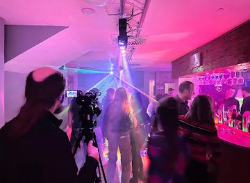
Evenings in Hohe Tauern National Park are generally quiet and village-based rather than centred on clubs or a large nightlife scene. Traditional inns, hotel bars and local pubs in places such as Mittersill, Matrei, Mallnitz, Heiligenblut, Rauris and the Krimml area provide opportunities for a drink and conversation, with the atmosphere often shaped by residents, walkers and seasonal visitors. Some larger gateway communities may host occasional music, cultural events or seasonal festivities, but programmes and venues change. After dark, the valleys offer a more natural form of entertainment: clear mountain air, dramatic silhouettes and, away from settlements, dark skies. Visitors staying in remote accommodation should expect limited late-night transport and should confirm evening dining and drink options locally rather than assuming resort-style opening hours.
-
Disco club
Stadtkeller Lienz
Experience the vibrant nightlife at Stadtkeller Lienz, the premier disco club in the heart of Tyrol, where unforgettable music and dancing await.
-
Night club
Wührers discotheque
Explore the energetic atmosphere of Wührers Discotheque in Bad Gastein, where unforgettable nights of music and dancing await you.
-
Disco club
Barracuda Club Kaprun
Discover the vibrant nightlife at Barracuda Club Kaprun, where music, dancing, and a lively atmosphere await every visitor.
-
Night club
Hütt'n Wirt
Discover the vibrant nightlife at Hütt'n Wirt, Außerfragant's premier night club, where unforgettable music and dance await you all night long.


Best shops in Hohe Tauern National Park
Shopping within Hohe Tauern National Park is concentrated in gateway towns and villages, with opportunities centred on practical supplies, regional food and locally made goods rather than large commercial districts. Mittersill, Matrei, Lienz, Mallnitz, Heiligenblut, Rauris and other valley settlements have shops for everyday provisions and outdoor equipment, while smaller communities may have only limited retail facilities. Farm shops and direct-sale producers offer products such as mountain cheese, honey, bread, cured meats, herbal goods and locally made spirits, although availability varies by season and business. Visitors may also find woodwork, woollen goods, ceramics, artwork and traditional craft items connected with the wider Alpine region. The Nationalparkzentrum in Mittersill and other interpretation centres can provide context for locally produced goods, but visitors should not expect extensive shopping inside remote mountain areas.
-
National park
Nationalpark Hohe Tauern
Discover the breathtaking beauty of Nationalpark Hohe Tauern, Austria's largest national park, with stunning landscapes and diverse wildlife.
-
Supermarket
SPAR
Discover local and international flavors at SPAR Supermarket in Matrei, your go-to grocery destination while exploring Tyrol.
-
Supermarket
BILLA
Discover the convenience of BILLA Supermarket in Matrei in Osttirol, where local flavors and fresh produce await your culinary adventure.
-
Ice Cream
Eisladen Matrei
Discover the creamy delights of Eisladen Matrei, an ice cream paradise in Matrei in Osttirol, where every scoop is a taste of happiness.


Get your free copy of our complete guide to Hohe Tauern National Park, delivered straight to you.
Everything on this page, from attractions and restaurants to essentials and local phrases, in one PDF you can read offline, print or share.
Already have an account? Sign in
Your Hohe Tauern National Park guide is ready.
We'll send it to · Not you? Sign out

Getting your guide ready…
We are putting together a fresh copy of the Hohe Tauern National Park guide. This can take up to a minute.
This can take a few moments. If your browser asks, choose Allow so the download can start. You'll find the guide in your Downloads folder.
Nothing happened? Download it again
Sorry, the guide is taking longer than usual. Please try again in a minute, or get it by email instead.
Hohe Tauern National Park essentials
Currency and Payment
Safety
Emergency Situations
Do's and Don'ts
Local Tips
From Eve
Local phrases worth knowing
You don't need to get them perfect. A few words go a long way, and locals appreciate the effort.
Basics
| English | Local | Say it |
|---|---|---|
| Hello | Servus | [sair-voos] |
| Goodbye | Auf Wiedersehen | [ouf vee-der-zay-en] |
| Yes | Ja | [yah] |
| No | Nein | [nine] |
| Please/You're welcome | Bitte | [bi-te] |
| Thank you | Danke | [dahn-kuh] |
| Excuse me/Sorry | Entschuldigung | [ent-shool-di-goong] |
| How are you? | Wie geht es dir? | [vee geht es deer] |
| Fine. And you? | Gut. Und du? | [goot oont doo] |
| Do you speak English? | Sprechen Sie Englisch? | [shpre-khen zee eng-leesh] |
| I don't understand | Ich verstehe nicht | [ikh fer-shtay-uh nikht] |
Eating & Drinking
| English | Local | Say it |
|---|---|---|
| I'd like to see the menu, please | Ich würde gerne die Speisekarte sehen, bitte | [ikh vur-deh gehr-neh dee shpy-zuh-kahr-teh zay-en, bi-teh] |
| I don't eat meat | Ich esse kein Fleisch | [ikh es-se kine flysh] |
| Cheers! | Prost! | [prohst] |
| I would like to pay, please | Ich möchte bitte bezahlen | [ikh mehrk-teh bi-teh beh-tsah-len] |
Emergencies
| English | Local | Say it |
|---|---|---|
| Help! | Hilfe! | [hil-feh] |
| Go away! | Geh weg! | [geh vehg] |
| Call the Police! | Rufen Sie die Polizei! | [roo-fen zee dee poh-lee-tsay] |
| Call a doctor! | Rufen Sie einen Arzt! | [roo-fen zee i-nen artsht] |
| I'm lost | Ich habe mich verirrt | [ikh hah-buh mikh feh-rirt] |
| I'm ill | Ich bin krank | [ikh been krank] |
Shopping
| English | Local | Say it |
|---|---|---|
| I'd like to buy... | Ich möchte kaufen... | [ikh mehrk-teh kow-fen] |
| I'm just looking | Ich schaue nur | [ikh show-eh noor] |
| How much is it? | Wie viel kostet es? | [vee feel kohs-tet es] |
| That's too expensive | Das ist zu teuer | [dahs ist tsoo toy-er] |
| Can you lower the price? | Können Sie den Preis senken? | [kur-nen zee den prees zehn-ken] |
Time & Numbers
| English | Local | Say it |
|---|---|---|
| What time is it? | Wie spät ist es? | [vee shpayt ist es] |
| It's one o'clock | Es ist ein Uhr | [es ist ine oor] |
| Half past (10) | Halb zehn | [halb tsehn] |
| Morning | Morgen | [mohr-gen] |
| Afternoon | Nachmittag | [nahkh-mit-tahg] |
| Evening | Abend | [ah-bent] |
| Yesterday | Gestern | [geh-stern] |
| Today | Heute | [hoi-teh] |
| Tomorrow | Morgen | [mohr-gen] |
| 1 | Eins | [ines] |
| 2 | Zwei | [tsvai] |
| 3 | Drei | [dry] |
| 4 | Vier | [feer] |
| 5 | Fünf | [fuenf] |
| 6 | Sechs | [zeks] |
| 7 | Sieben | [zee-ben] |
| 8 | Acht | [akht] |
| 9 | Neun | [noyn] |
| 10 | Zehn | [tsehn] |
Transport & Directions
| English | Local | Say it |
|---|---|---|
| Where's a/the...? | Wo ist ein/der...? | [vo ist ine/dehr] |
| What's the address? | Was ist die Adresse? | [vas ist dee ah-dreh-seh] |
| Can you show me (on the map)? | Können Sie mir zeigen (auf der Karte)? | [kur-nen zee meer tsey-gen (ouf dehr kahr-teh)] |
| When's the next (bus)? | Wann kommt der nächste (Bus)? | [vahn kohmt dehr neh-khs-teh (boos)] |
| A ticket (to ....) | Eine Fahrkarte (nach ....) | [i-ne fahr-kahr-teh (nahkh)] |
History of Hohe Tauern National Park
A Landscape Shaped by Ice and Uplift
The Hohe Tauern range belongs to the Eastern Alps and developed through the long geological processes that formed the Alpine mountain system. Uplift, erosion and repeated glaciation carved the high valleys, cirques, ridges and broad glacial troughs visible today. The park’s glaciers, including the Pasterze below the Grossglockner, remain important records of changing climate and alpine geology. Rivers descending from the mountains have continued to reshape valley floors and link the high country with settlements and agricultural land below.
Early Settlement and Alpine Pastoralism
People have used the valleys and lower mountain slopes of the Hohe Tauern for many centuries, while seasonal movement of livestock to high pastures became a defining feature of alpine life. Hay meadows, mountain pastures and scattered farmsteads reflect this long relationship between communities and the terrain. The high mountains were also crossed for local trade and communication, although routes were demanding and strongly influenced by snow and weather. This cultural landscape remains visible around villages and summer pastures on the park’s margins and within its inhabited valleys.
Mining, Trade and Mountain Communities
The Hohe Tauern was historically associated with mining, particularly the search for gold in parts of the range. Gold mining took place in areas including the Rauris and Gastein valleys and contributed to regional economic development during the late medieval and early modern periods. Mineral extraction, pastoralism, forestry and trade all shaped settlements such as Rauris, Heiligenblut and the communities of the Matrei and Isel valleys. Although mining declined, traces of this working mountain history survive in local heritage, place names and interpretive sites.
The Alpine Age of Exploration
From the eighteenth and nineteenth centuries, scientific interest and mountaineering gradually brought the high Hohe Tauern to wider attention. The first ascent of the Grossglockner in 1800 marked an important moment in the development of Alpine exploration, and later routes, mountain huts and improving roads made the range more accessible. The Großglockner High Alpine Road, opened in 1935, connected the northern and southern sides of the central massif and became a major scenic route, while tourism increasingly complemented farming and traditional mountain industries.
Protection and the National Park
Modern conservation grew from concern for the distinctive glaciers, peaks, forests, wetlands, alpine meadows and wildlife of the range. Hohe Tauern National Park was established in stages from the 1980s, beginning in Carinthia in 1981 and expanding through Salzburg and Tyrol. It is now Austria’s largest national park and one of the country’s major protected landscapes. Conservation operates alongside farming, settlement and responsible tourism rather than excluding all human use, making the relationship between natural processes and traditional land management central to the park’s modern identity.
Hohe Tauern National Park in Photos
Browse through our photo collection highlighting the charm and character of the destination.
Cities in Hohe Tauern National Park
The towns and cities of Hohe Tauern National Park, and the easiest places to base yourself.
-

-

-


Swipe for more cities
Neighbouring destination travel guides
The closest destinations to Hohe Tauern National Park, if you have time for more than one.
-

-

-

-

-


Swipe for more destinations
Explore more

Explore more of Kitzbühel Alps
Discover the Kitzbühel Alps: A year-round alpine paradise offering world-class skiing, hiking, and cultural experiences in Austria's scenic Tyrol region.
Explore Kitzbühel Alps
Explore more of Austria
Discover Austria's blend of alpine landscapes, rich cultural heritage, and culinary delights, from Vienna's historic charm to Tyrol's dramatic beauty.
Explore Austria