

Sarpang District Travel Guide - Free Web & App
Your ultimate guide to Sarpang District. Discover top landmarks, proposed trips, and local tips. Free on the web or via the Evendo companion app.


Sarpang District, Bhutan combines subtropical forests, Gelephu’s southern gateway, Royal Manas wildlife and peaceful routes beside Himalayan rivers.
Southern Landscapes and Wildlife
Sarpang District occupies Bhutan’s southern frontier, where the forested foothills of the Himalaya descend towards the Indian plains. Its geography is markedly different from the high valleys and mountain passes associated with northern Bhutan: the climate is warmer, the vegetation more subtropical, and the landscape shaped by broad lowland rivers, humid forests and fertile agricultural land. Gelephu, the district’s principal urban centre, is the main gateway for visitors arriving from India and an important base for exploring southern Bhutan.Read more about Sarpang District
Gateway to the Manas Region
Gelephu and Southern Bhutanese Life
When is the best time to visit Sarpang District?
Best: February, November–December · 23–27°C| Month | High (°C) | Rainfall (mm) |
|---|---|---|
| January | 22 | 10 |
| February (best) | 25 | 9 |
| March | 28 | 10 |
| April | 33 | 11 |
| May | 35 | 11 |
| June | 37 | 12 |
| July | 36 | 12 |
| August | 36 | 12 |
| September | 35 | 11 |
| October | 31 | 11 |
| November (best) | 27 | 10 |
| December (best) | 23 | 9 |
Getting to and around Sarpang District
How to get there
Transportation
Best attractions in Sarpang District
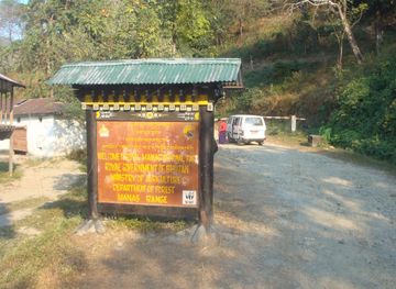
Royal Manas National Park is Sarpang’s leading natural attraction, offering access to a protected landscape of subtropical forest, riverine habitat and grassland on the edge of Bhutan’s southern frontier. The park is known for its biodiversity rather than built visitor facilities, and organised access, permits and local guidance are important. The Manas River and associated forest corridors provide opportunities for landscape viewing and birdwatching where access is authorised. Gelephu gives visitors a contrasting experience, with its market streets, transport links and lowland atmosphere, while Sarpang town provides a smaller centre for local travel. Rural roads reveal paddy fields, farms and forested foothills, though conditions and access can change seasonally. The district’s natural attractions are best understood as part of a broad conservation landscape rather than as a compact collection of viewpoints, and journeys between them require planning.
-
Local history museum
Lhayul, Chudzom, Sarpang
Explore the heart of Bhutan's culture at Lhayul, a captivating local history museum in Chudzom, Sarpang, perfect for cultural enthusiasts and curious travelers.
-
Hiking area
Gelephu View Point
Discover the breathtaking views and tranquil hiking trails of Gelephu View Point, a hidden gem in the heart of Bhutan's stunning landscapes.
-
Tourist attraction
Trong Heritage Village
Immerse yourself in the cultural beauty of Trong Heritage Village, a captivating tourist attraction in Bali showcasing traditional Balinese life.
-
Tourist attraction
Lungsigang
Lungsigang: A Scenic Retreat in Damphu with Stunning Views and Rich Cultural Experiences Awaiting Every Traveler.



Best landmarks in Sarpang District
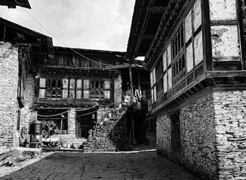
The Manas River is Sarpang’s defining natural landmark, flowing through a wider transboundary landscape that links Bhutan’s protected forests with the Indian plains. Royal Manas National Park is the district’s most significant conservation landmark and one of Bhutan’s oldest national parks, recognised for its subtropical habitats and exceptional biological diversity. The forested southern foothills, river corridors and cultivated lowlands form a contrasting physical setting to Bhutan’s high valleys and are important landmarks in their own right. Gelephu’s border-gateway character is the principal human landmark of modern Sarpang, while rural settlements, farms and roads illustrate the continuing relationship between cultivation, transport and forest conservation. The district has fewer monumental buildings than Bhutan’s historic western valleys, so its identity rests primarily on landscape, ecological significance and the lived character of its southern communities.
-
Tourist attraction
Phobjikha Valley
Explore the serene Phobjikha Valley, a breathtaking glacial valley known for its stunning landscapes, rich biodiversity, and tranquil atmosphere in Bhutan.
-
Picnic ground
Mwnabili Picnic Spot & Eco Tourism
Experience the tranquil beauty of Mwnabili Picnic Spot & Eco Tourism, where nature and relaxation come together in Assam's stunning landscapes.
-
National park
Royal Manas National Park
Explore the breathtaking landscapes and diverse wildlife of Royal Manas National Park, a top tourist attraction in Bhutan.
-
Border crossing station
Bhutan-India Border, Gelephu
Discover the vibrant Bhutan-India Border at Gelephu, where culture meets adventure and breathtaking landscapes await.


Explore Sarpang District on the map
Plan your trip on one map. See where the top attractions, landmarks, restaurants and hotels are, and book hotels and experiences in a few clicks.
Best hotels in Sarpang District
Best restaurants in Sarpang District
Dining in Sarpang is concentrated in Gelephu, Sarpang town and other established settlements rather than around remote forest attractions. Local eateries and small restaurants typically provide Bhutanese staples such as red rice, ema datshi, vegetable preparations, noodles and dumplings, alongside Indian-influenced dishes and everyday meals suited to the district’s close connection with the plains. Southern Bhutan’s warmer climate supports agricultural produce that appears in household and market cooking, while roadside establishments may offer simple, practical food rather than formal destination dining. Visitors staying near protected areas should arrange meals through their accommodation or guide and carry suitable provisions when travelling far from settlements. Gelephu has the broadest choice of shops and eating places, but opening patterns and menus can vary, so flexibility is useful in rural Sarpang.
-
Restaurant
Someplace Else
Discover authentic flavors at Someplace Else in Gelephu - where local meets global cuisine in a cozy dining atmosphere.
-
Restaurant
Chenzom Restaurant & Bar
Experience authentic Bhutanese cuisine blended with international flavors at Chenzom Restaurant & Bar in Sarpang.
-
Restaurant
Nangloo Restaurant
Experience authentic Bhutanese cuisine at Nangloo Restaurant in Gelephu - where every meal tells a story.
-
Restaurant
Manshashi Restaurent
Discover authentic Nepali and Bhutanese cuisine at Manshashi Restaurant in Gelephu - a delightful stop for every traveler.


Best bars in Sarpang District
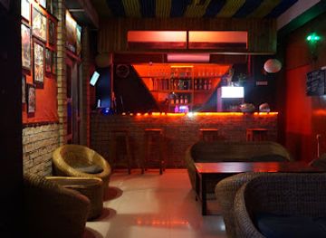
Sarpang is not a nightlife destination, and evening entertainment is generally modest and centred on local hospitality rather than dedicated clubs or late-night districts. Gelephu has the district’s most developed selection of places to eat, meet and enjoy an evening drink, while smaller settlements are more likely to offer quiet local establishments or accommodation-based social spaces. Evenings in rural areas are shaped by the climate, early travel starts and the surrounding forests, with bird and wildlife excursions normally beginning in daylight rather than continuing after dark. Visitors should not expect a busy bar scene around Royal Manas National Park or remote villages. Bhutanese etiquette favours considerate behaviour, particularly near homes, religious sites and conservation areas, and alcohol consumption should never be combined with driving or forest travel.
-
Karaoke bar
Crossroad bar and Karaoke
Experience the vibrant nightlife of Gelephu at Crossroad Bar and Karaoke, where unforgettable memories and melodies await every visitor.
-
Bar
Kota Bar
Discover the vibrant atmosphere of Kota Bar in Gelephu, where local flavors and friendly faces come together for an unforgettable experience.
-
Live music bar
Rusticpub
Discover the vibrant energy of Rusticpub in Gelephu, where live music and local flavors create an unforgettable nightlife experience.
-
Bar
Shambhu Restaurant
Discover the vibrant flavors of Bhutan at Shambhu Restaurant in Sarpang, where local cuisine meets a warm and inviting atmosphere.


Best nightclubs in Sarpang District
Sarpang is not a nightlife destination, and evening entertainment is generally modest and centred on local hospitality rather than dedicated clubs or late-night districts. Gelephu has the district’s most developed selection of places to eat, meet and enjoy an evening drink, while smaller settlements are more likely to offer quiet local establishments or accommodation-based social spaces. Evenings in rural areas are shaped by the climate, early travel starts and the surrounding forests, with bird and wildlife excursions normally beginning in daylight rather than continuing after dark. Visitors should not expect a busy bar scene around Royal Manas National Park or remote villages. Bhutanese etiquette favours considerate behaviour, particularly near homes, religious sites and conservation areas, and alcohol consumption should never be combined with driving or forest travel.
-
Karaoke bar
Crossroad bar and Karaoke
Experience the vibrant nightlife of Gelephu at Crossroad Bar and Karaoke, where you can enjoy drinks, music, and memorable moments with friends.
-
Live music bar
Rusticpub
Discover the dynamic live music scene at Rusticpub, Gelephu's top destination for entertainment and relaxation after a day of exploration.
-
Bar
Kota Bar
Experience the vibrant nightlife at Kota Bar in Gelephu, where refreshing drinks and lively music create an unforgettable atmosphere.
-
Disco club
Ocean 7 Club
Dance the night away at Ocean 7 Club in Gelephu, where vibrant music and a lively atmosphere create unforgettable nightlife experiences.


Best shops in Sarpang District
Shopping in Sarpang is practical and locally focused, with the widest choice found in Gelephu and smaller ranges available in Sarpang town and village markets. Visitors can look for Bhutanese food products, household goods, woven items, everyday clothing and regionally produced agricultural goods, although selection varies and is not comparable with the craft concentration of larger western Bhutanese towns. Markets also provide an opportunity to observe the district’s links with the Indian plains and its diverse southern communities. Supplies for journeys into rural or protected areas should be bought before leaving the main settlements, as remote forest approaches are unlikely to have extensive retail facilities. Travellers should distinguish genuinely local products from general imported merchandise and should avoid purchasing items made from protected wildlife or plants.
-
General store
Thinley general shop- sale all crockery items-cosmetice-grocery items,and Liquor Jampelling,Gelephu
Explore the treasures of Thinley General Shop in Gelephu: crockery, cosmetics, groceries, and local liquor await your discovery.
-
Produce market
Sansari Market
Discover the vibrant atmosphere of Sansari Market, Gelephu's premier produce market filled with fresh local goods and cultural experiences.
-
 Clothing store
Kiaara's Enterprise
Explore Kiaara's Enterprise in Gelephu for a blend of traditional and contemporary Bhutanese fashion that captures the essence of local culture.
-
Store
Miniso Bhutan Gelephu
Explore Miniso Bhutan in Gelephu for a unique shopping experience featuring trendy, affordable products that blend quality and style.


Get your free copy of our complete guide to Sarpang District, delivered straight to you.
Everything on this page, from attractions and restaurants to essentials and local phrases, in one PDF you can read offline, print or share.
Already have an account? Sign in
Your Sarpang District guide is ready.
We'll send it to · Not you? Sign out

Getting your guide ready…
We are putting together a fresh copy of the Sarpang District guide. This can take up to a minute.
This can take a few moments. If your browser asks, choose Allow so the download can start. You'll find the guide in your Downloads folder.
Nothing happened? Download it again
Sorry, the guide is taking longer than usual. Please try again in a minute, or get it by email instead.
Sarpang District essentials
Currency and Payment
Safety
Emergency Situations
Do's and Don'ts
Local Tips
History of Sarpang District
A Subtropical Himalayan Frontier
Sarpang’s physical setting has always distinguished it from Bhutan’s highland valleys. The district lies within the Himalayan foothill belt, where rivers descend towards the plains and dense subtropical forest supports a far wider range of wildlife than the alpine north. Historically, these lowlands formed part of the Duars, the forested foothill zone along the Bhutan–India frontier. Seasonal movement, forest use and trade connected the region with neighbouring plains communities, while the difficult terrain limited the development of large urban settlements.
Southern Settlement and Trade
The modern social character of Sarpang developed through long interaction between Bhutan’s central administration, southern farming communities and the adjoining Indian plains. Agricultural settlement expanded in the lowlands, with rice cultivation, livestock and forest resources forming important parts of local livelihoods. Gelephu grew as a market and transport centre, linking Bhutanese producers and travellers with the border economy. The district’s cultural landscape consequently reflects Bhutan’s wider southern diversity rather than the architectural and social patterns of the high valleys alone.
The Manas Conservation Landscape
Conservation became increasingly important as Bhutan recognised the ecological value of its southern forests and river corridors. Royal Manas National Park, established in 1966 and later expanded, protects a major section of this landscape and is Bhutan’s oldest national park. Its forests are ecologically connected with protected areas across the Indian border, creating a transboundary habitat for elephants, tigers, golden langurs, hornbills and many other species. Protection has required a continuing balance between biodiversity, local livelihoods, access and the management of human–wildlife contact.
Modern Connectivity and Gelephu
In recent decades, improved roads and the development of Gelephu as a southern entry point have strengthened Sarpang’s role in Bhutan’s national transport network. The district is now both a border gateway and a landscape of conservation importance, with settlements, farms and protected forests occupying neighbouring spaces. Gelephu’s proposed and developing plans for a larger southern economic and urban centre have added a new layer to the district’s modern history, although the pace and character of development continue to evolve.
Sarpang District in Photos
Browse through our photo collection highlighting the charm and character of the destination.
Neighbouring destination travel guides
The closest destinations to Sarpang District, if you have time for more than one.
-

-

-

-

-


Swipe for more destinations
Explore more
Explore more of Sarpang
Explore Sarpang in southern Bhutan for subtropical forests, wildlife landscapes, borderland culture, Gelephu markets and a warmer lowland journey.
Explore Sarpang
Explore more of Bhutan
Experience the enchantment of Bhutan, a Himalayan paradise where tradition meets tranquility and Gross National Happiness reigns supreme.
Explore Bhutan