

Plan (Valparaíso) Travel Guide - Free
Explore Plan in Valparaíso with Evendo's free guide. Find the best shops, historic streets, restaurants, and gems on web or mobile.


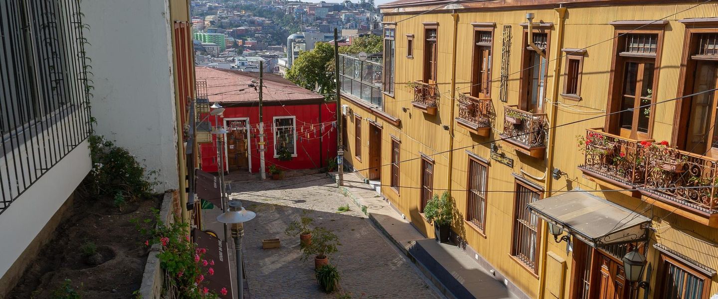


Plan, Valparaíso, brings together port history, grand civic squares, markets, museums, cafés and Pacific views in Chile’s historic harbour city centre.
A Flat Stage Beneath the Hills
In Valparaíso, El Plan is the locally used name for the relatively level central strip between the Pacific and the city’s steep cerros, or hills. It is not always defined by a single official boundary, but it generally includes the commercial and civic centre around Plaza Victoria, Plaza Aníbal Pinto, Plaza Sotomayor and the port-facing streets. Here, the city’s vertical drama is always close: stairways rise towards the hills, old ascensores climb the slopes, and the polished façades of the lower city give way quickly to weathered walls and colourful hillside buildings.Read more about Plan
Port, Commerce and Public Life
Living Heritage
Explore Plan on the map
A handpicked selection of must-see spots in Plan, mapped for you.
Best hotels in Plan
Plan essentials
Getting There
Getting Around
Safety
Emergency Situations
Do's and Don'ts
Local Tips

From Eve
Local phrases worth knowing
You don't need to get them perfect. A few words go a long way, and locals appreciate the effort.
Basics
| English | Local | Say it |
|---|---|---|
| Hello | Hola | [oh-lah] |
| Goodbye | Adiós | [ah-dyohs] |
| Yes | Sí | [see] |
| No | No | [noh] |
| Please/You're welcome | Por favor/De nada | [pohr fah-vohr/deh nah-dah] |
| Thank you | Gracias | [grah-syahs] |
| Excuse me/Sorry | Perdón/Lo siento | [pehr-dohn/loh syehn-toh] |
| How are you? | ¿Cómo estás? | [koh-moh ehs-tahs] |
| Fine. And you? | Bien. ¿Y tú? | [byehn. ee too] |
| Do you speak English? | ¿Hablas inglés? | [ah-blahs een-glehs] |
| I don't understand | No entiendo | [noh ehn-tyehn-doh] |
Eating & Drinking
| English | Local | Say it |
|---|---|---|
| I'd like to see the menu, please | Me gustaría ver el menú, por favor | [meh goos-tah-ree-ah vehr ehl meh-noo, pohr fah-vohr] |
| I don't eat meat | No como carne | [noh koh-moh kahr-neh] |
| Cheers! | ¡Salud! | [sah-loohd] |
| I would like to pay, please | Me gustaría pagar, por favor | [meh goos-tah-ree-ah pah-gahr, pohr fah-vohr] |
Emergencies
| English | Local | Say it |
|---|---|---|
| Help! | ¡Ayuda! | [ah-yoo-dah] |
| Go away! | ¡Vete! | [veh-teh] |
| Call the Police! | ¡Llama a la policía! | [yah-mah ah lah poh-lee-see-ah] |
| Call a doctor! | ¡Llama a un doctor! | [yah-mah ah oon dohk-tohr] |
| I'm lost | Estoy perdido/a | [ehs-toy pehr-dee-doh/ah] |
| I'm ill | Estoy enfermo/a | [ehs-toy ehn-fehr-moh/ah] |
Shopping
| English | Local | Say it |
|---|---|---|
| I'd like to buy... | Me gustaría comprar... | [meh goos-tah-ree-ah kohm-prahr] |
| I'm just looking | Solo estoy mirando | [soh-loh ehs-toy mee-rahn-doh] |
| How much is it? | ¿Cuánto cuesta? | [kwan-toh kwehs-tah] |
| That's too expensive | Eso es muy caro | [eh-soh ehs mooee kahr-oh] |
| Can you lower the price? | ¿Puede bajar el precio? | [pweh-deh bah-hahr ehl pree-syoh] |
Time & Numbers
| English | Local | Say it |
|---|---|---|
| What time is it? | ¿Qué hora es? | [keh oh-rah ehs] |
| It's one o'clock | Es la una en punto | [ehs lah oo-nah ehn poon-toh] |
| Half past (10) | Son las diez y media | [sohn lahs dyehs ee myeh-dyah] |
| Morning | Mañana | [mah-nyah-nah] |
| Afternoon | Tarde | [tahr-deh] |
| Evening | Noche | [noh-cheh] |
| Yesterday | Ayer | [ah-yehr] |
| Today | Hoy | [oy] |
| Tomorrow | Mañana | [mah-nyah-nah] |
| 1 | Uno | [oo-noh] |
| 2 | Dos | [dohs] |
| 3 | Tres | [trehs] |
| 4 | Cuatro | [kwah-troh] |
| 5 | Cinco | [seen-koh] |
| 6 | Seis | [seys] |
| 7 | Siete | [syeh-teh] |
| 8 | Ocho | [oh-choh] |
| 9 | Nueve | [nweh-veh] |
| 10 | Diez | [dyehs] |
Transport & Directions
| English | Local | Say it |
|---|---|---|
| Where's a/the...? | ¿Dónde está...? | [dohn-deh ehs-tah] |
| What's the address? | ¿Cuál es la dirección? | [kwal ehs lah dee-rehk-syohn] |
| Can you show me (on the map)? | ¿Puedes mostrarme (en el mapa)? | [pweh-dehs mohs-trar-meh (ehn ehl mah-pah)] |
| When's the next (bus)? | ¿Cuándo es el próximo (autobús)? | [kwan-doh ehs ehl proh-ksy-moh (ow-toh-boos)] |
| A ticket (to ....) | Un boleto (a ....) | [oon boh-leh-toh (ah)] |
History of Plan
A Coastal Settlement and Colonial Roadstead
The flat shore and narrow coastal strip that became the Plan formed part of the settlement around Valparaíso’s natural bay. Indigenous communities used the central coast before Spanish arrival, while the Spanish established a port settlement in the sixteenth century. For centuries Valparaíso remained comparatively modest, linked to Santiago by difficult routes and dependent on maritime trade. The lower ground beside the bay was the practical place for landing goods, building warehouses and connecting the waterfront with roads running inland, establishing the port-oriented geography that still distinguishes the Plan from the residential hills.
Independence and the Commercial Port
Valparaíso’s importance expanded sharply after Chilean independence and the opening of Pacific trade to international shipping. During the nineteenth century, merchants, shipping companies, banks and consulates concentrated activity in the lower city, while reclaimed and infilled ground gradually increased the usable space along the shore. Public squares, churches, commercial streets and substantial masonry buildings gave the Plan a more formal urban character. The arrival of the railway connection towards Santiago in the 1850s strengthened the relationship between port, national commerce and the central streets, bringing workers, migrants and foreign businesses into the same district.
Earthquake, Fire and Reconstruction
The 1906 earthquake caused extensive destruction across Valparaíso, including the commercial and civic centre of the Plan, and fires compounded the damage. Reconstruction altered the appearance of the lower city: some damaged buildings were replaced, streets and public facilities were reorganised, and new construction appeared beside surviving nineteenth-century fabric. The disaster did not erase the Plan’s role as the city’s administrative and commercial core, but it created the mixed architectural landscape visible today. Later earthquakes, economic changes and the gradual decline of Valparaíso’s dominant maritime position added further layers to the rebuilt centre.
A Heritage Centre in Transition
During the twentieth century, commercial activity, port operations, public institutions and everyday neighbourhood life continued to coexist in the Plan, even as Santiago became increasingly dominant in Chilean economic affairs. Historic buildings and public spaces later gained renewed attention through heritage conservation and cultural tourism, particularly after Valparaíso’s historic quarter was inscribed on the UNESCO World Heritage List in 2003. The designation concerns a wider historic area rather than every part of the Plan, but it helped focus attention on the lower city’s urban fabric. Today, restoration, changing retail patterns and uneven redevelopment continue to shape the neighbourhood.
Plan in Photos
Browse through our photo collection highlighting the charm and character of the destination.
Neighbourhoods near Plan
The closest neighbourhoods to Plan, if you have time for more than one stop.
-

-

-

-


Swipe for more neighbourhoods
Explore more

Explore more of Valparaíso
Valparaíso, Chile, pairs colourful hillside architecture with Pacific views, historic funiculars, street art, seafood, museums and memorable cultural sightseeing.
Explore Valparaíso