
Isenbjerg Bakkeø – Geodætisk målepunkt
Diskret høj top i Gludsted Plantage, hvor geodætisk historie møder stille midtjysk natur og vid udsigt over skov, hede og horisont.
Isenbjerg Bakkeø – Geodætisk målepunkt er et diskret, men markant højdepunkt midt i Gludsted Plantage sydøst for Ikast. Her hæver den lille bakkeø sig omkring 30 meter over det omgivende, flade hede- og skovlandskab og når cirka 102 meter over havet. Et geodætisk målepunkt markerer toppen og vidner om områdets rolle i landets kortlægning. Stedet byder på ro, vid horisont, lyng, plantageskov og en følelse af midtjysk vildmark kun få kilometer fra civilisationen.
A brief summary to Isenbjerg Bakkeø - Geodætisk målepunkt
- Ikast, 7430, DK
- Duration: 1 to 3 hours
- Free
-
Outdoor
- Mobile reception: 3 out of 5
Local tips
- Medbring vand, snacks og eventuelt en termokande – der er ingen caféer eller kiosker i eller omkring Isenbjerg Bakkeø.
- Brug solide sko; underlaget kan være ujævnt, sandet eller mudret afhængigt af årstid og vejr.
- Tag lag-på-lag tøj med, da vinden ofte mærkes tydeligere på toppen end nede i skovens læ.
- Medbring kort eller offline-kort på telefonen; stierne i plantagen kan virke ens, og skiltning er begrænset.
- Besøg uden for jagtsæsonens mest aktive perioder, og hold øje med eventuelle markeringer for jagt i plantagen.
For the on-the-go comforts that matter to you
- Trash Bins
- Information Boards
Getting There
-
Car from Ikast
Fra Ikast centrum tager køreturen til Gludsted Plantage ved Isenbjerg typisk 15–20 minutter afhængigt af trafik. Underlaget på de sidste kilometer er mindre veje og skovveje, som kan være smalle og ujævne, men normalt farbare med almindelig personbil i tørvejr. Beregn tid til at gå det sidste stykke fra nærmeste parkeringsmulighed til selve bakkeøen. Der er gratis parkering i området, men ingen tankstationer eller servicefaciliteter lige ved plantagen.
-
Bicycle from Ikast
Cykelturen fra Ikast til Gludsted Plantage tager omtrent 45–75 minutter afhængigt af tempo og rutevalg. Undervejs kombineres mindre asfaltveje med grusveje i plantagen, og en trekking- eller mountainbike er mest behagelig. Turen er let kuperet og kræver moderat kondition. Tag lygter, hvis du cykler tidligt eller sent på dagen, og medbring værktøj og drikke, da der ikke er cykelservice eller butikker inde i plantagen.
-
Public transport plus walking
Det er muligt at kombinere regional bus mod området omkring Gludsted eller nærliggende landsbyer med en længere gåtur ad landevej og skovveje ind i Gludsted Plantage. Rejsen fra Ikast varer typisk 45–70 minutter inklusive ventetid, og billetten koster omtrent 25–45 DKK afhængigt af zoner og billettype. Busser kan have begrænset frekvens, særligt aften og weekend, så tjek afgangstider og planlæg retur i dagslys, da der ikke er belysning i plantagen.
Isenbjerg Bakkeø - Geodætisk målepunkt location weather suitability
-
Clear Skies
-
Mild Temperatures
-
Cold Weather
-
Hot Weather
-
Any Weather
Discover more about Isenbjerg Bakkeø - Geodætisk målepunkt
En stille top over den midtjyske hede
Isenbjerg Bakkeø rejser sig som en lille ø af højere terræn i den ellers flade Gludsted Plantage sydøst for Ikast. Her topper bakkeøen omkring 102 meter over havet, hvilket i midtjysk målestok gør den til et markant punkt i landskabet. Selve højdepunktet er relativt beskedent i absolut højde, men forskellen på omkring 30 meter ned til det omgivende terræn gør oplevelsen overraskende dramatisk, når du står oppe på selve toppen. Den åbne himmel, den rolige skovstilhed og fornemmelsen af at stå på et naturligt udsigtspunkt giver stedet en særlig karakter. Selvom udsigten ikke er bjergtagende i klassisk forstand, får du et sjældent klart blik hen over plantagens mosaik af skov, hede og lysninger.Geodætisk punkt og dansk kortlægning
På selve toppen finder du det geodætiske målepunkt – en diskret markering, der fortæller en større historie om, hvordan Danmark er blevet opmålt og kortlagt. Sådanne punkter har været essentielle fikspunkter for landets geodætiske net, hvor præcise positioner i terrænet gjorde det muligt at skabe nøjagtige kort længe før moderne satellitnavigation. Målepunktet på Isenbjerg er valgt, fordi bakken stikker op over omgivelserne og giver fri siktlinje til andre punkter i terrænet. Når du står her, er du bogstaveligt talt på et koordinat, der indgår i det danske landmåleres system – et sted med både teknisk og historisk betydning, selvom det ved første øjekast blot ligner en stille skovtop.Fredet natur og plantagelandskab
Isenbjerg Bakkeø ligger i den sydvestlige del af Gludsted Plantage, et stort skov- og plantageområde med rødder i den gamle midtjyske hede. Området er fredet, og det mærkes i den rolige, uspolerede stemning. Her veksler tætte nåleskove med mere åbne partier, små hedepletter, sandede spor og lav bevoksning af lyng og græs. Den beskedne højde forskel skaber små klimatiske variationer på og omkring bakken. Du kan opleve mere vind og lys på toppen, mens de lavere partier ofte føles mere lukkede og skovklædte. Det giver gode muligheder for at sanse overgangen mellem plantage og bakkeø på selv en kort vandretur.Vandring, cykling og naturpauser
Isenbjerg Bakkeø er først og fremmest et mål for dem, der holder af stille naturoplevelser. Mange kombinerer toppen med en længere vandretur gennem Gludsted Plantage, hvor skovveje og grusspor gør det let at tilpasse ruten. Terrænet er generelt let kuperet og velegnet til både vandring og mountainbike på eksisterende spor. På selve bakken indbyder roen til en pause: en termokande i rygsækken, et kort hvil og et øjebliks udsyn over den midtjyske natur. Der er ingen udbyggede faciliteter, så du er afhængig af eget udstyr, men netop fraværet af anlagte komfortzoner er en del af områdets charme.Årstidernes skift på bakkeøen
Isenbjerg Bakkeø opleves forskelligt gennem året. Foråret bringer lysere dage, fuglesang og de første grønne nuancer i plantagen. Sommeren giver længere aftener og varme, hvor toppen kan føles næsten hedelignende med tørre dufte af nåle og lyng. Efteråret forvandler skovens farver, og udsigten fra bakken rummer gyldne og røde nuancer ud over de mørke graner. Vinterdage med frost eller drys af sne kan gøre bakkeøen særligt stemningsfuld, når konturerne i terrænet står skarpt frem, og lyden dæmpes af kulden. Hele året er det et sted, hvor man kan søge ro, bevægelse og en lille smule højde i hjertet af Midtjylland.Iconic landmarks you can’t miss
Bølling Lake
13.3 km
A restored glacial lake offering scenic walks, excellent fishing, and peaceful nature immersion in central Jutland.

Herning Turist
15.1 km
Experience panoramic views of Vejle's landscapes from the accessible Udsigtstårn observation tower.

Ilva
15.8 km
Experience contemporary art in a repurposed 1950s vending machine at Vejle's innovative Kunsthal Vejle.

Silkeborg Vesterskov mindesten
16.8 km
A modest memorial stone in Silkeborg Vesterskov, where forest tranquillity and wartime history meet in a quiet, contemplative woodland clearing.

Lagkagehuset
19.4 km
Experience innovative contemporary art in Vejle's historic vending machine gallery, open 24/7 with free admission.

Mindesten for H.Pontoppidan
19.6 km
A quiet memorial stone in Herning’s Sdr. Anlæg, honouring H. Pontoppidan and the ambitious transformation of Jutland’s once-harsh heath and bog landscapes.
Scandic Regina
19.7 km
Experience panoramic views of Vejle's natural beauty from the Udsigtstårn at Østengård.
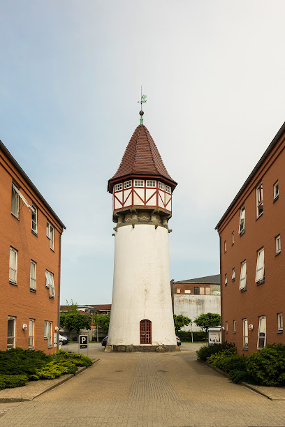
Silkeborg Water Tower
20.0 km
A heritage-listed industrial landmark symbolising Silkeborg's textile manufacturing legacy.
Louis Nielsen Herning
20.1 km
Experience contemporary art in a unique setting at Kunsthal Vejle, where a historic vending machine becomes a dynamic exhibition space.

Herning City Hotel
20.3 km
Experience breathtaking panoramic views and serene landscapes at Udsigtstårn in Vejle, Denmark.

silkeborg
20.6 km
Historic 1871 railway landmark connecting Central Jutland with frequent regional services and heritage charm.
Slotsholmen
20.9 km
Denmark's island of power: nine centuries of royal rule, government, and cultural heritage in Copenhagen's heart.

De Små Fisk
21.1 km
Discover De Små Fisk near Silkeborg: a serene lakeside escape with a child-friendly beach, scenic trails, and primitive camping, perfect for nature lovers and families seeking outdoor adventures.

Lovisehøj
21.4 km
A 73-meter forest hill with royal heritage and sweeping views across Danish lakes and woodlands.

Høgdal
21.5 km
Step back in time at Høgdal, a charming open-air museum near Them, Denmark, showcasing traditional rural life, historical workshops, and friendly farm animals in a picturesque setting.
Unmissable attractions to see
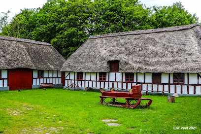
Jutland
5.8 km
Wind-shaped coasts, heather hills, old trading towns and modern cities meet across Denmark’s broad Jutland peninsula between the North Sea and the Baltic.
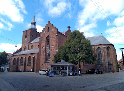
Naturcenter Harrild Heath
9.7 km
Historic watermill, wide open heath and clear river meet at Naturcenter Harrild Heath, a calm Central Jutland base for trails, learning and big‑sky nature.

Murermester Rasmus Nielsens Mindesten
13.4 km
Discover modern art masterpieces, Danish expressionism, and international talent at the heart of Silkeborg’s creative scene in Jutland’s premier contemporary art gallery.
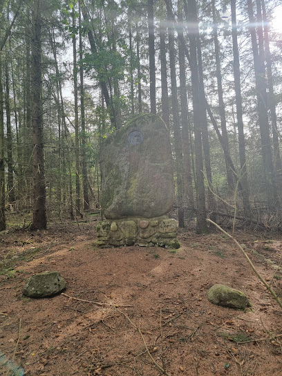
Stenalderens Jægere
13.5 km
A quiet rural stop near Silkeborg where fields, woods and wetlands hint at the lives of Stone Age hunters who once moved through this Jutland landscape.

Vandskellet
13.5 km
Stand on Denmark’s quiet continental divide, where raindrops choose between the Skjern Å to the west and the Gudenå to the east in softly rolling farmland.

Klosterlund Museum
13.8 km
Stone Age artifacts and industrial heritage converge in a beautifully restored peat factory overlooking Lake Bølling.

Den mystiske troldesten
14.2 km
A mysterious stone formation within a woodland dog park, blending folklore, nature, and outdoor recreation.

Them Bavnehøj
14.6 km
Historic beacon hill above Them, where a modest tower, wide horizons and a glacially carved landscape invite slow walks, simple picnics and big skies.
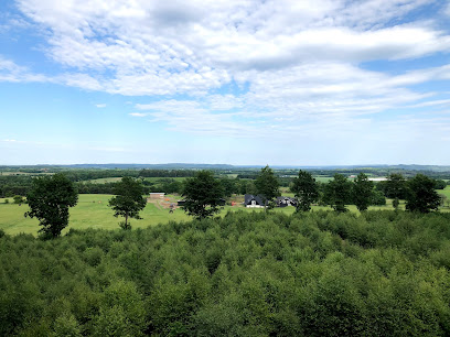
Silkeborg Rovfugleshow
14.6 km
Up-close raptors, roaming bison and a maze-like Owl Forest create a nature-focused, family-friendly wildlife experience in the rolling countryside near Silkeborg.

Funder Ruin
15.0 km
A colossal Ice Age boulder quietly resting in the fields near Silkeborg, where ancient geology, rural calm and subtle Danish folklore meet in one modest landmark.

Knudmose søerne
16.6 km
A restored bog landscape where winter sports, nature trails, and waterbird habitats create diverse recreational experiences.

Elia
16.7 km
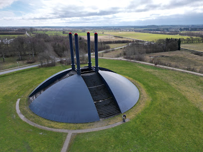
A colossal black steel dome on Herning’s edge, Elia blends industrial drama, fire, and open sky into one of Northern Europe’s most arresting contemporary sculptures.
De Geometriske Haver
16.8 km
A sculptural maze of hornbeam hedges where triangles, squares and circles turn landscape architecture into a walkable geometric artwork in Herning’s Birk Centerpark.

Herning skulpturpark
16.9 km
A free, open-air gallery in Herning’s Birk district, where contemporary sculptures are scattered through tranquil green parkland beside the monumental Elia.

Knagerne Silkeborg
17.2 km
A small, protected pocket of old-growth woodland in Silkeborg Vesterskov, where crooked beeches, fallen trunks and deep quiet create an evocative forest escape.

Essential places to dine
Indian Traditional Food
10.6 km
Family-run Indian takeaway and catering in a quiet Ikast neighbourhood, serving homely curries and biryanis with spice levels tailored to your taste.

Restaurant Noli
10.8 km
Modern Nordic cooking, candlelit hygge and polished service come together at this quietly sophisticated dining room in the centre of Ikast.

Vrads Station
12.5 km
A preserved forest railway station turned cosy summer restaurant, where vintage trains, Danish layer cakes and quiet lakeside woods meet in rural Jutland.

Hammerum Pizzeria
15.1 km
Casual neighborhood pizzeria and grill on Hammerum Hovedgade, serving affordable pizzas, kebabs and comfort food to locals and visitors in suburban Herning.

A Hereford Beefstouw - Lund - Herning
18.2 km
The original Danish Hereford steakhouse near Herning, where classic grilled beef, fine wine and Scandinavian design come together in historic Lund surroundings.

China Café
18.6 km
Casual, budget-friendly Chinese comfort food in the heart of Herning Centret, ideal for quick lunches and relaxed family dinners between shopping stops.

Kuplen - Cafe-Restaurant-Bar
18.6 km
Light-filled café-restaurant-bar overlooking Herning’s golf greens, blending relaxed everyday meals with flexible event spaces in a calm, green-edge setting.

Sooshi Herning Centret
18.8 km
Fresh sushi crafted with passion in the heart of Herning's shopping district.

Jensens Bøfhus
18.8 km
Easygoing Danish steakhouse in Herning serving familiar steaks, ribs and comfort dishes in relaxed, family-friendly surroundings with long, convenient opening hours.

Restaurant Karoline Amalie v/Rikke Brockstedt
19.3 km
Destination dining in the woods near Silkeborg, where seasonal Danish menus, thoughtful wine pairings and a calm, intimate room turn dinner into an evening-long occasion.

Dirty Ranch Steakhouse
19.5 km
Hearty steaks, schnitzel nights and a rustic Western vibe make Dirty Ranch Steakhouse Herning a lively choice for meat‑lovers and social, group‑friendly evenings.

Restaurant Den Kinesiske Mur Herning
19.6 km
Lively Chinese buffet and running sushi in central Herning, blending Mongolian grill, classic dishes and a playful conveyor-belt sushi experience under warm red décor.

Charolais Kroen ApS
19.7 km
Open-grill steaks, hearty portions and kro-style warmth in a rustic, centrally located Herning steakhouse dating back to 1977.

Bandhan Restaurant
19.7 km
Cosy Indian restaurant on Østergade in central Herning, serving fragrant curries, tandoori grills and generous vegetarian dishes in a warm, relaxed setting.

Pinto Thai Take A Way
19.7 km
Compact Thai takeaway in central Herning, serving bold curries, noodles and generous portions at budget-friendly prices for quick, flavour-packed meals.

Markets, malls and hidden boutiques
Antik og design Compagniet
10.7 km
Warehouse of Scandinavian design heritage and vintage furniture treasures in rural Jutland.

Baldur´s Archery APS
17.0 km
Denmark's premier archery specialist with expert guidance, premium equipment, and three decades of bowhunting expertise.

NORMAL Herning, HerningCentret
18.4 km
Central Jutland's premier shopping destination with 80+ stores, family events, and free parking.

Basic & More
18.5 km
Budget-friendly Danish homeware and everyday essentials in Herning, where ever-changing surplus finds and simple Nordic style turn shopping into a relaxed treasure hunt.

Viktor
18.7 km
Contemporary men’s fashion inside Herning Centret, offering smart, wearable Nordic style in a convenient, fully indoor shopping environment.

NEED • STORE
18.7 km
Contemporary streetwear and everyday fashion inside HerningCentret, offering relaxed Scandinavian style with the convenience of Jutland’s largest indoor mall.

BUDDY
18.7 km
Bright, family-friendly toy universe in Herning where shelves of games, figures and creative playsets make gift hunting easy for kids of all ages.

Wunderwear
18.7 km
Intimate lingerie and swimwear boutique inside Herning Centret, offering expert fittings, quality brands and discreet, personal service for women of all shapes and sizes.

Degn
18.7 km
A modern women’s fashion boutique in Herning, blending Scandinavian style and international labels for wearable outfits, from everyday essentials to polished occasion looks.

IGEN Op Shop
19.9 km
A spacious Herning charity shop where quality second-hand finds, friendly volunteers and circular shopping all support the Danish Cancer Society’s work.

Flying Tiger Copenhagen
19.9 km
A compact burst of colorful Scandinavian design in central Silkeborg, perfect for quirky gifts, affordable homeware and playful everyday essentials.

Pindhus.dk
20.0 km
Hand-curated Scandinavian design, gifts, and lifestyle treasures in the heart of Silkeborg.

Børnenes Kartel Silkeborg
20.0 km
A Scandinavian-style toy and children’s universe in central Silkeborg, where quality play, creative decor and family-friendly service turn shopping into a playful outing.

Boemo
20.0 km
A cozy Silkeborg lifestyle store where Scandinavian interiors, curated fashion and gallery art come together in one calm, design-focused space.

Mr Silkeborg A / S
20.0 km
Refined menswear boutique in central Silkeborg, combining Danish and international brands with attentive, style-focused service for business, casual and occasion wear.

Essential bars & hidden hideouts
Marquart Anita
8.3 km
Unpretentious local bar in Bording, serving cold beers, simple drinks and plenty of small-town Danish atmosphere under the watchful eye of host Anita Marquart.

Stokrosen
9.5 km
A revived village bar in Ejstrupholm where classic Danish pub culture, cold beer and local conversation create a quietly authentic small-town evening.

Bonderen
11.0 km
Ikast's unpretentious pub where locals gather for genuine conversation and casual good times.

Spinderokken ApS
11.2 km
Casual bar at the heart of Ikast's shopping district, where locals gather for drinks and conversation.

Hosekræmmeren
16.8 km
Brande's beloved pub where tradition meets lively social atmosphere in the heart of town.

min PUB
19.1 km
A cozy, basement-style neighborhood bar tucked into Herning’s Industriparken, serving straightforward beers and friendly conversation away from the city-center nightlife.

City-cafeen
19.7 km
Unpretentious bar-café in central Herning, offering inexpensive drinks, cosy pub-style atmosphere and a relaxed, local slice of Danish værtshus culture.

Bodega Hjørnet
19.8 km
A cosy corner bodega in central Silkeborg, where dim lights, cold beer and easy conversation capture the timeless charm of Danish bar culture.

Piano Herning
19.8 km
Cozy, centrally located bar in Herning with warm lighting, close-up atmosphere and late-night opening hours, ideal for relaxed drinks and sociable evenings.

Rabalder Bar
19.9 km
Cozy living‑room bar in Silkeborg serving affordable drinks, sing‑along hits and late‑night party vibes in a compact, homey setting.

Bifrost Sports Pub
19.9 km
Silkeborg's premier sports bar for live action, cold drinks, and vibrant nightlife.

Butchers Silkeborg
19.9 km
Compact late-night bar and nightclub in central Silkeborg, serving high-energy music, simple drinks and a youthful party vibe on weekend nights.

The bar Silkeborg ApS
19.9 km
Intimate late-night bar on Nygade in central Silkeborg, mixing easygoing pub charm with nightclub energy from evening drinks to early-morning dancing.

Fox and Hounds
19.9 km
Scottish pub excellence in the heart of Herning with craft beers, premium whiskeys, and genuine Danish hospitality.

Murphy's Pub
19.9 km
Cozy Irish-style pub in the heart of Herning, pouring good beer, hosting live music and quizzes, and blending Irish charm with Danish hygge late into the night.

Nightclubs & after hour spots
B'sharp - Silkeborg Rhythm Og Blues Association
20.0 km
Volunteer-run blues stronghold in central Silkeborg, where intimate weekend concerts, affordable drinks and close-up performances keep rhythm & roots music alive.

Mindegade5
20.0 km
Experience the heartbeat of Herning's nightlife at Mindegade5, where music, dance, and celebration converge.

Team Paderborner
40.2 km
Nightclub entertainment in Denmark's scenic Dyrehaven forest and lakeside setting.

Liglad Day & Nightlife
41.0 km
Compact late-night club on Grindsted’s main street, mixing local vibes, DJs and simple drinks for weekend nights that run into the early hours.

Scandic Opus Horsens
41.2 km
A contemporary Scandinavian hotel in Horsens with spa, dining, and panoramic city-to-nature views—an elegant gateway to both urban and outdoor experiences.

Horsens New Style Dance Club
41.8 km
Horsens' premier line dancing venue where beginners and advanced dancers unite in movement and community.

PDD
42.1 km
Compact, no-frills nightclub on Lindvigsvej in Horsens, offering late-night dancing, simple drinks and an intimate, local-party atmosphere on weekends.

Der Kuhstall Mønsted
42.1 km
Rural barn vibes meet late-night beats at this countryside nightclub near Viborg, where casual crowds, strong drinks and a compact dance floor power the weekend.

Morzybitten
42.2 km
Experience the essence of Danish 'hygge' at Morzybitten, Horsens' premier barista and beer bar with live music.

Sölibat Natklub
42.2 km
Late-night, no-frills clubbing in central Horsens, where loud music, simple drinks and a compact dance floor create an unapologetically local party vibe.

Hemingway's Horsens
42.2 km
Late-night disco bar in central Horsens with a mature crowd, classic hits from past decades and a cozy-but-lively atmosphere every Friday and Saturday.

Klodshans Horsens ApS
42.3 km
Discover live music, local art, and Danish hygge at Klodshans Horsens—a cozy harbor-side bar at the heart of the city's nightlife and cultural scene.

Kokomo Horsens
42.4 km
Three floors of colorful cocktails, big beats and tropical nightclub energy at the heart of Horsens’ weekend nightlife.

Jagtbar Horsens
42.4 km
Horsens' premier nightclub where relaxed cocktails transform into energetic dance nights.

The Last Waterhole
42.5 km
A beloved Vejle pub promising lively nights, affordable drinks, live music, and authentic Danish camaraderie just steps from the city’s vibrant heart.

For the vibe & atmosphere seeker
- Tranquil
- Scenic
- Relaxing
- Adventurous
- Unique
For the design and aesthetic lover
- Minimalist Designs
- Rustic Designs
For the architecture buff
- Parks & Gardens
- Viewpoints
- Heritage Neighborhoods
For the view chaser and sunset hunter
- Panoramas
- Iconic Views
- Sunset Spots
For the social media creator & influencer
- Photo Spots
- Selfie Spots
- Reel-Friendly
- Architectural Shots
For the eco-conscious traveler
- Low Impact
- Protected Area
- Leave-No-Trace Critical
- Wildlife Habitat
For the kind of experience you’re after
- Mindfulness
- Meditation Spot
- Cultural Heritage
- Photowalk
- Nature Escape
- Day Trip
- Roadtrip Stop
- Adventure Photo Shoot
For how adventurous you want the journey to be
- Easy Access
- Requires Hike
Location Audience
- Family Friendly
- Senior Friendly
- Child Friendly
- Teen Friendly
- Solo Friendly
- Couple Friendly
- Solo Female Friendly
- Vegetarian Friendly
- Vegan Friendly


