Background

Kvalitetssti Møns Klint (Quality Trail at Møns Klint)

A compact quality trail threading beech forest, towering chalk cliffs and Baltic shoreline into one of Denmark’s most dramatic and rewarding coastal hikes.
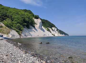
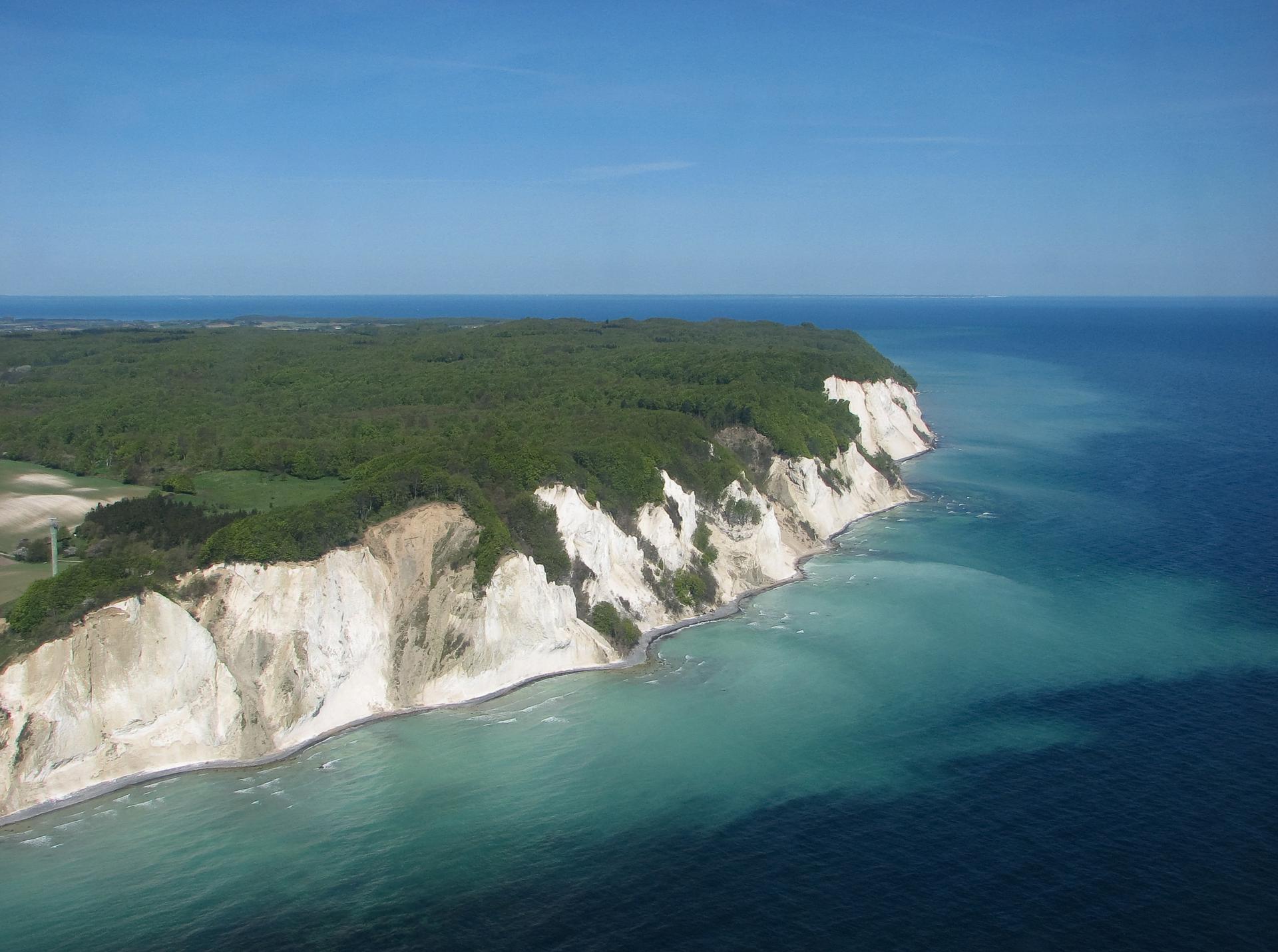
4.7

Chalk Cliffs and a Certified Quality Trail

Kvalitetssti Møns Klint is a designated quality trail created by the Danish Nature Agency and the Danish Hiking Association to showcase the most striking parts of Møns Klint in a compact loop. The route is around 5–6 km long, threading through the hilliest section of eastern Møn where the island suddenly rises into a wall of white chalk. Here, cliffs tower up to around 100 meters above the Baltic Sea, their faces constantly reshaped by waves, frost and rain. The trail is marked and maintained to demanding standards, with clear waymarking, varied terrain and frequent points of interest. Rather than simply tracing one level, it takes you up and down between cliff edge and shoreline, combining open views, shaded forest and stretches of quiet path where you may walk for minutes with only birdsong for company.

Forest Canopies and Ancient Landscapes

Much of the quality trail leads through Klinteskoven, an old beech forest draped over the steep slopes above the cliff. On sunny days, the canopy filters the light into a green glow, broken by sudden glimpses of blue sea far below. In spring, the forest floor is scattered with anemones; in summer, rare orchids thrive on the chalky ground; autumn brings vivid reds and golds to the hillsides. This is also a cultural landscape. Along or close to the route you can encounter ancient burial mounds, traces of old ramparts and the more manicured romance of Liselund’s garden if you extend your walk. The sense is of a place where human history sits lightly on far older geology, with the forest knitting everything together.

Steps, Beach and the Power of the Baltic

One of the most memorable sections of the trail involves the long wooden stairways that connect cliff top to shore. Maglevandstrappen, Denmark’s longest staircase, and the other nearby stairs descend hundreds of steps through the trees before emerging into daylight on the narrow beach. The descent is exhilarating; the climb back up, especially after a beach walk, is a real workout. At the foot of the cliffs, the character of the walk changes. Under your feet, firm chalk, flint pebbles and rounded stones crunch as waves roll in across surprisingly clear, turquoise‑tinged water. Up close, the chalk wall looms above you, streaked with grey bands and fresh scars where small landslides have fallen. Fossil hunters scan the shingle for ancient sea urchins and shells, reminders that these cliffs were once seabed.

Views, Dark Skies and Shifting Weather

Back on the plateau, the trail links a string of viewpoints where you can look along the cliff line and watch the coastline curve away into haze. On clear days you may spot seabirds gliding along the updrafts or a peregrine falcon arrowing past; in rougher weather the sea turns slate grey and whitecaps hammer the base of the cliff, underlining how this landscape is still being carved. Møns Klint is also known for its dark night skies. If you linger into evening on or near the route, the forest quietens and, on cloudless nights, stars emerge in astonishing numbers. Even in daylight, weather matters: wind funnelling along the coast, mist rising from the sea, or a sudden shower turning chalky paths slick all add drama to the hike and demand a little respect.

Planning Your Walk on the Quality Trail

Although relatively short, Kvalitetssti Møns Klint packs in real elevation and many steps, so it feels like a full outing rather than a casual stroll. Most hikers allow 2–3 hours, more if you plan long photo stops, a beach break or detours to other routes. Sturdy footwear is strongly recommended, as some sections can be muddy or uneven, especially after rain, and beach segments may involve wading around fallen blocks or shallow water. Waymarking and information boards help you understand what you are seeing, from the formation of the chalk to the area’s plant and bird life. Facilities at the cliff‑top hub, including the GeoCenter Møns Klint, car park and basic amenities, make it easy to combine the trail with a visit to exhibitions or family activities, but once you step onto the path, the forest and cliffs quickly reclaim your attention.

Local tips

  • Wear sturdy hiking shoes or trekking sandals with good grip; the many wooden steps, chalky slopes and pebble beach sections can become slippery, especially after rain.
  • Bring water, snacks and windproof layers even in summer; strong coastal breezes and steep stair climbs make the route more tiring than its distance suggests.
  • Allow extra time for detours down to the beach and for photo stops at viewpoints—these are some of the most striking coastal panoramas in Denmark.
  • Check recent conditions before walking close under the cliffs, as minor landslides can occasionally block parts of the beach or require brief wading.
  • If visiting with limited mobility companions, combine sections of the quality trail with the accessible wooden path to Freuchens Pynt viewpoint for wide sea and cliff views.
widget icon

Buy tickets

    No tickets available

Book tours with entry

    No tours available

Book tours without entry

    No tours available

A brief summary to Kvalitetssti Møns Klint

Getting There

  • Car from Copenhagen or Zealand

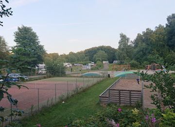
    Driving from Copenhagen or elsewhere on Zealand, allow about 1.75–2.5 hours to reach the Møns Klint area near Borre. The route uses major motorways and bridges before smaller country roads across Møn; traffic is usually light outside summer weekends. Parking near GeoCenter Møns Klint, close to the quality trail, is paid by machine or card and typically costs the equivalent of about 35–50 DKK for the day. In high season the car park can fill by late morning, so aim for an early start if you want a space close to the main trailheads.

  • Public bus via Vordingborg or Stege

    Without a car, you can combine train and regional bus. Trains from Copenhagen to Vordingborg generally take 1–1.25 hours, and from there buses run to Stege on Møn in about 35–50 minutes. A through ticket for train plus bus is usually in the range of 130–200 DKK one way, depending on time and discounts. From Stege, a seasonal or local bus line continues toward Møns Klint and the GeoCenter area in roughly 30–40 minutes. Services are less frequent on weekends and outside summer, so check timetables carefully and be prepared for some waiting time between connections.

  • Cycling from Stege on Møn

    For experienced cyclists, reaching the trail by bike from Stege town is a scenic option. The ride is around 20–25 km each way on rolling country roads and signed cycling routes, typically taking 1.5–2 hours depending on fitness and wind. There are short, steep sections near the cliffs but no extreme gradients by mountain standards. This option is free aside from any bike rental costs in Stege, which are usually charged per day. Surfaces are paved but can be exposed to strong headwinds, and there is limited shade on hot days, so bring water and layers.

Popular Experiences near Kvalitetssti Møns Klint

Popular Hotels near Kvalitetssti Møns Klint

Select Currency